#embeddedmaps
Explore tagged Tumblr posts
Visit Tumblr Blog
Explore Tumblr blogs with no restrictions, modern design and the best experience.
Last Seen Tumblr Blogs


Fun Fact
Tumblr has 16.74 million mobile monthly users in the US.
Text
How to Create and Embed Live Maps on Your website in Minutes
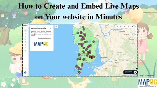
Why Use Live Maps in Your Content? In a world full of static images and walls of text, live maps offer something refreshing—interaction. Whether you’re writing about public parks, healthcare gaps, local events, or historical sites, embedding a map lets your readers explore the data directly, rather than just reading about it. It’s not just cool—it’s powerful. Imagine someone being able to click, zoom, and view real-time spatial info without ever leaving your blog.
The No-Code Way to Make It HappenYou don’t need to be a developer or GIS expert to add live maps to your stories. Tools like MAPOG make it easy to create custom maps without writing a single line of code. The process is simple: choose your area, add layers like parks or services, use visual tools such as buffers or walking zones, and generate your map. Once you’re happy with it, just hit share, copy the embed code, and paste it into your Tumblr post (or website, Notion, newsletter—you name it). That’s it!

Real-World Example: Park Accessibility Let’s say you're highlighting how many people have access to green spaces in your city. You can show administrative boundaries, pinpoint park locations, and even add a “10-minute walk” zone around each park—all visually. Anyone reading your post can instantly see what areas are underserved, just by looking at the map.
Who Is This For?
Bloggers telling local stories
Students working on research
Activists highlighting community gaps
Creators adding context to personal essays
Live maps turn your thoughts into something viewers can interact with. They help your audience see what you're saying literally.

Final Thoughts Adding an interactive map to your post isn’t just about aesthetics. It’s about giving your audience an experience—something they can explore. Thanks to platforms like MAPOG, you can do this in minutes, even without a technical background.
0 notes
Text
Interactive GIS Maps for Real Estate: Transforming Digital Listings into Smart Experiences

In the fast-evolving world of digital real estate, engaging users isn’t just about showcasing homes—it’s about telling a story through location. Embedding Geographic Information Systems (GIS) maps on real estate websites introduces an interactive layer that transforms how buyers experience properties online. From understanding proximity to schools and workplaces to visualizing neighborhood dynamics, these maps do more than display—they educate and captivate.
Why Embed Interactive Maps in Real Estate Platforms?
A property’s value is deeply tied to its location, but static descriptions often fail to convey the full picture. With GIS, maps become storytelling tools that offer spatial context and real-time exploration. Whether it’s comparing commute times or evaluating lifestyle amenities, these visual cues help users make faster, better-informed decisions—all while staying on your site longer.
Benefits of Using GIS in Real Estate Mapping
Location Clarity: Pinpoint where properties are and how they relate to local infrastructure.
Engagement Boost: Interactive tools promote exploration and hold attention.
Amenity Mapping: Display hospitals, transport hubs, schools, parks, and shopping nearby.
Advanced Filtering: Let users sort listings directly from the map view.
Skill Building: Agents and clients alike grow comfortable with digital mapping tools.
SEO & Marketing: Interactive content increases dwell time and shareability.
Practical Applications
Neighborhood Analysis: Map out livability factors like walkability, safety, and commute.
Virtual Property Tours: Simulate area visits with descriptive, photo-rich map points.
Buyer Education: Teach buyers how to evaluate location-based advantages.
Custom Landing Pages: Use maps to showcase themed listings (e.g., “Properties Near IT Parks”).
Step-by-Step: Build and Embed a Property Map Using MAPOG
To create an interactive property map, first collect property listings with essential details like name, type, features, and contact information. Obtain accurate geographic coordinates through GIS portals or manual entry. Start a new “Default” story titled “Why Embedding Maps Can Boost User Engagement on Your Website: as a Real Estate Agent.” Use the “Add Story” feature to add each property as a “Property Listing” point type, including custom attributes such as land size, number of units, floors, and apartment types, along with images. Then add “Nearby Points” like schools, hospitals, transit stops, colleges, IT companies, and shopping centers, noting distances and using relevant icons. Customize the map’s style, publish it, and embed it to enhance engagement on your website.

Use Case : Corporate Real Estate Website for Office Leasing
Commercial real estate platforms can embed GIS maps to help businesses evaluate office spaces based on access to highways, nearby metro stations, parking availability, and proximity to talent hubs like tech parks or universities. Clients exploring office leases can filter listings by square footage or price range while simultaneously visualizing nearby infrastructure.
Open GIS Tools Empower Innovation in Real Estate
Platforms like MAPOG democratize mapping, letting real estate teams, agencies, and even city planners create customized, interactive maps without advanced tech skills. These tools support collaboration, branding, and seamless embedding across web platforms.
Conclusion
GIS-powered maps redefine how real estate listings are explored and understood. By offering visual, interactive insights, they enable smarter choices, enhance credibility, and boost site engagement. Whether you're leasing office space, planning urban development, or marketing family homes, maps bring your properties to life—building trust and driving results.
Don’t just list properties map their stories. Start with MAPOG and give your users the power to explore like never before.
#RealEstateTech#InteractiveMaps#ClientEngagement#GISinRealEstate#PropertyMarketing#DigitalRealty#EmbeddedMaps#VirtualTours#RealEstateInnovation#SmartSelling
1 note
·
View note