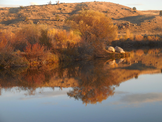
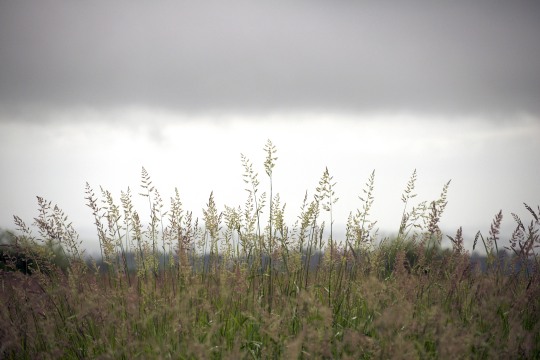
#fern ridge wildlife area
Text
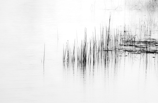
Toward the Minimal
#photographers on tumblr#original photographers#wetlands#minimal#minimalism#b&w#bnw#blackandwhite#monochrome#fern ridge wildlife area#oregon#landscape
331 notes
·
View notes
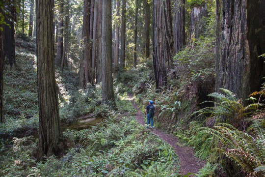
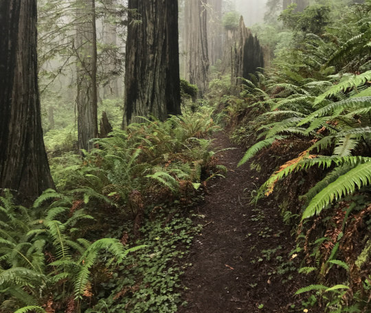
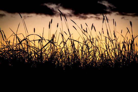
Text
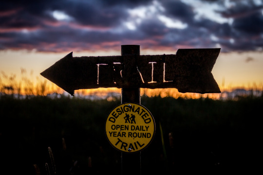
Trail - April 2013
Fern Ridge Wildlife Area ODFW
#oregon#lanecounty#lane county#the great pnw#pnw#original photography#real oregon#hiking trail#photographers on tumblr#original photographers
15 notes
·
View notes
Text
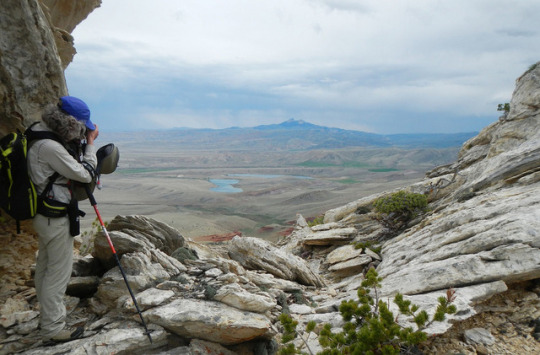
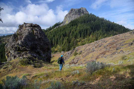
Sonoma’s Sugarloaf Mountain Range is it a local Yosemite?
Traversing up Adobe Canyon Road in Kenwood, just north of the town of Sonoma, a person seeking an exhilarating experience of nature and bucolic adventure will be breathtakingly taken aback by the rustic beauty of Sugarloaf Ridge State Park.
Some visitors have commented It’s Sonoma’s Yosemite. “I am not one of them,” said longtime Sonoma resident Mary Oswald.
Her reason for not comparing it to Yosemite is simple. “Sugarloaf is unique and it’s a part of Sonoma. It’s one of those special places that few people know about,” said Oswald.
As someone who has volunteered as a docent and visitor’s center guide, she explained why the 4,900-acre mountain range is called sugarloaf. “Sugar wasn’t always sold in the neat paper packages that we buy at the supermarket these days,” said Oswald.
“Before the 20th Century, said Oswald, sugar came in loaves that looked something like oversized, upside-down ice cream cones. The grocer just broke off pieces for his customers,” she said. To the pioneers who settled in the Sonoma Valley, “it reminded them of a piece of a loaf of sugar; hence the name Sugarloaf,” Oswald added.
A 25-foot waterfall flows after the winter rains. And now that spring has arrived it’s an ideal time to make the trek to the 200 to 2729 feet elevations of Sugarloaf.
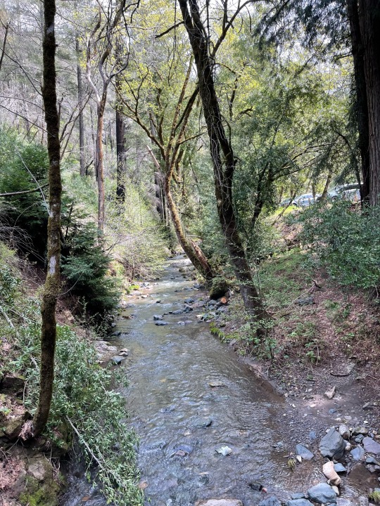
There is a self-guided nature trail along Sonoma Creek that starts near the picnic area. Sugarloaf Ridge State Park contains the headwaters of Sonoma Creek. It runs through gorge and canyon, across the meadow floor, beneath scenic rock outcroppings, and is surrounded at times by redwoods and ferns.
Views are spectacular as far as the human eye can see in just about every direction.
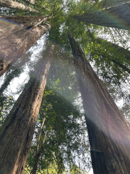
Trees of many varieties are abundant. Within the oak woodland and chaparral, the park has 25 miles of trails for hiking and horseback riding. But amid the abundance of arbor expansion Redwoods are the ancient gem of this hill and mountains retreat.
Simply stand beneath one and look up. The sounds of birds and of babbling creek waters are soothing as well as enticing.
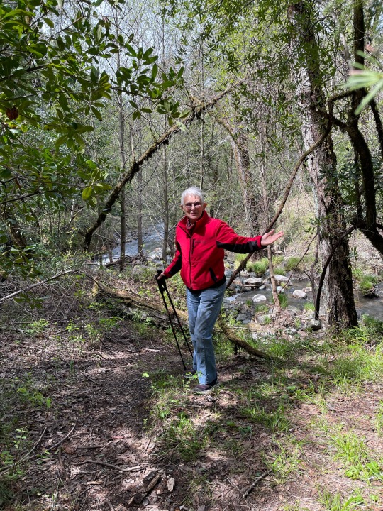
The eagerness to explore and meander is encouraging. Yet it’s advised to do so with caution as trails can be narrow. Twigs, branches, rocks and other obstacles can make for a slow climb or descending path.

With daylight hours increasing, this is an on-foot excursion that should be savored and not rushed.
On a clear day, visitors can see views of the Sierra Nevada and the Golden Gate bridge from the 2729-foot summit of Bald Mountain.
Deer, gray foxes, the occasional bobcat and coyote can be seen in the park. In spring, wildflowers provide a colorful palette across the green hills.
Lower portions of Sugarloaf is free for visitors to park and walk. Other higher portions and sections, especially campsites require an admission fee.
Note that all plants and wildlife within the park are protected. Collecting or destroying anything in the park, including mushrooms, is prohibited.
Dogs must be on a leash under your control at all times. Dogs are not allowed on trails.
Camping is permitted in designated areas. Dogs must be in a tent, camper or enclosed vehicle during the night.
The non-profit Valley of the Moon Observatory Association provides year-round astronomy education and interpretation programs at the Robert Ferguson Observatory within Sugarloaf Ridge State Park. Program fees vary, some are free with the payment of the park's Day Use Fee.
There are three telescopes and the New Generation 40-inch Telescope Project at the Ferguson Observatory which will be one of the largest telescopes dedicated for public viewing. For more information and public viewing schedules, visit the Sugarloaf State Park website.

1 note
·
View note
Video
Dry Prairie Meadow par Russell Tomlin
#wetlands photography#wetlands#dry wetlands#kr nielson rd#western Oregon#Fern Ridge Wildlife Area#landscape#landscape photography#summer#late summer#hot weather#kinda bright
8 notes
·
View notes
Video
Detail as Autumn Arrives by Russell Tomlin
#wetlands#wetland photography#Fern Ridge Wildlife Area#autumn#teasel#impressions#impressionist photography#medium format#GFX-100s
6 notes
·
View notes
Link
Excerpt from this story from InsideClimate News:
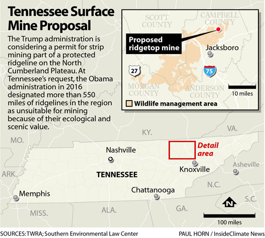
Even as the nation's demand for coal tumbles, the Trump administration is considering a permit that would allow strip mining on protected ridgelines in Tennessee's Cumberland Plateau over the objection of environmental groups and the state's Republican attorney general.
The wild, scenic terrain is within 75,000 acres designated, at the state's behest, as unsuitable for surface coal mining in 2016 by the Obama administration's Office of Surface Mining and Reclamation, the agency responsible for regulating coal mining in the state.
Senior Assistant Attorney General Elizabeth McCarter said in an October letter to the Trump administration that the federal designation prohibits surface mining on protected ridgelines in what is now the North Cumberland Wildlife Management Area, even though a mining company with mineral rights in the area had recently obtained surface rights from the state to 150 protected acres.
The Cumberland Plateau spans eastern Tennessee from Alabama into Kentucky. The Nature Conservancy describes it as a "labyrinth of rocky ridges and verdant ravines dropping steeply into gorges laced with waterfalls and caves, ferns, and rhododendrons."
This fight against Triple H Coal's mining permit pits Republicans against Republicans in a red state that President Donald Trump won in 2016 by 26 percentage points. The dispute is playing out as a nearly extinct coal industry in Tennessee yearns for a revival.
6 notes
·
View notes
Photo
Take a Hike Day on public lands!
Whether you are an avid backcountry trekker or a casual natural enthusiast, public lands and trails provide opportunities to get outside. Taking a hike is a great way to stay active and get reconnected with nature. Here are a few trails for you to get outside on National Take a Hike Day:
Campbell Tract, Alaska
The Campbell Tract is a 730- acre Special Recreation Management Area located in the heart of Alaska’s largest urban area, and provides outdoor recreation opportunities in a non-motorized natural setting for more than 300,000 visitors annually. During the winter, trails are groomed to allow for both classic and skate skiing. Also during the winter, visitors to Campbell Tract may have the opportunity to view world-class dog mushing activities. Campbell Tract is located near the Municipality of Anchorage's Tozier Track, which is the start and end point for many dog mushing races and training runs. During the winter, there are several trails on both Municipality and Campbell Tract lands that are reserved only for dog mushing activities. These trails are well-marked -- please stay off of them when snow is on the ground! Dog teams move quickly and silently, and cannot stop quickly. Wildlife viewing opportunities may include sightings of lynx, fox, coyotes, moose, black and brown bears, local and migratory songbirds, various raptors, and three species of Pacific salmon. Visitors are encouraged to practice "bear aware" techniques, including traveling in groups, making noise, and carrying bear spray. The main access point for Campbell Tract is the Smokejumper Trailhead, which is located off Elmore Road. Access is also available at the Campbell Airstrip Trailhead, located off Campbell Airstrip Road. Parking and visitor information kiosks are available at both trailheads. Access can also be gained from several points on the adjacent Far North Bicentennial Park.
The Civilian Conservation Corps Ponds/Pinedale Pathway, Wyoming
The Civilian Conservation Corps (CCC) Ponds/Pinedale Pathway are a perfect destination for those who enjoy fishing, hiking, biking, wildlife viewing and cross-country skiing. The original CCC Ponds were developed by the Civilian Conservation Corps during the Great Depression in an effort by Franklin D. Roosevelt to create jobs in the 1930s. The CCC Ponds are an important historical feature to the Pinedale Area. These Ponds were re-constructed during the 1990s and given specific themes to provide for various wildlife species: the Fish Pond, Duck Pond, Beaver Pond, and Frog Pond. A walking path was added to enable public access, as well as the installation of benches, interpretive signs, a warming hut and a parking lot. Attached to the CCC Ponds parking area is a paved bike path called the Pinedale Pathway that loops from the parking lot back down into town for a round trip of about 6 miles. In the winter, 3.5 miles of the CCC Pond area and part of the Pinedale Pathway are groomed for cross- country skiing opportunities.
Elk River Trail, California
If you want to see some really big and really old redwood trees in a fern-filled forest free of development, add the Headwaters Forest Reserve on California’s North Coast to your list. This 7,000-acre forest contains redwood trees that were growing well before European settlers arrived in North America. The oldest are 1,500 years old! A good way to see the forest is from the Elk River Trail, just south of Eureka, Calif. It offers opportunities ranging from a casual stroll on a paved route accessible to those with walking difficulties to a 10-mile hike that will take you into a grove of ancient, towering redwoods. The first three miles of the Elk River Trail follow a narrow stream corridor of public land that parallels the South Fork Elk River. The first mile is paved and accessible for those with limited mobility. Bicycles and dogs (under owner’s control) are allowed on the first 3 miles. The last 2 Ѕ miles wind beneath a closed tree canopy, ending at a small old-growth redwood grove. Please stay on the trail to avoid trespassing and to protect the area’s natural resources.
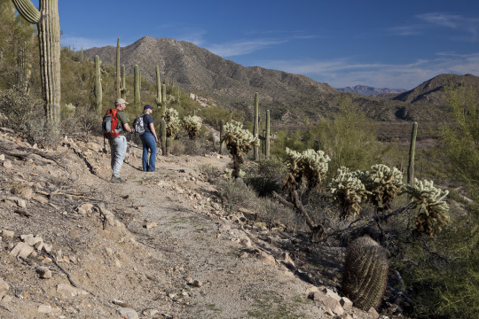
Arizona National Scenic Trail, Arizona
The Arizona National Scenic Trail traverses Arizona from Mexico to Utah, covering over 800 miles. This multi-use non-motorized, long distance trail highlights the state’s topographic, biologic, historic and cultural diversity. Features along the trail include historic sites, diverse natural features, geologic wonders and remote wilderness areas. The Tucson Field Office administers 34 miles of trail through two passages, Passage 15 (Tortilla Mountains) and Passage 16 (Gila River Canyons). Most passages can be assessed by motorized vehicle at the beginning and end. Some areas require four-wheel drive vehicles to get to the access point. The Kelvin Bridge trailhead provides access to BLM-managed lands for both passages. Passage 16 follows portions of the Gila River before traversing through the canyons. Opportunities include camping, hiking, wildlife viewing, photography, mountain biking (outside wilderness or other specially managed areas), horseback riding and backpacking. Fall, winter and spring provide the best opportunities to hike the trail. There are no visitor facilities or services on the trail, however, nearby communities offer various services and facilities.
166 notes
·
View notes
Photo
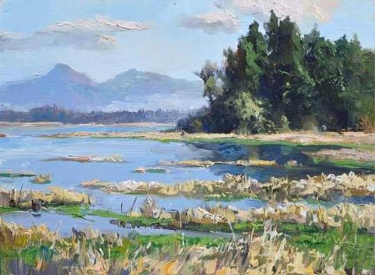
"Fern Ridge Wetlands" ,6" x 8" oil on gessoed hardboard, 2019 I painted this piece on location among the reeds of the Fern Ridge Wildlife Area a couple days ago. You can add this painting or any number of my other plein air efforts to your collection by following the "Daily Paintworks" link in my profile. #pleinair #landscape #painting #oregon #wetlands #artistsofinstagram #westernart #artcollector #originalart #originalpainting #artforsale #oil #pacificnorthwest #paintersofinstagram #instaart (at Fern Ridge Reservoir) https://www.instagram.com/p/BvfCAvvFF4b/?utm_source=ig_tumblr_share&igshid=1gjaow1mcmmwq
#pleinair#landscape#painting#oregon#wetlands#artistsofinstagram#westernart#artcollector#originalart#originalpainting#artforsale#oil#pacificnorthwest#paintersofinstagram#instaart
18 notes
·
View notes
Photo

Oregon has so many different faces. Some days, I revel in her misty forests and mossy trees. Other days, I embrace her fields and marshes. It's always a good day to go down the road apiece in Oregon, you never know what natural splendor you're going to experience. . . . #optoutside #stayandwander #wildernessculture #ventureout #cascadiaexplored #pnwcollective #oregonexplored #traveloregon #thegreatpnw (at Fern Ridge Wildlife Area) https://www.instagram.com/p/Bvhlx9HHrBg/?utm_source=ig_tumblr_share&igshid=1tis2sz9009j0
#optoutside#stayandwander#wildernessculture#ventureout#cascadiaexplored#pnwcollective#oregonexplored#traveloregon#thegreatpnw
3 notes
·
View notes
Text
10 Best Places to go in Honduras
The country in Central America is famed because of the beaches, lush rainforests, amazing islands, coral reefs, and opportunities. Tourists are attracted by this paradise, with experiences like swimming pool with sharks, rafting, and researching Aztec ruins.
Roatán
Roatán is your biggest & most. Once a wellkept secret, it’s currently also a favorite holiday location and also a cruise ship interface – notably for divers and snorkelers. A spine undulates throughout the centre of the island, and coral reefs that are booming fringe its beaches offering opportunities. In spite of the influx of travelers, the shores of Roatán are all amazing.
One among the Greatest strands is the West Bay Beach. Though packaged with cruise ship days, it rains all the boxes, together using clean seas, snorkeling, swaying palms, and a great deal of restaurants and shops near.
Copán Ruins Archeological Site
Copán Ruins Archeological Site (Copán Ruinas Sitio Arqueológico) is the most studied Maya Community in the world and Also a UNESCO World Heritage Site. Dating back almost 2000 decades has been profoundly symbolic, stratified, and centered on heritage. Visitors will find plenty to love here. The website is famed for its stelae and altars which are sprinkled across the plaza, the majority which were built throughout the summertime 736 and 7 11.
Other highlights are the basketball courtroom; the Hieroglyphic Stairway, a more exceptional temple, that holds the most famous sacred textand the Acropoliscomprising superb carved reliefs of the 16 kings of Copán.
Utila
Around 3 2 km from the west shore of Roatán, Utila could be the very funding friendly of this Bay Islands. Backpackers flock to the small people come here on dip holidays that are cheap. Presiding within an arching bay, even Utila Town could be your most important payoff where sailors compete over domino matches and tourist shops and dive centres scatter the streets.
Besides diving people bide their time bathing in the beachfront vibe and snorkeling at the lagoon, zipping out from the southwest shore of the island, or on both slivers of shore.
Little French Key
A popular daytrip out of Roatán, Small French Crucial is a green tropical paradise outside the island’s south coast. Imagine hammocks slung between palmsand sparkling waters using snorkeling, and also a shore with kayaks along with chaises longues.
After some hours of beach fun, people can dine on fresh fish at your restaurant or check out the wild life refuge to get closeup creature adventures. Residents include saving animals such as deer, reptiles, and toucans. Individuals seeking a tranquil knowledge in encircles will relish it .
La Tigra National Park
Approximately 20 km from Tegucigalpa, La Tigra National Park (Parque Nacional La Tigra) is currently still perhaps probably one among the most gorgeous places in Honduras. Perched at an elevation of 2,270 meters, that this park keeps a cloud forest which houses ocelots, pumas, and reptiles, even though it’s rare to find such creatures.
Thepark is a sanctuary for birds; even significantly more than 200 species flit including trogons, toucans, and also also the quetzal, within its boundaries. Hiking paths wind through the woods where fauna and bromeliads thrive.
Lago de Yojoa
Together the road between San Pedro Sula and Tegucigalpa, Lago de Yojoa could be also a sanctuary for birders and your biggest lake in Honduras. Significantly more than 480 species are seen here, for example northern jacanas ducks, and crakes. Visitors slip through the reeds at a kayak, or may research this river in the coast.
Two coastal national parks edge the lake: Santa Bárbara National Park around the west coast along with Cerro Azul Meambar National Park into the southwest. Other activities within the region include hikes researching tours of coffee plantations and sites, also a underground cave network.
Parque Nacional Jeanette Kawas
Formerly referred to since the Punta Sal National Park, this gorgeous wilderness area is currently known as after the ecological activist, Jeanette Kawas, that battled during her entire life to conserve its rich ecosystems. The park goes across a peninsula at the western end of this Bay of Tela and supports diverse habitatsfrom tropical rainforest, mangroves, and wetlands to amazing shores and coral reefs.
Wildlife is abundant and includes many species that are rare. Visitors can encounter howler monkeys, angels, and also a range of birds including toucans, quetzals, and motmots. Even the Micos Lagoon gets the maximum population of critters at the location with as much as 350 distinct species.
Tour operators conduct excursions to the park in Tela, that typically incorporate a rise on the other side of the peninsula into quite a beach, swimmingpool , snorkeling, or diving; along with also an optional trip to the conventional Garifuna village of Miami to a scenic beach and lagoon.
Carambola Botanical Gardens & Trails
Exquisite Carambola Botanical Gardens & Trails provides a island nature adventure. Trails wind through woods of mahogany, palms, ferns, orchids, spices, as well as fruit trees. For views that are stunning, follow along the mountain way to the peak of the ridge at which a look out peers out across the Caribbean, the barrier reef, also for people that time it dolphins leaping out of the water in Anthony’s Key Resort. For a number of the wild life that is tropical, keep a look out On the road.
Birds dart all through the foliage, and people can see Roatan Anoli interesting and lizards parades of leaf cutter ants. Additionally from the gardens, Iguana Wall can be an utter section of pond that delivers a breeding area for iguanas and parrots.
Cayos Cochinos
Also referred to as the Hog Islands, the archipelago of all Cayos Cochinos is a undeveloped tropical heaven. This collection of small, privately-owned islands and cays is located 17 km off the shore near the banana interface of La Ceiba. The islands and also the coral reefs reefs which encircle these really are a Marine Biological Reserve and also stay pristine because of their remote location and difficult access.
Cayos Cochinos, An actual back to nature adventure offer snorkeling, snorkeling, hiking, and birdwatching. Accommodation options involve bucolic eco friendly resorts in addition to hammocks or huts at local Garifuna cities.
Museum of Mayan Sculpture
Take a Look at the pieces of sculptures and stelae at the Museum of Mayan Sculpture. Visitors are advised to opt where these bits originate out of so as to comprehend before going ahead. Some of the principal attractions at the Museum of Mayan Sculpture is the replica of the Rosalila temple.
10 Best Places to go in Honduras
1 note
·
View note
Text
Beauty in the Ordinary 418
#photographers on tumblr#original photographers#wetlands#grasses#landscape#nature#photography#oregon#fern ridge wildlife area
202 notes
·
View notes
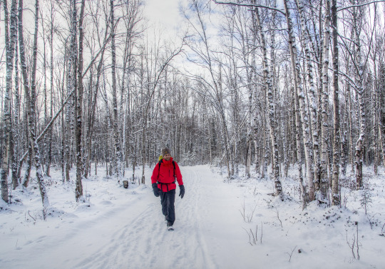
Text
Fern Ridge Wildlife Area - April 2013
We did not domesticate wheat; wheat domesticated us.
Yuval Noah Harari
Fern Ridge Wildlife Area ODFW
#wheat#sunset#Fern Ridge#lanecounty#lane county#oregon#realoregon#real oregon#original photography#original photographers#photgraphers on tumblr
19 notes
·
View notes
Photo
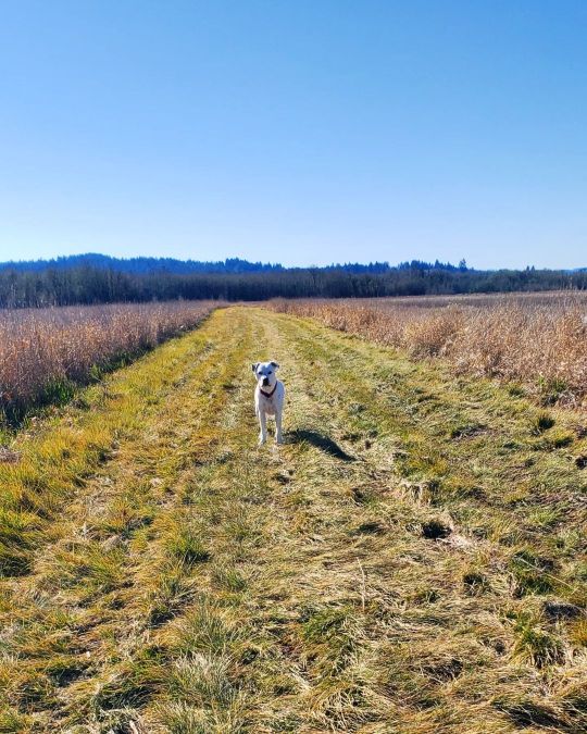
We sauntered for miles & miles~~~🐾👣 • 🐾 • 👣 • #hikingwithdogs #sauntering #milesandmiles #crashthedog #crash #bestdogever #letsgoexploring #nofilterneeded #itsabeautifulday #ilovemydog #pnwdogs #woofwoof #pitbulladvocate #adoptdontshop #adoptapet #bekindtoanimals #nature_valley #outdoorproject #trailblazin #traveloregon #realoregon #discoveroregon #eugenecascadescoast #jj_oregon #fernridgewildlifearea #youroregon #mypnwlife #meanwhilebackattheranch #wildopenspaces (at Fern Ridge Wildlife Area) https://www.instagram.com/p/CZ58NdtLNz0/?utm_medium=tumblr
#hikingwithdogs#sauntering#milesandmiles#crashthedog#crash#bestdogever#letsgoexploring#nofilterneeded#itsabeautifulday#ilovemydog#pnwdogs#woofwoof#pitbulladvocate#adoptdontshop#adoptapet#bekindtoanimals#nature_valley#outdoorproject#trailblazin#traveloregon#realoregon#discoveroregon#eugenecascadescoast#jj_oregon#fernridgewildlifearea#youroregon#mypnwlife#meanwhilebackattheranch#wildopenspaces
0 notes
Video
Tule Before a Summer Sky par Russell Tomlin
#wetlands photography#wetlands#dry wetlands#kr nielson rd#western Oregon#Fern Ridge Wildlife Area#landscape#landscape photography#summer#late summer#hot weather#kinda bright#tule#weeds#reeds#summer sky
7 notes
·
View notes
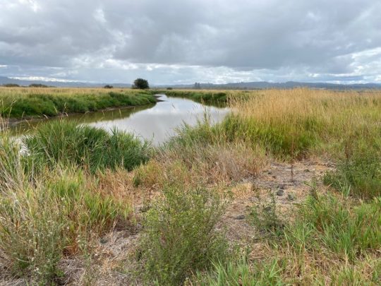
Text
Brain rinse
All marshy shots are from Fern Ridge Wildlife Area
Do not favor the company of paranoia. Whether it’s people, places, or the internet. I recently advised someone asking for help, “don’t pick friends who light up your paranoia.”
“If you walk there, you will smell like pennyroyal,” said a voice.
“Is that good or bad?” I asked.
“I think it’s good,” said another. “It’s in the mint family.”
“I…
View On WordPress
1 note
·
View note
Photo
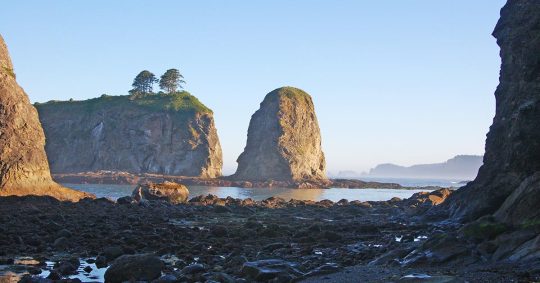
Best Things to do in Olympic National Park
Best Things to do in Olympic National Park: With its incredible range of precipitation and elevation, diversity is the hallmark of Olympic National Park. Encompassing nearly a million acres, the park protects a vast wilderness, thousands of years of human history, and several distinctly different ecosystems. Located on Washington's Olympic Peninsula, the park has four regions, including 70 miles of wild Pacific coastline, alpine areas, old-growth temperate rain forests and the forests of the drier east side. My name is Rob Decker and I'm a photographer and graphic artist with a single great passion for America's national parks! I've been to 50 of our 61 national parks — and Olympic National Park has so many different areas, there are tons of things to see and do! You can hike in the mountains, kayak or canoe in a lake or river, play in the tide pools, relax in the hot springs...and so much more! I've explored many areas of Olympic National Park — so I'm ready to help! If this is your first time to the park, or your returning after many years, here are some of the best things to do in Olympic National Park! Exploring the Pacific Coastline The coastal portion of the park is a rugged, sandy beach along with a strip of adjacent forest. It is 60 miles long but just a few miles wide. While some beaches are primarily sand, others are covered with heavy rock and very large boulders. The most popular piece of the coastal strip is the 9-mile Ozette Loop. The Park Service runs a registration and reservation program to control usage levels of this area. From the trailhead at Ozette Lake, a 3-mile leg of the trail is a boardwalk-enhanced path through near primal coastal cedar swamp. Once you arrive at the ocean, you can continue out on the headland trails for spectacular views and sunsets. Some of the best places to enjoy the Olympic coast include: Rialto Beach Second Beach Third Beach James Pond Kalaloch Beach 4 Ruby Beach Tidepool Activities The most popular tidepools areas are at Kalaloch's Beach 4 and Mora's Hole in the Wall. Rangers offer programs at both locations. Second Beach, Third Beach, Ruby Beach and many other coastal wilderness locations are also excellent places to view intertidal life in the park. Explore Olympic's Rivers by Kayak and Canoe There are many kayak and canoe options in Olympic National Park's rivers and lakes. Here's a quick rundown of some of the most popular spots to see the park from the water. Paddle The Rivers of Olympic National Park Elwha River (Class II-IV) This river can be paddled most of the year, but the best season is in the spring or early summer. The most common put-in sites are in the lower portions of Glines Canyon and Altair Campground. Hoh River (Class II-III) This river offers scenic views of old-growth rainforest, but is frequented with log jams. Always scout ahead before paddling to avoid hazards. The most popular put-in locations are at the Hoh Campground and near the park entrance station on the Hoh River Road. Queets River (Class II-III) Queets River is a great place to experience secluded rain forests during higher water levels. In late summer, the river is often blocked by large debris and water that is too low for paddling. Log jam hazards may exist throughout the year. Popular put-in sites are the Queets Campground above Sam's Rapid and the Hartzell Boat Launch. Quinault River (Class II-V) For expert kayakers willing to hike into the backcountry, the Quinault River offers challenging water. From the Graves Creek trailhead, hike 2.5 miles to Pony Bridge. This 3 mile route is through a gorge and has a mandatory portage at Dolly Falls. For calmer waters, a popular launch site is near-end of the North Shore Road at the bridge. Sol Duc River (Class III-V) For experienced kayakers, a 1.2 mile hike up the North Fork Trail in the Sol Duc Valley to the launch site offers fun water above Salmon Cascades. For experts interested in rapids, put-in at Salmon Cascades Overlook. Enjoy The Lakes of Olympic National Park Lake Crescent Big, deep, and blue, Lake Crescent offers a scenic paddling experience, particularly in the early morning when winds are most likely to be calm. Winds often come up in the afternoon and can quickly create waves of a foot or more. Boat launches include Storm King Ranger Station and Fairholme. Kayaks and canoes can be rented at concession operated Log Cabin Resort and Lake Crescent Lodge. Lake Ozette Near the coast and filled with summer water lilies, Lake Ozette offers a secluded paddle journey. Two boat launches exist at the Ozette Ranger Station and Ozette Campground. Kayak and Canoes can also access a few backcountry campsites. Sudden weather changes are common in the Ozette area -- always check the forecast and plan for the possibility of sudden, strong winds and waves. Lake Quinault In a rainforest valley, Lake Quinault boasts mountain views and old-growth forests. Afternoon winds are common here, so always be prepared. Two boat launches are found on the U.S. Forest Service operated Falls Creek and Willaby Campgrounds. Boat rentals are available at the concession operated Lake Quinault Lodge. Fishing in Olympic National Park Olympic National Park protects over 70 miles of Pacific Coast, 600 lakes, and 4,000 miles of rivers and streams that support some of the most extensive runs of wild salmon, trout, and char remaining in the Pacific Northwest. Only catch and release fishing is allowed, which improves native fish populations by allowing more fish to remain and reproduce in the ecosystem. This practice provides an opportunity for increasing numbers of anglers to enjoy fishing and to successfully catch fish. Releasing native fish caught while in a national park will help to ensure that enjoyment of this recreation opportunity will last for generations to come. Fishing gear is perhaps the most important factor affecting whether a fish will survive being caught and released. Use artificial lures or flies. Use of bait is prohibited in all park waters. Use rod, reel, and line of sufficient strength to quickly land the fish Use properly sized single circle or barbless hooks. Visit The Hoh Rainforest Throughout the winter season, rain falls frequently in the Hoh Rain Forest, contributing to the yearly total of 140 to 170 inches (or 12 to 14 feet!) of precipitation each year. The result is a lush, green canopy of both coniferous and deciduous species. Mosses and ferns that blanket the surfaces add another dimension to the enchantment of the rainforest. The Hoh Rain Forest is located in the stretch of the Pacific Northwest rainforest which once spanned the Pacific coast from southeastern Alaska to the central coast of California. The Hoh is one of the finest remaining examples of temperate rainforest in the United States and is one of the park's most popular destinations. The Hoh lies on the west side of Olympic National Park, about a two-hour drive from Port Angeles and under an hour from Forks. The Hoh Rain Forest is accessed by the Upper Hoh Road, off of Highway 101. See Olympic National Park on Foot Day hikes of varying length and difficulty are found throughout the park. Some are universally accessible while others are more challenging. Because of the diverse nature of the park, and depending on how much time you're able to spend in the park, you'll want to choose one or more areas to explore. Before You Go... Even on short hikes, be prepared for changeable weather. Carry food, water, raingear and extra layers of clothing. Do not drink water directly from streams. Boil water or use a water filter or other treatment that kills or filters giardia and cryptosporidium. Iodine tablets do not kill cryptosporidium. Stay on trails to avoid injury to yourself and the park's vegetation. Pack out all trash, including food waste. Wildlife Viewing Birds Many bird species share Olympic's skies. Bald eagles, northern pygmy owls, black oystercatchers and sooty grouse are among the 300 species of birds found in the diverse habitats of the park. Deer Black-tailed deer can be encountered in nearly all areas of the park. Deer often roam in the mountainous and forested locations within the park and tend to be more active during the morning and evening. Olympic Marmots Spot these charismatic animals at Olympic's higher elevations. Trails near Hurricane Ridge and alpine trails make prime destinations for marmot sightings during the summer. Roosevelt Elk Most elk sightings occur in Olympic's lower valleys and rainforests. Elk encounters occur throughout the day, but are most common during dusk or dawn. Salmon Olympic's rivers are home to all five species of Pacific salmon, as well as anadromous steelhead and bull trout. Although there are salmon migrations throughout the year, fall is the best time to view the salmon's dramatic upstream journey. Most rivers in the park host a fall salmon run, but the Salmon Cascades Overlook in the Sol Duc Valley provides one of the best views from late September to Early October. Whales The Olympic coast offers many opportunities to view whales during their migration seasons of April - May and October - November. Prime whale watching sights include Kalaloch, Rialto, and Shi Shi Beaches. Mountain Goats Although not native, mountain goats can been seen high elevation areas of the park and may be encountered along alpine hiking trails. They occasionally roam near Hurricane Ridge Visitor Center. Black Bears Black Bears are seldom sighted in areas with high human presence, such as roads and Visitor Centers. Most sightings, while rare, occur along backcountry trails. Exploring Olympic National Park in Winter At an elevation of 5,242 feet, Hurricane Ridge is Olympic's alpine destination in winter. Typically snow-covered, Hurricane Ridge provides opportunities for snowshoeing, cross-country and downhill skiing, snowboarding, tubing and more. Hurricane Ridge's winter season is generally mid-December through the end of March. Click here to see the Olympic National Park poster Rob Decker is a photographer and graphic artist with a single passion for our national parks! Rob is on a journey to explore and photograph each of our national parks and to create WPA-style posters to celebrate the amazing landscapes, vibrant culture and rich history that embody America's Best Idea! Click here to learn more about Rob and the National Park Poster Project https://national-park-posters.com/blogs/national-park-posters/best-things-olympic-national-park?utm_source=rss&utm_medium=Sendible&utm_campaign=RSS
0 notes
Last Seen Blogs

modalartismalay
ModalArtisMalay

avheilig
Autoverwertung Heilig GbR

obatwcmampetgarut
Jual Obat WC Mampet Kabupaten Garut

rose-and-mirror-blog
Rose and Mirror

kiwiishh
ico