#vintagecartography
Text
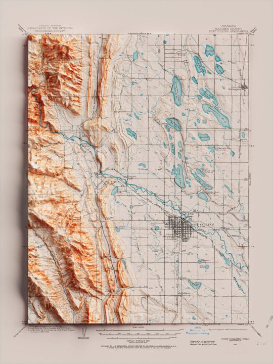
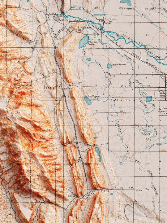
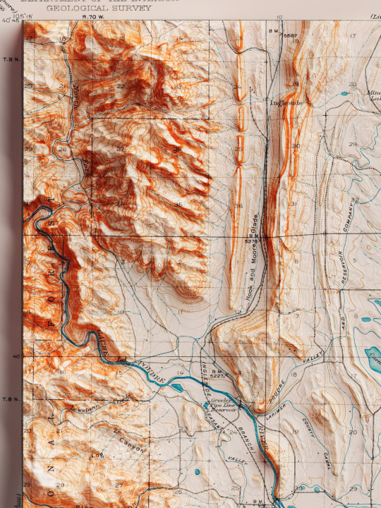
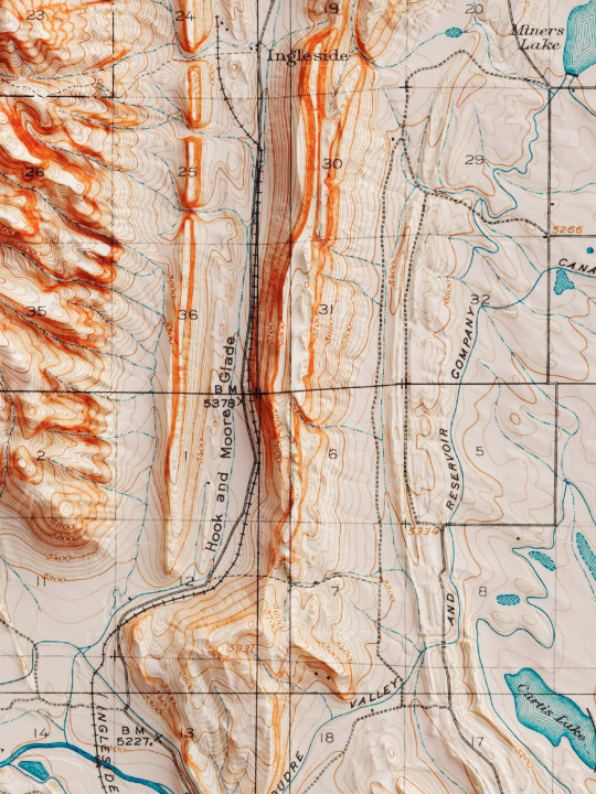
Shaded relief map with 3D effect of a topographic map of Fort Collins, Colorado (United States of America), in the quadrangle series and prepared and published by U.S. Geological Survey in 1906.
If you like our work, want to see our daily updates (or want to say hello to our studio), consider to follow our Instagram or Twitter account. Otherwise if are interested in our prints or have a custom request check our shop.
#homedecor#shadedrelief#shadedreliefmaps#map#cartography#cartographer#cartographie#cartographycommunity#vintagecartography#usa#usa🇺🇸#fortcollins#fortcollinsart#fortcollinscolorado#coloradogram#coloradotography#coloradosprings#3darts#digitalart#digitalartist#blendercycles#blenderartist#fineartprints#fineartprintshop#fineartprintstore#fineartprintstudio
7 notes
·
View notes
Last Seen Blogs

greenteatits
mommy 😍

letsmalicias
Malicia-ass

moeego-blog
Sem título

strangeigneous
Derp with a side of tickles

foryour4-blog
Untitled