
Statistics
We looked inside some of the posts by vizcart and here's what we found interesting.
Average Info
Notes Per Post
140
Likes Per Post
108
Reblog Per Post
27
Reply Per Post
5
Time Between Posts
14 days
Number of Posts By Type
Text
17
Last Seen Tumblr Blogs


Fun Fact
In Q3 of 2020, 31% of US users access the Tumblr app daily.
Text


Europe, satellite texture mixed with geo elevation tint. Shaded relief.
If you like our work, want to see our daily updates (or want to say hello to our studio), consider to follow our Instagram or Twitter account. Otherwise if are interested in our prints or have a custom request check our shop.
10 notes
·
View notes
Text


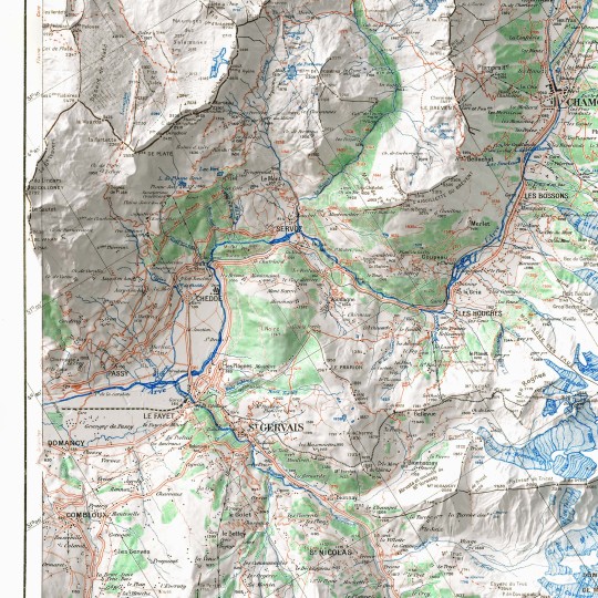
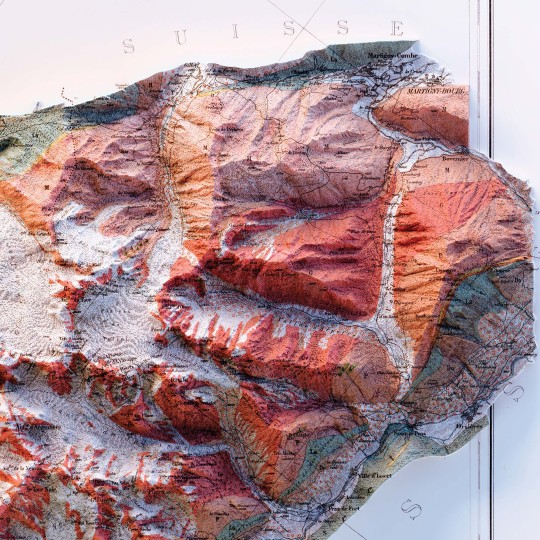
Mount Blanc topographic Relief Map.
This 2D poster features a restored version of the original 1946 map with shaded relief.
Discover more at vizcart.io.
#VintageMap#HistoricalCartography#MapArt#MapPoster#FramedPoster#cartography#geography#shadedrelief#datavisualization#gis#alps#mountains#maps#mount blanc
1 note
·
View note
Text


Australia map, from polish Pergamon Atlas, 1967.
If you like our work, want to see our daily updates (or want to say hello to our studio), consider to follow our Instagram or Twitter account. Otherwise if are interested in our prints or have a custom request check our shop.
#cartography#geography#shadedrelief#dataviz#maps#datavisualization#qgis#australia#geographylover#vizart#pergamon atlas
1 note
·
View note
Text


Mediterranean sea in a map realized by UNESCO in 1981.
If you like our work, want to see our daily updates (or want to say hello to our studio), consider to follow our Instagram or Twitter account. Otherwise if are interested in our prints or have a custom request check our shop.
0 notes
Text


France. The original map was prepared by J. Bartholomew and published in The Times Atlas of the World. Mid-Century Edition by Houghton Mifflin Co. in 1955.
If you like our work, want to see our daily updates (or want to say hello to our studio), consider to follow our Instagram or Twitter account. Otherwise if are interested in our prints or have a custom request check our shop.
0 notes
Text
Just a video to summarise our work for the map "tour du mont. blanc" of 1945.
1 note
·
View note
Text


Shaded relief of the Europe. This one will be changed soon with a shaped version where borders will be shown.
If you like our work, want to see our daily updates (or want to say hello to our studio), consider to follow our Instagram or Twitter account. Otherwise if are interested in our prints or have a custom request check our shop.
5 notes
·
View notes
Text
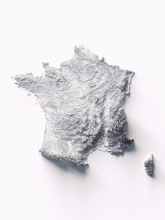


Minimal version of the France Relief. Realized by Vizart, it's one of the 4 colour variants.
If you like our work, want to see our daily updates (or want to say hello to our studio), consider to follow our Instagram or Twitter account. Otherwise if are interested in our prints or have a custom request check our shop.
0 notes
Text
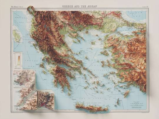
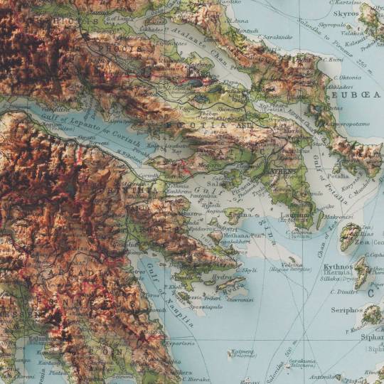
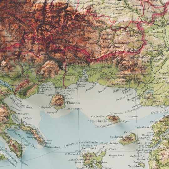
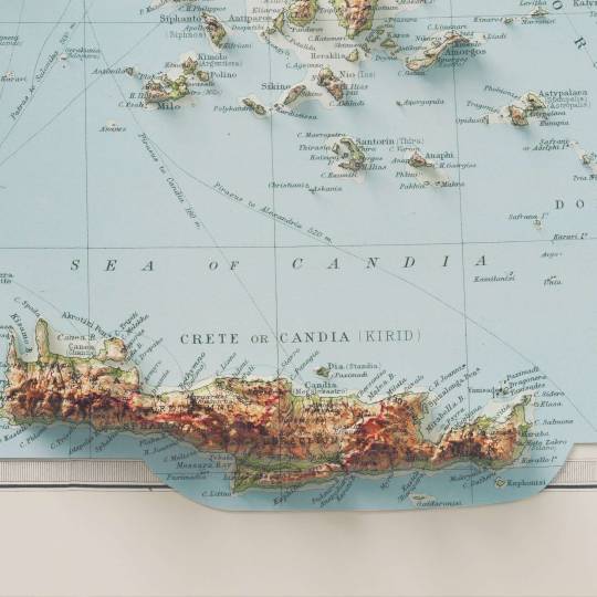
I love this map, and this atlas too. I think is one of the best result we achieved with the shaded relief maps, and I hope to find more time to find vintage maps on Mediterranean sea and coutries.
If you like our work, want to see our daily updates (or want to say hello to our studio), consider to follow our Instagram or Twitter account. Otherwise if are interested in our prints or have a custom request check our shop.
95 notes
·
View notes
Text
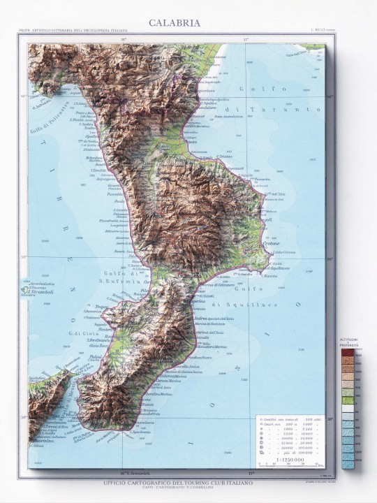
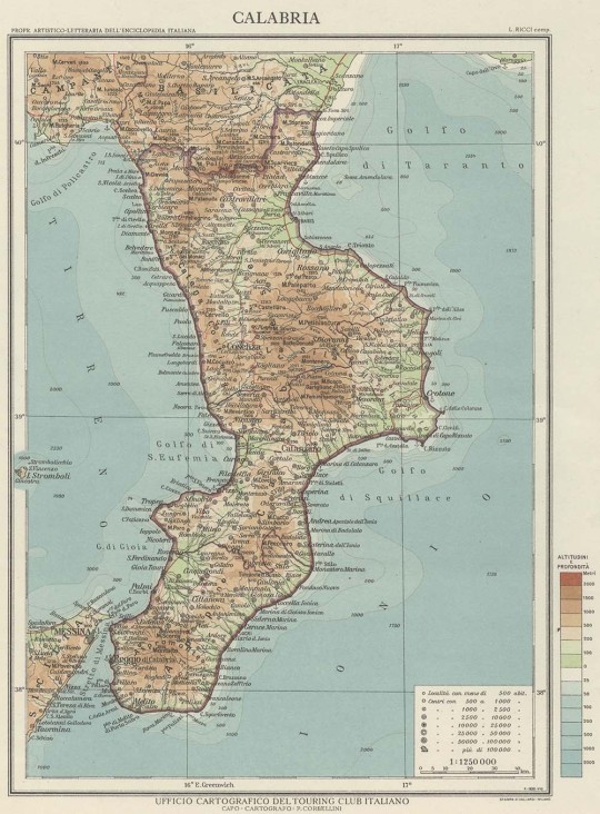
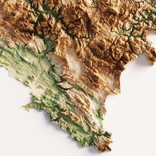
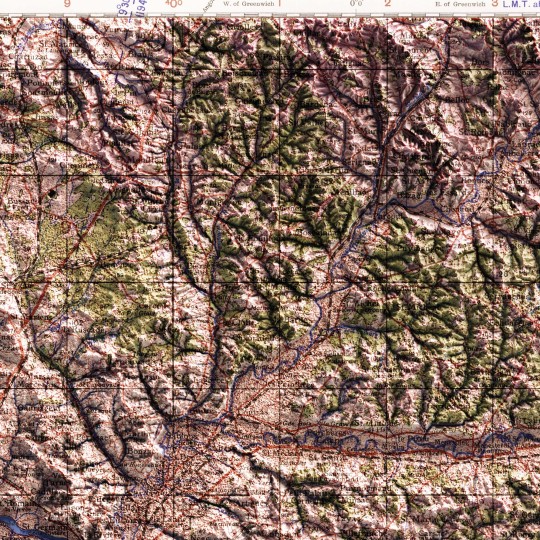
The great absentees from our collections on Italy were the southern continental regions. Today we share this map of Calabria made in 1930 by the Touring Club. The second image is the original map, before our restoration and relief work.
If you like our work, want to see our daily updates (or want to say hello to our studio), consider to follow our Instagram or Twitter account. Otherwise if are interested in our prints or have a custom request check our shop.
#cartography#geography#shadedrelief#maps#gis#mapart#calabria#vintage italy#touring club#messina#catanzato
6 notes
·
View notes
Text
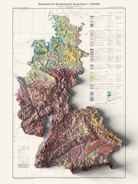
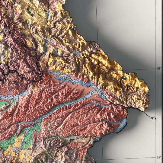
An unusual map of BDR from 1962.
🗺️ 𝗠𝗔𝗣 𝗜𝗡𝗙𝗢
Bodenkarte Der Bundesrepublik Deutschland, Bundesanstalt Fur Bodenforschung; 1963. Source: ESDAC.
If you like our work, want to see our daily updates (or want to say hello to our studio), consider to follow our Instagram or Twitter account. Otherwise if are interested in our prints or have a custom request check our shop.
4 notes
·
View notes
Text
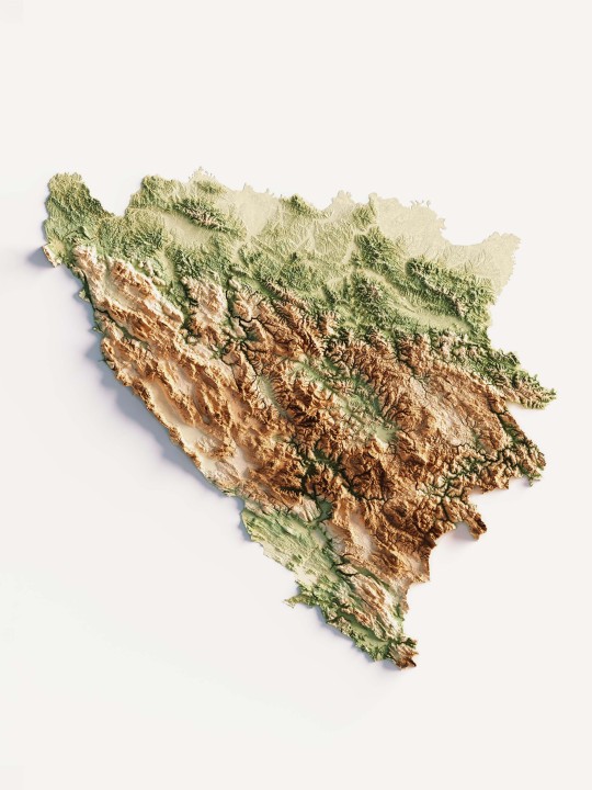
This elevation map was made as custom creation for a client, then we find really interesting the result, so re-make the map to fit our aesthetics lines.
If you like our work, want to see our daily updates (or want to say hello to our studio), consider to follow our Instagram or Twitter account. Otherwise if are interested in our prints or have a custom request check our shop.
7 notes
·
View notes
Text


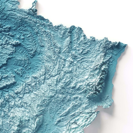

Shaded relief of hypsometric map with 3D effect of France with deep blue tint.
If you like our work, want to see our daily updates (or want to say hello to our studio), consider to follow our Instagram or Twitter account. Otherwise if are interested in our prints or have a custom request check our shop.
#MapLovers#ShadedRelief#CartographyArt#FranceMaps#MapCollection#MapDesign#elevationmap#modern design#graphic art
1 note
·
View note
Text
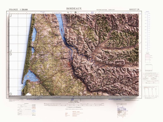
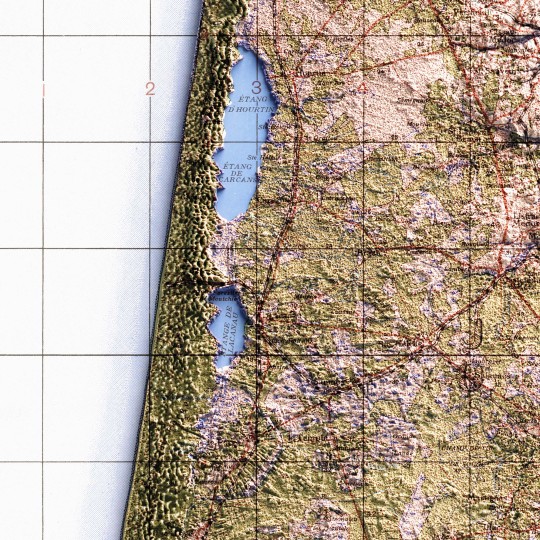
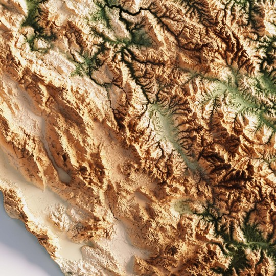
Shaded relief map with 3D effect of a topographic map of Bordeaux (France), produced and published by Great Britain War Office, in GSGS 2738 series in 1943.
If you like our work, want to see our daily updates (or want to say hello to our studio), consider to follow our Instagram or Twitter account. Otherwise if are interested in our prints or have a custom request check our shop.
#BordeauxTopo#VintageCartography#MapAesthetics#HistoricMaps#ReliefMapArt#FranceTopography#GeographyLovers#MapCollector#ClassicMaps#CartographyLove#TopographyArt#RetroMaps#MapEnthusiast#1943Maps#CartographyLife
0 notes
Text
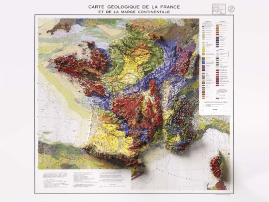
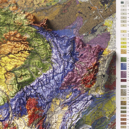
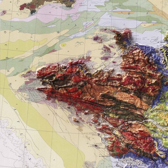
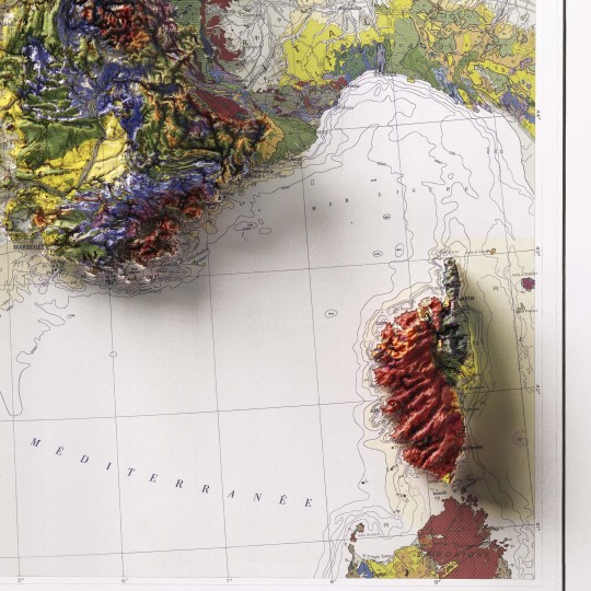
Shaded relief geological map of continental France, 1980.
🗺️ 𝗠𝗔𝗣 𝗜𝗡𝗙𝗢
Carte geologique et marge continentale, 1980. Département des Arts graphiques du B.R.G.M. Source: ESDAC.
If you like our work, want to see our daily updates (or want to say hello to our studio), consider to follow our Instagram or Twitter account. Otherwise if are interested in our prints or have a custom request check our shop.
#GeologicalMap#FranceMap#ShadedRelief#CartographyArt#MapDesign#GeologyMap#VintageMaps#BRGM#MapLovers#ReliefMap#MapCollection#GeologyArt#TopoMap#EarthScience#CartographyCommunity
5 notes
·
View notes
Text
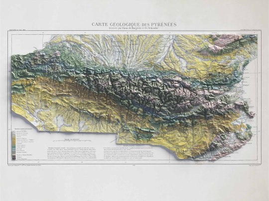
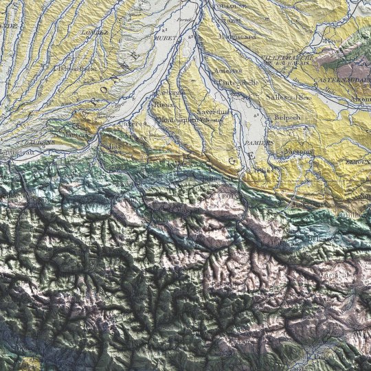
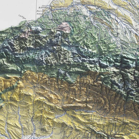
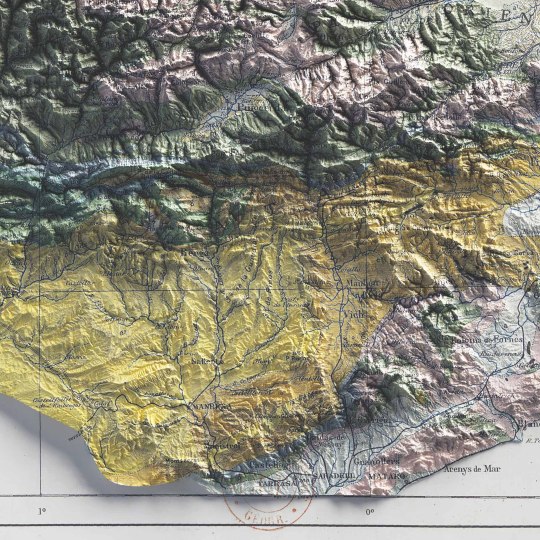
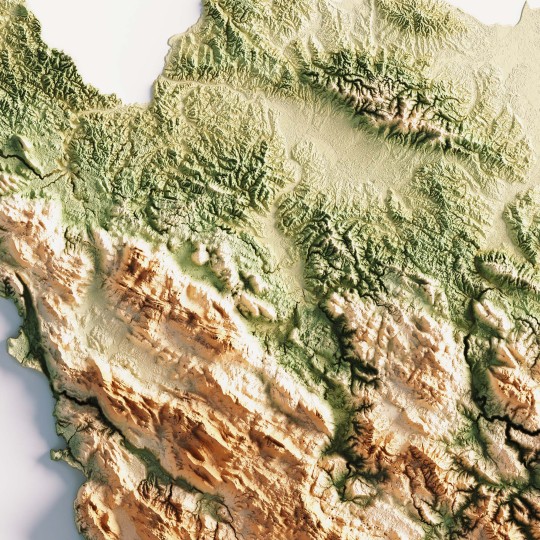
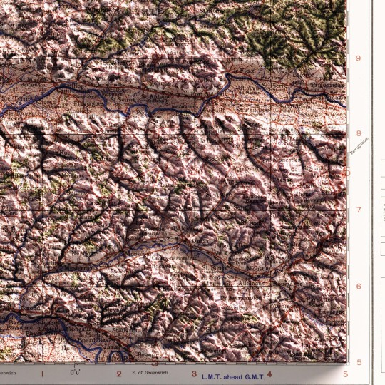
Pyrenees, shaded relief geological map.
🗺️ 𝗠𝗔𝗣 𝗜𝗡𝗙𝗢
Carte géologique des Pyrénées / dressée par Emm. de Margerie ; et Fr. Schrader, Annuaire du C. A. F. 1891, Hachette (Paris). Source: Gallica.
If you like our work, want to see our daily updates (or want to say hello to our studio), consider to follow our Instagram or Twitter account. Otherwise if are interested in our prints or have a custom request check our shop.
#cartography#maps#PyreneesMap#VintageMaps#ShadedRelief#CartographyArt#HistoricalMaps#MapLovers#GeographyArt#VintageCartography#MountainMaps#ReliefMapping#MapCollection#OldMaps#19thCenturyMaps#MapAesthetics#TopoMaps
3 notes
·
View notes
Text


We mapped Alps! Rosa, Matterhorn, Grossglockner, Dolomites! Have you seen that we have a geological map of Mont Blanc available? It was published in 1898!
If you like our work, want to see our daily updates (or want to say hello to our studio), consider to follow our Instagram or Twitter account. Otherwise if are interested in our prints or have a custom request check our shop.
#blender#datavisualization#qgis#geography#mapporn#cartography#mapping#gis#blender3d#dataviz#b3d#alps#alpsmountains#swissalps#frenchalps#italianalps#montblanc#montebianco#alpi#alpinism#alpinist#alpinismo#alpes
1 note
·
View note