
cairnme
Cairn
Staying connected means getting home safely. Get the app!
57 posts
Don't wanna be here? Send us removal request.
Last Seen Blogs

paperjshow
paper wholesale

hookthatyarn
HookThatYarn.com

manfrommars2000
Sweet Toxic Lust

timeless-willows
experience send

roxidan-ampora
IRL Shitpost
Text
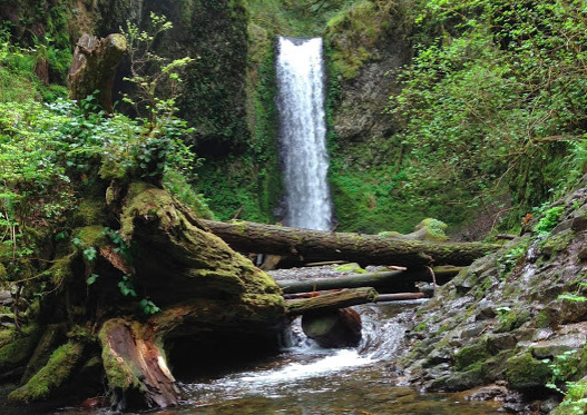
New Features, New Trails!
New ways to hike smarter
Record your hikes, climbs, and outdoor runs, and then analyze your trips’ stats. Cairn now shows your total distance and elevation covered by month, year to date, and all time.
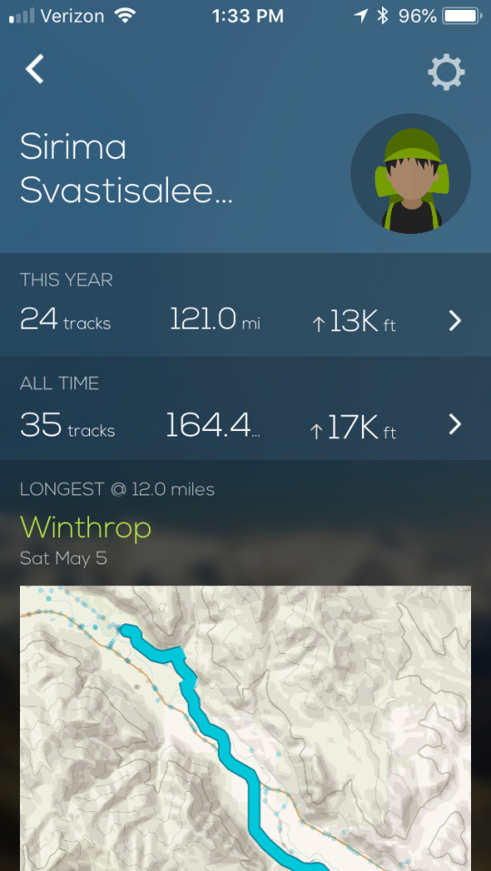
It doesn’t end there. You also get to see the following:
The longest distance you’ve hiked.
The hike or climb with the most elevation gain.
The highest point you’ve been to.
These features are great for training, setting goals, or gaining bragging rights. Make sure you record your track and save at least four of them.
New cell coverage milestone
Cairn users have collected over four million points of wilderness cell coverage worldwide, making the wilderness safer!
New trails
Team Cairn was in the Scottish Highlands recently mapping out cell coverage and scouting out trails to include in the app. It was a tough job but we thoroughly enjoyed it.
For those interested in staying connected, we found that Vodafone, O2, EE, and Verizon (for those Americans) generally have good coverage, to check on an exact area search for and view it in Cairn.
Here’s a quick summary of our favorite hill walks:
Isle of Skye
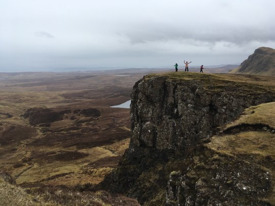
Quiraing — This is an essential walk for any Isle of Skye visitor as it passes through some of the most spectacular landscape in Scotland. World-class views start almost immediately and just get better. We recommend doing a loop (in Cairn). Start with the Prison and then climb up to The Needle. Then go through the slot to the Table (an epic tent site) for great views of the coast and mountains. Loop back by following the side trail north to the main trail.
Fairy Pools — These are at the foot of the Black Cuillins near Glenbrittle; beautifully crystal-clear blue pools on the River Brittle. These famous pools attract walkers from all over the world as they make some great ‘wild swimming’ for those brave enough to enter the cold water. If you partake, be sure to find a safe spot! Avoid going in above the falls or near fast rushing water. And be cautious on the rocks; just because you see others in the water doesn’t mean it’s safe.
Old Man of Storr — This is one of the most visited hikes on the Isle of Skye. The ‘Old Man’ is a large pinnacle of rock that stands high and can be seen for miles around. The wide trail and fairly easy climb make this a good option for novice climbers.

Neist Point Lighthouse — This is one of the most famous lighthouses in Scotland and can be found on the most westerly tip of the Isle of Skye near the township of Glendale.
While the walk down to the lighthouse is easy, the concrete path is quite steep at the beginning. Be sure to wear sturdy shoes or boots and reconsider going at all if you think you’ll encounter ice. You’ll see stunning views of the high cliffs and the lighthouse itself from the outset. At sunset the view is phenomenal, making this a top destination for photographers.
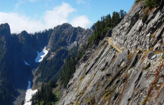
Cairngorms National Park
Cairngorms boasts the UK's biggest areas over 600, 900 and 1200 meters. There are plenty to choose from.

Ben Macdui — This is a great training climb for mountaineers and those looking for a challenge. At 1,309 meters, it’s the highest peak in the Cairngorms and the second highest mountain in Britain (after Ben Nevis). Climb it from the car park at the ski grounds on Cairngorm and wander up through Coire an t-Sneachda to the track that climbs the crags on to the Cairngorm plateau. Enjoy the "romp" to Lochan Buidhe, then head south over the arctic-like landscape of the final slopes to the summit. You’ll have a decent cell phone signal with EE.
Meall a’ Bhuachaille — A good choice for those with kids. The walk starts in a nice forested area and opens up with views passing a few creeks. There are nice views at the top. It was incredibly windy when we were there.
Know of trails you want to see in the app? Email us and we’ll add them.
0 notes
Text
Valley of Fire State Park Cell Phone Reception
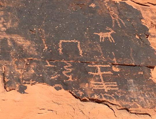
Well worth the drive from Las Vegas (about an hour and fifteen minutes), Valley of Fire State Park is one of Nevada’s first and best state parks. The diversity and drama of the landscape in this park are spectacular. Slot canyons, petroglyphs, unique stone formations and colorful wavy rocks provide incredible opportunities for photos.
With limited cell coverage, this is a great wilderness area for finding solitude. The Valley of Fire takes its name from the red sandstone formations here that were created from great shifting sand dunes about 150 million years ago. This is a fun place for adults and children alike. Here are our favorite hikes and a crowdsourced cell coverage summary:
Mouse's Tank
Mouse’s Tank is an easy, often crowded, three-quarter-mile out-and-back hike along a sandstone trail. You’ll wind through a canyon with hundreds of petroglyphs. The trail is flat with essentially no elevation gain if you stick to the path. You’ll dead end at the Mouse's Tank; a natural water catchment that in most months will contain water. You’ll find many nooks and crannies in which to crawl, making this a great hike for kids. However, there is no cell coverage here; our advice is to put your device in airplane mode in order to conserve your battery.
Fire Wave
This hike has colorful rock hills and mounds that stretch out from your feet in every direction as you stand on striated stone fields. The trail is an out-and-back hike that descends from the parking lot and across a sandy slope. You’ll find wildflowers here in the spring. The trail is marked with posts and stone cairns, but this is an area where you can wander freely and explore. Step on rocks to avoid damaging the fragile vegetation. Each direction reveals unique perspectives. This trail offers little shade and the rocks radiate heat on hot days. Take plenty of water and protect yourself from the sun with proper clothing, sunglasses, and sunscreen. Plan for at least an hour long hike. There is spotty Verizon cell coverage on this trail.
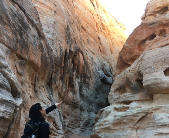
White Domes
If you only have time for one hike in the Valley of Fire, make it this one. This scenic one-mile loop hike has some interesting treats along the path, including a movie set and a dramatic (but short) slot canyon. There is a branch that you can take to a smaller less traveled canyon which is worth exploring but we recommend a GPS or the Cairn app to navigate. Cell coverage is spotty to non-existent.
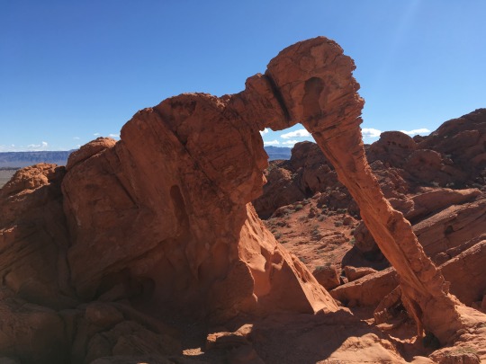
Elephant Rock
This is one of the most dramatic rock formations in the park. You can clearly see the elephant shape and it’s one of the most photographed sites in the park. It is one of the last spots of good cell coverage as you enter the park. The trail is located near the east entrance, immediately after entering the park. From the parking area, you can hike along a trail that parallels the road for a short distance. The elephant will be off to your right, set high up on the rocks above you. From here the trail continues on and around behind the rock that Elephant Rock is perched upon. Watch out for snake dens.
Lastly, the campground and visitor center have no cell coverage or Wi-Fi, so plan accordingly. We recommend that you download all of your Cairn maps before heading into the park.
0 notes
Text
OptOutside2017 with team Cairn, 52HikeChallenge, and REI.
Join the Cairn founders in partnership with the 52Hike Challenge and sponsored by REI for a Black Friday hike to Mason Lake.
This is a great opportunity to:
Meet fellow #52HikeChallenge participants and partners.
Meet the Cairn founders and pick their brains from apps to wilderness survival.
Make new hiking buddies.
Learn tips and tricks of using Cairn.
Chance to win some sweet swag from REI.
Post your photos with #52HikeChallenge #OptOutside #Cairnapp
Bring the following: 10 essentials, layers, rain gear, snacks, 2 liters of water, poles, micro-spikes, and notify safety contacts / download the offline map with Cairn.
Everyone participating must sign & turn in our liability waiver - which can be e-signed here: https://waiver.fr/p-nWfS7
Driving Directions: From Seattle, drive east on I-90 to exit 45. Turn left and cross under the highway, then veer left onto FR-9030. About one mile from the exit, stay left at the fork onto Mason Lake Road, FR-9031. Park in the lot at the end of this road, 3.8 miles from the highway. There is a privy at the trailhead.
Parking Pass/Entry Fee: Northwest Forest Pass
Get more information on this hike here: http://www.wta.org/go-hiking/hikes/ira-spring-memorial
Please RSVP and save the date. See you on the trails!
0 notes
Text
Call Dad from One of these 5 Iconic Summits

Get out with Dad for an epic Father’s Day — or at least give him a call! Cairn users have mapped over two million points of cell coverage worldwide while getting tracked for safety and using Cairn to navigate. Thanks to their efforts we’ve identified some awesome summits you can call Dad from to wish him a happy Father's Day!

1. Mount Rainier
Mount Rainier, the most heavily-glaciated peak in the contiguous United States, offers an exciting challenge to the mountaineer. Once on the summit crater, head up towards the rim to the true summit. To get the best signal from all carriers face the Seattle area. LTE signals are strong enough to post pictures.

2. Mount Hood
Mt. Hood is the second-most climbed mountain in the world and attracts more than 10,000 climbers annually. But it’s no walk in the park! On a sunny summer day, the main problem with getting a call off to Mom at the summit is not finding coverage — it’s having a private conversation. Watch out for cornices at the summit.
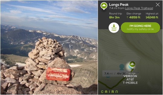
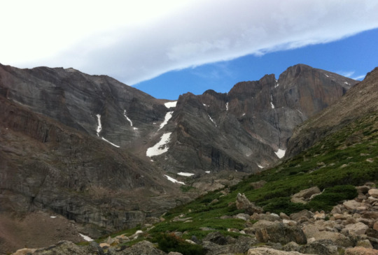
3. Longs Peak
Longs Peak towers above all other summits in Rocky Mountain National Park. The flat-topped monarch is seen from almost anywhere in the park. There’s decent Verizon and good AT&T coverage on the summit and summit approach. For best results, face toward Denver. With other carriers you’ll need luck to even get an SMS out.
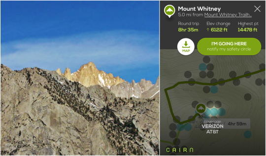
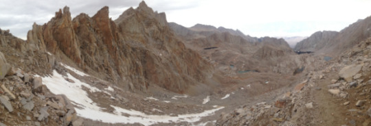
4. Mount Whitney
Mount Whitney is the tallest mountain in the lower 48 states. At best you’ll have spotty cell coverage on the route up to the summit with any carrier, But there are a few spots at the top with Verizon and AT&T coverage.

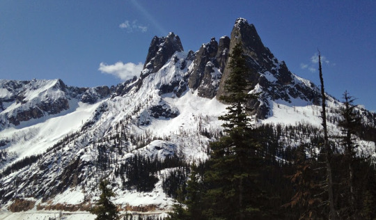
5. Mount Shasta
Mount Shasta is the second highest volcanic peak in the Cascade Range. Climbing it is physically challenging, but you’ll have stunning scenery along the way. Climbers have gotten AT&T and Verizon coverage at the summit facing south.
To all dads, happy Father’s Day!
Team Cairn www.cairnme.com
0 notes
Text
Solar Eclipse: 21 Spectacular Last-Minute Places to Camp
Haven’t reserved a spot for August’s total solar eclipse yet? Many hotels and reservable campsites in the eclipse path are completely booked. But all hope is not lost. We’ve scouted out 21 first-come, first-serve camping destinations across the U.S. that are directly in the eclipse path of totality. You just need to be willing to arrive early or be able to rough it a bit.
Car Camping
If car camping is for you, you’ll need to snag a spot early. Having access to restrooms, picnic tables and fire pits can certainly make your stay more comfortable. Many sites are situated in the trees so you’ll need to hike or drive to a suitable eclipse-viewing spot. We’ve have suggestions for such places; you can find their exact locations by downloading the Cairn app. Be aware that most campsites allow a maximum 14-day stay, so you might be looking at getting to these as much as two weeks in advance to ensure you find one that’s available.
Note that every one of Oregon’s state park campsites have already been reserved, even those usually designated as first-come first-serve.
Backpacking and Dispersed Camping
With the right gear and a little flexibility you can take your eclipse experience to the backcountry. We’ve listed some backpacking destinations that should make for some fine eclipse viewing. But also consider dispersed camping: In the U.S. you can camp in national forests and in Bureau of Land Management (BLM) areas for free as long as you’re away from designated campgrounds. So that means millions of acres available for you to conceivably enjoy the eclipse without any crowds. You won’t have any services (like water and restrooms) so you’ll need to do a little extra planning. Bring water and be prepared to walk a little way from your vehicle. You’ll also have to get there early enough in the day to find a suitable spot.
A Word to the Wise
Check whether you’ll have cell coverage before you go (the Cairn app is the best place for this, of course). If you have spotty coverage it can be especially challenging to get a signal when there are crowds. Follow The Leave No Trace principals. Be respectful of others. And be especially careful of fire regulations. An unplanned wildfire would be most unwelcome in August. And finally, enjoy this once-in-a-lifetime opportunity!

Don’t forget to download the Cairn app!
1. Hunt’s Cove, Willamette National Forest, Oregon
Crowd prediction: Medium
Historical avg cloud cover: 30%
Eclipse totality duration: 1:58 at 10:18 am
Up-close views of Mt. Jefferson make this a fantastic setting for backcountry eclipse watching. Hike 7.3 miles one way.
2. Triangulation Peak, Willamette National Forest, Oregon
Crowd prediction: Low
Historical avg cloud cover: 30%
Eclipse totality duration: 2:01 at 10:18 am
Set up camp at the trailhead and then hoof the 2.6 miles to the summit in the morning to experience the eclipse.
3. Three Fingered Jack, Mount Jefferson Wilderness, Oregon
Crowd prediction: Low
Historical avg cloud cover: 30%
Eclipse totality duration: 1:39 at 10:18 am
Camp at the trailhead and then get up early for the 6.6 mile climb where you’ll find a phenomenal summit view of the eclipse and the Cascades.
4. Priest Hole, John Day River, Oregon
Crowd Prediction: Medium
Historic avg cloud cover: 20%
Eclipse totality duration: 2:04 at 10:20 am
Snag a riverside site at Priest Hole on Bureau of Land Management land. Drive 25 minutes to the stunning Painted Hills Overlook to experience the eclipse.
5. Walton Lake, Ochoco National Forest, Oregon
Crowd prediction: Medium
Historical avg cloud cover: 40%
Eclipse totality duration: 1:41 at 10:20 am
Arrive early to snag one of the walk-up sites at this lovely lakeside campground. Find a lakeshore spot facing southeast to witness the eclipse.
6. Strawberry Campground, Malheur National Forest, Oregon
Crowd prediction: Medium
Historical avg cloud cover: 30%
Eclipse totality duration: 1:49 at 10:22 am
Grab one of this campground’s ten first-come first-serve sites or simply find yourself a dispersed spot almost anywhere in the forest.
7. Indian Rock, Umatilla National Forest, Oregon
Crowd prediction: Medium
Historical avg cloud cover: 30%
Eclipse totality duration: 1:34 at 10:23 am
1.7 million acres of forest available for dispersed camping means little competition for spots. Make your way to Indian Rock for the eclipse.
8. Sheepeater Hot Springs, Boise National Forest, Idaho
Crowd Prediction: Low
Historical avg cloud cover: 30%
Eclipse totality duration: 0:56 at 11:28 am
Raft or hike (13.5 miles) along the Middle Fork Salmon River to the Sheepeater Hot Springs Campground. Hop in the springs for one-of a-kind eclipse viewing.
9. Norton Lakes, Sawtooth National Forest, Idaho
Crowd Prediction: Low
Historical avg cloud cover: 50%
Eclipse totality duration: 1:19 at 11:29 am
Bring your tent and fishing gear to these lovely emerald green lakes (2.4 miles). Hike an hour to Norton Pass in the morning for big sky views of the eclipse.
10. Borah Peak, Salmon-Challis National Forest, Idaho
Crowd Prediction: Low
Historical avg cloud cover: 40%
Eclipse totality duration: 2:11 at 11:30 am
Experience moon-like scenery on your climb to the highest point in Idaho. Camp at the trailhead and time your summit arrival for the eclipse totality at 11:30 am.
11. Lava Flow Campground, Craters Of The Moon National Monument, Idaho
Crowd Prediction: Medium
Historical avg cloud cover: 40%
Eclipse totality duration: 1:15 at 11:31 am
Camp directly on an old lava flow at this 51-site campground (all walk-up). Scout out a spot along Highway 26 for the eclipse experience.
12. Snowdrift Lake, Grand Teton National Park, Wyoming
Crowd Prediction: Medium
Historical avg cloud cover: 50%
Eclipse totality duration: 2:17 at 11:34 am
Trek 8.2 miles to camp at this spectacular high-altitude lake. Head to Avalanche Divide (1.2 miles) for dramatic eclipse viewing. Hope for clear skies.
13. Curtis Canyon Campground, Bridger-Teton National Forest, Wyoming
Crowd Prediction: High
Historical avg cloud cover: 50%
Eclipse totality duration: 2:19 at 11:34 am
Arrive early to grab a walk-up site at this campground. In the morning take the tram to the top of Rendezvous Mountain ($42) or tackle the 4,000+ foot elevation hike.
14. Esterbrook Campground, Medicine Bow National Forest, Wyoming
Crowd Prediction: Medium
Historical avg cloud cover: 30%
Eclipse totality duration: 2:15 at 11:44 am
Try for one of the 12 walk-up sites at this campground nestled among ponderosa pines. View the eclipse right from your camp.
15. Berryman Campground, Mark Twain National Forest, Missouri
Crowd Prediction: Medium
Historical avg cloud cover: 30%
Eclipse totality duration: 1:45 at 1:16 pm
Grab one of eight sites or find a nearby dispersed spot to camp. You’ll find a high area for eclipse viewing 1.2 miles northwest along the Ozark Trail.
16. Inspiration Point, Shawnee National Forest, Illinois
Crowd Prediction: High
Historical avg cloud cover: 30%
Eclipse totality duration: 2:37 at 1:21 pm
Hike .8 miles to this summit for big views of the river valley and bottomlands, perfect for eclipse-watching. Find your own dispersed campsite.
17. Double Spring Gap Shelter, Great Smoky Mountains National Park, North Carolina
Crowd Prediction: High
Historical avg cloud cover: 45%
Eclipse totality duration: 1:25 at 2:25 pm
Hike 3.6 miles to this Appalachian Trail shelter. In the morning head to the the Clingmans Dome Observation Tower (the highest point in Tennessee) for 360-degree panoramic views.
18. Deep Hole Campground, Chattahoochee National Forest, Georgia
Crowd Prediction: Medium
Historical avg cloud cover: 45%
Eclipse totality duration: 1:06 at 2:35 pm
Camp, canoe & fish along the Toccoa River at this 8-site first-come first-serve campground. Head to Wilscot Mountain for open eclipse views. Dispersed camping also allowed.
19. Appalachian Trail (near Wayah Bald), Nantahala National Forest, Georgia
Crowd Prediction: Medium
Historical avg cloud cover: 45%
Eclipse totality duration: 2:35 at 2:35 pm
Find a campsite along the Appalachian Trail about a mile southwest of Wayah Bald Fire Tower. Climb the tower for a panoramic view of the eclipse.
20. East Fork Trail, Sumpter National Forest, South Carolina
Crowd Prediction: High
Historical avg cloud cover: 45%
Eclipse totality duration: 2:33 at 2:36 pm
Snag a campsite near the bridge along this trail. You’ll get a nice view of the eclipse from the north side of the Chattooga River.
21. Bluff Campground, Congaree National Park, South Carolina
Crowd Prediction: Medium
Historical avg cloud cover: 45%
Eclipse totality duration: 2:42 at 2:42 pm
Hike just one mile to this six-site campground and relish the beauty of the bottomland old-growth forest. See the eclipse right from the campground.
You can access offline maps, stats, and cell coverage on the each of these locations via the Cairn app.
Press — Download the infographics from our press page.
NOTE: Mt. Jefferson Park is currently closed due to a large wildlife fire and will stay closed through the eclipse. Check the forest service website for the latest conditions.
#On August 21st#eclipsecamping#2017eclipse#eclipse#oregoneclipse2017#idahoEclipse2017#WyomingEclipse2017#SouthCarolinaEclipse
1 note
·
View note
Text
Know when you’ll get there

When we’re on the trail, most people respond to our greetings with a polite hello. But there is always someone that asks, “How much farther?” It’s the big question on the trail. Now Cairn can tell you. It won’t use up your battery, it’s instantaneous and works offline. Here’s a quick (like, 20 second) lay of the land:
See if your trail is there
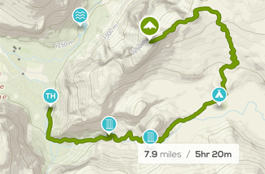
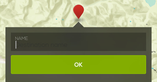
Search for your destination in the app. We’ve significantly improved the way search works, so your destination should come up right away. Your trail will be outlined in green. If your trail’s not there, shoot us an email and we’ll add it.
Download the map
This step isn’t strictly necessary if you know you’ll have strong cell coverage. But we always download our maps beforehand because it saves battery, time and data costs. The whole thing is a two-tap process, because Cairn now knows just what part of the map to download.
Get out on the trail and bring up the app
You’ll automatically see all your stats; when you’ll get there, elevation left to climb (or descend), even the highest point along your route. Having this info at your fingertips will make you feel like a hiking superhero know-it-all.
0 notes
Text
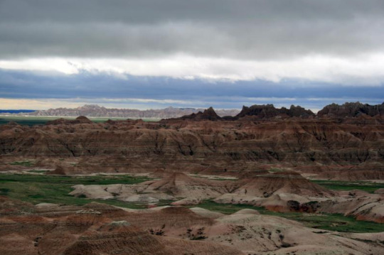
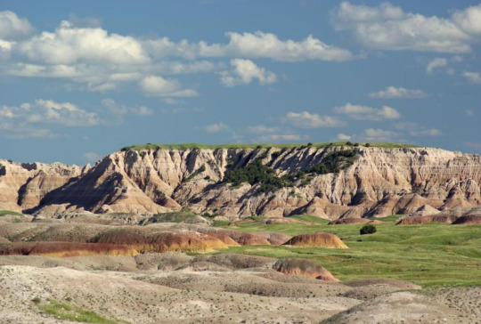
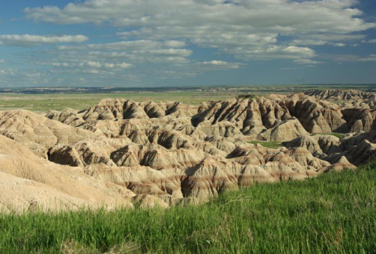
Staying Connected at Badlands National Park
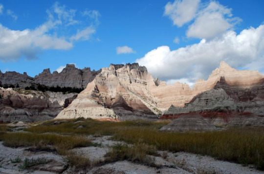
The Twitter account for Badlands National Park recently went rogue (apparently at the hands of an ex-employee) to draw attention to climate change. This was despite the Trump administration’s blackout on government social media posts. The park’s number of followers skyrocketed from about 7k to more than 180k on Jan. 24, 2017, which means a bunch of people who were previously unaware of how spectacular the Badlands is might be inspired to visit.
Love of the great outdoors and for our public lands are causes that people of any political persuasion can get behind and might just be the bridge that brings us together and keeps the Trump administration accountable. At Cairn we believe it is important to fight for our public lands and allow the parks to share information that impacts and affects us.
Here is the scoop on the best spots to find cell coverage at Badlands. Share your love for national parks from these amazing places to maximize impact:
Conata picnic area and basin overlook has decent AT&T coverage but Verizon is strong, enough to post photos in real-time.
On the hike to Sage Creek Basin, the further away from the road you get, the fewer spots have coverage. This is a good place to find solitude and enjoy the rugged terrain of Badlands.
The southeast entrance and Cedar Pass Area both have many decent AT&T spots. There is great Verizon coverage but no Sprint or T-Mobile coverage.
Panorama Point along 240 had OK AT&T and Verizon coverage.
Caution: There is no potable water in Badlands backcountry so carry at least a gallon per person each day when hiking or backpacking. Don’t forget to check in with a park ranger for the latest conditions and send a Cairn to your safety contacts. Most of all, enjoy your public lands!
Image Credits: Badlands NPS website
#findyourpark#Climatechange#theresistance#altusnatparkservice#altnatparkser#badlands#Badlands National Park
0 notes
Text
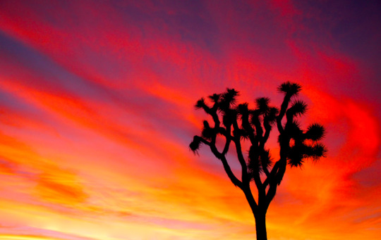
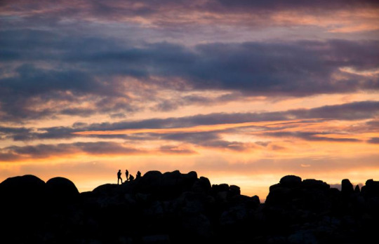
Cell Coverage at Joshua Tree National Park
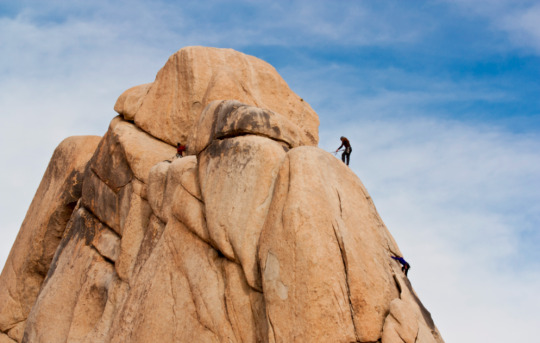
Find exact points of cell coverage at Joshua Tree National Park where you’ll experience piles of topsy-turvy boulders, scrubby washes, rough trees, and beautiful wildflowers. Nights are filled with stars and meteorite shower shows. Not to mention some of the best bouldering and rock climbing in the United States. Cairn users have mapped a fraction of this gem but here’s a summary of the popular places people have driven, hiked, and climbed using Cairn.
Indian Cove — There’s good Verizon and AT&T coverage at the ranger station and campground there.
Boy Scout Trailhead — This is a spectacular and rugged loop and you might even get a shot at seeing bighorn sheep. You’ll find decent Verizon coverage to send your coworkers photos and make them jealous.
Hidden Valley Campground — No T-Mobile, Verizon, or AT&T at the campground — but all three have spotty signals on Park Boulevard which is directly to the west.
Jumbo Rocks Area (a rock climber’s mecca) has decent AT&T, Verizon, and Sprint coverage. This area includes Corridor, Sky King Rock, and Nuclear Reactor Rock, along Park Ave. and the campground. Verizon sports the best signal overall and is also strong at Skull Rock Nature Trailhead.
Keys View — The view is grand. The cell coverage, not so much. Verizon, Sprint, and T-Mobile have weak signals and AT&T service is not available at all. There’s essentially enough coverage to send Mom an ‘I’m OK’ message with Cairn if you have Verizon, Sprint, or T-Mobile.
The best coverage from all carriers is at the Oasis Visitor Desert Institute. It’s no surprise since it’s located in the town of Twentynine Palms.
The best place to unplug is Cottonwood Spring Campground and Trail. Hike to Lost Palms Oasis to view one of the largest stands of fan palms in Joshua Tree. You’ll also be rewarded with hummingbird sightings as they hang out near yuccas, chollas, and ocotillos. At this point no Cairn hikers to the area have found a signal from any carrier, so plan to disconnect.
Remember to spread the love! Share Cairn with a friend.
0 notes
Text
Cell Coverage on Colorado's 14ers (and more)
As Cairn grows we’re seeing more areas with mapped cell coverage, including two of Colorado’s national parks and over three dozen 14er summits (14ers are peaks that rise 14,000 feet or more above sea level). Wondering when the best season is to explore Colorado’s natural beauty?
Colorado has some of the best scenic outdoor spots in the world. Top activities include skiing, ice climbing, snowshoeing, hiking, backpacking, rock climbing, and trail running. No matter the time of year, there’s always something to do outdoors.
Communication, information and planning are key to staying safe and for making good decisions. We’ve put together a sampling of the popular spots where you can find a signal so you can plan your Colorado adventure accordingly.
Rocky Mountain National Park
Rocky Mountain National Park’s 415 square miles encompass and protect dramatic mountain ecosystems. It’s got alpine lakes, wildlife, and meadows that the whole family will enjoy. It has towering peaks for the more adventurous to conquer. There’s something for everyone, including many overlooks to experience the subalpine and alpine worlds — along with over 300 miles of hiking trails. As far as cell coverage, this park is great for disconnecting with plenty of spots where you won’t find a signal. But there are a few with coverage:
Bierstadt Lake — Verizon has coverage with some spots getting enough of a signal to send photos and check email. The best spots are up on the trail rather than along the lake bank.
Bear Lake & Car Park — Decent Verizon and poor AT&T coverage. AT&T subscribers might be able to get a faint signal (enough for a text). Most people with the Cairn app using AT&T were not able to find coverage in this area.
Moraine Park Discovery Center and Moraine Campground — Some Verizon spot were mapped, mainly on the road and south portion of the campground.
Longs Peak — Poor Verizon and good AT&T coverage on the summit and summit approach. For best results face toward Denver. Sprint was non-existent.
Grand Lake East Inlet Trailhead — People with AT&T were able to map some coverage points just east of the lake on the trail.
Lost Falls — No one with Cairn has mapped this trail yet but it’s a popular search. We could really use help if you plan on hiking or backpacking this area.
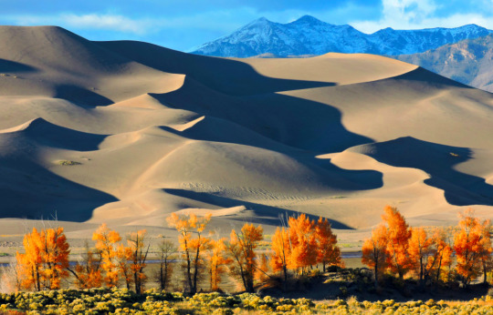
Great Sand Dunes National Park
This park is famous for having the tallest dunes in North America, but Great Sand Dunes offers much more than just that. It has a a diverse landscape of grasslands, wetlands, conifer and aspen forests, alpine lakes, and tundra. Popular activities include camping, hiking, sand sledding, splashing in Medano Creek and wildlife watching. One unique safety consideration to be aware of is hot sand In summer, as the sand surface can reach up to 150°F (66° C). Plan to hike the dunes in early morning or evening to avoid heat exhaustion and burned feet. Wear closed-toe shoes (not sandals) if you must hike in the middle of the day. Blowing sand can occur in the windy spring season or during storms. To protect your eyes and lungs, avoid the dunes when windy or wear eye protection. If you get sand in your eyes, flush with running water or saline eye solution. Verizon has the best coverage at Great Sand Dunes National Park. Following is a quick rundown of carriers and where people have found signals.
Montville Nature and Mosca Pass Trails — Good AT&T and Verizon coverage at the trailheads. It’s not clear if there is data along the trails.
High Dune — It’s no surprise with the height and vast openness here that people were able to find good Verizon and AT&T phone coverage.
Highway 150 — Verizon, AT&T, and T-Mobile coverage. Be safe on the road while making those calls.
Colorado 14ers
Colorado boasts 54 peaks over 14,000 feet high. Climbers and hikers have used Cairn on over three dozen of them. Overall coverage at most of the fourteeners’ summits is good. Just because one person’s phone did not detect a signal does not mean there is no coverage. Another person with a different device, experiencing different weather conditions, or standing in a slightly different spot might be able to pick up coverage.
Colorado 14ers with T-Mobile, AT&T and Verizon coverage at their summits:
Grays Peak — Verizon
Mt. Bierstadt — Verizon, but no AT&T or T-Mobile.
Torreys Peak — Verizon
Quandary Peak — Both AT&T and Verizon signals on summit and summit ridge
Mt. Democrat — AT&T and T-Mobile
Mt. Lincoln — Verizon
Mt Cameron — Verizon and AT&T on summit and summit ridge.
Mt Bross — AT&T and Verizon at numerous spots on summit knoll
Mt. Elbert — AT&T and Verizon on the summit and on the higher section of the summit trail
Mt Evans — Verizon
Pikes Peak — Spotty T-Mobile and decent Verizon and AT&T
Mt. Massive — Verizon
Mt Columbia — Verizon and T-Mobile at the summit and along the Harvard-Columbia traverse
Prefer to be completely unplugged? You’ll be hard pressed to find any signal from any carrier on Sunshine Peak.
To see exact points of coverage and see them on topo maps while offline, download Cairn and give it a try. You’ll help make the wilderness safer just by using Cairn.
#colorado 14ers#rockymountainnationalpark#rockymountainnps#greatsanddunes#rockymountains#greatsanddunesnp#coloradohike#hikecolorado#fourteeners#14rs#climbcolorado#coloradoclimbing
0 notes
Text
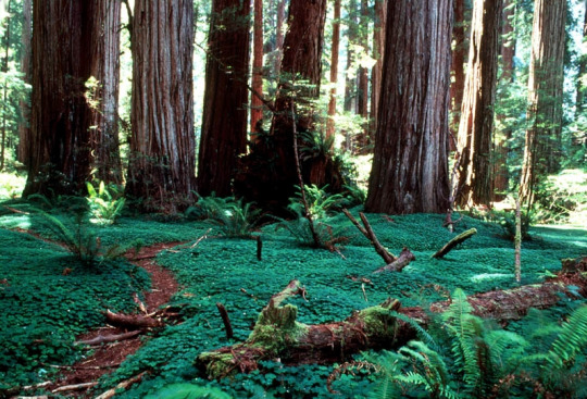
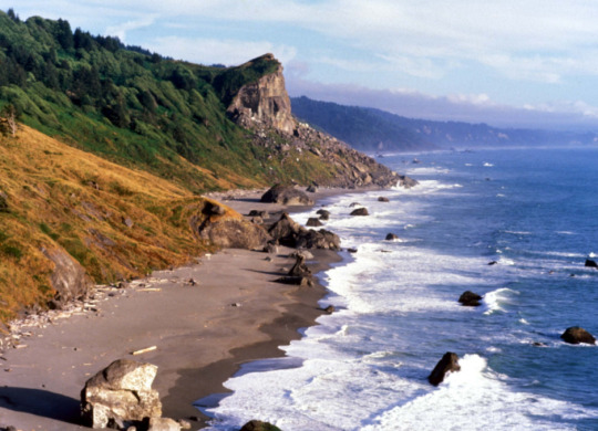
Cell Coverage At Redwood Forest National and State Parks
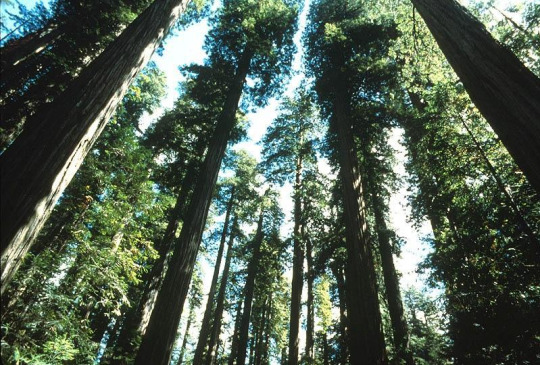
Redwood is home to the tallest trees on Earth. The parks also protect vast prairies, oak woodlands, wild riverways, and nearly 40 miles of scenic rugged coastline. For thousands of years, people have lived in this majestic area. Together, the National Park Service and California State Parks manage these lands.
The Redwoods are great for novices and families who want to enjoy the outdoors and still manage to woo experienced hikers and backpackers. Some Cairn users have recently explored the area and were able to map the following carriers. Here’s a short overview on getting a signal:
Hwy 101 - Generally decent coverage from Verizon and AT&T as you near Crescent City and False Klamath, ok at the Trees of Mystery trailhead. Including as you enter Del Norte Coast Redwood State Park.
AT&T was weak at Tall Trees Grove Trailhead, so this is a great spot to get away from technology. The popular 4-mile round-trip Tall Trees Trail (also known as Libbey Tree) heads to the Tall Trees Grove, an alluvial flat next to Redwood Creek that hosts a former title-holder of world’s tallest tree. This former record-holder, discovered by a National Geographic survey team in 1963, in part, spurred the creation of the National Park in 1968. Due to limited parking, you need to stop at the Kuchel visitor center first and get a permit to hike or park at this trailhead. The road is rough and dusty, 4 wheel high clearance vehicle recommended.
Dry Lagoon State Park - One Cairn user with T-mobile was able to map some spots with the best coverage North near Freshwater Lagoon. Good hike-in or kayak-to campgrounds here.
Boy Scout Trail - A must hike if, in the area, T-mobile, AT&T, and Verizon were spotty, your best bet for getting a signal are at the trailhead and end of the hike but not much in between.
Jedediah Smith Redwood State Campground - AT&T and Tmobile spotty, Verizon a bit better with the best coverage in the southern spots.
Stout Grove Trailhead - A good place to take your teenagers who want to share social media photos, Cairn users from AT&T, Verizon, and T- mobile were all able to get signals.
Summers do get busy and crowded, even with multiple towers in Redwood City and the general area, calls still drop because of overloaded lines. Remember Cairn shows you trail details on topo maps with coverage spots and even lets you download these for offline use.
0 notes
Text
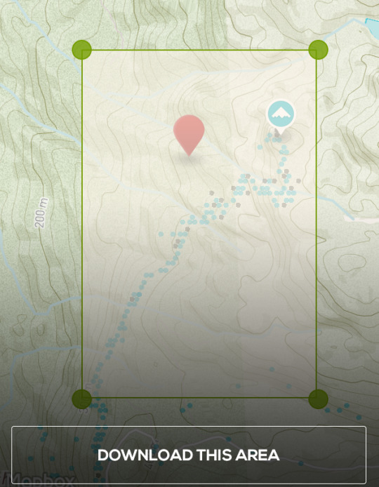
Offline Topo Maps are Live
Select a destination or tap and hold a spot on the map for a few seconds, then you'll get a prompt to download a map. You can adjust the corners of the rectangle to specify the area to download and zoom in/out to make the area bigger or smaller. If you lose cell coverage, the map and your GPS location will still be available. We recommend doing this while you still have wifi, especially with larger map areas. We store the last 5 map downloads. Once downloaded, all you need to do is hit the trail and enjoy.
We believe experiences with others are more important than buying stuff, so we are doing what we can to help you spend more time outside this holiday season. Cairn recently launched offline maps. Cairn is one of the only apps that allows you to download Topo maps for offline use for free. Even sweeter, we show you cell coverage overlays- here's the scoop:
Download a map before your trip:
Select a destination or tap and hold a spot on the map for a few seconds, then you'll get a prompt to download a map. You can adjust the corners of the rectangle to specify the area to download and zoom in/out to make the area bigger or smaller. If you lose cell coverage, the map and your GPS location will still be available. We recommend doing this while you still have wifi, especially with larger map areas. We store the last 5 map downloads. Once downloaded, all you need to do is hit the trail and enjoy.
#OptOutside
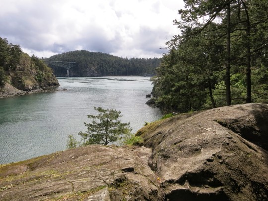
On Black Friday we're joining REI and many others by hitting the trail. Join us and share using the #OptOutside hashtag on your favorite social site. Look for team Cairn on the trails at Deception Pass State Park, WA on Black Friday.
ENJOYING CAIRN?
You can help us by telling others about the app. Here is a pre-populated tweet and email for easy sharing.
Love Team Cairn
0 notes
Text
Solo Hiking Safety Tips
Should I run or hike solo? As a prior wilderness survival instructor, I am often asked this question. And my answer is yes, I believe everyone would benefit from experiencing the wilderness alone at least one time. Solitude isn’t the only reason to hike alone, sometimes scheduling conflicts or varying fitness levels could be a reason to hike alone. But along with the benefits of solo hiking come additional risks. If you do choose hike alone, here are some tips for doing it safely:
Risk tolerance
Know your limitations and stick to the trail. As a solo hiker, you should have a lower risk tolerance than being with a partner who can help or summon help in an emergency. Especially if you are traveling on a trail without much traffic. When hiking alone factor in tolerance for the weather, amount of gear needed, exposed spots on the trail, allergies, and turn around times (hint: Cairn’s ETA feature shows your time to destination and adjusts as you hike based on your current speed).
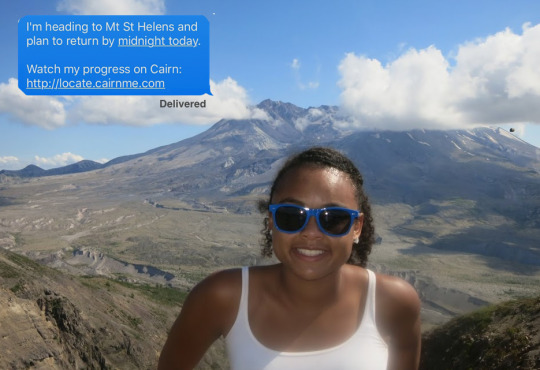
Leave a Detailed Trip Plan
Send a Cairn to contacts before you leave. Letting a reliable person (or group) know where you are going, the time you are expected back, what to do if you don’t check in, and other details are one of the best ways to help Search and Rescue save time in finding you. Cairn makes it super easy (less than a minute) to do this by email or SMS. Contacts can then track your progress and even be alerted to your device battery status at each point.
Carry the updated 10 essentials.
As a solo hiker, it’s even more important because you don’t have a partner who you can share essentials with.
Navigation (map, compass, smartphone)
Sun protection (sunglasses and sunscreen)
Insulation (extra clothing- see below and sleeping pad)
Illumination (headlamp/flashlight)
First-aid kit
Fire (waterproof matches or magnesium fire starter)
Repair kit and tools (multi-tool)
Nutrition (extra food)
Hydration (extra water and purification method)
Emergency shelter (poncho or small tarp)

Pack extra clothing
Clothing is the first line of defense against the environment and one of the most important factors. Since exposure is one of the leading causes of death in the wilderness, this is one of those items that will help reduce risk. Focus on layering. Start with a good base layer (long underwear top & bottom) that’s breathable. Depending on how cold it is and your activity level you’ll want to bring insulated or fleece tops, insulated or fleece bottom, a shell top & bottom, at least 1 extra pair of socks, gloves (can be base & shell), a warm hat (watch cap), and extra dry t-shirt or long sleeve shirt in event your base layer gets wet. Wear a tough pair of insulated (such as 600 grams of Thinsulate Ultra Insulation) waterproof (100% Gore-Tex) boots. I also recommend packing hand and foot warmers.
Take a wilderness first aid course
Practice how to bandage yourself and read up on self-aid improvising. Realize self-aid is different than what is taught in much other first aid or wilderness first responder courses. This will also give you confidence and build experience.
Stay fit
Having a high level of fitness will allow you to push through, cover larger distances, and get out of tough situations when you encounter an emergency. I recommend using one of the FitClimb fitness plans to stay in shape when not hiking.
Practice skills during inclement weather
Hiking in rain or snow is much different than a sunny 70-degree day. Start off by going on shorter hikes in inclement weather to optimize your skills and gear. You’ll see if your boots leak and figure out how to stay warm and dry. As you gain experience to learn how to dry gear and thrive in several days of bad weather.
Managing Batteries
Devices such as headlamps, radios, GPS, PLBs, and smartphones have are indispensable to wilderness activities. Prolong use and the cold can drain batteries. In cold one option to extending your device battery life is to ensure the battery and device are warmed up before using, do this by storing on your body between layers of clothing or holding it for a few minutes. Pack extra power in the form of extra batteries or chargers. There are many new and economical charging devices on the market from solar to crank ones. Follow these 6 tips for managing your smartphone battery in the wilderness.
Know your navigation skills
Novice hikers tend to get in trouble when they end up off trail and don’t have the right nav skills. Know how to use a compass, GPS, and map. Understand how to read contour lines to identify elevation gain/loss, peaks, saddles, drainages, and ridges. Also being able to measure and judge distance traveled and left is key. On the way to your destination look back occasionally to remember the trail from a different view, especially at key intersections.
Don’t let anyone deter you
Ladies, you’ve probably had people try to dissuade you from hiking alone. There’s no evidence that women going solo are at more risk than men; 84% of sexual assaults are from someone you know. I’ve found that using common sense, following your instincts, and camping at least a mile away from the trailhead tends to avoid most trouble from other humans. Those that are prone to cause mischief tend to stick close to the road.
Carry? Take a firearm safety course
Some people recommend carrying a firearm which could increase peace of mind but comes with other factors to consider. I don’t recommend or not recommend this and think it’s a personal decision. If you do pack make sure you know how to use it and take a firearm safety course. If in bear or cougar country do carry pepper spray, make it’s easily accessible and read the use instructions ahead of time. Some solo hikers opt for a dog or Spot device (satellite communicator) instead of a firearm.
Got other solo hiking tips you think I should have included? Drop me an email or comment on our Facebook page and I’ll respond.
Happy Adventuring
Ali Alami
Cairn co-founder
0 notes
Text
6 Tips for Managing Your iPhone’s Battery Life in the Wilderness

Wondering how long your battery will last on your iPhone in the wilderness? In our field tests, the new iPhone 7 outperformed the iPhone 6. While many of us complain about the speed with which our batteries drain in the outdoors, most of us still carry and use our phones. They provide valuable data while hiking, climbing, skiing, or backpacking. Cell phone calls to 911 from the wilderness remain the number one way to initiate a rescue.
PLBs (personal locator beacons) or Spot devices don’t appeal to most weekend wilderness warriors due to their high cost. The main challenge with your phone on the trail, ski slope or mountain is getting cell coverage and managing your battery life. We’ll cover cell coverage in a different post, but here are six tips for managing and extending the all-important battery life.
1. Make sure you have a full charge when you start. This means charging in your car, especially if you use your phone’s GPS on the way to the outdoors.

2. Turn off your phone when you’re not using it. It’s better to turn it on every 30 minutes to check your bearings, take and share pictures, send email, etc. Don’t let your battery get below 30% so you have some juice for an emergency. If you are trying to get through to 911, turn it on five minutes before and after the top of every hour. If you have a standalone GPS, use that for getting your location (and save your phone for other stuff). For iPhone users, the low power mode works well for providing GPS but also conserving battery. The Cairn app works well in low power mode.
3. Use Cairn’s low power mode. While Cairn is optimized for battery life, there’s still more you can do. On multi-day trips, adjust Cairn’s collection settings to log your location every 30 minutes. Your location is tracked less often, but battery load is lessened.
4. Extend your phone’s charge by keeping it somewhat warm. When the phone is in use, the cold tends to drain the battery. Keep your device close to your body and ensure it’s warm before powering up.
5. Turn off unneeded apps that run in the background. There’s very little reason you need Foursquare to track your every step in the wilderness, or that rating and review site to send you restaurant recommendations.
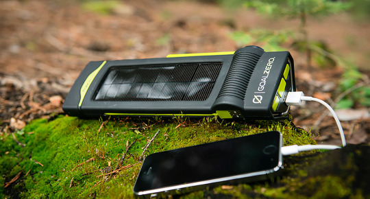
6. Carry backup power or a portable charger. There are lots of items on the market for this. From simple USB chargers that deliver a whole charge, to solar chargers that work great in sunny areas. Look for solar chargers that are at least twelve inches by ten inches and can be strapped to the back of a pack. Goal Zero seems to be the market leader and gets good reviews. We like multi-use items and there are over a dozen crank flashlights with weather radios that also have adaptors to charge USB devices like iPhones and iPads.
0 notes
Text
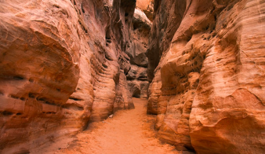
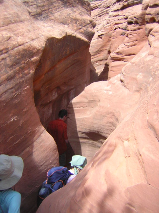
Our Favorite Slot Canyons
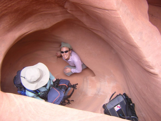
Slot canyons are one of the greatest wonders of the outdoors and can be incredibly fun to explore. Being based in Seattle has its benefits but when Fall arrives we like to take some sun breaks and the Southwest is one of our top choices. Some of our favorites are in South Eastern Utah and Northern Arizona. We really enjoyed hiking in Buckskin Gulch, Peek-a-boo, and Spooky in the Escalante area.
Another one not to miss is Antelope Canyon near Page, Arizona. They are generally safe but do present some hazards and while you might be able to get cell coverage above or at the trailhead it’s usually non-existent inside the slots. Here are some tips to stay safe:
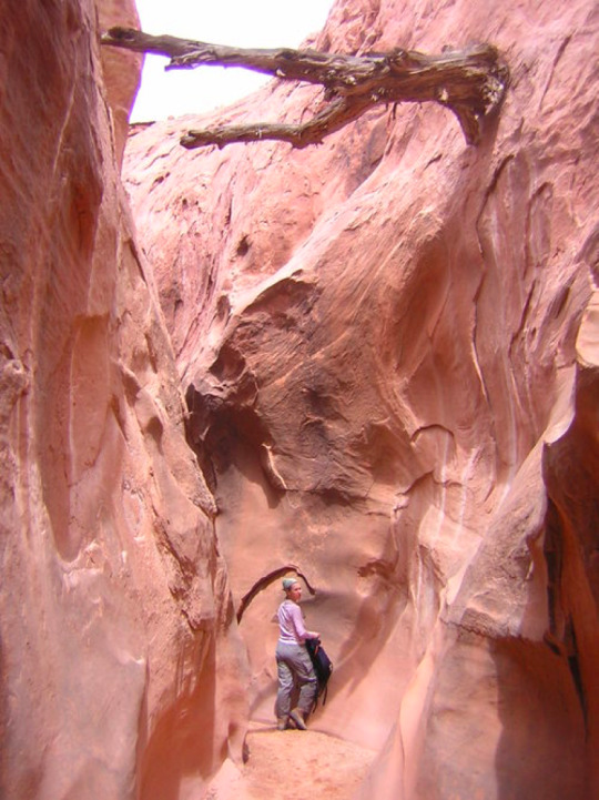
1. Check the weather. Rain-caused floods pose one of the greatest threats in narrow canyons. They happen when rain (even miles away) overwhelms the watershed, running off clay and rock to the lowest points and into slot canyons. Within narrow canyons, a small amount of rain can quickly become a high-speed and deadly wall of water. In many slots one can observe debris left from flash floods, which many times are above one’s head, giving you an idea of the water level. Verify weather conditions before you start, stay alert to cloudy skies, rain-drops, and thunder and avoid the canyons at first sign.
2. Learn the moves. You can move more efficiently in canyons using a variety of techniques to get around obstacles and tight spots. For short drops, face forward, feet flat, use your hands against the sides of walls and crab walk. Avoid jumping in uneven spots. Utilize stemming or opposing force to climb over obstacles. In some spots you’ll want to rock-climb sideways to avoid pools of water.
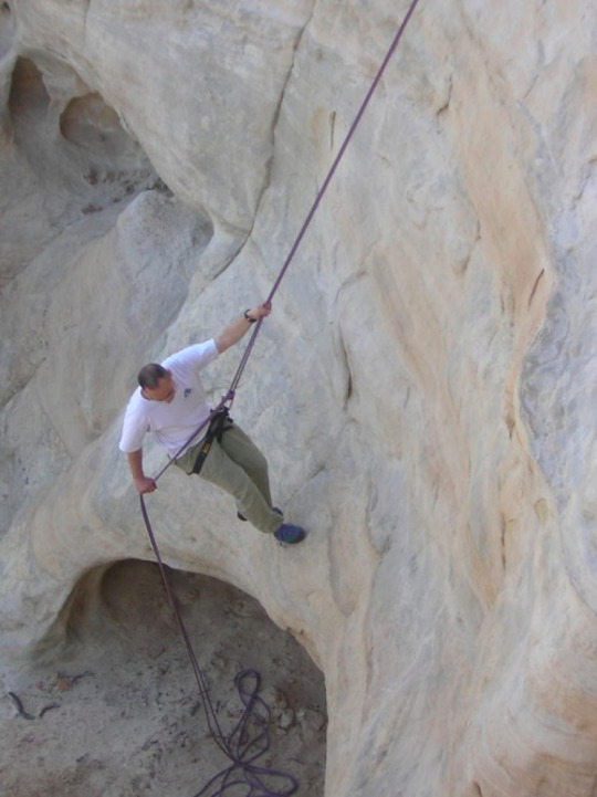
3. Use a guide for technical canyons above class two if you don’t have experience canyoneering, setting anchors, rope work, and rappelling.
4. You most likely won’t get satellite or cell phone reception inside. While you still have reception, create a digital track by sending a Cairn email or SMS notification to your safety contacts. Using Cairn we also recommend checking the coverage map to see where near the slots others have found coverage.
5. Wear leather boots and pay attention to your step. Small rattlesnakes are not hard to step on.
Got a favorite slot canyon you can recommend, shoot us an email and let us know.
0 notes
Text
SMS and More Totally Awesome New Features
Here’s the scoop on what's new at Cairn. SMS alerts, live tracking and more!
SEND ALERTS VIA SMS
Get your contacts’ attention by using SMS. You can also use email, of course (or both!). And we have to agree, our contacts are more like to see those text messages.
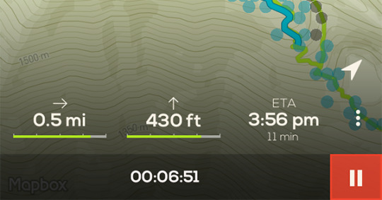
TRACK YOUR STATS
Track your distance, elevation gain, and get a live ETA. The ETA adjusts itself according to your pace and is especially helpful for making a decision on your turnaround time.
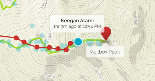
LIVE TRACKING
Now your contacts can keep tabs on your progress. The link to your trip map is now automatically provided to your safety contacts.
FIND YOUR SPOT
Now it’s much easier to specify your destination. We’ve added more trails to our search and have made it easy to find and name your own custom location. Just tap and hold on the map!
ENJOYING CAIRN?
You can help us by telling others about the app. Here is a pre-populated tweet and email for easy sharing.
Happy trails!
Love,
Your friends at Cairn
0 notes
Text
Cairn On The Pacific Crest Trail
With the help of our community, team Cairn was able to map nearly the entire Pacific Crest Trail in 2015. 2,650 miles (4,265 kilometers) of the PCT were hiked by Three Go North and cell coverage mapped for Verizon and AT&T, including many dead spots. Other users have since gathered data on T-Mobile and Sprint. If a PCT section or thru-hike is in your near future you are probably wondering if you will be able to make phone calls, check emails, or post photos to social pages from various spots on the trail.
Overall there are places with great LTE coverage to not a single signal for up to 10 days. 2650 miles of trail is a large area to cover so in the spirit of brevity, we’ve highlighted specific spots going South to North. Download Cairn and search for a place to view the area of the trail you are interested in. You will see circles depicting mapped areas and can get carrier details by tapping a circle.
Southern California
The PCT starts on a small hill near Campo (elev. 2,915′), a town near the Mexican border, passes through Lake Morena County Park, Laguna Mountains, dips into Anza-Borrego Desert State Park at Scissors Crossing (bad coverage south of here), but as you pass near Big Bear lake you can get a weak signal which gradually gets stronger close to town. Overall coverage for AT&T and Verizon is pretty dismal on this part including poor at Cedar Springs and Bouquet Reservoir.
Central California
Starting from this section’s lowest point at Walker Pass (elev. 5,246′), the trail enters a roadless and scenic area, alternating between expansive meadows and conifer forests; Sequoia National Park, the John Muir Trail (JMT), Mount Whitney (elev. 14,494′), and Yosemite National Park are all highlights. As you head North cell coverage tends to improve, with decent AT&T and Verizon spots at the summit of Mt. Whitney, many spots on the JMT, and Yosemite. On the Central California stretch the route repeatedly descends deep canyons only to ascend to high saddles, as expected you won’t find coverage in canyons and the best spots are ridges/peaks with line of site to towns and cities.
Northern California
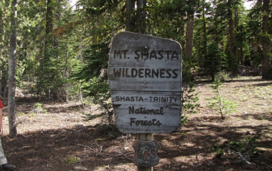
As you hike Northern California North of Donner Summit (elev. 7,989′), old volcanic flows and sediments bury most of the ancient bedrock of the Sierra Nevada crest. Beyond the North Fork of the Feather River, the Sierra Nevada yields to the southern Cascade Range. The PCT traverses Lassen Volcanic National Park where there’s good AT&T coverage North of Old Station, onto Mount Shasta with AT&T coverage on the South slopes but not the summit, as you pass through Castle Crags State Park in this area you’ll have a strong Verizon signal but lose it and AT&T gets weak further North in the Trinity Alps Wilderness. The trail climbs to 7,600 feet in the mountains connecting the inland Cascade Range with the coastal ranges, winding north through the Marble Mountain Wilderness before descending to the Klamath River (elev. 1,370′). It climbs again to the crest of the Siskiyou Mountains with spotty to no signal from any carrier as it traverses east, entering Oregon.
Oregon
As the trail crosses I-5 near Siskiyou Summit (elev. 4,310′) in southern Oregon to the Washington border you’ll pick up AT&T signals, enough to post pictures. Other highlights in Oregon include Mount McLoughlin (good Verizon to South on trail), Crater Lake National Park (dismal coverage except for AT&T at the top of Watchman Peak) , Diamond Peak Wilderness (no cell coverage), the Three Sisters (Verizon on South Sister but not others), Mount Washington (better coverage further North), Three Fingered Jack (AT&T is strong), Mount Jefferson (no signals from AT&T or Verizon on this section of the PCT), and Mount Hood (ok Verizon and AT&T). The major elevation change in Oregon on the PCT is the 3,160 foot drop into the Columbia River Gorge crossing Interstate 84 and the Columbia River on the Bridge of the Gods (elev. 180′), this is a good spot to plan for communications and photo shares with decent LTE signals from Verizon and AT&T. A side trip to Multnomah Falls is highly recommended in this area.
Washington
This section begins at the Bridge of the Gods on the Columbia River and ends at Monument 78 on the Canadian border (elev. 4,240′).
Starting with a lengthy climb out of the Columbia River Gorge, generally decent cell coverage in this section on high points and ridges. As you pass Mount Adams (elev. 12,276′). Just north lies the dramatically rugged Goat Rocks Wilderness and a traverse of the Packwood Glacier with no cell coverage to at all.
The trail crosses Highway 12 at White Pass before encountering dozens of lakes in the William O. Douglas Wilderness. Between White Pass and Highway 410 at Chinook Pass, occasional spots of coverage (best to view Cairn for the exact places), the trail skirts many lakes as it approaches the towering monarch of the Cascades, Mount Rainier National Park (one of our most mapped National Parks) from Chinook Pass, the trail has an easy, rapid run to Interstate 90 at Snoqualmie Pass (Strong LTE). As you work your way North from I-90 coverage goes from ok in some spots to non-existent and improves as you near HWY 2. North of HWY 2 is some of the most rugged terrain on the PCT (and US), near North Cascades National Park with non-existent cell coverage. This is also one of the most remote regions, one of the only and last places in this section to get a call off to family is small the town of Mazama.
As you near completion and reach EC Manning Provincial Park Canadian carriers take over (check your roaming settings) but with weak signals, best to use landlines and wifi at the nearest town. An additional seven miles were added beyond the border by the Canadian government to provide access to Highway 3 in British Columbia’s Manning Provincial Park (elev. 3,800′).
Remember it’s possible to get a full cell coverage map of the PCT by downloading the Cairn App and in some cases you can call 911 on another carrier's signal so Cairn shows all carriers on it’s topo maps.
#pct2016#pct2017#pacificcresttrail#thruhike#cairnapp#hikingthepct#pcthiking#YosemiteNP#sequoia#kingscanyon
0 notes
Text
Trailblazer Help Wanted at National Parks
The Cairn crew has mapped over 850K points of cell coverage to date using the Cairn app, including trails in many US national parks. But we still have a few gaps where we could use your help, especially in these parks:
1. Great Smoky Mountains National Park
2. Acadia National Park
3. Grand Canyon National Park
4. Canyonlands National Park
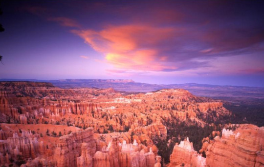
5. Bryce Canyon National Park
6. Big Bend National Park
7. Redwood National Park
8. Badlands National Park
9. Everglades National Park
10. Capitol Reef National Park
Simply use the Cairn app on your hikes and climbs to become a trailblazer.
#greatsmokymountains#acadia#acadia national park#grand canyon#grand canyon national park#canyonlands national park#canyonlands#cairnsafetyapp#cairn#bryce canyon#bryce canyon national park#big bend#big bend national park#redwood national park#badlands#badlands national park#everglades#everglades national park#capital reef national park#capitol reef
0 notes