
highlandcreekconnect
Highland Creek Connect
Connect with Highland Creek!
396 posts
Don't wanna be here? Send us removal request.
Last Seen Blogs

sinningsprinkles
Crying into Ceral

s-sxfiaaa
sxfiaa

tiredyke
jakey hater

lattaewithsuga-blog
🌸봄날🌸

chrisevansgoodgirl
so what if you taste just like heaven
Text
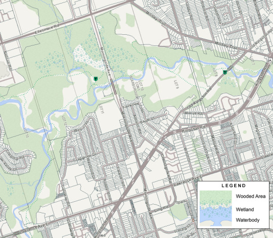
Why Morningside Park Forest Is Considered Environmentally Significant

Morningside Park Forest, combined with the adjacent Highland Forest ESA, forms the largest remaining forest block within the Highland Creek watershed.
Morningside Park Forest is one of four Environmentally Significant Areas (ESAs) in the Highland Creek Watershed (the others being Stephenson’s Swamp, Hague Park and Highland Forest).
The forest encompasses a large area on the east branch of Highland Creek, stretching from just north of Highway 401 almost to the confluence of the creek south of Ellesmere Road.

Morningside Park Forest ESA and Highland Park Forest ESA. Photo credit: City of Toronto ESA map.
Morningside Park Forest contains a narrow floodplain with steep forested valley walls dominated by deciduous and mixed forest.
Eastern white cedar dominates much of the forest area, although mixed forest of sugar maple, white birch and eastern hemlock is scattered throughout the valley. The ESA designation of Morningside Park Forest is based on the maturity and health of these forests and the degree of tree regeneration.

Eastern white cedar. Photo credit: Natural Resources Canada.

Mounted police navigating the rugged terrain of Morningside Park, 1974. Photo credit: Digital Archive Ontario.
Morningside Park Forest, combined with Highland Forest ESA, has three of the four criteria to receive ESA designation:
Rare species and communities: This area contains 56 significant flora species, 23 significant vegetation communities and 6 significant fauna species
Significant size and level of diversity: 84 vegetation communities and a TRCA size score of 4 (out of 5)
Significant ecological functions: It’s a major node in the regional Highland Creek corridor that
contains marshes and swamps that provide 21.5 hectares of water storage area
contributes to a connection between foraging and breeding habitat for amphibians
provides a breeding habitat for amphibians
provides a habitat for colonial nesting birds (e.g., bank swallow)
The original extent of wetland cover for the Highland Creek watershed during pre-settlement times is estimated at 149 hectares. Currently, approximately 23.5 hectares of wetland remain, and no natural wetlands of any significance are found north of Highway 401.
Wetland conservation is important for maintaining local and regional representation of many species. Amphibians in particular use wetlands for breeding, which is why Morningside Park Forest is an important breeding habitat for the green frog, American bullfrog and American toad.

Morningside Park Forest is an important breeding habitat for amphibians like the American toad. Photo credit: Wikimedia Commons.
The ESA program was developed to identify and protect the regionally significant lands and waters vital to the health of the ecosystem in the Toronto region. For more information about ESAs, visit the City of Toronto website.
Related posts:
The Origin of Morningside Park
Why the Highland Forest Is Considered Environmentally Significant
Why Hague Park Is Considered Environmentally Significant
What Makes Stephenson’s Swamp Important?
Why Is There a Rock Wall Near Morningside Park?
0 notes
Text
Why the Highland Forest Is Considered Environmentally Significant

The Highland Forest is located on both sides of Morningside Avenue south of Ellesmere Road. The 242 hectare site encompasses an extensive mature mixed forest on the valley slope and Highland Creek Swamp in the lowland area.
Map of the Highland Forest area created through Ministry of Natural Resources and Forestry.
The Highland Forest is one of four Environmentally Significant Areas (ESAs) in the Highland Creek Watershed (the others being Stephenson’s Swamp, Hague Park and the Morningside Park Forest). The Morningside Park Forest directly connects with the Highland Forest to form the largest remaining forest block within the Highland Creek watershed.
The Highland Forest has three of the four criteria to receive ESA designation:
It’s home to rare or endangered plants or animals: There are 56 significant flora species, 23 significant vegetation communities, and 6 significant fauna species found within the Highland Forest!
It’s large, diverse, and relatively undisturbed.
It provides important ecological functions:
The marshes and swamps of the forest provide 21.5 hectares of water storage area.
It’s a major node in the regional Highland Creek corridor that contributes to a connection between foraging and breeding habitat for amphibians.
It provides a breeding habitat for amphibians (e.g., green frog, American bullfrog, American toad).
It provides a habitat for colonial nesting birds (e.g., bank swallow).
Walking through the Highland Forest, you’ll see steep, high quality deciduous and mixed forested slopes, coniferous forest, as well as wetlands. The dominant trees include sugar maple, American beech, white ash, and red oak.

Regionally uncommon black maple found in the Highland Forest. In the fall, most leaves turn yellow-brown but some can be orange. Photo credit: University of Guelph.
The site also features the uncommon black maple and large specimens of red maple. Although a small amount of trampling and erosion has occurred in the slope forest, the ground layer features a high diversity of native wildflowers, including white trillium, trout lily, jack in the pulpit, red baneberry, and two species of toothwort.

Red-backed salamanders such as those found within the Highland Forest make their homes in woodlands, wooded ravines, and river valleys living under logs and rocks or in moist rotting stumps. Photo credit: Wikimedia Commons.
The presence of red-backed salamanders is a further indication of forest quality. The nationally and provincially rare roughleaved goldenrod is also known to occur at this site. The swamp portion of the Highland Forest supports such regionally uncommon plants as balsam fir, water avens, water pennywort and the two sedges. Unfortunately, there’s a severe infestation of dog strangling vine in the south end of that portion of the forest found on the east side of Morningside Avenue.
The ESA program was developed to identify and protect the regionally significant lands and waters vital to the health of the ecosystem in the Toronto region. For more information about ESAs, visit the City of Toronto website.
Keep an eye out for our next post about the Morningside Park Forest, another ESA in the Highland Creek Watershed!
0 notes
Text
Why Hague Park Is Considered Environmentally Significant

Hague Park bridge. Photo credit: Scott Amos, Google Maps Photos.
Hague Park is a 9.3 hectare park at Bellamy Road and Lawrence Avenue East that features a mature forest in the West Highland Creek Ravine and is part of the West Highland Creek Trail.
This small park at the junction of Bendale, Cedar Brook and McCowan Parks is one of four Environmentally Significant Areas (ESAs) in the Highland Creek Watershed (the others are Stephenson's Swamp, Highland Forest and the Morningside Park Forest).
Hague Park has two of the four criteria to receive ESA designation:
It’s home to rare or endangered plants (i.e., American hazelnut) or animals.
It provides important ecological functions that contribute to the health of ecosystems beyond their boundaries (Hague Park has seepage areas that support diversity of wetland communities).
Hague Park features a moderate to steep deciduous and mixed forest on the valley slopes, as well as a lowland forest and swamp on the floodplain situated along West Highland Creek.
In this park you’ll find sugar maple, American beech, eastern hemlock, eastern white cedar, white birch and basswood. Especially relevant is a healthy stand of trees dominated by black cherry, an important forest tree for local wildlife because of its fruit.
Hague Park is also home to regionally rare American hazelnut, one of two hazelnut species indigenous to Ontario (the other is the beaked hazelnut). These hazelnut trees can produce edible nuts that mature between July and October. They’re also vulnerable to Eastern Filbert Blight, a disease that kills hazelnut trees in less than a decade if left untreated.

Leaf of an American hazelnut. Photo credit: Wikimedia Commons.
The ESA program was developed to identify and protect the regionally significant lands and waters vital to the health of the ecosystem in the Toronto region. For more information about ESAs, visit the City of Toronto website.
Keep an eye out for future posts about the other ESAs in the Highland Creek Watershed!
0 notes
Text
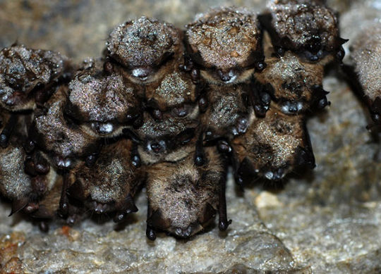
Happy Bat Week!

Big Brown Bat. Photo credit: Toronto Zoo.
From October 24 to 31 we’re celebrating Bat Week! A week to celebrate an amazing, often misrepresented animal that is vital to the health of our environment and economy.
Scarborough, like the rest of Toronto, is home to several bats despite its high urbanization. In fact, research suggests that Scarborough is home to at least seven out of eight of Ontario’s bat species!
Why is it important to raise awareness about bats?
Ontario’s native bats are on the decline. Of the eight species of bats found in Ontario, four have been listed as endangered as of 2012. Bats play an important role in maintaining the balance in ecosystems by controlling insect populations, pollinating flowers and crops, and spreading seeds that grow new plants and trees. By consuming large quantities of bugs, bats also benefit nearby farmers by decreasing the need for pesticide use.
Bats in decline
There are several reasons why the bat population is in decline. Loss of habitat, including deforestation and mine closures have dramatically reduced the populations of bats. Many bats also succumb to a condition known as white-nose syndrome, a deadly fungus that damages wing and skin tissue. Use of pesticides passed on from affected insects can also cause illness and be passed on to infant bats through nursing.
Bats with white nose syndrome. Photo credit: Toronto Zoo.
Five of Ontario’s eight bat species are non-migratory, which means they spend their winters in Ontario hibernating in caves or mines!
Hibernating bats are considered especially vulnerable, since any disruption (e.g., from noise or light) will cause them to wake up and use up some of their fat reserves meant to sustain them for the winter. If these energy reserves are depleted before the end of winter, these interruptions can be fatal.
TRCA’s bat recorders and bat boxes
In 2017, TRCA teamed up with the Toronto Zoo’s Native Bat Conservation Program to learn more about local bat species by setting up bat echolocation recorders in the Humber River and Duffins Creek watersheds. This year, several more recorders have been set up in urban and urbanizing zones.
Finished setting up song metres in our northern regions to confirm calling start dates for breeding frogs & breeding bat species diversity! pic.twitter.com/bobdnZWk2g
— TRCA Monitoring (@TRCA_Monitoring) March 27, 2017
TRCA is also installing 14 bat boxes as part of the East Don Trail Project along the project site to provide habitats for bats in the Don River Valley.
To learn more about Eastern Canadian bats, including instructions on how to build your own bat box, download the Toronto Zoo’s “Bats: A Conservation Guide.”
Happy Bat Week!
2 notes
·
View notes
Text
The 2018 Salmon Festival at Highland Creek!
youtube


0 notes
Text
The Origin of Morningside Park
Next to Morningside and Ellesmere, you’ll find Morningside Park—a 596-acre stretch of wilderness tucked away in a highly urbanized area. Here Highland Creek winds its way through an expanse of mature trees, along footpaths and naturally eroded cliffs.
After the Second World War, a housing shortage led many people to move outwards towards the suburbs. Small cottages in the Highland Creek area were converted into year-round residences, in particular in the Willows area (north-east of Lawrence and Orton Park Road) and the Highland Creek Valley south of Highway 401. The western end of the present-day park also housed Camp of the Crooked Creek, which belonged to the Toronto District of the Boy Scouts Association.

Map of Scarborough, circa 1916 showing property lines (site of the future Morningside Park indicated in blue). Photo credit: University of Toronto Map & Data Library. Zoomable map available online.
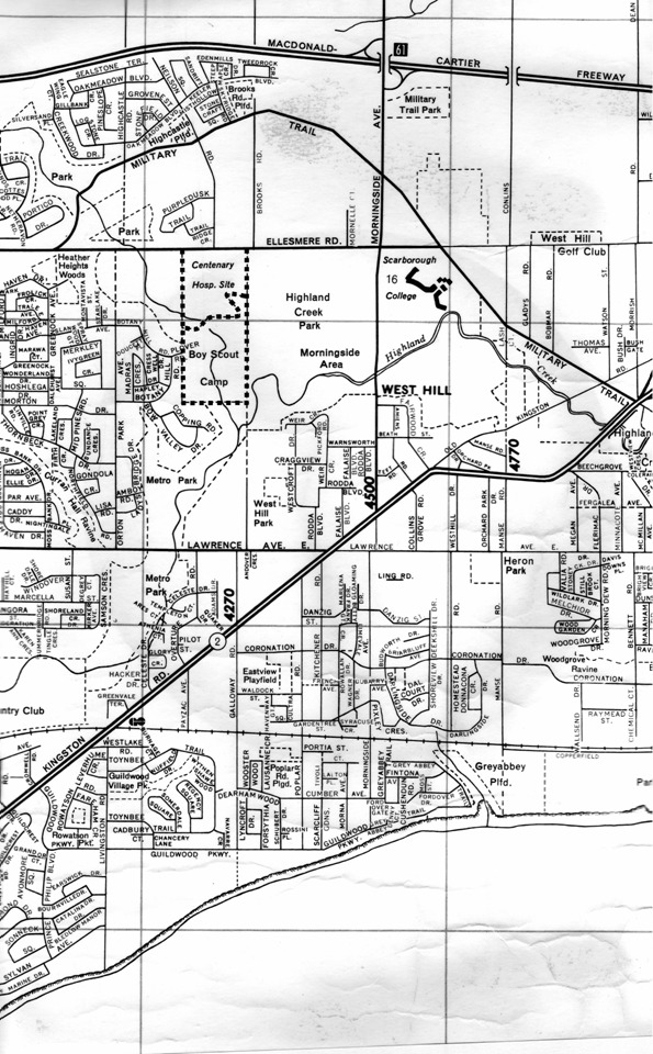
City map of Scarborough, circa 1960 prior to the creation of Morningside Park (an amalgamation of Highland Creek Park and neighbouring parkland to the west that included the Boy Scout Camp). Photo credit: Camp of the Crooked Creek.
The boom of new residents put a strain on the cottage land, which wasn’t designed for year-round habitation. The steep slopes and flat floodplain of Highland Creek valley also meant that flash flooding was a constant threat, as were the threats of contaminated wells and nearby erosion.
In 1954, Hurricane Hazel hit Toronto with a severity that is still unmatched to this day. Catastrophic damage and loss of life from the event led to the expansion of TRCA’s responsibilities to include flood control and granted TRCA the ability to acquire lands for recreation and conservation purposes to prevent further development on floodplain land.
Severe damage from Hurricane Hazel led to the removal of housing in the Highland Creek valley area and the land was protected from any future developments being built. In the 1960s, city-owned Highland Creek Park and adjacent TRCA-owned property to the west were merged to form the present day Morningside Park.

Highland Creek Park sign, photo credit City of Toronto Archives.
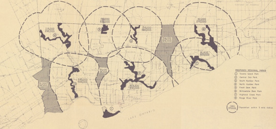
Map showing different regional parks in Toronto and populations within a 3 mile radius, circa 1965. The Highland Creek Park area at the time had a population of 81,400. Photo credit: City of Toronto Archive. Zoomable map available online.
Today, Morningside Park offers visitors hundreds of acres of picturesque woodland, meadow, marsh, sheer cliff and rugged hillside—all hidden within its urbanized surroundings. The park holds a designation by both the TRCA and City of Toronto as an Environmentally Significant Area (ESA). It’s also home to the largest remaining forest block within the Highland Creek watershed, the site of TRCA’s annual Salmon Festival at Highland Creek, and provides a high-quality habitat for a range of wildlife and regionally rare plant species.


Have a question or story idea for Highland Creek Connect blog? We’d love to hear from you! Send us a suggestion, comment or question in the contact section of our blog!
0 notes
Text
Beautifying Public Spaces in Lawrence-Orton

Early last month, the Lawrence-Orton neighbourhood celebrated the unveiling of a new community-led mural at 3941 Lawrence Avenue East. The mural depicts the coming together of the natural environment with the built environment and is the product of how one community is coming together to improve and beautify their physical spaces.
Lawrence-Orton is a Toronto Community Housing community (TCHC) and one of three pilot communities in the ReSet program. The program, which started in 2015, focuses on renewing buildings that are in need of repair with emphasis on community involvement. Residents have the opportunity to be involved in improving public spaces and address some of the economic and social challenges their community faces.
Toronto Community Housing and ERA Architects approached Lawrence-Orton residents for ideas to improve a public space in the neighbourhood, and that’s when the idea of the mural was born. Completing the mural was a team effort, with Park People overseeing the project and artists from SKETCH (a community arts initiative for young people) designing the mural in consultation with community residents.

There have been many other programs this year that have engaged residents from the Lawrence-Orton community, including an Earth Day clean up, community swap, barbeques, movie nights and ESL classes.
“Through a TD Park Builders Grant we have had access to funding to improve our tree canopy, introduce native plant gardens, engage residents in Zumba fitness, children in outdoor play, seniors in outdoor activities they enjoy, and the entire community in seasonal outdoor programs,” says long-time Lawrence-Orton resident, Nicole Carnegie.
Lawrence-Orton has also been able to collaborate with several organizations, like StreetARToronto, The Boys and Girls Club and Park People, who have helped the community carry out their programs.

“In a neighborhoods like ours, it's important to keep the youths engaged in non-violent activities, so that they have something positive to do with their time,” explains Nicole.
As for future community projects, Nicole has already connected with another artist who owns a business painting murals and teaches painting to youths. “We'd like to start a program with him in our community soon,” says Nicole. “We'd also like to incorporate other forms of art into our community such as music and dance, in the hope of inspiring our youths to think creatively. We want them to achieve their goals, to give back to their community and motivate them out of poverty.”
You can keep up-to-date on Lawrence-Orton’s projects by following their Instagram account, @lawrenceortonpics.
All photos from @lawrenceortonpics on Instagram.
0 notes
Text
The Discovery of the Alexandra Site Near L’Amoreaux Park

Outline of a longhouse at the Alexandra Site (Source: Archaeological Services Inc.).
On the north end of L’Amoreaux Park pond stands two heritage plaques commemorating the archaeological discovery of the Alexandra Site—a 2.5 hectare ancestral site spanning much of the mid- to late-fourteenth century A.D.
In 2000, the consulting firm Archaeological Services Inc. was asked to prepare test pits on a farmer’s field just north of L’Amoreaux Park in advance of a subdivision development planned for the area. These pits uncovered almost 250 artefacts, indicating that this testing area was home to a larger, yet undiscovered archaeological site.
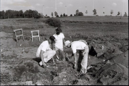
Excavations at the Alexandra Site (Source: Archaeological Services Inc.).
The Alexandra Site contained the remnants of a 600-year-old Huron-Wendat village thought to have housed up to one thousand people. An archaeological dig was conducted, unearthing artifacts such as bone awls, bone beads, ground stone axes and ceramic pottery fragments dating back to 1350 AD. There was also evidence of sweat lodges, hearths, middens (garbage pits) and 16 longhouses stretching between 5 metres to 70 metres long.

Illustration of a Huron-Wendat longhouse village (Source: The Canadian Encyclopedia).
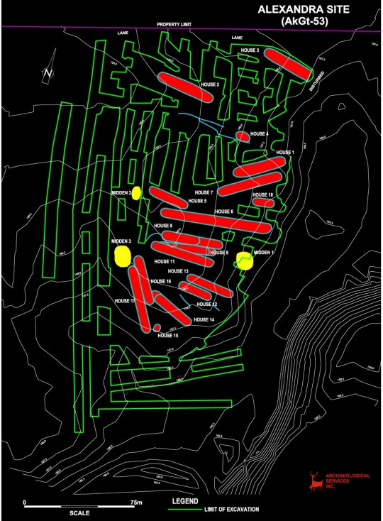
Alexandra site plan (Source: Archaeological Services Inc.).
The village stood on a small ridge overlooking Highland Creek, which provided the village with a means for transportation, fishing and agriculture. Plant and animal remains from the site indicate a diet of domesticated and wild resources like maize; fruits, such as wild berries; deer, used for meat, hides and tools made of bone; and fish such as lake trout from the streams and wetlands near the site. The Alexandra Site also had remnants of beads made of seashells from the eastern seaboard, evidence of an extensive trade network that existed for the Huron-Wendat people.
Typically the Huron-Wendat lived on a site until the nutrients of the land were depleted, then they would relocate to a new site, reusing the village’s construction materials for firewood. In time, the surrounding forest would reclaim the abandoned village and restore the nutrients through the natural cycling of forest materials. The Alexandra Site, however, was used for several decades or possibly occupied during several separate periods over the course of 40 years.
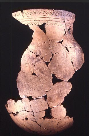
Partially reconstructed vessel at the Alexandra Site (Source: Archaeological Services Inc.).
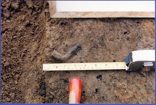
Miniature decorated pipe from the Alexandra Site (Source: Archaeological Services Inc.).
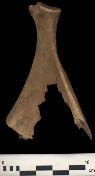
Deer scapula hoe or trowel (Source: Archaeological Services Inc.).
While the village appears isolated from other Iroquois communities in Highland Creek (the only other site being Tabor Hill Ossuary), this speaks more to rapid development within Scarborough before planning policies allowed for archaeological conservation work to be conducted. According to the book Toronto’s Ravines and Urban Forests, approximately 8,000 archaeological heritage sites may have been lost in the GTA between 1951 and 1991 alone, before stricter legislation on archaeological conservation was introduced.
Archaeological sites on TRCA properties span 11,000 years of human habitation of southern Ontario. To find out more about current archaeological projects, visit the Archaeology section of the TRCA website!
0 notes
Text
Why Is There a Rock Wall Near Morningside Park?

If you’ve walked the section of Highland Creek downstream of the Morningside Avenue Bridge, you’ve probably noticed a large supporting rock wall dividing the trail from the creek bed. While this wall adds to the scenic beauty of the Highland Creek trail, it also serves a very important purpose.
With heavy rains, erosion is an ongoing issue for the river valley and park land. Increased water levels flowing into the creek can send rushing waters capable of moving trees and large boulders during storms and can cause damage to bridges, pathways and properties.
On August 19, 2005, a storm exposed and broke sewers along the creek system and stripped as much as 30 metres from backyards on Birkdale Ravine. Erosion became progressively worse and began to affect a 70 metre-long section of the paved trail. In 2011, this trail was closed due to public safety concerns.
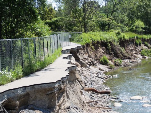
Erosion of the paved trail leading to its closure in 2011.
In 2011, the City of Toronto approached TRCA to design and implement a long-term erosion control solution to restore and protect the eroded section of the trail.
Below are some photos showing some elements of the project:
Removal of large bar deposition. This is where gravel and other materials have accumulated on the inside of the stream meander. Some of the removed material was used as backfill for the armourstone wall pictured below.

Design of an armourstone retaining wall to restore the bank and eroded trail. The wall includes two types of supporting rock structures: a gabion stone drainage layer and rip rap to protect the base of the wall.

Installation of bendway weirs (pictured on the bottom left). These rock structures alleviate stress and redirect flow from the armourstone retaining wall and towards the centre of the channel during storm events.

Installation of a post and paddle fence along the armourstone retaining wall to improve public safety.

Map showing trail closure during construction.
Below is the finished product! With work from TRCA in partnership with the City of Toronto, this stretch of the Highland Creek trail was able to be transformed from a closed and severely eroded area to the scenic nature trail that stands today.

Visit the TRCA website to read more about the Highland Creek Erosion Control Project or look up other past or ongoing conservation projects!
#highland creek#restoration#erosion#trail closure#monitoring#City of Toronto#construction#armourstone
0 notes
Text
What Can We Learn from the Salmon Run?

Listen carefully the next time you walk by a creek, river or stream and you may just hear the splash of salmon running upstream. That’s because every fall, salmon leave the cold waters of the Great Lakes where they spend most of the year and return to tributary streams to spawn. In late summer and early fall, they can be found gathering at the mouth of rivers before starting their journey upstream.
The salmon you’re likely to find in local waters are chinook salmon, the largest of the Pacific salmon species.
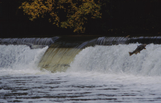
Chinook salmon during a salmon run in the Humber River.
During a salmon run, female chinook salmon will dig broad, shallow nests or redds into the gravel, choosing to lay their eggs in areas where there is fast-flowing, fairly deep waters. The timing of their egg deposition is to ensure that their young will emerge during an appropriate season for survival and growth. For female chinook salmon, they will guard their redd between 4 to 25 days before dying. The eggs will hatch after a total of 90 to 150 days depending on water temperature.
The average number of eggs laid by a single female is almost 5,000! These eggs may be spread across several nests.
So what makes the story of the chinook salmon run interesting? For starters, despite their numbers, chinook salmon are not actually native to the Highland Creek and Great Lakes region. Up until the late 19th century, you would more commonly find native Atlantic Salmon, but due to unsustainable fishing practices, alterations to the river courses, the blocking of migratory passages, and habitat loss and degradation, these fish eventually became locally extinct (or extirpated) from the watershed.
As a top predator species in Lake Ontario, the loss of the Atlantic Salmon from Highland Creek left a gap in the food chain. Chinook salmon were introduced into the Great Lakes as far back as the 1870s, but more recently they were stocked to control the invasive alewives population, which exploded after the decline of their main predator, the lake trout.
Recent years have also seen renewed and significant efforts to bring back Atlantic salmon to Lake Ontario. Since 2006, a coalition of more than 40 partners have been undertaking the Lake Ontario Atlantic Salmon Restoration Program with the goal of a vibrant and self-sustaining Atlantic Salmon fish population in Lake Ontario and its tributaries.
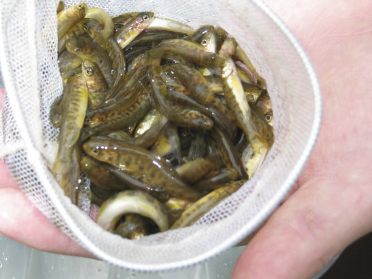
Restocking of Atlantic salmon fry.
Salmon runs occur in all of Ontario’s Great Lakes and take place in early September to November when temperatures are between 3°C to 10°C.
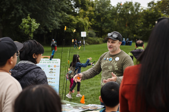
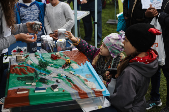
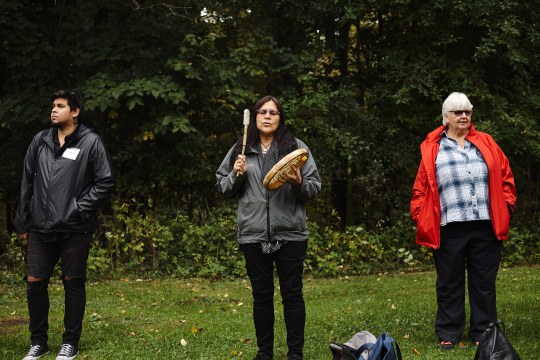
The natural history of salmon in Lake Ontario and Highland Creek is a complicated and interesting story. To celebrate the remarkable journey of the chinook salmon and learn about the unique history and importance of protecting our local ecosystem, come join us on October 2 for the 7th Annual Salmon Festival at Highland Creek! Register for free at thesalmonfestival.ca.
0 notes
Text
What Makes Stephenson’s Swamp Important?
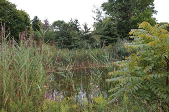
Tucked away in the Lower Highland Creek is Stephenson’s Swamp, a designated Environmentally Significant Area (ESA) and one of the city’s few Provincially Significant Wetlands. What that means is that Stephenson’s Swamp has met specific requirements to make it eligible for special protection to preserve its environmentally significant qualities.
Stephenson’s Swamp is what remains of a once large coastal marsh located at the mouth of Highland Creek. Today it’s part of a wetland complex composed of four individual wetlands totaling an area of 7.6 hectares. To give you an idea of its size, that’s bigger than the entire Rogers Centre complex, which measures only 5.14 hectares!
Forest swamps such as Stephenson’s Swamp were once the most common type of wetland prior to European settlement, but today coastal wetlands such as these are rare on Lake Ontario. That’s why having a wetland complex of this size is such an important ecological feature.
Not only is the wetland complex itself rare, but it’s also a breeding area for several uncommon species such as the blue-gray gnatcatcher and yellow-spotted salamander as well as being home to rare flora like dotted wolffia and radiate sedge.
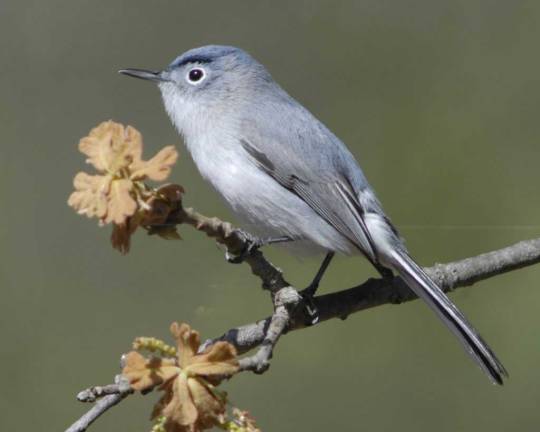
The blue-gray gnatcatcher makes its home in the crack willow forest found around Stephenson’s Swamp. Photo from Audubon.
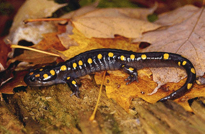
Yellow-spotted salamander. Photo from the Canadian Encyclopedia.
In the past, the area around the wetland complex has been altered by land filling, railway construction and increasing urbanization. Problems include an inconsistent water flow from Centennial Creek and the presence of exotic species such as purple loosestrife and carp.
Wetland conservation is a key component of maintaining local biodiversity. Not only are many amphibian species particularly susceptible to changes in wetland health, but they also require a close relationship between aquatic and terrestrial habitats for breeding. Although these conditions are difficult to maintain within such a fragmented environment, they do occur within this wetland complex, making it an important site for many sensitive species.
Did you know?
There are actually four Environmentally Significant Areas in the Highland Creek Watershed: Stephenson’s Swamp, Highland Forest, Hague Park and the Morningside Park Forest. Find out more about these and other watershed features on the Highland Creek section of the TRCA website!
0 notes
Text
Tabor Hill Ossuary–60 Years After its Discovery

Tabor Hill Ossuary and commemorative plaque in Taber Hill Park (Wikipedia).
On August 17, 1956, a steam shovel began clearing a 60-foot mound near Lawrence Avenue and Bellamy Road. The soon-to-be flattened land would be used for a suburban subdivision in Scarborough, and the removed soil would be used as construction material for the building of Highway 401.
Instead, what was discovered was a First Nations ossuary–a ceremonial burial ground measuring about 50 feet long, seven feet wide and one foot deep, containing the remains of almost 500 ancestral Huron-Wendat members. It’s believed that the remains found in the ossuary are linked to a ceremony in which bodies are left to decompose on platforms for several years before they are carefully cleaned and buried during a Feast of the Dead ritual.
The Tabor Hill Ossuary is believed to date back to the 14th century, making it one of the earliest ossuary sites in Ontario. A second burial pit was also discovered nearby, slightly smaller than the first.
After the two discoveries, the land was re-purposed as a cemetery and a reburial ceremony was held in October 1956 to return the remains to Tabor Hill. The ceremony, a 3-day tribute to the Feast of the Dead ritual, brought together First Nations leaders as well as several thousand spectators.
For its significance as a sacred site, the Tabor Hill Ossuary, has been given cemetery designation and is recognized under the Ontario Heritage Act.

Memorial plaque to commemorate the Tabor Hill Ossuary (Flickr).
0 notes
Text
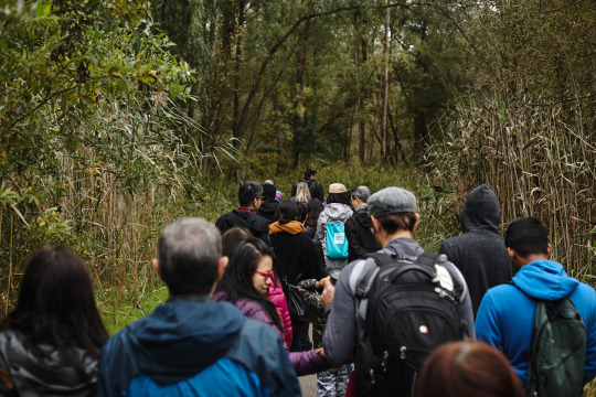
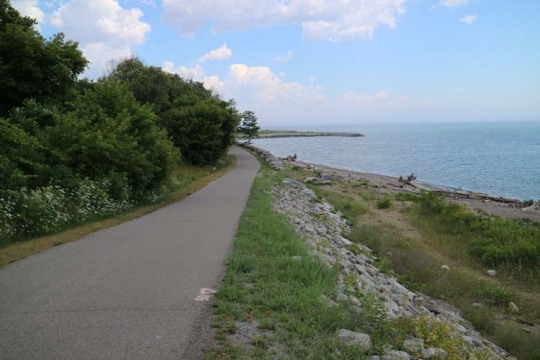
Trail Walk: Morningside Park to East Point Park
This trail walk starts in Morningside Park, Toronto’s largest park by area, through Colonel Danforth Park, and winds southward along a continuous forest corridor leading to Lake Ontario. Along the way you’ll see views of the Highland Creek valley, naturally eroded cliffs, the Highland and Morningside Park forests (both of which are recognized as Environmentally Significant Areas), and if you’re lucky, you may spot wildlife like a white-tailed deer or red fox.
The trail starts off following a narrow and winding Highland Creek, where the river banks are often bordered by large rock and sandy areas. In the fall, this is a great place to catch a glimpse of the salmon run, in which salmon swim up stream to spawn. To celebrate this event, the Don and Highland Creek team at TRCA organizes an annual Salmon Festival in Morningside Park, now in its seventh year. This year’s event will take place on October 2, with details available on the Salmon Festival website.

As you walk along the trail, you’ll notice several native and invasive species of plants and wildflowers. Note how high the invasive European common reed (Phragmites) tower over the speed sign in the photo below!


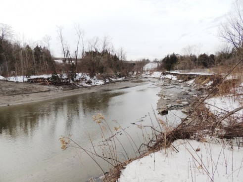
The photo below shows the toll that strong water flows have on Highland Creek. These flows have eroded the bank so much that some concrete pipe infrastructure has fallen into the creek.
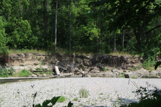
Signs of erosion are especially common in the sandy bank areas of Colonel Danforth Park. Soil erosion continues to be an issue in Highland Creek, which is affected by variable streamflows, bank erosion and some risk of flooding. Several of these erosion scars can measure 30 to 70 cm high.
As you can see in the next couple photos, erosion has led to an unnatural widening of the channel, causing water to flow as a thin sheet over a broad area. In the photo below, notice how the trees on the left side have fallen into the valley.


Found along the trail was this giant ichneumon wasp! It may look like it has a terrifying stinger, but it’s actually a very long ovipositor used for egg-laying. Her powerful needle-like ovipositor is strong enough to inject itself into live trees or logs so she can lay her eggs.


While the trail is for the most part litter free, you do see some debris along the way, like this discarded Toronto Sun box.

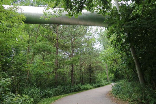
An overhead utility pipe crosses over the path. These pipes are usually conduits for telephone and fiber optics lines.
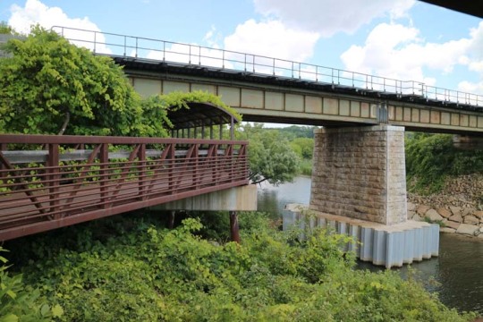
A scenic walk to East Point Park along this bridge, passing underneath the GO Train tracks.
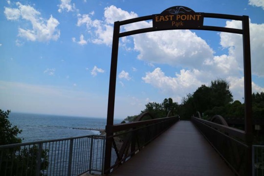
Make your way down to the beach at East Point Park. This 55-hectare park along the water’s edge is a great place to stop for lunch or spot some interesting wildflowers and birds, such as bobolinks, meadowlarks and savannah sparrows, which prefer meadows to woodland. If you’re feeling ambitious, you can continue your walk along the Waterfront Trail.
For more ideas on how to enjoy the great outdoors, visit the TRCA Activities page of our website!
#Waterfront#Waterfront Trail#scarborough#trail#Morningside Park#highland creek#erosion#colonel danforth park#wildflowers#salmon festival#salmon run
0 notes
Text
How the Forestry Industry Transformed Highland Creek
Scarborough of the 1800s was a settler’s dream—the land was rich with pine and hardwoods, the rivers were filled with trout and salmon, and the waterways provided easy transportation to different parts of the township.
By the 1850s, the population of Scarborough was close to 4,200 people. Forestry in the Highland Creek watershed became the first significant resource use and economic activity. To meet the demand, saw mills sprang up, leveling trees and using the cleared land to create homesteads, barns and farms.

By 1851, almost 75% of the township was covered in forest. Within 10 years this was down to about 30%. By then, the forest was so depleted that industry in the Highland Creek area was replaced with agriculture. The saw mills all closed and in their place grist mills were built, grinding grain that now grew in the Highland Creek area into flour.
“On first coming to this country, nothing surprised me more than the total absence of trees about the dwelling houses and cleared lands...Man appears to contend with the trees of the forest as though they were his most obnoxious enemies; for he spares neither the young sapling in its greenness nor the ancient trunk in its lofting pride.”
Catherine Parr Traill, early Canadian settler, naturalist, author, 1832
Trees, like everything in an ecosystem, play an interconnected role with all other parts of the ecosystem. By the late 1800s, deforestation led to water fluctuations. Flooding of the Highland Creek became more frequent and unpredictable, damaging properties and making it difficult to run the mills, many of which either closed or switched to steam power.
How has this shaped Highland Creek?
Historical land uses are significant because they shape the character of the watershed we see today. The loss of forest cover resulted in a lower water table, which caused many of the tributaries of the Highland Creek to disappear and caused an increase in runoff and erosion from the land. This reduced fish populations in the area, due to changes in flow pattern, barriers within the stream and the loss of habitats.
In Highland Creek, the history of resource-based industry has since been replaced by urban land uses and today the watershed is entirely urbanized. Through regular monitoring, TRCA tracks and reports on changes to the shorelines and watershed areas to promote and restore its health and regional biodiversity.
To read more about what we do in the Highland Creek watershed, check out the Highland Creek section of the TRCA website.
Photos from the Toronto Public Library’s digital archive.
0 notes
Text
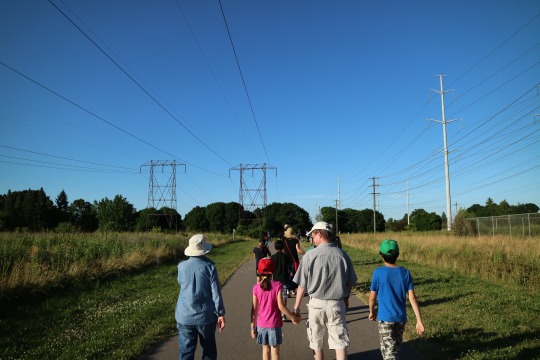
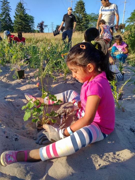
Greening the Gatineau Hydro Corridor
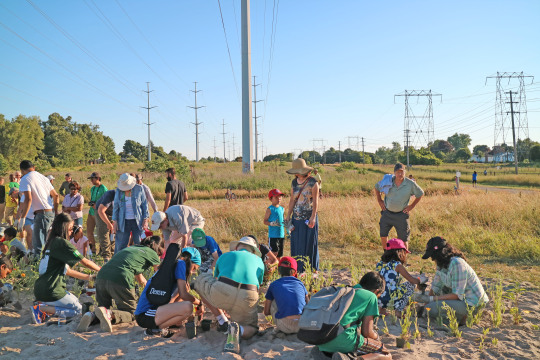
On June 29, the Don and Highland Creek Watersheds team hosted a community wildflower planting event to help build a revitalized greenway trail in the Gatineau Hydro Corridor.
Over 100 Scarborough residents came out to the event and another 350 students from St. Richard’s Catholic Public School came out to an earlier planting. Thanks to the support of local residents, there are now 1200 new seedlings that will grow into native wildflowers such as blackeyed susans, columbines, blanket flowers and native grasses.

Conservation experts were on hand to lead groups on guided nature walks along the corridor. Attendees also had the opportunity to chat with Scarborough Centre Councillor Glenn De Baeremaeker, who also took part in the festivities.

Children were able to get their hands dirty planting wildflower seedlings and creating seed balls to plant in their gardens at home.
The planting event is part of a greening initiative to create a continuous naturalized corridor from the Lower Don River trail to Rouge Park. Through education and stewardship programs, community members will be able to connect with nature and take active ownership of the space to maintain it for future generations to enjoy.
To stay informed about future TRCA planting events in the Highland Creek Watershed, visit or subscribe to our online events calendar.
youtube
0 notes
Text
Should I Be Worried About Ticks in Toronto?

There’s no denying that summers in Canada can be short, so making the most of the outdoors is usually on the top of everyone’s list. But with every summer, there are also stories of ticks and the risk of Lyme disease that have some people re-thinking that trip outdoors.
While it’s true that blacklegged ticks have been found in some parts of the Toronto region, their numbers are still very small and according to Toronto Public Health, the risk of developing Lyme disease is low. Lyme disease can be quite serious if not detected and treated in the early stages, but it’s also considered an easily preventable and treatable disease if caught early.
How is Lyme disease spread?
In Ontario, the only type of tick that carries Lyme disease is the blacklegged tick (sometimes called the deertick). They can be as small as a sesame seed to as large as a pea. Lyme disease is spread when a person is bitten by a tick infected with the Borrelia burgdoferi bacteria. Not all blacklegged ticks carry this bacteria, therefore not all tick bites can cause Lyme disease. Ticks are slow feeders and will attach themselves to a host for 24 to 72 hours. Typically, the bacteria is spread once an infected tick has been attached for 24 hours or longer, which is why being able to detect a tick bite early is so important.
Where have blacklegged ticks been found in Toronto?
Blacklegged ticks have been found in Morningside Park, Cedar Ridge Park, Rouge Park and Algonquin Island in the Toronto Island area. Ticks are found in places where there is tall grass and in wooded or bushy areas where there are lots of leaves on the ground. Although ticks are slow, flightless bugs, they can easily travel by attaching themselves to people, animals and birds.
Toronto Public Health has created a map of active tick surveillance as part of their blacklegged tick surveillance program. The map shows areas where blacklegged ticks have been found and whether the ticks carried the bacteria that causes Lyme disease. TRCA has been collaborating with Regional Public Health units to address West Nile virus, and Lyme disease has been included in our Public Health partner’s vector-borne disease programs.
How can I protect myself against ticks?
Although the risk is low, it’s still important for people to take a proactive approach to help stop the spread of Lyme disease. That means
Taking preventative measures to avoid tick bites, like wearing long-sleeved clothing and using DEET-based insect repellents.
Conducting tick checks after spending time in wooded or bushy areas, including checking children and pets.
Knowing the proper way to remove a tick by using tweezers to grip the tick close to the skin and gently pulling the tick straight out.
Being able to identify the symptoms of Lyme disease.
Complete information on all these items can be found on the Toronto Public Health website.

To do our part in managing the spread of Lyme disease, all events hosted by the Don & Highland Creek Watersheds Team will have tick removal kits on hand. Families visiting the many outdoor wooded and grassy spaces in the Toronto area can also minimize their chance of encountering ticks by keeping to the centre of trails.
When bitten by a tick carrying Lyme disease, early detection is key to making a full recovery. By knowing how to practice prevention, detection and symptom identification for tick bites, you can make sure you and your family can enjoy all your favourite activities this summer.
Images from CBC and Canadian Paediatric Society.
#ticks#lyme disease#scarborough#Toronto Public Health#morningside park#cedar ridge park#Rouge Park#algonquin island
0 notes
Text
Register for LEAF's Tree Tenders Volunteer Training Program!
What is the number one threat to the survival of newly planted trees? What tree species are best for clay soils? How can you help the tree canopy in your community? Just a few questions you’ll be equipped to answer after graduating from the Tree Tenders Volunteer Training Program!
This multi-day course will give you a solid understanding of how trees function and what they need to survive and thrive. You’ll learn about the benefits of urban trees and the challenges they face. Our expert instructors deliver engaging indoor and outdoor sessions that will give you skills you can apply immediately in your own yard and/or neighbourhood. You will even plant a tree!
Eligible for International Society of Arboriculture (ISA) Continuing Education Units. May also qualify for credits through other continuing education programs.
Class Dates and Times:
Tuesday, May 10, 6:00 p.m. – 9:00 p.m.
Thursday, May 12, 6:00 p.m. - 9:00 p.m.
Saturday, May 14, 10:00 a.m. – 4:00 p.m.
Tuesday, May 17, 6:00 p.m. – 9:00 p.m.
Cost: $80 + HST - includes all classes and course manual
Location:
St. Matthew’s Clubhouse
450 Broadview Ave Located in Riverdale Park East at Langley Ave
Toronto, ON M4K 2N3
Canada
For more information and to register, click here.
0 notes