#19thCenturyMaps
Explore tagged Tumblr posts
Visit Tumblr Blog
Explore Tumblr blogs with no restrictions, modern design and the best experience.
Last Seen Tumblr Blogs


Fun Fact
Mobile US users spent an average of 115.8 minutes on Tumblr app monthly.
Text
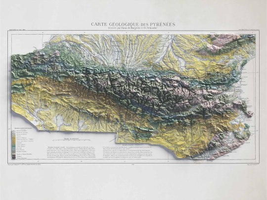
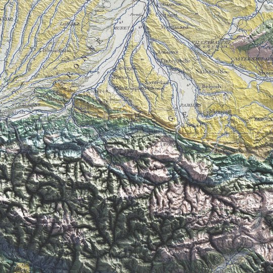
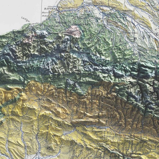
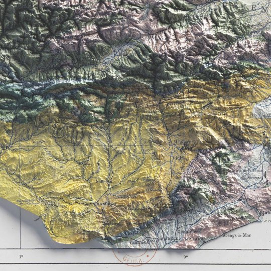
Pyrenees, shaded relief geological map.
🗺️ 𝗠𝗔𝗣 𝗜𝗡𝗙𝗢
Carte géologique des Pyrénées / dressée par Emm. de Margerie ; et Fr. Schrader, Annuaire du C. A. F. 1891, Hachette (Paris). Source: Gallica.
If you like our work, want to see our daily updates (or want to say hello to our studio), consider to follow our Instagram or Twitter account. Otherwise if are interested in our prints or have a custom request check our shop.
#cartography#maps#PyreneesMap#VintageMaps#ShadedRelief#CartographyArt#HistoricalMaps#MapLovers#GeographyArt#VintageCartography#MountainMaps#ReliefMapping#MapCollection#OldMaps#19thCenturyMaps#MapAesthetics#TopoMaps
3 notes
·
View notes
Photo

1832 Antique South Italy Engraved Map By J Arrowsmith With The Maltese Islands eBay item number 224043037099 #map #southitaly #italy #mapofitaly #antiquemap #maps #oldmaps #jarrowsmith #malta #19thcentury #19thcenturymap https://www.instagram.com/p/CBVdEAWnDFv/?igshid=1fq3vtorw1mwb
#map#southitaly#italy#mapofitaly#antiquemap#maps#oldmaps#jarrowsmith#malta#19thcentury#19thcenturymap
0 notes
Photo

Original Wall Maps of the North East from 1773 to 1955 great collection prices from £20 to £250 #tynemouth #northshields #fishquay #northumberland #whitleybay #newcastle #morpeth #hexham #antiquemaps #vintagemaps #18thcenturymap #19thcenturymap #20thcenturymaps #forsale #oldmaps (at Huscrofts Decorative Salvage - North Shields) https://www.instagram.com/p/Bu6lbe-gVHR/?utm_source=ig_tumblr_share&igshid=1h3cz0qygx1me
#tynemouth#northshields#fishquay#northumberland#whitleybay#newcastle#morpeth#hexham#antiquemaps#vintagemaps#18thcenturymap#19thcenturymap#20thcenturymaps#forsale#oldmaps
0 notes