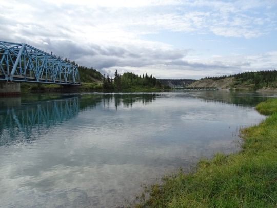
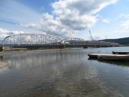
#Nisutlin Bay Bridge
Text


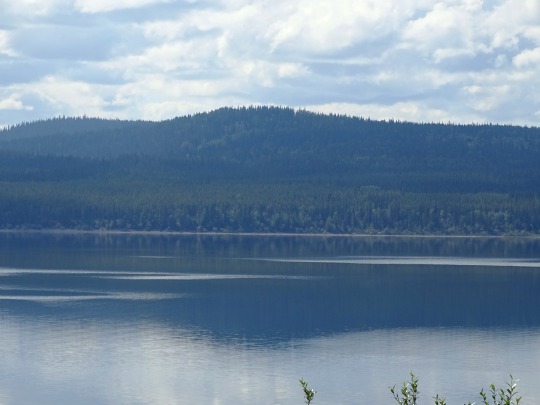


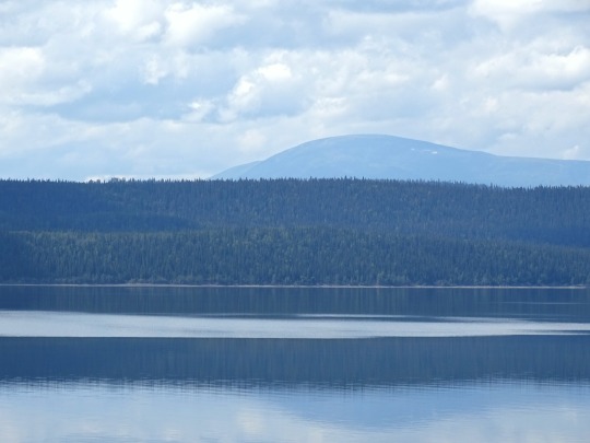
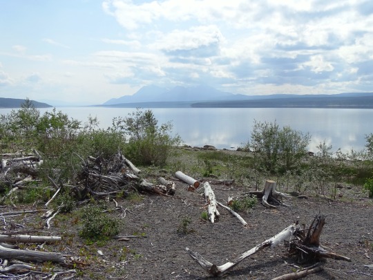
Teslin Lake, YT (No. 2)
There are three Taku River Tlingit First Nation communities around the south end of the lake in British Columbia: Jennings River Indian Reserve No. 8, Teslin Lake Indian Reserve No. 7, and Teslin Lake Indian Reserve No. 9; in the same area there once was a Hudson's Bay Company trading post. On the Yukon portion of the lake there are three First Nation communities: Nisutlin Indian Reserve No. 14, Nisutlin Bay Indian Reserve No. 15, and the Teslin Tlingit Council. The latter is centred in the Village of Teslin, which is located where the Alaska Highway meets the lake, following its northern/eastern shore from there towards Whitehorse. The Nisutlin Plateau limns the eastern side of the lake north of the mouth of the Teslin River and extends into Yukon.
Source: Wikipedia
#Teslin Lake#Yukon#travel#original photography#vacation#tourist attraction#landmark#landscape#countryside#lake shore#dead wood#drift wood#flora#mountains#Nisutlin Bay Bridge#engineering#woods#forest#nature#pine#fir#clouds#the North#Canada#summer 2023#Alaska Highway#Teslin
11 notes
·
View notes
Text
Muncho Lake to Whitehorse
June 21st (stayed first night Watson Lake)
First day of summer! Another great day in this GREAT country. It is a good thing our kilometres are few because the photo spots are too numerous.
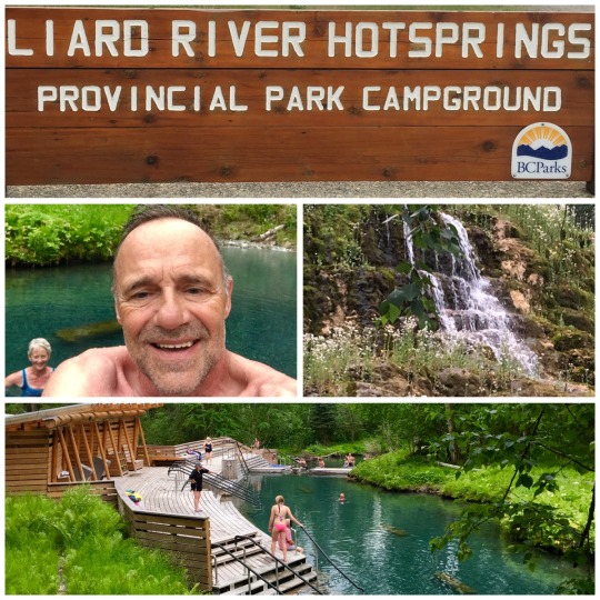
Our first stop today was Liard River Hot Springs Provincial Park where we took a soak in the pools. This Park must be very busy in summer months but today was ideal with few people.
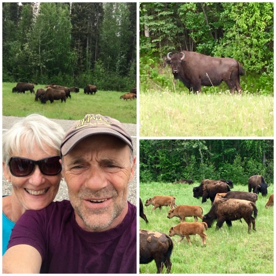
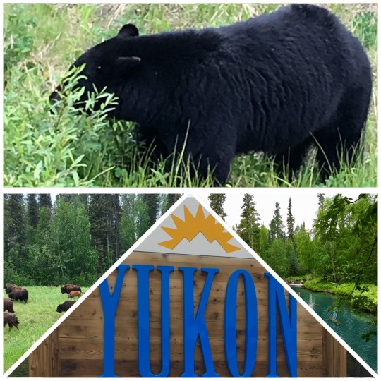
The next spot on the itinerary was Watson Lake. There were so many bison and bears to admire that the drive took a little longer. The number of bison definitely outnumbered the bears today.
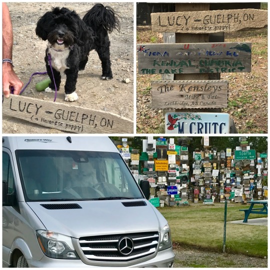
Watson Lake with a population of 1500 is the trade centre for southeastern Yukon. It is also the junction for two main routes; Cassiar Highway to interior British Columbia and Campbell Highway which runs northwest to meet the Klondike Loopat Carmacks.
The most famous sight in town is the Signpost Forest with over 75,000 signs. It was started by a G.I. during the construction of the Highway. Some people bring their signs from home but we opted to create one for Lucy and nailed it to a post.
Tomorrow we continue our explore of the Yukon.
June 22nd (destination Whitehorse)
Our day began with a 4:30 sunrise and the buzzing of mosquitos. The 11:30 pm sunset is not bad but starting the day so early still takes getting used to. Hopefully it will get easier as Dawson City is but days away and they have 20 hours of daylight.
We decided to push for Whitehorse today (420 km) freshen up with supplies and continue to Dawson City. We plan to return to Whitehorse next week when Alicia and Chris join us for Canada Day.
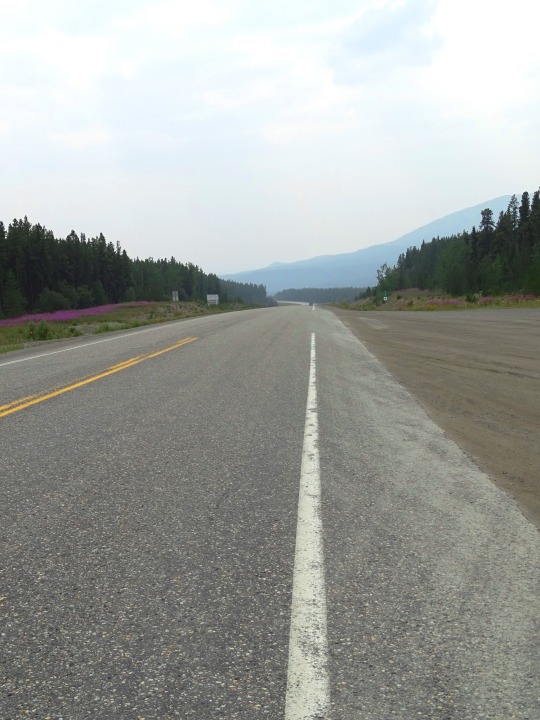
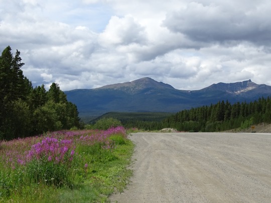
The drive was picturesque with beautiful mountains. The Yukon terrain does remind us of Newfoundland in some ways minus the mountains but not the Moose warnings! Our only wildlife sightings today were 2 black bears and finally a brown bear. Maybe tomorrow my photo finger will catch a snapshot.
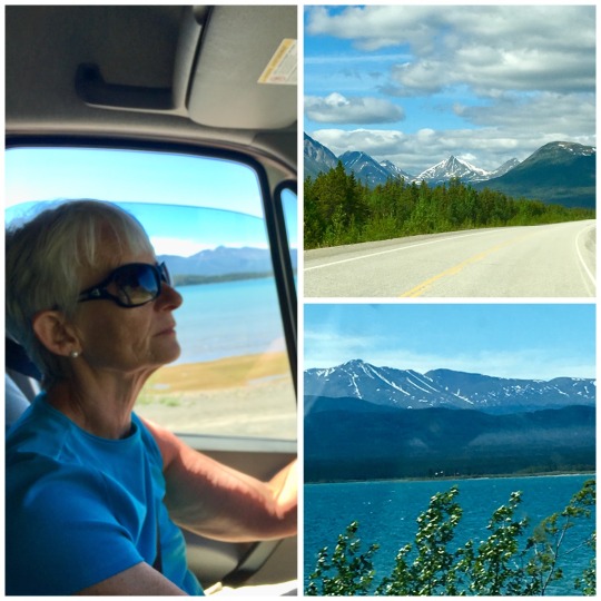
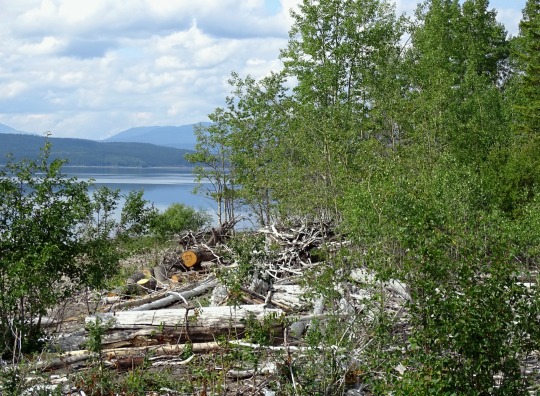
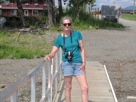
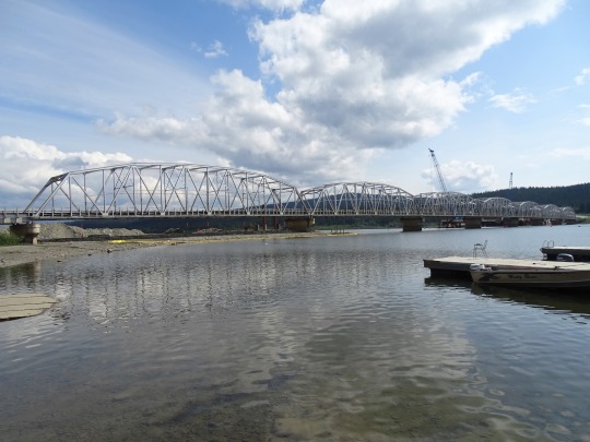
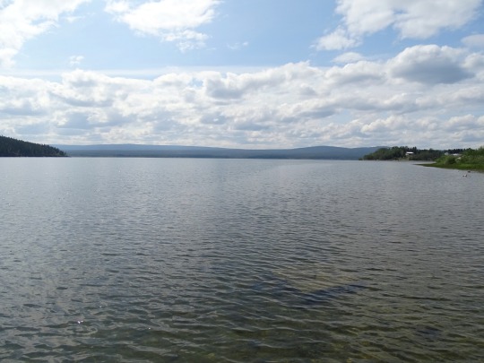
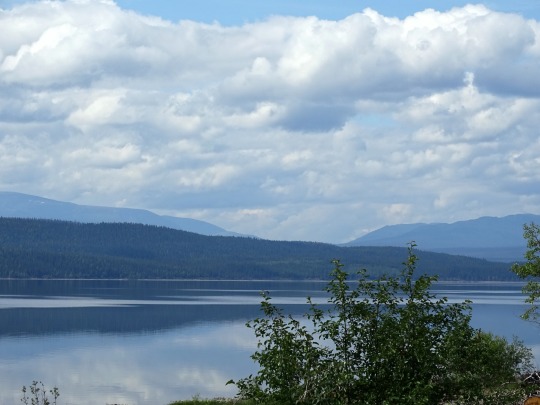
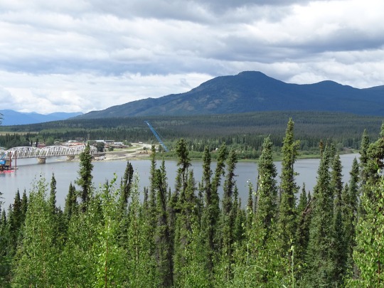
One of our stops today included Teslin. It is a village on the shores of Nisutlin Bay on Teslin Lake. During the Klondike Gold Rush of 1898 seekers travelled up the Stikine River from Alaska, then trekked 150 miles overland to the headwaters of Teslin Lake. There they constructed boats to sail the lake and down rivers to Dawson City and gold fields. Teslin became such a popular stopover that Hudson Bay established a trading post. That is long gone and tourism now plays a big role. The Nisutlin Bay Bridge is the longest water span on the Alaska Highway at 584 metres.

Tomorrow we motor onto Dawson City.
0 notes

Text


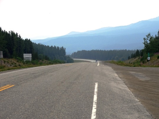


Alaska Highway, CDN (No. 2)
The road was originally built mostly by the U.S. Army Corps of Engineers as a supply route during World War II. In 1942, the Army Corps of Engineers assigned more than 10,000 men, about a third of whom were black soldiers, members of three newly formed African-American segregated regiments. There were four main thrusts in building the route: southeast from Delta Junction, Alaska, toward a linkup at Beaver Creek, Yukon; north then west from Dawson Creek (an advance group started from Fort Nelson, British Columbia, after traveling on winter roads on frozen marshland from railway stations on the Northern Alberta Railways); both east and west from Whitehorse after being ferried in via the White Pass and Yukon Route railway. The Army commandeered equipment of all kinds, including local riverboats, railway locomotives, and housing originally meant for use in southern California.
The official start of construction took place on March 9, 1942, after hundreds of pieces of construction equipment were moved on priority trains by the Northern Alberta Railways to the northeastern part of British Columbia near Mile 0 at Dawson Creek. Construction accelerated through the spring as the winter weather faded away and crews were able to work from both the northern and southern ends; they were spurred on after reports of the Japanese invasion of Kiska Island and Attu Island in the Aleutians. During construction the road was nicknamed the "oil can highway" by the work crews due to the large number of discarded oil cans and fuel drums that marked the road's progress. The construction crew had also passed through an Indigenous village known as Champagne (Shadhala-ra) which they used to set up camp. Unfortunately, disease spread and nearly wiped out the indigenous population of the village. After the war, the survivors left the village to find work, leaving the location a ghost town.
Source: Wikipedia
#Yukon River#Teslin Lake#Alaska Highway#Nisutlin Bay Bridge#street scene#travel#original photography#vacation#landmark#landscape#countryside#summer 2023#flora#nature#woods#forest#fireweed#wildflower#mountains#Canada#Yukon#bridge#Alaska-Canadian Highway#ALCAN Highway#Alaskan Highway#the North#no traffic#reflection
10 notes
·
View notes
Text


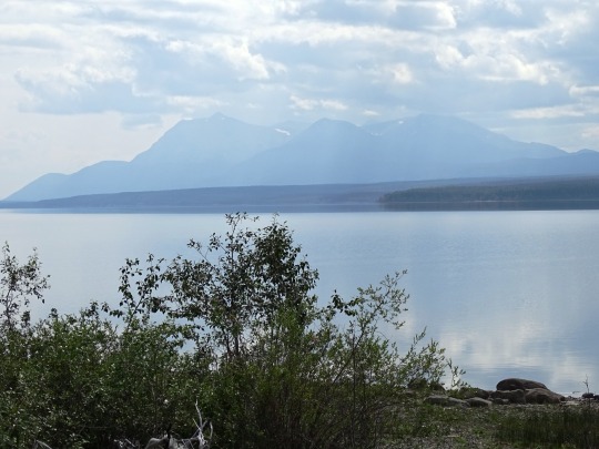
Teslin Lake, YT (No. 4)
George Johnston (trapper) (1884–1972), trapper and photographer, founder of "Teslin Taxi." He captured the life of the inland Tlingit people of Teslin and Atlin in numerous photos taken between 1910 and 1940. Johnston also brought the first car to Teslin; it was a 1928 Chevrolet. He built a 3 to 5 mi (4.8 to 8.0 km) road for his "Teslin taxi" since the Alaska Highway had not been built yet. In winter, he put chains on the car, painted it white, and drove it on frozen Teslin Lake. The '28 Chevy has been restored and is now on permanent display at the George Johnston Museum in Teslin.
In 1995 the Teslin Inland Tlingit negotiated and signed a land claims agreement with the federal government, under which they re-established their own government and became self-sustaining. The Teslin Inland Tlingit now enact their own legal and political framework for government-to-government relations with Canada and the Yukon.
Source: Wikipedia
#Teslin Lake#Yukon#travel#original photography#vacation#tourist attraction#landmark#landscape#countryside#lake shore#dead wood#drift wood#flora#mountains#Nisutlin Bay Bridge#engineering#woods#forest#nature#pine#fir#clouds#the North#Canada#summer 2023#Alaska Highway#Teslin#cityscape
16 notes
·
View notes
Text


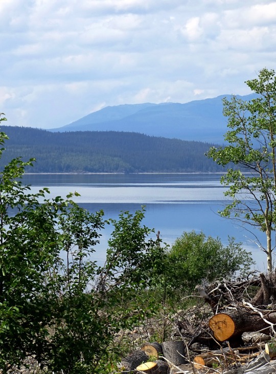
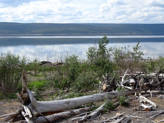
Teslin Lake, YT (No. 3)
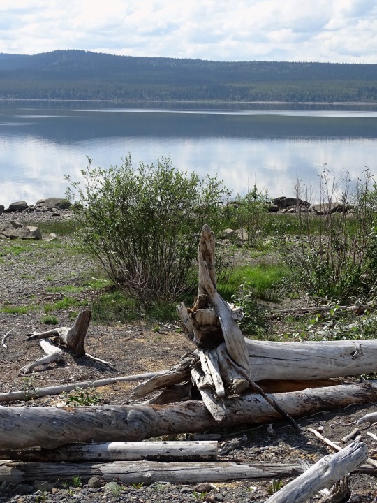
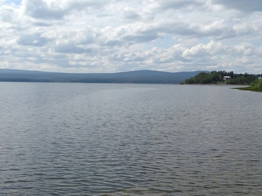
The community of Teslin (Tlingit: Desleen) includes the Village of Teslin in Yukon, Canada. Teslin is situated at historical Mile 804 on the Alaska Highway along Teslin Lake. The Hudson's Bay Company established a small trading post at Teslin in 1903 (i.e. Teslin Post).
Teslin is home to the Teslin Inland Tlingit First Nations. The name Teslin came from a Tlingit word��"Teslintoo." Teslin has one of the largest Native populations in Yukon. Much of the community's livelihood revolves around traditional hunting, trapping and fishing.
Teslin is made up of two moieties; Wolf and Crow. Under the moiety of Wolf there are two clans; Eagle (Dakhl'awedi') and Wolf (Yanyedi). The Crow moiety have three clans; Raven's Children (Kukhhittan or Crow), Frog (Ishkitan) and Split tail Beaver (Deshitan). Under their matrilineal kinship system, children are considered born into the mother's clan, and descent is traced through her line.
Source: Wikipedia
#rental car#Ford Expedition#Teslin Lake#Yukon#travel#original photography#vacation#tourist attraction#landmark#landscape#countryside#lake shore#dead wood#drift wood#flora#mountains#Nisutlin Bay Bridge#engineering#woods#forest#nature#pine#fir#clouds#the North#Canada#summer 2023#Alaska Highway#Teslin#cityscape
8 notes
·
View notes
Text
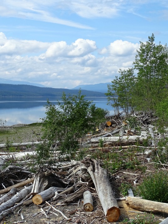
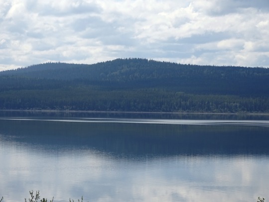

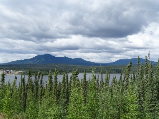

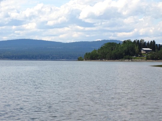
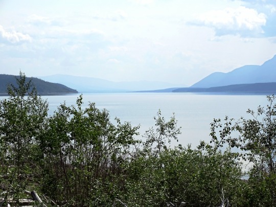
Teslin Lake, YT (No. 1)
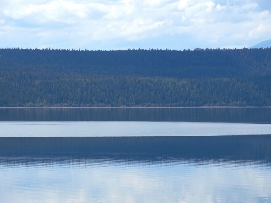
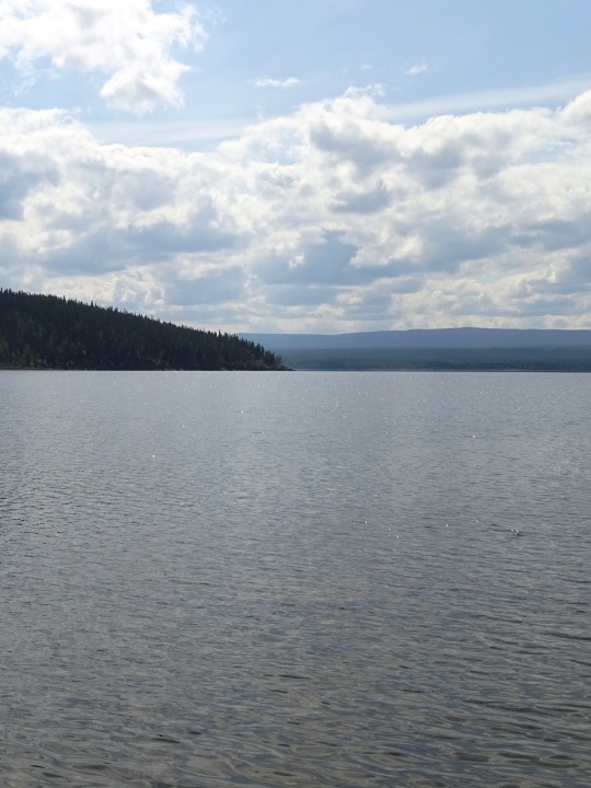
Teslin Lake is a large lake spanning the border between British Columbia and Yukon, Canada. It is one of a group of large lakes in the region of far northwestern BC, east of the upper Alaska Panhandle, which are the southern extremity of the basin of the Yukon River, and which are known in Yukon as "the Southern Lakes" (the other major ones in the group are Atlin Lake and Tagish Lake but include Bennett and Lindeman Lakes, the headwaters of the Yukon River itself). The lake is fed and drained primarily by the Teslin River, south and north, but is also fed from the east by the Jennings River and the Swift River, and from the west by the Hayes River.
According to the Yukon Geographical Names Project, "Teslin" means "long water", but in the Tlingit language the local kwaan or tribe of Tlingit is called Deisleen Kwáan", meaning "Big Sinew Tribe".
Source: Wikipedia
#Teslin Lake#Yukon#travel#original photography#vacation#tourist attraction#landmark#landscape#countryside#lake shore#dead wood#drift wood#flora#mountains#Nisutlin Bay Bridge#engineering#woods#forest#nature#pine#fir#clouds#the North#Canada#summer 2023#Alaska Highway#Teslin
14 notes
·
View notes
Text


From Watson Lake to Whitehorse (No. 4)
When the United States approached Canada again in February 1936, the Canadian government refused to commit to spending money on a road connecting the United States. The Canadians also worried about the military implications, fearing that in a war between Japan and North America, the United States would use the road to prevent Canadian neutrality. During a June 1936 visit to Canada, President Franklin D. Roosevelt told Prime Minister W. L. M. King that a highway to Alaska through Canada could be important in quickly reinforcing the American territory during a foreign crisis. Roosevelt became the first American to publicly discuss the military benefits of a highway in an August speech in Chautauqua, New York. He again mentioned the idea during King's visit to Washington in March 1937, suggesting that a $30 million highway would be helpful as part of a larger defense against Japan that would include, the Americans hoped, a larger Canadian military presence on the Pacific coast. Roosevelt remained a supporter of the highway, telling Cordell Hull in August 1937 that he wanted a road built as soon as possible. By 1938, Duff Pattullo, the BC premier, favored a route through Prince George. The U.S. offered either a $15 million interest-free loan, or to cover half the construction costs.
The December 7, 1941 attack on Pearl Harbor and beginning of the Pacific Theater in World War II, coupled with Japanese threats to the west coast of North America and the Aleutian Islands, changed the priorities for both nations. On February 6, 1942, the construction of the Alaska Highway was approved by the United States Army and the project received the authorization from the U.S. Congress and Roosevelt to proceed five days later. Canada agreed to allow construction as long as the United States bore the full cost, and that the road and other facilities in Canada be turned over to Canadian authority after the war ended. It proved unimportant for the military because 99 percent of the supplies to Alaska during the war were sent by sea from San Francisco, Seattle, and Prince Rupert.
Source: Wikipedia
#Lewes River Control Structure#Yukon River#Teslin Lake#Nisutlin Bay Bridge#Alaska Highway#travel#original photography#vacation#tourist attraction#landmark#landscape#countryside#view#meadow#moutains#Yukon#the North#Canada#summer 2023#ALCAN Highway#Alaska-Canadian Highway#street scene#road trip#empty street#woods#forest#flora#wildflower#nature#clouds
1 note
·
View note
Last Seen Blogs

alice-jem
Crazy Bank Pranks

student-stock
Untitled

thestruidora
breaker

simpingwriter
Cal's Dragonfly
elaine404
hungry