#Yukon River
Text
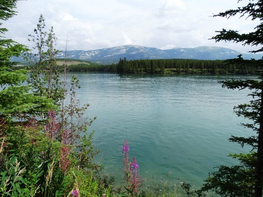
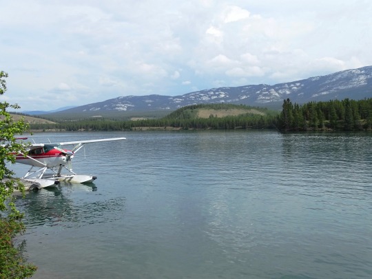
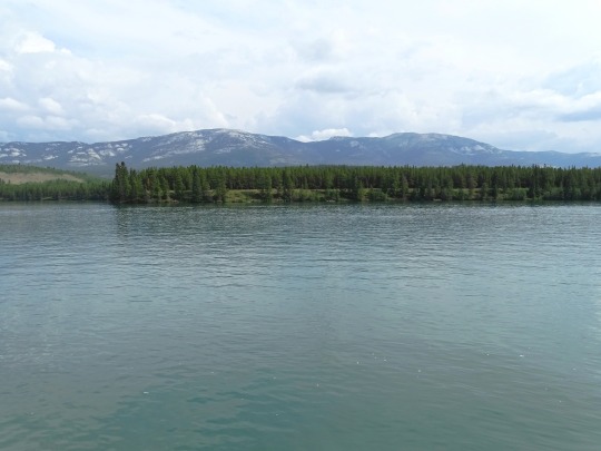
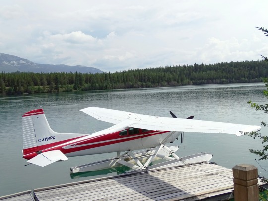
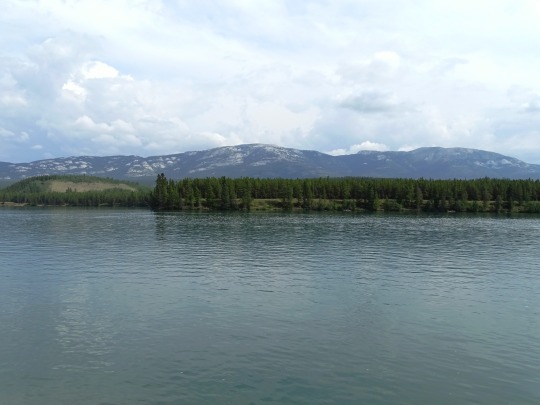
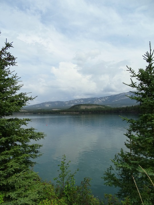
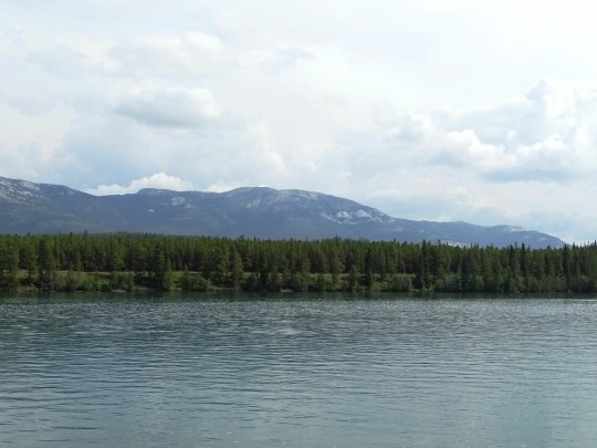
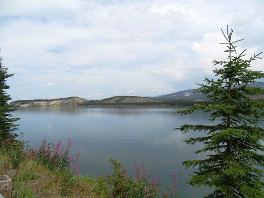
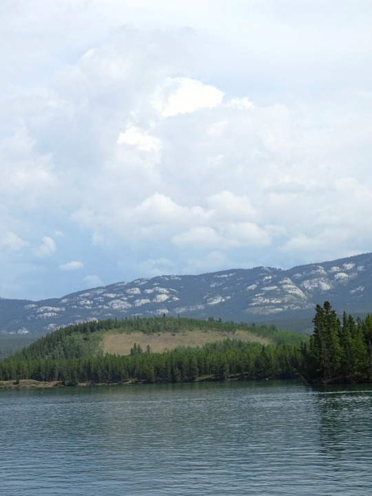

Schwatka Lake, Whitehorse
Schwatka Lake is a reservoir created by the damming of the Yukon River in Whitehorse, Yukon, completed in 1958. The dam provides electrical power generation and is operated by the Yukon Energy Corporation. The White Horse Rapids, which gave the city its name, are now under the lake. The lake was named after Frederick Schwatka, a US Army Lieutenant who was first to explore the total length of the Yukon River.
A fish ladder has been constructed around the hydroelectric dam to allow the passage of Chinook salmon to their spawning grounds upstream of Whitehorse. The Chinook salmon that pass the dam have the longest freshwater migration route of any salmon, over 3,000 kilometres to the mouth of the Yukon River in the Bering Sea.
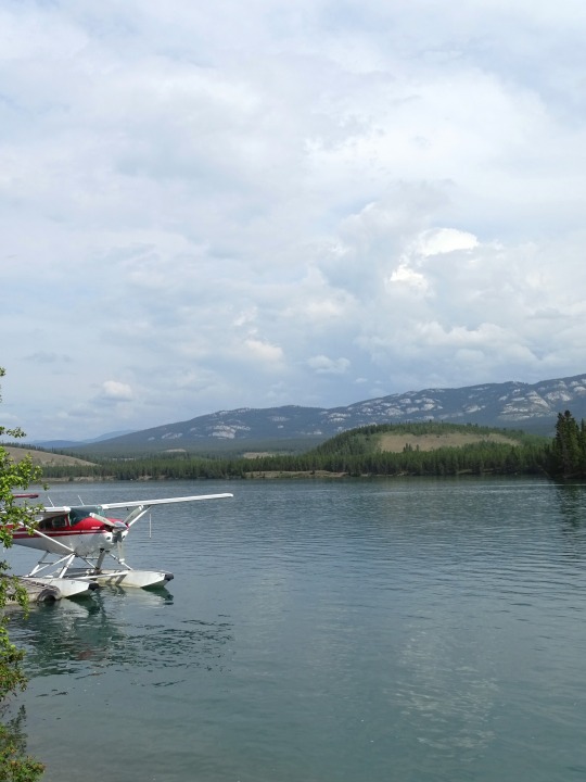
Whitehorse Water Aerodrome, a float plane base, is located on the lake. The lake has been the city's water supply for some years, but the city is now converting to relying entirely on aquifers, partly due to the threat of pollution from fuel spills and other activities by people in the watershed of the lake. Previously, there had been talk of moving the float plane base or the water supply to Fish Lake, which is impractically located to the west over a winding, steep road.
Source: Wikipedia
#Cessna A185F#Cessna 185 Skywagon#Schwatka Lake#seaplane#floatplane#Whitehorse#Yukon#travel#original photography#vacation#tourist attraction#landmark#cityscape#landscape#Yukon River#summer 2023#woods#forest#flora#nature#mountains#engineering#the North#fireweed#widlflower#river bank#lake shore#Canada
30 notes
·
View notes

Text

Whitehorse sits on the Yukon River
13 notes
·
View notes
Text
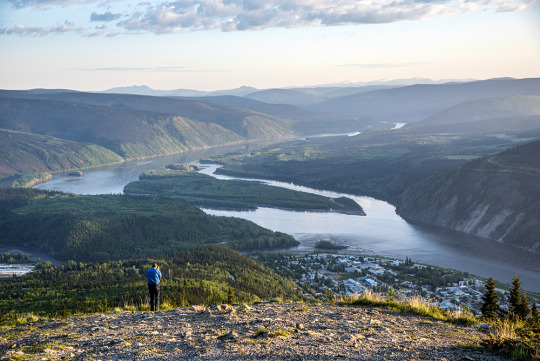
John on a viewpoint overlooking Dawson City and the Yukon River
3 notes
·
View notes
Text
The biggest cowards are the ones without ambition

Fuck the wall, build the dams
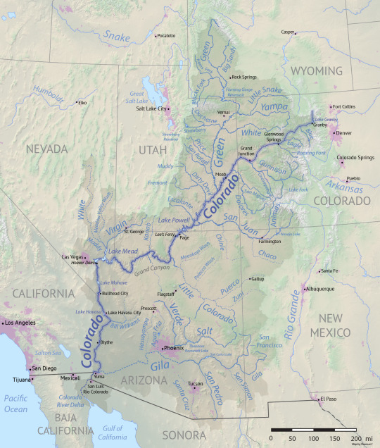
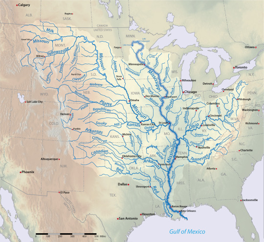
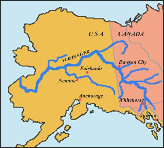
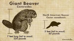
#beaver#mississippi river#Yukon River#missouri river#colorado river#columbia river gorge#snake river#shitpost
1 note
·
View note
Text
(Based on the 12 largest primary rivers by watershed area)
#polls#mississippi#mississippi river#Mackenzie river#st lawrence#Nelson river#yukon#yukon river#columbia#Columbia river#colorado river#rio grande river#Churchill river#fraser river#Sacramento river
0 notes
Text


Juveline Gulls - August 2023
There were a lot of gulls flying around the Five Fingers Rapids. The viewing platform near the river put me close enough to get several good images of the juveniles with their parent.
MWM
0 notes
Text
Breezly Bruin headcannon (Nome edition)
With Camp Frostbite having been deactivated, you have to imagine Breezly and Sneezly's primary hangout in Nome being the main steamship docks, particularly for the barge traffic as operates on the Kuskokwim and Yukon Rivers via Koyuk, Unalakleet, Hooper Bay, Toksuk Bay, Bethel and onwards to the rail and road heads at Fairbanks and Yutana.
0 notes
Photo

(via A Road Trip from Anchorage to Dawson City)
1 note
·
View note
Text


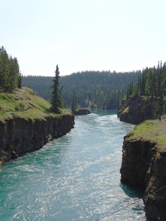
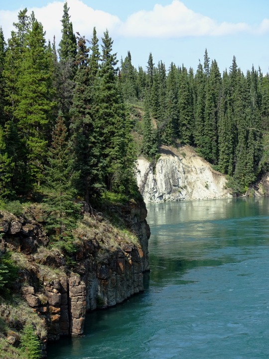
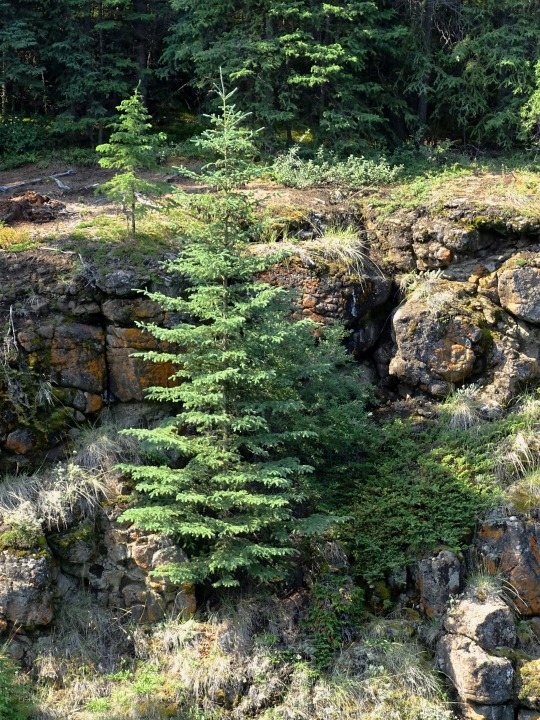


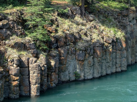
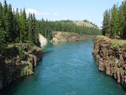
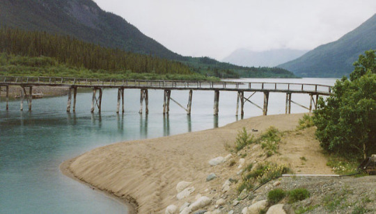
Miles Canyon, YT (No. 3)
The Miles Canyon Basalts represent a package of rocks that include various exposures of basaltic lava flows and cones that erupted and flowed across an ancient pre-glacial landscape in south-central Yukon.
The volcanic rocks are best exposed and most easily accessible at the Miles Canyon location where the Yukon River cuts through a succession of flows south of Whitehorse. In the spring, good exposures can also be seen immediately downstream from the Yukon River hydro dam in Whitehorse which was built to extract energy from the cataracts that were the White Horse Rapids. These rapids and the Miles Canyon provided a significant challenge to gold-seekers heading to the Klondike Gold Rush, and also established the upstream terminus for paddle-wheel river boats. Thus, the Miles Canyon Basalts are the reason for the establishment of the townsite of Closeleigh, eventually the City of Whitehorse.
Source: Wikipedia
#Miles Canyon#Miles Canyon Basalt#geology#volcanic rocks#travel#original photography#vacation#tourist attraction#landmark#landscape#Canada#Yukon#Whitehorse#the North#subalpine fir#river bank#summer 2023#forest#woods#flora#nature#countryside#cityscape#Yukon River#Miles Canyon Suspension Bridge#architecture#engineering
26 notes
·
View notes
Text

Another day, another glimpse of a similar view.
4 notes
·
View notes
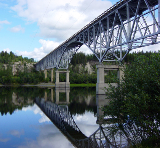
Text
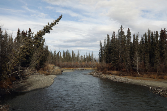
Yukon River Bridge near Whitehorse
6 notes
·
View notes
Text

The ferry to cross the Yukon River at Dawson City.
1 note
·
View note

Photo
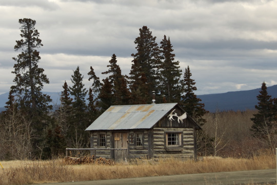


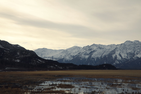


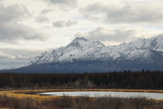
Kluane National Park and Reserve, Yukon
Taken October 2022
#mountains#northern gothic#yukon#canada#cabins in the woods#rivers#kluane national park#autumn#my photos#my places#nev
2K notes
·
View notes
Text
Foot bridge across Natasaheen River near Carcross in Yukon, Canada. (galenfrysinger.com)
35 notes
·
View notes
Last Seen Blogs

lilyminer
Fandoms and Sadness

lucidaloucura
Lúcida Loucura

uterostudio
útero studio

fermentaionstation2
elliot ceo of cringe

indianasolo221
Another Jellicle Blog