#PrecisionMapping
Explore tagged Tumblr posts
Visit Tumblr Blog
Explore Tumblr blogs with no restrictions, modern design and the best experience.
Last Seen Tumblr Blogs


Fun Fact
Celebrities use Tumblr as well.
Text
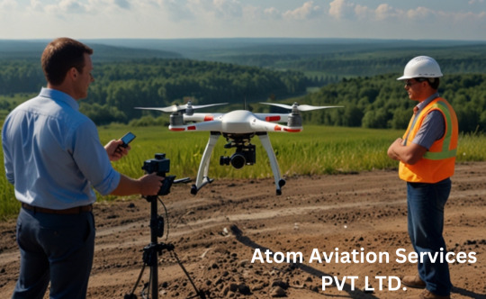
Drone Survey and Mapping: The Future of Precision and Efficiency
Introduction
In recent years, the use of drones has revolutionized various industries, from agriculture to construction, and one of the most impactful applications has been in the field of surveying and mapping. Drone survey and mapping have become essential tools for professionals who require accurate, high-resolution data in a fraction of the time it would take using traditional methods. In this blog, we’ll explore why drone survey and mapping are gaining popularity, how they work, and why they might be the perfect solution for your next project.
What is Drone Survey and Mapping?
Drone survey and mapping involve the use of unmanned aerial vehicles (UAVs) equipped with advanced cameras, sensors, and GPS technology to capture aerial data. This data is then processed using specialized software to create detailed maps, 3D models, and topographic surveys. Unlike traditional surveying methods, drones can cover large areas quickly, safely, and with incredible precision.
Why Choose Drone Survey and Mapping?
Speed and Efficiency Drones can survey vast areas in a matter of minutes or hours, compared to days or weeks with ground-based methods. This speed is particularly beneficial for time-sensitive projects like construction site monitoring or disaster assessment.
Cost-Effective By reducing the need for heavy equipment, manpower, and time, drone surveys significantly cut down on costs. They also minimize the risk of errors, which can be expensive to correct later.
High Accuracy Modern drones are equipped with advanced sensors like LiDAR and photogrammetry cameras, which capture data with centimeter-level accuracy. This makes them ideal for creating detailed topographic maps or 3D models.
Safety Drones can access hard-to-reach or hazardous areas, such as steep slopes, unstable terrain, or disaster zones, without putting human surveyors at risk.
Versatility From agriculture and mining to urban planning and environmental monitoring, drone surveys can be tailored to suit a wide range of industries and applications.
How Does Drone Survey and Mapping Work?
Planning the Flight Before launching a drone, surveyors plan the flight path using specialized software. This ensures complete coverage of the area and optimal data collection.
Data Collection The drone is equipped with cameras and sensors that capture high-resolution images, elevation data, and other relevant information as it flies over the area.
Data Processing The collected data is processed using photogrammetry or LiDAR software to create maps, 3D models, or contour lines. This step often involves stitching together hundreds or thousands of images to form a cohesive model.
Analysis and Reporting The final output is analyzed and presented in a format that meets the project’s requirements, whether it’s a topographic map, volumetric analysis, or a detailed 3D rendering.
Applications of Drone Survey and Mapping
Construction Drones are used to monitor construction progress, track stockpile volumes, and create as-built surveys.
Agriculture Farmers use drone surveys to assess crop health, plan irrigation systems, and optimize land use.
Mining Drones help in calculating stockpile volumes, monitoring mine sites, and ensuring compliance with safety regulations.
Environmental Monitoring Conservationists use drones to map forests, monitor wildlife, and assess the impact of natural disasters.
Urban Planning City planners rely on drone surveys to create detailed maps for infrastructure development and zoning.
Choosing the Right Drone for Survey and Mapping
When selecting a drone for surveying and mapping, consider the following factors:
Payload Capacity: Ensure the drone can carry the necessary cameras and sensors.
Flight Time: Longer flight times allow for larger areas to be covered in a single mission.
GPS Accuracy: High-precision GPS is essential for accurate data collection.
Software Compatibility: The drone should be compatible with industry-standard mapping software.
Popular drones for surveying include the DJI Phantom 4 RTK, senseFly eBee X, and WingtraOne.
The Future of Drone Survey and Mapping
As technology continues to advance, the capabilities of drone survey and mapping are only expected to grow. Innovations like AI-powered data analysis, real-time mapping, and improved battery life will make drones even more efficient and accessible. Additionally, the integration of drones with other technologies, such as augmented reality (AR) and the Internet of Things (IoT), will open up new possibilities for industries worldwide.
Conclusion
Drone survey and mapping have transformed the way we collect and analyze spatial data. With their unmatched speed, accuracy, and versatility, drones are becoming an indispensable tool for professionals across various fields. Whether you’re a land surveyor, a farmer, or a construction manager, incorporating drone technology into your workflow can save time, reduce costs, and improve the quality of your projects.
If you haven’t yet explored the potential of drone survey and mapping, now is the time to take flight. The sky’s the limit when it comes to what you can achieve with this cutting-edge technology!
Call to Action Ready to elevate your surveying and mapping projects? Contact us today to learn more about how drone technology can benefit your business. Let’s map the future together!
#DroneSurvey#AerialMapping#GIS#RemoteSensing#LidarTechnology#Geospatial#TopographicMapping#LandSurvey#UAVMapping#AerialSurvey#3DMapping#SurveyingSolutions#PrecisionMapping#DroneTechnology#MappingInnovation
1 note
·
View note
Text
Exploring the Depths of Bathymetric Survey and Trusting Dolphin Engineers for Expert Solutions
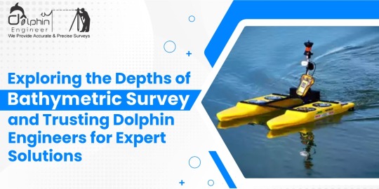
Bathymetric surveys are essential in understanding and mapping the underwater topography of oceans, seas, rivers, and lakes. The process involves measuring the depths and shapes of underwater features, which can provide invaluable data for various industries, including marine construction, navigation, environmental studies, and resource exploration.
Understanding Bathymetric Surveys
Bathymetric surveys utilize advanced technologies such as sonar systems, echo sounders, and GPS equipment to develop highly accurate maps of underwater surfaces. Such maps enable the determination of depth variations, sediment buildup, and any underwater structures. Such data is vital for the planning of maritime construction projects such as ports, bridges, or pipelines. It further helps in ensuring safe navigation for vessels, understanding marine ecosystems, and detecting potential hazards beneath the water surface. These surveys also significantly add to scientific research when they provide insights into underwater geological formations and aquatic habitats. For example, knowing the dispersion of sediment in a river gives one a chance to discover erosion patterns and aid in the proper design of flood control systems.
Why Choose Dolphin Engineers for Bathymetric Surveys
Dolphin Engineers is the most trusted name in the industry when it comes to bathymetric surveys. Here's why they are the best fit for your project:
Accuracy and Reliability Dolphin Engineers uses high-tech equipment and tested methodologies to ensure highly accurate results. The team ensures that every data point is carefully recorded and analysed to provide reliable information for decision-making.
Experienced Professionals The company has a team of experienced professionals who have extensive experience in conducting complex bathymetric surveys. Their experience allows them to handle various challenges, whether it is surveying shallow rivers or deep ocean floors.
Customized Solutions Dolphin Engineers understands that each project has different requirements. It works closely with clients to come up with the survey plans aligned with specific goals and challenges that result in meeting expectations.
Commitment to Safety is a top priority for Dolphin Engineers. Their operations comply with all industry standards and regulations, ensuring that both personnel and the environment are protected throughout the survey process.
Dolphin Engineers delivers comprehensive services other than data gathering, including the processing, analyzing, and generating reports. This is done so that the deliverable will be friendlier to its users, ensuring that the end clients can work with the finding properly.
Cost-Effective Options Despite providing premium-quality services, Dolphin Engineers offers competitive pricing. They strive to deliver value for money by optimizing resources and streamlining processes.
Applications of Bathymetric Surveys
Bathymetric surveys have numerous applications in various fields:
•Marine Construction: It provides foundational data for the construction of harbors, oil rigs, and underwater tunnels.
•Environmental Monitoring: Assessing aquatic ecosystems and tracking changes over time.
•Resource Exploration: Identifying underwater mineral deposits or potential fishing zones.
•Navigation Safety: Updating nautical charts to prevent accidents.
•Flood Management: Studying riverbeds to predict and mitigate flooding risks. Conclusion
Choosing a reliable bathymetric survey partner is indispensable to achieving very accurate and useful results. This is because the company, with Dolphin Engineers advanced technologies, experienced professionals, and service commitment to ensuring that every single project is handled to the high standards of success, will give a client the needed confidence in what they receive-quality and accurate underwater data.
#BathymetricSurveys#DolphinEngineers#MarineSafety#SonarTechnology#UnderwaterMapping#PrecisionMapping#NavigationSolutions#EchoSounding#MarineSurveying#SurveyingExperts#FloodManagement#AdvancedSurveyTech#Oceanography#AccurateDataSolutions#ResourceExploration#GeospatialAnalysis#HydrographicSurveying#TrustedSurveyPartner#EnvironmentalConservation#SmartMapping#EnvironmentalMonitoring#SedimentAnalysis#MarineConstruction#CoastalEngineering#InfrastructurePlanning#WaterResourceManagement
0 notes
Text
🌍 Discover the Power of Aerial Mapping in Dubai with Takhteet Survey ✈️
Aerial mapping is revolutionizing how we approach land surveying and data collection, and Takhteet Survey is at the forefront of this innovation in Dubai. Using cutting-edge drone technology, we provide highly accurate, detailed, and cost-effective mapping services for a wide range of industries, including construction, urban planning, and environmental monitoring.
Why choose aerial mapping for your projects?
✅ Precision – Capture accurate, high-resolution images and topographic data.
✅ Speed – Conduct surveys in record time, reducing project timelines.
✅ Cost-Effective – Save on labor and equipment costs while achieving exceptional results.
✅ Accessibility – Access hard-to-reach or hazardous areas safely and efficiently.
Whether you’re working on large-scale infrastructure, land development, or simply need precise data for your project, Takhteet Survey is your trusted partner in Aerial Mapping in Dubai.
🌐 Explore our services at Takhteet Survey
#AerialMapping#DubaiSurveying#DroneTechnology#SurveyingServices#TakhteetSurvey#PrecisionMapping#DubaiLandSurveying
0 notes
Text
youtube
How Do Surveyors Survey Land
Learn how surveyors determine land boundaries, size, and characteristics using advanced technology like 3D laser scanners, GPS, and ground-penetrating radar. Discover the reasons for land surveys, including property boundary establishment, construction suitability, planning permission, legal disputes, mortgage applications, and agricultural mapping. Understand the tools and techniques surveyors use to collect accurate data, ensuring safe and efficient project execution. Visit our website for more information: https://www.mbsurveysolutions.co.uk/
#LandSurveying#SurveyingTechniques#MBSurveySolutions#GPS#TotalStations#PrecisionMapping#SurveyingAccuracy#Youtube
0 notes
Text
Navigate with confidence, discover with maps
1 note
·
View note
Text
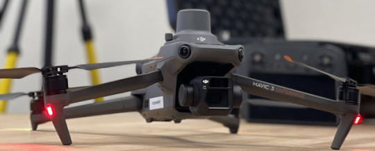
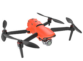
DJI Mavic 3 Enterprise Series: Redefining Aerial Technology
DJI Mavic 3 Enterprise Series: Redefining Aerial Technology
In the world of commercial drones, the DJI Mavic 3 Enterprise series stands out as a testament to innovation and versatility. With a focus on providing advanced features tailored to various industries, this series has redefined the possibilities of aerial technology.
Unveiling the DJI Mavic 3 Enterprise Series
The DJI Mavic 3 Enterprise series is a line of commercial drones designed for a variety of industries, including public safety, construction, and inspection. It is the most advanced and capable drone in DJI's Mavic lineup, with features that set it apart from the competition.
Advanced Camera System
At the core of the Mavic 3 Enterprise series is a dual-camera system that includes a 20MP wide-angle camera and a 56× zoom camera. This powerful combination allows users to capture high-resolution images and videos from impressive distances, providing a new dimension to aerial photography and videography.
Thermal Imaging Capability
The Mavic 3T variant, in particular, boasts a thermal camera for day and night inspections. Thermal imaging is invaluable for applications such as identifying heat signatures, detecting anomalies, and assessing temperature differentials in various environments.
Precise Positioning
For industries that demand pinpoint accuracy, the Mavic 3 Enterprise series comes equipped with an RTK (Real-Time Kinematic) module. This module ensures centimeter-level positioning accuracy, a vital feature for tasks like precise mapping, surveying, and geospatial applications.
Extended Flight Time
The Mavic 3 Enterprise series offers an impressive flight time of up to 45 minutes, significantly enhancing operational efficiency by providing more time in the air before needing to recharge.
Intelligent Flight Modes
These drones come with a suite of intelligent flight modes and features, including Spotlight 2.0, ActiveTrack 5.0, and SmartPhoto. These functions simplify complex tasks and enhance the capabilities of the drone, making it easier for operators to achieve their goals.
Accessory Compatibility
The Mavic 3 Enterprise series is not limited to its built-in capabilities. It is also compatible with a range of accessories, such as a speaker, spotlight, and beacon, which further expand its utility across diverse applications.
Diverse Applications
The Mavic 3 Enterprise series is a versatile tool that caters to a multitude of industries and applications:
Mapping and Surveying
These drones are ideal for creating precise maps and surveys of expansive areas, including construction sites, farms, and disaster zones. The data collected can be instrumental in planning and decision-making.
Inspection
Infrastructure inspections, from bridges to power lines, benefit greatly from the Mavic 3 Enterprise series' capabilities. Detecting damage early can prevent costly failures and ensure public safety.
Search and Rescue
In search and rescue operations, drones provide invaluable assistance in locating missing individuals and assessing the extent of damage caused by natural disasters. Their aerial perspective aids in efficient deployment of resources and swift response.
Firefighting
In firefighting efforts, the Mavic 3T can assess fire damage, track wildfire progression, and provide invaluable situational awareness to first responders.
In essence, the DJI Mavic 3 Enterprise series is a powerful and adaptable tool that enhances the capabilities of various industries. Its ease of use and ability to deliver high-quality images and videos make it an indispensable asset for organizations seeking cutting-edge solutions to their unique challenges.
The Top 10 Drones for Industrial Inspections
Here is a list of the top 10 drones for industrial inspections, in no particular order:
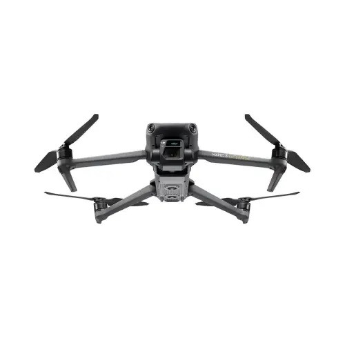
1. DJI Mavic 3 Enterprise Advanced
DJI Mavic 3 Enterprise Advanced drone
· Pros: Long flight time, dual-camera system with zoom lens, thermal camera option, RTK module for centimeter-level accuracy, intelligent flight modes and features
· Cons: Expensive
2. DJI Matrice 300 RTK
DJI Matrice 300 RTK drone
· Pros: Long flight time, powerful camera system with zoom lens, thermal camera option, RTK module for centimeter-level accuracy, obstacle avoidance system, modular design for attaching different payloads
· Cons: Expensive, large and heavy
3. Flyability Elios 3
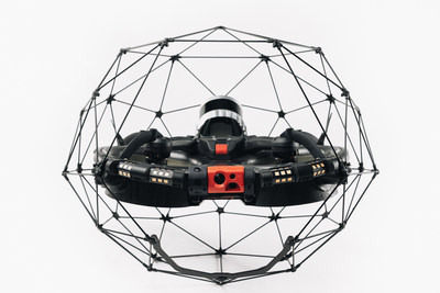
Flyability Elios 3 drone
· Pros: Unique design allows it to fly in confined spaces, impact-resistant cage, thermal camera option, long flight time
· Cons: Expensive, can be difficult to fly in windy conditions
4. Parrot Anafi USA

Parrot Anafi USA drone
· Pros: Compact and lightweight, affordable, high-quality camera system, zoom lens
· Cons: Short flight time, no RTK module
5. Autel Robotics EVO II Pro
Autel Robotics EVO II Pro drone
· Pros: Long flight time, high-quality camera system with zoom lens, obstacle avoidance system, affordable
· Cons: No RTK module
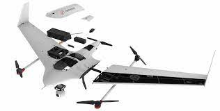
6. senseFly eBee X
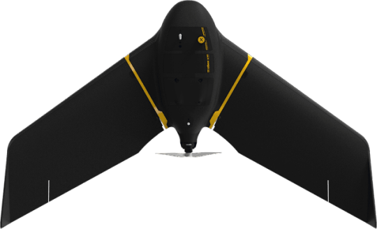
senseFly eBee X drone
· Pros: Long flight time, high-quality camera system, accurate mapping and surveying capabilities
· Cons: Can be difficult to fly in windy conditions, expensive
7. Skyward Vertical Take-Off and Landing (VTOL) Drone
Skyward Vertical Take-Off and Landing (VTOL) Drone
· Pros: Can take off and land vertically, long flight time, high-quality camera system, RTK module
· Cons: Expensive, large and heavy
8. Inspire 2
Inspire 2 drone
· Pros: Powerful camera system with zoom lens, thermal camera option, obstacle avoidance system, modular design for attaching different payloads
· Cons: Expensive, large and heavy
9. Phantom 4 RTK
Phantom 4 RTK drone
· Pros: Long flight time, high-quality camera system, RTK module for centimeter-level accuracy
· Cons: No zoom lens, expensive
10. AscTec Falcon 8
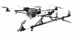
AscTec Falcon 8 drone
· Pros: Robust and reliable, long flight time, high-quality camera system, RTK module
· Cons: Expensive
When choosing a drone for industrial inspections, there are a number of factors to consider, such as:
· Flight time: How long does the drone need to be able to fly for?
· Camera system: What type of camera system does the drone need to have? (e.g., zoom lens, thermal camera, high resolution)
· Accuracy: How accurate does the drone need to be? (e.g., RTK module)
· Obstacle avoidance: Does the drone need to have obstacle avoidance?
· Payload capacity: Does the drone need to be able to carry any additional payloads? (e.g., sensors, lights)
· Price: How much is the user willing to spend?
It is also important to consider the specific needs of the inspection application. For example, if the drone needs to fly in confined spaces, then a drone like the Flyability Elios 3 would be a good choice. If the drone needs to have a long flight time, then a drone like the DJI Mavic 3 Enterprise Advanced or the DJI Matrice 300 RTK would be a good choice.
Once you have considered all of these factors, you can start to narrow down your choices and choose the best drone for your needs.
Certainly, here are some frequently asked questions (FAQs) related to the DJI Mavic 3 Enterprise Series and industrial drones for inspections:
1. What industries can benefit from the DJI Mavic 3 Enterprise Series?
- The DJI Mavic 3 Enterprise Series is designed for a wide range of industries, including public safety, construction, inspection, mapping and surveying, search and rescue, firefighting, and more.
2. What are the key features of the DJI Mavic 3 Enterprise Series?
- The key features include a dual-camera system, thermal imaging capability, precise positioning with an RTK module, extended flight time, intelligent flight modes, and compatibility with various accessories.
3. How long can the DJI Mavic 3 Enterprise Series drones fly on a single charge?
- The Mavic 3 Enterprise Series offers an impressive flight time of up to 45 minutes, which significantly enhances operational efficiency.
4. What are RTK modules, and why are they important for industrial inspections?
- RTK (Real-Time Kinematic) modules provide centimeter-level positioning accuracy, which is crucial for tasks like precise mapping, surveying, and geospatial applications in industrial inspections.
5. Can the DJI Mavic 3 Enterprise Series be customized with accessories?
- Yes, these drones are compatible with a range of accessories such as a speaker, spotlight, and beacon, which can expand their utility for various applications.
6. What factors should I consider when choosing a drone for industrial inspections?
- Factors to consider include flight time, camera system capabilities (e.g., zoom lens, thermal camera), accuracy (e.g., RTK module), obstacle avoidance, payload capacity, and budget.
7. Are there any drones suitable for flying in confined spaces?
- Yes, drones like the Flyability Elios 3 are designed with a unique cage-like structure that allows them to fly in confined spaces and are suitable for inspections in such environments.
8. Are there affordable options for industrial drones with good camera systems?
- Yes, options like the Parrot Anafi USA and Autel Robotics EVO II Pro are more affordable while still offering high-quality camera systems.
9. What is the advantage of having a thermal camera for industrial inspections?
- Thermal cameras are invaluable for detecting heat signatures, identifying anomalies, and assessing temperature differentials, which is useful in various inspection applications, such as identifying electrical issues or assessing structural integrity.
10. How can drones assist in firefighting efforts?
- Drones like the Mavic 3T can assess fire damage, track wildfire progression, and provide situational awareness to first responders, helping them make informed decisions and improve firefighting effectiveness.
Read More:-DJI Drone Price in UAE - Explore the Best Deals on Aerosmart.ae
#Drones#IndustrialInspections#AerialTechnology#DJIMavic3#DJIEnterprise#ThermalImaging#PrecisionMapping#AerialPhotography#SearchAndRescue#FirefightingDrones#DroneTech#GeospatialMapping#PublicSafety#ConstructionInspection#SurveyingDrones#DroneInnovation#SmartDrones#DroneAccessories#DroneFlight#AerialVideo
0 notes
Text
"Drone Sensor Advancements: Market Dynamics and Forecast (2024-2033)"
Drone sensors are revolutionizing the capabilities of unmanned aerial vehicles (UAVs) by providing advanced data collection and analysis for various industries. Equipped with high-resolution cameras, LiDAR, thermal imaging, and multispectral sensors, drones are now essential tools in agriculture, construction, environmental monitoring, and disaster management. These cutting-edge sensors enable precise mapping, efficient resource management, and real-time monitoring, driving innovation and transforming operations across sectors.
#DroneSensors #AerialIntelligence #UAVTechnology #PrecisionMapping #AgricultureTech #ConstructionInnovation #EnvironmentalMonitoring #DisasterManagement #LiDAR #ThermalImaging #MultispectralSensors #DataCollection #TechInAgriculture #SmartFarming #InnovativeTech #RealTimeMonitoring #DroneInnovation #AdvancedSensors #TechRevolution #FutureOfDrones
0 notes
Text
"Future Insights into the Aerial Imaging Market (2024-2033)"
Aerial Imaging is revolutionizing various industries by providing high-resolution, bird's-eye views of landscapes, infrastructure, and environments. Utilizing advanced drone technology and sophisticated imaging sensors, aerial imaging captures detailed visual data that is invaluable for applications in agriculture, construction, real estate, environmental monitoring, and more. This technology enables precise mapping, efficient resource management, and enhanced decision-making processes. As aerial imaging technology continues to advance, it promises to deliver even greater accuracy, efficiency, and innovative solutions across a wide range of sectors.
#AerialImaging #DroneTech #HighResolution #BirdsEyeView #LandscapeMapping #InfrastructureMonitoring #AgricultureTech #ConstructionTech #RealEstateInnovation #EnvironmentalMonitoring #DronePhotography #PrecisionMapping #ResourceManagement #TechAdvancements #ImagingSensors #AerialSurvey #InnovativeSolutions #VisualData #EnhancedDecisionMaking #TechInnovation
0 notes
Text
Why Dolphin Engineers Should Be Your Top Choice for Drone Survey Solutions

Drone surveys are revolutionizing industries by providing accurate, efficient, and reliable data collection methods. Among the numerous service providers, Dolphin Engineers stands out as a leader in this field. Here's why Dolphin Engineers should be your go-to choice for drone survey needs.
1. Experience and Expertise
The experience of Dolphin Engineers in delivering quality drone survey solutions across various industries has been very well proven. The team with years of experience in drone technology and survey methodologies understands the intricacies and details of different projects, ensuring precision every time. 2. Advanced Technology
Dolphin Engineers uses the most advanced in drone technology for excellent service. Its drones, coupled with high-resolution cameras, thermal imaging sensors, and LiDAR systems, can take clear images with a level of detail that no one else can, and with the accuracy of the data obtained, it will definitely be reliable for decision-making purposes. 3. Customized Solutions
Being cognizant that each project requires specific needs, Dolphin Engineers will customize its service delivery to answer individual needs. The company could map the land, monitor construction processes, conduct agricultural surveys, and inspect inaccessible regions among other tasks while providing an optimum outcome in any application. 4. Cost-Efficiency
Traditional surveying methods are quite costly, in terms of time and resources. The drone surveys provided by Dolphin Engineers are cost-effective without compromising on quality. Drones are efficient in reducing manpower and time, thus saving costs for clients. 5. Safety and Accessibility
One of the most important advantages of using Dolphin Engineers is their ability to conduct surveys in hazardous or inaccessible areas. From inspecting tall structures to surveying disaster-affected regions, their drones can operate in environments where manual surveying is unsafe or impossible. 6. Compliance and Accuracy
Dolphin Engineers complies with all regulations and guidelines that establish the legality and ethics of its operations. The firm commits itself to precision and compliance, making sure data is accurate and set up within the boundaries of industrial requirements. 7. Timely Deliverables
Time is an essential factor in any project. Dolphin Engineers ensures that all surveys are completed and delivered within the agreed timelines. Its efficient workflow and advanced processing capabilities minimize delays, keeping clients on schedule. 8. Environmental Responsibility
Dolphin Engineers are environmentally friendly as they conduct drone surveys. This reduces the use of heavy machinery and minimizes ground disturbance, thus making their services sustainable in data collection and site analysis. 9. Wide Range of Applications
Dolphin Engineers caters to a broad spectrum of industries, including construction, agriculture, mining, urban planning, and more. Their versatility ensures that clients from various sectors can benefit from their expertise, regardless of the project’s scale or complexity. 10. Proven Client Satisfaction
The trust and loyalty of their clients speak volumes about Dolphin Engineers' commitment to excellence. In fact, there are many testimonials and repeat partnerships, which speaks of their consistency in delivering what they promise.
In conclusion, The Dolphin Engineers' combination of experience, technology, affordability, and reliability cannot be easily beaten. They will help you create accurate maps, inspect your entire area, and provide you with a comprehensive analysis of the data gathered. Dolphin Engineers are up to the challenge, and doing so with great professionalism and efficiency. Quality, innovation, and commitment to exceeding client expectations will drive your choice of Dolphin Engineers for your drone survey needs.
#DroneSurveys#DolphinEngineers#AdvancedTechnology#PrecisionMapping#AerialData#CustomSolutions#CostEffective#SurveyInnovation#DroneTechnology#EnvironmentalResponsibility#EfficientDataCollection#SafetyFirst#TimelyDeliverables#IndustryLeader#ClientSatisfaction
0 notes
Text
youtube
Are Land Surveyors Accurate
Discover the importance of measured surveys in construction projects. Learn how these surveys provide precise building dimensions, essential for creating detailed digital drawings. Understand the tools used, like laser scanners and drones, and see how architects, engineers, and construction companies benefit from accurate data to avoid issues, reduce delays, and comply with regulations. Ensure your project's success with a measured survey. Visit our website for more information: https://www.mbsurveysolutions.co.uk/
0 notes
Text
Surveying Excellence in Bihar: A Closer Look at Our Recent Projects in Varisligajz
A survey is a method of collecting information by doing relevant research and using technology to analyze the data, and condition of a specific area or mapping out the construction area. This data is important for planning, designing, and constructing different projects. The survey is an essential part of our service, we have been providing accurate reports and reliable results to our clients for over two decades and recently surveyed in Varisligaj, Bihar.
The survey that we Did in Varisligaj, Bihar
We did six surveys out there: bridge survey, rail line survey, highway survey, grid survey, agriculture land survey, and canal survey. Here is Brief Information about those surveys.
Bridge Survey: We Did a bridge survey of a rail bridge and reviewed the HFL level and Dl level survey of water that helps to understand the water flow during the rainy season. HFL represents the High Flude Level and Dl Deadline. Through this surveying of the bridge, we do our survey for stronger, safer connections, Structural integrity of bridges, and other similar structures.
Rail Line Survey: Rail Line Surveying is conducted to collect data on a railroad to improve rail operations. the survey report can be used to identify problems and develop plans for repairing or replacing the track or other infrastructure.
Highway Survey:
We did this Survey under the State Highway Survey in Bihar. A highway survey also known as a road survey is a kind of land that is done for precise measurement, mapping, and analysis of roads, highways, and transportation infrastructure.

Agriculture Land Survey:
A land survey is the simplest form of plan survey, it assesses and maps farmland to optimize crop production and land management.
Canal survey: This survey helps in measuring how much water is discharged daily. It also helps in measuring the level of water whether it is low or high. This survey helps in analyzing whether the flow of the water is proper or not.
Grid Survey:
W e id Grid survey for the Grid Sub center Varisligaj, Bihar. It is associated with a Grid Survey Framework and describes a period during which field crews will look for the plants in the area. It also contains the assignment of crews to particular cells.
Why survey are important?
Surveys provide researchers with reliable, usable, primary data to inform. They are important because the data comes directly from the individuals you have identified in your goal. Surveys give you a detailed, systematic way to view and analyze your data. Surveys play a major role in gathering data, opinions, and feedback from clients. Accurate survey data also helps avoid costly mistakes and rework, making the project more cost-efficient. Additionally, surveys ensure that projects comply with local, state, and federal regulations, preventing legal issues and fines.
Conclusion
Surveys are a powerful tool that can help organizations, governments, and individuals make informed decisions, identify trends, and understand public perspectives. Dolphin Engineer understands the importance of surveys and offers a range of survey services to our clients. Whether you need topographical surveys, River surveys, or Solar Power Plant surveys, we have the expertise and equipment to deliver accurate and reliable results.
Contact us today to learn more about our survey services and how we can help you achieve your goals.
#Surveying#InfrastructureDevelopment#BridgeSurvey#RailSurvey#HighwaySurvey#LandSurvey#CanalSurvey#GridSurvey#BiharDevelopment#ConstructionPlanning#CivilEngineering#DolphinEngineer#PrecisionMapping#EngineeringServices#ProjectManagement#SurveyingServices
0 notes
Text
🚁 Elevating Exploration: Unveiling the Drone Sensors Market! 🌐🔍
Embark on a high-flying adventure into the world of drone technology and explore the game-changing Drone Sensors Market. From aerial intelligence to precision mapping, discover how sensors are taking drone capabilities to new heights! 🛰️🌍✨
#DroneSensorsRevolution #SkyTechInnovations #PrecisionMapping #AerialIntelligence #SensingTheSkies #FutureOfDrones #ExploreWithSensors #HighTechHorizons #DroneInnovations #AerialSolutions 🌿🌏
Swipe left to unveil the cutting-edge sensors that are turning drones into sophisticated data collectors and problem solvers! 🔄🔬🛸 Let's explore how the Drone Sensors Market is not just about flying high but also about seeing the world with unprecedented clarity. 🌈🔧 #SensorsInFlight #TechToExplore #DataFromAbove #AerialInsights #InnovateTheSkies 🚀🔍
Tag a friend fascinated by technology or someone curious about the potential of drones! 👥💬 Join the conversation about the transformative impact of drone sensors, and together, let's soar into the future of aerial exploration! 🌟🌐 #DroneAdventures #TechInTheSky #SensorsOnHigh #FutureOfExploration #FlyWithInnovation 🌐💫
0 notes