#SurveyingExperts
Text
About Dolphin Engineer: Leading the Way in Surveying Solutions
A survey is a method of collecting information by doing relevant research and using technology to analyze the data, and condition of a specific area or mapping out the construction area. This data is important for planning, designing, and constructing different projects. Dolphin Engineer understand the importance of surveys in various industries. The survey is an essential part of our service, we have been providing accurate reports and reliable results to our clients for over two decades.
Who We Are
Dolphin Engineers was established on the principles of innovation, expertise and customer satisfaction. Our team is composed of seasoned surveyors and engineers who have amassed years of experience working in the industry. We are dedicated to advancing our knowledge so we can remain at the cutting edge of modern techniques and technologies. Our goal is to make sure that every client we work with has the most precise information they can get their hands on, which would allow them to make sound judgments without hesitation.
What We Do
Dolphin Engineers offers a plethora of surveying services tailored to meet our client’s individual needs. We boast vast knowledge in both land surveying and mapping as well as construction surveys that involve monitoring amongst other things hence giving us enough resources for handling projects varying in size or complexity. We use state-of-the-art equipment such as GPS systems, LiDARs (Light Detection and Ranging units), and drones among others when collecting topographic data so that accuracy precision and timeliness are ensured.

Our Values
At Dolphin Engineers, we're committed to:
Quality: We strive for quality surveying services that are based on the highest levels of precision as well accuracy.
Innovation: We also constantly seek for ways of improving what we do through use of new technology or devising new techniques.
Customer Satisfaction: Always ensuring all our customers get what they need from us is one policy we follow religiously.
Integrity: We are honest, clear-cut, sincere people who do not tolerate dishonesty from anybody.
Why Choose Dolphin Engineers?
So why choose Dolphin Engineers for your surveying needs? Here are just a few reasons:
Experience: Our team has a wealth of industry experience spanning many years and has worked on projects of various sizes and challenges.
Expertise: We specialize in modern surveying technologies and methodologies, consistently striving to be ahead in this field.
Quality: At all times, we provide premium level surveying services n according to extensive accuracy and precision requirements.
Customer Service: With us, customer satisfaction is always paramount, thus we willingly provide excellent service to all our clients.
Get in Touch
Dolphin Engineers is your ideal survey company if you are in search of a provider of precise, trustworthy and prompt information. Contact us today in order find out more about what we do and how we may be of assistance in achieving your objectives.
To find out more about our services and see who’s part of our team, please visit our website at https://www.dolphinengineers.com/ . We hope to work together soon!
#SurveyingServices#Engineering#DolphinEngineers#LandSurveying#ConstructionSurvey#Mapping#TopographicSurvey#LiDAR#GPSSurveying#InnovationInSurveying#CustomerSatisfaction#PrecisionEngineering#ModernTechnology#EngineeringExcellence#AccurateData#SurveyingExperts#DronesInSurveying#ConstructionPlanning#SurveyingSolutions
0 notes
Text
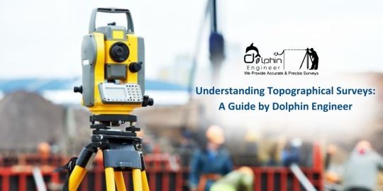
Understanding Topographical Surveys: A Guide by Dolphin Engineer
At Dolphin Engineer, we understand the importance of topographical surveys in infrastructure development. A topographical survey is an essential step in the planning and execution of any construction project. It provides a detailed and accurate representation of the natural and man-made features of the land, which is essential for designing and building safe and functional infrastructure. This also includes everything from hills and valleys to buildings and roads. A topographical survey also called a topo survey for short, uses fancy equipment to measure distances, angles, and elevations (heights) across the land.
What is a Topographic Survey?
Have you ever wondered how engineers and architects plan those amazing buildings and winding roads? A topographic survey which is also known as a contour survey or land survey shows the exact location of both human-made and natural features on a parcel of land. it focuses on both horizontal and vertical aspects, providing information about the property. The reason behind a topographic survey is to define changes in elevation on a parcel of land, which is essential for planning land use.
Why Do You Need a Topographic Survey?
When buying, developing, or evaluating land, a topographic survey is the first step. A topographic survey is important in many cases, as it helps identify potential issues with the land. By identifying issues early on, you can find simple solutions, such as relocating building locations, adding proper drainage, or levelling the ground.
The Importance and Process of Topographical Surveys
At Dolphon Engineer we are an expert team of engineers who use to plan and design buildings, roads, and other structures. Developers need accurate land details to plan new subdivisions or commercial properties. Environmental scientists rely on these surveys to understand the landscape, and they also help resolve property disputes and define land boundaries. To conduct a topographical survey, surveyors gather existing maps and records, visit the site with tools like GPS and drones, process the data with computer software, and produce a detailed map or report showing the land’s features.
How is a Topographical Survey Done?
At Dolphin Engineer, we follow a systematic process to ensure accurate and reliable results. First, we do an Initial consultation here we connect with you to understand your needs and the specifics of the projects. Our team visits the site to gather data using advanced tools like GPS, drones, and total stations. Then we process the collected data to create detailed maps and models. after analysing provide you with the reports and visualizations, with 2D maps and 3D models.
Conclusion
At Dolphin Engineer, we understand the importance of topographical surveys in infrastructure development. Our team of experienced surveyors and engineers use the latest technologies and methods to provide accurate and reliable topographical surveys. Whether you're planning a new construction project or need to update an existing infrastructure, our topographical survey services can help you achieve your goals.
#TopographicalSurvey#LandSurveying#InfrastructureDevelopment#ConstructionPlanning#Engineering#LandDevelopment#GPS#Drones#SurveyingTechnology#SitePlanning#EnvironmentalScience#PropertyBoundaries#TopoSurvey#CivilEngineering#AccurateData#ProjectPlanning#LandEvaluation#SurveyingExperts#DolphinEngineer#3DMapping#2DMapping
1 note
·
View note
Last Seen Blogs

kissme-imenglish
keep the car running

gangnamfullsalong
강남하이퍼블릭

biahrt
bia

sunshyni
sunshyni

its-sexy-beastington-to-you
What happen to the stairs?