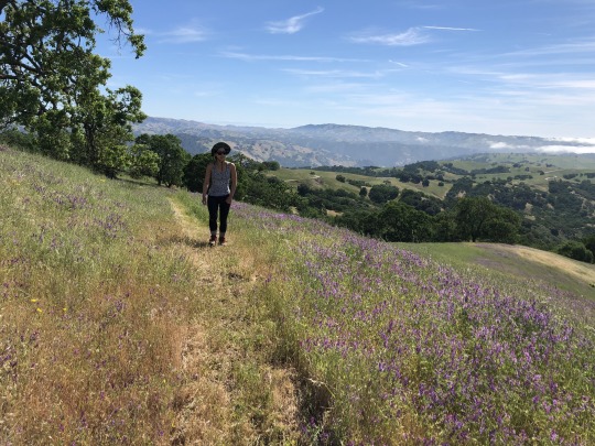
#San Diego Backcountry Mountains
Photo

Get ready for more desert adventures for the mind body and spirit with new videos coming soon on YouTube: Desert Mountain Apothecary!
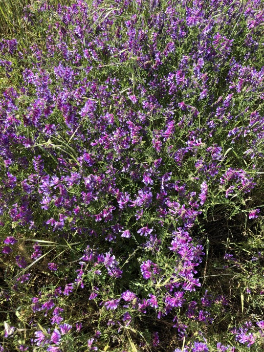
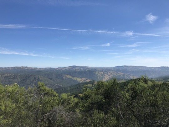
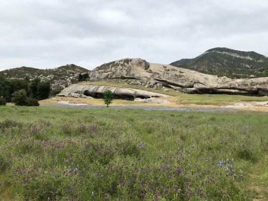
After a wet winter, the San Diego Backcountry Desert and Mountains are looking lush and green.
Just like me, my videos are wholesome, natural, and pure, and my new ones coming up soon are sure to put a country mile wide smile on your face.
Please enjoy my channel: Desert Mountain Apothecary, I’m Will Brennan and I love you for watching.
All the best,
Will
William Z. Brennan, founder of Desert Mountain Apothecary & author of upcoming e-book Natural Lifestyle Optimization
Let’s Connect:
YouTube:
https://www.youtube.com/@desertmountainapothecary/
Website:
https://desertmountainapothecary.com/
DMA Journal:
https://desertmountainapothecary.com/blogs/blog
Mastodon:
https://mindly.social/@DesertMountainApothecary
Pinterest:
https://www.pinterest.com/desertmountainapothecary/
Medium:
https://desertmountainapothecary.medium.com/
Linkedin:
https://www.linkedin.com/in/william-z-brennan
Tumblr:
https://www.tumblr.com/blog/view/desertmountainapothecary
LinkTree:
https://linktr.ee/desertmountainapothecary
About Desert Mountain Apothecary: The original desert apothecary for mind, body & spirit: desert roots & desert mountain botanicals: Desert Mountain Apothecary by William Z. Brennan. Supremely natural natural skincare & botanical fragrance hand made with love from the purest natural source plant-based ingredients.
About William Z. Brennan: William Z. Brennan is a natural lifestyle expert, founder of Desert Mountain Apothecary & author of upcoming e-book Natural Lifestyle Optimization. Originally from New York, and with a background in fragrance, skincare, fashion design & bespoke mens tailoring, he is now based in the Southern California Desert.
youtube
#hiking#hike#hike with me#let's hike#let's go hiking#san diego#san diego daytrip#san diego roadtrip#san diego travel destination#san diego backcountry#california#socal#southern california#things to do in southern california#things to do in julian#julian ca#julian california#santa ysabel#San Diego Backcountry Mountains#Anza Borrego Desert#anza borrego desert state park#anzaborrego
5 notes
·
View notes
Text
Wild Giants of Big Rock Canyon
This rugged canyon on the San Gabriel Mountains’ northern side is a sort of Bluff Creek South. The area is believed to be the home base of southern California Sasquatches who have terrified hikers and homeowners in the San Gabriels and Antelope Valley.
These creatures have been rumored to exist in the southern California backcountry for many years. During Spanish colonial times, Indians told Spanish padres of the hairy giants who supposedly live near certain dry arroyos. In 1876, white hunters spotted an apelike beast roaming the mountains near Warner’s Ranch in San Diego County.
But southern California’s real Sasquatch epidemic hit in mid-1960s. In 1966, newspaper reports told of a girl pawed by a seven-foot-tall, slime-covered beast in the Lytle Creek wash north of Fontana. A few weeks earlier two boys hiking in the wash had seen “an ape in a tree” there. And in Quartz Hill, on the west end of the Antelope Valley, two young men told L.A. County sheriff’s deputies that they had seen a dark, giant biped silhouetted against the sky on a hill.
Such reports tantalized and perplexed Sasquatch hunters. They had concentrated their search for the creature in the rugged wilderness of the northwest. It seemed incredible, and more than a little disturbing, that the big ape could be lurking on the outskirts of Los Angeles.
Hunters picked up the southern California Sasquatch trail in Big Rock Canyon in 1973a, year in which apelike creatures were spotted all over Antelope Valley. Frightened homeowners and frustrated lawmen were never able to capture any of the beasts, and believe that they hid out in the neighboring San Gabriel Mountains. Sasquatch expert Ken Coon hired a plane, flew over the mountains, saw forested, creek-fed Big Rock Canyon, and guessed that the wild mountain valley was probably the Sasquatches’ Los Angeles County lair.
And sure enough, the beast turned up there. On April 22, 1973, three young men from the San Fernando Valley saw one near the Sycamore Flats campground. The three were riding in a pickup truck at about ten p.m. when an eleven-foot Sasquatch jumped out of the bushes and chased the truck for about twenty seconds, it’s long arms swinging in front of its chest.
The boys reported the incident to the sheriff’s office in Lancaster and went straight back to Big Rock Canyon. There they located the spot where the big ape had appeared and were amazed to find hundreds of huge footprints along the road, some of which they later preserved in plaster of paris. These prints were especially odd in that they were three-toed. To date, all other Sasquatch tracks had been five-toed.
Soon hunters were scouring Big Rock Canyon for the three-toed Sasquatches, and more sightings and track casts rolled in. Something left twenty-one-inch tracks with a hunter Margaret Bailey saw a “huge figure” in the moonlight at Sycamore Flats. Then, inevitably, reports tapered off. Once again, the hairy giants retreated from public view and headed back to whatever strange twilight world they inhabit.
They were seen around Big Rock campground, at the top of the canyon, one more time each-in 1974, 1975, and 1976. William Roemermann, who had become Big Rock Canyon’s answer to Roger Patterson, made the last two sightings. Weird California was told that Sasquatch was last seen in the region at Devil’s Punchbowl County Park a few years ago, when two girls and their horses were scared senseless by an apelike monster. Since Devil’s Punchbowl is just west of Big Rock Canyon, it’s possible that the creatures are still dwelling in the area and might make a comeback before too long.
0 notes
Text
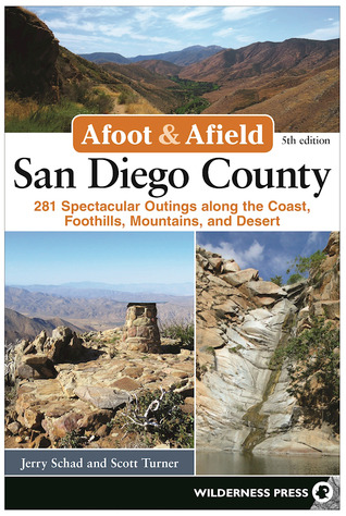
Read Afoot and Afield San Diego County 281 Spectacular Outings along the Coast Foothills Mountains and Desert [ PDF ] Ebook
>Download Afoot and Afield: San Diego County: 281 Spectacular Outings along the Coast, Foothills, Mountains, and Desert Ebook
Read/Download Visit :
http://happyreadingebook.club/?book=0899978010
Book Details:
Author : Jerry Schad
Publisher : Wilderness Press
ISBN : 0899978010
Publication Date : 2017-3-14
Language :
Pages : 512
Book Synopsis:
Since 1986, Jerry Schad’s Afoot and Afield: San Diego County has been the premier trail guide for hikers, backpackers, and mountain bikers. It describes routes ranging from brief, family-friendly hikes to multiple-day overnight trips in remote regions of the backcountry, providing equal weight to the scenic and recreational value of each trip. Each route features at least one or more significant botanical, cultural, or geological highlight with detailed information about what makes each one significant. The book’s lengthy history as the preferred hiking guide for the region creates trust and recognition in its readers, while the variety within the book caters to a wide population of recreational enthusiasts.Current co-author Scott Turner has fully updated the book by re-hiking each of the routes contained within the book and adding (up to) 30 new routes to ensure that information for each trip is fully current.
1 note
·
View note
Text
Bring on desert livin’, calling Las Vegas home
San Diego has been home for almost five years, oh how I love the evenings spent in the ocean’s waves and the endless palm trees & perfect sunsets. But I’ve been in a rut, nothing that made me unhappy, just unrestful. Being in Mammoth Lakes for the summer brought into light the importance of being close to the places I love to be outside. There, I could walk out my backdoor and access the backcountry by foot or bike; rarely even touching my truck for the whole summer! That perspective of the mountain lifestyle made me realize that San Diego had me a bit trapped from all the things I cared most about. Each weekend I would rally hard, driving sometimes 7 hours one way, to reach the gorgeous places I loved to climb or bike or hike or fish. Now all I wanted was to look out my window and be able to see adventures right in the foreground.
Las Vegas, although The Strip gives it a bad reputation, is a hidden gem for outdoor access right out it’s back door. I fell in love with the public lands just outside of Las Vegas several years ago on my first climbing trip for a friends Thanksgiving. Since then I’ve always felt such a sense of excitement and peace being here. When the opportunity came up for a recreation management job at the Spring Mountain National Recreation Area, I applied on a whim. I had just always felt drawn to Las Vegas; never did I think I would actually live here. The stars aligned when my best friend/climbing partner committed to moving here for school and I got offered the job at the same time; it seemed like a sign. I pulled the trigger on the job and within a month, we both were calling this place “home.”
Megan and I found a cozy apartment close to our work & school but more importantly, close to Red Rocks National Conversation Area and Spring Mountain National Recreation Area. We are only a short drive to world class climbing and endless miles of trails; I cannot get enough.
Change is so hard & uncomfortable in the moment but it’s what we all need to continually grow and thrive in life.
Leaving San Diego has been the hardest move yet for me in life, there’s many people and places I still love and miss daily; it pains me at times. But I feel this light and burst of new in Las Vegas that I haven’t felt in me in years; it keeps me going, knowing that I think I’m on the right path for me.
1 note
·
View note
Text
[R.A.R] Afoot and Afield San Diego County 281 Spectacular Outings along the Coast Foothills Mountains and Desert EPUB$
[R.A.R] Afoot and Afield: San Diego County: 281 Spectacular Outings along the Coast, Foothills, Mountains, and Desert *EPUB$
Afoot and Afield: San Diego County: 281 Spectacular Outings along the Coast, Foothills, Mountains, and Desert

[PDF] Download Afoot and Afield: San Diego County: 281 Spectacular Outings along the Coast, Foothills, Mountains, and Desert Ebook | READ ONLINE
Author : Jerry Schad
Publisher : Wilderness Press
ISBN : 0899978010
Publication Date : 2017-3-14
Language :
Pages : 512
To Download or Read this book, click link below:
http://read.ebookcollection.space/?book=0899978010
[DOWNLOAD IN @PDF]
Synopsis : [R.A.R] Afoot and Afield: San Diego County: 281 Spectacular Outings along the Coast, Foothills, Mountains, and Desert *EPUB$
Since 1986, Jerry Schad’s Afoot and Afield: San Diego County has been the premier trail guide for hikers, backpackers, and mountain bikers. It describes routes ranging from brief, family-friendly hikes to multiple-day overnight trips in remote regions of the backcountry, providing equal weight to the scenic and recreational value of each trip. Each route features at least one or more significant botanical, cultural, or geological highlight with detailed information about what makes each one significant. The book’s lengthy history as the preferred hiking guide for the region creates trust and recognition in its readers, while the variety within the book caters to a wide population of recreational enthusiasts.Current co-author Scott Turner has fully updated the book by re-hiking each of the routes contained within the book and adding (up to) 30 new routes to ensure that information for each trip is fully current.
0 notes
Text
California Relies on Incarcerated Women to Fight Wildfires. Then it Abandons Them.
On September 11, Otila Rogers, a former inmate who spent most of the past decade in and out of California's prison system, received a phone call she'd been waiting for since March.
CAL Fire, the state's largest fire department, wanted to fly her to an airbase in Redding, California to prepare supplies to fight the Bobcat Fire, a wildfire currently raging in the San Gabriel Mountains which overlook Los Angeles from the east.
The assignment, which came during the worst wildfire season in the state's recorded history, is Rogers' first as a certified wildland firefighter, but not her first time fighting California wildfires. Rogers carried out two prison sentences between 2014 and 2018 in the state's fire camps for women, operating a chainsaw while fighting dozens of wildfires in California's backcountry for $1 an hour, and clearing brush for $3 a day during off-season.
"At fire camp, my captains always laughed and said, 'You're so good at this. Why don't you keep doing it when you're out of here?'" Rogers told me on the phone. "The work changed my mentality on life—I loved it. I could smell the fresh air, have the sun hitting my skin, and touch a tree if I wanted to."
After she was released on parole in 2018, she said she didn't think she could continue fighting wildfires, and struggled to find meaningful work in Los Angeles. (Her record, a combination of drug trafficking and arms dealing offenses, precluded her from applying to most jobs, she said.)
"I didn’t have any references or know the right people. Being a felon and having strikes—my whole life since 18, I was in and out of prison and jail—I thought there was no hope for me when I got out," she said. "What fire department is going to hire an ex-felon?"

Otila Rogers, second from left, working on a fire line in December 2019.
California's reliance on lowly-paid incarcerated people to fight fires is well documented, as is the fact that institutional barriers prevent people from being able to become full-time professional firefighters after they are released from prison. Many of the firefighters that Motherboard spoke to found the work meaningful and life-changing. But the sub-minimum wages, which activists and abolitionists have compared to slave labor, and the fact that they are performing inherently essential and dangerous work cannot be ignored.
The ongoing wildfires blazing across the West Coast were sparked by intense, dry lightning storms in August. The destruction has had California and Oregon's governors pleading with foreign governments and other states for additional fire crews. California has received aid from firefighters flown in from Israel, Mexico, and Australia, as well as six states.
Mainstream news outlets have reported that the labor shortage stems from California Governor Gavin Newsom's decision to release hundreds of inmate firefighters in May to prevent the spread of Coronavirus in prisons—saying while it's good news for the criminal justice system, the decision was an imprudent one given record-breaking wildfires are occurring more often. At the start of wildfire season last year, there were 2,772 incarcerated people in the state's conservation fire camps. As of this week, that number had sunk to 1,996, according to a spokesperson for the California Department of Corrections and Rehabilitation.
The current labor shortage, in large part, was brought on by the state itself. Thousands of Californians who have served time in the state's Conservation Camp Program have the training and experience to fight ongoing wildfires, but many institutional barriers prevent them from doing so. Since 1946, California has relied on prison labor to fight wildfires. Inmate firefighters typically make up anywhere between 50 to 80 percent of fire personnel on any given wildfire small or large across the state, and they're some of the state's most exploited workers, earning $1 an hour to risk their lives on the fire line. Six inmate firefighters in California have died over the past four decades.
Once inmate firefighters are released from prison, the barriers to pursuing a career as a firefighter are enormous. EMT certification, for example, excludes people with felonies and certain misdemeanors. Parole requirements prevent people from travelling to remote areas, making it impossible for them to fight wildfires. Meanwhile, CAL Fire and municipal fire departments in California, such as the Los Angeles Fire Department, do not accept applicants with felony records.
Brandon Smith, the executive director of a nonprofit organization called Forestry and Fire Recruitment Program that trains and mentors formerly and currently incarcerated firefighters in California for careers in the wildland and forestry sector, says that incarcerated firefighters have been abandoned by the state, an egregious error considering the extent of California's annual environmental disasters.
"It's a good thing people were released. But [CAL Fire chief] Thom Porter and Governor Gavin Newsom are saying we don't have any more firefighters," Smith told Motherboard. "As of last week, they said there's no more available fire crews. Now they're requesting support from every single state and other countries. No offense but there's a group of people sitting at home in California who are ready and willing to do this work right now. There are thousands of people who can go fill this space."
Formerly incarcerated women, in particular, face the double whammy of overcoming criminal records and institutional sexism, and rarely end up back on the fire line again. In the United States, women make up about 12 percent of civilian wildland firefighters. Aging fire stations often don't accommodate women, and the industry still has many people who wrongly believe that women lack the physical capabilities to be good firefighters.
"Sadly to say, there is little diversity in California's fire departments," Smith said. "Professional firefighters are mostly white men. Meanwhile, the people in fire camps are men of color and women."
The California prison system designates three of its 44 fire camps, Rainbow, Malibu, and Puerta La Cruz, for incarcerated women. Forty-nine incarcerated women firefighters currently remain in the system. Earlier this year, 265 women were serving time in the camps.
"Many of us know everything about being a wildland firefighter," said Rogers, who grew up in a Samoan community in South-Central Los Angeles. "But unfortunately it's about who you know, not what you know."
Rogers, who fought the 2017 Lilac Fire and 2015 Valley Fire, vividly remembers viewing the wreckage of past fires as an inmate. "We would drive through towns, seeing houses burned to the ground. You feel this sadness. You could see everyone praising firefighters, drawing pictures for us, 'We love you guys, we appreciate you guys.' Those people don’t see you as an inmate or a prisoner. They never judged us. It triggered us to be like 'Oh we’re loved, not everyone hates us.'"
Krista Garcia, another formerly incarcerated firefighter who served a seven-and-a-half month prison sentence at Puerta La Cruz, a women's fire camp near San Diego, shared a similar story with Motherboard. "I fell in love with firefighting, being part of a community and giving back, but it really sucks that prisoners get paid so little. It's our life too and we chose to go to the camps," she said.
"When I got out, I wanted to get back into wildland firefighting, but it wasn't something I could rush into," she continued. "I was fighting to get back my three children, and I got a job catering food. After I got off parole, I moved to South Dakota to get a fresh start."
Last year, Garcia moved back to the Los Angeles area, and now is on the path to receiving her wildfire firefighter certification as a student at the Forestry and Fire Recruitment Program.

Krista Garcia
On September 11, Newsom signed into law a new bill that could bring more incarcerated firefighters back into wildfire forestry post-prison. The law will allow California's inmate firefighters, excluding some convicted of violent or sex crimes, to have their records expunged, making them eligible for EMT certification and other positions in municipal fire departments they previously had been excluded from.
Criminal justice activists say they appreciate the state's initiative with the caveat that it isn't a full solution; expungement only wipes the most recent felony from someone's record, is not a formal pardon, and state and federal agencies have not said whether they'll accept the state's expungement.
The state's most powerful firefighters union CAL Fire Local 2881, a statewide federation of police unions, and some state prosecutors have opposed the law, saying it would put people in need of emergency assistance at risk.
Smith, the founder of the Forestry and Fire Recruitment Program, himself a formerly incarcerated firefighter who was released in 2014, says it took him two years to figure out how to apply to work as a firefighter after getting released from Wasco State Prison.
"Firefighting is a close knit family. Because of that, you have to hop into the network, know who to talk to, and how to apply for the job. That was never available to us," Smith, who is Black, said. "There's none of that for people of color or women or urban communities. I didn't know about wildfire firefighting until I went to prison, even though I grew up in the backdrop of the San Gabriel Mountains in Altadena, California."
Since the law passed on September 11, Smith says his organization—which has helped more than 100 formerly incarcerated people transition to careers in firefighting since its 2015 founding for free—has received hundreds of inquiries from current and former inmates seeking pathways to a career in firefighting.
Rogers met Smith at an American Jobs Center in Compton, California in 2019, after bouncing between jobs while completing parole. "Brandon walked in and gave a speech about firefighting, and I was like, 'Hey do you accept ex-felons?" He was like 'yeah.' And I was like, 'I am so interested.' I was tripping out, talking to a real life firefighter again."
Shortly after, she enrolled in his wildfire and forestry training program. When she received her red card certification to perform tasks on wildfires in California in December 2019, her extended family showed up to her graduation ceremony, adorning her in a crown, leis, and flowers. Until last week, she had been working in a warehouse and waiting to get a fire call from one of the state's fire departments for an assignment.

Otila Rogers

Otila Rogers next to a Bureau of Land Management truck, which is used to provide support on fight wildfires.
We spoke, on the phone, two days before her assignment began.
“I'll be making inventories, driving out to different fires in a big beautiful firetruck and giving them supplies for different fires," she said. "I used to be like, 'Damn I don't know what to do. No one's going to take me seriously as a firefighter.'"
Shannon Clark, another formerly incarcerated fighter who served time in the Malibu Fire Camp for women, and is also now training at the Fire and Forestry Recruitment program to become a certified wildland firefighter.
"When I started firefighting I knew I had found what I had been searching for my whole life. It was like this is what I'm supposed to be doing. I haven't found that feeling anywhere else," she said.
Clark, who grew up in Santa Clarita, California, playing volleyball, soccer, softball, and camping as a teenager, went to the prison for the first time when she was 18 for a residential burglary, and spent the next decade in and out of the system, eventually landing in a conservation camp.
"Any major fire in Los Angeles between 2015 and 2018 I was on. I got out in 2018 and had no idea how to keep doing it. I'm a little bit older and didn't have the connections. I got jobs waitressing, in the parks department, and at an aerodynamics factory," she said. "I didn't think it was possible to continue because of my record. It's hindered me in the past."

Shannon Clark
Smith, the fire and forestry recruitment director, says that benefits of having former firefighter inmates work as career firefighters are social, economic, and environmental—echoing the Green New Deal, but law-and-order advocates have skewed public perception toward the opposite conclusion.
"The biggest issue is public perception. Folks are afraid of previously incarcerated people. But it's like 'Sorry we were already protecting your houses while we were incarcerated,’" Smith said. "This is a conversation about criminal justice and the environment. And there's a lot of unique ways we can help out. One of the biggest challenges in the west is that there's too many trees, we need a labor force just to do forest thinning projects. You have utility companies charged with preventing wildfires. I say, instead of hiring private contractors why don't you hire us?"
California Relies on Incarcerated Women to Fight Wildfires. Then it Abandons Them. syndicated from https://triviaqaweb.wordpress.com/feed/
0 notes
Text
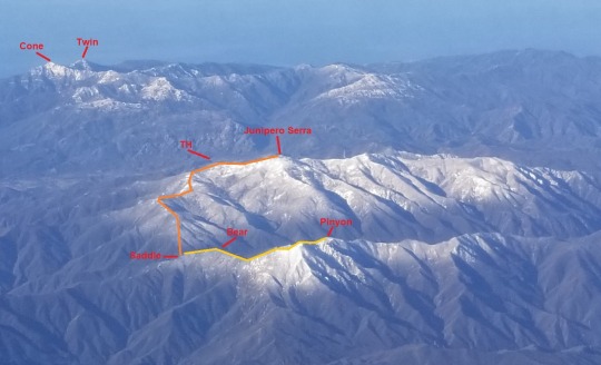
Junipero Serra Peak, Bear Mountain & Pinyon Peak, The Bushwhack from Hell

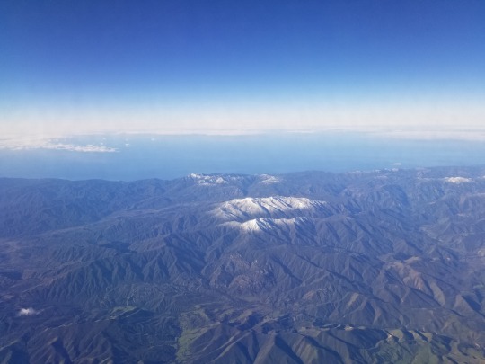
Junipero Serra Peak is the high point of Big Sur, and has been on my to do list for some time. This California county high point finds itself on several prominence and isolation based lists, and is only a moderate challenge for the avid peak bagger. The fact that it also lies on the California Coastal List was the icing on the cake, but I held off because in the nearby vicinity were two other peaks on the CC list; Pinyon Peak and Bear Mountain. In order to reach Bear Mountain, and then Pinyon Peak, one must first climb over Junipero Serra Peak. All other options seem much more difficult. My biggest concern for the combo trip was water, and on one of my flights to San Diego for work, I noticed a good amount of snow on the summits of all three peaks
I sent an email to the coastal gang proposing the trip and received very little enthusiasm. Daryn and Kathy both expressed interest, but they could not go on such short notice, and suggested we go in April instead. I agreed, knowing the snow would be gone by then. The route I had in mind was pioneered by David McMillan, Dave Dostal and Paul Danielson in 2005. Trip reports from Piero Scaruffi in 2005, John Fedak in 2007 and Bob Burd in 2009 were my only reference points.
Clearly stated in Fedak’s trip report was, “Note: This route burned extensively in the 2008 fires. Check the VWA website (or my backcountry page to the left) for more recent conditions.” In hindsight, there also looked to be some major fire damage prior to 2005 when viewing Piero’s photos. With the last documented trip report from a decade prior, I didn’t have much to go off of for recent conditions. All I knew was that it hadn’t burned since, but I felt that if all these groups could get up the peak in one day, I would for sure be able to do it as an overnight when camping on the summit of Junipero Serra Peak. Up to this point I had never camped on a summit before, so we were in the makings of an exciting trip.
As the trip grew nearer, I realized that the late April weekend that we scheduled for the Pinyon Peak trip was the same weekend as the Henry Coe Back Country Weekend, which I had already paid for in advance. Dope! Not to worry, I thought to myself. I could visit both Henry Coe and Big Sur in the same weekend. Burra Burra Peak lies on the Nifty Ninety List and was of some interest to me. The hike to the summit is very easy when accessed from Kaiser Aetna Road, which is open during that weekend. I had just enough time to climb Burra Burra Peak on Saturday morning, drive to the trailhead of Junipero Serra Peak afterwards, then start the hike up the tallest peak in Big Sur with the goal of making it to camp before sunset. What an ambitious yet fool proof plan, I thought to myself.
Asaka and I woke up in our own beds on the morning of April 27th, completely unaware of the impending struggle we had ahead of us. We reached the Henry Coe park entrance and showed our printable permit then drove up the dirt road to the trailhead of Burra Burra Peak. We parked alongside the road and were greeted with great views of the Diablo Range from the start.

The trail was faint, but easy to follow. It looked as if someone cleared the way with a weed whacker the week before.

Some of the wildflowers were blooming and it was a wonderful sight.
1.6 miles later we reached the summit. To the north were Mt Stakes and Robison Mountain.

To the west was Wilson Peak.

To the south was Mitt French’s property, the owner of the land containing many of the more interesting peaks in the Diablo Range.

To the east was more private ranch land, as is most of the Diablo Range.
Since we were on a time budget, we quickly made our way back down the trail to the car.

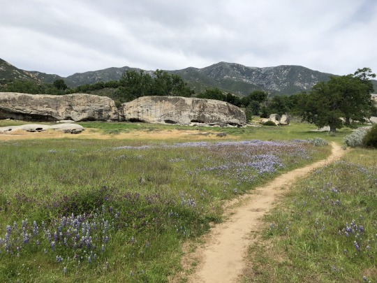
With our first peak in the bag, we drove south to Fort Hunter Liggett. I was concerned about access issues reported by previous parties, but encountered no hindrance as I drove through. We crossed a small river then drove to the Santa Lucia Memorial Park. It was a beautiful drive that time of year. We parked the Jeep, and found Daryn and Kathy getting ready. My apprehensions about the trip surrounded access to water, so I packed 12 liters between Asaka and me, with myself carrying the lion’s share. I felt that it was a bit much, however I’d rather have too much water than not enough. We started up the trail passing by interesting rock formations.
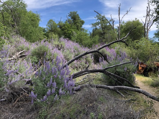
The beautiful wildflowers from Henry Coe had followed us here.

I was nervous about ticks but I only saw one the entire trip. An abandoned tractor was slowly being consumed by vegetation alongside the trail.
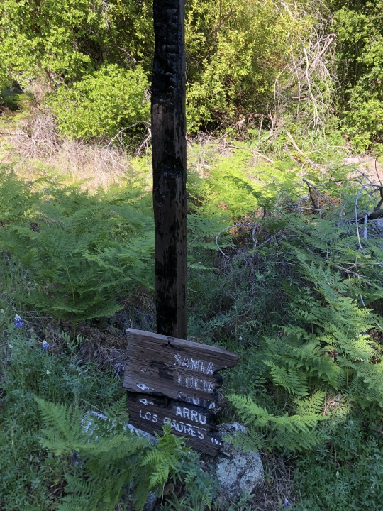
We passed by an old trail sign, partially burned from the fire over a decade ago.

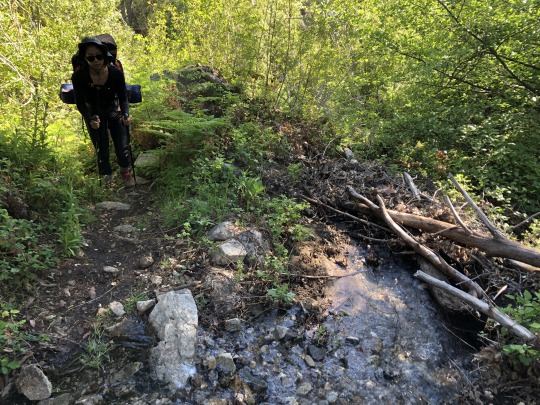
The climb was beautiful, but it was a bit warmer than I would have liked. Asaka’s energy was low, probably due to a combination of our earlier hike, her heavy pack and the heat.

We paralleled a creek as we climbed earnestly up a canyon. Before the canyon became too steep, the trail began switchbacking up towards the ridge.

Sections of the trail were a little over grown, but the trail was good enough by my standards. We took a break atop the ridge where remnants of old trails branched off in different directions. Most of these trails are no longer maintained and seem to lead into no man’s land.

I checked our time and noticed we were behind schedule. I kept taking on more and more of Asaka’s weight, most of which was water. At one point I was carrying over 11 liters all to myself. Asaka and I argued and she eventually disappeared ahead of me. To the west was Cone Peak, which we climbed earlier that year.
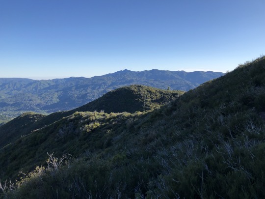
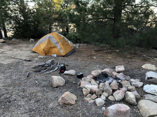
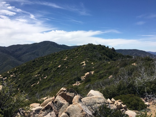
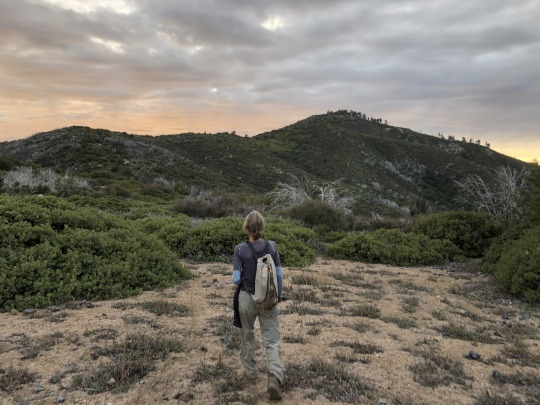
I labored up the ridge as the trail wound around the backside of Junipero Serra Peak. I finally caught up with Asaka, and we met Daryn and Kathy near the start of the brushy section. While the trail was overgrown in places, it was by no means a bushwhack, and we had no trouble finding our way. The chaparral slowly gave way to pine forests, which was a nice break from the overgrown coastal shrub we had been hiking through. We made it to the summit area just before sunset, a couple hours later than I had intended. The true summit of Junipero Serra Peak would be left for the following day, and I focused on setting up the tent while Asaka prepared dinner. I climbed the dilapidated summit tower which felt more like an abandoned scaffolding where I watched the sunset. The Pacific Ocean gave me a sense of calmness as the sun dipped below the horizon.

I carefully climbed down and made a fire where we all enjoyed dinner.
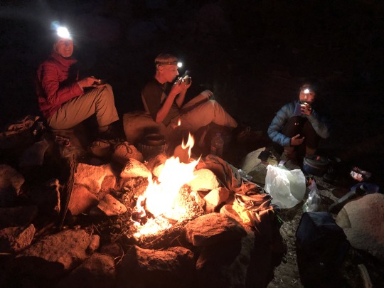
Cooking dinner required a good amount of water, but we still had about 7 liters remaining. The ground was soft and sandy so I walked around barefoot all evening. With a good part of the elevation gain in the rear view mirror, we felt a 7am departure would give us plenty of time.
The next morning we had breakfast and began the second leg of our journey. I packed 3.5 liters of water, which was more than I usually bring.
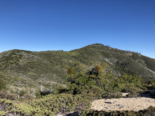
We first visited the summit of Junipero Serra Peak just a short distance from camp. We signed the summit register and examined the ridge we would follow towards Bear Mountain and Pinyon Peak. Asaka decided to leave her jacket here as the weather was already starting to get warm.

Getting to the old firebreak along this ridge had us bushwhacking from the start. This was my first hike wearing long pants, and I’m thankful that I had these on me.

After some struggling, the bushwhacking gave way to some patches in the brush and eventually we hit the remnants of an old road.


The road would dead end at times and we would have to find a break in the brush. Along this section of the ridge, there was always a way through. Some prior good Samaritans had clipped a path through some of the thicker sections. The ridge had its fair share of ups and downs, but I could live with these so long as there was a path through the vegetation. I noticed bear scat and many mountain lion tracks along the way. Kathy dragged her trekking pole during this section, and it took me a while to realize that she wasn’t doing this out of laziness. Later on, we would be able to follow that line in the sand to minimize our route finding efforts on the return.
We spotted a horned lizard which blended in very well with the dirt.
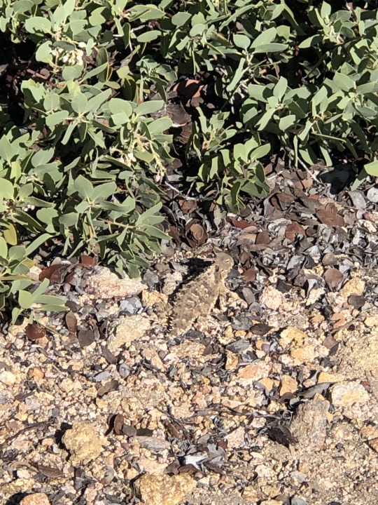
Up to spot point 5039 shown on the topo, the ridge was generally clear. Sure, there were some obstacles, but all of which had a weakness. We took a slight left here and continued for another quarter mile until the open sections began to dwindle. I feared the upcoming section, a 1,200 ft drop to a saddle, but past bushwhacking experiences while chasing the California coastal peaks had hardened me to a certain extent, and I was ready for the challenge. The next two hours were a miserable, horrendous stretch of thick vegetation. At times I felt like I was suffocating. The tree limbs and shrubs would fight back, hitting me in the face and other exposed areas. I crawled, squatted under, climbed over and rammed through the nasty chaparral. I did anything I could to keep moving forward. I snaked through this section looking for an easier path, but found more of the same. It was a free for all and most of the time we couldn’t see each other, but we tried to stay within vocal range. We crossed over the old road at times, but the vegetation had grown back thicker on the flat roadbed, making the road useless. I wondered if the three rocks I spotted were a cairn, but they were most likely completely natural.

It’s hard to find words to describe the agony, but we had come so far that we weren’t ready to turn around just yet. My shoe laces kept coming untied, forcing me to stop and retie them frequently. We kept telling ourselves that things would get easier. We saw pictures from the previous trip reports, and we expected to soon encounter an open road climbing towards Bear Mountain. We reached the saddle where we had a long rest. I was starting to worry about my water situation, but hopes of easier passage kept me encouraged. There was an old illegible sign here; a reminder that we were not the only humans to traverse this hellish place. After our rest, we all bushwhacked up to the road, which we found severely overgrown.

Oh how we fought to stay on that road. We eventually realized that the road would do us little good, and it was best to follow the sandy openings alongside the road. I was stopped in my tracks by a huge rattlesnake. It lay there in silence until Daryn showed up behind me, which got it all riled up. Getting bit out here would be a death sentence. It rattled its tail as we walked very close to it, trying to stay within the openings in the chaparral. I prayed to not run into it again on the way down.

I put my phone away. Things were now getting serious. We pushed through the thick brush until we reached the top of the ridgeline, which was no easy matter. From here the travel didn’t become easier. We continued to push through until we reached the summit of Bear Mountain. I was extremely tired, as was the rest of the group. Kathy and Asaka agreed to go no further. They would wait for us back at the saddle. I had the route downloaded, so I exchanged phones with Asaka. I carefully explained where to go, while I kept her phone for photo and communication purposes. While the peak was still over a mile away, I optimistically read the topo map and convinced myself it was only a half mile further. I also convinced myself that the hardest bushwhacking was behind us, but Daryn reminded me that Burd suggested the hardest part was yet to come. How could such a blasphemous statement be valid? We followed the firebreak until we were engulfed. We tried to stay towards the top of the ridge, and we got to the point of fighting for mere inches. I started to worry about my safety. There was a high chance that I would run out of water, but would my body allow me to push through and make it back to camp without collapsing? We tried to push through one section but it was so thick that we had to back off. We tried another section and it somehow worked. What remained were some open switchbacks that added distance to our route, but I was too tired to climb directly up the southeastern slopes of the peak. We would for sure make the summit at this rate, but it was nearing 2pm, and hopes of returning in day light began to shrink. We reached the location of the old fire lookout where we found a register, but it was clear that the point further west was higher.
We took a rest here and read through the entries. The only person to sign the register since Burd admitted to taking a helicopter to the summit. I surmise that he was an employee of Cal Fire because I did not recognize his name as a peak bagger, and I cannot think of another reason for someone to visit this forgotten place. While it was a short walk, I struggled to reach the true summit in my exhausted state, but at least the final traverse wasn’t brushy. To the southwest was Junipero Serra Peak.
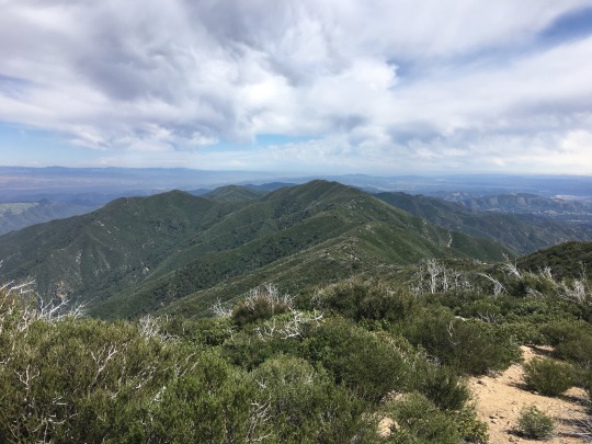
To the northwest was the drainage of Santa Lucia Creek.

To the north were the Salinas Valley and the rugged Los Padres National Forest.

To the east were the false summit and the southern Diablo Range.

To the south were the peaks surrounding San Luis Obispo.

It was now after 2pm and after rationing, my water was almost gone. I had yet to eat lunch, but doing so would make me more dehydrated, so I decided to hold off. I was in survival mode and didn’t feel hungry. I texted my own number to tell Asaka that we reached the summit. As we began our descent back down to Bear Mountain, I wondered if we could find water in Santa Lucia Creek below the main saddle. I looked for a sparkle but saw nothing through the dense vegetation. I listened closely and while I thought I could hear running water in the canyon below, I couldn’t rule out wind. Satellite imagery showed a break in the brush heading down towards drainage from the saddle, but such a path may have just been a digital hallucination, and there was no guaranteeing that water would be accessible.

We feared the impending bushwhack as we dropped to the saddle between Pinyon Peak and Bear Mountain. Rather than repeat our ascent route, I stayed more on the western side of the ridge. At first this went much better, but the brush began to envelop us once more. Every time I thought we hit a dead end, I found a slight weakness, and we luckily got back to the firebreak with much less expended effort than before.

We got back to Bear Mountain. Kathy and Asaka had already left. I snapped one photo of the declining ridgeline where an old, forgotten firebreak lies.
Rather than follow the same overgrown road, we took a more direct route straight down to the saddle, aiming for the patches in the brush. Asaka and Kathy became visible a few hundred feet beneath us. I was glad that they wouldn’t have to wait for us very long. Thankfully, we didn’t stumble upon the rattlesnake again. We reached the saddle, discussed whether it was worth searching for water, but decided against it in the end. Now the most toilsome effort of my life was about to begin. If there is a secret to bypassing the next mile with minimal effort, then we failed to crack the code. The guys were having a rougher go at this section than the ladies, probably because they were able to conserve energy while waiting on Bear Mountain. Since I was feeling weak, I let Daryn lead the way for the first half of the climb, but he started to lose his cool the longer we struggled up the hill. It was hard to stay positive knowing we had over 2,000 ft of climbing left to go before camp, with most of that through some of the densest brush in the state. The retying of my shoes was starting to drive me mad. All the while it felt like I was swimming rather than hiking. As we neared the half way point of the tough section, Daryn started to have a freak out. I’ve hiked many difficult peaks with Daryn in the past, and have never seen him act so out of character. Sensing the severity of the situation, I felt it was my turn to step up and lead the bushwhack. I somehow began to find humor in our situation, which allowed me to speak encouragingly and with positivity. We were going to make it out of this mess one way or the other. In my depleted state, I entered a mindset of being one with the plants. I spoke to the brush and it spoke back. I was able to methodically pick an easier path, drifting further and further to climber’s left. It wasn’t long before we began to recognize patches in the brush and even our old footprints. The patches became bigger and bigger until finally we broke out of the worst of it. We took a long rest near spot point 5039 on the topo where Asaka gave me 0.5 to 0.75 liters of her own water. I remained parched afterwards, but that generous donation changed my outlook, and I knew that we would be able to make it out. Daryn’s mood had also returned to his calm and cool natural state. Kathy stayed in good spirits throughout the ordeal. Asaka surprisingly didn’t berate me too much throughout the day. Maybe she could sense my weakened state.

We looked back at Pinyon Peak and Bear Mountain and wondered when they would be climbed again. It would take another burn to make the peak reasonable by even the most hardened peak bagger. From here we followed Kathy’s line in the sand as we made our way back to Junipero Serra Peak.
It was clear that we would not make it back to camp in day light, let alone the car. I asked Daryn if this was the hardest hike he had ever done, to which he said yes. This was quite the comment from someone who’s climbed well over two thousand peaks. With the temperature dropping, I became more at ease, and fear of dehydration diminished. I looked forward to the water I had at camp, and we discussed the pros and cons of staying the night versus hiking down. My brand new pants were already heavily damaged and my shoes were toast. The sun set while we were a mile away from the peak and it got dark when we were still a half mile away from the summit. Lights from the Salinas Valley produced a calming effect as we picked our way through the manzanita. I challenged myself by using my night vision, keeping my headlamp stashed away for the time being. I finally used my light as we thrashed through the final bushwhack. We had to go back to the true summit to get Asaka’s jacket which was an inconvenience, but didn’t add too much extra effort. We reached camp at 9pm, making for a 14 hour outing up to that point. The water that we had left at camp was much less than I remembered, but it would keep me and Asaka going. I laid in the tent and ate my lunch; a peanut butter and jelly sandwich. Asaka had a lime, and how amazing it tasted. I sucked on that lime until every drop was absorbed by my arid tongue. While I was exhausted and requested to sleep on the summit, the others overruled me and we agreed to hike out. I told the others I would join them, but would need to lay down for 20 minutes. Asaka and I finished our water quickly. I remained parched, but motivated by the running creek at the bottom of the switchbacks. I didn’t get the full 20 minutes of rest I requested, however I got enough. As I began to stow away my tent, I noticed scorpions crawling everywhere, and to think that I was walking around camp barefoot the previous night!

I was glad that the others convinced me to hike out that night as I quickly found my third wind. The trail was tough to follow at first in the dark, but we found our way. As we marched down the trial, lightning to the south began to fill the sky. The storm was over the San Luis Obispo area and provided a light show. I spotted the campfires down at the Memorial Park Campground and wished I could be enjoying the evening with those campers rather than suffer above on the mountain. Once we reached the creek, I dropped my pack and filled up our bottles. I didn’t bother to filter. The water was pure. We spent about ten minutes sitting in the dark replenishing ourselves. All that remained was a gradual trail back to the cars. There was spooky eye shine throughout the canyon, but at that point I couldn’t care less if one were from a mountain lion. We surprised a couple of hikers who were going for the peak at midnight. I felt they were quite odd, but maybe it was a smart way to avoid the heat. Like most epics, the hike dragged on, but we kept passing recognizable landmarks from the day before and we finally reached the meadow near the trail head. We reached the cars at 1:30am, needless to say much later than we anticipated. The peak was in the bag, and no one could take that way from us! We bid farewell to Daryn and Kathy and drove the lonely road out to Fort Hunter Liggett. I considered getting a motel in King City, but in the end we just drove home, stopping at Jack in the Box for a late night feast.
On returning home I reread the trip reports from Burd and Fedak. I laughed out loud at my computer when I saw the conditions of the road they had on their outings. Things have changed quite a bit since then. In retrospect, I should have taken more pictures, however the harder the hike, the less photos I tend to take. I don’t know who will be next to climb this peak, however my prediction is either Clément Guillaume or Eric Su. If it burns, then all bets are off because then many will be able to do this.
Below are the notes from my condensed trip report the day after the trip:
Water-
This is maybe the most challenging issue. The last water source is 2.8 miles into the hike. After that it is completely dry. There is a chance of a spring on the west side of the saddle, but the brush makes it very difficult to reach. I thought I heard water on a few occasions, but I couldn't completely rule out wind. Daryn and I both ran out of water, and the last few miles back to camp with a dry mouth was unpleasant. The weekend was also warmer than I expected. I brought 3.5 liters and ran out slightly past the saddle on the return. Thankfully, Asaka saved me and offered me 0.5 to 0.75L of water later on (I remained parched), then had another 1.5 liters waiting for me at camp (remained parched again). I didn't feel fulfilled until we reached the stream several miles later. If camping on top, you also need enough water for cooking dinner. This peak might be best done after snowfall so you can melt water on the summit.
Brush-
After reviewing the photos from Bob's trip report, I was shocked to see how much the brush has grown back. Bob climbed Pinyon a year after a fire a decade ago. Now many of the previous open sections are grown over. It was the worst bushwhacking I've had to endure. I have endless cuts and bruises across my arms and legs. No poison oak though!
Distance-
Burd underestimates the distance. Firstly, its 6.5 miles from the trailhead to the summit of JS. Secondly, it is much more than 4 miles from JS to Pinyon Peak. While I didn't record a GPS track, my estimate is 6-6.5 miles. Therefore, Total distance is 25-26 miles, rather than the 20 miles as advertised by Burd.
Time-
We started from the summit of Junipero Serra at 7am and returned to camp at 9pm. We reached the cars at 1:30am.
Animals-
This isn't really an issue, but we saw a rattle snake on the way. We found several scorpions around camp as we packed out. There were many mountain lion tracks along the ridge from JS to Bear. There was bear scat in places. I saw only one tick.
There was one other person who made the summit recently, but he took a helicopter. I recommend waiting for another burn to attempt this peak unless your a masochist.
0 notes
Video
Rusted & Rustic: Julian & Santa Ysabel Frontier Roots - Supreme San Diego Backcountry - Wild Mountain Autumn Adventure
Join me for a rusted and rustic adventure in the San Diego Backcountry Mountain Towns of Julian and Santa Ysabel. Two more charming historic frontier towns filled with delights for the senses would be hard to find, so let’s get into it!
https://www.youtube.com/watch?v=nxoSZmpcUcM
Read more:
https://desertmountainapothecary.com/blogs/blog/rusted-rustic-julian-santa-ysabel-frontier-roots-supreme-san-diego-backcountry-wild-mountain-autumn-adventure
#Calico Cidery#Julian#julian ca#Sant Ysabel#Santa Ysabel CA#Santa Ysabel California#julian california#San Diego#san diego backcountry#San Diego Backcountry Mountains#Frontier Town#Historic Town#Historic Frontier Town#Travel#Southern California#California#YouTube#Video#Desert Roots#Desert Wild#Desert Supreme#Desert Apothecary#Desert Mountain Botanicals#Siphon#Draw#Grateful Desert
0 notes
Photo


image above: Walter Biggs
May 5 through June 9, 2019
Opening reception: Sunday, May 5th, 6-8 pm
Gallery Hours: Monday through Friday, 12-6, Saturday and Sunday please call 717.490.2091for appointment.
During Atlas Studios work hours please call 845.391.8855 for admittance
A Momenta Art exhibition presented at:
11 Spring St, Newburgh, NY, 12550
Richard Barnes
Walter Biggs
Jonathon Cancro
Rebecca Forgac
Cat Glennon
Oliver Lee Terry
A group exhibition regarding the natural temperament of the Earth today through photography, painting, video, and assemblage.
Richard Barnes’ series of large-scale photographs in the Refuge series depict five bird nests, each representing a different species. Seen as isolated and singular subjects, enlarged and artificially lit in a studio setting, the nests take on the presence of sculpture. The constructions vary widely, as though built by individual architects favoring particular styles and materials. The project’s title relates to the tension between the elaborate structures that humans refer to as avian “architecture,” different from a natural place of “refuge” as built by birds.
Walter Biggs’ paintings composed of graphite, sand, oil and acrylic mediums allude visually, physically, and experientially to nature, landscape and environment. A deeper perception may intuit a connection to loss, death, and a wasting – of what may once have lived but is now frozen in time as an inanimate surface, an exquisite ghostly relic of the past – a fossil.
Jonathon Cancro's Green Space works are a series of videos that are each composed of several static shots looking through, into, and out at the hyper-lush landscapes of the island of Kauai. Through manipulation of video footage, the artist transforms and augments the experience of the subject or event. As one scene dissolves into the next, the viewer is pulled through the intimate and the expansive. Hallucinatory fields of color get pressed into fine-grain dream textures.
Rebecca Forgac’s large graphite drawings are part of an ongoing series depicting rock formations. These particular works use a basalt cave in the north of Iceland and a geothermal travertine formation in Mexico as their starting points, chosen for their particular strangeness and sublimity. Stemming from a consideration of a fragile and complex relationship to the natural landscape, the drawings engage human and geologic timescales with humor and humility.
Cat Glennon’s ongoing series titled Manifest West, commemorates the women who were a part of the Western Expansion of the United States. This work included in this exhibition titled Shrine to the lady Argonauts is dedicated to the women who worked in the gold fields of California. In order to connect to the stories of women that were unrecorded and remain unknown, the artist employs architectural and design elements connected to the Wild West to portray mountainous landscapes as a way of focusing on the unchanging landscape that connects them and us.
Oliver Lee Terry’s assemblages include cat litter, ferns, grass, hibiscus, and herbs in combination with makeshift organic structures and photographs. The works humorously question masculine drives to compete, embracing sincerity and “naivete” in imagining lifestyles of abundance and conservation in contrast to growth-based economies.
Richard Barnes has exhibited in solo exhibitions at the Museum of Photographic Arts in San Diego, the Carnegie Museum of Art in Pittsburgh, the Carpenter Center at Harvard University, Cranbrook Academy of Art Museum, and the University of Michigan Art Museum. His works can be found in numerous public and private collections, including the Museum of Modern Art, Metropolitan Museum of Art, the Whitney Museum of American Art, the Boston Museum of Fine Arts, The Cleveland Museum of Art, the Philadelphia Museum of Art, the San Francisco Museum of Modern Art, and the Hirshhorn Museum and Sculpture Garden. Barnes was a recipient of the Rome Prize 2005-2006, and was a Smithsonian Artist Research Fellow (SARF) in 2012. His work was featured in the 2006 Whitney Biennial and awarded the Alfred Eisenstadt Award for Photography. He was the 2009 recipient of the Sidman Fellow for the Arts from the Institute for the Humanities at the University of Michigan. In 2010 he completed a residency from Lightwork/Syracuse University. A monograph of his work entitled Animal Logic, was published 2009.
Walter Biggs received an MFA from School of Visual Arts, New York, in 1990. He currently lives and works in Harlem and the Catskills, NY. His work has been exhibited at Momenta Art, Philadelphia, PA, Trans-Hudson Gallery, NJ and NY, and Sperone Westwater Gallery, NY, Galleria Cardi, Milan, Museo D’Arte della Citta de Ravenna, Ravenna, among others.
Jonathon Cancro is a video artist who lives and works in New Jersey and New York. Cancro received his B.F.A. from the University of Washington and his M.F.A. from the University of Pennsylvania. He has completed residencies at the Vermont Studio Center and Ucross Foundation. Recent group exhibitions include The Flat Files,Tiger Strikes Astroid, New York; Andrew Prayzner’s Half-Life, Brooklyn; Matthew Murphy’s One Night Only, Marblehead, MA; Knox College, Illinois; MBN StudiosPhiladelphia; and Tower Gallery, Philadelphia.
Rebecca Forgac was born in 1987 in Winchester, Massachusetts. She currently lives and works in Brooklyn, spending a portion of the year in the backcountry, primarily of the American Southwest, Iceland or Japan.
Cat Glennon is an inter-disciplinary artist, working mainly in photography and large scale sculpture living in Brooklyn, NY where she has lived since graduating with a BA from Pratt. Her work has been collected by the Museum of Old and New Art, The University of Santa Cruz and the University of Minnesota.
Oliver Lee Terry received an MFA from Goldsmiths University of London and a BFA from Metropolitan State University of Denver. His work has been exhibited in solo and group shows internationally, and he has been an artist in residence at the Wassiac Project. He currently lives, works, and gardens in Newburgh, NY.
Special thank you to Atlas Industries for their generosity in providing a location for Earthy
Momenta Art' is a 501(c)3 not for profit organization.
0 notes
Text
Afoot and Afield: San Diego County - Jerry Schad & Scott Turner
Afoot and Afield: San Diego County
282 Spectacular Outings Along the Coast, Foothills, Mountains, and Desert
Jerry Schad & Scott Turner
Genre: United States
Price: $24.99
Publish Date: February 20, 2017
Publisher: Wilderness Press
Seller: Perseus Books, LLC
Since 1986, Jerry Schad's Afoot and Afield: San Diego County has been the premier trail guide for hikers, backpackers, and mountain bikers. It describes routes ranging from brief, family-friendly hikes to multiple-day overnight trips in remote regions of the backcountry, providing equal weight to the scenic and recreational value of each trip. Each route features at least one or more significant botanical, cultural, or geological highlight with detailed information about what makes each one significant. The book's lengthy history as the preferred hiking guide for the region creates trust and recognition in its readers, while the variety within the book caters to a wide population of recreational enthusiasts. Current co-author Scott Turner has fully updated the book by re-hiking each of the routes contained within the book and adding (up to) 30 new routes to ensure that information for each trip is fully current. http://bit.ly/2EM3t0V
0 notes
Text
Rolando, San Diego
This is from a three-part series that ran in Rolando's community newsletter last year. I'd interviewed people who grew up in the area between the late '50s and early '80s, but the self-indulgent second part was the one best received and now featured permanently on the RCC website. Kevin B. Staff, February 15, 2019
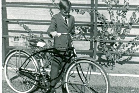
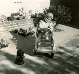
Growing Up in Rolando, 1960s - early 1970s
On a hot summer day in 1960, a young musical group piled into a car for a drive to North County. They called themselves Rosie and the Originals. Their destination was an airplane hangar in San Marcos that doubled as a recording studio. Their saxophonist was missing because he had committed to mowing a lawn, and his mom wouldn’t let him out of it. Another group member knew the rudiments of blowing a simple instrumental break, and the unpolished nature of the recording that resulted is probably part of what makes it so hauntingly appealing, as if emanating from no particular place or time.
By fall, Rosie’s “Angel Baby” had become popular locally. By Christmas, it was an international hit.
In mid-September 1960, as the song was first getting airplay, our next-door neighbor on College Avenue walked me to Henry Clay School for my first day of afternoon kindergarten. My mom had broken a toe while chasing my little brother and me around the coffee table in our living room. The plan was to show me a definite route to follow—from College to Acorn Street to Seminole Drive to Solita—and, after a week of escort, to let me walk it on my own. There were no sidewalks along College Avenue in those days, but I was able to make the walk.
During that first week, a kid kept crying in class, and on one occasion tried to escape. Old Ms. Leber seemed to leap across the room in a single bound as she grabbed him by the collar and dragged him back. Resistance was futile. My best childhood friend, a year younger than I, spent several days with me trying to build an airplane out of bamboo strips and pinwheels that we thought we could use to fly away in, so that I wouldn’t have to go to school.
I came to like kindergarten after a while. I began to walk with a girl who lived in the back unit of a duplex near the corner of College and Acorn. I tried to impress her by breaking glass bottles on the wall of the Campus Drive-In until an old lady came out and made me sweep it up and that was the end of that. One day, I came to the girl’s door just as her father was rushing off to work. The screen door hit me and knocked me into a cactus garden by the side of the house. He actually seemed relieved to be able to call in late. While her mom telephoned my mom to explain what had happened, he took me into the bathroom, had me pull down my pants, removed a number of cactus needles from my bum and rubbed the area with Bactine. It was quite embarrassing.
The rest of my elementary school flew by, in retrospect, although a year seems to take forever when you’re a kid. Kennedy was inaugurated in January 1961, To me, he was President for a long time. It was hard to think of him as young, since all adults seemed old and he was even older than my dad! He was assassinated while I was in third grade. We heard about it just before recess and did talk about it on the playground, but it wasn’t as if the world had stopped. We played ball and ate our lunches; I even bought a bag of Planter’s peanuts for a nickel that day.
We moved to our new house on Seminole Drive on Veterans’ Day 1965. Although it was less than a mile away, I didn’t see as much of old friends and started hanging out with a different set of kids. The area west of Henry Clay had been developing steadily since the early ‘60s. The apartments on the south side of Acorn Street went up around 1963; we used to climb around on the building materials until the workers chased us off. An old-style ranch house with a big front porch was torn down, and four houses, including the one we moved into, went up on the west side of Seminole. The shopping center where the BLVD63 apartments now stand started out as a large dirt lot with just a De Falco’s Food Giant on the east end.
As the rest of the shopping center developed, Thrifty Drug Store and College Theater opened, with a few small retail businesses between them. There was a vacancy between Thrifty and Von’s for several years, until Straw Hat Pizza Palace opened. It showed old Laurel and Hardy films and such, and instantly became a favorite hangout for older kids. The back of Thrifty had a tall flat wall and a good-sized parking lot that quickly became a place for playing handball and racquetball. We got to know most of Thrifty’s employees, who let us go up to the roof to retrieve our ball if we somehow hit it up there. We bought candy bars that over the years went from five cents to ten cents to fifteen cents while becoming smaller and smaller, and could get a scoop of ice cream on a cone for a nickel, with two scoops for a dime.
Sixth grade at Henry Clay ended in June 1967, just before the weekend of the much-remembered Monterey Pop Festival and several weeks after the release of the Beatles’ much- overrated Sergeant Pepper album. In the fall, I moved on to Horace Mann. Because I went to Sunday school in the College Area and had joined the church-sponsored Scout troop, I already had a collection of acquaintances from other elementary schools that I now saw every day. It was quite a change, having to go to different classrooms and listen to bells ringing every hour. Miniskirts were much in fashion, and we guys were beginning to notice.
For those who went through adolescence in the late ‘60s, the era has always been something of an enigma. That time in a kid’s life is chaotic and confusing enough, but we also had to deal with living in one of the most tumultuous eras in modern history. There was a lot of anti-establishment posturing by kids my age—mainly aping older siblings, I suspect. At heart, I think, teenagers are the most reactionary of conformists. If you were going to rebel against society, there was a very definite way to dress and behave. But political posturing aside, kids will be kids. We enjoyed going through what we called the A&W and Uni-mart storm drains, identified by the businesses nearest the tunnel entrances. We had raucous impromptu after-school football, basketball, and soccer games. We took off on long bike rides without bothering to tell our parents where we were going or when we’d be back. We threw water balloons at each other in hot weather.
In fall 1970 I started high school in 10th grade at Crawford. It seemed a much more easygoing place than Horace Mann, with basically no dress code and fewer ringing bells and public announcements. I didn’t take part in many extracurricular activities, having embraced the current drop-out-of-society ethos. That fall I took drivers training, then offered by public schools. Dad occasionally let me borrow the car, but I really wanted a motorcycle. In July, after working a few months at Campus Chuck Wagon, I was able to buy a little Honda CB160. By the middle of my high school years, several of us had small bikes and would take them on weekend camping trips in the backcountry. Although my Honda wasn’t built for off-roading, we did a bit of that too, often in the area that is now Mission Trails Park. There weren’t a lot of restrictions on where you could ride then. Soon enough, the noise and dust got on people’s nerves and laws changed.
I participated irregularly in wrestling and track, but for the most part was uninterested in school-related activities. I did stay active in the Boy Scout troop throughout high school because of its outdoor program. A half-dozen other boys my age felt the same way and we’d all become friends. It was through the troop’s outdoor program that I got to know most of San Diego County, particularly Anza Borrego State Park. We climbed Mount San Jacinto in the San Bernardino mountains each year, in preparation for an annual week-long trek through the Sierras. I’d climbed Mount Whitney twice by the time I was 16!
Watergate was just getting underway when I graduated from high school and American participation in the Vietnam War had ended earlier that year. For us, the feeling was that the ‘60s were definitely over but nothing particularly cool had come along to take its place. There was a lot of soft rock music, and it was considered fashionable to be a “sensitive male.” On the other hand, it was the era of the Guitar Hero–all about making a lot of noise while playing fast. To me, most of the hard rock seemed much less tuneful than ‘60s music.
I left San Diego that fall of 1973 to become an auto mechanic in Arizona. It seemed like a practical thing to do until I realized I intensely disliked the work. After a year, I joined the army. Although I came back to San Diego for short periods, I didn’t live here permanently again until 1997. The Rolando area was basically recognizable as the place where I grew up, until about ten years ago when the shopping center was demolished to be replaced by BLVD63, the Thrifty became Rite Aid and moved to its present location by the Post Office, and Henry Clay got some upgrades.
When I taught at Palomar College in San Marcos, I had the chance to ask Rosie Hamlin, the lead singer of Rosie and the Originals, if she remembered the location of the hangar where they recorded “Angel Baby,” but it was all too long ago and far away from her current life. In March of last year, Ms. Hamlin died. *The author of this article is Kevin Bradshaw Staff, Class of 1973 and is on the Rolando News Staff.
0 notes
Video
It crosses the Peninsula several times, connecting the Pacific Ocean and the Sea of Cortez. On it ’s way cutting through beautiful backcountry deserts and major mountain ranges. Using already existing roads and tracks, of which more than 95% are unpaved, the Baja Divide leads into the remote wilderness of Mexico’s Peninsula. This often requires the rider, to carry 2-3 days of food and up to 12 liters of water. The condition of the route varies, between graded dirt roads to rocky or sandy jeep tracks and this makes the riding tough and sometimes technical. It ’s essential to pack light and make use of the warm, dry climate between November and March.
Finishing the Great Divide in the USA, Franzi & Jona not only wanted to explore more bike packing routes on their way to South America, but also to ride something even more challenging. Excited to test out their comfort zones and physical boundaries, they started the Baja Divide at the beginning of November, as one of the first ones ever riding the route. It took them more than seven weeks to ride from San Diego to La Paz, the covered daily distances varying between 50 and 80km.
The riding was tough, beautiful and breathtaking in every way. They enjoyed being surrounded by vast desert landscapes and days, passing without coming across towns or many other people. The Baja Divide is mainly about being in the backcountry, but nonetheless specially in the south part of the route, they passed through small Spanish mission towns, with an abundances of history, palm trees and charm, basic fishercamps or bustling highway towns, Which give you the opportunity to refill your resources and enjoy some worldy comforts. The Baja Divide felt raw and bold to them and they can only recommend to take on the challenge and ride it. Be aware, that this Route requires special equipment and some previous bikepacking experience, for more detailed information head over to bajadivide.com
Tales On Tyres:
In 2012 the German couple Franzi and Jona (“Tales on Tyres”) quit their jobs and went for a global hiking tour starting in New Zealand before crossing to India and Nepal. Soon they got tired of walking, organised some bikes and continued on two wheels through Iran and Mongolia. After working in Canada for a year to replenish their funds, they started their current trip zig-zagging from Alaska to Patagonia. After completing “The Great Divide” they realised the bikes they were using couldn’t withstand the conditions they were encountering – and that’s how we came on board. We met up with Franzi and Jona in the Sierra Nevada in September last year and provided them 2 of our Beyond+ bikes. After getting them loaded up Franzi and Jona headed south, to take on the “Baja Divide”. Currently they ride the Andes with Destination Patagonia.
Riders: Franzi & Jona (tales-on-tyres.com/)
#Video#Adventure#sport#mexico#Baja#California#desert#geology#Nature#landscape#Bicycle#Biking#Outdoors#tyre#backpacking#the earth story
22 notes
·
View notes
Text
Death Valley National Park Thanksgiving

Death Valley National Park: the hottest and driest place in North America with consistently the hottest temperatures in US, the highest ever recorded temperature on Earth (134°F), the largest National Park in the contingent US, and the second lowest point in the Western hemisphere at Badwater Basin 282 feet below sea level - this park is surely a "land of extremes"...
Straddling the California and Nevada borders, east of the Sierra Mountain range, Death Valley's unique landscape is attributed to its location in the arid Great Basin and the Mojave Desert with mountain ranges barricading the basin causing it to be the driest place in North America (with only 1.5 inches of rain annually). But when it rains, it pours - making the area prone to flash floods that actually remodel the landscape.
Even with the extreme climate and hellish names like "The Devil's Cornfield" and "Dante's Viewpoint," there are still signs of a "heaven" above: As a designated "dark sky park" the vast blackness provides amazingly angelic stargazing to leave you awe-inspired for nights to come.
We hope you are able to get out and see the vast beauty that Death Valley has to offer, but first let us impart some knowledge for your trip...
Tips:
Where to camp: Stovepipe Wells is a very convenient location with gas, restaurants and stores nearby - but don't count on any privacy tent camping! It's mostly suited for RVs. We camped 45 minutes outside the "town" of Stovepipe Wells at Mesquite Springs. It was beautiful and secluded, and much more suited to tent camping.

Mesquite Springs Campground
Gas: This park is HUGE (the biggest one in the US) and takes up more space than LA and San Diego combined! Which means you will be driving ALOT. Prepare to spend a lot of money on gas, and always know where your next tank is coming from (we almost ran out). Fill up as often as possible in Stovepipe Wells or Furnace Creek.
Food: You will want to pack in all the food you're going to need for the weekend. There are convenience/grocery stores as well as restaurants at Stovepipe Wells and Furnace Creek, but they are really not very robust or tasty. You can get emergency snacks and supplies overpriced at these stores, but for your big meals, we suggest planning ahead with crockpot chilis, hot dogs, and other things that'll keep for a few days in a cooler and cooking at camp.
4 Wheel Drive: This park is really not suited to regular cars and we missed out on a lot of sightseeing because our cars just couldn't make it and it was too far to actually walk. We realized (too late) that they are actually jeep rentals available in Furnace Creek, and we highly suggest getting one if you can. Or if you already have dirt bikes, 4 wheelers, or ATVs, that actually looks like the most fun route to go!
Weather: Early winter is the perfect time to visit this park. With temperatures consistently reaching over 116°F in summer, it is not even possible to go any other time! But don't let the heat fool you - it is COLD at night time in the desert, and can get below freezing in the colder months! Bring plenty of layers for the daytime, and be prepared to bundle up at night.
Pets: National Parks are notoriously infamous for not being very pet-friendly, but since Death Valley is a little more of a drive around park, you can actually get away with having your dog. Plus dogs are allowed on any dirt road or trail a car could go on, just not the backcountry trails. So for light sight seeing and less intense hiking, Rover can definitely join!

Josie chillin' at the campsite
Recommended Sightseeing/Trails:
Mesquite Flats Sand Dunes

Mesquite Flats Sand Dunes where scenes from Stars Wars IV were actually filmed.

Mesquite Flats Sand Dunes at sunset
It is 2 miles to summit the tallest sand dune, or you can just run around the dunes and take the sights in. I loved how out of place the dunes looked from the large mountains and arid brushy landscape, and during sunset the light plays on the reflection of the bare sands. Fun fact: Scenes from Star Wars Episode 4 were actually filmed here!
Telescope Peak Trail
This is the highest peak in the park at over 11,000 feet elevation, but the trailhead can really only be accessed with 4 wheel drive. From the trailhead, the hike is 14 miles roundtrip up to a breathtaking viewpoint juxtaposed by looking down on the lowest point of the park: Badwater Basin.
Because we didn't have a 4 wheel drive vehicle, we weren't able to make it to this trail, but we did drive as far as we could through beautiful mountain scenery to check out the Charcoal Kilns before the trailhead. The kilns converted the surrounding pinyon and juniper trees into charcoal and were used to fuel nearby mines in the late 1800s.

Charcoal Kilns from the 1800s
Racetrack Playa Rocks

Racetrack Rocks (image via LA Times)
This was the number one thing we wanted to see in Death Valley, and once again, it was impossible without 4 wheel drive as you have to make it 30 miles down a super rocky path to get to it. The scenic dry lake has rocks that look like they have magically skidded on their own, leaving behind long drag marks. It is actually caused when ice sheets just a few millimeters thick start to melt during periods of light wind, shoving the rocks at up to five meters per minute, but I like to pretend the rocks are alive and sailing on their own.
Badwater Basin Salt Flats

Badwater Basin - the second lowest point in Western hemisphere!
The second lowest point in the Western hemisphere at 282 feet below sea level, this site is a MUST! The flats (which are actually table salt) were formed when a 30 foot lake dried up over 3,000 years ago. The area occasionally floods leaving behind a thin sheet of still "bad water" that evaporates quickly leaving behind crystallized salt.
Titus Canyon Narrows

Titus Canyon Narrows formed by floods cutting through the land

Below the 500+ foot walls of Titus Canyon Narrows
Because this is a dirt road, dogs were allowed, so we took advantage of that fact as we hiked under the massive rock walls surrounding us. We saw the rental jeeps plowing through this trail, and I have to admit it looked much more fun to be trekking via an ATV rather than on foot. Elusive Bighorn Sheep roam this area as the 500 foot canyon walls offer up great protection and shade.
Artist's Drive

The colorful palette of Artist's Drive

A scenic 9 mile loop drive through breathtakingly beautiful canyons splattered with pinks, greens, purples, and yellows like Michelangelo himself came through and painted it first. These volcanic and sedimentary hills actually get their color from the oxidation of various metals during the area's ancient volcanic eruptions. The drive is very beautiful around sunset as it only intensifies the color palette before your eyes.
Natural Bridge Canyon
1.5 miles across the park's largest natural rock span, this trail is super easy and conveniently right next to Artist's Drive.
Golden Canyon to Badlands Loop
Also near Artist's Drive, Golden Canyon is a very popular easy 2 mile in-and-out hike where you are immersed inside narrow, high, colorful canyon walls. This also connects to the popular 2.7 mile Badlands Loop. More details on the trail here.
Ubehebe Crater

Ubehebe Crater - 500+ feet deep

This 2,000 year old crater was formed as rising hot magma boiled the groundwater into steam and as the steam pressure builds up, the rock explodes leaving behind this massive whole in the ground a half mile across and 500+ feet deep. There is also a trail available to trek down into the crater which was very reminiscent to me of hiking down into the Grand Canyon (on a much smaller scale of course)!
Have you been to Death Valley? We'd love to hear about your favorite sights to see!

0 notes
Text
TEDx Salt Lake City - Time Well Spent
I’ve just returned from TEDx Salt Lake City 2019 and I am super excited about the experience. If you have ever watched any of the hundreds of TED talks online, you know what I’m talking about.
TED conferences bring together a myriad of different subjects and speakers are given 20 minutes to give the audience an incredible amount of info about whatever subject they are an expert on.
Here is the description straight from the TED website:
TED is a nonpartisan nonprofit devoted to spreading ideas, usually in the form of short, powerful talks. TED began in 1984 as a conference where Technology, Entertainment and Design converged, and today covers almost all topics — from science to business to global issues — in more than 110 languages. Meanwhile, independently run TEDx events help share ideas in communities around the world.
I spent the day learning incredible things from incredible people and then afterwards I was lucky enough to get a chance to spend some time talking with some of the speakers and learning even more. Also, this isn’t just about learning, it is an *event*! Held at Kingsbury Hall on the University of Utah campus, the breaks throughout the day allowed attendees to go outside and enjoy food trucks, dancers, scientific exhibits, and more. The only way to really appreciate what these events are all about is to attend one in person.
Attending a TED Conference has been on my bucket list for a few years now. I had originally thought that the meetings were something reserved for special individuals, but it turns out that all you need is a desire to learn and to purchase a ticket. You can either visit the TEDx Salt Lake website or you can go to the main TED website for ALL the details.
Here are people and bios of those who brought me so much education on Saturday:
Cathy Callow-Heusser
Instructional Designer and Educational Researcher
Cathy Callow-Heusser started her career as a software engineer. She coded expert systems and multimedia applications while earning degrees in Instructional Design and Educational Research and Evaluation. She has worn many hats, but her happy place is teaching math. Cathy prefers to teach students who have traditionally struggled in math because she loves watching attitude changes as students become successful. The best decade of her career involved evaluating the Bureau of Indian Education’s (BIE) Reading First program and subsequent initiatives in literacy and math, as well as providing technical assistance to help teachers improve reading and math instruction. During this time, she and her teams traveled to 86 BIE schools throughout the US, which cemented her passion for honoring cultures and languages. Representation MATTERS! Cathy is the proud mom of 2 biological, 2 adopted, and 3 bonus children. She and her husband Val have 10 grandchildren.
Connor Behr
Molecular Biology Student
Connor Behr is currently a student at BYU PathwayConnect in pursuit of a degree in molecular biology, which he has loved and studied since he was 12 years old. He is skilled in the field and has experience shadowing at ARUP Laboratories and a summer internship at the Huntsman Cancer Institute. Connor received the Emperor Science Award in 2017 for his research in cancer development and treatment, and he conducted related gene and protein expression projects with Physarum polycephalum, an organism he has been studying for more than 9 years. He is currently heading a campaign called the PhyR Project for the development of an alternative insulin production technique.
Cynthia Bee
Conservational Landscape Architect
Cynthia works to translate the technical nature of landscaping into public friendly messaging as the Outreach Coordinator for the Jordan Valley Water Conservancy District's Conservation Garden Park. Whether it's teaching landscape classes to homeowners or creating digital and social media marketing content, she's learned how homeowners think about landscaping-and how to influence them. Cynthia earned her Bachelor's Degree in Landscape Architecture from Utah State University and has spent more than 20 years working in different sectors of the green industry.
David Kozlowski
Marriage & Family Therapist
David Kozlowski obtained a Masters degree in Counseling Psychology from National University in San Diego. Since 1999, David has worked as a counselor, behavioral specialist, mental health worker, and therapist in group homes, crisis treatment centers, psychiatric hospitals, drug addiction facilities, and schools for severely emotionally disturbed kids and teens. David has his own private practice, is the Host of the Light The Fight podcast, and is the Executive Director of the Non Profit Quit Trip’n.
Denise Druce
Yoga Instructor
For nearly four decades, Denise Druce has been inspiring people to live healthier, happier lives. She calls herself an Elevator…when you’re around her, you’re going up! Denise has taught a wide variety of fitness classes over the years, from step to indoor cycling to her current and lasting love, yoga. She teaches her students to stand at the “Soft Edge of the Hard Place” in fitness and in life. Her non-profit Yoga Forward is "taking yoga where it isn’t"…prisons, shelters, schools, and shopping malls. She has a Masters Degree in Public Health, is a Yoga Alliance E-RYT500, and is a breast cancer Thriver. She spends most weekends on the road, making the world a better place by getting more people trained to teach yoga everywhere. Denise and her husband, Michael live in Salt Lake City with their three boys.
Dr. Joey Wilson
Engineer and Entrepreneur
Dr. Joey Wilson is an acclaimed engineer and entrepreneur, focused on the field of sensing people using radio waves. Dr. Wilson’s breakthrough doctoral work on detecting and locating movement using wireless networks at the University of Utah has earned worldwide attention. Dr. Wilson is now the founder and CEO of XANDEM, a company focused on high-tech radio frequency sensors for applications like energy efficiency, elder care, healthcare and security. XANDEM was the first to research, design, and ship a product that utilizes everyday wireless networks to accurately detect and locate moving people within buildings. Joey and his team are now helping other businesses turn existing wireless devices into powerful people-sensing systems. In his free time, you can find Joey throwing a disc with his wife and two sons on the grassy fields near their home in Salt Lake City, finger picking his guitar, backcountry skiing through the trees, or trail running in the beautiful mountains of Utah.
Dr. Ruby Chou
Executive Director, Mundi Project
Dr. Ruby Chou is an arts executive, classical pianist, and educator. Ruby advocates for open access to pianos, music education, and innovative performances as the executive director of Mundi Project, a Utah-based nonprofit community music organization. Mundi Project is launching Utah’s first intergenerational music program at Neighborhood House in October. As an educator, she mentors 21st-century musicians as adjunct professor of piano and music entrepreneurship at Weber State University and specializes in teaching youth and adults in various learning environments. Ruby performs locally and nationally with professional, amateur, and young musicians. Ruby also serves on the board of directors for Utah Nonprofits Association. Dr. Chou earned a doctoral degree in Music and Human Learning from The University of Texas at Austin. She graduated from Manhattan School of Music in NYC with a master’s degree in piano performance and a Bachelor of Music degree from The University of Utah.
Dr. Taylor Sparks
Associate Professor of Materials Science and Engineering
Dr. Taylor Sparks is an Associate Professor of Materials Science and Engineering at the University of Utah. He is originally from Utah and an alumni of the department he now teaches in. He did his MS in Materials at UCSB and his PhD in Applied Physics at Harvard University and then did a postdoc in the Materials Research Laboratory at UCSB. He is currently the Director of the Materials Characterization Lab at the University of Utah and teaches classes on ceramics, materials science, characterization, and technology commercialization. His current research centers on the discovery, synthesis, characterization, and properties of new materials for energy applications. He is a pioneer in the emerging field of materials informatics whereby big data, data mining, and machine learning are leveraged to solve challenges in materials science. When he’s not in the lab you can find him running his podcast “Materialism” or canyoneering with his 3 kids in southern Utah.
Em Capito
LCSW
Em Capito is an unconventional psychotherapist obsessed with the widespread loss of resilience in the face of overwhelming comfort. While studying her own trauma from the inside out, Em embarked on a series of experiments that led to a prescription for intentional discomfort. Em blends these experiential interventions with meditation and yoga therapy to build the holistic mind-body resilience that carries us through our darkest moments. She completed a master’s degree in social work at the University of Utah in 2007 and a master’s degree in business administration at the University of Phoenix in 2011. Em is a Licensed Clinical Social Worker, a certified LifePower yoga teacher, and a Dharana Method meditation teacher with a private practice in Salt Lake City, Utah.
Foreign Figures
Musicians
Foreign Figures’ alternative take on pop music stems from the four very different humans that create it together: EJ, Steve, Seth and Jonny T. Formed in late 2014, the Utah band has achieved millions of streams online, received licensing deals from Fox, MTV and Fox Sports, and taken their charismatic live show to over half of the United States. The band’s sound and synergy comes from their desire to create something unique together that they couldn’t or wouldn’t create on their own. They view their creative differences and skills as something to celebrate, and collaboration as something special. The band name is a synonym for authenticity and imagination, which comes through lyrically in many of their songs, breaking down the culture of choosing sides. Everyone is a foreign figure to someone else in the world—if you’re unlike anyone else, then you’re a foreign figure.
Gerald Elias
Musician, Author, Conductor, Composer
Gerald Elias leads a dual life as an internationally acclaimed musician and award-winning author. A former violinist with the Boston Symphony and associate concertmaster of the Utah Symphony, Elias, performer, conductor, composer, and teacher has concertized on five continents. He has been music director of the Vivaldi by Candlelight chamber series in Salt Lake City since 2004. His Daniel Jacobus mystery series takes place in the dark corners of the music world where greed, ambition and lust lurk backstage. His debut novel, Devil’s Trill, was a Barnes & Noble Discover Great New Writers selection. Two others have been recorded as unique audio books in which Elias performs musical clues. Elias has also authored a children’s story, Maestro, the Potbellied Pig. His 2018 essay, “War & Peace. And Music,” won 1st prize from the Utah Division of Arts & Museums. Elias resides in Salt Lake City and West Stockbridge, Massachusetts.
Jaxon Willard
Dancer, Choreographer
Jaxon Willard dances at Center Stage Performing Arts Studio. He currently trains in numerous styles of dance, including Jazz, Contemporary, Hip-Hop, Ballet, Musical Theater and Ballroom. Jaxon has been dancing since before he could walk. He was a quick study and loved music and to move. He started choreographing early on as well. He made the Brigham Young University Youth Ballroom team when he was 12, but after much thought and heartache, he began his formal training for all styles of dance and dance company involvement. At his very first Nationals competition, the Dance Awards Vegas 2016, he placed in the Top 10 for the Best Dancer. The following year at the Dance Awards Nationals Vegas 2017, he was honored to be named the First-Runner Up for The Best Dancer, with a self-choreographed piece. Jaxon feels blessed to have the opportunity to have found something that brings him such happiness and allows him to express himself in a profound and positive way.
Jessica Baynes
Founder, Healing in Motion Dance
Jessica Baynes attended the University of Utah, where she received her BFA in Modern Dance. Jessica sustained a Traumatic Brain Injury during her freshman year and underwent almost two years of intensive rehabilitation to regain quality of motor function. During that time, she experienced social isolation, stigmatization, and loss of identity as a result of her injury. Since recovering, Jessica founded Healing in Motion Dance, an arts and medicine initiative that teaches rehabilitative ballet classes to participants with neurological conditions that impair neuromuscular function such as Multiple Sclerosis, Parkinson's Disease, and stroke. Her goals with the program are to physically strengthen and emotionally empower others with motor function inhibiting diagnoses, through ballet. Healing in Motion Dance serves as a platform on which collegiate dance and physical therapy students collaborate by designing adaptive ballet classes for patients in their local healthcare system.
Josh Taylor
Creative Change Agent
Josh Taylor is a filmmaker, designer, writer, art director, and creative strategist, but at his core, he is a Creative Change Agent and Business Storyteller. He helps companies in the midst of pivotal change/transformation moments, discover, craft and share their own stories through creative content, experiences, and workshops, in order to help their employees and customers build stronger emotional engagement and human connection to the business and its journey.
Karen Burns
Assistant Director, Intermountain Therapy Animals
After working in the corporate world for many years, Karen Burns found her true passion in a non-profit organization, Intermountain Therapy Animals (ITA). Karen is the Assistant Director of ITA and manages Reading Education Assistance Dogs (R.E.A.D.) Programs in 30 (and growing) schools and libraries in the state of Utah. She has partnered with three different therapy animals over the past two decades, and is also a licensed ITA Workshop Instructor and R.E.A.D. Instructor. Karen enjoys traveling around the country and internationally training others to use our literacy support program, R.E.A.D., in their communities. Karen remains passionate about sharing the gifts our four-footed friends can offer people during difficult times in their lives. They offer hope, healing, fun and a sense of normalcy in settings where that is rarely otherwise possible.
Kotryna Liepinyte
Student
Kotryna Liepinyte is a former undergraduate student from the University of Utah with a BA in English Literature and Communications. She was born in Kaunas, Lithuania and is passionate about honoring her foreign culture and engaging in conversation about immigration stereotypes. Kotryna's mission is to provide an open dialogue about the representation of immigrants in local and global news. Kotryna intends to pursue her education and passion by attending law school. She also enjoys traveling around the world and experiencing a variety of cultures.
LeBaron Family
Singing Family
The LeBaron family was brought to the limelight when a casual recording of their family karaoke night went viral. Dennise LeBaron had requested that her children make her a video of them singing “One Day More.” The LeBaron children and their spouses all love to sing, so they happily complied. The video was posted to Facebook, and by the end of the week, it had over 8 million views! When the children were very young, they showed themselves to be extremely musical and eager to perform. Mom and Dad, musicians themselves, were pleased to instruct them in the hope that sharing music would create strong bonds between their children. After the oldest daughter, Holli passed away in 2002, the remaining siblings have prolonged her legacy through music. The family attributes its closeness to the memory of Holli and her deep appreciation for music and their family’s religious faith. The LeBarons hope to not only share their music with the world, but make everyone who hears it feel like family.
Rob Landes
Violinist
Take a classically-trained violinist who began studying at the age of 3, add two music performance degrees, include a loop pedal and a dash of humor, and you have Rob Landes. Rob Landes has become a sensation on both YouTube and Bilibili (China’s most popular short-video platform) for his combination of video game music, pop music, comedy, and costumes. With over 1.6 Million subscribers worldwide and 160 million views online, Rob has delighted diverse audiences with hundreds of musical covers. As to his live performances, Rob Landes has opened for T-Pain, Rachel Platten, and Jason DeRulo, while also having performed at New York Fashion Week, Carnegie Hall, the Sundance Film Festival, throughout Europe, Northern Africa, Southeast Asia, and now TEDxSaltLakeCity!
0 notes
Photo

Meet Dr. Kurt Calender
Skill and compassion go hand in hand when providing exceptional patient care. As a dental professional, I stay up to date on the latest advancements in dentistry in order to provide the most current treatment options for my patients. As a doctor, I recognize that my patients are unique individuals who have placed a great deal of trust in me and my team, and that is just one reason why I value each and every patient relationship.
I started my dental career in 1982 as a Navy dentist in San Diego, but my wife Lynne got me to Texas as fast as she could. We live in Keller and I have been practicing in the Dallas-Fort Worth metroplex for more than thirty years; we are also long-time members of Gateway Church in Southlake. I enjoy cycling, fly fishing, and hiking to fly fish in the Rocky Mountains backcountry with our oldest son each summer. I am a member of the ADA, TDA, and the Academy of General Dentistry.
I appreciate the time you’ve taken to visit this site and find out more about our practice and the many services we can provide to help you achieve optimum oral health and your best smile ever!
0 notes
Text
As California Legalizes, Laws Collide at US Checkpoints
The Associated Press by way of Leafly Reports:
PINE VALLEY, Calif. (AP) — California legalizes marijuana for recreational use Monday, but that won’t stop federal agents from seizing the drug — even in tiny amounts — on busy freeways and backcountry highways.
Marijuana possession still will be prohibited at eight Border Patrol checkpoints in California, a reminder that state and federal laws collide when it comes to cannabis. The U.S. government classifies marijuana as a controlled substance, like heroin and LSD.
RELATED STORY
California Goes Legal: Updated List of Open Adult-Use Stores
“Prior to Jan. 1, it’s going to be the same after Jan. 1, because nothing changed on our end,” said Ryan Yamasaki, an assistant chief of the Border Patrol’s San Diego sector. “If you’re a federal law enforcement agency, you uphold federal laws.”
The checkpoints, located up to 100 miles (161 kilometers) from Mexico, are considered a final line of defense against immigrants who elude agents at the border. They also have been a trap for U.S. citizens carrying drugs, even tiny bags of marijuana.
About 40 percent of cannabis seizures at Border Patrol checkpoints from fiscal years 2013 to 2016 were an ounce (28 grams) or less from U.S. citizens, according to a Government Accountability Office report last month. California’s new law allows anyone 21 and over to carry up to an ounce.
Motorists typically are released after being photographed and fingerprinted. They generally aren't charged with a crime.
The Border Patrol operates 34 permanent checkpoints along the Mexican border and an additional 103 “tactical” stops, typically cones and signs that appear for brief periods.
Ronald Vitiello, acting deputy commissioner of parent agency Customs and Border Protection, called drug seizures an “ancillary effect” of enforcing immigration laws. Motorists typically are released after being photographed and fingerprinted. They generally aren’t charged with a crime because prosecutors consider them low priority.
The clash between state and federal marijuana laws played out on a smaller scale near the Canadian border in Washington after that state legalized marijuana in 2014. California is a far busier route for illegal crossings with many more agents.
RELATED STORY
ICE Uses a Cannabis Misdemeanor To Arrest, Deport
State and federal marijuana laws have conflicted since California became the first to legalize marijuana for medical use in 1996. Next week, California will be among seven states and Washington, D.C., with legal recreational cannabis.
U.S. Attorney General Jeff Sessions, a staunch opponent of legalization, said last month that he was taking a close look at federal enforcement, suggesting a tougher stance than President Barack Obama’s administration.
At highway checkpoints, Border Patrol agents look for signs of nervous drivers, like clutching steering wheels and avoiding eye contact and interrupting when passengers are asked to state citizenship. Some panicked drivers make a U-turn when they spot the checkpoint, a dead giveaway.
RELATED STORY
How to Stay Legal at the Border and Beyond
One recent morning on westbound Interstate 8 about 40 miles (64 kilometers) east of San Diego, an agent standing outside a booth under a large white canopy stopped drivers for a few seconds to ask their citizenship or waved them through after peering inside.
In about an hour, three raised enough suspicion to be ordered aside for a thorough vehicle search.
A dog discovered a marijuana stash about the size of a thumbprint inside the pickup truck of a man with Arizona license plates who was taking his elderly uncle to a hospital appointment. It would have taken up to an hour to process the arrest, so agents released him after seizing the cannabis and warning it was illegal.
“I didn’t know that, sorry,” the driver said, walking to his truck after waiting on a bench a few minutes while the dog searched.
RELATED STORY
Are Extracts Illegal in Arizona? Not So Fast
The animal sniffed something in another car but found nothing in the seats or trunk. The apologetic driver said she smoked marijuana a week earlier, implying the odor lingered.
The Pine Valley checkpoint, amid oak- and chaparral-covered mountains on the main route from Arizona to San Diego, gets busy with drivers returning from weekend getaways but is less traveled than others.
Agents say a checkpoint on Interstate 5 between San Diego and Los Angeles can cause a 4-mile (6.4-kilometer) backup in 90 seconds during peak hours.
The government faces pushback over checkpoints. Some residents complain about delays and trespassers trying to circumvent checkpoints — some even dying from heat and exhaustion. Motorists who consider them a privacy invasion steadfastly refuse to answer questions and post their test encounters on YouTube.
RELATED STORY
Jeff Sessions Leaves the Cole Memo Intact, for Now
Border Patrol officials insist they are effective. Without them, Vitiello said, smugglers would have open passage to cities like Phoenix and Albuquerque, New Mexico, once past the border.
The U.S. Supreme Court ruled in 1976 that agents can question people at checkpoints even without reason to believe anyone in the vehicle is in the country illegally and don’t need a search warrant.
Michael Chernis, an attorney who represents people charged with marijuana crimes, believes checkpoint seizures are a waste of resources but acknowledged the government is empowered.
“The bottom line is, there’s absolutely no protection against federal interaction when it comes to adult use,” he said.
TO READ MORE OF THIS ARTICLE ON LEAFLY, CLICK HERE.
https://www.leafly.com/news/politics/as-california-legalizes-laws-collide-at-us-checkpoints
0 notes
Last Seen Blogs

biscuitsmarmalade
Untitled

myfairkatiecat
Katie’s Hyperfixations

username237
Unbetitelt

kasokesa
Be Happy with Nothing

gyffindraws
watch it, spaceman!