#a creek and a prairie and hills and wildflowers
Text
I don’t mean to be depressing but the older I get the more man-made things seem sad to my eyes. A beautiful house, a beautiful ancient ruin of a castle, is nothing to the weedy and wild nature it sits on. Meticulously landscaped gardens cannot compare with natural prairies. Carefully made-up faces with surgically crafted noses and artificially full lips and good eyeliner lack the character and the charm and the goodness of a plain, wrinkled, freckled, and tired face. I am just grown tired of man’s tired, twisted, corrupted, and failed attempts to mimic God’s creation. I understand that we need structure to survive nature in a fallen world but I more and more desire to see a renewed earth, uncorrupted by sin, in the full glory of God’s creation.
#samantha.txt#I just no longer desire even beautiful architecture when there could be a wooded land#a creek and a prairie and hills and wildflowers#I remember the feeling in college of being made almost physically sick by not being able to leave campus#and only ever seeing the carefully landscaped bits of nature allowed in#I just cannot live like that for very long#I must see God’s hand in nature or I’ll go insane
5 notes
·
View notes
Text
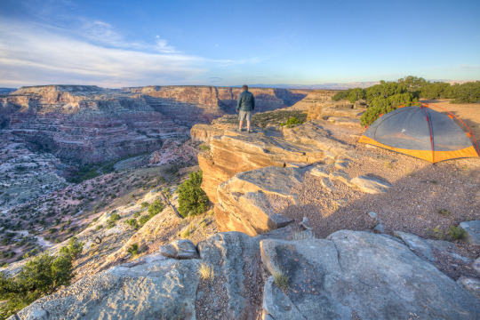
BOTR - Day 7 - June 21, 2024
Darkness and rain last night forced us to abandon our campsite for the dry comforts of a hotel, 100 miles before our target destination. We both slept well and our internal clocks had us up before 6am local time (8am Eastern, haha). We were on the road early hoping to get to a first come first served campsite before anyone else. Our target was the South Fork CG that we didn’t make it to the previous evening.
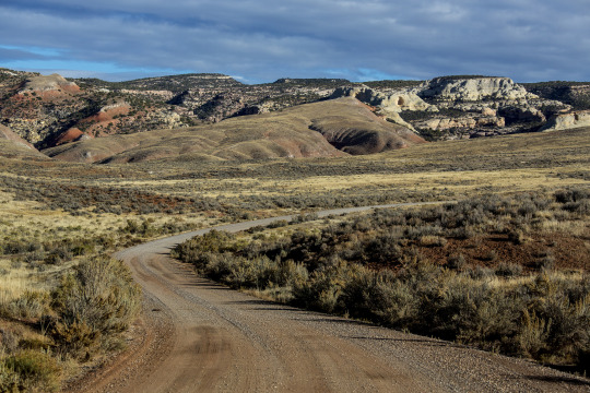
Wyoming is an amazing place. We easily drove 30+ miles between towns. Along the way we saw rolling hills and prairie in every direction. Occasionally, we’d see a ranch house and the associated farm buildings. We were able to spot a few pronghorn and a few more cows and sheep. The sky seemed to go on forever.

The open road.
I was also surprised at how little resource exploitation (oil, gas, coal, wind) we saw. Over the 300 miles we’ve traveled in the state, I might have seen a dozen pump jacks. The two or three windmills looked like they supported individual homes. We did see one 100+ car train loaded with coal but we have no idea where it came from.
Once off the major highway, we cruised through the historic district in Buffalo, WY. Pleasantly, the town was thriving, homes were well kept, and there were many people out and about. The district truthfully advertised itself… historic late 1800s & early 1900s buildings, all well kept and open for tourists headed towards Yellowstone.
We didn’t stick around to check out the town considering our need to get a campsite. We drive through Buffalo up into the mountains for the first time on this trip. The foothills are lush and green and the high peaks still have snow.
We wound our way the 16 miles to our turnoff. We were greeted by the camp host when we rolled in! She pointed to the only available site and we parked there immediately. After we told her that we had a reservation that we missed the previous night, she waived our fee for this evening!

Finally camping in the mountains.
An hour later, we had eaten lunch and were off for a hike along the creek behind camp. We were in a beautiful evergreen forest with the occasional white birch. The sound of the stream was the most dominant sound we heard. White puffy clouds mix with grey ones blocking out the sun for short periods. The temperature varied from cool to toasty depending on the cloud cover.
Our hike took us to the Tea Hack Reservoir. We saw wildflowers along the way and occasionally heard birds over the sound of the stream. At the reservoir, a family was fishing and they’d caught a few brook and brown trout which they’ll enjoy for breakfast tomorrow. On the way back, Diane heard and saw a Mountain Chicadee, a first for her.


Tea Hack Reservoir.

While hiking, I noticed a few times that short climbs left me a little breathless. I was surprised when Diane shared our altitude as identified on her cell phone app… just over 7700 feet above sea level. Good because I need to get acclimated for our Colorado adventure.

After, we relaxed in camp while enjoying a few snacks. Clouds rolled in and brought the temperature down to the point where we both put on pants and jackets. Soon after, the sky grew dark and rain washed away any warmth.
Sometime along the way a wayward elk walked into camp and wandered out just as quickly.
We ate an early dinner while it rained and spent the first part of the evening playing Phase 10 to a close finish. Soon after, we wrapped up by reading in bed as the sun when down.
G’nite
0 notes
Text
Across Canada
I will try to post a little more text today, but the internet service here is pretty poor so I will leave posting of any more photos until we get home. We leave the US this evening and arrive back in Melbourne before dawn on Wednesday, having missed an entire day along the way.
We took a cab to Union Station to catch the VIA Rail across the country. We have usually paid cab fares by card, but Heather used cash this time. The cabbie gave her a few coins as change and when Heather said that there should have been some notes, he said he was keeping that as his tip - about 50% of the fare. Heather argued, but he bullied her and insisted that he was keeping it. Had I been closer instead of getting our bags out of the boot, he may not have been so demanding, but it left a sour taste in our mouths as it was.
The train is by no means luxurious, obviously oldish, but it is quite functional and we are comfy enough in our little cabin. One good thing is that the bunks are bigger and much more comfortable than on the ship or the other trains we have used. We have both slept well.
On the other hand, there is no WiFi at all, only an occasional phone signal and although there are 110-volt power outlets, they won’t charge my PC - so once again, the technology has failed us. Maybe I am naive, but we are now in the 21st century and I reckon basic power and signal issues should have been sorted out years ago. As it is, the battery in my PC is flat and there is no way I can use it until we reach Vancouver at best. That means I can’t look at my photos or do much with my blog other than draft bits on my iPad.
Canada is exquisitely beautiful. It is an absolute picture postcard, full to bursting with trees and lakes. The overwhelming colour is green, with literally billions of tall skinny pointy trees. Actually, they are not that tall. We have seen very few trees more than 8-10 metres tall, but there are zillions of them, mostly densely packed with both understory and overstory. In some places, it is a bit more open, but still usually gloomy and mysterious, inviting us to explore - if only we were out there in the bush. Aspen, larch, spruce, alder, birch, pines and firs, conifers of every description, millions of stark white trunks, black trunks, all sorts, drowning in a thousand shades of green, leaves shimmering in the breeze, gleaming in the sun, with just a smattering of autumn tones starting to appear here and there.
Then there are the thousands of lakes. We must have traversed 1000 kilometres of marshy land with water shimmering through the low vegetation as far as we could see. But there are thousands of open lakes as well, from just a hectare or two to those speeding past the train for kilometre after kilometre. Did I say picture postcard? We have seen them all. The little ones that look like they came out of a cutesy 50s or 60s movie, with the summer camp atmosphere - a few canoes tied up to a little landing, a pontoon and shallow diving board, a short rowing course, maybe a pathetic little waterski-jump and a collection of quaint little huts that are probably family holiday shacks. Then there are the more remote ones, some with a tiny island or two with just 2 or 3 perfectly conical fir trees on them and a kayak tied up to a partly-submerged drowning landing that defies imagination about how one might access it - not even a hiking track, much less a road, in sight. Then we have the larger ones with a couple of small tinnies out there, each with a fisherman or two, sound asleep with their rods dangling limp over the side, or perhaps the ten deserted sheds, some literally falling down, and only a tiny Cessna anchored to the shore to suggest that anyone might occasionally visit them. We are not talking upscale Hillbilly country. This is magically picturesque country that should warrant criminal charges if anyone but us invades it. Add your own superlatives, but for me, I have run out. Simply stupendously glorious!
Later. We have just crossed the border from massive Ontario into Manitoba - after more than 20 hours heading west. Slowly, the trees and lakes seem to be getting slightly larger, the terrain is a little more open, the trees a little lighter green and the wildflowers more profuse and colourful - mainly white, yellow and mauve/purple.
For the entire trip, there has been a line of telegraph posts and cables beside the train: around 20 cables, but obviously long defunct. Thousands of the posts have simply sunk into the boggy earth or fallen over or submerged into the lakes, and many of the cables are broken or hanging limp and tangled. I am amazed that nobody has attempted to salvage the hundreds of thousands of dollars of copper out there.
As we went west, it became a little hillier and we even went through a couple of short tunnels. We also went through many cuttings where the rock had been blasted away for the track. There was a lot of red in the rocks and it is likely that some sort of algae was growing on it to make it that colour.
It was getting dark when we rolled into Winnipeg, but we had an hour and a bit stopover, so we went into the station and used the WiFi to download our email - alas, mostly more bills to pay! I had prepared a few emails to send, but they were all on my PC and inaccessible due to the flat battery!
It was a very rocky night, but we were up early for showers. I raised the blind just a centimetre or two in our cabin and could see everything there was to see. The landscape was entirely in landscape. Flat, flat, flat - all the way to the horizon. Everything looked manicured as if the farmers had risen early and swept or ironed their paddocks to welcome us. A bit later, we saw patches of forest and lots of neat (or sometimes sprawling) farmhouses, often with 2 or 3 little cottages and a barn or two, and mostly at least a field-bin or ten (or 30) and a tractor parked nearby. Many farms also have a machinery graveyard, usually at a distance from the house, with rows of rusty tractors, trucks, cars, pick-ups, ploughs, harvesters, caravans, campers and who knows what, all lined up in their final resting places, slowly sinking into the landscape. The houses all have pitched rooves, presumably to avoid too much snow collecting on them in the winter.
The paddocks are mainly cropped with wheat, barley, oats and canola, but there is also a lot of uncropped land, mostly looking too boggy to crop. Quite a bit of the uncropped land is still productive though, with miles of road and rail verges being harvested and baled for silage. It is obviously harvest time over here with quite a lot of crop already cut, but with plenty more still to go. We haven’t seen much actually being harvested, but plenty of hay bales in neatly shorn paddocks. There are a few cattle but no big herds. Also a few horses, half a dozen goats, a donkey, a young deer standing beside the track staring at me - and at least one fox scampering across the prairie with four magpies harassing it. It was nearly two days later before we saw any sheep: about 20 near one house and 3 at another – then none through to Vancouver.
There have been a few shallow lakes, mainly fairly small and at last, a few birds. We crossed one wide river, very shallow with flat mud islands and hundreds of birds: all gulls and Canada Geese as far as I could see. It is very frustrating not having any internet because I can’t identify the birds conclusively without my favourite Merlin app, but I am taking photos and making notes and hope I will be able to tie some of them down later. It is even more frustrating that Heather can sit there posting to Facebook and her blog almost any time when the SIM we purchased for me doesn’t work in either my phone or my iPad!
There were a few places along the rivers and nearby lakes where I suspect beavers were at work. A couple of creeks appeared to be dammed and there was an area near one suspected lodge where a whole lot of smallish trees had been felled – all with pencil-sharpener bases. And I saw a few flat conical structures a metre or so above the water level – again with a collection of pick-up-sticks pencil-ended logs embedded in the structure. I could be just imagining it, but the indications seemed to be there that beavers could have created the dams and underwater pyramids.
It is strange that we rocketed through the night, speeding along much faster than anywhere to date, making for a very bumpy ride - then arriving in Saskatoon where they said we were way ahead of our timetable so there would be a two hour stopover to get back on schedule. Go figure! The track we are on is apparently owned by a freight company and freight trains always have priority. This means that we frequently need to stop at sidings or on branch lines, often for half an hour or more until a freight train passes. The freight trains are massive, up to about 3 kilometres long and mostly double-deckers that roar along carrying hundreds of thousands of tonnes of cargo across the country day and night. They are not as bad as in Russia where a few kilometres of freight barrelled past us every time I raised my camera for a shot, but there must still be at least several dozen here each day.
Next time we woke up, we were in Saskatchewan and the terrain slowly became more varied, with lumpy low hills, uneven ground, more diverse vegetation, taller trees and in due course, we had an hour or so stopover in Edmonton and next morning we rolled into Jasper in the Canadian Rockies. Our Edmonton stop was marked by the start of a dramatic electrical storm. It was really ferocious with lightning flashing brilliantly around us every few seconds. We went to dinner as it was getting dark and the lightning outside the dining car was tremendous. We were soon locked up, cosy in bed, but several other passengers said the electrical storm was amazing and followed us for hours.
1 note
·
View note
Text
Mima Mounds Natural Area Preserve
Founded in 1976 to preserve Puget prairie grasslands and Mima mound landforms, The Mima Mounds Natural Area Preserve on Waddell Creek Raod, Olympia, welcomes visitors to explore approximately 640 acres of grassland covered forest land and Mima mounds. As one of the National Natural Landmarks in Washington, this is a unique place to know more about Mima mound hypotheses, geology, fire, prairie ecology and Native American historical usage of the mounds.
What made these big mounds remains a mystery, and this puzzle is one with suggested explanations ranging from glaciation, earthquakes to giant gophers, an extraterrestrial activity and various other phenomena, but none are proven. Mima Mounds Natural Area Preserve is a brilliant place for hiking and walking especially when the wildflowers have blossomed on the rolling hills in the spring.
The National Natural Landmark provides a fully accessible path which is half a mile that enables everyone to enjoy the unique and alluring landscape. There are various viewpoints including the official refuge site itself - for those who have limited time this should be the priority. There are also different views on the road going over to the shooting range. They offer a variety of trails, apparently, one that is wheelchair accessible.
youtube
Nice Trails
At the beginning of the trail, you have a look outbuilding that allows you to see how far out the mounds are and see how massive they are. Down inside the little observatory you have the history of the hills and theories of past explorers on the walls. It is very informative, and the trail is nice to walk around with pets and or kids - nothing too tricky. The mystery behind the mounds is intriguing, and if you're into history and nature, this spot is right for you.
This is a wonderful spot for the whole family since it is kid-friendly. They have an easy paved hike with exciting facts about native plants throughout the park. Also, it has a more extensive trail choice. It is a peaceful place where kids can carefully explore, discover and experience nature. It is highly recommended to go in May or June when the butterflies are migrating.
Summary
If you liked your geology, then this would be an excellent park to tour. It is not known what made these big mounds of gravel on the otherwise flat prairie, but there are plenty of them of all sizes. These mounds extend over an area of about 12 miles; some of the best-undeveloped views can be seen further to the east, north of Tenino along the route of the Amtrak line.
This place is loaded with unusual native flowers, birds, and butterflies. Endangered species including the checkerspot butterfly and streak horned lark as well as Mazama pocket gopher are under local protection. There are always plenty of bluebirds around and often beautiful hawks circling above. This is a lovely open area to get out and have a walk and feel a Pacific Northwest prairie environment.
Mima Mounds Natural Area Preserve is a beautiful place in Olympia where you can enjoy the natural beauty. The natural beauty of any place is not complete without trees and for beautiful trees, care of these trees are important. You can find a different tree service provider in Olympia. You can find more information about trees from http://deadoralivetreeservices.com/.
Location: https://goo.gl/maps/9CJGuufBUVv
1 note
·
View note
Text
The Best Paved Paths To Ride Your Electric Bike

Scattered across the country are beautiful and user-friendly bike trails that electric bike enthusiasts can enjoy. These places feature some of the best paved paths for e-bikes of all makes and models, so there’s no need to stress over tire size and gear. If you’re looking to pack the bike and hit the trails, here is a list of some must-visit locations in the US.
Monterey Bay, California
Monterey Bay Trail is a haven where the ocean meets land. Riders can enjoy scenic views and the breathtaking landscape of the coastline. The bonus to this path is the moderate hills and turns, allowing riders to enjoy a leisure stroll without much effort. It’s roughly 36 miles from start to finish, so there’s plenty of trail to put your e-bike to the test.
Coeur d’Alene, Idaho
Not many plan a trip to Idaho, but if you’re an electric bike rider, you should consider making the adventure. Coeur d’Alene is one of the most interesting rides you’ll experience, so you don’t want to miss an opportunity to hit the path. There are over 70 miles of paved trails that combine history, lakes, mountains, and prairies. Ensure you prepare your vehicle correctly and haul your bike safely any time you travel a long distance.
Pine Creek, Pennsylvania
On the other side of the Mississippi, you can find this expansive 62-mile cruise in Pine Creek Gorge, Pennsylvania. The area features lush, green forests and a winding trail that runs parallel to the river. There are stops along the way, including a campground, a small town, and abundant history. The ride itself is easy, vibrant, and filled with wildlife.
River Mountains Loop, Nevada
The desert is an outdoorsy paradise, but consider making the trip when the temperature is below 100 degrees Fahrenheit. The River Mountains Loop gives riders a taste of mountain life with views of Lake Mead, Las Vegas Valley, and the Hoover Dam. The area’s wildlife—including bighorn sheep and desert crawlers—adds to this interesting ride. The trail is roughly 35 miles, so it’s the perfect distance on a warm day.
Shark Valley, Florida
Shark Valley is a shorter ride, but deserves a spot on this list because of its unique environment and smooth pathway. You can cruise on your electric bike along this 16-mile stretch of pristine paved path. The wildlife in the area is consistent with the Everglades biology and includes wildflowers, alligators, birds, and marsh creatures. Along the way, you might find a picnic table to rest and soak in your surroundings.
There are many places to enjoy your electric bike. Securing your e-bike to your vehicle and making a road trip to one of these locations can allow you to reset, unplug, and cruise the days away. Where will you go first?
Read the full article
0 notes
Text
Nature and Quick
Repost, don’t reblog!
BOLD everything that applies to your character:
fluffy white nimbus clouds || dark grey cumulonimbus clouds || rain clouds || a hurricane || light spring breeze || a sherbet-colored sky at sunrise || hazy yellow skies || deep blue ponds of fresh water || blankets of sparkling snow || tornado winds || monsoon flooding || rich, orange sunsets || soft, purple clouds at dusk || heavy hail || the rumbling of thunder || a meandering river || a lightning-blasted tree || a field of wildflowers
icy sleet || gentle snowfall || moss-dusted tree bark || pink sunset clouds || grey winter skies || navy blue skies in the daytime || cool mist in the morning || leaf-bare trees || giant ocean waves || the full moon || a cracked, dry desert || rolling hills of prairie grass || sweeping waves of briny seawater || rocky, steep ravines || rippling canyon walls || spindly cave stalactites || creeping green ivy || lush canopies of leafy trees || a peaceful creek of clear water
flowering cacti dusted with dew || a bubbling hot pool of volcanic sulfur || sharp gray mountainsides || fossils nestled in chunks of rock || a white sand beach || deep imprints of animal tracks in the dirt || soft, squishy moss || uniform rows of birch trees in winter || delicate mushrooms popping up from beneath the decay on the forest floor || tumbleweeds blowing in the faintest wind across the desert landscape || light rain || dense, white fog
summer wildfires || a mixing of hot and cool air before a storm || silent lightning in the static of summer heat || a windy blizzard || thick flakes of snow tumbling down from the sky || a tree standing alone in a barren, yellow field || a desert of loose sand and tall, orange dunes || a pure blue sky || a river of molten rock || a grove of flowering trees || twisting, mangled roots sticking up from the muddy ground || new leaves in spring
bitter, cold winds || tumultuous skies of stormy clouds || branches of lightning ripping across the sky || a foggy swamp || the tree-bare foothills of a mountain range || sandy brown cliff sides || rocky coastlines || the violent shaking of an earthquake || the mysterious sound of ethereal trumpets in the sky || the lights of the aurora borealis and australis || an aristocrat’s manicured garden || the scent left after the rain has fallen
a black sand beach || a lone tropical island in a reef of shallow, aqua waters || underwater volcanic vents || a herd of migrating mammals || tree branches growing heavy with ripe fruit || light streaming down through the clouds || a field of lush grain waving peacefully in the summer breeze || the sound of insects and frogs teeming in the night || natural diamonds nestled in coarse desert sands || a frozen lake || golden and red autumn leaves
Tagged by: @aedice
Tagging: @threska, @feathersandfoxtails, @anyone else!
6 notes
·
View notes
Text
Nature Aesthetics - Zhrianaa

Repost, don’t reblog!
BOLD everything that applies to your character:
fluffy white nimbus clouds || dark grey cumulonimbus clouds || rain clouds || a hurricane || light spring breeze || a sherbet-colored sky at sunrise || hazy yellow skies || deep blue ponds of fresh water || blankets of sparkling snow || tornado winds || monsoon flooding || rich, orange sunsets || soft, purple clouds at dusk || heavy hail || the rumbling of thunder || a meandering river || a lightning-blasted tree || a field of wildflowers
icy sleet || gentle snowfall || moss-dusted tree bark || pink sunset clouds || grey winter skies || navy blue skies in the daytime || cool mist in the morning || leaf-bare trees || giant ocean waves || the full moon || a cracked, dry desert || rolling hills of prairie grass || sweeping waves of briny seawater || rocky, steep ravines || rippling canyon walls || spindly cave stalactites || creeping green ivy || lush canopies of leafy trees || a peaceful creek of clear water
flowering cacti dusted with dew || a bubbling hot pool of volcanic sulfur || sharp gray mountainsides || fossils nestled in chunks of rock || a white sand beach || deep imprints of animal tracks in the dirt || soft, squishy moss || uniform rows of birch trees in winter || delicate mushrooms popping up from beneath the decay on the forest floor || tumbleweeds blowing in the faintest wind across the desert landscape || light rain || dense, white fog
summer wildfires || a mixing of hot and cool air before a storm || silent lightning in the static of summer heat || a windy blizzard || thick flakes of snow tumbling down from the sky || a tree standing alone in a barren, yellow field || a desert of loose sand and tall, orange dunes || a pure blue sky || a river of molten rock || a grove of flowering trees || twisting, mangled roots sticking up from the muddy ground || new leaves in spring
bitter, cold winds || tumultuous skies of stormy clouds || branches of lightning ripping across the sky || a foggy swamp || the tree-bare foothills of a mountain range || sandy brown cliff sides || rocky coastlines || the violent shaking of an earthquake || the mysterious sound of ethereal trumpets in the sky || the lights of the aurora borealis and australis || an aristocrat’s manicured garden || the scent left after the rain has fallen
a black sand beach || a lone tropical island in a reef of shallow, aqua waters || underwater volcanic vents || a herd of migrating mammals || tree branches growing heavy with ripe fruit || light streaming down through the clouds || a field of lush grain waving peacefully in the summer breeze || the sound of insects and frogs teeming in the night || natural diamonds nestled in coarse desert sands || a frozen lake || golden and red autumn leaves
Tagged by: @eye-of-kuu
Tagging: @vasdensoultreader @scarletlioness @lumealblackstrider @sassyfireexpertthing @kavtari @aly-g-on-wyrmrest (any toon you want) @belillinafireseeker
8 notes
·
View notes
Text
Nature - Kav Tari
Repost, don’t reblog!

BOLD everything that applies to your character:
fluffy white nimbus clouds || dark grey cumulonimbus clouds || rain clouds || a hurricane || light spring breeze || a sherbet-colored sky at sunrise || hazy yellow skies || deep blue ponds of fresh water || blankets of sparkling snow || tornado winds || monsoon flooding || rich, orange sunsets || soft, purple clouds at dusk || heavy hail || the rumbling of thunder || a meandering river || a lightning-blasted tree || a field of wildflowers
icy sleet || gentle snowfall || moss-dusted tree bark || pink sunset clouds || grey winter skies || navy blue skies in the daytime || cool mist in the morning || leaf-bare trees || giant ocean waves || the full moon || a cracked, dry desert || rolling hills of prairie grass || sweeping waves of briny seawater || rocky, steep ravines || rippling canyon walls || spindly cave stalactites || creeping green ivy || lush canopies of leafy trees || a peaceful creek of clear water
flowering cacti dusted with dew || a bubbling hot pool of volcanic sulfur || sharp gray mountainsides || fossils nestled in chunks of rock || a white sand beach || deep imprints of animal tracks in the dirt || soft, squishy moss || uniform rows of birch trees in winter || delicate mushrooms popping up from beneath the decay on the forest floor || tumbleweeds blowing in the faintest wind across the desert landscape || light rain || dense, white fog
summer wildfires || a mixing of hot and cool air before a storm || silent lightning in the static of summer heat || a windy blizzard || thick flakes of snow tumbling down from the sky || a tree standing alone in a barren, yellow field || a desert of loose sand and tall, orange dunes || a pure blue sky || a river of molten rock || a grove of flowering trees || twisting, mangled roots sticking up from the muddy ground || new leaves in spring
bitter, cold winds || tumultuous skies of stormy clouds || branches of lightning ripping across the sky || a foggy swamp || the tree-bare foothills of a mountain range || sandy brown cliff sides || rocky coastlines || the violent shaking of an earthquake || the mysterious sound of ethereal trumpets in the sky || the lights of the aurora borealis and australis || an aristocrat’s manicured garden || the scent left after the rain has fallen
a black sand beach || a lone tropical island in a reef of shallow, aqua waters || underwater volcanic vents || a herd of migrating mammals || tree branches growing heavy with ripe fruit || light streaming down through the clouds || a field of lush grain waving peacefully in the summer breeze || the sound of insects and frogs teeming in the night || natural diamonds nestled in coarse desert sands || a frozen lake || golden and red autumn leaves
4 notes
·
View notes
Text
Friday, July 9 - Sunday, July 11, 2021
Happy to be back out on the Ice Age Trail!! We’re hiking without Gary as he had to fly back to New Jersey for a funeral today, but with luck will see him tomorrow. Our rendezvous point was only 70 minutes from our house so it was nice to be able to leave just after 6 AM and get to the meeting point before 7:30 AM. Even though we’d just seen everyone, we were excited to be together again. Jeff had to gently shepherd us into the cars, reminding us that we had all day to talk and swap stories and we should get going.
We left two cars at our meeting point and got into Dan and Tam‘s SUV and drove to the start of the Deerwood Segment, where we left off on that rainy Sunday just a few weeks ago. We were delighted to find it looking much different today - it’s a perfect Wisconsin summer day. It was about 60° when we started out, with plenty of sunshine.
We hiked 10 miles before a lunch break - wonderful segments (Deerfield, Bohn Lake and Greenwood) through pine trees, around beautiful lakes, with short road walks mixed in. This combination allows us to cover pretty good ground because we can really book it on the road walk and stop and enjoy when we’re in the woods a little bit more. We took two different snack breaks this morning which was really helpful because I was used to having a long drive to drink my coffee and gradually eat my breakfast. I brought along my small thermos of coffee and that was really great to wash down a cliff bar with hot coffee. Another unusual factor is that we encountered several couples – still so strange to see others on these amazing trails. One couple was out with their 11-year-old dog, and said they walk this 4-mile loop every day. The other couple had three grandchildren along and they had buckets and were just going blackberry picking. We chatted with them for a while and Tam told the kids to pick enough berries so grandma could make a blackberry cobbler. Grandma said “shut up,” which gave us all a great laugh and reminded us of Jen at the bar a couple weeks ago who told a customer “Shut up and give me all your money.” In addition to a couple snack breaks I ate a lot of ripe blackberries along the trail (yum) and found myself hoping that the café at lunchtime will have blackberry cobbler.
The summer wildflowers are really starting to come in to full bloom which attracts a myriad of different kind of butterflies, including many monarchs. As we were walking through the pine forest, it was very quiet due to the sand and pine needles underfoot and we heard buzzing in the trees. While we couldn’t see a beehive, we’re pretty sure that’s what we heard. We walked probably another hundred feet and had the same thing. It was really cool and it made me think made me think of Winnie the Pooh and the way he would sing to the honeybees and try to float along with a balloon to get the honey from the hive in the tree!
After 10 miles we came out through the woods right where our cars were – always, thankful for that! We climbed into the two cars and drove about 7 miles to Coloma where we stopped at the Red Hill café for lunch (except we all had omelets). This is an Amish area and the café served an Amish wheat bread with our omelets, the best bread I’ve had in a long time! One of their specials of the day was a ‘double caramel chocolate roll muffin’ which sounded a bit too decadent, even for me. Like all establishments these days the café was probably short-staffed so it took a long time for us to order and for our food to come, so it was about 2:30p before we shuttled the cars and were back on the trail. With full bellies, it was off to a slow start as we started again down the connecting road.
This afternoon we finished the Greenwood segment had a short road walk and started the Mecan River segment. The area was designated Mecan Springs State Natural Area, and the trail was gorgeous but we didn’t see much of the river, which is always disappointing to me.
We all had several wood-ticks today, but we’re getting used to them and no one seems as freaked out as last year. Other than a few flies, and some intermittent buzz-bys from deer flies, no other bugs – no mosquitoes, which is a bit unbelievable!
At one point the trail today came out into a farm field and there was a fabulous prairie easement between two cornfields and that we were allowed to walk through. We rousted up some sand hill cranes, always majestic to watch them take off and fly away. The prairie flowers were just starting to come into bloom and the view was breathtaking to me. There were spots in the cornfield where the probably original oak trees still stood and rocks were piled up and you could just imagine the settlers clearing the fields and piling up the rocks. And we think we’re working hard out here just slogging along the trail, silly us!
With our dallying, it was nearly 6 o’clock before we got back to the car – 17.5 miles for the day. We had a quick shuttle to pick up the other two cars and soon we were back in Coloma for a bathroom stop at the gas station. Jeff and I picked up root beer floats at the A&W that was attached to the gas station. The other two couples stopped at a restaurant in Coloma for dinner, but Jeff and I decided to head home and tend to our cat. We arrived home about 7:30 PM completely exhausted. I had all I could do to eat a little leftover salad, re-supply my pack for tomorrow run a hot bubble bath and then crawl into bed shortly after nine.
A late-night text from Gary said he was stranded in Charlotte, North Carolina which is pretty far from New Jersey, and further from Wisconsin. On our drive north today, we learned he was now in Detroit, which is closer, but he still wasn’t going to make the hike today. That made us all sad because we’re a little lost without him, but we pressed on anyway. We were all at the rendezvous spot at 8 AM, and we took two cars back to Highway GG in the middle of the Mecan river segment and we were hiking by 8:30 AM, an easy early start.
This part of the Mecon river segment actually paralleled the river, winding around through oak and pine forest, on another absolutely gorgeous Wisconsin summer day. The ladies lagged behind a bit, using my “Picture This” app to identify some of the flowers. We were hiking through an area that had been logged several years before, which was now growing a bunch of pretty flowers and berries most of which are poisonous to humans of course.
Over the past two days, much of the trail had vole or moles that had burrowed trails than intersected under our trails! We were a bit perplexed by the volume, but actually, it made for softer trails. Jeff figured there must be a lot of grubs in the area for them to be eating!
We had a great morning enjoying the hike along the river, stopping once at a bench to take a coffee break and enjoy the scenery. We ended the Mecan River segment and had 2.3-mile road walk. It was warm but we had a nice breeze. We walked through a little village, Richford, which seemed to be primarily an Amish settlement. We walked through the edge of a cemetery with really old tombstones -many of them that you couldn’t even make out the writing anymore. I heard a “clap clap clap” on the pavement behind us, and there was an Amish farmer in a horse and buggy – that was a first for our connecting route walking! Soon we heard another, but that one was a horse pulling a farmer in a really uncomfortable looking cart!
We arrived at the start of Wedde Creek segment, and took another sit-down break – most of us taking off our boots to cool our feet after walking on the hot road. It was a shorter segment, through another gorgeous pine forest and a meadow with lots of wildflowers and butterflies. I lagged behind the group taking photos and just embracing the joy of the day.
After that we had 0.7-mile CR to the Chaffee Creek Segment which will be our last segment for about 40 miles. On this segment we crossed underneath Highway 51 again (we crossed from west to east just south the Tomahawk sometime last winter). For the next couple days will cross underneath Highway 51 back-and-forth a few times until we get to Portage and then will finally turn west and get into familiar territory for us.
We backtracked about a half mile to visit the Rest Stop on I-39/51 – kind of crazy, but always great to have a flush toilet! We hiked through the last of the Chaffee Creek segment, crossing the creek again. We went through another pretty meadow with lots of butterfly activity. We ended up at an official trail parking at a cul de sac, and chatted with a guy there that appeared he was going to do trail maintenance, but actually was doing some work on a friend’s adjacent property. There was trash there that indicated the cul de sac may be a party site. I had a trash bag in my pack, so I pulled it out and started cleaning up the space. Down the road just a bit, there was a branch of a tree nearly blocking the road – the guys got out Jeff’s saw and cleared the road – probably the first time in nearly 600 miles that they cleared a tree on a connecting route!
We had about 1.5 miles CR to get back to Kent’s SUV. We picked up enough trash to fill up TWO bags on our way, always feels good to leave it a little better than we found it. Just don’t get what’s in people’s minds that they just throw trash out the window.
Felt great to be down early. We shuttled back to the Mecan River segment to pick up the other two SUVs, and then to the gas station / A&W in Coloma again. We were home just about 4pm, which was awesome.
For reasons that I don’t understand the Ice Age Trail has a bifurcation, and at the end of our day today we reached that spot of the northern bifurcation. We have opted to take the eastern route which will lead us to Portage, where we’ll walk Levee Road on the south side of the Wisconsin River, south over the Baraboo Bluffs, and we’ll pick up a trail again just around Parfrey’s Glen and that will take us to Devils Lake. The western bifurcation like the eastern in that its mostly CR with very few trail segments. It goes through Baraboo and rejoins the trail at the north side of Devils Lake.
Throughout the hike, we’ve had a lot of Kilimanjaro logistics chatter – its both exciting and anxiety provoking, but I’m so looking forward to that trek – just 9 weeks out now.
Sunday morning, we met at 8AM in Westfield. Shocking to arrive 20 minutes early and find the Knickmeier’s’ already there!! And no Gary, but soon after we arrived, Kent and Lynn pulled in, and Gary soon behind him. Definitely a first! We were all glad to have him back with us today. We left 3 cars in the parking lot of the “Bent Rail” brewpub, where we planned to have lunch. We shuttled north to where we’d left off yesterday, another gorgeous day. I figured we had about 10 miles to lunch, and we were hiking by 8:15am. Even though it was all CR, I managed to pick up a wood-tick during my “quick trip” stop in the woods before we started!
We walked through a lake/resort area, which was odd after days of farms. There were people out running and road cyclists out enjoying the morning – felt kind of normal to us, but different from what we’ve been seeing.
Time passed quickly; seems we never really run out of things to talk about since we’re such a companiable group! It’s also ok for someone to be out front alone when they want to move, or lag behind when they want space. We took a few snack breaks, but mainly just moved. True to form, I was a bit off in the math using the Guthook app to estimate the distance, and it was actually 12 miles. It was warm, but generally with a nice breeze and we arrived at the brew pub about 12:30pm. Like everywhere, they were short staffed – in fact, had a note on their menu asking for patience and offering rewards of free beer for employee referrals. We had a delightful waitress named Tanya, and had some great beer and good food. Patience was required though, and it was after 2P before we were back on the road. Gary and I shuttled his SUV just 3 more miles down the road, and we set off hiking about 2:30PM, and knocked it out in about an hour. Half of it was on a busy County Highway J, so it was great to turn off onto a smaller road, past a few farms and to Gary’s car.
We volunteered to bring Tam and Dan back to their car, which gave us an opportunity to detour back to Coloma and get another A&W float for the drive home. Made for a perfect day! We got a text from Lynn that I-94 had a backup, so we diverted to Portage and took a slower more leisurely
0 notes
Photo


#NewYearNewAdventures: Our favorite road trips/byways
We’re continuing to share some of the top spots on #yourpubliclands to start the New Year off right. Explore the outdoors with these road trips and byways this year to BLM-managed public lands.

Dalton Highway, Alaska
The Dalton Highway stretches 414 miles across northern Alaska from Livengood (84 miles north of Fairbanks) to Deadhorse and the oilfields of Prudhoe Bay. Built during construction of the trans-Alaska oil pipeline in the 1970s, this mostly gravel highway travels through rolling, forested hills, across the Yukon River and Arctic Circle, through the rugged Brooks Range, and over the North Slope to the Arctic Ocean. Along most of its length, you'll see no strip malls, no gift shops, no service stations, just forest, tundra, and mountains, crossed by a ribbon of road and pipe.The BLM manages a swath of public lands along the highway from the Yukon River to the north side of the Brooks Range. Within the Dalton corridor, the BLM maintains campgrounds, rest areas, interpretive panels and the award-winning Arctic Interagency Visitor Center in Coldfoot.This is no ordinary road -- it pays to be prepared. There is no cell phone service or public Internet connection along the Dalton Highway.

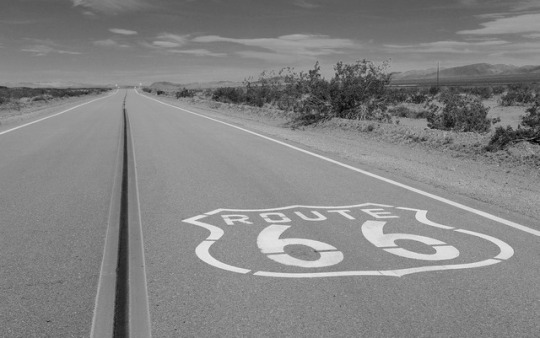
Route 66 Historic Backcountry Byway, Arizona
This 42-mile stretch of two-lane blacktop is one of the last and best-preserved segments of the original Route 66, one of America's first transcontinental highways. This portion of the highway once included one of the most fearsome obstacles for "flatland" travelers in the 1930's: the hairpin curves and steep grades of Sitgreaves Pass, which characterize Old Route 66 as it makes its way over the Black Mountains of western Arizona.
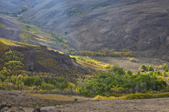
Bodie Hills, California
Always on our #roadtrip #bucketlist! California’s Eastern Sierra region is a dramatic transition zone between the snow-capped granite spires of the Sierra Nevada and the endless sagebrush covered uplands of the Great Basin. A trip at the right time of year will reward visitors with a diversity of wildflowers.
One great wildflower viewing area is just north of Mono Lake and east of Yosemite National Park in the rolling Bodie Hills – hills being an understatement since they top out at over 10,000 feet! Because of their high elevation, wildflower blooms are later here than much of California – typically arriving in May-June on the lower slopes and into July on the highest peaks. Several back roads traverse the area and offer access to view the displays of phlox, penstemon and paintbrush to name a few of the many wildflower species. More than 100,000 acres of BLM lands cover most of the Bodie Hills and include several wilderness study areas.
Bodie State Historic Park is the best-preserved ghost town in California, and arguably in the United States. Wildlife viewers can see antelope, mule deer, and if lucky, get a glimpse of a sage grouse. If you visit later, around early October, crisp clear nights will turn the scattered aspen stands to gold, giving a second opportunity to see Bodie Hills in color.
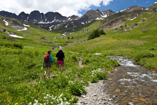
Alpine Loop National Backcountry Byway, Colorado
A #roadtrip to the #AlpineLoop should be on your #bucketlist for 2018! Located northeast of Silverton, Colorado in San Juan and Hinsdale counties, the Alpine Loop Back Country Byway is a premiere visitor destination. The epic scenery draws off-highway-vehicle enthusiasts across the country who are treated with a network of roads that climb above the timberline, accessing unparalleled vistas in an alpine environment. The hiking, biking and camping in the area is also fantastic. Scattered along the Alpine loop are remnants of our nation’s frontier history, where visitors can learn about the bustling mining towns that once thrived here.
While many roads are accessible by regular, two-wheel drive vehicles, getting into the alpine areas require high-clearance, four wheel drive vehicles. Plan your trip accordingly.
Washington-Rochambeau Revolutionary Route National Historic Trail, Virginia
Journey through early American history and walk in the footsteps of our nation’s founding fathers as you explore the Washington-Rochambeau Revolutionary Route. This National Historic Trail commemorates over 680 miles of land and water trails followed by the allied armies of General George Washington and the French Lieutenant General Comte Jean de Rochambeau. During their 1781 march from Newport, Rhode Island to Yorktown, Virginia, the French army established an encampment on what is now the Meadowood Special Recreation Management Area (SRMA). A segment of this trail connects with a BLM system of trails crossing the SRMA on the historic Mason Neck Peninsula, just a short drive from the nation’s capital. At Meadowood, the trail transects open meadows, enters into mature hardwood forests, and crosses riparian wetlands. While in the area, visit Gunston Hall, the home of Founding Father George Mason, a strong supporter of individual liberties and the author of the Virginia Declaration of Rights. Many of the concepts in that document found embodiment in the first ten amendments to the U.S. Constitution, the Bill of Rights.
Lewis and Clark Backcountry Byway, Idaho
The Lewis and Clark Backcountry Byway and Adventure Road is a 36-mile loop drive through a beautiful and historic landscape following the Lewis and Clark National Historic Trail and the Continental Divide National Scenic Trail. Experience incredible views of the Lemhi Valley and the surrounding mountain ranges; truly some of the finest scenery in America!
The mountains, evergreen forests, high desert canyons and grassy foothills look much the same today as when the Lewis and Clark Expedition passed through in 1805. Take a slow and meandering journey along this drive with time to stop along the way for hiking, fishing, mountain biking and exploration. With a 4,000 foot gain and loss in elevation, expect some steep grades too.
Lemhi Pass is well-known for its wildflower displays in the spring and summer. Captain Lewis collected three new plant species in this area: mountain maple, common snowberry and Lewis’s monkey flower. You might see elk, mule and whitetail deer, black bear, moose, pronghorn antelope, coyotes and many smaller mammal species. Early mornings and evenings are the times to look for wildlife, particularly where the forest and meadow meet.
By late September, shorter days and cooler temperatures release hues of red, yellow, and gold in aspens, cottonwoods, willows and shrubs. Don’t miss Agency Creek in October – it’s beautiful! Download a visitor guide for your roadtrip from our website.
Big Sky Byway, Montana
The 105-mile Big Sky Back Country Byway begins in Terry, MT, and travels north and south covering badlands and rolling prairies. The byway ends in Wolf Point, MT, on the beautiful Missouri River, part of the Lewis and Clark National Historic Trail. The route is part of the National Scenic Byways Program, linking Terry with Wolf Point. Taking 2 hours one way, you can stop to take a look at the information kiosks in Terry, Circle, and Wolf Point, which describe byway attributes, local history, and culture. Visitors can enjoy the scenic badlands of eastern Montana year round from this all-weather road.
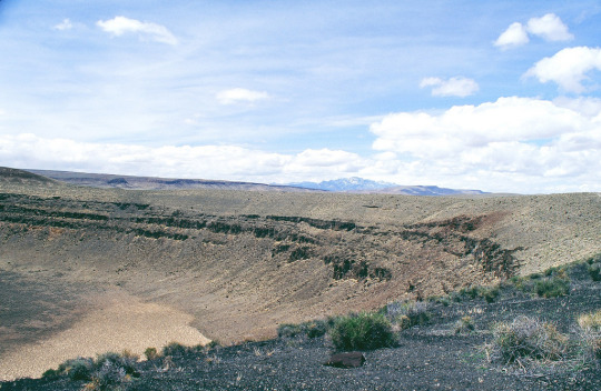
Lunar Crater Backcountry Byway, Nevada
The scenic loop (the Lunar Crater Back Country Byway) passes by the crater with a stopping point near the crater where visitors can get out to view the impressive volcanic feature. Vehicles are limited to existing roads and trails.

Lake Valley Backcountry Byway, New Mexico
A meandering 48-mile drive on paved roads takes visitors through ranching and mining country and past the ruins of the 1880s mining town of Lake Valley. The Lake Valley Backcountry Byway is nestled between the Mimbres and Caballo Mountains and the Cooke's Range in southwestern New Mexico and offers spectacular scenic views. Rich in history and scenery, the Byway offers an outstanding trip for travelers with an hour to spare.
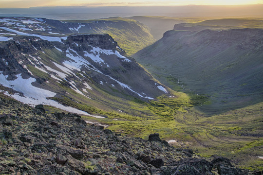
Steens Mountain, Oregon
How about this for a scenic byway: Glacier-carved gorges, pristine alpine lakes and wild and scenic rivers, all accessible via the highest elevation road in Oregon!
Come take a drive on the 52-mile-long Steens Mountain Backcountry Byway! There are four campgrounds along the byway for those wanting to stay a little bit longer in one of the most remote places in the U.S.!
Photo/video: https://goo.gl/VOkTFg
San Rafael Swell, Utah
Make the most of your road-trip to Moab or the Skyline Drive! Take the scenic route through the San Rafael Swell. Emery County Road 332 is a gravel road that connects approximately 45 miles between Huntington, Utah to Interstate 70 in the heart of the San Rafael Swell. Enjoy the amazing desert scenery, stop at the wedge overlook for a view of the “Little Grand Canyon,” view the ancient rock art of the Buckhorn Draw Panel, and maybe even take a side trip to the Cleveland-Lloyd Dinosaur Quarry. While there is primitive-style camping in the area, there are no other services. Come prepared with everything you need, and take home everything you bring. Flat tires are common.
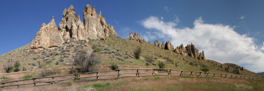
Red Gulch/Alkali National Backcountry Byway, Wyoming
The Red Gulch/Alkali National Backcountry Byway is a 32-mile scenic drive on improved gravel and dirt roads through the foothills of the Bighorn Mountains. Near each of the two entrances to this historic route you will see a National Backcountry Byway kiosk which provides historical information about the byway as well as road conditions. The steep, rugged canyons cut into the mountains along the byway and offer many challenging and interesting hiking opportunities. Among the wondrous sights you may see are hoodoos. These strange, artistic rock formations were carved over the centuries by Wyoming’s wind.
#bureau of land management#explore#yourpubliclands#recreation#roadtrip#byway#outdoors#getoutdoors#outside#newyearnewadventures#newyear#2018#solitude#nature#photography#wilderness#alaska#arizona#california#colorado#virginia#idaho#montana#nevada#newmexico#oregon#utah#wyoming
42 notes
·
View notes
Text
Natural Aesthetics | Star

This is Star, my main MC for Mystic Messenger and current muse.
I was going to cheat and use the one for Kayla that I did a few weeks ago but @aearyn and especially @windwyrm worked very hard on theirs and then tagged me so I thought it only fair I do a new one.
~bold the natural aesthetics that appeal to / apply to your muse
repost, do not reblog. feel free to add any natural features you see fit!~
fluffy white nimbus clouds.
dark grey cumulonimbus clouds. rain clouds. a hurricane.
light spring breeze.
a sherbet-colored sky at sunrise. hazy yellow skies.
deep blue ponds of fresh water.
blankets of sparkling snow. tornado winds. monsoon flooding. rich, orange sunsets.
soft, purple clouds at dusk.
heavy hail. the rumbling of thunder.
icy sleet.
gentle snowfall
. moss-dusted tree bark. pink sunset clouds. grey winter skies. navy blue skies in the daytime.
cool mist in the morning.
leaf-bare trees. giant ocean waves.
the full moon.
a cracked, dry desert. rolling hills of prairie grass. sweeping waves of briny seawater. rocky, steep ravines.rippling canyon walls. spindly, cave stalactites. creeping, green ivy. lush canopies of leafy trees. dense, white fog.
a peaceful creek of clear water.
flowering cacti dusted with dew, catching light in the morning sun. a bubbling, hot pool of volcanic sulfur. sharp, grey mountainsides. fossils nestled in chunks of rock. a white sand beach. deep imprints of animal tracks in the dirt.
soft, squishy moss.
uniform rows of birch trees in winter.
delicate mushrooms popping up in spring from beneath the decay on the forest floor.
tumbleweeds jerking in the faintest wind across the desert landscape.
light rain.
summer wildfires. a mixing of hot and cool air before a storm. silent lightning in the static of summer heat. a windy blizzard.
the night sky and twinkling stars.
thick flakes of snow tumbling down from the sky. a tree standing alone in a barren, yellow field. a desert of loose sand and tall, orange dunes.
a pure blue sky.
a river of molten rock.
a grove of flowering trees.
twisting, mangled roots sticking up from the muddy ground.
a field of wildflowers under a spring sky.
bitter, cold winds. tumultuous skies of stormy clouds. branches of lightning ripping across the sky. a foggy swamp. the tree-bare foothills of a mountain range. sandy brown cliff sides. rocky coastlines. the violent shaking of an earthquake.
the mysterious sound of ethereal trumpets in the sky.
the lights of the auroras borealis and australis.
a black sand beach. a lone tropical island in the reef of shallow, aqua waters. underwater volcanic vents. a herd of migrating mammals.
tree branches growing heavy with ripe fruit.
light streaming down through the clouds.
a field of lush grain wading peacefully in the summer breeze.
the sound of insects and frogs teeming in the night. natural diamonds nestled in coarse desert sands. a frozen lake.
a crisp night sky in winter filled with stars.
Not sure who to tag since it seems everyone has had a chance so in that case anyone feel free to give it a go either for the first time or for another muse:-)
1 note
·
View note
Text
Nature Aesthetics - Arzu

Repost, don’t reblog!
BOLD everything that applies to your character:
fluffy white nimbus clouds || dark grey cumulonimbus clouds || rain clouds ||a hurricane || light spring breeze || a sherbet-colored sky at sunrise || hazy yellow skies || deep blue ponds of fresh water || blankets of sparkling snow || tornado winds || monsoon flooding || rich, orange sunsets || soft, purple clouds at dusk || heavy hail || the rumbling of thunder || a meandering river || a lightning-blasted tree || a field of wildflowers
icy sleet || gentle snowfall || moss-dusted tree bark || pink sunset clouds || grey winter skies || navy blue skies in the daytime || cool mist in the morning || leaf-bare trees || giant ocean waves || the full moon || a cracked, dry desert || rolling hills of prairie grass || sweeping waves of briny seawater || rocky, steep ravines || rippling canyon walls || spindly cave stalactites || creeping green ivy || lush canopies of leafy trees || a peaceful creek of clear water
flowering cacti dusted with dew || a bubbling hot pool of volcanic sulfur || sharp gray mountainsides || fossils nestled in chunks of rock || a white sand beach || deep imprints of animal tracks in the dirt || soft, squishy moss || uniform rows of birch trees in winter || delicate mushrooms popping up from beneath the decay on the forest floor || tumbleweeds blowing in the faintest wind across the desert landscape || light rain || dense, white fog
summer wildfires || a mixing of hot and cool air before a storm || silent lightning in the static of summer heat || a windy blizzard || thick flakes of snow tumbling down from the sky || a tree standing alone in a barren, yellow field || a desert of loose sand and tall, orange dunes || a pure blue sky || a river of molten rock || a grove of flowering trees || twisting, mangled roots sticking up from the muddy ground || new leaves in spring
bitter, cold winds || tumultuous skies of stormy clouds || branches of lightning ripping across the sky || a foggy swamp || the tree-bare foothills of a mountain range || sandy brown cliff sides || rocky coastlines || the violent shaking of an earthquake || the mysterious sound of ethereal trumpets in the sky || the lights of the aurora borealis and australis || an aristocrat’s manicured garden || the scent left after the rain has fallen
a black sand beach || a lone tropical island in a reef of shallow, aqua waters || underwater volcanic vents || a herd of migrating mammals || tree branches growing heavy with ripe fruit || light streaming down through the clouds || a field of lush grain waving peacefully in the summer breeze || the sound of insects and frogs teeming in the night || natural diamonds nestled in coarse desert sands || a frozen lake || golden and red autumn leaves
Tagged by: @ziasilverstar
Tagging: @inerris-sunsong, @naisav, @alvae-main and anyone else I missed last time that wants to do it
1 note
·
View note
Text
Nature Aesthetics - Rin

Repost, don’t reblog!
BOLD everything that applies to your character:
fluffy white nimbus clouds || dark grey cumulonimbus clouds || rain clouds ||a hurricane || light spring breeze || a sherbet-colored sky at sunrise || hazy yellow skies || deep blue ponds of fresh water || blankets of sparkling snow || tornado winds || monsoon flooding || rich, orange sunsets || soft, purple clouds at dusk || heavy hail || the rumbling of thunder || a meandering river || a lightning-blasted tree || a field of wildflowers
icy sleet || gentle snowfall || moss-dusted tree bark || pink sunset clouds || grey winter skies || navy blue skies in the daytime || cool mist in the morning || leaf-bare trees || giant ocean waves || the full moon || a cracked, dry desert || rolling hills of prairie grass || sweeping waves of briny seawater || rocky, steep ravines || rippling canyon walls || spindly cave stalactites || creeping green ivy || lush canopies of leafy trees || a peaceful creek of clear water
flowering cacti dusted with dew || a bubbling hot pool of volcanic sulfur || sharp gray mountainsides || fossils nestled in chunks of rock || a white sand beach || deep imprints of animal tracks in the dirt || soft, squishy moss || uniform rows of birch trees in winter || delicate mushrooms popping up from beneath the decay on the forest floor || tumbleweeds blowing in the faintest wind across the desert landscape || light rain || dense, white fog
summer wildfires || a mixing of hot and cool air before a storm || silent lightning in the static of summer heat || a windy blizzard || thick flakes of snow tumbling down from the sky || a tree standing alone in a barren, yellow field || a desert of loose sand and tall, orange dunes || a pure blue sky || a river of molten rock || a grove of flowering trees ||twisting, mangled roots sticking up from the muddy ground || new leaves in spring
bitter, cold winds || tumultuous skies of stormy clouds || branches of lightning ripping across the sky || a foggy swamp || the tree-bare foothills of a mountain range || sandy brown cliff sides || rocky coastlines || the violent shaking of an earthquake || the mysterious sound of ethereal trumpets in the sky || the lights of the aurora borealis and australis || an aristocrat’s manicured garden || the scent left after the rain has fallen
a black sand beach || a lone tropical island in a reef of shallow, aqua waters || underwater volcanic vents || a herd of migrating mammals || tree branches growing heavy with ripe fruit || light streaming down through the clouds || a field of lush grain waving peacefully in the summer breeze || the sound of insects and frogs teeming in the night|| natural diamonds nestled in coarse desert sands || a frozen lake || golden and red autumn leaves
0 notes
Photo


Deer Creek State Park
20635 State Park Road 20
Mt. Sterling, OH 43143
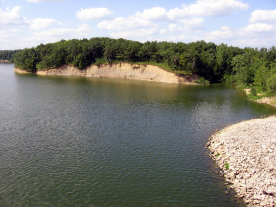
Located in the heart of Ohio's agricultural country, Deer Creek State Park is central Ohio's vacation showplace. A collage of meadows and woodlands surround the scenic reservoir. This resort park features a modern lodge, cottages, campground, golf course, swimming beach and boating for outdoor Deer Creek State Park lies on the eastern edge of the great till plains of Ohio. These plains receive their name from the glacial debris, or till, which is a mixture of sand, silt and gravel that was deposited by the glaciers. As glaciers advanced across the northern two-thirds of Ohio, most hills and valleys were covered and filled in by the till, leaving this part of Ohio relatively flat. Today, these rich plains in the park's region support corn, soybeans and wheat. The first settlers to the area did not find these open fields. Except for a few small prairie openings, the region was covered by dense woodlands. A regrowth of the original woodlands can be found scattered along the ridge tops and creek bottoms of the park. Wildflowers abound in the fields and woodlands of the till plains. In spring, common flowers are Dutchman's breeches, rue anemone, trillium, spring beauty and bloodroot. Summer months produce thimbleweed, wild lettuce, jewelweed and daisy fleabane. In autumn, the most abundant flowers are aster, goldenrod and chicory, whose roots were used by settlers to make a coffee-like beverage.
The best known animals of the Deer Creek area include amphibians such as the chorus frog, spring peeper and American toad. Reptiles include box and painted turtles, black rat snake and eastern garter snake. Numerous mammals inhabit the park. Most of them are small and include the red fox, raccoon, opossum, woodchuck, skunk, rabbit, deer mouse and white-tailed deer. Deer Creek is known for its population of ring-necked pheasant. Other birds of the area include eastern meadowlark, song sparrow, cowbird, eastern bluebird, barn swallow and woodcock. On a long ridge that once overlooked Deer Creek and its valley, researchers have discovered evidence of a camp of an ancient Indian tribe. The nomads who camped here around 2,000 B.C. were hunters and gatherers and used this camp periodically throughout the year. Since agriculture was not practiced by the nomads, they moved on after they depleted the plant or animal food supplies in a locale. Burial sites near the camp indicate it was inhabited over a period of time. In more recent years, a cottage owned by Harry M. Daugherty, the attorney general under President Warren G. Harding, overlooked the valley. The rustic one and one-half story cottage was built in 1918. The President was said to have visited this cottage which now bears his name. The completion of the dam in 1968 created the lake with the park officially opening in 1974.
The campground at Deer Creek has 232 sites. All have electricity. The campground features showers, flush toilets and a dump station. Pets are permitted on designated sites. Four Rent-A-Camp units consisting of a tent, dining fly, cooler, cook stove and other equipment can be rented during the summer months by reservation. A group camp is also available by reservation. A horsemen's camp provides primitive overnight facilities for riders and a primitive group camp offers an area for groups. Twenty-five cottages offer overnight accommodations. The cottages have two bedrooms, bath with a shower, living room, complete kitchen, dining area and screened porch. The cottages sleep six people. The historic Harding Cabin offers a unique setting and sleeps 8. The lodge at Deer Creek has 110 guest rooms, many with a panoramic view of the lake. Lodge features include indoor and outdoor pools, sauna, whirlpool and exercise room. A restaurant, lounge, and meeting rooms provide additional accommodations. A spacious 1,700-foot swimming beach graces the shores of Deer Creek State Park. A concession area and changing booths are special features at the beach. Unlimited horsepower boating is permitted on the 1,277-acre Deer Creek reservoir. Two launch ramps provide access to the lake. A fully equipped marina offers fuel, boat rental and seasonal dock rentals.
0 notes
Text
If You Really Want to Visit a National Park, Skip the Big Ones
Paddleboarding in Minnesota’s Voyageurs National Park | Getty Images
America’s larger parks are attracting major crowds. Here’s where to avoid them
As summer creeps into full swing and cities across America do the dance of easing, and then reinstating, COVID-19 restrictions, people are clamoring to be someplace — anyplace — besides their own homes. While there is no form of travel that’s perfectly safe right now, there are certainly more responsible options than others for scratching the itch.
National parks, in all their wide-open space, are more befitting a socially distant vacation than, say, resort towns or theme parks. But even vast wilderness expanses have potential for riskier areas — visitor centers, for one, and popular trailheads near main parking areas. And then there are the mosh pit-like crowds at Yellowstone’s Old Faithful or the scenic drive at Zion National Park, which has been so popular since reopening that the park had to cap access at 6:30 a.m.
Now more than ever, then, this is the time to visit some of America’s lesser-known national parks. Steering clear of the millions of tourists at Yosemite, the Grand Canyon, and the Great Smoky Mountains, exploring new territory provides a sense of discovery, with the added benefit of having the trails mostly to yourself. The adventure doesn’t stop at park boundaries, either, as these less-famous parks are often surrounded by bucolic communities and smaller cities rich with their own charms, including destination-worthy restaurants, unexpected speakeasies, and a chicken-fried Texas saloon.
As enticing as all this sounds, it’s important that travelers tread carefully in and around all national parks, since these smaller gateway communities are not equipped to handle a potential outbreak brought in from visitors. It’s a double-edged sword for small businesses that rely on tourism dollars to survive, which is why it’s important to maintain the same caution on your road trip as you’ve maintained at home; just because you’re on vacation doesn’t mean you can put your face masks in storage. Wherever you are, social distancing and rigorous adherence to health mandates are of the utmost importance, in order to support these communities while keeping them safe.
So, with safety top of mind, here are some alternative parks to consider for your 2020 summer escape, and, of course, the best places to eat — to go, dine-in, or dine-out — nearby.

Getty Images/iStockphoto
The boardwalk at Congaree National Park
Congaree National Park, South Carolina
Judging by the fact that Congaree sees about 3 percent of the annual visitors of parks like Yellowstone and Rocky Mountain, it seems many people don’t even know this South Carolina park exists. Located in the middle of the state, the swamp-like terrain feels part Everglades and part Redwood, with the tallest trees east of the Mississippi and labyrinthine waterways ripe for paddling. The park’s most popular attractions, like the Boardwalk Trail, remain closed, but visitors are able to canoe or kayak on Cedar Creek, a narrow waterway that weaves through hardwood forest so tall and dense that it blocks out the sun, which is perhaps why hooting owls can be heard at all hours of the day. For easy hiking, out-of-the-way trails like the River Trail and Oakridge Trail are currently accessible. The park is within 20 miles of the state capital of Columbia, a small city with quality food and drink to be had.
Where to Eat: Before paddling through Congaree, it’s important to fuel up with a hearty breakfast, like tequila-spiked pancakes. Novelty breakfast is the bread and butter of the Black-owned 27 Pancakes food truck, which is operating on weekends only for the summer due to the pandemic. Chef-owner Joy Eggleston is a veritable Willy Wonka with pancake batter, offering classics (e.g., buttermilk, blueberry) alongside more whimsical and savory offerings, like a shrimp-and-grits pancake made with a grits batter, plump baby shrimp, and jalapenos, or the aforementioned tequila pancake, an almond-flour flapjack glazed with a blend of honey, maple syrup, and tequila reduction. Follow 27 Pancakes on social media to check its schedule.

Universal Images Group via Getty
The Starlight Theatre saloon in Terlingua, outside Big Bend
Big Bend National Park, Texas
About four and a half hours southeast of the closest major airport, in El Paso, this sprawling west Texas park has plenty of room (nearly 1 million acres, in fact) to spread out and explore, from Chisos Mountains hikes and soothing hot springs to the Santa Elena Canyon, a vast chasm offering shaded respite along the meandering Rio Grande. Due to its sheer size, geographic diversity, and faraway locale, this is the perfect park to immerse yourself in for a week, with plenty of sights and activities to keep you busy and enthralled. The surrounding communities are rich with character but low on crowds, like the dusty ghost town of Terlingua, which is emerging as a tranquil artist’s enclave, and the peaceful riverside town of Lajitas, where a goat serves as mayor.
Where to Eat and Drink: The star attraction in Terlingua is the Starlight Theatre, a lively contrast to a town filled with graves and derelict homes, both belonging to miners who succumbed to mercury poisoning or mining accidents in the early 1900s. The spacious saloon, known for its thoughtful riffs on gamey West Texas flavors, like chicken-fried wild boar strips with beer gravy and tequila-marinated quail in blueberry-balsamic sauce, is operating with dine-in and bar service at 50 percent capacity, and has added takeout as well as periodic live music performances.
Getty Images/EyeEm
The famous cliff dwellings in Mesa Verde national park
Mesa Verde National Park, Colorado
In lush southwest Colorado, Mesa Verde National Park is once again beckoning visitors itching to hike, drive along the Mesa Top Loop Road, and marvel at the park’s famed cliff dwellings, elaborate structures and communities built centuries ago by Puebloan peoples. At just over 50,000 acres, the park is the perfect weekend getaway, renowned for its mesa-skimming scenic drives and hiking trails that make you feel like you’re traipsing through the clouds, surrounded by panoramic views of the Colorado valley. The arty gateway town of Mancos is small, but surprisingly abundant with galleries, cafes, and restaurants, which have navigated new methods of operation.
Where to Eat: Absolute Bakery & Cafe is a beloved community hub for locals and tourists alike, who pregame before Mesa Verde with avocado omelets, chicken Florentine, Cubano sandwiches, and house-baked pastries like cherry strudel, pumpkin brownies, and coconut-walnut blondies. Since COVID-19, the cafe has extended its service to seven days a week (up from six) in order to serve breakfast and lunch to go, along with take-and-bake meals like pot pie, quiche, and lasagna perfect for cooking up in the RV. It’s also started nightly pizza dinners for takeout, made with sourdough crusts and rotating toppings like asparagus pesto, Hawaiian, and pepperoni. The cafe strongly encourages guests to wear masks, and it’s stocked with hand sanitizer stations.
Matt Kirouac
Kerouac’s restaurant in Great Basin National Park
Great Basin National Park, Nevada
Located along U.S. Route 50, a highway so desolate that its nickname is “The Loneliest Road in America,” and next to the tiny town of Baker, Great Basin National Park is the ultimate park for social distancing. Aside from the people you travel with, it’s unlikely you’ll encounter other humans here at all. This Great Basin region of eastern Nevada, sandwiched between the Sierra Nevadas and Wasatch Mountains, is a place of extremes — from the skyscraping tip of Wheeler Peak, the highest point in the park (and second highest in Nevada) at 13,065 feet, to the craggy passageways within Lehman Caves and the gnarly looking bristlecone pines, the oldest trees on Earth, some nearing 5,000 years of age. Best of all? With under 200,000 annual visitors and 77,000 acres worth of diverse terrain, you’ll find plenty of solitude among the epic environs.
Where to Eat: An homage to the ultimate road-tripper, Kerouac’s Restaurant is a seasonal restaurant open May through October at the Stargazer Inn in Baker. Due to COVID-19, the restaurant is only offering counter service this year, with food and drink available to go or for dining on the homespun front patio. The menu reads like a hit list of American comfort classics, sure to satisfy after a long drive or a long hike. Think pesto-mushroom pizzas, spicy chicken sandwiches, veggie burgers, oatmeal cranberry cookies, and even strawberry-rhubarb Moscow mules.

Getty Images/iStockphoto
Grassy rolling hills in Wild Cave National Park
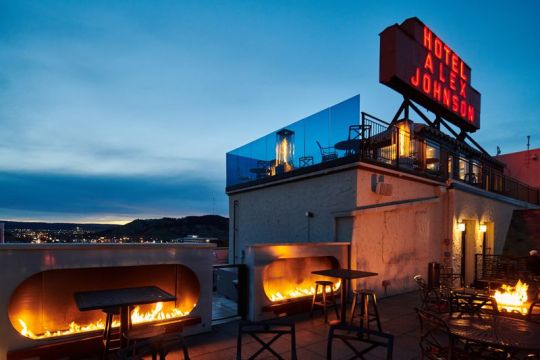
Hotel Alex Johnson / Facebook
The rooftop deck at Vertex Sky Bar in Rapid City
Wind Cave National Park, South Dakota
Western South Dakota is well known for iconic parks and monuments, like Badlands National Park and Mount Rushmore, but for those looking to eschew crowds, Wind Cave is a good choice for a day trip. Though the cave itself — a dense maze of jagged calcite formations, like needle-looking frostwork, and boxwork, a rare grid-shaped feature found in almost no other cave on Earth — is currently closed down, the park has many miles (and some 30,000 acres) of peaceful prairie hikes, rolling hills, and meadows strewn with wildflowers so vibrant they look like fields of confetti. Keep your eyes peeled for a chance to spot bison, prairie dogs, elk, and the rare black-footed ferret.
Where to Eat: As the urban hub of western South Dakota, Rapid City’s got an impressive food scene despite its small size and population. An hour’s drive from Wind Cave, head to the bi-level Vertex Sky Bar atop the historic Hotel Alex Johnson to drink in the Black Hills views while drinking in the rosé, or dine at Kōl, which reopened for reservations-only dine-in service with tables spread six feet apart, for wood-fired pizzas, steaks, and roast chicken. In the morning, downtown’s Harriet & Oak cafe reduced seating and limited the amount of time customers can linger to two hours, which is still enough to enjoy a trendy latte and some oh-so-Instagrammable avocado toast. Curbside pickup and online ordering is also available.
Getty Images/iStockphoto
Lost Lake campsite at Voyageurs National Park
Voyageurs National Park, Minnesota
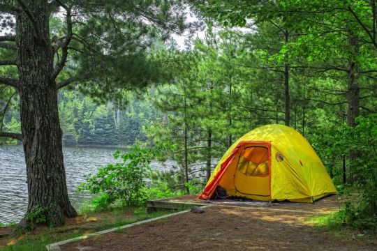
On the northern border of Minnesota lies Voyageurs National Park, a tranquil landscape of lakes and islands, where loons replace the din of city sirens. Up here, in the heart of the Land of 10,000 Lakes, it’s easy to maintain social distance for a few days, considering a third of the 250,000-acre park is, well, water, and most activities involve kayaks, canoes, and fishing.
Where to Eat: It doesn’t get more quintessential Minnesota Northwoods than the Rocky Ledge, a cabin-like restaurant on the tree-lined shores of Kabetogama Lake, with a penchant for Minnesota specialties like wild rice casserole. And in case you weren’t able to reel in your own catch on the lake, fear not: the restaurant offers fry-bread fish tacos and breaded walleye sandwiches to make up for it.

Matt Kirouac
The tap lineup at Superior Bathhouse
Hot Springs National Park, Arkansas
For travelers who prefer a more relaxed experience over, say, a backcountry trek, Arkansas’s historic Hot Springs is a tiny city park that’s ideal for an afternoon stopover. Anchored by ornate bathhouses utilizing the region’s famed thermal waters, the town is nicknamed “The American Spa,” and it’s been enticing visitors for more than a century. Bathhouse Row is the heart of the park, lined with steaming water fountains and palace-sized buildings with intricate Gilded Age architecture. While you may not be able to take a traditional bath quite yet, visitors can hike up the gentle slopes of Hot Springs Mountain, whose summit affords vista views of the bright-green Ouachita Mountain range, and then imbibe that spring water at the rare brewery located within a national park.
Where to Eat: Superior Bathhouse, located in one of the former bathhouses along Main Street’s Bathhouse Row, has reopened for limited counter service. Visitors are required to wear masks, unless they’re eating (beer cheese dip and sweet potato-beet sandwiches are excellent choices), or drinking one of the beers brewed on-site — e.g., hazy blood-orange I.P.A., honey-basil kolsch, oatmeal stout — made with Hot Springs’ thermal waters. To connect with the Southern soul of Hot Springs, head to Emma Lee’s, a warm and welcoming dining room wafting with aromas of buttery peach cobbler, beef roast, and fresh cornbread. The family-run restaurant is the dream of owner Courtney Sanders, who pays homage to his grandmother Emma Lee with her most beloved recipes. The restaurant is still offering curbside pickup along with limited dine-in service on Wednesdays, Thursdays, Saturdays, and Sundays. No matter what’s on deck for the day, be it thick slabs of smoky brisket and candied yams or mac and cheese served bubbling-hot under a golden-brown crust, this is the kind of restaurant that’s sure to warm hearts during a time when it’s needed most. Masks are required for entry, but customers can remove them while seated.
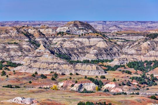
Getty Images
The rugged badlands of Theodore Roosevelt National Park
Theodore Roosevelt National Park, North Dakota
Badlands, petrified wood, roving bison, and wild horses make it clear what endeared President Theodore Roosevelt to this tranquil part of the country, where you’re more likely to encounter chirping prairie dogs on your hike than people. Split into two main north and south districts, each worth visiting for a day or two, the 70,000-acre park feels like the quintessential Wild West, with the Little Missouri River zig-zagging through fields of verdant grassland and eroded sandstone formations that look like super-sized sandcastles. Medora is the tiny home of the park’s popular south unit, but nearby Dickinson is a small city with an array of independent options.
Where to Eat: There’s really no better way to kickstart your day than with a blackberry pancake latte and a sticky caramel roll, and the Brew, a former church-turned-coffee shop, delivers on both fronts. Later, unwind with a sweet and spicy jalapeno honey beer and a Badlands pizza, made with pepperoni, Italian sausage, and ricotta, at Phat Fish Brewing. The brewpub is open for dine-in seating, with spaced-out indoor tables and a sprawling patio with a grassy lawn. It’s also offering take-and-bake pizza kits and bottled beers to go.
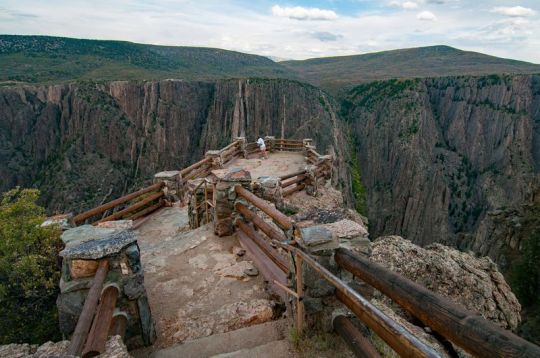
Getty Images/iStockphoto
An overlook at Black Canyon of the Gunnison National Park
Black Canyon of the Gunnison National Park, Colorado
With its blissfully warm temperatures, lush forests, and wildly diverse terrain, Colorado is popular for outdoorsy recreation, but rather than queueing up at crowded Rocky Mountain National Park, try the lesser-known Black Canyon of the Gunnison. The state’s least visited national park, Black Canyon is open for hiking along both the north and south rims, with trails that’ll get you unnervingly close to the breathtaking canyon and the raging river far below. Both sides of the canyon are worth visiting, so be sure to carve out at least two or three days to thoroughly explore. Since the only way to the north rim is driving all the way around the southern end of the canyon, it requires some added travel time. For fearless hikers, the park also has a few steep trails down to the canyon floor, which is a nice way to get out of the sun, since the canyon is so tall and narrow that it’s almost constantly shrouded in its own shadow. Nearby, the town of Montrose is the entry point to the park’s southern rim, which has the most trails and scenic viewpoints.
Where to Eat: It’s not often a speakeasy offering craft cocktails and charcuterie platters can be found on the outskirts of a national park, which is what makes Phelanies a special find. Accessed down an alley off one of Montrose’s main streets, the spacious lounge has gone alfresco for the first time, adding a patio and expanding its menus to include more food (like Korean barbecue pulled pork and duck wontons) and seasonal cocktails, like honeydew margaritas and the timely COVID Reviver No. 19, a Corpse Reviver riff with gin, orange liqueur, Lillet Blanc, lemon, and a CBD tincture. Guests are asked to wear masks any time they’re not seated, and limit movement around the bar except for necessities like bathroom runs.
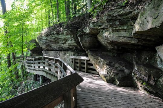
Getty Images/iStockphoto
The Brandywine Falls Trail at Cuyahoga Valley National Park
Cuyahoga Valley National Park, Ohio
Sandwiched between the nearby cities of Cleveland and Akron, hugging the crooked Cuyahoga River for some 30,000 acres, Cuyahoga Valley provides a literal breath of fresh air for Ohio city-dwellers seeking to escape the traffic for the day and replace it with dense green forests, babbling creeks, and 70-plus waterfalls. While popular sites like the Brandywine Falls boardwalk remain closed, there are still opportunities for hiking along miles of woodland trails, horseback riding, fishing, and kayaking.
Where to Eat: The park is a convenient day trip from larger cities in Ohio, making it ideal for safe travel, since visitors are able to minimize their footprint without having to stay overnight. If you’re traveling from Cleveland, start your day with a fried ring of purple-hued blueberry cake, bursting with juicy, tangy flavor, from the Vegan Doughnut Company. Located in suburban Lakewood, the Black-owned bakery from sisters Kharisma and Kyra Mayo exhibits a penchant for vibrant, whimsical pastries, like a birthday-cake doughnut strewn with multicolored sprinkles and crushed Golden Oreos, or a vanilla-glazed variety decorated with chocolate chips and dollops of cookie dough. For now, the shop is open weekends only for to-go doughnuts. Later, after you’ve chased a few waterfalls in the park, wood-fired pepperoni and banana-pepper pizza is an apt pick-me-up, and you can get your fix at Sarah’s Vineyard and Winery. Housed in a timber-clad barn that doubles as an art gallery, the lofty restaurant and tasting room has reopened for dine-in, spread out its ample patio seating, added hand sanitizer stations by the entrance, and shifted its menu to heartier crowd-pleasers like pulled pork sandwiches, nachos, and pizza. Sit outside for sweeping vineyard views and pair your spicy pie with a carafe of sweet Ohio-grown Vidal.
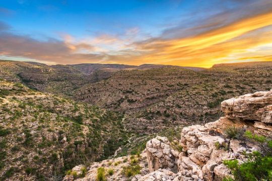
Getty Images/iStockphoto
Rattlesnake Canyon at Carlsbad Caverns National Park
Carlsbad Caverns National Park, New Mexico
The world-famous caverns — brimming with stalagmites, stalactites, and a colony of Brazilian free-tailed bats so populous that they look like clouds of swirling black smoke on their nightly flights — are still closed to visitors, but the underrated hiking trails on the surface are well worth the excursion, especially for a morning or late-afternoon hike (the sun gets pretty scorching midday). With nearly 50 miles of trails through the peaceful Chihuahuan Desert, from Rattlesnake Canyon to Guadalupe Ridge, there’s plenty to explore, and plenty of opportunity to break away from crowds and convene with cacti and roadrunners.
Where to Eat: In the nearby town of Carlsbad, Guadalupe Mountain Brewing Company reopened for dine-in service, with restricted hours and a patio. House-brewed beers run the gamut from a puckering grapefruit gose to creamy coconut porters, while the thin and crispy brick-oven pizzas are so popular they sell out regularly. They also offer gluten-free crusts, cauliflower-crust pizzas, and periodic specials like berry-studded dessert pizzas and New Mexican green chile pies.
A full-time RV traveler and freelance travel writer, Matt Kirouac is the co-founder and co-host of Hello Ranger, a national parks community blog, podcast, and forthcoming app.
from Eater - All https://ift.tt/38HIo58
https://ift.tt/2Zbjk3i
Paddleboarding in Minnesota’s Voyageurs National Park | Getty Images
America’s larger parks are attracting major crowds. Here’s where to avoid them
As summer creeps into full swing and cities across America do the dance of easing, and then reinstating, COVID-19 restrictions, people are clamoring to be someplace — anyplace — besides their own homes. While there is no form of travel that’s perfectly safe right now, there are certainly more responsible options than others for scratching the itch.
National parks, in all their wide-open space, are more befitting a socially distant vacation than, say, resort towns or theme parks. But even vast wilderness expanses have potential for riskier areas — visitor centers, for one, and popular trailheads near main parking areas. And then there are the mosh pit-like crowds at Yellowstone’s Old Faithful or the scenic drive at Zion National Park, which has been so popular since reopening that the park had to cap access at 6:30 a.m.
Now more than ever, then, this is the time to visit some of America’s lesser-known national parks. Steering clear of the millions of tourists at Yosemite, the Grand Canyon, and the Great Smoky Mountains, exploring new territory provides a sense of discovery, with the added benefit of having the trails mostly to yourself. The adventure doesn’t stop at park boundaries, either, as these less-famous parks are often surrounded by bucolic communities and smaller cities rich with their own charms, including destination-worthy restaurants, unexpected speakeasies, and a chicken-fried Texas saloon.
As enticing as all this sounds, it’s important that travelers tread carefully in and around all national parks, since these smaller gateway communities are not equipped to handle a potential outbreak brought in from visitors. It’s a double-edged sword for small businesses that rely on tourism dollars to survive, which is why it’s important to maintain the same caution on your road trip as you’ve maintained at home; just because you’re on vacation doesn’t mean you can put your face masks in storage. Wherever you are, social distancing and rigorous adherence to health mandates are of the utmost importance, in order to support these communities while keeping them safe.
So, with safety top of mind, here are some alternative parks to consider for your 2020 summer escape, and, of course, the best places to eat — to go, dine-in, or dine-out — nearby.
Getty Images/iStockphoto
The boardwalk at Congaree National Park
Congaree National Park, South Carolina
Judging by the fact that Congaree sees about 3 percent of the annual visitors of parks like Yellowstone and Rocky Mountain, it seems many people don’t even know this South Carolina park exists. Located in the middle of the state, the swamp-like terrain feels part Everglades and part Redwood, with the tallest trees east of the Mississippi and labyrinthine waterways ripe for paddling. The park’s most popular attractions, like the Boardwalk Trail, remain closed, but visitors are able to canoe or kayak on Cedar Creek, a narrow waterway that weaves through hardwood forest so tall and dense that it blocks out the sun, which is perhaps why hooting owls can be heard at all hours of the day. For easy hiking, out-of-the-way trails like the River Trail and Oakridge Trail are currently accessible. The park is within 20 miles of the state capital of Columbia, a small city with quality food and drink to be had.
Where to Eat: Before paddling through Congaree, it’s important to fuel up with a hearty breakfast, like tequila-spiked pancakes. Novelty breakfast is the bread and butter of the Black-owned 27 Pancakes food truck, which is operating on weekends only for the summer due to the pandemic. Chef-owner Joy Eggleston is a veritable Willy Wonka with pancake batter, offering classics (e.g., buttermilk, blueberry) alongside more whimsical and savory offerings, like a shrimp-and-grits pancake made with a grits batter, plump baby shrimp, and jalapenos, or the aforementioned tequila pancake, an almond-flour flapjack glazed with a blend of honey, maple syrup, and tequila reduction. Follow 27 Pancakes on social media to check its schedule.
Universal Images Group via Getty
The Starlight Theatre saloon in Terlingua, outside Big Bend
Big Bend National Park, Texas
About four and a half hours southeast of the closest major airport, in El Paso, this sprawling west Texas park has plenty of room (nearly 1 million acres, in fact) to spread out and explore, from Chisos Mountains hikes and soothing hot springs to the Santa Elena Canyon, a vast chasm offering shaded respite along the meandering Rio Grande. Due to its sheer size, geographic diversity, and faraway locale, this is the perfect park to immerse yourself in for a week, with plenty of sights and activities to keep you busy and enthralled. The surrounding communities are rich with character but low on crowds, like the dusty ghost town of Terlingua, which is emerging as a tranquil artist’s enclave, and the peaceful riverside town of Lajitas, where a goat serves as mayor.
Where to Eat and Drink: The star attraction in Terlingua is the Starlight Theatre, a lively contrast to a town filled with graves and derelict homes, both belonging to miners who succumbed to mercury poisoning or mining accidents in the early 1900s. The spacious saloon, known for its thoughtful riffs on gamey West Texas flavors, like chicken-fried wild boar strips with beer gravy and tequila-marinated quail in blueberry-balsamic sauce, is operating with dine-in and bar service at 50 percent capacity, and has added takeout as well as periodic live music performances.
Getty Images/EyeEm
The famous cliff dwellings in Mesa Verde national park
Mesa Verde National Park, Colorado
In lush southwest Colorado, Mesa Verde National Park is once again beckoning visitors itching to hike, drive along the Mesa Top Loop Road, and marvel at the park’s famed cliff dwellings, elaborate structures and communities built centuries ago by Puebloan peoples. At just over 50,000 acres, the park is the perfect weekend getaway, renowned for its mesa-skimming scenic drives and hiking trails that make you feel like you’re traipsing through the clouds, surrounded by panoramic views of the Colorado valley. The arty gateway town of Mancos is small, but surprisingly abundant with galleries, cafes, and restaurants, which have navigated new methods of operation.
Where to Eat: Absolute Bakery & Cafe is a beloved community hub for locals and tourists alike, who pregame before Mesa Verde with avocado omelets, chicken Florentine, Cubano sandwiches, and house-baked pastries like cherry strudel, pumpkin brownies, and coconut-walnut blondies. Since COVID-19, the cafe has extended its service to seven days a week (up from six) in order to serve breakfast and lunch to go, along with take-and-bake meals like pot pie, quiche, and lasagna perfect for cooking up in the RV. It’s also started nightly pizza dinners for takeout, made with sourdough crusts and rotating toppings like asparagus pesto, Hawaiian, and pepperoni. The cafe strongly encourages guests to wear masks, and it’s stocked with hand sanitizer stations.
Matt Kirouac
Kerouac’s restaurant in Great Basin National Park
Great Basin National Park, Nevada
Located along U.S. Route 50, a highway so desolate that its nickname is “The Loneliest Road in America,” and next to the tiny town of Baker, Great Basin National Park is the ultimate park for social distancing. Aside from the people you travel with, it’s unlikely you’ll encounter other humans here at all. This Great Basin region of eastern Nevada, sandwiched between the Sierra Nevadas and Wasatch Mountains, is a place of extremes — from the skyscraping tip of Wheeler Peak, the highest point in the park (and second highest in Nevada) at 13,065 feet, to the craggy passageways within Lehman Caves and the gnarly looking bristlecone pines, the oldest trees on Earth, some nearing 5,000 years of age. Best of all? With under 200,000 annual visitors and 77,000 acres worth of diverse terrain, you’ll find plenty of solitude among the epic environs.
Where to Eat: An homage to the ultimate road-tripper, Kerouac’s Restaurant is a seasonal restaurant open May through October at the Stargazer Inn in Baker. Due to COVID-19, the restaurant is only offering counter service this year, with food and drink available to go or for dining on the homespun front patio. The menu reads like a hit list of American comfort classics, sure to satisfy after a long drive or a long hike. Think pesto-mushroom pizzas, spicy chicken sandwiches, veggie burgers, oatmeal cranberry cookies, and even strawberry-rhubarb Moscow mules.
Getty Images/iStockphoto
Grassy rolling hills in Wild Cave National Park
Hotel Alex Johnson / Facebook
The rooftop deck at Vertex Sky Bar in Rapid City
Wind Cave National Park, South Dakota
Western South Dakota is well known for iconic parks and monuments, like Badlands National Park and Mount Rushmore, but for those looking to eschew crowds, Wind Cave is a good choice for a day trip. Though the cave itself — a dense maze of jagged calcite formations, like needle-looking frostwork, and boxwork, a rare grid-shaped feature found in almost no other cave on Earth — is currently closed down, the park has many miles (and some 30,000 acres) of peaceful prairie hikes, rolling hills, and meadows strewn with wildflowers so vibrant they look like fields of confetti. Keep your eyes peeled for a chance to spot bison, prairie dogs, elk, and the rare black-footed ferret.
Where to Eat: As the urban hub of western South Dakota, Rapid City’s got an impressive food scene despite its small size and population. An hour’s drive from Wind Cave, head to the bi-level Vertex Sky Bar atop the historic Hotel Alex Johnson to drink in the Black Hills views while drinking in the rosé, or dine at Kōl, which reopened for reservations-only dine-in service with tables spread six feet apart, for wood-fired pizzas, steaks, and roast chicken. In the morning, downtown’s Harriet & Oak cafe reduced seating and limited the amount of time customers can linger to two hours, which is still enough to enjoy a trendy latte and some oh-so-Instagrammable avocado toast. Curbside pickup and online ordering is also available.
Getty Images/iStockphoto
Lost Lake campsite at Voyageurs National Park
Voyageurs National Park, Minnesota
On the northern border of Minnesota lies Voyageurs National Park, a tranquil landscape of lakes and islands, where loons replace the din of city sirens. Up here, in the heart of the Land of 10,000 Lakes, it’s easy to maintain social distance for a few days, considering a third of the 250,000-acre park is, well, water, and most activities involve kayaks, canoes, and fishing.
Where to Eat: It doesn’t get more quintessential Minnesota Northwoods than the Rocky Ledge, a cabin-like restaurant on the tree-lined shores of Kabetogama Lake, with a penchant for Minnesota specialties like wild rice casserole. And in case you weren’t able to reel in your own catch on the lake, fear not: the restaurant offers fry-bread fish tacos and breaded walleye sandwiches to make up for it.
Matt Kirouac
The tap lineup at Superior Bathhouse
Hot Springs National Park, Arkansas
For travelers who prefer a more relaxed experience over, say, a backcountry trek, Arkansas’s historic Hot Springs is a tiny city park that’s ideal for an afternoon stopover. Anchored by ornate bathhouses utilizing the region’s famed thermal waters, the town is nicknamed “The American Spa,” and it’s been enticing visitors for more than a century. Bathhouse Row is the heart of the park, lined with steaming water fountains and palace-sized buildings with intricate Gilded Age architecture. While you may not be able to take a traditional bath quite yet, visitors can hike up the gentle slopes of Hot Springs Mountain, whose summit affords vista views of the bright-green Ouachita Mountain range, and then imbibe that spring water at the rare brewery located within a national park.
Where to Eat: Superior Bathhouse, located in one of the former bathhouses along Main Street’s Bathhouse Row, has reopened for limited counter service. Visitors are required to wear masks, unless they’re eating (beer cheese dip and sweet potato-beet sandwiches are excellent choices), or drinking one of the beers brewed on-site — e.g., hazy blood-orange I.P.A., honey-basil kolsch, oatmeal stout — made with Hot Springs’ thermal waters. To connect with the Southern soul of Hot Springs, head to Emma Lee’s, a warm and welcoming dining room wafting with aromas of buttery peach cobbler, beef roast, and fresh cornbread. The family-run restaurant is the dream of owner Courtney Sanders, who pays homage to his grandmother Emma Lee with her most beloved recipes. The restaurant is still offering curbside pickup along with limited dine-in service on Wednesdays, Thursdays, Saturdays, and Sundays. No matter what’s on deck for the day, be it thick slabs of smoky brisket and candied yams or mac and cheese served bubbling-hot under a golden-brown crust, this is the kind of restaurant that’s sure to warm hearts during a time when it’s needed most. Masks are required for entry, but customers can remove them while seated.
Getty Images
The rugged badlands of Theodore Roosevelt National Park
Theodore Roosevelt National Park, North Dakota
Badlands, petrified wood, roving bison, and wild horses make it clear what endeared President Theodore Roosevelt to this tranquil part of the country, where you’re more likely to encounter chirping prairie dogs on your hike than people. Split into two main north and south districts, each worth visiting for a day or two, the 70,000-acre park feels like the quintessential Wild West, with the Little Missouri River zig-zagging through fields of verdant grassland and eroded sandstone formations that look like super-sized sandcastles. Medora is the tiny home of the park’s popular south unit, but nearby Dickinson is a small city with an array of independent options.
Where to Eat: There’s really no better way to kickstart your day than with a blackberry pancake latte and a sticky caramel roll, and the Brew, a former church-turned-coffee shop, delivers on both fronts. Later, unwind with a sweet and spicy jalapeno honey beer and a Badlands pizza, made with pepperoni, Italian sausage, and ricotta, at Phat Fish Brewing. The brewpub is open for dine-in seating, with spaced-out indoor tables and a sprawling patio with a grassy lawn. It’s also offering take-and-bake pizza kits and bottled beers to go.
Getty Images/iStockphoto
An overlook at Black Canyon of the Gunnison National Park
Black Canyon of the Gunnison National Park, Colorado
With its blissfully warm temperatures, lush forests, and wildly diverse terrain, Colorado is popular for outdoorsy recreation, but rather than queueing up at crowded Rocky Mountain National Park, try the lesser-known Black Canyon of the Gunnison. The state’s least visited national park, Black Canyon is open for hiking along both the north and south rims, with trails that’ll get you unnervingly close to the breathtaking canyon and the raging river far below. Both sides of the canyon are worth visiting, so be sure to carve out at least two or three days to thoroughly explore. Since the only way to the north rim is driving all the way around the southern end of the canyon, it requires some added travel time. For fearless hikers, the park also has a few steep trails down to the canyon floor, which is a nice way to get out of the sun, since the canyon is so tall and narrow that it’s almost constantly shrouded in its own shadow. Nearby, the town of Montrose is the entry point to the park’s southern rim, which has the most trails and scenic viewpoints.
Where to Eat: It’s not often a speakeasy offering craft cocktails and charcuterie platters can be found on the outskirts of a national park, which is what makes Phelanies a special find. Accessed down an alley off one of Montrose’s main streets, the spacious lounge has gone alfresco for the first time, adding a patio and expanding its menus to include more food (like Korean barbecue pulled pork and duck wontons) and seasonal cocktails, like honeydew margaritas and the timely COVID Reviver No. 19, a Corpse Reviver riff with gin, orange liqueur, Lillet Blanc, lemon, and a CBD tincture. Guests are asked to wear masks any time they’re not seated, and limit movement around the bar except for necessities like bathroom runs.
Getty Images/iStockphoto
The Brandywine Falls Trail at Cuyahoga Valley National Park
Cuyahoga Valley National Park, Ohio
Sandwiched between the nearby cities of Cleveland and Akron, hugging the crooked Cuyahoga River for some 30,000 acres, Cuyahoga Valley provides a literal breath of fresh air for Ohio city-dwellers seeking to escape the traffic for the day and replace it with dense green forests, babbling creeks, and 70-plus waterfalls. While popular sites like the Brandywine Falls boardwalk remain closed, there are still opportunities for hiking along miles of woodland trails, horseback riding, fishing, and kayaking.
Where to Eat: The park is a convenient day trip from larger cities in Ohio, making it ideal for safe travel, since visitors are able to minimize their footprint without having to stay overnight. If you’re traveling from Cleveland, start your day with a fried ring of purple-hued blueberry cake, bursting with juicy, tangy flavor, from the Vegan Doughnut Company. Located in suburban Lakewood, the Black-owned bakery from sisters Kharisma and Kyra Mayo exhibits a penchant for vibrant, whimsical pastries, like a birthday-cake doughnut strewn with multicolored sprinkles and crushed Golden Oreos, or a vanilla-glazed variety decorated with chocolate chips and dollops of cookie dough. For now, the shop is open weekends only for to-go doughnuts. Later, after you’ve chased a few waterfalls in the park, wood-fired pepperoni and banana-pepper pizza is an apt pick-me-up, and you can get your fix at Sarah’s Vineyard and Winery. Housed in a timber-clad barn that doubles as an art gallery, the lofty restaurant and tasting room has reopened for dine-in, spread out its ample patio seating, added hand sanitizer stations by the entrance, and shifted its menu to heartier crowd-pleasers like pulled pork sandwiches, nachos, and pizza. Sit outside for sweeping vineyard views and pair your spicy pie with a carafe of sweet Ohio-grown Vidal.
Getty Images/iStockphoto
Rattlesnake Canyon at Carlsbad Caverns National Park
Carlsbad Caverns National Park, New Mexico
The world-famous caverns — brimming with stalagmites, stalactites, and a colony of Brazilian free-tailed bats so populous that they look like clouds of swirling black smoke on their nightly flights — are still closed to visitors, but the underrated hiking trails on the surface are well worth the excursion, especially for a morning or late-afternoon hike (the sun gets pretty scorching midday). With nearly 50 miles of trails through the peaceful Chihuahuan Desert, from Rattlesnake Canyon to Guadalupe Ridge, there’s plenty to explore, and plenty of opportunity to break away from crowds and convene with cacti and roadrunners.
Where to Eat: In the nearby town of Carlsbad, Guadalupe Mountain Brewing Company reopened for dine-in service, with restricted hours and a patio. House-brewed beers run the gamut from a puckering grapefruit gose to creamy coconut porters, while the thin and crispy brick-oven pizzas are so popular they sell out regularly. They also offer gluten-free crusts, cauliflower-crust pizzas, and periodic specials like berry-studded dessert pizzas and New Mexican green chile pies.
A full-time RV traveler and freelance travel writer, Matt Kirouac is the co-founder and co-host of Hello Ranger, a national parks community blog, podcast, and forthcoming app.
from Eater - All https://ift.tt/38HIo58
via Blogger https://ift.tt/2DnLPCm
0 notes
Text
NATURE AESTHETICS.
BOLD the natural aesthetics that appeal to or apply to your muse!
Repost, do not reblog. Feel free to add any natural features you see fit!
fluffy white nimbus clouds. dark grey cumulonimbus clouds. rain clouds. a hurricane. light spring breeze. a sherbet-colored sky at sunrise. hazy yellow skies. deep blue ponds of fresh water. blankets of sparkling snow. tornado winds. monsoon flooding. rich, orange sunsets. soft, purple clouds at dusk. heavy hail. the rumbling of thunder.
icy sleet. gentle snowfall. moss - dusted tree bark. pink sunset clouds. grey winter skies. navy blue skies in the daytime. cool mist in the morning. leaf - bare trees. giant ocean waves. the full moon. a cracked, dry desert. rolling hills of prairie grass. sweeping waves of briny seawater. rocky, steep ravines. rippling canyon walls. spindly, cave stalactites. creeping, green ivy. lush canopies of leafy trees. dense, white fog. a peaceful creek of clear water.
flowering cacti dusted with dew, catching light in the morning sun. a bubbling, hot pool of volcanic sulfur. sharp, grey mountainsides. fossils nestled in chunks of rock. a white sand beach. deep imprints of animal tracks in the dirt. soft, squishy moss. uniform rows of birch trees in winter. delicate mushrooms popping up in spring from beneath the decay on the forest floor. tumbleweeds jerking in the faintest wind across the desert landscape. light rain.
summer wildfires. a mixing of hot and cool air before a storm. silent lightning in the static of summer heat. a windy blizzard. thick flakes of snow tumbling down from the sky. a tree standing alone in a barren yellow field. a desert of loose sand and tall, orange dunes. a pure blue sky. a river of molten rock. a grove of flowering trees. twisting, mangled roots sticking up from the muddy ground.
bitter, cold winds. tumultuous skies of stormy clouds. branches of lightning ripping across the sky. a foggy swamp. the tree - bare foothills of a mountain range. sandy brown cliff sides.rocky coastlines. the violent shaking of an earthquake. the lights of the auroras borealis and australis.
a black sand beach. a lone tropical island in the reef of shallow, aqua waters.underwater volcanic vents. a herd of migrating mammals. tree branches growing heavy with ripe fruit.light streaming down through the clouds. a field of lush grain wading peacefully in the summer breeze. the sound of insects and frogs teeming in the night. natural diamonds nestled in coarse desert sands. a frozen lake. a thicket of thorny bushes. ruins overtaken by nature. a solar eclipse. lily pads on dark pond water. a field of wildflowers.
tagged by: @underthekillingmxxn
tagging: anyone who wants to do it
3 notes
·
View notes
Last Seen Blogs

a-bombshell
𝖘𝖆𝖓𝖉𝖗𝖆 ʚïɞ

typical-trope
What's My Prompt, Again?

lezkissgifs
lesbian kissing gifs and videos

sage-pyro
Slapbox Champion Of Miami-Dade 4 Years In A Row

zyronoidablog
Untitled