#cristoforo buondelmonti
Photo

Map of Constantinople in 1422 by Cristoforo Buondelmonti
by @vintagemapstore
125 notes
·
View notes
Photo
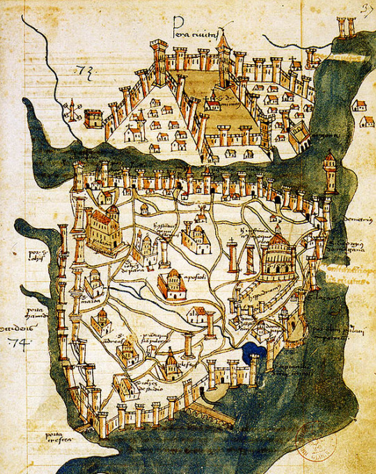
Constantinople: Cristoforo Buondelmonti, 1422.
49 notes
·
View notes
Photo
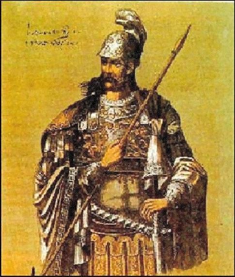
04 Works, Today, May 29th is Constantine XI Palaiologos’ day, his story in Paintings #149 Constantine XI Dragases Palaiologos, Latinized as Palaeologus (8 February 1405–29 May 1453) was the last reigning Byzantine emperor, ruling as a member of the Palaiologos dynasty from 1449 to his death in battle at the fall of Constantinople in 1453… Please follow link for full post
#Ancient#Art#Biography#Cristoforo Buondelmonti#Fine Art#footnotes#Gentile Bellini#History#mythology#Paintings#religion#Religious Art#Theophilos Hatzimihail#Zaidan
0 notes
Photo

Cristoforo Buondelmonti - Mappa di Costantinopoli, 1422
4 notes
·
View notes
Photo

Map of Constantinople (modern-day Istanbul), designed in 1422 by Florentine cartographer Cristoforo Buondelmonti.
#map#harita#constantinople#istanbul#1422#art#florentine#cartography#cristoforo buondelmonti#italian#history#tarih#byzantium
580 notes
·
View notes
Text

Map of Constantinople: A map of Constantinople, the capital and founding city of the Byzantine Empire, drawn in 1422 CE by Florentine cartographer Cristoforo Buondelmonti. This is the oldest surviving map of the city and the only one that predates the Turkish conquest of the city in 1453 CE.
166 notes
·
View notes
Text
La moschea sotterranea

Ad Istanbul c'è una incredibile moschea che è situata ad li sotto del livello stradale. Per questo motivo è stata soprannominata la "Moschea sotterranea", o "Yeraltı Camii" in turco.
Il soffitto è molto basso e lo spazio è buio, illuminato con poche lampade. Ci sono all’interno delle antiche tombe che ospitano dei martiri arabi illuminate da stridenti lampade fluorescenti verdi.
Si ritiene che qui sorgeva un forte bizantino, presente anche su una mappa di Cristoforo Buondelmonti (il luogo in questione é cerchiato).

Il forte era nominato “Kastellion ton Galatau” (Castello di Galata) ed é il luogo che conteneva presumibilmente l'enorme catena che proteggeva Costantinopoli dalle navi nemiche che volevano entrare nel Corno d'oro.
In epoca ottomana il sito fu utilizzato per lo stoccaggio di munizioni fino a quando, nel 1640, non vennero scoperti alcuni corpi che si ritennero fossero dei soldati che parteciparono al fallito assedio arabo di Costantinopoli nel VII secolo. Sarebbero i “compagni di Maometto”: Amr İbni As, Vehb Bin Hüşeyre e Süfyân Bin Uyeyne.


Lo spazio fu infine convertito in una moschea nel 1757. Dopo la moschea di Eyüp, è considerato tra i luoghi sacri islamici più visitati di Istanbul. Sono cinquantaquattro i pilastri all’interno. La luce del giorno arriva solo attraverso delle finestre aperte su una parete. Nei pomeriggi d’estate non é raro trovare all’interno delle persone che dormono.


La mia Vita a Istanbul: consigli e informazioni turistiche. Disponibile come GUIDA per delle ESCURSIONI in città. Scrivi una e-mail a: [email protected] Seguici anche su www.facebook.com/istanbulperitaliani
2 notes
·
View notes
Photo

Mappa di Costantinopoli
Map of Constantinople
Cristoforo Buondelmonti, 1422
2 notes
·
View notes
Photo

Cristoforo Buondelmonti’s map of Constantinople (1422) is the oldest map of the city and the only one to depict it during the pre-Ottoman period. The Ottomans took over the city in 1453.
240 notes
·
View notes
Photo

Constantinopla en 1422. Mapa del cartógrafo florentino Cristoforo Buondelmonti.
0 notes
Text
Guneslsmail
~1422 yılında Floransalı gezgin Cristoforo Buondelmonti tarafından çizilen, İstanbul’un basit ama güzel bir haritası. 30 yıl sonrasında ise şehir tamamen farklı bir hale bürünecek. 😉 https://t.co/4bf7Gbb6bS
0 notes
Link
0 notes
Photo

04 Works, Today, May 29th is Constantine XI Palaiologos' day, his story in Paintings #149
Please follow link for full post
Ancient, Art, biography, Cristoforo Buondelmonti, fine art, footnotes, Gentile Bellini, History, Mythology, Paintings, Religion, RELIGIOUS ART, Theophilos Hatzimihail, Zaidan,
https://365saints.blogspot.com/2020/05/04-works-today-may-29th-is-constantine.html
0 notes
Photo

Map of #Constantinople (modern-day #Istanbul), designed in 1422 by Florentine cartographer Cristoforo Buondelmonti… …
0 notes
Last Seen Blogs

evansmith2910-blog
Untitled

minimaewibblywobbly221b
Vavoom

brianmaryansky-blog
Brian Maryansky Photography

truuuu1245
772

artech-bd
Untitled