#east bluff trail
Video
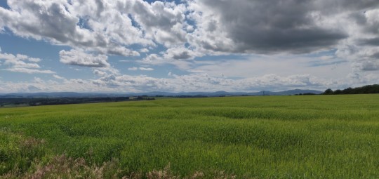
Stairway of shadow and light by Stephen Gifford
0 notes
Text
Iridescent: Chapter 18
A/N: So sorry! I think this is the longest I have gone between updates for this fic! But I did post a bonus one-shot about Optimus and Bumblebee in this series if you're interested in checking that out! And from now on we should be back to our regularly scheduled updates! Xxxxxxx
Ao3
FF.net
"What are your opinions on Uraya?"
"That it was a shit hole even before the war." Jazz replied.
With the Decepticons now clearly aware of the locations of both the Ark and their MacCadam's base, Optimus had understandably decided that the Autobots needed to find a safer place to call home.
Which was why Jazz was currently sitting opposite Prowl in the Head Tactician's office, a holomap of Cybertron projected on the desk between them with most of the cities being covered with big red crosses.
They had been debating over locations for so long that Jazz had nearly finished his army of tiny replicas of high command out of scraps of metal.
Thankfully as long as Jazz stayed on topic and didn't wreck his office, then Prowl put up with it.
"Polyhex?" Prowl suggested.
Jazz snorted as he twisted the top of Scrap-Prowl's head into its signature chevron points.
"As much as my old home town will always hold a special space in my spark, it was a city state through and through. Even in ruins there ain't enough space to park the Ark."
Jazz may have been omitting certain details about why he personally didn't want to go back to the place he had once run away from, but that didn't mean that his words weren't true.
For similar reasons, he wasn't even going to entertain the idea of suggesting Praxus to the former Praxian enforcer.
"Whattdya think about Iacon?" Jazz asked, changing the topic.
"It is well fortified and has the most remaining structures of any city left on the planet. However, as the previous capital for the Autobots, I fear it would be too obvious a location."
"The Deceptions could think it's a double bluff?" Jazz suggested, putting his feet up on Prowl's desk.
Prowl promptly batted them away.
"I will not be risking the safety of our faction on a bluff."
"Fair enough." Jazz shrugged, adding his now completed Scrap-Prowl to the line of sculptures standing to attention on Prowl's desk. "What about Kalis? The Ark should fit inside the arena."
Polyhex might've been known for its music, but Kallis was the real entertainment centre of the planet, home to the largest stadium on Cybertron which held the World Cube Championship every year. One of the few wonders of the world left standing.
"It would provide some protection." Prowl considered. "Unfortunately the construction was designed with quantity of seats of quality of fortification in mind. It would not be a suitable long term base. However-"
Jazz watched as Prowl zoomed in on Kallis.
"- Kalis' docks would easily provide enough space to hoke the Ark, with the remains if the city providing cover to the East whilst the Rust Sea would provide natural protection from the West."
"Looks like we've got a winner." Jazz grinned, glad that they had finally found themselves some new digs.
As Prowl started arguing that he still needed to run a few thousand simulations before he could confirm that Kalis' Docks really were their best choice, Jazz checked the time on his wrist screen. It was late, most bots would be in recharge by now and Red Alert's shift had finally finished meaning that there was a next to zero chance of random room inspections.
Absent-mindedly nodding along to Prowl’s points, Jazz stood up out of the chair. He then slowly made his way around to Prowl’s side of the desk, trailing his hand under the rim as he did so, thankfully finding no listening devices.
Jazz folded his arms and leaned against the edge of the desk, careful not to jostle any of his sculptures To any observing eye he would appear the picture of casualties.
He looked down at Prowl's face, a chiselled picture of focus which he could never capture the beauty of in a piece of scrap. As someone with an often erratic attention span, even when he once hated the guy's spark, Jazz had always admired Prowl's ability to put his entire being into focusing to complete a task.
Jazz hated to ruin such a sight but he needed to get what he was about to say off his chest.
"Hey mech, I got something to tell ya." Jazz said, his tone as casual as if he was asking the weather.
"Then say it." Prowl said, those piercing blue eyes giving him his full attention.
Jazz took a deep breathe. There would be no taking this back once it was out in the open.
"I think we've got a spy."
Jazz watched in trepidation whilst Prowl considered the bombshell for a moment. Then in the next that familiar calculating blank look vanished as the bot nodded.
"Yes, my calculations have come to the same conclusion."
Jazz let out a vent he didn't realise he'd been holding. Although with a brain as big as Prowl's he should have known that the tactician would already have had similar thoughts.
"Have you told anyone else of your suspicions?" Prowl asked.
Jazz shook his head.
"I ain't got enough proof to go to Optimus or Red Alert yet."
"Then why are you telling me?" Prowl asked, once again those brilliant blue eyes giving him his full attention.
"Because I trust you."
Prowl blinked, his optics flickering as they ran yet another set of calculations. This time they didn't appear to have come to any conclusions. At least one that they didn't share with Jazz. And well Jazz was a spy after all so he wasn't going to hold keeping secrets against the tactician.
"Do you have any suspects?" Prowl said eventually.
Jazz shrugged.
"All I can tell is that they know the current location of the Ark, which so far narrows to down to everybody on base."
"What about the circumstances of apparent self destruction of Head of Communications at the MacCadam's base?"
"I don't know Elita's crew well enough the narrow down anyone specific. And most of them know our location too so that doesn't help much either."
At this late, or rather early hour, the darkness of the room pretty easily captured the downer mood.
However, even in the dim light of the projection, Jazz could see the dark purple undersides of Prowl's optics that marred his usually handsome face.
"Well, looks like its time to hit the sack." Jazz said with an exaggerated yawn.
"I'll just finish-"
"Oh no," Jazz protested. "We need your big brain firing on all cylinders tomorrow if we want to convince Optimus that Kalis is our best bet. Besides-"
Jazz leaned over the tactician, their helms so close that he could see the reflection of his grin in those bright blue eyes.
"Even if you worked all through the night, you would to need my persuasive pizzaz to win him over."
For a long time, Prowl refused to speak, which meant that he refused to admit that his calculations had shown Jazz to be correct.
"Fine." Prowl conceded through gritted denta. "As long as we can work on this first thing tomorrow."
Jazz gave him a cheeky salute.
"Yessir!"
#jazzprowl#transformers#prowljazz#jazz#prowl#transformers jazz#transformers prowl#jazz x prowl#red alert#optimus prime#transformers fanfiction
10 notes
·
View notes
Text

I really wish I could have gone to the north-east and Hawaii before I got sick. But I never got the chance. Even if I can visit somehow, I'd be in my wheelchair with a stamina of less than one, which sucks. This illness sucks, but at least I have some stories of adventures from before I got ill. (That's the line in my life. The Before I Got Sick and After I Got SIck.)
No, I have no idea how I skipped Oregon, South Carolina, and Oklahoma. At least northeast made sense since it's a region, the other three who knows. (I took the train a lot Before I Got Sick but I also drove a lot or drove with others who drove a lot).
Before I Got Sick, I worked in California, Texas, Lousiana, Mississippi, Alabama, Wyoming, and Iowa. The only reason I worked in the south was due to AmeriCorps*NCCC who stationed my team there to clean up after a nasty hurricane ripped the region apart.
Mississippi is where I almost drowned, but a bird diving in front of my face saved my life. I grabbed it, and the bird showed me which way was up in that murky-ass water. I can't swim well, but birds can swim. Bird was very unhappy about the whole me grabbing them. I got my hand pecked at pretty good, but at least I survived! My teammates rescued me when I burst free from the water and unleashed the bird from my hand.
That story is one of the many reasons why my nickname is Bird. The moral of this story is Beware Of Rip Tides and Don't Wade Too Deep If You Can't Swim Well.
There's also the time I fell off a 500 foot bluff in Wisconsin, landed in a tiny-ass tree, and clung to it like a Bird for five hours in 25 degree Fahrenheit weather with no coat. Because I was a smart teenager, you know. How I got up there and why I fell is not important.
The moral of this story is Do Not Climb Sandstone Bluffs. Sandstone is very brittle and will easy crack and break with any amount of pressure.
Also, I'm majorly sad that I missed the helicopter rescue of the Bluff incident. My younger sister swears it happened, but I guess I was too high on hypothermia to really register a fucking helicopter above my head. I guess it makes sense in retrospect since why else would the firefighter be hanging from a rope next to my little tree? All I could think about at the time is how kind the person was to give me the firefighter's coat, so I could be warm again and pretend I'm a firefighter.
Since this also happened in the middle of nowhereland Wisconsin, emergency teams used my rescue as practice. So I got strapped down to stretcher, unstrapped, and strapped again by each trainee/person needing practice. I think this happened after they confirmed no major injuries, but honestly who knows. I was tripped out hypothermic/dissociating at the time.
Moral of that story is Wear A Coat In Cold Weather, Especially Below Freezing Weather.
I got lost in Wyoming with some of my Polish friends once. I had been taking pictures of the scenery behind us with my flipphone (gosh were those photos poor quality but I had no other phone at the time). This was our first misadventure too. Well, we ended up lost, way south of where we hoped to go, and ran out of water. I had one water treatment tablet, so we used that for the water from streams. We also had a bag of peanuts for some reason.
I realized I'd been taking pictures behind us, mostly because I liked to see how far we'd gone. Made me feel like we made progress. So I matched the landscape to the photo, and we backtracked to the start of the trail that way. This is why I only take photos of where I've been when I hike (or used to hike).
Moral of that story is Read The Map More Often and Bring More Water Treatment Tablets.
The second misadventure in Wyoming with my Polish friends involved the Turquoise Lake expedition. We made it to the lake by correctly reading maps. That lake was gorgeous as fuck. However, we started at six in the morning, failed to keep track of time, and got to the lake at five pm in afternoon. Which meant half our journey back to civilization was done in the dark. With very little ways to verify landmarks.
We also had to hide from a moose who walked onto our trail and started munching berries. Moose are brutal and will rip you apart (even tear into cars! Like when I hung out with the Mormons, whose jeep got chased by a bull moose for three miles! I thought we were done for, but that little jeep somehow escaped).
Moral of that story is Either Plan For An Overnight Complete With Supplies or Turn Back To Avoid Getting Caught Walking In Darkness In A Mountainous Forest. Oh, the Mormon Jeep story's moral is Do Not Piss Off Moose.
I have other ridiculous stories from the times Before I Got Sick. My illness destroyed my ability to hike or do much exercise, so my stamina is shit now. Now all I have is stories. Let me know if you wanna hear more.
Maybe it's a good thing I'm relegated to a wheelchair now. I can't get into ridiculous fixes with a wheelchair...
... or can I?
#i don't know what this is#I wrote this because I don't feel well and felt like it i guess#I was actually looking for a different picture but then saw I did that 'visited states' quiz so did that instead#but if I'm gonna do that pic then I gotta share some of the stories#Bird's Tales of the Void#Or Those Times I was an Anime Character#Or Before I got Sick
6 notes
·
View notes
Text
WIP Wednesday 5.24.23

Hi, tumblrs! It’s still Wednesday where I am, and I have two WIPs to share. It’s two new ideas that somehow cut the line and demanded I write something out.
One was supposed to be my submission for #WorldWhiskeyDay, although it may be better suited for Halloween; not Fingers … I had the idea, but no cohesive thoughts have made an appearance yet. Although knowing me, this will probably post Halloween 2024.
The other is yet another take on the Applewood scandal. This is what, my third or fourth one?
And just to put us all on the same page and keep my brain on track, top priorities during writing time over the holiday weekend are: NYC AU, Waiting Room, and these two stories. The MC lunch ask is still floating around in my head as well and thoughts on a companion piece to Cocktail.
Anyways, excerpts are below the cut. As usual, everything is in a rough draft and final, published version may differ. Hope you like it!
Middle of Nowhere (tentative tile)
Song Inspo: Death Letter, Johnny Farmer, Organized Noize
The house sits on a bluff in the middle of nowhere overlooking a large, lazy river, as it has for the past century and a half. It’s almost picturesque, gleaming white clapboard covered with blue sky and bathed in early spring sunlight. Freshly mown grass is interspersed with wildflowers; pussy willows surround the bases of moss-covered trees.
The house has no postal address; it sits on Highway 62 East at Marker 129, in the unincorporated hamlet of Tannerton, equidistant between two bigger towns; not larger … bigger. Fifteen miles to the east is Potter’s Farm where residents and visitors enjoy the movie theater, gourmet Chinese food, a public library, and shopping at big box stores. Fifteen miles to the west is Easton, home to blue collar businesses, public parks and a hiking trail, and long stretches of road filled with fast-food chains, pizzerias, an ice-cream parlor, and a combination barber shop/hair salon.
The house sits empty as it has for the past five years; rumor, legend, and lore say the domicile is haunted, the land it sits on the site of brutal and unnecessary massacres. History tells of previous occupants who met grisly ends, or simply vanished as if the house’s walls and floorboards had swallowed them alive. There is no way to separate fact from fiction. Tannerton’s population is zero; the once-bustling waterway town is no more, save for the house.
Any eyewitnesses to the horrors of the house are the disappeared.
Except for two.
The realtor stands on the front of the house’s wraparound porch, her blue eyes taking in the slow-rolling waves of the Acheron River. In Greek mythology, the River of Acheron was known as the River of Woe and was one of five rivers that led to Hell. As far as the woman knew, no one in this godforsaken corner of the world is aware of that interesting tidbit.
But she is. Her husband is, as he should. He named the river.
She is adjusting the long sleeves of her beige linen dress when her husband joins her on the veranda.
“Is everything ready?” she asks as she turns to face him. The realtor is an older woman, but her face gives no indication of that. Her skin is smooth and unlined even devoid of cosmetics, her sapphire-blue eyes clear and alert, her mouth a cupid’s bow with pale-pink tinted lips.
Her glossy brown hair is still long and wavy, but silver liberally threads her tresses. Her hands are liver-spotted and knotty with veins; her fingers are gnarled, the brittle nails yellowed with age. She tells anyone foolish enough to ask she suffers from arthritis.
“Is everything ready?” she asks, her tone distant as if her thoughts are otherwise occupied.
The man nods stiffly. He is tall and trim; like his wife, his appearance is youthful despite his graying hair. Unlike his wife, his hands and fingers were neither aged nor disfigured.
“It is. They’ll be arriving soon, it may be best to set out the refreshments.”
She nods absently as she scans the front yard. The setting is charming, inviting. A frisson of excited energy courses through her body at the thought of selling the house. There’s a buyer; a younger couple looking to escape the three C’s of a growing city: crime, clubs, congestion. Today is the final walkthrough. The house has sat empty too long; the whiskey untouched even longer.
Annabelle Beaumont walks around her husband to pull the screen door open. “Come, Barthelemy; we have to make sure the Walkers feel right at home when they arrive.”
Come on, come on, come on home
Scandal
Song Inspo: Delusional World Champion, Jean Dawson
Tariq Keriakos stared in puzzlement between his room door and Bastien Lykel, who stood in front of it barring the minor noble’s entry.
“There was a flood?” Tariq repeated stupidly.
The head of the King’s Guard nodded affirmatively. “A pipe burst while the hunt was going on. None of your belongings were harmed; maintenance noticed it almost immediately, but at the moment your quarters are without water.”
“Just my room?”
“Yes, m’Lord. The damage was contained in a timely manner, but we are awaiting parts to arrive. To avoid further inconvenience, another room has been secured for you. It’s Room 4 South.”
“South wing? Isn’t that where the suitors are housed?” Tariq questioned while Bastien pressed a key into his palm.
The sentry was briefly taken aback; the housing arrangement for the visitors at Applewood wasn’t a secret per se, but it wasn’t common knowledge. Bastien quickly recovered.
“It is; given that this is the last night, and all rooms have private baths, I do not foresee an issue.”
Tariq exhaled a long breath. The time at Applewood had been exhausting, this day more than usual. Between Lady Penelope passing him letters from Lady Riley, the horse ride to and from the Ruins, and now his room unavailable to him, Tariq was pretty much done.
“Fine. But my clothing? My toiletries?”
“Already moved and set up in your new quarters,” Bastien assured him.
With a resigned nod, Tariq made his way from the east wing, thinking only of a hot shower and a long sleep.
In the south wing, Riley Brooks, the suitor from America, sat at the vanity in her room re-thinking and possibly regretting every life choice that led to her being in Cordonia.
Tagging: @jared2612 @ao719 @marietrinmimi @queenjilian @indiacater @kingliam2019 @bebepac @liamxs-world @mom2000aggie @liamrhysstalker2020 @twinkleallnight @umccall71 @superharriet @busywoman @gabesmommie1130 @tessa-liam @beezm @gardeningourmet @lovingchoices14 @mainstreetreader @angelasscribbles @lady-calypso @emkay512 @princessleac1 @charlotteg234 @alj4890 @yourfavaquarius111 @motorcitymademadame @queenmiarys @walkerdrakewalker @choicesficwriterscreations
#dcbbw writes#even more wips#trr/trh au fanfiction#writer on tumblr#one day I will finish all the wips#then what will I do
18 notes
·
View notes
Text
Illinois

Illinois, a state located in the Midwestern region of the United States, is known for its diverse landscapes, rich history, and vibrant culture. It is the sixth most populous state in the US, with Chicago as its largest city and Springfield as the state capital. Illinois is bordered by Wisconsin to the north, Indiana to the east, Kentucky to the southeast, Missouri to the west, and Iowa to the northwest.
The state of Illinois covers a total area of 57,915 square miles and has a varied terrain, including vast farmlands, dense forests, rolling hills, rugged bluffs, and pristine lakes. The state's economy is heavily based on manufacturing, agriculture, and services, with major industries including financial services, healthcare, transportation equipment, and food processing.
Illinois has a rich history and heritage that dates back to ancient times. The region was inhabited by various indigenous tribes, including the Cahokia, Potawatomi, and Illiniwek, before the arrival of European explorers and settlers in the 1600s. The French established the first settlement in Illinois, and it later became part of the United States in 1818.
The state has a diverse population of around 12.7 million people, with a rich cultural tapestry of ethnicities, religions, and languages. English is the most widely spoken language in Illinois, followed by Spanish and other languages spoken by immigrants. The predominant religions in the state are Christianity, Judaism, and Islam.
Illinois is also home to many stunning natural attractions, such as the Shawnee National Forest, Starved Rock State Park, and the Lincoln Trail State Park. The state also boasts a rich cultural heritage, with world-class museums, art galleries, and music venues. Illinois is famous for being the birthplace of many notable public figures, including Abraham Lincoln, Ronald Reagan, Ernest Hemingway, and Oprah Winfrey.
If you visit Illinois, you will experience the warmth and hospitality of the locals, enjoy the natural beauty and stunning vistas of the state's countryside, and immerse yourself in the rich cultural heritage and diversity that the state has to offer. Whether you are a nature lover, a history buff, or a foodie, Illinois has something for everyone.

Etymology
The name 'Illinois' comes from the French rendering of the Algonquian language word for the Illinois Confederation, 'ilinwek' or 'illiniwek.' This name refers to a group of Native American tribes who lived in the region even before the arrival of European explorers. The meaning of 'ilinwek' is disputed, but it is commonly translated as 'tribe of superior men,' 'men of men,' or 'best people.'
The Illinois Confederation was a loose alliance of several tribes, including the Cahokia, Kaskaskia, Peoria, and Tamaroa, among others. They inhabited the region around the Mississippi River, extending from present-day Illinois to parts of Wisconsin and Missouri.
The name 'Illinois' was officially adopted as the state's name when it achieved statehood in 1818. It was chosen by the state's first governor, Shadrach Bond, who sought to honor the Native American tribes who had long inhabited the land.
History
Illinois has a rich and diverse history, dating back to precolonial times. Before European settlers arrived, the area was home to indigenous peoples, including the Illini, Miami, and Potawatomi tribes.
In the years that followed, Illinois played a key role in the French and Indian War and the American Revolution. The state became part of the Northwest Territory in 1787 and was officially recognized as a state in 1818.
Throughout the 19th century, Illinois grew rapidly, becoming a major hub for transportation and industrial development. The state was also notable for its involvement in the Underground Railroad, helping slaves escape to freedom in the north.
In the early 20th century, Illinois was a key player in the labor movement, with major strikes and protests taking place in Chicago and other urban centers. The state also played a significant role in both World Wars, supplying troops and resources for the war effort.
In the years that followed, Illinois continued to grow and evolve, with major advancements in industry and technology. The state was also marked by several notable political scandals, including the impeachment and removal of Governor Rod Blagojevich in 2009.
Today, Illinois is a vibrant and diverse state, with a rich cultural heritage and thriving economy. Its history is woven throughout the fabric of the state, from its urban centers to its rural communities.
Geology
Illinois has a diverse geological landscape with various regions that all have their unique formations. One of the most notable geological features in Illinois is the Ozark Dome, a subterranean formation characterized by underground mines of lead, zinc, and other minerals. In contrast to this, the northwest and north-central region have mostly glacial formations such as drumlins, eskers, and moraines, created by the last ice age.
The state has a rich history of coal mining that has left behind abandoned underground mines throughout the central part of the state. These coal deposits are from the Pennsylvanian period and are believed to have been formed about 300 million years ago. The coal-rich areas in Illinois are where the land is flat and the soil is fertile.
Illinois has also been known to produce natural gas and petroleum, which has played a significant role in the industrialization and economic growth of the state. The reserves of natural gas and petroleum are found primarily in southern Illinois, in the Illinois Basin.
The state has an extensive system of rivers and lakes, including the Mississippi, Illinois, Ohio, and Wabash rivers, that have played a significant role in shaping the geological makeup of Illinois. The contributions of these rivers and lakes have been significant in creating the rich farmland that exists in the state, aside from providing transportation for goods and services.
the state of Illinois has a diverse geological landscape that ranges from underground mines that are rich in minerals to the flatlands that are suitable for farming. The state's history has been shaped by the natural resources found within its borders, with coal, natural gas, and petroleum being significant contributors to Illinois's industrialization. The region's numerous rivers and lakes have also had a remarkable impact on shaping the landscape and creating the fertile soil necessary for farming.
Geography
Illinois is a heavily populated state located in the Midwest of the United States. It is surrounded by Indiana to the east, Missouri to the west, Wisconsin to the north, and Kentucky to the south. The state is divided into three distinct regions: the Central Plains, Shawnee Hills, and the Illinois Ozarks. The Central Plains region consists of gently rolling hills and vast prairies with fertile soil, while the Shawnee Hills region is characterized by hills, bluffs, and forests. The Illinois Ozarks region, on the other hand, consists of rugged hills, ridges, and deep ravines.
Illinois also houses several water bodies, including the Mississippi River, the Ohio River, and the Wabash River. The state also has many lakes, including Lake Michigan, which is the fifth-largest freshwater lake in the world by volume. The Chicago River also meanders through downtown Chicago to create an impressive sightseeing opportunity.
The land use in Illinois is predominantly agricultural, with over 75% of the land used for farming purposes. The state is one of the largest producers of corn and soybeans in the United States. In addition to agriculture, the state is also known for its manufacturing and industrial capabilities. The major industrial centers in the state include Joliet, Rockford, Peoria, and Bloomington-Normal.
Over the years, there has been a significant increase in urbanization and suburbanization in Illinois, primarily near Chicago, which is the largest city in the state. The state ranks fifth in the country in terms of urbanization, with over 87% of the population residing in urban areas.
The state has an extensive transportation infrastructure network, including roads, highways, railways, and airports. The Illinois Tollway system covers over 292 miles of roadway to connect the major cities and metropolitan areas in the state. The Chicago O’Hare International Airport is the busiest airport in Illinois and one of the busiest in the United States. It serves over 83 million passengers every year.
Illinois is also home to several protected areas and parks, including the Shawnee National Forest, the Illinois Beach State Park, the Starved Rock State Park, and the Lincoln Park Zoo. These parks offer visitors a glimpse of the state's natural beauty and biodiversity and are popular destinations for hiking, camping, and wildlife watching.
the physical geography of Illinois is an interesting mix of rolling hills, deep ravines, forests, and water bodies. The state's land use is predominantly agricultural, with a growing urbanization trend near major cities. It has an extensive transportation network and offers numerous recreational and entertainment options for tourists. Illinois is indeed one of the most geographically diverse and culturally rich states in the United States.
Ecology
Illinois is a state filled with diverse ecology, with several major biomes present within its borders. Forests, grasslands, wetlands, rivers, lakes, and streams are all habitats for a wide variety of plants and animals. About 25% of the state remains forested, with the majority of it located in the southern part of the state.
The state's wetlands play a crucial role in regulating water levels, filtering pollutants, and providing habitat and food for many species. Sadly, many of these biomes have been severely impacted by human activities such as development and farming.
The Illinois Department of Natural Resources (IDNR) works tirelessly to preserve and maintain these natural areas. They have established numerous state parks, nature preserves, and wildlife refuges to protect habitats and support wildlife populations. the state has several programs to provide financial and technical support to landowners who wish to participate in conservation efforts.
One of the most significant conservation challenges in Illinois is combating invasive species that threaten many of the state's native ecosystems. The state has established protocols to identify and remove these species, including the use of prescribed burns, herbicides, and other methods.
The state is also working to address water quality concerns, particularly in the Illinois River. Agricultural runoff, sewage treatment discharge, and other pollutants have had a damaging effect on the river's ecology. The state is implementing a variety of measures to improve the water quality, including guidelines for agricultural practices, new wastewater treatment facilities, and river restoration projects.
The state also recognizes the importance of protecting its endangered and threatened species. The Illinois Endangered Species Protection Board is responsible for developing and implementing plans to conserve and recover species on the brink of extinction in the state. Several species, such as the gray wolf, black bear, and mountain lion, have been eliminated from the state and are being considered for reintroduction.
the state encourages residents and visitors to participate in conservation efforts and education programs. These programs provide opportunities for people to learn about the state's ecology, wildlife, and natural resources and how they can help protect them.
Biodiversity
Illinois boasts a diverse array of flora and fauna, with both native and introduced species inhabiting the state. Several types of forests, including oak-hickory and beech-maple, cover much of the state. The Illinois River, Lake Michigan, and other waterways are home to several species of fish, turtles, and amphibians.
Moreover, Illinois' native plant life provides an important habitat for a variety of animals. Wildflowers such as purple coneflowers and wild lupine are often found on the state's prairies, providing food and shelter for animals ranging from bison to butterflies. Threatened or endangered species such as the Illinois mud turtle and Hine's emerald dragonfly call the state home, requiring conservation efforts to protect their habitats.
In addition to the native species, Illinois has seen an influx of non-native species. Some species have been deliberately introduced due to their perceived benefits, while others have arrived unintentionally through human activities such as shipping and travel. However, non-native species can have negative impacts on the environment and native species, often outcompeting and marginalizing them. As a result, Illinois has regulations in place to prevent the introduction and spread of non-native species.
Protecting Illinois' biodiversity is necessary to maintain the state's ecological health and promote its economic wellbeing. The state has established several programs to address conservation and restoration efforts, such as the Illinois Wildlife Action Plan and the Illinois Nature Preserves Commission. the state has regulations in place to protect threatened and endangered species and their habitats, as well as to prevent the introduction of non-native species that may threaten the native ecosystems.
Furthermore, Illinois residents also play a critical role in the protection of the state's biodiversity. For example, homeowners can plant native species in their yards to provide habitat and food for local wildlife and can take steps to reduce their carbon footprint, aiding in the fight against climate change. Conservation organizations and volunteer groups also provide opportunities for citizens to get involved in restoration and conservation efforts across the state.
Illinois' biodiversity is essential to its ecological and economic health. The state's rich natural resources provide habitat for a diverse array of native species, as well as several non-native species. However, conservation efforts are necessary to protect these resources and prevent the spread of non-native species. Through both governmental and individual actions, Illinois can continue to promote its ecological wellbeing while supporting its social and economic interests.

turtles
Climate
Illinois has a diverse climate due to its location in the central United States, bordering the Great Lakes region and stretching south to the Mississippi River. The state experiences all four seasons, with hot summers and cold winters.
In the northern part of the state, the climate is considered humid continental, characterized by warm summers and cold winters with heavy snowfall. Average temperatures in January, the coldest month, range from 24°F to 30°F (-4°C to -1°C), while July, the warmest month, sees averages from 64°F to 82°F (18°C to 28°C).
In central Illinois, the climate is also humid continental, but with warmer temperatures throughout the year. Summers are hot and humid with occasional thunderstorms, while winters are milder with less snowfall. Average temperatures in January range from 25°F to 33°F (-4°C to 0°C), while July sees averages from 65°F to 85°F (18°C to 29°C).
Southern Illinois is located within the humid subtropical climate zone, characterized by hot summers and mild winters with occasional snowfall. Average temperatures in January range from 32°F to 40°F (0°C to 4°C), while July averages range from 69°F to 89°F (21°C to 32°C).
Illinois sees its fair share of severe weather, including thunderstorms, tornadoes, and even blizzards in the winter. The state averages about 35 to 45 thunderstorm days per year, with potential for damaging winds, hail, and tornadoes. The peak tornado season is from March to June, with an average of 47 tornadoes per year.
Due to its location near the Great Lakes and Mississippi River, Illinois also experiences lake-effect snow and flooding. In the winter, cold air over the Great Lakes travels south, picking up moisture and dumping heavy snow on coastal areas. In the spring, heavy rains can cause flash flooding, especially in the central and southern parts of the state.
Illinois' climate varies depending on location, but the state experiences all four seasons with mild to hot summers and cold to mild winters. Visitors should always check the weather forecast and be prepared for any potential severe weather events.
Environmental issues
Illinois is faced with numerous environmental challenges and concerns. One of the major concerns is the issue of pollution, both air, and water pollution. There are multiple sources of pollution in Illinois, including industrial facilities, agriculture, and transportation. Industrial facilities such as power plants, refineries, and manufacturing plants release toxic pollutants into the air and water, which can be harmful to human health and the environment.
Agricultural activities such as the use of pesticides and fertilizers in farming contribute to water pollution in the state. These chemicals find their way into streams and rivers, leading to increased algae growth and the death of aquatic life. Transportation is also a major source of air pollution in Illinois. The use of vehicles such as cars, trucks, and buses releases harmful pollutants into the air, leading to respiratory problems and other health issues.
Another major concern in Illinois is climate change. The state has experienced extreme weather conditions in recent years, including floods, droughts, and severe storms. These extreme weather events have led to damages to infrastructure, crop losses, and human health problems. The state is taking measures to reduce greenhouse gas emissions and promote clean energy sources, but more needs to be done to mitigate the effects of climate change.
Illinois also faces challenges in conserving its natural resources such as forests, wetlands, and wildlife. Deforestation, urbanization, and industrialization have led to the loss of important habitats and biodiversity. The state has established protected areas such as state parks and nature reserves, but these efforts are not enough to prevent the loss of wildlife and habitats.
waste management is another major environmental concern in Illinois. The state produces a significant amount of waste yearly, and proper disposal and recycling methods are needed to prevent land and water pollution. The state has implemented waste reduction programs such as the Illinois Green Business Association to promote sustainable waste management practices.
Illinois is faced with numerous environmental challenges and concerns, from pollution to climate change and natural resource conservation. The state government, together with stakeholders, is taking measures to address these issues, but concerted efforts are needed to ensure a sustainable environment for future generations.
Read the full article
2 notes
·
View notes
Text
A Geographic History of the People

Independent Republic Cities
A string of lakes and rivers on a relatively isolated northeastern peninsula is the main home of humans. Perhaps early people developed extensive trade because of the connected lakes providing quick transport of goods and people between even small settlements. Now there are 4 cities - Veristade, Seristade, Lavistade, Penstade - who (they tell outsiders) are equal and independent administrations. In reality of course the headland is a hotbed of rivalries and intrigue as each tries to one up the other. Very small remaining forests exist in a delicate state of the these fierce competitors trying to use them for themselves without completely destroying them.
Flat Sands
A mostly desolate area just south west of the peninsula, constantly eroded by endless hot winds. The aptly named hamlet of Oasis provides a breather for those travelling across, along with outposts near the twin coasts.
Bay of Chooms
A warm bay of fish so plentiful that boats move through them like sludge. It cuts into the continent’s eastern shore.
Freeholds
Many hamlets and farms dot these lands. Although looked down upon for their simple lives, the people here are content to live this way, tucked between breathtaking mountains, forest, and sea. This is the largest mass of land within the continent and takes up the full south eastern quarter.
Mountain Hold
A somewhat mysterious dwarven city in the mountain, height of their culture and provider to everyone else of gem and ores. A fascinating trail though the mountain range starts here - (mostly) above ground roads and underground dwellings (largely roadside inns) allow peoples to traverse the otherwise impenetrable landscape. It is just east of the centre of the continent, with the train heading west.
Jeese and Jeese River
At the centre of the continent and end of the dwarven trail is the city of Jeese. Although built in dwarven vernacular this is a cosmopolitan city. Every kind of creature finds a comfortable home, from underground halls, to sunny houses carved into the side of the Jeese Mountain, to riverside mound-houses. The wide river is famous for its yearly salmon runs and many ferry services for getting across.
Foglands and Mushroom Shield
Wet, foggy plains surround these 2 strange settlements. This cartographer unfortunately cannot tell you much of them as I left when I realized that they both happily count goblins among their inhabitants. They hinted at underground settlements although I cannot see how that is possible with the relatively soft ground. This area is reached by going north after leaving the dwarves trail (Players may discover underground caverns held up by giant hardwood-like mushrooms and dangerous dwellings within them)
Thamberland
An entirely forested island home to 2 elf ‘tree forts’ - Silvate and Warstona. Inhabitants grew trees over centuries shaped into pleasant (for the stout-hearted) homes. This large island site northwest of the mainland.
Soft Shoals
“Islands” that sit below the water’s surface instead of above, providing sun warmed hard ground for the gilled and finned people living here. Several house boats offer quarters and markets for others. Kelp and coral products are the main exported resources. This is the most western point of the map.
Goblin Blight
A dangerous “city” of goblins in the marshlands. The deltas, shores, and wetlands provide enough resources for the small mean creatures to thrive despite and unwillingness to cooperate even among their closest kin. The nearby craig bluffs and lone Craig Mountain even provide ore for their rudimentary weapons. The delta is on the westernmost part of the continent and the Blight its self is on the western coast.
Lacarno Beaches
A series of long beaches provide a pleasant stop on the one’s journey. The laid back inhabitants (fish and land dwelling) mostly live in fishing villages. Warm - despite its southerness - due to warm currents from an unknown source. (Players may discover underwater thermal activity).
Mayne Island
Despite being the largest island, Mayne island is crowded by mountains, sea, and forests, leaving little room for the people. Due to the cold southern climate they wear heavy skins as clothing, making their makeup hard to discern. Their buildings are likewise ambiguous in nature.
3 notes
·
View notes
Text
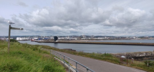
Day Twenty-four

Another day with an earlier update!
Camping on the clifftops south of Aberdeen was an amazing experience, the worst of the wind prevented by a convenient bluff and lulled off to sleep with the sound of the rain coming down and the sea crashing against the land. Definitely worth the effort getting out to the spot and back with all the gear!
It's back to the road though, and just around the corner some construction works mean a bit if a detour is needed to go visit Girdle Ness Lighthouse, before turning back around and begging the trip through Aberdeen itself.
I'm very glad I decided not to push in through yesterday. The initial road surfaces heading into the very busy city centre aren't great fun, but the route soon directs into Old Aberdeen, which whilst very pretty is a hell of a lot of cobbles. Rather than ride a pneumatic drill and shake the bike to pieces, I had to walk for most of the way through.
NCN 1 follows the River Don westwards, where the signposting gets a bit precarious and, combined with a mess of blocked roads due to more construction works, mean a lot of time is spent backtracking and figuring out where on earth to go.
This was compounded by some of the newer estates deciding to name all their roads almost identically. Mugiemoss road, Mugiemoss drive, Mugiemoss crescent, etc... Smart thinking there.
Regardless, finally out the other side we hit the A947 and push along this up to Dyce, where the trail leads onto a nice old rail route and allows some relatively flat riding.
The sun is out in force today and shade on this part is hard to come by, so it entailed a good few breaks in order to avoid horribly overheating.
The north east stretch of the coastline here is another mess of busy roads, so the bike route tracks inland past Newmachar en route to link back up to the coast at Banff.
A lot more uphill slogging in the late afternoon is finally rewarded with some excellent downhill runs, zooming down country lanes and providing a necessary breeze to take the edge off the heat!
By 5pm Tarves is reached, and a quick stop at the small park there allows for a bit of a break and to take a bit more shelter from the sun for a brief spell.
It's been a week since hitting the Scottish border and the last two day's hills have definitely been taking their toll! So whilst I've had a shorter run of it today and yesterday, I think a proper rest day will go a long way to easing some of the soreness creeping in in various places! Supplies are looking good so it's time to find a spot to rest for a while.
See you all back on Monday!
3 notes
·
View notes
Text
Baldwin Hills and Santa Monica (LA)
9 February 2023

This morning was another 30 mile ride (though it took only half the time of the previous one). It was flat, with the exception of the steep climb up to the Baldwin Hills Scenic Overlook (obvious on the profile), the ascent from the beach to the top of the bluff in Santa Monica, and a few rollers on Northvale Road just north of Culver City on the way back.

I got off to a messy start. My planned route hadn’t synced with my bike computer properly, so I was doing it by feel and with occasional stops to check Google Maps on my phone. It doesn’t help that this part of town has some major arterials that are hard to cross, a light rail line with very few crossings, and that a key bridge over Ballona Creek was completely shut down for construction! But I eventually got myself to Jefferson and warmed up my legs on Hetzler Road (the Baldwin Hills climb).

The views from the overlook were great. Downtown, with snow capped Mount Baldy in the background. The hills north and west of LA, from Malibu to Griffith Park. The ocean in the distance to the west - where I’d be headed next.


My route to the beach was on the bike trail down Ballona Creek, another concrete channel that seems to be more storm sewer than creek. It was pretty busy with dog walkers, parents biking with their kids to school, and occasionally a more serious cyclist out for a morning training ride. The Ballona Creek Trail intersects the bike path that follows the beaches at the south edge of Marina del Ray.


The ride north to Santa Monica was familiar territory from a ride I did back in 2020 (Palos Verdes Peninsula). The trail runs the perimeter of Marina del Ray before joining the beach north through Venice and on to Santa Monica. I left the beach at the Santa Monica Pier and after a little sightseeing, headed east through downtown and picked up the Exposition Corridor Bike Trail that follows the E-Line. It’s a good trail, though it crosses some major arterials. There were always crosswalks and lights, but sometimes there were some awfully long waits. And the trail sort of vanishes in Culver City, although I understand they are working on that.
Probably the diciest part of today’s ride was the final leg on Venice Boulevard - and making the left onto Fairfax. Traffic wasn’t actually too bad and if it had been worse, I probably could have found alternatives. Admittedly, it’s always interesting to be making a complicated left on a busy multi-lane road and be riding next to a self-driving car (but it behaved itself quite well).


4 notes
·
View notes
Text
Convenient Living Options
In addition to one-, two-, and three-bedroom homes, The Lincoln also offers studio apartments in Lone Tree. This community provides thoughtful amenities to enhance the living experience for all residents. One standout feature is the package and cold food delivery storage, ensuring that deliveries are safe and secure until residents are ready to retrieve them. For those who enjoy outdoor activities, The Lincoln offers bike and ski gear storage, complete with a repair shop, making it easy to maintain equipment. These amenities cater to a lifestyle of convenience and adventure, allowing residents to enjoy their hobbies without hassle. The Lincoln truly understands the needs of modern living, providing options that make daily life easier and more enjoyable.
The Geography of Lone Tree, Colorado
Lone Tree, Colorado, is located in the Denver metropolitan area, nestled at the foothills of the Rocky Mountains. Its geography features a mix of rolling hills and beautiful open spaces, providing stunning views of the mountains. The city is bordered by several parks, including the popular Lone Tree Golf Club and the expansive Bluffs Regional Park, which offers trails for hiking and biking. The area is also conveniently close to major highways, making it easy to access nearby cities like Denver and Colorado Springs. With its combination of natural beauty and urban convenience, Lone Tree provides residents with a perfect balance of outdoor adventure and city life. This unique geography makes it a desirable place to live and explore.
Lone Tree Brewing Company
Lone Tree Brewing Company is a popular local brewery located in Lone Tree, Colorado. Known for its friendly atmosphere and wide variety of craft beers, it’s a great place for beer enthusiasts and casual drinkers alike. The brewery offers a rotating selection of styles, including IPAs, stouts, and seasonal brews, all made on-site. Visitors can enjoy tastings in the cozy taproom or on the outdoor patio, perfect for sunny days. Lone Tree Brewing also hosts fun events, such as trivia nights and food trucks, making it a lively spot for social gatherings. With its commitment to quality and community, Lone Tree Brewing Company is a favorite destination for those looking to relax and enjoy great craft beer.
Former Lone Tree Mayor Millet Honored With ‘Good Governance’ Award
Recognizing public officials who perform well is important because it shows appreciation for their hard work and dedication to the community. When former Lone Tree Mayor Millet was honored with the ‘Good Governance’ award, it highlighted her positive impact on the city. Awards like this encourage officials to keep striving for excellence in their roles. They also inspire others to take their responsibilities seriously and work for the good of the community. Celebrating achievements helps build trust between leaders and residents, showing that good leadership is valued. It reminds everyone that effective public service makes a real difference in people’s lives. Recognizing such efforts helps strengthen the community and encourages continued progress.
Link to Map
Driving Direction
Lone Tree Brewing Company
8200 Park Meadows Dr #8222, Lone Tree, CO 80124, United States
Head east toward Park Meadows Dr
180 ft
Turn left toward Park Meadows Dr
69 ft
Turn right onto Park Meadows Dr
2.0 mi
Continue straight to stay on Park Meadows Dr
0.2 mi
Turn left onto Park Ridge
0.2 mi
Turn right onto Park Meadows Dr
Destination will be on the right
0.5 mi
The Lincoln
10275 Park Meadows Dr,
Lone Tree, CO 80124, United States
#three bedroom apartments in lone tree#two bedroom apartments in lone tree#one bedroom apartments in lone tree#studio apartments in lone tree
0 notes
Video

flickr
Trouble on the Trail by Steve DaCosta
Via Flickr:
A stack composite of three lightning strikes over Scotts Bluff. Nikon D810 and Nikkor 24-120mm. Our chase on May 20th, 2020, started in Limon, Colorado. We drove north to Cheyenne, then up toward the Laramie Mountains, east towards Lusk, and eventually ended up in Scottsbluff, Nebraska, chasing this supercharged lightning barrage. An overzealous deputy sheriff pulled me over for doing 4 over the speed limit, costing us precious time, but we finally got into position to shoot sunset lightning at Scotts Bluff National Monument. Scotts Bluff is a series of protrusions of sedimentary rocks called badlands; they were formed when layers of sediment eroded from the Rocky Mountains were transported by wind and water and deposited here along the plain of the North Platte River and later exposed by continued weathering. The area was first inhabited by numerous groups of indigenous peoples, including the Arapaho, Cheyenne, Kiowa, and later, the Sioux. In the early 19th century, the area was first documented by American and European fur traders and was used as a route for military expeditions into the West. Later, the Scotts Bluff became an important landmark along the Oregon Trail, California Trail, and Mormon Trail. It's estimated that 300,000 or more emigrants passed through here between the 1830's and 1869, when the transcontinental railroad was completed.
0 notes
Text
The four of us walked slowly down the deep, narrow canyon in southern Utah. It was midwinter, and the stream that ran alongside us was frozen over, forming graceful terraces of milky ice. Still, the place had a cozy appeal: had we wanted to pitch camp, we could have selected a grassy bank beside the creek, with clear water running under the skin of ice, dead cottonwood branches for a fire, and—beneath the 800-foot-high rock walls—shelter from the wind.
More than seven centuries ago, however, the last inhabitants of the canyon had made quite a different decision about where to live. As we rounded a bend along the trail, Greg Child, an expert climber from Castle Valley, Utah, stopped and looked upward. “There,” he said, pointing toward a nearly invisible wrinkle of ledge just below the canyon rim. “See the dwellings?” With binoculars, we could just make out the facades of a row of mud-and-stone structures. Up we scrambled toward them, gasping and sweating, careful not to dislodge boulders the size of small cars that teetered on insecure perches. At last, 600 feet above the canyon floor, we arrived at the ledge.
The airy settlement that we explored had been built by the Anasazi, a civilization that arose as early as 1500 B.C. Their descendants are today’s Pueblo Indians, such as the Hopi and the Zuni, who live in 20 communities along the Rio Grande, in New Mexico, and in northern Arizona. During the 10th and 11th centuries, Chaco Canyon, in western New Mexico, was the cultural center of the Anasazi homeland, an area roughly corresponding to the Four Corners region where Utah, Colorado, Arizona and New Mexico meet. This 30,000-square-mile landscape of sandstone canyons, buttes and mesas was populated by as many as 30,000 people. The Anasazi built magnificent villages such as Chaco Canyon’s Pueblo Bonito, a tenth-century complex that was as many as five stories tall and contained about 800 rooms. The people laid a 400-mile network of roads, some of them 30 feet wide, across deserts and canyons. And into their architecture they built sophisticated astronomical observatories.
For most of the long span of time the Anasazi occupied the region now known as the Four Corners, they lived in the open or in easily accessible sites within canyons. But about 1250, many of the people began constructing settlements high in the cliffs—settlements that offered defense and protection. These villages, well preserved by the dry climate and by stone overhangs, led the Anglo explorers who found them in the 1880s to name the absent builders the Cliff Dwellers.
Toward the end of the 13th century, some cataclysmic event forced the Anasazi to flee those cliff houses and their homeland and to move south and east toward the Rio Grande and the Little Colorado River. Just what happened has been the greatest puzzle facing archaeologists who study the ancient culture. Today’s Pueblo Indians have oral histories about their peoples’ migration, but the details of these stories remain closely guarded secrets. Within the past decade, however, archaeologists have wrung from the pristine ruins new understandings about why the Anasazi left, and the picture that emerges is dark. It includes violence and warfare—even cannibalism—among the Anasazi themselves. “After about A.D. 1200, something very unpleasant happens,” says University of Colorado archaeologist Stephen Lekson. “The wheels come off.”
This past January and February, Greg Child, Renée Globis, Vaughn Hadenfeldt and I explored a series of canyons in southeast Utah and northern Arizona, seeking the most inaccessible Anasazi ruins we could find. I have roamed the Southwest for the past 15 years and have written a book about the Anasazi. Like Greg, who has climbed Everest and K2, Renée is an expert climber; she lives in Moab, Utah, and has ascended many desert spires and cliffs. Vaughn, a tour guide from Bluff, Utah, has worked on a number of contract excavations and rock art surveys in southeastern Utah.
We were intrigued by the question of why the villages were built high in the cliffs, but we were equally fascinated by the “how”—how the Anasazi had scaled the cliffs, let alone lived there. During our outings, we encountered ruins that we weren’t sure we could reach even with ropes and modern climbing gear, the use of which is prohibited at such sites. Researchers believe the Anasazi clambered up felled tree trunks that were notched by stone axes to form minuscule footholds. These log ladders were often propped on ledges hundreds of feet off the ground. (Some of the ladders are still in place.) But they would not have been adequate to reach several of the dwellings we explored. I believe that archaeologists—who are usually not rock climbers—have underestimated the skill and courage it took to live among the cliffs.
The buildings that Greg had spotted were easier to get to than most of the sites we explored. But it wasn’t so easy to navigate the settlement itself. As we walked the ledge of the ruin, the first structure we came to was a five-foot-tall stone wall. Four small loopholes—three-inch-wide openings in the wall—would have allowed sentries to observe anyone who approached. Behind this entry wall stood a sturdy building, its roof still intact, that adjoined a granary littered with 700-yearold, perfectly preserved corncobs. Farther along the narrow ledge, we turned a sharp corner only to be blocked by a second ruined wall. We climbed over it and continued. Twice we were forced to scuttle on our hands and knees as the cliff above swelled toward us, pinching down on the ledge like the jaws of a nutcracker. Our feet gripped the edge of the passage: one careless lurch meant certain death. Finally the path widened, and we came upon four splendidly masoned dwellings and another copious granary. Beneath us, the cliff swooped 150 feet down, dead vertical to a slope that dropped another 450 feet to the canyon floor. The settlement, once home to perhaps two families, seemed to exude paranoia, as if its builders lived in constant fear of attack. It was hard to imagine elders and small children going back and forth along such a dangerous passage. Yet the ancients must have done just that: for the Anasazi who lived above that void, each foray for food and water must have been a perilous mission.
Despite the fear that apparently overshadowed their existence, these last canyon inhabitants had taken the time to make their home beautiful. The outer walls of the dwellings were plastered with a smooth coat of mud, and the upper facades painted creamy white. Faint lines and hatching patterns were incised into the plaster, creating two-tone designs. The stone overhang had sheltered these structures so well that they looked as though they had been abandoned only within the past decade—not 700 years ago.
Vertiginous cliff dwellings were not the Anasazi’s only response to whatever threatened them during the 1200s; in fact, they were probably not all that common in the culture. This became apparent a few days later when Vaughn and I, leaving our two companions, visited Sand Canyon Pueblo in southwest Colorado, more than 50 miles east of our Utah prowlings. Partially excavated between 1984 and 1993 by the not-for-profit Crow Canyon Archaeological Center, the pueblo comprised 420 rooms, 90 to 100 kivas (underground chambers), 14 towers and several other buildings, all enclosed by a stone wall. Curiously, this sprawling settlement, whose well-thought-out architecture suggests the builders worked from a master plan, was created and abandoned in a lifetime, between 1240 and about 1285. Sand Canyon Pueblo looks nothing like Utah’s wildly inaccessible cliff dwellings. But there was a defense strategy built into the architecture nevertheless. “In the late 13th century,” says archaeologist William Lipe of Washington State University, “there were 50 to 75 large villages like Sand Canyon in the Mesa Verde, Colorado, region—canyon-rim sites enclosing a spring and fortified with high walls. Overall, the best defense plan against enemies was to aggregate in bigger groups. In southern Utah, where the soil was shallow and food hard to come by, the population density was low, so joining a big group wasn’t an option. They built cliff dwellings instead.”
What drove the Anasazi to retreat to the cliffs and fortified villages? And, later, what precipitated the exodus? For a long time, experts focused on environmental explanations. Using data from tree rings, researchers know that a terrible drought seized the Southwest from 1276 to 1299; it is possible that in certain areas there was virtually no rain at all during those 23 years. In addition, the Anasazi people may have nearly deforested the region, chopping down trees for roof beams and firewood. But environmental problems don’t explain everything. Throughout the centuries, the Anasazi weathered comparable crises—a longer and more severe drought, for example, from 1130 to 1180—without heading for the cliffs or abandoning their lands.
Another theory, put forward by early explorers, speculated that nomadic raiders may have driven the Anasazi out of their homeland. But, says Lipe, “There’s simply no evidence [of nomadic tribes in this area] in the 13th century. This is one of the most thoroughly investigated regions in the world. If there were enough nomads to drive out tens of thousands of people, surely the invaders would have left plenty of archaeological evidence.”
So researchers have begun to look for the answer within the Anasazi themselves. According to Lekson, two critical factors that arose after 1150—the documented unpredictability of the climate and what he calls “socialization for fear”—combined to produce long-lasting violence that tore apart the Anasazi culture. In the 11th and early 12th centuries there is little archaeological evidence of true warfare, Lekson says, but there were executions. As he puts it, “There seem to have been goon squads. Things were not going well for the leaders, and the governing structure wanted to perpetuate itself by making an example of social outcasts; the leaders executed and even cannibalized them.” This practice, perpetrated by Chaco Canyon rulers, created a society-wide paranoia, according to Lekson’s theory, thus “socializing” the Anasazi people to live in constant fear. Lekson goes on to describe a grim scenario that he believes emerged during the next few hundred years. “Entire villages go after one another,” he says, “alliance against alliance. And it persists well into the Spanish period.” As late as 1700, for instance, several Hopi villages attacked the Hopi pueblo of Awatovi, setting fire to the community, killing all the adult males, capturing and possibly slaying women and children, and cannibalizing the victims. Vivid and grisly accounts of this massacre were recently gathered from elders by Northern Arizona University professor and Hopi expert Ekkehart Malotki.
#studyblr#history#military history#archaeology#architecture#houses#cliffs#warfare#drought#cannibalism#native americans#ancestral puebloans#hopi#zuni people#usa#utah#colorado#arizona#new mexico#four corners#chaco culture national historical park#mesa verde national park#pueblo bonito#sand canyon pueblo
1 note
·
View note
Text
Exploring Iowa's Scenic Wonders: The Most Beautiful Regions to Visit
Iowa, often overshadowed by its neighboring states, is a treasure trove of natural beauty and charming landscapes. Known for its rolling plains and rich agricultural heritage, the state offers diverse scenery that captivates residents and visitors alike. From breathtaking river bluffs to picturesque small towns, Iowa's prettiest parts are worth exploring. Here's a look at some of the most scenic regions in the Hawkeye State.
The Driftless Area: Nature's Untouched Beauty
The Driftless Area, located in northeastern Iowa, stands out for its unique geological features. Unlike the rest of the state, this region was not flattened by glaciers during the last Ice Age, resulting in a landscape of steep hills, deep river valleys, and limestone bluffs. The Mississippi River winds through this area, providing stunning views and abundant recreational opportunities.
Effigy Mounds National Monument is a highlight of the Driftless Area. It showcases ancient Native American mounds shaped like animals. This site offers not only historical significance but also panoramic views of the surrounding landscapes, especially during the fall when the foliage turns vibrant shades of red, orange, and yellow.
The Loess Hills: A Unique Geological Marvel
Stretching along the western edge of Iowa, the Loess Hills are a rare geological formation composed of wind-deposited silt. This narrow band of rugged terrain offers some of the most striking vistas in the state. The hills are magnificent in the spring when wildflowers bloom, covering the landscape in a colorful carpet.
Visitors can explore the region through the Loess Hills National Scenic Byway, a route that provides breathtaking views and access to various parks and preserves. Preparation Canyon State Park and Hitchcock Nature Center are popular spots for hiking, bird watching, and enjoying the unique flora and fauna of the region.
The Amana Colonies: A Step Back in Time
Nestled in east-central Iowa, the Amana Colonies are a group of seven villages known for their well-preserved historical charm. Established by German immigrants in the 19th century, these communities are a living museum of heritage and tradition. The area is picturesque, with its quaint brick buildings, lush gardens, and scenic farmlands.
The Amana Colonies offer more than just a visual treat. Visitors can experience traditional crafts, sample delicious homemade foods, and shop for unique handcrafted items. The peaceful and idyllic setting makes it a perfect spot for a leisurely day trip.
The Iowa Great Lakes: A Summer Paradise
In the northwest corner of the state, the Iowa Great Lakes region is a popular destination for summer recreation. This area is home to several large glacial lakes, with West Okoboji Lake and Spirit Lake being the most well-known. The clear blue waters, sandy beaches, and vibrant nightlife make it a favorite spot for both relaxation and adventure.
Aside from water-based activities like boating, fishing, and swimming, the region also offers beautiful golf courses, bike trails, and amusement parks. The Iowa Great Lakes area combines natural beauty with plenty of entertainment options, making it a top destination for families and outdoor enthusiasts.
Decorah: A Blend of Culture and Natural Beauty
Decorah, located in northeastern Iowa, is a charming town that perfectly blends cultural attractions with natural beauty. It's surrounded by scenic bluffs and the Upper Iowa River, making it an ideal location for outdoor activities such as canoeing, hiking, and biking. The town itself is known for its Norwegian heritage, which is celebrated through festivals and local museums.
The Decorah Fish Hatchery and Dunning's Spring Park are must-visit sites for nature lovers. The area's vibrant arts scene and local food culture add to its appeal, offering a unique blend of rural charm and cultural richness.
The Mississippi River Corridor: Majestic River Views
The Mississippi River forms Iowa's eastern border, providing some of the most majestic and scenic views in the state. The river corridor is dotted with charming towns, each offering unique perspectives and attractions. Dubuque, one of the oldest cities in Iowa, features historic architecture, beautiful riverfront parks, and the National Mississippi River Museum & Aquarium.
Traveling along the Great River Road, visitors can enjoy stunning vistas of the river and the lush landscapes that flank it. The drive is exceptionally breathtaking during the autumn months, when the leaves turn vibrant colors.
While Iowa may not be the first place that comes to mind when thinking of scenic beauty, it offers a surprising variety of picturesque landscapes and charming towns. From the unique geological formations of the Loess Hills and the Driftless Area to the tranquil waters of the Iowa Great Lakes and the cultural richness of the Amana Colonies and Decorah, the state is a treasure trove of hidden gems waiting to be discovered. Whether you're a nature enthusiast, a history buff, or simply looking for a peaceful getaway, Iowa's prettiest regions offer something for everyone.
0 notes
Text
Exploring the Great Outdoors: Hiking and Biking Trails around Moses Lake, Washington.
Nestled in the heart of Washington State, Moses Lake offers outdoor enthusiasts an array of hiking and biking trails to explore. From picturesque lakeside paths to rugged desert terrain, there's something for everyone seeking adventure in this scenic region. Let's dive into some of the best trails to discover around Moses Lake, Washington.
1. Moses Lake Sand Dunes:
For those craving an adrenaline rush, the Moses Lake Sand Dunes provide an exhilarating playground. These vast sand dunes offer opportunities for thrilling ATV rides, sandboarding, and hiking. With panoramic views of Moses Lake and the surrounding landscape, this unique terrain promises an unforgettable experience for outdoor enthusiasts.
2. Potholes State Park:
Just a short drive from Moses Lake lies Potholes State Park, a haven for hikers and bikers alike. The park boasts miles of trails that wind through diverse ecosystems, including wetlands, shrub-steppe, and basalt cliffs. Visitors can explore the scenic beauty of the area while spotting wildlife such as deer, waterfowl, and even the occasional bald eagle.
3. Columbia National Wildlife Refuge:
Venture a bit further east, and you'll discover the Columbia National Wildlife Refuge, a pristine wilderness teeming with natural wonders. Hikers can traverse trails that lead through sagebrush flats, along riverbanks, and up rocky bluffs, offering breathtaking views of the Columbia River Basin. Birdwatchers will delight in the diverse avian species that call this refuge home, including great blue herons, sandhill cranes, and white pelicans.
4. Grant County PUD Nature Trails:
For those seeking a more leisurely outing, the Grant County PUD Nature Trails provide a serene setting for hiking and biking. Located along the shores of Moses Lake, these well-maintained trails offer easy access to the water's edge, perfect for a refreshing swim or picnic. Interpretive signs along the way educate visitors about the area's natural and cultural history, adding depth to the outdoor experience.
5. North Dam Park:
Conveniently located within Moses Lake city limits, North Dam Park offers a network of trails for hikers and bikers of all skill levels. Whether you're out for a brisk morning walk or a leisurely bike ride, you'll find plenty to enjoy in this scenic urban oasis. The park's proximity to downtown makes it a popular destination for locals and visitors alike, providing a convenient escape into nature without venturing far from civilization.
6. Ice Age Floods Trail:
History buffs and outdoor enthusiasts will appreciate the Ice Age Floods Trail, which traces the path of cataclysmic floods that sculpted the landscape thousands of years ago. Interpretive signs along the trail illuminate the geological forces at play, offering insights into the region's fascinating past. Hikers and bikers can follow the trail through dramatic coulee landscapes, marveling at the power of nature unleashed.
7. Ancient Lakes Trail:
For a truly unforgettable hiking experience, set out on the Ancient Lakes Trail, located near the town of Quincy, a short drive from Moses Lake. This trail meanders through a dramatic desert canyon, leading to a series of sparkling lakes nestled amidst towering cliffs. The contrast between the arid landscape and the lush oases of the lakes creates a surreal and captivating environment that's perfect for exploration.
In conclusion, Moses Lake and its surrounding areas offer a wealth of hiking and biking trails for outdoor enthusiasts to enjoy. Whether you're seeking heart-pounding adventure or tranquil beauty, you'll find it in this scenic corner of Washington State. So lace up your hiking boots, pump up your bike tires, and embark on an unforgettable journey through the natural wonders of Moses Lake and beyond.
0 notes
Text
Top 5 Neighborhoods In Scarborough
Scarborough, one of Toronto’s most diverse regions, offers a variety of residential experiences, ranging from vibrant urban centers to serene suburban landscapes. If you’re considering moving to Scarborough, it’s crucial to understand the unique characteristics of each area to find the perfect fit for your lifestyle. This guide delves deeper into the preferred neighborhoods, areas to be cautious about, and provides enriched general tips for making an informed decision.
Preferred Neighborhoods in Scarborough
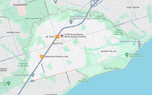
West Hill
Characteristics: West Hill is a serene suburb known for its lush green spaces and family-friendly atmosphere. The neighborhood boasts a range of amenities including shopping centers, schools, and easy access to public transit.
Community Insights: Residents enjoy the tranquility and the recreational opportunities provided by nearby parks and the waterfront.
Guildwood
Characteristics: Guildwood is renowned for its well-kept lawns, mature trees, and picturesque setting along the Scarborough Bluffs. It offers a peaceful residential environment with a strong sense of community and heritage.
Community Insights: The area is popular among retirees and families looking for a quiet, scenic place to live with excellent local schools.

Port Union (East End)
Characteristics: Known for its waterfront trails and newer residential developments, Port Union combines modern living with stunning natural beauty. It’s an active community with sports facilities and outdoor activities.
Community Insights: It’s ideal for those who appreciate outdoor lifestyles, with easy access to beaches and parks along Lake Ontario.
Morningside
Characteristics: This neighborhood offers affordability and accessibility, with several educational institutions and healthcare facilities nearby. It’s a mixed area with both residential and commercial developments.
Community Insights: While generally seen as a convenient and budget-friendly area, it’s important to research specific streets and blocks for safety and community vibe.
Areas to Exercise Caution
Tuxedo Court
Concerns: Historically known for higher crime rates and social housing challenges. Potential residents should be aware of these issues.
Community Insights: Active community efforts are underway to improve the area, but caution and thorough research are advised before moving.
Kingston and Galloway
Concerns: This area has struggled with socio-economic challenges and crime, making it less appealing to those looking for stability and quiet.
Community Insights: There are community initiatives aimed at revitalization and improving public safety.
Malvern Town Centre
Concerns: The area around Malvern Town Centre can be busy and sometimes unpredictable, with a mix of commercial and low-income housing.
Community Insights: Residents have access to good shopping and public transit, but should be mindful of the diverse urban environment.
Mason Rd and Eglinton
Concerns: This neighborhood has varied socio-economic conditions and can differ widely in terms of safety and community upkeep from street to street.
Community Insights: Prospective residents should visit multiple times at different hours to get a true sense of the area.

General Tips for Choosing a Neighborhood in Scarborough
School Rankings: Schools often reflect the community’s investment in its future. Areas with higher-ranked schools usually have better maintained properties and a more active community life.
Building and Street Quality: The physical appearance of buildings and streets can indicate the level of care and management. Well-kept areas often suggest a lower crime rate and a safer environment.
Personal Visits: Visit the neighborhood at different times of the day and week. Talk to locals to get a sense of community issues and the social dynamics.
Local Amenities: Consider the proximity to essential services like grocery stores, medical clinics, and leisure activities, which contribute to the quality of life.
Conclusion
Choosing the right neighborhood in Scarborough requires a balance of personal needs, safety considerations, and lifestyle preferences. By thoroughly researching and visiting potential areas, you can find a neighborhood that not only meets, but exceeds your expectations for a new home in this vibrant and diverse part of Toronto.
For more details, visit CondoTrend
1 note
·
View note
Text
Three Sisters and Broken Top Circumnavigation (4/5)
On this five-day trip filled with highs and lows (but mostly highs), the fourth day, spent hiking from Reese Lake to Green Lakes, was probably the most straightforward day. That doesn't mean it wasn't still awesome, though.
Hoping to get to Green Lakes early enough in the afternoon to enjoy it before the sun set, I got up before sunrise and was on the road shortly after it.
Less than a mile south of Reese Lake, I passed into the burn zone from the 2017 Nash Fire. Though the first few miles of hiking for the day were relatively flat as the PCT traversed around the west flank of South Sister, my environs more closely resembled the blasted east side of the Sisters Loop than what I'd grown used to on the less-burnt west side.

While there wasn't a lot of elevation change through this section, there were parts where the soil was so loose due to the burn that it was hard to simultaneously scramble up and over deadfall and avoid turning an ankle in the loam.
At one point, I passed a family of four, all of them ahorse and kitted out as if they had literally walked out of an episode of Yellowstone. The father, riding in the lead, literally tipped his cowboy hat to me when I said hello. All four riders had long rifles low-slung from their saddles, and rifle bullets displayed prominently (and individually) in pockets sewn onto their saddles. A blue heeler wove in and out of the horses' legs as they passed by. I felt like I had traveled back in time.
Shortly after, I passed a small lake that could have provided a camp site and overnight access to water in an emergency. It had nothing on Reese Lake, though.
Next up was Mesa Creek, where the man I'd met the previous morning at the Yapoah Crater had recommended I camp. While seeing it in the flesh didn't make me regret my choice of Reese Lake, the open meadow through which the creek ran was gorgeous and golden in the fall light. There were plenty of open campsites under the trees that lined the meadow, and the creek itself was running fast despite the lateness of the year. I dropped a pin on my map so I would remember the spot for any later trips.
Not far beyond the meadow the trail climbed up through some trees to a spot that Lindsey, who is partial to alpine meadows, had dubbed "The Ultimate Place" on our 2018 hike. I dropped a pin on the map here as well, and took some pictures so she could at least feel like she'd been there in spirit this time around.

It wasn't long after this that the trail squeezed between a bluff to the right and the creatively-named Rock Mesa to the left, a pass-through that served as the gateway to the Wickiup Plain.
There are a lot of spots along this loop that you could mistake for Mordor, or the moon, but none are more strikingly desolate than the Wickiup Plain. This had been another spot where we'd struggled in 2018: the PCT only runs for about one-and-a-half miles through the Plain, but it's entirely open, and there's just something about being able to see so far into the distance that's dispiriting when you're trying to cover distance while avoiding melting in the sun.
All that said, the Rock Mesa rising to your left in front of a snowy South Sister summit is quite the sight.

Crossing the Plain this time around was significantly less apocalyptic than in my memory, likely because of the fall temperatures. Before long, I bore left onto the Le Conte Crater Trail, leaving the PCT and its relatively heavy (read: "not heavy at all") traffic flow behind for the rest of the trip. The sharp cone of the Le Conte Crater passed by on my left, and then Kahleetan Butte appeared in the distance: a pretty unremarkable butte made remarkable by the flatness of the surrounding area.

The Le Conte Crater Trail proceeds for a mile through this open area before it ends in a T-intersection. I turned left/north and began to climb - a rarity on this particular day!
The Moraine Lake Trail climbs about five hundred feet en route to the eponymous Moraine Lake, but on this morning, when I'd already gotten into my head the idea that this was supposed to be an "easy" day, the climbing felt like a struggle. At least while contouring around Kahleetan Butte I got to hike through the thick pine forest that's typical just south of South Sister. The shade kept me cool as I climbed a trail that seemed far steeper than I remembered.
Eventually, though, the "classic" view of South Sister appeared as I crested a hill. Two days before, I'd reached South Matthieu Lake and a dead-on view of North Sister from the north. Now, at the other end of the loop, the south side of South Sister loomed. I wasn't done yet, but it felt like a milestone along the way.

The reason I think of this as the "classic" view of South Sister is because I and many others experience the mountain primarily through climbing it, and the vast majority of those attempting to summit do so from the south, from the Devil's Lake Trailhead. After an initial climb from that trailhead, you reach a plateau due south of the mountain where the climber's trail and the Moraine Lake Trail cross. I've been to this intersection many times, typically in pursuit of the summit, and I was looking forward to reaching it again on this trip, even if I was approaching it from the west instead of the south, and even if I was "just" passing through rather than summiting the mountain.
Upon arrival at the plateau intersection, I stopped briefly, reflecting on all of the times I'd passed the spot before. This had been Lindsey and I's last break spot in 2018 before we'd completed the Sisters Loop by descending the final mile-plus to Devil's Lake. It was a place heavy with memories shared with others on a trip where I had spent most of a week living in my own head. It was a nice reprieve.
From the plateau, I descended northeast and down to Moraine Lake, then took a long lunch break on the shore. Moraine Lake is a spot I've often seen and appreciated from a distance, so I was happy to have the opportunity to spend some quality time there.

From Moraine Lake, I turned east and eventually south to skirt around the awesomely-named Devil's Chain, a long, tall lava formation that oozes down to the southeast of South Sister proper. This section of the trail always takes longer than it seems like it should, but once you've made it around the formation and you loop back toward the north, you enter one of my favorite sections of trail in the entire Sisters Wilderness.

Here, for about two miles, you hike alongside both lava walls and Fall Creek, sheltered by tall pines and ensconced in the sound of rushing water. Especially after three-ish days of mostly dry landscapes punctuated by burn zones, this area, which I suppose is still apocalyptic by most standards, felt absolutely paradisaical.
By this point, I was also well into popular day-hike territory. I felt a bit self-conscious about my relative grubbiness as I passed and was passed by lots of fashionable and clean Bend-area day-hikers, but I also figured they were used to occasionally having a hairy backpacker crash through the background of their Instagram Reels.
Eventually, I reached the outskirts of the Green Lakes area, which is one of my all-time favorite places to camp. Earlier in the day, I'd been a bit worried about finding a good campsite here; this was mostly because before 2021, Green Lakes had been one of the best-known and best-"loved" backcountry spots in Oregon, and accordingly, one of the most difficult places to find a campsite at on any given (summer) night. In 2021, though, the Forest Service began a new permit system that limited access to the area, and since then, it's never been the absolute circus it once was, at least not on the days that I've been there. My worry that all the sites in the area would be full up in spite of the permit system, in the middle of October, was irrational, of course. I didn't expect to find the entire place to be empty save for two other hiking parties, though!
My favorite sites in the Green Lakes area are all on the southern side, so last summer, when I entered the area from the north on my way around Broken Top for the first time, I took the time to hike all the way around the Lakes before settling in for the night. This time, I was approaching from the south, which meant that I didn't have to hike around the Lakes at all to reach my favorite spots. It also meant that I'd have much more time to just enjoy the views and rest before having to get set up for my last night of camping out on this trip.

One of the many things I love about Green Lakes is that you can see all Three Sisters and Broken Top from certain spots along the main lake. This makes for some beautiful views, of course, but as someone who was currently undertaking a circumnavigation of all four peaks, the encompassing view had special resonance.

I'd entered the area hoping to get one of my favorite three sites for the night. As it turned out, nobody else was camping anywhere near the south end of the Lakes at all. So, instead, my "problem" became choosing while of the three great sites I wanted to set up at. Ultimately, I chose the same site I'd camped at the previous year during my first loop around Broken Top, which provides excellent views of both South Sister and Broken Top from your tent.
With some extra daylight on my hands after setting up my tent, I took a short sojourn out around some of the Lakes sans my backpack, took some (more) photos, chatted with one group of campers, ate a few cookies, and then returned to my site just as dusk was settling in.
After cooking one last dinner, I decided to put off going to bed for a bit and instead walk down to the south shore of the closest lake and sit for a bit. I did have a long, difficult day ahead of me the next morning, but it would be the last of the trip, and I felt well-rested and well-fed enough that I wasn't terribly worried. If I slept poorly or didn't get enough sleep, at this point I could just power through it. Veggie burgers and a real bed were only twenty-four hours away, after all.
For the first time in all my visits to Green Lakes, I had the time to take some astrophotos of one of my favorite views on Earth, looking across the water toward South Sister.

Then, I walked back to my tent and went to bed for the night, both looking forward to and dreading finishing this fantastic trip with a visit to the incredible Bend Glacier and scrambling the long-awaited pass over Broken Hand.
#mountains#central oregon#north sister#middle sister#south sister#hiking#camping#backpacking#photos#three sisters#writing#broken top
1 note
·
View note
Text
Juan de Fuca Marine Trail Day 2: Bear Beach to Chin Beach
Day 2 was a 12 km hike and definitely our most difficult day of the journey. We hiked from Bear Beach to Chin Beach and gained a total of 540 metres of elevation throughout the day. The bluffs in this section are steep, so be prepared for lots of hill-climbing and descents!
Approaching Rock-on-a-Pillar at Bear Beach East Camp.
If you missed the Day 1 post, find it here, along with helpful…
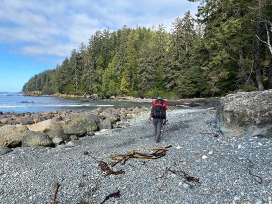
View On WordPress
0 notes
Last Seen Blogs

findsarahh
Ar lath ma vhenan

photonegativki
Фотонегативки / Photonegativki

piratennrw
copy, remix & share

adigopnik
Eldritch Gopnik

mustbklutzy
Wear your mess of colours with pride!