#helloVizart
Photo

USA - exaggerated relief map with elevation tint.
by u/helloVizart
944 notes
·
View notes
Text


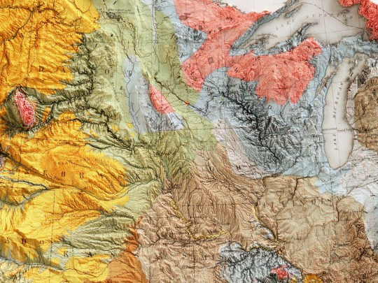

Geological map of United States, 1874.
Compiled by C.H. Hitchcock and W.P. Blake.
original map source: David Rumsey Collection
If you like our work, want to see our daily updates (or want to say hello to our studio), consider to follow our Instagram or Twitter account. Otherwise if are interested in our prints or have a custom request check our shop.
#hellovizart#shadedrelief#3dmaps#digitalart#cartografia#ilovegeology#geological#usa#unitedstates#vintagemaps#reliefmaps#artprint#retromaps#mapillustration#vintagemapsforsale#cartography#geology#gis#blenderart#3dmap
3 notes
·
View notes
Photo

This map required a longer intervention because it was split in half and ruined by time, being a document from 1943. We chose to leave behind the dusty look of an archive document and give it new life with a stronger colouring.
by @hellovizart
142 notes
·
View notes
Photo

South America shaded relief.
by @hellovizart
200 notes
·
View notes
Photo

Volcanoes in Italy.
by @hellovizart
94 notes
·
View notes
Photo
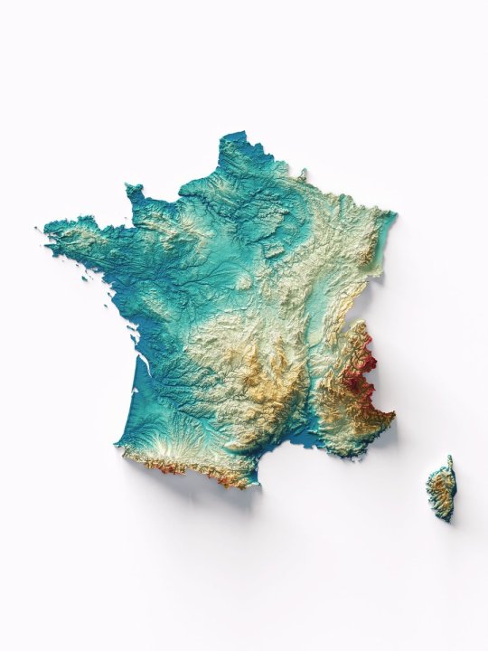
France with spectral elevation tint. Colour experiments on elevation tints are particularly satisfying because they allow the artistic aspect to be reconciled with cartographic representation.
by @hellovizart
176 notes
·
View notes
Photo

Norway relief map.
by @hellovizart
119 notes
·
View notes
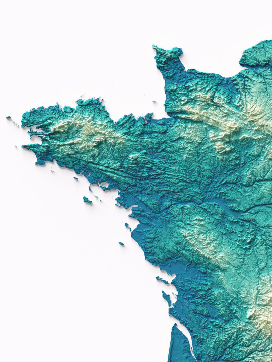
Photo

Mixed elevation tint of France.
by @hellovizart
86 notes
·
View notes
Photo
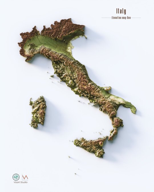
Hypsometric maps of Italy.
by @hellovizart
194 notes
·
View notes
Photo

National parks of Italy.
by @hellovizart
113 notes
·
View notes
Text


New version of France with spectral elevation tint.
Colour experiments on elevation tints are particularly satisfying because they allow the artistic aspect to be reconciled with cartographic representation.
-Immagine del profilo di hellovizart
hellovizart
Among our colourways, Geo always has a special place.
Today we share with you our most classic version of the shaded relief print of France with elevation tint geo, inspired by traditional maps.
If you like our work, want to see our daily updates (or want to say hello to our studio), consider to follow our Instagram or Twitter account. Otherwise if are interested in our prints or have a custom request check our shop.
#france#france🇫🇷#francetourisme#paris#pyrénées#mountain#mountains#mountainlovers#cartography#cartographyartist#cartographytravel#cartographyart#gis#vivelafrance#3dart#3drender#blender3d#blendercycles#blendercommunity#blenderart#shadedrelief#shadedreliefmap#datavizsociety#actofmapping#corsica#corsicanlife#normandie
4 notes
·
View notes
Photo

Hypsometric tint map of Africa with shaded relief and borders.
by u/helloVizart
271 notes
·
View notes
Photo

3d render of Mont Blanc with a geological map of 1898.
by @hellovizart
124 notes
·
View notes
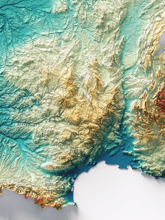
Photo
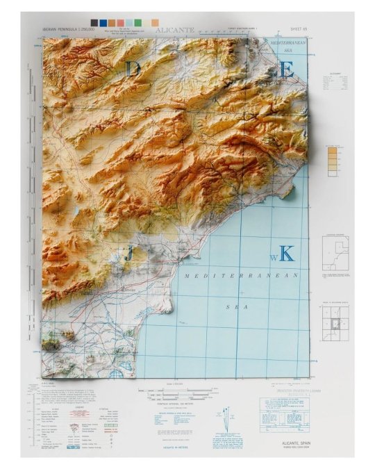
Full map of Alicante
Info: Penisola Iberica 1:250.000: Alicante, sheet 65. Series A.M.S. M581 Fonte: University of Texas.
by @hellovizart
74 notes
·
View notes
Photo

English version of Polish Pergamon Atlas map of Italy with 3D relief, 1967.
by hellovizart
334 notes
·
View notes
Photo

Shaded relief map of the Hawaii islands.
Map info: Hawaii, International Map of the World Sheet NE/NF 4-5, U.S. Geological Survey, 1974 Source: University of Texas Libraries
by @hellovizart
152 notes
·
View notes
Last Seen Blogs

fuckyeahsundrop-blog-blog
FuckYeahSundrop

vype6969
Untitled

kochilltea
Kochill

ragchaser
hi-di-he,hi-di-ho, lets get on with the show!

audelliaeverdale
grsvethome