#hickison petroglyph recreation area
Photo

Hickison Petroglyph Recreation Area
1 note
·
View note
Text


Hickerson Petroglyphs Recreation Area, Nevada.
After the grand cave the day before, I had to stop for the petroglyphs, which were pretty grand themselves. A little walk with lots of views and history. From May 2017.
#hiking#short hike#Nevada#petroglyphs#landscape#Hickison Petroglyphs Recreation Area#nature#outside#mountains#travel#Hickison Petroglyphs#hike#day hike#interpretive trail#basin and range
6 notes
·
View notes
Photo


#FindYourAdventure: See Ancient Petroglyphs in Nevada
Nevada’s Hickison Petroglyph Recreation Area is a great place to take a walk, let the kids run, have a picnic, spend a few days camping, and look at ancient petroglyphs. Hickison offers long vistas, shade, and an opportunity to think about early Native Americans hunting, drawing on rock, and living in this area.
The cultural resources at this site are protected by federal law against damage, defacement, removal, etc., and visitors should take care to help protect these sites. The native rock should not be carved, painted or otherwise modified in any way.
This week, we invite you to explore many of the hidden gems on your public lands by checking out blm.gov/visit. We want to remind you to always be safe outdoors and make sure you prepare for whatever adventure you choose. Many of the recreation opportunities on BLM-managed public lands are often remote and rugged, offering unparalleled connections to the American outdoors.
#bureau of land management#nevada#visit#recreation#petroglyphs#hickison#native american#cultural#history#geology#rock art#public lands
116 notes
·
View notes
Photo


Day 2: June 24, 2017 - Carson City, Nevada to Ely, Nevada
Highway 50 in Nevada is known as “the loneliest road” ever since a Life magazine article described it that way, and then the Nevada tourism people sort of reclaimed it. It’s beautifully desolate, interrupted only by a handful of small towns. The top photo is an exhibit in the Churchill County Museum in Fallon. Then, two photos of ancient petroglyphs from the Hickison Petroglyph Recreation Area near Austin. I stopped for lunch at the Toiyabe Cafe in Austin, opting not to go to the other cafe in town, which had a huge Trump sign. The rest of the pictures, except the very last one, are all from Eureka, which also has a museum. (The typewritten text is from an old school yearbook.)
My plan had been to sleep in my van every night, usually parking in parking lots, but the first night, I discovered that the battery for my BiPAP machine didn’t last the entire night. I like being able to breathe at night, so I needed a way to have access to power outlets at night until I was able to get a second battery. After doing a bit of googling, I figured out that you can just use a regular extension cord at a place that has RV spaces with hookups, so that’s what I did, at the Prospector Motel and RV Park in Ely, Nevada. That worked out pretty well, and I saw a cute dog. In Ely, I went to a karaoke bar but there weren’t enough people there to actually start the karaoke night, so I left after drinking a Blue Moon with no orange slice in it because they were out of oranges. That pretty much sums up Ely, Nevada.
1 note
·
View note
Photo


Bean Flat Rest Area, NV
U.S. Route 50 (US 50) is a transcontinental highway in the United States, stretching from West Sacramento, California, in the west to Ocean City, Maryland, on the east coast. The Nevada portion crosses the center of the state and was named The Loneliest Road in America by Life magazine in July 1986. The name was intended as a pejorative, but Nevada officials seized it as a marketing slogan. The name originates from large desolate areas traversed by the route, with few or no signs of civilization. The highway crosses several large desert valleys separated by numerous mountain ranges towering over the valley floors, in what is known as the Basin and Range province of the Great Basin.
US 50 has a diverse route through the state, traversing the resort communities of Lake Tahoe, the state capital in Carson City, historical sites such as Fort Churchill State Historic Park, petroglyphs, alpine forests, desert valleys, ghost towns, and Great Basin National Park.
The route was constructed over a historic corridor, initially used for the Pony Express and Central Overland Route and later for the Lincoln Highway. Before the formation of the U.S. Highway System, most of US 50 in Nevada was designated State Route 2. The routing east of Ely has changed significantly from the original plans. The route change resulted from a rivalry between Nevada and Utah over which transcontinental route was better to serve California-bound traffic, the Lincoln Highway or the Victory Highway.
US 50 crosses the central portion of Nevada, entering the west side of the state near Lake Tahoe and exiting the east side near Great Basin National Park. The route crosses mostly desolate terrain in its journey across the state; US 50 passes through several large desert valleys and basins. The highway crosses 17 named mountain passes that break up the Nevada desert. To crest some of the passes along US 50 requires navigating steep 8% grades and hairpin turns through pine forests to reach elevations of over 7,000 feet (2,100 m).
In the stretch of highway between Fallon and Delta, Utah, a span of 409 miles (658 km), there are three small towns, Austin, Eureka, and Ely. This span is roughly the same distance as Boston, Massachusetts, to Baltimore, Maryland, or Paris, France, to Zurich, Switzerland. Traffic along US 50 varies greatly. The average annual daily traffic in 2007 ranged from 52,000 vehicles per day in Carson City, to 530 vehicles per day near the Duckwater turnoff.
In addition to portions being designated the Loneliest Road and Lincoln Highway, the portion concurrent with Interstate 580 in Carson City is designated the Carson City Deputy Sheriff Carl Howell Memorial Freeway in honor of a sheriff's officer who was shot to death while attempting to rescue a victim of domestic violence from her house.
Austin lies 110 miles (180 km) east of Fallon. The city, founded by Pony Express riders who discovered silver, was a mining boomtown that now describes itself as a living ghost town. In 1862, at the peak of the silver boom, Austin had a population of 10,000 people. Today, about 300 residents remain. Perched above the town and just to the south of the highway is Stokes Castle, a long abandoned monument to a prominent eastern family with local mining interests. Passing Austin, travelers encounter hairpin turns and steep grades in the ascent up Austin Summit in the Toiyabe Range. This area is inside the Humboldt-Toiyabe National Forest, the first part of US 50 to run inside a national forest since leaving Lake Tahoe. At Hickison Summit, about 20 miles (32 km) east of Austin, is the Hickison Petroglyph Recreation Area, a rest area and campground featuring a walking tour of petroglyphs.
The next town is Eureka, which bills itself as the "Friendliest Town on the Loneliest Road in America". Eureka was similarly founded as a mining boom town. Although mining has diminished, it remains a large component of the community and its economy. The centerpiece of the historical district of Eureka is the Eureka Opera House, built in 1880.
Past Eureka is Ely, founded as a stage coach station along the Pony Express and Central Overland Route.
Source: Wikipedia
#Bean Flat Rest Area#Highway 50#Loneliest Road in America#travel#USA#Nevada#Western USA#landscape#original photography#flora#grass#sagebrush#mountains#view#vacation#summer 2019#fence#Eureka#Antelope Range#Lincoln Highway#road trip#countryside#blue sky
0 notes
Photo

Waking up at the Hickison petroglyphs recreation area. We love these BLM places. #authorseye #cosmiccorks #verlundsaga — view on Instagram https://ift.tt/2P10nIB
0 notes
Photo
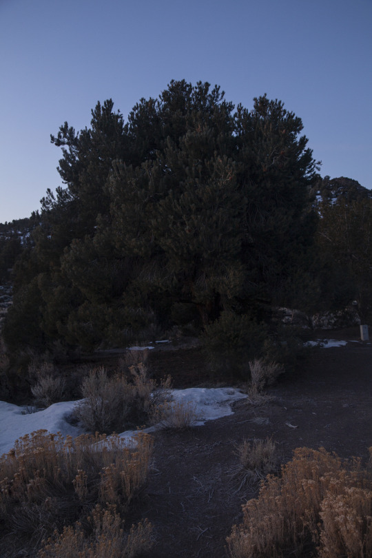

Sun set off Highway 50, Nevada, Hickison Petroglyph Recreation Area
1 note
·
View note
Photo


Sun rise off Highway 50, Nevada, Hickison Petroglyph Recreation Area
0 notes
Last Seen Blogs

dailyviolet-fitzpatrick-blog
i only ever cared for;

classycosmoqueen
Dark Academia


haleylara78
Untitled

hajimasexy
amigo