#kittitas valley
Text
#hiking#eastern washington#manastash ridge#manastash 1#manastash ridge observatory#kittitas valley#umtanum ridge
0 notes
Text
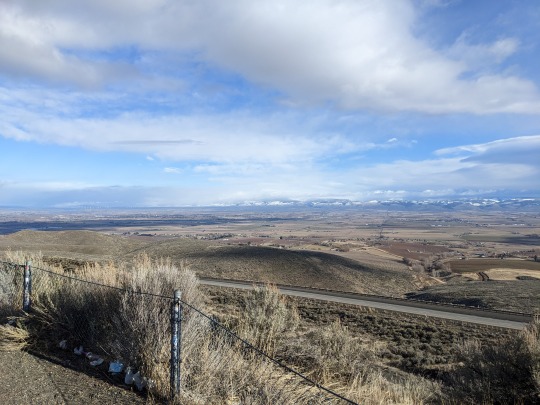
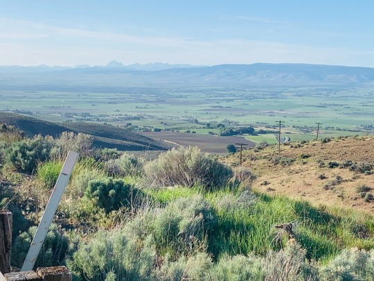
goodbye for good small town in kittitas valley
4 notes
·
View notes
Text
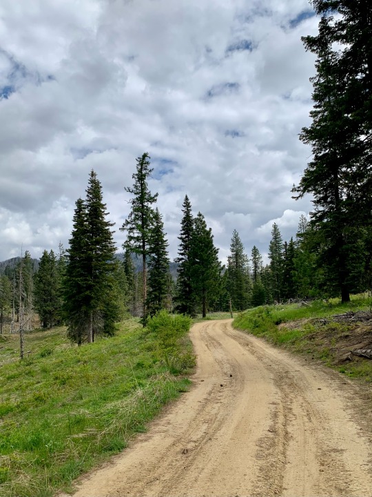
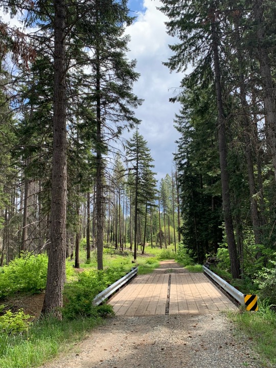
Cle Elum - Teanaway Loop
25 May 2023
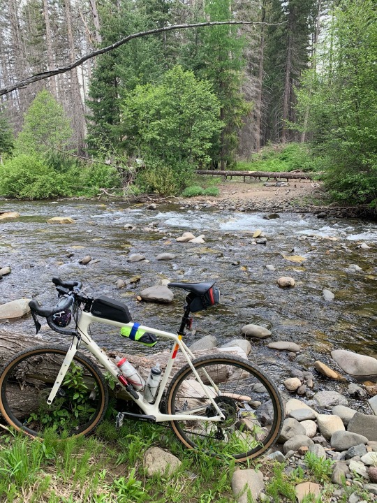
I picked up coffee before 7:00 on my way out of Seattle and was at the parking spot on Red Bridge Road, east of Cle Elum, less than two hours later. I was riding for about 4 hours. I had lunch at the Twin Pines drive-in outside of Cle Elum at 1:30 and was home by 3:30.
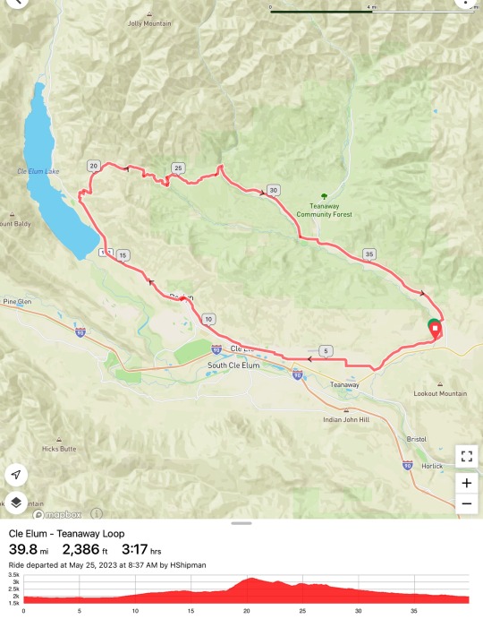
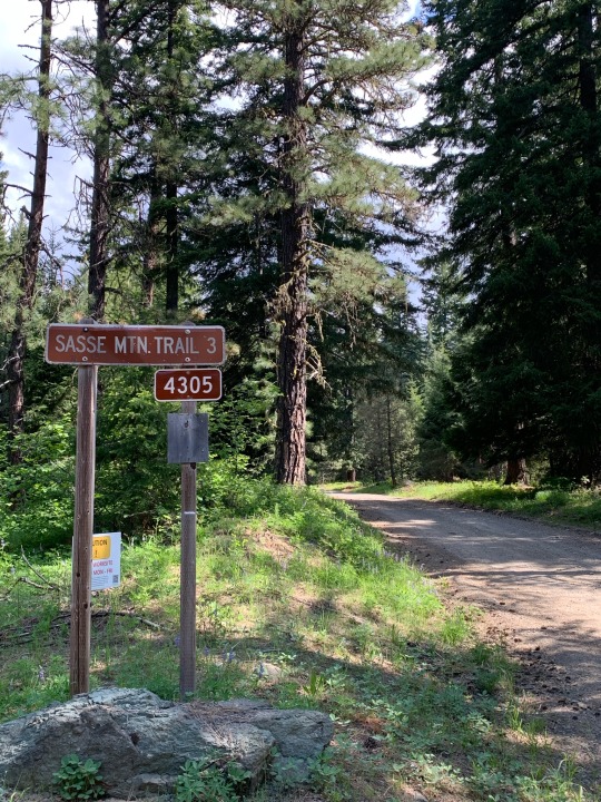
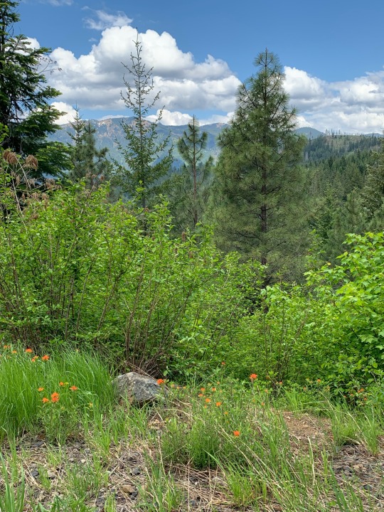
The ride was 40-miles on a great mix of different roads and trails and surfaces. The crux of the ride was the 12 miles of dirt between the Salmon la Sac Road and the beginning of pavement on the Middle Fork Teanaway Road. This section began with a stiff 1000’ climb, but that was really the worst of it. The biggest challenge was a short section of hike-a-bike where the route crosses the upper West Fork of the Teanaway River, since the road had been blocked off (quite effectively) and the stream had to be forded. I suppose it cost me 20 minutes of pondering options and having to finish ride in wet shoes (which was no problem at all in today’s 70 degree weather).
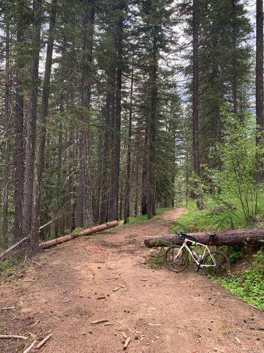
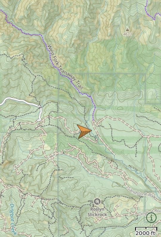
Today was a good example of the limitations of using online resources to plan bike rides. Ride With GPS, my usual starting point for planning a ride, proposed this route between the Cle Elum Valley and the Teanaway, but as Google cautions, ‘bicycling directions may not always reflect real-world conditions’! It turns out there was a short section of aggressively decommissioned forest road (#113) and a river crossing that required a little bit of extra thought (including the possibility of turning around and retracing my route). I’m including a screenshot of the area from Gaia GPS (my favorite source for detailed offline maps on my phone when I’m out of cell service). Everything worked out fine, but sometimes these glitches can become major problems. Homework and adaptability and backup navigation resources are always a good idea. And maybe an extra pair of shoes for the river crossing.
1 note
·
View note
Text
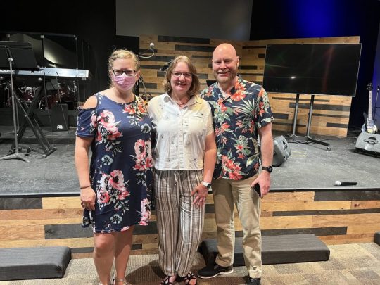
New Lead Pastors!
Update!
Welcome to our Co-Lead Pastors, Pam and George Beers!
This last Sunday, June 26th, our members voted overwhelmingly for George and Pam to be our co-lead pastors.
We are thrilled to have them join our family here in Kittitas and make the valley their home.
As you can assume, it takes time to move and get settled, so they’ll be starting at New Life in the beginning of August. Big thanks to our…
View On WordPress
0 notes
Conversation
U.S. Daily Low Temperature Records Tied/Broken 5/13/22
Unincorporated Cochise County, Arizona: 28 (previous record 34 1953)
Coronado National Memorial, Arizona: 34 (previous record 39 1971)
Picacho Peak State Park, Arizona: 51 (previous record 52 2010)
Unincorporated Pima County, Arizona: 35 (previous record 41 2003)
Sierra Vista, Arizona: 40 (also 40 2019)
Grass Valley, California: 37 (also 37 2017)
Imperial Beach, California: 46 (also 46 1956)
Unincorporated Riverside County, California: 49 (also 49 2015)
Unincorporated San Bernardino County, California: 53 (also 53 1963)
Stanislaus National Forest, California: 16 (previous record 18 2017)
Alamosa, Colorado: 20 (also 20 1966)
Bear Mt. summit, Idaho: 26 (previous record 29 2000)
Unincorporated Bonner County, Idaho: 24 (previous record 26 1999)
Unincorporated Clearwater County, Idaho: 25 (previous record 26 1986)
Mullan Pass summit, Idaho: 22 (previous record 23 1955)
St. Joe National Forest, Idaho: 28 (also 28 2009)
Unincorporated Shoshone County, Idaho: 26 (also 26 2004)
Unincorporated Shoshone County, Idaho: 24 (also 24 1999)
Banfield Mt. summit, Montana: 28 (also 28 2004)
Hot Springs, Montana: 28 (also 28 2014)
Lewis & Clark National Forest, Montana: 23 (previous record 24 2004)
Moss Peak summit, Montana: 18 (previous record 19 2004)
Unincorporated Lincoln County, Nevada: 35 (previous record 36 1998)
Tonopah, Nevada: 26 (previous record 30 1942)
Unincorporated Grant County, New Mexico: 25 (previous record 27 2010)
Unincorporated Benton County, Oregon: 36 (also 36 2009)
Cannibal Mt. summit, Oregon: 35 (also 35 1999)
Unincorporated Douglas County, Oregon: 40 (also 40 2009)
Goodwin Peak summit, Oregon: 35 (previous record 37 1985)
Unincorporated Jefferson County, Oregon: 26 (previous record 27 1974)
Unincorporated Jefferson County, Oregon: 27 (previous record 29 1999)
Unincorporated Lane County, Oregon: 34 (previous record 34 1999)
Unincorporated Lane County, Oregon: 35 (previous record 36 1999)
Mt. Hood National Forest, Oregon: 21 (previous record 22 2009)
Portland, Oregon: 37 (previous record 39 1974)
Rye Mt. summit, Oregon: 34 (also 34 2009)
Unincorporated Sherman County, Oregon: 33 (previous record 34 2009)
Table Rock Wilderness, Oregon: 29 (previous record 30 1986)
Unincorporated Umatilla County, Oregon: 30 (also 30 2009)
Warm Springs Reservation, Oregon: 28 (previous record 29 1974)
Unincorporated Wasco County, Oregon: 30 (also 30 1999)
Whitman National Forest, Oregon: 23 (previous record 24 1999)
Alpine Lakes Wilderness, Washington: 26 (previous record 27 1999)
Arbuckle Mt. summit, Washington: 20 (previous record 21 1999)
Blewetts Pass summit, Washington: 26 (previous record 27 1999)
Gold Mt. summit, Washington: 26 (previous record 30 2017)
Harts Pass summit, Washington: 19 (also 19 2009)
Unincorporated Kittitas County, Washington: 24 (also 24 1999)
Lake Chelan National Recreation Area, Washington: 30 (also 30 1986)
Mt. Crag summit, Washington: 26 (previous record 28 1999)
Okanagan National Forest, Washington: 27 (previous record 28 1994)
Seattle, Washington: 38 (also 38 1956)
Umatilla National Forest, Washington: 27 (previous record 30 2009)
Walla Walla, Washington: 37 (previous record 38 2006)
#U.S.A.#U.S.#Arizona#1970s#1950s#1960s#Nevada#1990s#1940s#New Mexico#Oregon#Montana#1980s#Washington#Idaho#Colorado
0 notes
Text
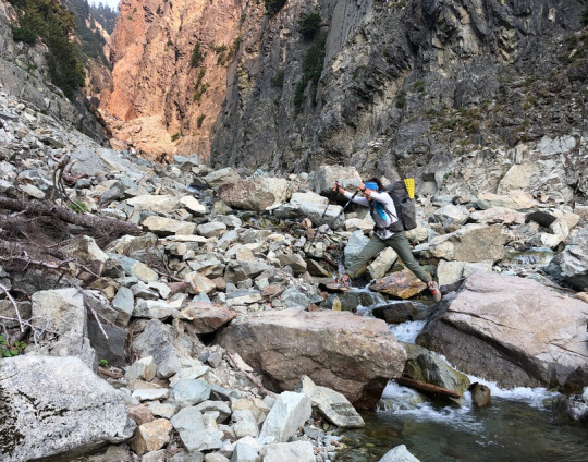
The photographer's (Michael Irving) daughter "Paintbrush" leaps the headwaters of the Cle Elum River in Northern Washington. The crest at Cathedral Pass offers an excellent view across the Cle Elum River valley to Granite Mountain. In the language of the Kittitas people, Cle Elum translates as 'swift water'.
7 notes
·
View notes
Photo
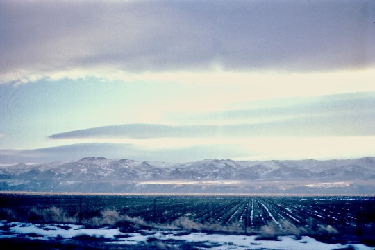
Kittitas Valley in Winter, Washington, 1972.
#landscape#fields#mountains#kittitas county#washington state#1972#photographers on tumblr#pnw#pacific northwest
8 notes
·
View notes
Photo
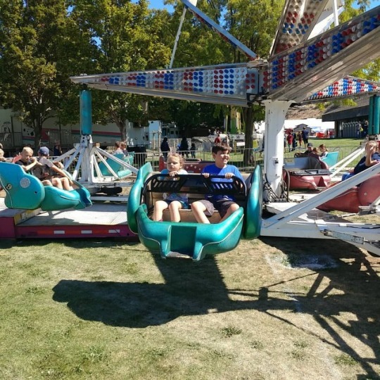
Great day at the Kittitas County Fair! #countyfair #fair #granddaughter #grandson #love (at Kittitas Valley Event Center) https://www.instagram.com/p/BnIAK9wgndx/?utm_source=ig_tumblr_share&igshid=1msm1o6gpm1i8
3 notes
·
View notes
Text
Mount Transistor by Flag Mountain and Lion Rock via Teanaway / 電晶體山
Mount Transistor by Flag Mountain and Lion Rock via Teanaway / 電晶體山
Mount Transistor by Flag Mountain is east of the vast Teanaway Backcountry. It’s also part of the Mission-Naneum Range north of Kittitas Valley Wind Farm. First Creek off Highway 97 gives the shortest way to the top.
Mount Transistor up ahead
See more trip photos here.
Mount Transistor at a Glance
Access: NF-3506Round Trip: 7.4 milesElevation Range: 2240′-3942′Gear: noneRoute Info: Scott…
View On WordPress
0 notes
Text
Level 3 evacuation order issued for Cle Elum residents due to wildfire
... and Kittitas Valley Fire and Rescue (KFVR) officials have control around three sides using ground personnel, air resources, and heavy equipment.
from Google Alert - Heavy Equipment https://ift.tt/36cEK2D
0 notes
Photo
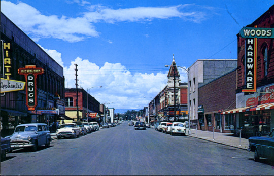
Postcard: Pearl Street, Ellensburg, Washington 1958.
1958
Publisher
J. Boyd Ellis, Arlington, Washington
Description
Looking north on Pearl Street between Third and Fourth Streets, this late 1950s section of Ellensburg remained the central business district. The towered Davidson Building, a well known landmark of Ellensburg, was constructed in the fall of 1889. The two large buildings on the left, the Geddis Building and the Cadwell-Olympic Building, were also build immediately after the July 1889 fire. The gray, streamlined and remodeled bank on the right was the former, ornate stone Ben Snipes Bank. Snipes, known as the northwest cattle king, during the 1860s and 1870s, had the his second band built in 1889.Postcard description, “Ellensburg, Washington. Home of the world famous Ellensburg Rodeo. Trade center of the Kittitas valley in Eastern Washington. Central Washington College of Education is located here. #C-345.”
Recommended Citation
“Early Pearl Street XVI” (1958). Ellensburg History Photographs. 158.
https://digitalcommons.cwu.edu/ellensburg_history/158
Source
Local History Collection Photographs, Ellensburg Public Library
4 notes
·
View notes
Photo

Violas and parsley from our garden, lovage and radishes from @steelwheel.farm, tomatoes from Kittitas Valley Greenhouse at @seattlefarmersmkts, lemon goat cheese, sesame seeds, homemade balsamic dressing. . . . . #salad #spring #dinner #farmersmarket #seattlefarmersmarket #eatlocal #vegetarian #nonbinarygardeners #ourqueerkitchen
#ourqueerkitchen#nonbinarygardeners#salad#seattlefarmersmarket#eatlocal#spring#vegetarian#dinner#farmersmarket
3 notes
·
View notes
Text
Dan James has been making music from the <b>Bronx</b> to the Burg for 20 years
Dan James has been making music from the Bronx to the 'Burg for 20 years now, settling into the Kittitas Valley music scene three years ago with gigs ...
from Google Alert - Bronx https://ift.tt/2JaPCpp
via https://ift.tt/2G9ANlB
0 notes
Photo
Anatomy scan time! #gummybearthomas So glad Nate could be there for this appointment! (at Kittitas Valley Healthcare) https://www.instagram.com/p/CCtrchkp5xk/?igshid=v2ucn3o3wf17
0 notes
Text
Kittitas Valley <b>Event</b> Center blood drive June 10
Red Cross reports say someone in the U.S. needs blood every two seconds, which needs to be constantly replenished and the Kittitas Valley Event ...
from Google Alert - event https://ift.tt/36WlJ4b
0 notes
Last Seen Blogs

ligeiaresurrected
Dark obsessions...

stanmaksivamakinalari
Stanmak Sıva Makinaları

alaridas
M.L.

audioledcar
AUDIOLEDCAR.COM tu tienda de accesorios online

porquenolostodos
The one thing I am is Not You