#nolsoy
Explore tagged Tumblr posts
Visit Tumblr Blog
Explore Tumblr blogs with no restrictions, modern design and the best experience.
Last Seen Tumblr Blogs


Fun Fact
China blocked Tumblr because of pornography and censorship problems in 2013.

Note

Nolsoy, Faroe Islands
24 notes
·
View notes
Photo

Faroe Islands, the dream. december 2019
@storiesbyso on instagram and twitter
#faroe islands#faroe#faroes#island#photography#fujifilm x#fujinon#fujifilm xseries#fujifilm#foggyweather#foggy mind#foggy forest#foggy day#atlantic ocean#oceanphotography#oceanlife#ocean aesthetic#nolsoy#polar exploration
11 notes
·
View notes
Photo

Europe, Faroe Islands, Streymoy, Nólsoy - webcam
10 notes
·
View notes
Photo

#faroeislands @rib62 #ribboat #boat #nolsoy #speedboat #fun #whereintheworldislianna #seals #wildlife #nature #ocean (at Faroe Islands) https://www.instagram.com/p/Ch8MEYTDJPy/?igshid=NGJjMDIxMWI=
0 notes
Photo

Voici mon 63ème vlog (blog en vidéo) Je suis partis pour un voyage de 8 jours aux îles Féroé Je te fais visiter cet archipel de 18 îles Je te propose de découvrir et d’explorer avec moi la petite île de "Nólsoy" afin d’y découvrir ses sublimes paysages (le lien de ma chaîne YouTube se trouve dans la description de ce compte Instagram) #voyage #voyages #exporation #explorer #découverte #visite #tourisme #travel #ilesferoe #færøerne #faroeislands #tórshavn #torshavn #nólsoy #nolsoy #borðan #bordan (à Nólsoy, Faroe Islands) https://www.instagram.com/p/Cgox8QhtaLe/?igshid=NGJjMDIxMWI=
#voyage#voyages#exporation#explorer#découverte#visite#tourisme#travel#ilesferoe#færøerne#faroeislands#tórshavn#torshavn#nólsoy#nolsoy#borðan#bordan
0 notes
Photo

Nólsoy from Hoyvík, Faroe Islands
10 notes
·
View notes
Text
The Italian researcher Felice Vinci has also taken up the question of the location of the events related by Homer. He presents his case in a book called The Baltic Origins of Homer's Epic Tales and in an article entitled “The Nordic Origins of the Iliad and Odyssey” in the Athens Journal of Mediterranean Studies. Vinci's ultimate conclusion is that there was a big migration from Scandinavia in prehistoric times, the migrants eventually settled in what is now Greece and became the Mycenaeans, and they brought with them their epic narratives and reassigned them to the Mediterranean region.
Vinci's argument, conveniently summarized in his journal article, rests on a careful comparison of the world described in Homer's texts with that of the Baltic and North Atlantic in about the second millennium BCE. For example, the climatic conditions described by Homer are a far cry from those of the sunny eastern Mediterranean. The Iliad describes violent storms, fog, and snow, but rarely mentions the sun. Homer's characters wear thick cloaks, sometimes lined with fur, similar to those found in northern Bronze Age tombs. Their diet does not include the olives, figs, and other staples of the Mediterranean, but rather large quantities of meat, as with the Vikings. They drink from beakers of metal or, in the case of poor people, wood, but not from pottery vessels, as would have been usual in the ancient Greek world. There is also abundant support for Vinci's theory from mythology. For example, the story of the abduction of Helen to Troy has a parallel in a Norse myth about how Snion, son of the Danish king, abducts the beautiful queen of Sweden and precipitates a war as related by the medieval chronicler Saxo Grammaticus in his Gesta Danorum...
The most powerful evidence adduced by Vinci is geographical. Homer's description of the lands visited by Ulysses does not correspond to any places in the Mediterranean, whereas they fit perfectly when shifted to the north. Calypso's island was already identified by the Greek author Plutarch (c. 44–120 CE) as lying in the North Atlantic, and Vinci identifies it as Nolsoy in the Faroe Islands. The Peloponnese, described as a plain in both the Iliad and the Odyssey, is, of course, mountainous, while Ulysses's own island of Ithaca fits exactly the Baltic island of Lyø.
What of Troy itself? Vinci writes that “100 km west of Helsinki there is a village, Toija, whose characteristics correspond exactly to those Homer passes down to us: a hilly ground dominating the valley with the two rivers, a plain stretching to the coast and a mountainous area . . .” Equally striking is the passage in the Odyssey referring to a people called the Ciconians or, in Greek, Kíkones, who attacked Ulysses and his men shortly after the Trojan campaign had ended. Vinci has discovered that, at the corresponding spot, about fifty kilometers inland from the coast of Finland is a town called Kíikoinen.
Then there is the figure of Ulysses himself, whom Vinci links with the Nordic god Ull, a warrior, hunter, and, like Ulysses, a skilled archer. Vinci also discusses a highly important aspect of Ulysses, namely his shamanic characteristics. He draws attention to a passage in the Odyssey that describes how Ulysses constructed his bedroom around an olive trunk: “I built my bedroom around it with thick stones / till I finished it, then I suitably covered it above properly / and built sturdy doors” (Odyssey 23, 192–94). Mircea Eliade states that a central pillar in a dwelling is a common feature in communities where shamanism is practiced and represents the axis of the world. He writes: “This pole is sacred; it is regarded almost as a god. At its foot stands a small stone altar, on which offerings are placed...”
Joramo, like Vinci, believes that an advanced people lived in the north in ancient times and were forced to migrate to other parts of the world because of climatic changes. This would mean, he says, that “contrary to all accepted dogma on the matter, important roots of our Western Civilization could be in the north and not in the Mediterranean”
Let us for a moment consider one of the arts that might have been transmitted to the Hellenic world from the North, namely the art of poetry. As we know from the Edda and the sagas, the figure of the bard played an enormously important role in Nordic society, and to become one involved acquiring complicated skills. One had to master several different poetic meters and know which one to use for a particular subject matter. One had to know how to chant the different meters. One also had to master elaborate metaphors called kennings. This is when, for example, you describe sunlight as the sword of the gods or a warrior as the feeder of the ravens, referring to the ravens scavenging among the corpses after a battle. And sometimes you would replace one word of the kenning with another kenning, creating elaborate layers of metaphor. All this had to be painstakingly acquired, so to be a bard carried great prestige. This is reflected in the fact that Odin, the father of the Nordic pantheon, is also the god of poetry. Poets had a similar prestige in Homeric Greece, and many of the same kennings appear in both traditions. For example we find in Homer the term “sea horses” (Odyssey IV: 780), meaning ships, identical to the Norse v´gmarr (“horse of the waves”). And Vinci suggests, intriguingly, that the famous “wooden horse” is probably actually a kenning indicating a ship.
- Christopher McIntosh, Beyond the North Wind
34 notes
·
View notes
Photo

Seeburg Fure West #seeburg #seacastle #chateaudemer #zeekastelen #zeekasteel #nordostseekanal #nok #furewest #nolsoy #schiffe #kiel #kielcanal #schepen #shipspotter #shipspotting #ship #schip #schiff #canon #kameraliebe #canon60d #60d #canonm50 #m50 #fotografie #fotos #foto #photography #capturinglight (hier: Nord-Ostsee-Kanal) https://www.instagram.com/p/BqVDOc0Al9Q/?utm_source=ig_tumblr_share&igshid=12dy1hchx0fhn
#seeburg#seacastle#chateaudemer#zeekastelen#zeekasteel#nordostseekanal#nok#furewest#nolsoy#schiffe#kiel#kielcanal#schepen#shipspotter#shipspotting#ship#schip#schiff#canon#kameraliebe#canon60d#60d#canonm50#m50#fotografie#fotos#foto#photography#capturinglight
0 notes
Photo


Blick vom 'Campingplatz' (= Schotterparkplatz) auf Nólsoy (oben) Bettchen, im Hintergrund die Ausläufer Thorshavns (unten)
0 notes
Photo

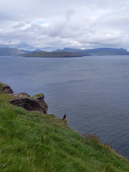
#nolsoy Island. Where is the #sheep? #island #puffin #faroe #birdwatching #photooftheday #instagood #instaphoto #ocean #travel #travelling #travellife #discover (presso Norðlýsið)
#photooftheday#island#puffin#instaphoto#travel#sheep#travellife#travelling#nolsoy#instagood#discover#ocean#faroe#birdwatching
0 notes
Photo

Small Towns of the Faroe Islands
While I was in the islands, I stayed in Torshavn (population 14,000-ish), visited Nolsoy via ferry (220), shared a taxi to Vestmanna and took the public bus service back (1215), and sailed to tiny Mykines from Vestmanna (10.5!). My point is that you better like your neighbors in some of these towns. Just kidding! I got a great sense of community from the Faroese people, they welcomed me and were extremely friendly. They’ve lived and been so isolated and far away from any other country and living MUST have been very difficult before modern times. A sense of solidarity and community was probably necessary!
I’ve already mentioned how much I want to go back, and honestly, the next time I go, I want to rent a car and spend enough time there to explore every corner of the islands. I don’t think visiting every town is my goal, but I plan to go back with the plan to do more hiking. And yes, I’d love to go back and run the half-marathon again and be prepared for those monstrous hills!
What I loved about each small town:
Torshavn: The big metropolis and capital of the island. This was the most cosmpolitan of the towns. It really did have a cute little downtown, with nicer restaurants, and a few higher end shops, museums about the history of the islands,etc. There were also hotels and a variety of places to suit anyone’s taste for nightlife. The main bus terminal for the island is here, the port for ferries/cruises to continental Europe and Iceland is in Torshavn. I think if you were traveling to the islands it would serve as a good base for day trips in a car or by bus, (if you didn’t want to stay somewhere different each night) because it has the most dining and accommodation options. There were several Airbnbs, hotels, hostels, and bed and breakfasts.
Nolsoy: Across the sea from Torshavn lies Nolsoy (both island and town). It is becoming more common for people in Nolsoy to work in Toshavn and take the ferry to and from work daily, as it was only about a 30 minute journey. I went to the ferry to hike the trails but the rain discouraged me and I ended up befriending some Swedish women and the locals and hanging out in the only bar on the island called Maggie’s Cafe. There was another cafe but it closed right as the ferry arrived. I would definitely head back here for the hike and for views on a clear day.
Vestmanna: Site of the port from which we sailed to Mykines. This town was on the bigger side but was spread out and did not seem to have a central area. Or, we missed it! Either way, it seemed kind of isolated and dare I say, boring, considering its size. This town probably sees a good amount of tourists and has a pretty darn good little restaurant right in the harbour/visitor center gift shop. If you book a boat tour and don’t have warm clothes, you’ll find sweaters, hats, and gloves in that shop. After our tour to Mykines, I ate with my new friends Desi, AnnCharlott, at the visitor center restaurant and had the most delicious fish soup and salad at the restaurant with a glass of wine. Most of our boat tour did as well! It was Whit Monday in the islands (a religious holiday) and so many things were closed but we walked into the town after we ate to explore and stretch our legs. We spotted a few restaurants and pubs and the main church but it seemed like a much quieter town despite the fact that it was the largest one I went to after Torhsavn. It seemed like a jumping off point to other places.
Mykines: Tiny Mykines! The town and the island are both named Mykines. This small town is on the westernmost of the Faroe Islands and is only accessible by boat or helicopter. There is a hostel and a bed and breakfast that serves food. I’m assuming the hostel does too because there is nothing else commercial on the island. We arrived and stopped at Marit’s house to have a bit to eat, which consisted of local sheep cheese, fish cakes, local blood sausage, rhubarb jam, and local butter, bread, and coffee, all for 100 DKK or about $18 at the time of purchase. Then we set off for the hiking! There are definitely more animals on this island that people. The operator of the b&b told us 10.5 people live on the island beause he is only there in summer to operate the business. We didnt’ interact with any other local people on this island, just sheep, puffins, and dogs. :) A few of the locals were out and about and nodded or smiled to acknowledge us, but I have to guess that if one chooses to live in such an isolated and small town, that they’re friendly but not interested in talking to small boatloads of tourists. This town was magical though, out of a fairytale. I felt like I’d stepped back in time even though I had cell service and there was electricity and all the modern conveniences, which was comforting.
Overall, I loved getting a peek at these little towns in the Faroe Islands. When I go back, I have my sights set on the northern islands and the towns on the island of Vagar so that I can hike the famous and picturesque lake Sorvagsvatn and see more of the natural scenery of the islands. Each one has its own charms!
#travel#faroeisland#torshavn#visittorshavn#vestmanna#nolsoy#mykines#puffins#sheep#40before40#40countriesbefore40#solotravel#Wanderlust
0 notes
Photo

#faroeislands @rib62 #ribboat #boat #nolsoy #speedboat #fun #whereintheworldislianna #lighthouse #bluesky #cliff #nofilter #nature #beautiful (at Faroe Islands) https://www.instagram.com/p/Ch8L19DjtEK/?igshid=NGJjMDIxMWI=
#faroeislands#ribboat#boat#nolsoy#speedboat#fun#whereintheworldislianna#lighthouse#bluesky#cliff#nofilter#nature#beautiful
0 notes
Photo

15 Mai, 12h23 - Nólsoy, île de Nólsoy, Îles Féroé, Danemark #nólsoy #nolsoy #faroeislands #faroeisland #ilesferoe #îlesféroé #danemark #dänemark #dänemark🇩🇰 #travel #travelphotography #travelphoto #voyage #voyages (at Nólsoy) https://www.instagram.com/p/CdllCfHte8-/?igshid=NGJjMDIxMWI=
#nólsoy#nolsoy#faroeislands#faroeisland#ilesferoe#îlesféroé#danemark#dänemark#dänemark🇩🇰#travel#travelphotography#travelphoto#voyage#voyages
0 notes
Text
Feröer-szigetek
Augusztus második felében a sivatagi éghajlatból, egy óceáni éghajlatú, vulkanikus eredetű szigetcsoportra látogattam el, a Feröer-szigetekre.
A dán királysághoz tartozó Feröer (magyarul: Juh-szigetek) az Atlanti-óceánon húzódik, félúton Skócia és Izland között.
A szigetcsoport 18 nagyobb szigetből áll, legmagasabb pontja 882 méter. Azt olvastam, hogy bárhol is vagyunk a szigeteken az óceán nem lehet messzebb tőlünk, mint 5 km.
Egy szerdai napon indultam el feröeri utamra. Koppenhágában kellett átszállnom, az idő nagyon szép volt a repüléshez. Gyorsan teltek a repülőutak, már alig vártam, hogy meglássam a szigeteket. Ahogyan ereszkedtünk lefelé szép lassan emelkedtek a magasba a sziget vonulatainak csúcsai. Két látnivalót semmiképpen nem akartam kihagyni az utazásom alatt, az egyik a "Tó az óceán felett", a másik pedig a Drangarnir-sziklacsoport. Mindkettőt volt szerencsém látni a repülőből. Már ezért érdemes volt elutazni. :-)

Miután leszállt a gép Vágar városában szerencsésen elértem az utolsó buszt ami elvitt Tórshavn-ba, ahol a szállásom volt. A buszúton szerintem végig mosolyogtam, mert nagyon nagyon szeretem a hegyeket, főleg ha vulkanikus eredetű és óceán veszi körül tavakkal.
A legmelegebb hónapban utaztam, 11 fok volt mikor leszállt a gép. Kissé hidegnek tűnt első érzésre az otthoni 33 fok és a Dubai-i 43 fok után. Hoztam magammal sapkát, sálat, kesztyűt, úgyhogy nincs kifogás a hideg ellen.
Első teljes napon Tórshavn városát fedeztem fel, ami a szigetek fővárosa. Nevének jelentése "Thor kikötője", a dörgés és villámlás istenéről a skandináv mitológiából. Időjárás szempontjából elég zord időre ébredtem aznap, de egy gyors reggeli után elindultam utamra fél 8 körül. Bementem a városközpontba, először a kikötőbe. Sapka-sál-kesztyű kombó a táskámban volt eredetileg, de mialatt megtettem a kb 15 perces sétát addigra mindhárom "kedvenc" téli ruhadarab már rajtam volt. Nagyon esett az eső és mégjobban fújt a szél, de nem bántam, mert ki akartam maxolni az itt töltött időt. A kikötő után a Tinganes-hez mentem, ami a feröeri kormány székhelye. A városban mindenhol színes házak vannak, a kormány épületeinek színe piros, ami legalább egy kis melegséget sugárzott a számomra fagyos időben.

Tovább keresve a piros színeket a Skansin felé haladtam tovább, ami a kikötő közelében található egy piros-fehér színű világítótoronnyal. Az eső nem hagyott alább, de folytattam utamat a főváros "katedrális"-a felé. Sajnos még túl korán volt, így csak kívülről tudtam megnézni.
Már annyira esett az eső, hogy ez nem volt elég nekem és eltúráztam egy vízeséshez, ami a Svartafoss Waterfall névre hallgat. A város közelében található, egy jól kiépített túraútvonalon lehetett megközelíteni. Eső nélkül is szép lehet, de esővel csodás volt, viszont mivel már az arcomról is az esővíz folyt, így úgy döntöttem, hogy bemegyek a hotelbe egy órára melegedni és teázni.
Később még tettem egy sétát a közeli parkban, majd áthajóztam a legközelebbi szigetre Nolsoy-ra. 1,5 óra volt a visszaútig, amit azzal töltöttem el, hogy elsétáltam a sziget egyik végébe, majd vissza a faluba. :) Nagyon jól esett a lelkemnek ez a sziget, főleg azért, mert nem szakadt az eső, és jó érzés volt túrázni egy kicsit az ismeretlenben. Nolsoy szigetén egyébként kb 200 ember él, és a sziget hosszúkás és keskeny alakja, valamint elhelyezkedése miatt szinte védi Torshavn városát a nagy hullámoktól. Sajnos a hajóút ezt számomra nem bizonyította - mert nagyon imbolygott a hajó - de ezt olvastam az egyik ismertetőben.

Az első teljes napot így közül 20 km-rel a lábamban tettem meg. Mi lett volna ha szép napos az idő, és nem pihenek meg a hotelben kétszer a nap folyamán? :)
A következő nap, pénteken egy kiscsoportos utazáson vettem részt, melynek az volt a neve, hogy "See it all". Azzal kezdtük a napot, hogy a Streymoy szigetről - ahol Tórshavn fekszik - átautóztunk Eysturoy szigetre, ez a két legnagyobb sziget a 18 sziget közül. A szigetek között óceán alatti alagúton mentünk át, melynek beljesében egy körforgalom is található, ami egyedülálló a világon.
Az első szigeten az alábbi városokban, falvakban álltunk meg:
Funningur (innen láttuk a szemközti James Bond szigetet, Kalsoy-t, ahol véget ért a filmsorozat)
Gjógv (itt találtunk egy padot, ahol 2005-ben Mária dán hercegnő ült és élvezte a királyi kilátást)
Eysturoy sziget után visszamentünk Streymoy szigetre és megnéztünk itt is pár látnivalót:
Tjornuvík (ahol sétáltunk a vulkanikus eredetű fekete homokos tengerparton)
Fossá waterfall (legnagyobb, 140 méter magas, két szintes vízesés)

Saksun (itt lakik egy bácsi, aki annyira komolyan veszi a fűre lépni tilos szabályt, hogy a túravezető elmondása szerint egyik nap odament egy turistához és felpofozta, mert fűre lépett, valamint egy másik turista drónt használt itt, amit a bácsi puskával lelőtt)

A két legnagyobb sziget után a harmadik legnagyobb következett: Vágár szigete, ahol a repülőtér is található. Itt is megnéztünk pár látványosságot:
Drangirnir (Tindhólmur szigetecske része, melynek egyik tagja az ég felé magasodik szinte érezhetően hegyes csúcsával)
Gásadalur (egy legenda szerint egy Gasa nevű asszonyról kapta a nevét, aki a fél szigetet birtokolta, de amikor kiderült, hogy böjt idején húst evett, elvesztette birtokát)

Faroe prison (a sziget börtene, melynek ablakaiból csodás kilátás nyílik az óceánra, és melynek része egy minigolf pálya is)
A nap zárásaként, miután pihentem egy órát a hotelben elsétáltam a legközelebbi beach-re. A második napot így csak 10 km-rel zártam, de annál több látnivalóval. :)
Szombaton túrázós napot tartottam. Busszal elutaztam Midvágur városba, ahol kezdődik a Tó az óceán felett túraútvonal. 200 feröeri korona a hiking fee, 1,5 óra volt oda és vissza a túra. A látvány elmondhatatlanul szép volt, de nagyon siettem, mert szakadt az eső.
Kicsit extázisba is kerültem, amikor megláttam a sziklákat, és egyik oldalamon a tó volt, a másik oldalon pedig az óceán. :) A közel 6 km hosszú és 59 méter mély tó az óceán felett "fekszik" és egy vízesésben ömlik az óceánba. Tényleg nem tudom szavakkal leírni annyira gyönyörű.

A túra végén átsétáltam a szomszédfaluba, Sandavágur-ba, ahol nagyon sokat kellett várni a buszra dideregve, mert nagyon átáztam és átfagytam. Az eső továbbra is esett sajnos, így Tórshavn-ba beérve először egy kicsit pihentem és melegedtem a hotelben, majd este még elmentem egy laza sétára, ami alatt átsétáltam egy másik faluba, Hoyvík-ba, így szombaton is megvolt a 20 km. Nagyon sok túra jellegű út van a főváros közelében és ezeket is igyekeztem bejárni a szigeten töltött idő alatt.
Vasárnap volt az utolsó teljes napom a szigeteken, amit szerettem volna kimaxolni. Ennek ellenére nem indult jól, mert elbuszoztam Klaksvik-ba, de sajnos olyan köd és dézsàból ömlő víz fogadott, hogy egyszerűen nem láttam, amit meg akartam nézni. A falu tulajdonképpen két öböl között fekszik és az egyikből tökéletes a kilàtás a szemközti Kanoy szigetre tiszta időben. A kèt sziget között pár 100 méter van lègvonalban, de ma nem igazán volt látható. Megnéztem így a templomot és sétáltam a faluban, de mivel a ruhàim az első 10 percben totàl vizesek lettek, igy inkàbb visszautaztam Tórshavn-ba. A buszút kárpótolt Klaksvik miatt.

Délután Mykines szigettúra lett volna, de sajnos a szeles idő miatt törölték. Szomorú voltam, mert így nem látok puffint, helyette Tórshavn-ban sètàltam.

Hètfőn màr csak a visszaút volt a menün. Ez az utazás volt eddigi legjobb életem során, még a zord idő ellenére is. Puffint látni vissza kell jönnöm vagy másik úticélt választani, ahol puffin is lakik. :)

1 note
·
View note
Link
Buddhism, Christianity, spiritualism , they all arrive at the same conclusion. Be present, enjoy each day ,be grateful for what you already have and help others
0 notes