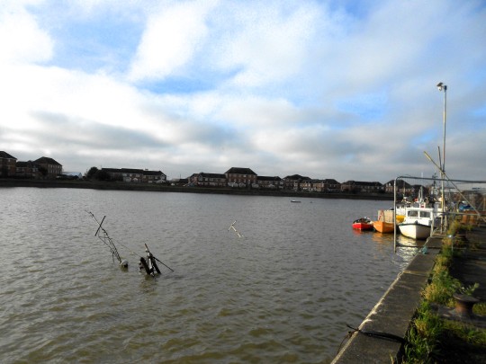
#river wyre estuary
Text
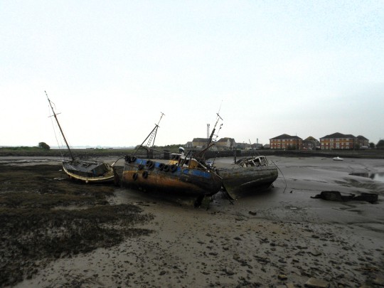
Part of the ships' graveyard in the estuary of the River Wyre at Fleetwood. There are other wrecks up and down the estuary.
7 notes
·
View notes
Text
Day Seventy
I realised I'd accidentally missed a count whilst dealing with the injury, which means today is in fact the ten week mark!
Up early from the woods by Silverdale, the sun is shining and the wind is low, should be a good day for the mileage!
Today's ride starts out with a nice glide downhill from Arnside & Silverdale AONB and across the wetlands of RSPB Leighton Moss, before rolling into Carnforth for a quick stop for supplies.
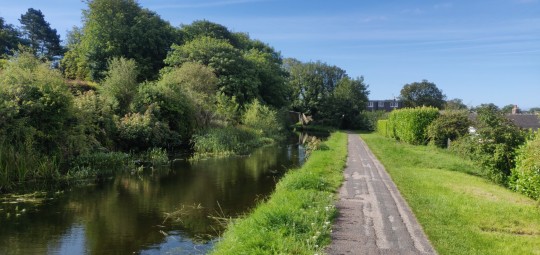
From here, it's time to jump on to the canal towpath heading alongside the A6 for some nice level riding. The towpath surface isn't great, alternating between stoney gravel or pockmarked with holes, but it's still enjoyable going through the tunnels of trees along the canalside.
The canal is followed down to Hest Bank, where I swing west to jump onto the coastline for a lovely ride along the seaside across to Morecambe.
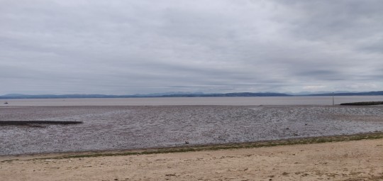
The tide is out, and a ceiling of cloud has appeared, but it's high up and still a warm day, with the air clear enough to gaze right across the bay to see Helvellyn and its surrounding peaks in the Lake District standing proudly on the horizon.
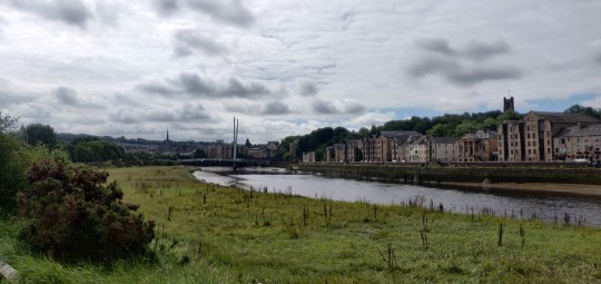
After taking in the views awhile, it's time to head back inland along The Greenway cycle path, a great long stretch of smooth paving through some lovely forested sections down to the River Lune and historic Lancaster.
Crossing ove the river via the Millennium Bridge, the cycle route turns and tracks along the River Lune for another few miles all the way down to Condor Green. The path turns to a rocky bridleway halfway along which does slow progress and requires a deal of concentration to find viable routes to prevent the bike shaking me to bits, but what scenery I'm able to take in is still enjoyable.
I opt to take the bike route inland to cut out a section of A road, which ends up leading me into a few stiff climbs as it loops out and back again around the M6, before heading back out westward through Cockerham.
The route here is branded as the "Lancaster Cycleway", but in reality there is no provision whatsoever for cycling infrastructure, and it's a long slog along some busy roads with the wind starting to come in from the west, making for a bit of a tough section across the flats.
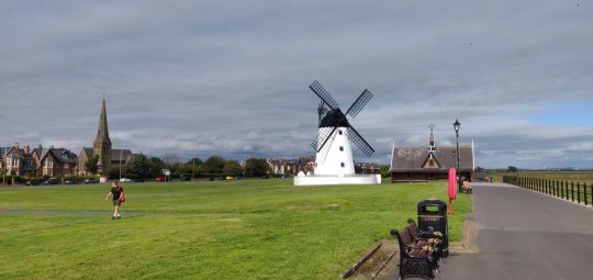
With there being no route across the River Wyre along the coast, the route swings south across the fields to reach the toll bridge at Great Ecclestone. Heading a little further south through Elswick, it's a further jaunt through windy country lanes westward along the B5269 as the hills begin to roll in a little.
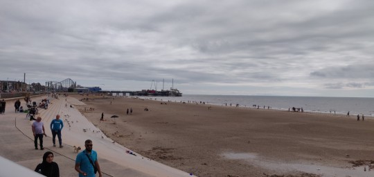
The day is brightening though, and before long tue busy lanes turn into bugger, busier roads as we ride into the outskirts of Blackpool.
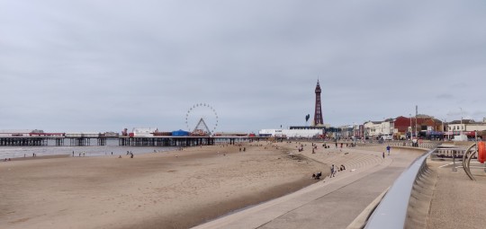
Doing what I can to avoid the seriously heavy traffic through much of town, I carry on westward a little further and hit the seaside again, with a nice sight if the famous Blackpool Tower.
The air is clear enough still to even catch a glimpse of the beautiful peaks of Snowdonia far across the water.
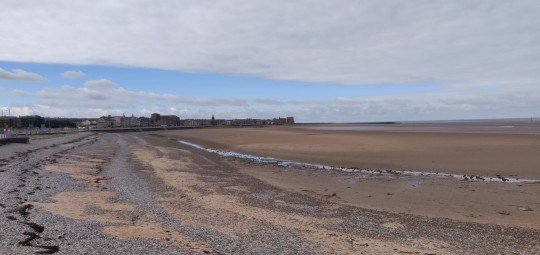
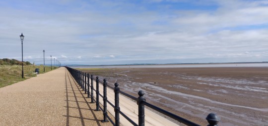
From the pleasure beach, it's time for a jaunt along the promenade. I've really enjoyed riding along a good few seaside promenades through this journey, and the stretch along from Blackpool is some of the best yet.
Some great smooth level riding right along the waterside, with a short jump onto the road before continuing again around the sandy expanses of St Anne's and the nature reserves by Lytham.
The view across the Ribble Estuary is gorgeous, with so much of the upcoming coast on display.
With some big urban stretches ahead, I don't want to progress too much further today and get caught up in them when trying to find a place to sleep, so I resolve to find a spot prior to Preston. But the legs are still feeling energetic currently, so I push on from Lytham and into rish hour.
The traffic on the road by Saltcotes is as heavy as it gets, but with an adjacent cycle path I have a good deal of pleasure pushing on and zooming past the queueing cars as the sun shines out once more, and carey on past Freckleton.
It's a stretch if dual carriageway here, but I'm feeling bullish and start charging down it. I realise I may have miscalculated as the miles grind down as before I know it I'm hitting the outskirts of Preston.
There are aome good cycle paths around here though, and I start following the Guild Wheel route along Savick Brook to scout out some possible stopping points to setup in.
Then I receive a lovely and unexpected present from the wonderful Ellie! Given that my back is still playing up somewhat after my fall, I decide to use it to book into a nice cheap B&B just a little further down the road to give me a nice soft bed to help aid the recovery a little more.
That's been a decent day's progress! Honestly wasn't expecting to get this far on today, but starting out tomorrow this deep into Preston puts me in a great position to get through the main urban challenges tomorrow, and possibly get over the border to Wales. We shall see what the morning holds.
TTFN!
6 notes
·
View notes
Text


Tobes has taken some great photos of the derelict steam ship jetty at St. Annes-on-sea. I will add a photo later of what it looked like in the era it was functional. The jetty was built in the 1880s, its purpose as a landing spot on which to load and unload livestock and goods from ships travelling to and from Liverpool. Much of the three-tier structure is now buried under the sand as a new shipping channel* caused sand levels to rise by 20ft*. [Will add more details later]. It was originally attached to the pier but that suffered two fires and the remains of the adjoining part has since been demolished.
Will add more info and sources etc later.
* The Ribble Navigation and Preston Dock Act of 1883 led to dredging of the river channels to improve access to Preston. These changes to the estuary meant that the pier was eventually left on dry land, ruining the resort's steamer trade.
* Perhaps even more than 20ft - as two of the tiers are submerged under sand? Needs checking.
Presumably the construction of the shipping channel displaced huge amounts of sand which turned to silt when mixed with sea water and over time was carried by the tide and deposited on St. Annes beach, creating the sand level to rise. Will look into this further and also find out about Preston Dock.
The conical structures on the landing base were originally some type of beacons, will add more info later.
Will also look at previous blog post about how Fleetwood lost its position as an important dock when a new railway line was built which created an alternative route to Scotland.
Also add link to blog posts about Skippool, now a ships' graveyard on the River Wyre, at one time a port busier than Liverpool. Find out more about its decline.
Also, what's puzzling me about the apparent rise in sand level is that the whole coast all the way up to Fleetwood seems to be the same level. I'm going to write to the local history department at St Annes and hopefully find out more info.
1 note
·
View note
Text
Plover Scar Lighthouse with Cloud

#plover scar#lighthouse#cloud#mindful photography#contemplative photography#black and white photography#monochrome#film photography#35mm#foma film#fomapan 200#caffenol#home brew developer#river wyre#lancashire#estuary#water margin#ishootfilm#istillshootfilm#films not dead#outdoors#landscape photography#summer#low tide#analogue photography#original photographers#photographers on facebook#photographers on flickr#photographers on instagram#photographers on tumblr
41 notes
·
View notes
Photo

A shot from the banks of the river wyre with the breeze blowing and sun setting #studio4photo #studio4lytham #riverwyre #fleetwood #poultonlefylde #wyre #river #water #sunset #sun #blackandwhitephotography #blackandwhite #travel #travelphotography #visitlancshire #visitwyre #visituk (at River Wyre Estuary) https://www.instagram.com/p/COuk3jCgGjc/?igshid=25nnpyh3x8y8
#studio4photo#studio4lytham#riverwyre#fleetwood#poultonlefylde#wyre#river#water#sunset#sun#blackandwhitephotography#blackandwhite#travel#travelphotography#visitlancshire#visitwyre#visituk
0 notes
Text

Part of the infrastructure of the abandoned roll-on roll-off ferry terminal at Fleetwood, including a gangway.
3 notes
·
View notes
Text

A dredger working in the estuary of the River Wyre between Fleetwood and Knott End. I assumed dredging had ceased after Fleetwood stopped being an Anglo-Irish ferry port, but apparently not.
3 notes
·
View notes
Text

Fleetwood's fishing fleet having a lie down in the estuary of the River Wyre.
4 notes
·
View notes
Text
Part of Fleetwood's mighty fishing fleet not having a particularly good day.
3 notes
·
View notes
Text
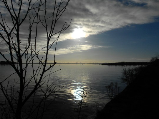
Low sun over the estuary of the River Wyre at Fleetwood in November.
3 notes
·
View notes
Text

A low sun over the estuary of the River Wyre at Fleetwood.
5 notes
·
View notes
Text

The footpath alongside the estuary of the River Wyre at Fleetwood is gradually returning to nature.
3 notes
·
View notes
Text

The roll-on roll-off ferry terminal at Fleetwood is well protected, even though there is not a huge amount left to protect. At least it stops people larking about on it and falling into the mud or water of the River Wyre estuary, depending on the tide.
2 notes
·
View notes
Text

Footpath alongside the River Wyre Estuary at Fleetwood, with the late roll-on roll-off ferry lorry park fence on the right.
2 notes
·
View notes
Text

An inlet of the River Wyre at Thornton in Lancashire, used to launch and recover small boats and jetskis. Zooming about on a jetski looks uninteresting. I think most people who buy jetskis agree with me, because a lot of them are sold after one season of use.
7 notes
·
View notes
Text

A boat sailing from Fleetwood, past the abandoned roll-on roll-off ferry terminal.
2 notes
·
View notes
Last Seen Blogs

cjnneto
Sem título

carmenfool
:3

finninicky
"do you find this...
distracting?"

condrache-mihai-zeu
Condrache Mihai (ZEU)

nancywheelercoded
stancy endgame