#rockfall protection and mitigation
Explore tagged Tumblr posts
Visit Tumblr Blog
Explore Tumblr blogs with no restrictions, modern design and the best experience.
Last Seen Tumblr Blogs


Fun Fact
The “We are the 99%” Tumblr blog became the slogan for the Occupy Wall Street movement.
Text
Rockfall Protection Techniques in India
The majestic mountains and rugged terrains of India add to its natural beauty, but they also present a unique challenge: rockfalls. These sudden and often unpredictable occurrences pose a significant threat to life, property, and infrastructure. Thankfully, various rockfall protection techniques exist to mitigate these risks and ensure the safety of individuals, communities, and critical assets.
Understanding the Threat:
Rockfalls can be triggered by various factors, including:
● Natural causes: Heavy rainfall, earthquakes, and erosion can loosen rocks and trigger falls.
● Human activities: Construction, mining, and blasting can destabilize slopes and increase the risk of rockfalls.
The consequences of rockfalls can be severe, causing:
● Loss of life and injuries: Falling rocks can directly harm people or damage structures, leading to casualties.
● Infrastructure damage: Roads, bridges, buildings, and other infrastructure can be damaged or destroyed by rockfalls, disrupting essential services and causing economic losses.
● Environmental damage: Rockfalls can destabilize slopes, trigger landslides, and damage vegetation, impacting the environment.
Rockfall Protection Techniques:
Fortunately, various rockfall protection and mitigation techniques exist to address these concerns. Some common methods include:
● Passive barriers: These are fixed structures like rockfall barriers, mesh nets, and draped nets that intercept and absorb the impact of falling rocks.
● Active barriers: These are dynamic systems like rockfall fences and rockfall catchers that deflect or capture falling rocks using kinetic energy.
● Rockfall stabilization: This involves techniques like anchoring, bolting, and shotcreting to stabilize loose rocks and slopes.
● Monitoring and early warning systems: These systems use sensors and cameras to detect potential rockfalls and provide advance warnings for evacuation or mitigation measures.
Choosing the Right Technique:
The ideal rockfall protection technique depends on several factors, including:
● The size and type of rocks: Different techniques are suitable for different sizes and types of rocks.
● Slope characteristics: The steepness, stability, and geology of the slope influence the choice of technique.
● Budget and resources: Different techniques have varying costs and require specialized expertise.
Shri Sai Eco Solutions: Your Partner in Rockfall Protection:
Shri Sai Eco Solutions is a leading provider of rockfall protection and mitigation solutions in India. With years of experience and expertise, we offer a comprehensive range of services, including:
● Site assessment and risk evaluation: We assess the specific rockfall risks at your site and recommend the most suitable protection techniques.
● Design and engineering: Our team of experienced engineers designs and plans effective rockfall protection systems tailored to your specific needs.
● Installation and maintenance: We provide skilled personnel and equipment for the installation and maintenance of your rockfall protection system.
● Regulatory compliance: We ensure all our solutions comply with relevant regulations and safety standards.
Investing in rockfall protection is an investment in safety and security. By partnering with experienced professionals like Shri Sai India, you can safeguard your communities, infrastructure, and assets from the dangers of rockfalls.
#rockfall protection#rockfall protection and mitigation#rockfall protection techniques#Shri Sai Eco Solutions#Gabion Boxes#gabion retaining walls
0 notes
Text
How Can Rock Netting Improve Safety and Stability in Slope Protection Projects?

In the realm of construction and geotechnical engineering, rock netting plays a critical role in mitigating risks associated with loose or falling rocks. Whether on highways, railways, or mountainous terrains, this protective mesh system is a reliable solution designed to control rockfall hazards. The installation of rock netting is not just about safety—it’s also a strategic investment that extends the lifespan of infrastructure and minimizes maintenance costs over time.
0 notes
Text
What Is Rockfall Protection and Why Is It Important?

In regions with steep slopes, mountains, or rocky terrain, falling rocks pose a serious hazard to lives, infrastructure, and the environment. Whether triggered by natural erosion, heavy rainfall, seismic activity, or freeze-thaw cycles, rockfalls can lead to severe damage and loss. That’s where rockfall protection comes into play.
Rockfall protection refers to a series of engineering methods and safety measures designed to prevent, control, or mitigate the impact of falling rocks. These solutions are essential for safeguarding roads, railways, buildings, and other critical infrastructure situated near unstable slopes or cliffs.
Understanding Rockfall Events
Rockfalls occur when fragments of rock break away from a steep slope or cliff and tumble downslope under the influence of gravity. These events can range from small stone dislodgements to large-scale mass movements involving several tons of rock.
Common causes of rockfalls include:
Weathering and erosion of rock faces
Seismic activity and vibrations
Rainfall that weakens slope material
Freeze-thaw cycles that cause cracks to expand
Human activity, such as excavation or blasting
Rockfalls can be sudden and unpredictable, making rockfall protection a critical component of risk management in hazard-prone areas.
What Is Rockfall Protection?
Rockfall protection involves a combination of passive and active systems designed to prevent rocks from reaching vulnerable areas or reduce the impact when they do.
1. Active Rockfall Protection
These systems are aimed at preventing rockfalls from occurring by stabilizing slopes and rock masses. Common active measures include:
Rock bolts and anchors to secure unstable rock
Shotcrete (sprayed concrete) to reinforce slope faces
Wire mesh or netting to hold loose rock in place
Drainage systems to prevent water-induced slope weakening
2. Passive Rockfall Protection
These systems are designed to intercept or control falling rocks after detachment. Examples include:
Catch fences or rockfall barriers to absorb and deflect rocks
Draped mesh systems that guide falling rocks safely to the base
Rockfall galleries or sheds built over roads or railways
Impact walls or embankments to block rock paths
Both systems can be used independently or combined, depending on the site-specific conditions, hazard level, and type of infrastructure at risk.
Why Is Rockfall Protection Important?
1. Ensures Public Safety
The most important reason for implementing rockfall protection is to safeguard human lives. Rockfalls along highways, railroads, or tourist destinations can lead to deadly accidents. Protection systems help reduce these risks significantly.
2. Protects Infrastructure
Bridges, tunnels, roads, dams, and buildings near slopes are all at risk of damage from rockfalls. By installing appropriate rockfall protection systems, authorities and developers can prevent expensive repairs, operational disruptions, and potential legal liabilities.
3. Supports Economic Development
Many transport routes and infrastructure projects pass through mountainous or hilly terrain. Rockfall protection ensures these areas remain safe and accessible, supporting economic activities like tourism, trade, and local development.
4. Reduces Long-Term Costs
Proactively installing rockfall protection is more cost-effective than dealing with the aftermath of a rockfall disaster. It also minimizes downtime and maintenance costs over time.
5. Complies with Regulations
Many countries have regulations and safety standards that require risk assessments and mitigation for rockfall-prone zones. Implementing effective rockfall protection helps meet these legal obligations and enhances public trust.
Conclusion
Rockfalls are natural yet dangerous events that can have devastating consequences if not managed properly. Rockfall protection plays a vital role in preventing accidents, saving lives, and protecting infrastructure in at-risk areas. With advancements in engineering and technology, modern protection systems are more efficient, cost-effective, and adaptable than ever before.
Whether you’re planning a road project through rocky terrain or assessing the safety of an existing site, investing in rockfall protection is a crucial step in ensuring long-term stability and resilience.
0 notes
Text
Innovations and Advancements in Metal Netting Technology for Landslide Mitigation

Landslides pose significant threats to both human lives and infrastructure, especially in regions with challenging topographies. Innovative solutions are continually being developed to address these risks, and one such advancement that has proven effective in landslide mitigation is the use of metal netting technology. Over the years, ongoing research and technological innovations have led to significant advancements in metal netting systems, enhancing their effectiveness, durability, and adaptability in preventing and managing landslide hazards.
1. Material Innovations:
One of the key advancements in metal netting technology for landslide mitigation lies in material innovation. Traditional metal nets were primarily made from steel, offering strength and durability but often susceptible to corrosion over time. Recent innovations involve the use of corrosion-resistant alloys and composite materials that significantly extend the lifespan of metal netting systems. These materials not only withstand the harsh environmental conditions common in landslide-prone areas but also reduce the need for frequent maintenance.
2. High-Tensile Strength Designs:
Advancements in metallurgy and engineering have led to the development of metal netting with higher tensile strength. High-tensile strength metal netting can withstand greater loads and forces, making it more effective in stabilizing slopes and containing rockfalls or debris flows. This innovation is particularly crucial in regions with steep terrains and high-risk zones where the resilience of the metal netting is paramount to ensuring long-term stability.
3. Adaptive and Flexible Mesh Drapery Systems:
In recent years, there has been a shift towards the development of adaptive and flexible metal netting systems, such as mesh drapery. These systems utilize interwoven metal cables that conform to the natural contours of the terrain. This flexibility allows for better adaptation to irregular surfaces and varying slope profiles. Mesh drapery systems are particularly advantageous in complex geological settings, providing effective coverage and stability while minimizing visual impact on the landscape.
4. Monitoring and Sensing Technologies:
Integrating monitoring and sensing technologies into metal netting systems represents a cutting-edge advancement in landslide mitigation. These technologies, such as sensors and geospatial monitoring systems, enable real-time tracking of environmental conditions, slope stability, and potential signs of instability. If irregularities are detected, automated warning systems can be triggered, allowing for timely intervention and preventive measures. This integration enhances the overall effectiveness of metal netting technology by providing a proactive approach to landslide risk management.
5. Customized Solutions through 3D Modeling:
Advancements in 3D modeling and simulation technologies have facilitated the development of customized metal netting solutions tailored to specific geological conditions. By creating detailed digital models of the terrain and simulating potential landslide scenarios, engineers can design metal netting systems that precisely match the topography and address unique challenges of a particular location. This customization enhances the efficiency and efficacy of landslide mitigation efforts, ensuring that the metal netting is optimized for the specific conditions it will encounter.
6. Durability in Harsh Environments:
In regions with extreme weather conditions, including heavy rainfall, freezing temperatures, or intense sunlight, metal netting technology has seen advancements to enhance durability. Specialized coatings and treatments are applied to metal nets to protect against corrosion, UV radiation, and temperature fluctuations. These innovations extend the lifespan of the metal netting, ensuring its continued effectiveness in preventing landslides despite exposure to harsh environmental elements.
7. Eco-Friendly Approaches:
In response to growing environmental concerns, innovations in metal netting technology also focus on eco-friendly approaches. The development of metal netting systems that have minimal environmental impact during manufacturing, installation, and throughout their lifecycle reflects a commitment to sustainable and responsible landslide mitigation practices. This aligns with global efforts to balance infrastructure development with environmental conservation.
In conclusion, the continuous innovations and advancements in metal netting technology for landslide mitigation represent a significant stride in enhancing the resilience and effectiveness of these systems. From material improvements to adaptive designs, sensing technologies, and eco-friendly approaches, these innovations collectively contribute to creating more robust, efficient, and sustainable solutions for managing landslide risks. As technology continues to evolve, the integration of these advancements into comprehensive landslide mitigation strategies will play a crucial role in protecting vulnerable regions and ensuring the safety of communities in landslide-prone areas.
0 notes
Text
Transport Resilience Fund Boosts West Coast
Investing in Road Resilience
The New Zealand government is committing more than $22 million to enhance the resilience of roads on the West Coast that have been vulnerable to recent extreme weather events, Prime Minister Chris Hipkins announced today. This substantial investment aims to safeguard the state highway network in the region from the disruptive impact of severe weather. Transport Resilience Fund at Work The establishment of a dedicated Transport Resilience Fund paves the way for early preventative measures to protect the state highway network from future severe weather disruptions. This fund will be instrumental in fortifying critical road infrastructure across the West Coast. Roads Receiving Funding The roads in the West Coast region that are set to benefit from the Transport Resilience Fund include: - SH6 Gates of Haast river erosion - SH6 Wanganui River Protection - SH6 Whataroa River Protection - SH73 Rock Shelter DSA and Strengthening - SH73 Otira River Bridge Abutment Protection - SH6 Buller Gorge Rock Scaling - SH6 Douglas Culvert No.2 Replacement - Cascade Corner - Cobden Hill West - Depot Creek - Ormon Falls - East of McGraths Corner - McGraths Corner - Whites Bridge West Approach - Rocky Point - SH73 Candys Bend Scouring - SH6 Meybille Bay Slip - SH6 Epitaph Slip - Remote Monitoring Additionally, the Haast to Hawea section of SH6 has been identified as a high priority for improving the overall resilience of the state highway corridor, with planning work scheduled for the 2024-27 NLTP period. Building Resilience Against the Elements State Highway 6, in particular, has been susceptible to closures resulting from slips, rockfalls, and flooding, while the West Coast remains prone to adverse weather events. "Many roads in the region have experienced repeated extreme weather events in recent years. We need to repair our state highways after these events and also build greater resilience so they're less affected in the future," stated Prime Minister Chris Hipkins.
Supporting Tourism and Local Communities
Improving road resilience not only ensures safer transportation but also bolsters the tourism industry on the West Coast, a vital sector for the region and its residents. "Safer and more resilient roads will also help support tourism on the West Coast – a key industry for the region and for many locals," emphasized Prime Minister Hipkins. Commitment to Resilience In this year's budget, the government established the $419 million Transport Resilience Fund to support investments that enhance regional recovery. Prime Minister Hipkins highlighted, "Investing in resilience creates savings down the road, as well as ensuring communities aren't cut off and isolated after extreme weather." Expanding Resilience Initiatives Further emphasizing the commitment to regional resilience, Prime Minister Hipkins noted, "In this year's budget, we set aside $6 billion in funding to support the implementation of a National Resilience Plan. I can confirm that projects in the top of the south will be considered for funding as part of this ongoing work." Unity in Resilience "No region can foot the bill for building transport resilience on their own. That's why the Government is coming to the table to support regions with a range of funds to help them recover," stated Prime Minister Hipkins. "We are absolutely committed to the region's recovery."
Partnering for a Stronger West Coast
Associate Transport Minister Damien O'Connor underscored the importance of this investment, stating, "We are committed to supporting the region to rebuild and build back stronger from the challenges of recent times. We know severe weather events will be an ongoing challenge, and West Coast highways need to be resilient." "This funding will repair vulnerable points in the road network to help mitigate the risk of them failing in future storms or other natural hazards." A Collective Effort In a time where resilience against extreme weather is paramount, the government's investment in road resilience demonstrates a collective commitment to ensuring safer, more reliable transportation and strengthening the West Coast's ability to withstand future challenges. Sources: THX News & New Zealand Government. Read the full article
#ChrisHipkins#Governmentinvestment#Highwayupgrades#Infrastructuresupport#Recoveryinitiatives#Resilienceprojects#Roadimprovements#TransportResilienceFund#Weatherresilience#WestCoastroads
0 notes
Link
India`s best geotechnical engineering company.
#slope stabilization#ground anchors#erosion control#rockfall mitigation#micropiling#avalanche barrier#ground improvement#avalanche protection
2 notes
·
View notes
Photo

For weeks, spiders and venomous snakes tucked us in at night after long days spent climbing in terenchal downpour. . We initially started up “Leve Leve” in the rain. (Est. @hermanospou ) Efforts came to a halt after tip toeing around slimy Jenga blocks with sub marginal protection took its toll. . When we turned around we began to question everything. Why did we come? Why was this important to us? and how much risk was “worth it”. . Just two days before this photo was taken we had thrown in the towel, We had txted mom and dad. The trip was over. After a scary incident with rockfall while climbing in the rain, we could no longer justify the risk. . But when the clouds lifted we couldn’t help but be drawn back in by the beauty and mystery that brought us here in the first place. The rock was far from dry, but we made a team decision to give it our absolute best if it wasn’t raining when we woke up. . At 3 am we heard no rain. We switched gears and started up the tower via “nubivagant”. a work of art est. by @gazleah and @stoaga . We were greeted by wet, muddy, loose rock. But luckily interspersed with good bolts thanks to gaz. We pushed on and soon we were committed. . I’ve climbed some choss in my day, but nothing of this magnitude. Between the slick rock, mud and giant loose blocks, the route was a test of risk mitigation. A delicate dance of free climbing what we could get away with, and aiding the rest when the risk was too high to personally accept. Pushing on rocks and not pulling. Watching the rope on sharp edges, knocking on each flake before you grab it, in fear you might kill your best friends. . I’m really proud of us for reaching the top. Perhaps the most mentally taxing route I’ve ever climbed. I’m proud of our decisions on the wall, and I can’t stress enough how lucky I feel to have the team down alive and uninjured. . I couldn’t be closer with sav and sasha. I was incredibly impressed with the girls. Both put forth 100% effort every minute on the wall. I felt as safe as I could be in their care! . By @angela_vanwiemeersch (at São Tomé Island) https://www.instagram.com/p/B1LQAR5HGcc/?igshid=mo4mvhdxk84t
2 notes
·
View notes
Text
Advanced Techniques and Equipment Used by Rock Drilling Contractors in Melbourne
Rock Drilling Contractors in Melbourne play a crucial role in the construction industry, especially when it comes to projects involving challenging terrain and rock formations. These professionals possess the expertise, experience, and access to advanced techniques and equipment required for efficient and precise drilling. In this blog post, we will explore the advanced techniques and cutting-edge equipment used by rock drilling contractors in Melbourne, highlighting their importance in projects such as basement drilling, drilling services, and piling.

1. Basement Drilling Techniques
Basement Drilling Melbourne often requires specialized techniques to overcome the hardness and density of rocks. One advanced technique used by rock drilling contractors is diamond core drilling. This method utilizes diamond-tipped drill bits that can penetrate even the toughest rock formations. Diamond core drilling allows contractors to extract core samples for analysis and assess the geological conditions of the site accurately. It provides essential information for designing foundations, determining load-bearing capacities, and ensuring structural integrity.
2. Drilling Services for Various Applications
Rock drilling contractors in Melbourne offer a wide range of drilling services to cater to diverse construction needs. They employ advanced techniques such as rotary drilling, percussion drilling, and auger drilling. Rotary drilling utilizes a rotating drill bit to bore through rocks, while percussion drilling involves a repeated hammering motion to break through hard formations. Auger drilling, on the other hand, is ideal for softer rock and soil, creating holes for various applications like fence posts or soil sampling. These techniques allow contractors to adapt to different ground conditions and project requirements effectively.
3. Specialized Equipment for Piling
Piling is a critical aspect of many construction projects in Melbourne, requiring the installation of deep foundation elements to support structures. Rock drilling contractors employ specialized equipment like hydraulic drills and piling rigs to ensure accurate and efficient piling. Hydraulic drills are capable of creating deep boreholes through challenging rock formations, while piling rigs are used to drive piles into the ground. These advanced machines offer precise control, high productivity, and increased safety during the piling process.
4. Rock Reinforcement Techniques
In certain construction projects, rock drilling contractors in Melbourne may need to reinforce rock formations to enhance stability and prevent rockfalls. They employ advanced techniques such as rock bolting and shotcrete application. Rock bolting involves drilling holes into the rock and inserting steel bolts, providing additional support and preventing rock movement. Shotcrete, also known as sprayed concrete, is applied to rock surfaces using specialized equipment, forming a strong and durable protective layer. These techniques ensure the safety and stability of rock formations in construction sites.
Check these services:-
Rock Drilling Melbourne
Core Barrelling Melbourne
Piling Contractors Melbourne
5. Geotechnical Instrumentation and Monitoring
To ensure the ongoing safety and performance of construction projects in Melbourne, rock drilling contractors utilize geotechnical instrumentation and monitoring techniques. This involves the installation of various sensors and instruments to measure parameters such as rock stresses, groundwater levels, and deformation. Advanced monitoring equipment allows contractors to detect any potential issues or changes in real-time, enabling proactive measures to be taken to mitigate risks and ensure the project's success.
Conclusion
Drilling Services Melbourne employ advanced techniques and cutting-edge equipment to overcome the challenges posed by rock formations in construction projects. The utilization of techniques such as diamond core drilling, specialized drilling services, piling equipment, rock reinforcement, and geotechnical instrumentation showcases the expertise and commitment of these professionals. By leveraging advanced techniques and equipment, rock drilling contractors in Melbourne ensure efficient and precise drilling, contributing to the successful completion of projects involving basement drilling, drilling services, and piling.
0 notes
Text
GEO TEST #2
PHYSICAL GEOGRAPHY -GEOMORPHOLOGY is the study of the shape of the land and the processes that make those shapes -SLOPE PROCESSES: MASS MOVEMENTS AS GEOHAZARDS certain environments, especiallyy high altitude and mountainous places, have them. Movement of materials downslope, sometimes rapid and a sgnificant geohazard. -Factors that control and trigger mass movements -4 forms, creep, flow, slide, fall -Humans can contribute -Mass movement = Mass wasting -Masses of rock and soil move downhill under influence of gravity -Types include landslide, mudslide, rock avalanche -arise from rock fragmentation through weathering and is a major geomorphological process on slopes (especially steeper ones) that results in a decline in the slope angle over time -Frequently rapid but not always. can be disastrous, a significant geohazard - Important part of land evolution, especially in high relief areas (high elevation) -Relief = Highest point minus lowest point of elevation CONTROLLING FACTORS -Gravity (pulls everything towards center of earth) Increase weight, decrease of friction, increase angle helps it move downslope -Nature of material on slope (slope materials vary according to geology, main division is between unconsolidated and consolidated material. Unconsolidated material has an angle of repose which is the maximum angle at which a slope of loose material lies without movement. It’s unstable if the angle gets steeper.) If particles are smaller and weathered, it’s easier for downslope movement to occur). Size and shape matter. Consolidated material has slope steepness maintained but instability is still possible. Like if it becomes undercut (over-steepened) or vegetation is removed through clearing or fire. Deep weathering alters rock to reduce binding forces and makes slopes more susceptible to movement and prone to failure. -Moisture content of material because surface tension, a cohesive force between water molecules. Enough moisture between particles keeps them together and increases stability. Can also be a trigger factor when too much is there. Saturation of material like rain reduces internal friction and promotes movement. -Slope angle. Underlying geology matters, weathered rocks may lie at or close to the angle of repose but harder and more resistant rocks may fragment into small large blocks that can form steep cliffs. In sedimentary rocks, bedding planes can promote weaknesses through weathering. The attitude of the planes determines the type of movement. -all of this is important that predispose slopes for mass movement, interacting with each other. TRIGGER FACTORS -Earthquakes and Tremors (vibration) -Heavy rainfall (lubrication) -human modification of slopes causes both of these through construction CLASSIFICATION OF MOVEMENT -Loose definitions based on material (rock or unconsolidated), velocity, and how it moves -Usually a combination -creep is extremely slow movement of soil material under the influence of gravity, promoted by cycles of wet and dry, heat and cool, freeze and thaw, to produce heaving. Moves between 1mm and 10 mm per year. Deformation is clear in fences, trees, telephone poles etc. in cold climates Solifluction or gelifluction is a special case of accelerated creep restricted to high latitude tundra. surface layers thaw in summer and saturated soil flows across frozen subsoil (permafrost). This is at a rate of 1-10 meters per year. -flow is the earthflow or mudflow (fine-grained material) and debris flow. Fluid mass movements as fast as 100 km per hour. Mudflows are often associated with rainstorms. Volcanic conditions have pyroclastic flow (lahar) which is a mixture of hot volcanic gases and ash (Mt Vesuvius in AD 79 was an example of this in Pompeii). -slide or landslide. Slumps, debris slides, and rock slides. Involves rotational movement as a single unit along a slippage plane thats well defined.usually tilts backwards and is separated from original plan by a curved (arcuate) incision scar (spoon-shaped). Rate is variable, slower than flow but fasterthan creep. Could reach 50km per hour. -Fall, feature of cliffs and by definition associated with consolidated parent materials. Rockfall is the detachment of individual blocks that free fall instantaneously from a cliff. Rocks accumulate at base of slope, called a talus or spree. -Human activity has environmental implications . Excavation and dam construction promote mass movement. Human activity is then affected by it like high magnitude low frequency events. -Concrete dam in Vaiont Italy impounds large reservoir-volume of this promotes further instability. Debris slide of 240 million cubic meter (2km x 1.6km x 150m) on October 9th 1963. Caused spillover into river after filling dam. 70m flood wave moves down. Almost 3000 deaths. Limestones and shales were weak around it. Scar of ancient slide on valley slide above the reservoir. Small rockslide in 1960 too. They should have known not to build it. LANDSLIDE HAZARD ASSESSMENT -careful observation and monitoring of risk factors -assessment of historical mass movement activities -avoid construction in vulnerable areas, no over-steepening of slopes and manage drainage (mitigation) -Geo-engineering solutions (adaptation) -Early-warning systems WATER: a key element in geomorphology -Running water is by far the most important agent in landscape formation. Other agents are wind, ice, and groundwater, are locally dominant depending on locality. -Viewed from space, water dominates earth. stream valleys dominate most of earth’s terrestrial landscapes. -Freshwater is 3%, Ocean (Saline) water is 97%. 68.7% of freshwater is in glaciers, 30.1% is groundwater, 0.9% is other, Surface water is 0.3% (2% Rivers, 11% Swamps. 87% Lakes). GLOBAL WATER -most freshwater is frozen but it still plays a vital role in river systems and in preserving life -A lot of water, distributed differently due to hydrological cycle HYDROLOGICAL CYCLE -Precipitation, clouds form due to ascent (forced or spontaneous) of saturated air parcel and associated cooling. Rain and snow come from coalescence of cloud water droplets. Fog/Mist is the same, except the cooled air is found close to ground surface. Creates spatial variation. Distribution and intensity of rain is highly variable. Rain shadow, high spacial variability, Some places get more rain than others. Temporal variability is the differences over time in this. Intensity is also variable. Arid regions have lower and more variable and less reliable precipitation values. -Interception, rain doesn’t fall directly into the ground (most falls into oceans( it falls on vegetation, that vegetation is what intercepts it. Vegetation protects land surface from direct impact of rainfall. It also protects soil through binding action of plant roots -Evapotranspiration is the process by which water is transferred from the land to the atmosphere and transpiration by plants. There’s usually a difference between precipitation inputs ad outputs due to evaporation and transpiration. It accounts for 87% of precipitation in Africa, 57% in Europe. Ratio of total rainfall to total runoff in a catchment is the runoff ratio or coefficient, Values are LOW in semi arid and seasonal rainfall climates such as across large areas of Southern Africa. -Infiltration, when some precipitation enters soil. Maximum rate of absorption is the infiltration capacity, if exceeded surface water runoff occurs. Soil conditions matter, as coarse textured soils are more freely-drained then clay soils and land thats being used have lower infiltration capacities. Runoff is more likely on less permeable surfaces and the outcome could be erosion or transport of material. Water that does not evaporate or run across the land surface infiltrates (percolates) downwards to become groundwater. -Zone of saturation/water table is where precipitation that passes soil to underlying bedrock lands.It follows the shape of surface topography and the seasonality of precipitation produces fluctuations in elevation of water table. RUNOFF -Hortonian overland flow is the main cause of the rapid rise of river levels or flooding during storms -but surface runoff rarely is simultaneously widespread in a landscape and rainfall intensities rarely exceed infiltration capacity even during storms. -Saturation overland flow is an additional mechanism, when rainfall duration is initiating factor. -subsurface flow across large portions of the drainage basin is important. lateral movement of water within soil is known as throughflow/interflow and can produce pipes or even tunnels which transmit water at considerable speed. -movement of water on slopes is a combination of all these. they all end up in water channels -runoff is measured in discharge, volume of water flowing through the stream per unit time. = cross sectional area times velocity.. Cubic meters per second. Extreme cases of discharge = a flood. Changes are recorded in a flood hydrograph. Shape varies based on catchment conditions. Peak occurs faster and larger in urban areas. Lag time is the delay between maximum rainfall amount and peak discharge. HYDROGRAPH SHAPES -surface conditions affect them. Different surfaces have different infiltration capacities due to differences in interception (evaporation) and infiltration. -Natural vegetation, agriculture, urbanization (catchment hardening) affect this. so does size of drainage basin, soil type, and slide steepness. WATER CHANNELS -Erosion-following precursors of weathering (physical and chemical) running water erodes rock and soil by abrasion (knocking together of particles) and undercutting actions of currents. Stream ability to erode dependent on type of flow either laminar or turbulent. Laminar flow is basically smooth and parallel but turbulent is irregular. -Transport- once eroded, material is transported in direction of flow, called entrainment. Finest particles dispersed throughout flow, a dissolved load. Finer particles are temporarily suspended in flow, suspended load. Coarsest particles rolled and slid on bottom as bed load. Overall, turbulence lifts particles from stream and carries them downstream as suspended load. Ability to transport sediment is known as competence and is dependent on velocity of flow, volume of flow, and periodicity of flow. -Deposition results from a loss of stream competence that can arise from changes in discharge or in gradient of bed. Within drainage basin there are zones of predominant erosion (headwaters) transport (middle reaches) and deposition (lower reaches like flood plains and deltas). THE HJULSTROM MODEL -nature of relationship between particle size and velocity of flow determines whether particles are eroded, transported, or deposited. HUMAN IMPACT ON RIVERS -human dependence on water means that fluvial systems are severely impacted -environmental impact processes include land use changes, urbanisation, dam construction -impacts a wide range of stream characteristics so that all aspects of the hydrological cycle are modified. such as discharge, channel form, and sediment load. -land use changes causes annual and seasonal discharge (example is fynbos catchments increases biomass and reduces runoff). flood characteristics increase/decrease, water quality worsens (fertilisers), erosion increases. -Dams decrease sediment load downstream of the impoundment. Results in clearwater erosion, incision of stream below dam wall due to increased competence. Impacts beach and dunes because of sediment starvation. Deltas shrink (compounded by accelerated sea level rise and land subsidence). Mass of water and increased pore water pressures in underlying geology can increase slope failure. WIND -Physical laws of fluid motion also control winds, except they can go uphill. -it’s generally less effective than water for erosion transport and deposition except for arid zones. Water still matters in arid zones too tho in ROCKY environments. Wind is more important in sandy environments. DESERTS -arid zones with limited water. creating unique arid zone geomorphology -aridity is a combination of low moisture input and high moisture output due to low precipitation and high evaporation. -Aridity Index=P/PET is the ratio between precipitation and evaporation. PET is potential evapotranspiration aka if there was unlimited water. -Aridity is characterized as net surface water deficit caused by global atmospheric, oceanographic, and topographical factors. Atmospheric stability due to global air mass dynamics and cold ocean currents and continentality -Air mass dynamics: arid areas form in zones of dry, descending, stable air over the sub-tropical high pressure belts. -ocean currents: cold ocean currents associated with descending stable dry air. -Distance from oceans prevents penetration of rain-bearing winds. Rain-shadows where mountains act as barriers to the penetration of rain-bearing winds. -47% of the world is desert. 10% is dry-subhumid, 18% is semi-arid. 12% is Arid. 7% is Hyperarid. 1/3 of all arid zones are in Africa. Southern Africa has a mean annual precipitation of 350 mm and a global average of 800 mm. WIND EROSION -wind doesn’t do much to directly erode solid unweathered rock by itself. but is an important agent weathering fragments rocks and makes transportable material available at the surface. -Landform features shaped by the wind are found where winds blow frequently at high velocities and where entrained particles are blasted against easily disintegrated surfaces. -Quite widespread process as shown by satellite imagery. LANDFORMS MADE BY WIND EROSION -deflation hollows, some vegetation can protect against it. mostly hollowed out ground. ground deflates bc wind takes away sand and silt particles. Blow-out may expand over time due to collection of runoff and intensification of weathering associated with fluctuating groundwater. -desert pavements, deflation leaves behind a “lag” layer of gravel as finer-grained particles are selectively removed -ventifacts, abrasive action of entrained material causes grooving and polishing of surface rocks and ‘wind-faceted’ stones. result from impact by suspended particles, sandblasting. Complex shapes and sculpturing can occur. -yardangs, irregular ridge of sand lying in direction of prevailing wind in desert. formed by wind erosion of less resistant material, -abrasion or attrition is the key process WIND TRANSPORT -similar to water -maximum transport is about 0.04 to 0.4 mm grains. -grains are rounded -wind turbulence promotes uplift and entrainment -sand movement is through creep and saltation. -Dust, fine particulates, 10-100 microns, can be carried 10,000km+ like dust from Sahara could be the main supplier of nutriests to amazon rain forest. Could remain suspended for a very long time. AEOLIAN DEPOSITION -reduction in wind energy/loss of competence, leads to deposition of entrained material. -sand sized particles may form discrete landforms like dunes -dunes may occur locally in response to certain wind and sediment combinations of supply conditions, or may cover very large expanses (sand seas and ergs). -controleld by sand supply grain size velocity, frequency and direction -dune types include barchan (crescent dunes in groups. upside down crescents. most common) transverse (can result from barchan coalescence to form irregular/perpendicular ridges to prevailing wind. Found in places with abundant sand supply and no vegetation. Migrates slower than barchans).longitudinal (or linear, long straight ridges parallel to prevailing wind. form in areas f moderate sand supply. migrate slowly and may be vegetated. accumulates sediment) star (very large mounds of sand with a central peak and several radiating ridges. forms when multiple winds in different direction blow in areas of high sand supply. Non-migratory) and parabolic (mirror barchan) ENVIRONMENTAL IMPLICATIONS: DESERTIFICATION -humans can induce the spread of deserts as mobile dune forms invade non-desert areas or stable dunes are reactivated. -many causes like drought grazing and crop mismanagement and climate change. impacts are often severe like a famine and bad consequences. -desertification globally is exaggerated but still widespread. -Kalahari is the largest area globally of inactive sand dunes (vegetated or fossil dunes). Active in drier and windier past. LANDSCAPES OF THE SW CAPE -landscape as an illustration of relationships between different components of physical environment like geology, geomorphology, climate, soils, natural vegetation, and people. -SW Cape has malmesbury shales at the bottom, cape granites above, then table mountain group sandstone, then recent sands.
0 notes
Text
Buildings should withstand Intensity VIII earthquakes, at least -Solidum
#PHinfo: Buildings should withstand Intensity VIII earthquakes, at least -Solidum
Usec. Renato Solidum (PIA NCR file)
CALOOCAN CITY, March 1 (PIA) -- A senior science and technology official is urging businesses in the country to effectively mitigate disaster by building earthquake-resilient infrastructures.
Dr. Renato U. Solidum Jr., Undersecretary for Scientific and Technical Services and Officer-in-Charge of the Philippine Institute of Volcanology and Seismology of the Department of Science and Technology (DOST-PHIVOLCS), said buildings should withstand at least an Intensity VIII of an earthquake.
"The country is highly exposed to natural hazards and climate change. We need to address their potential impacts by achieving resilience through reducing the risks or impacts," Solidum said in a recent webinar.
The DOST-PHIVOLCS describes an Intensity VIII event as "very destructive" and emphasized that the following scenario may occur:
People are panicky.
People find it difficult to stand even outdoors.
Many well-built buildings are considerably damaged.
Concrete dikes and foundation of bridges are destroyed by ground settling or toppling.
Railway tracks are bent or broken. Tombstones may be displaced, twisted or overturned.
Utility posts, towers and monuments mat tilt or topple.
Water and sewer pipes may be bent, twisted or broken.
Liquefaction and lateral spreading cause man-made structure to sink, tilt or topple.
Numerous landslides and rockfalls occur in mountainous and hilly areas.
Boulders are thrown out from their positions particularly near the epicenter.
Fissures and faults rapture may be observed.
Trees are violently shaken.
Water splash or stop over dikes or banks of rivers.
"The key here is to be able to understand the hazards and the risks. There are tools that Phivolcs has developed," he said, citing the GeoRiskPhilippines Initiative project of the DOST, and urging businesses to prepare to respond effectively and efficiently.
The project is a geographic information system (GIS) that integrates hazard maps, exposure data, and have these accessed by the public and government agencies.
Visualize assessments are in the form of charts, graphs, and maps to better help the public understand and prepare for natural hazards.
Solidum said disaster preparedness and resilience is not just a government approach, but the whole of society.
One ongoing activity that involves the whole of society, and guided by the National Disaster Risk Reduction and Management Council (NDRRMC), is the conduct of the Nationwide Simultaneous Earthquake Drills (NSED).
This year's first quarter NSED will be held online, in consideration of the COVID-19 public health emergency, on March 11, 2021 at 2 p.m., and would put emphasis on the participation of women, children, the youth and students, and senior citizens, among others. All local government units will spearhead the exercise in their respective area of responsibility.
Furthermore, the 14 basic sectors will serve as the focus for NSED 2021 and this aims to highlight the earthquake preparedness efforts for and by the basic sector in pursuit to building a more resilient community. The 14 Basic Sectors as identified by the National Anti-Poverty Commission include: artisanal fisherfolk, farmers and landless rural workers, urban poor, indigenous peoples, formal labor and migrant workers, workers in the informal sector, women, children, youth and students, senior citizens, persons with disabilities, victims of disasters and calamities, non-government organizations, and cooperatives.
Solidum said earthquake evacuation should be prioritized over a stay-at-home order if the situation calls for it.
He also emphasized the importance of preparing an emergency survival bag or “Go Bag” containing health-related personal protective equipment such as face masks and sanitation solutions, and other essentials for survival including easy-to-prepare and non-perishable food
He said in the event of an earthquake, “drop, cover, and hold” until the shaking stops, and when vacating a building after an earthquake, remember to bring your “Go Bag” and wear a face mask.
As much as possible, physical distancing of at least one meter must be observed throughout the evacuation, Solidum said. (PIA NCR)
***
References:
* Philippine Information Agency. "Buildings should withstand Intensity VIII earthquakes, at least -Solidum." Philippine Information Agency. https://pia.gov.ph/news/articles/1068214 (accessed March 01, 2021 at 02:12PM UTC+08).
* Philippine Infornation Agency. "Buildings should withstand Intensity VIII earthquakes, at least -Solidum." Archive Today. https://archive.ph/?run=1&url=https://pia.gov.ph/news/articles/1068214 (archived).
0 notes
Text
Slope Protection for Trails and Hiking Paths
Trails and hiking paths offer invaluable opportunities to connect with nature, enjoy breathtaking views, and engage in healthy outdoor activities. However, many of these pathways traverse challenging natural terrains, making them susceptible to hazards like rockfalls and erosion. For both the safety of enthusiasts and the long-term preservation of these natural assets, robust slope stabilization solutions are paramount.
The Challenges Trails and Hiking Paths Face
Unlike highways or urban infrastructure, trails and hiking paths are often designed to blend seamlessly with the natural environment. This close proximity to natural slopes exposes them to various risks:
Rockfalls: Loose rocks and boulders, especially in mountainous or hilly regions, can detach and fall onto paths, posing a direct and severe threat to hikers.
Erosion: Rainfall, wind, and foot traffic can erode soil, undermining the path's integrity, creating hazardous uneven surfaces, and leading to the loss of natural vegetation.
Landslides: Larger slope failures can completely obliterate sections of a trail, rendering them impassable and requiring extensive, costly repairs or rerouting.
Debris Flow: In certain conditions, saturated soil and loose material can transform into dangerous debris flows, sweeping away paths and anything in their path.
Tree Falls: Unstable trees on steep slopes, often exacerbated by soil erosion, can fall onto trails, creating blockages and hazards.
These natural processes, if left unaddressed, can lead to trail closures, injuries, and a degradation of the natural beauty that draws people to these paths.
Effective Slope Protection for Outdoor Recreation
Implementing a well-designed rockfall protection system and comprehensive slope stabilization measures is crucial for the safety and sustainability of trails. Here are some common approaches:
Rockfall Netting and Barriers: For areas with active rockfall, high-strength steel mesh netting can be draped over slopes to contain loose rocks. Where larger individual boulders are a risk, strategically placed rockfall barriers can be installed to intercept them before they reach the trail.
Gabion Walls and Retaining Structures: These structures, made of wire mesh filled with local rocks, are excellent for reinforcing eroded sections of a trail, creating stable steps, or building low retaining walls to prevent further slope degradation. Their natural aesthetic often blends well with the environment.
Soil Nailing and Anchoring: For more significant instability, particularly where deeper soil layers are prone to movement, soil nailing or rock anchoring can be used. These involve inserting steel rods or cables into the slope to reinforce it and prevent large-scale failures.
Bioengineering Solutions: Utilizing natural vegetation is a highly effective and environmentally friendly approach. Planting native grasses, shrubs, and trees with extensive root systems helps to bind the soil, reduce erosion, and absorb excess moisture, contributing to long-term slope stability. Fascines (bundles of live branches) and wattles can also be used to stabilize small gullies and shallow slopes.
Controlled Blasting and Scaling: In some instances, for highly unstable rock faces, controlled blasting might be used to remove imminent hazards, followed by "scaling" where loose rocks are manually dislodged to improve stability. This is often part of a broader rockfall mitigation strategy.
Drainage Management: Proper water management is critical. Installing simple drains, swales, and culverts prevents water from saturating slopes and causing erosion or landslides. Directing water away from vulnerable areas is a fundamental yet often overlooked aspect of slope protection.
Stepped Terracing: For very steep sections, creating stepped terraces can reduce the effective slope angle, making it more stable and reducing erosion.
Ensuring the safety and longevity of trails and hiking paths requires expertise in geotechnical engineering and an understanding of ecological balance. At Shree Sai Eco Solutions, we specialize in providing comprehensive slope stabilization solutions that are both effective and environmentally sensitive. Whether it's designing a robust rockfall protection system for a hazardous section or implementing bioengineering techniques for long-term erosion control, our team is equipped to safeguard your natural recreational areas.
We offer tailored rockfall mitigation strategies and slope protection solutions that consider the unique challenges of trails and their natural surroundings. Partner with Shree Sai Eco Solutions to create safer, more durable, and environmentally harmonious trails for generations of hikers and nature lovers to enjoy. Contact us today to explore how we can help protect your trails and hiking paths.
#rockfall protection & mitigation#slope stabilization solutions#gabion retaining walls#gabion exporters#shri sai eco solutions
0 notes
Text
Ige says state securing assets, making plans in case lave cuts off lower Puna
Gov. David Ige returned to the Big Island on Sunday for an update about the emergency situation in lower Puna after lava from Kilauea volcano crossed Highway 137 and entered the ocean Saturday night.
During an afternoon press conference, Ige said planners connected to Joint Task Force 50, comprised of Hawaii National Guard and active duty military personnel, are “looking at working with the helicopter assets at Pohakuloa” Training Area in the event highways in lower Puna are completely cut off by lava.
“I did reach out earlier to (U.S. Pacific Command) to talk about needing other assets that would be here in the area …,” the governor said. “If that should occur, we definitely will have access to whatever helicopter assets we would need to do a helicopter evacuation.
“… We’re looking at making sure we identify what that scenario would look like, if we have to make a big mass evacuation.”
Ige said he’s “committed to keeping our transportation routes available to the public, looking at (Government) Beach Road and other temporary kinds of connections to ensure that people would have access in and out of the area.”
“Clearly, some roads are in better conditions than others, I mean, as temporary bypass roads,” he said. “… We want to … ensure the safety of the public, but we know that they need to have access to the area for their lives to return to some form of normalcy.”
Earlier in the day, Cheryl Chipman of the National Park Service said the federal agency, the state Department of Transportation and other government agencies are planning “to prepare the Chain of Craters Road as an evacuation route if Highways 130 and 137 are going to be cut off.”
“The estimate of how long it will take to get through the 0.7 miles of solidified lava on that road is anywhere from two to four weeks,” Chipman said.
Ige said efforts continue to cool down and cap wells at the Puna Geothermal Venture power plant, which is less than a mile away from recent eruptive activity.
“We are mitigating the risk to the geothermal plant,” he said. “… We want to protect the people as best as we can.”
The governor also said he’s concerned about the potential for people who get too close to the lava ocean entry points to inhale “laze,” a noxious gas containing steam, hydrochloric acid and small particles of volcanic glass.
“I want to make sure that people stay away from the area where the lava is entering the ocean,” Ige said.
Hawaiian Volcano Observatory spokeswoman Janet Babb said earlier in the day the effects of laze are dependent upon “the amount of lava going into the ocean and the wind direction and how strong the wind is.”
“Given the vigor of the ocean entry, the amount of lava going into the ocean, and the wind direction, we estimate that the effects could reach as far as 15 miles downwind,” Babb said Sunday. “… Now, if the wind were to stop blowing, it could spread out more like a pancake. (But) with the wind, the effects will be downwind.”
Babb said a store-bought respirator can stop the inhalation of glass particles from laze, but the device won’t filter out hydrochloric acid.
HVO also reports that sulfur dioxide emissions recently tripled.
National Weather Service meteorologist Derek Wroe said current wind patterns are moderate northeasterlies or trades, which are forecast to continue for the next few days.
County Civil Defense Administrator Talmadge Magno said he knows people are attempting to get a look at lava entering the ocean, but urged them to stay away because of the laze.
“It could be a long-term health hazard … from the glass particles in your lungs, because the particles, they’re there forever,” Magno said.
The U.S. Coast Guard said Sunday it began enforcing a “lava entry safety zone” of 300 meters in all directions for the navigable waters surrounding the ocean entry of the lava near MacKenzie state park.
U.S. Geological Survey volcanologist Wendy Stovall said a ground crack opened in the “main eastern channel” of the fissure 20 complex.
“Lava is flowing down into the hole in the ground, and we don’t know exactly where that lava is going, nor do we know where that lava might crop up or if it will ever crop up again. There is also a hole that lava is flowing into on the westernmost side of that fissure complex,” Stovall said. “… We did see the same type of thing during the Kamoamoa eruption in 2011. And the lava that was pouring into the ground never reappeared at the surface.”
According to Stovall, lava samples from fissure 17 contain andesite, a rock not usually found in Hawaii volcanic eruptions. She said the rock’s presence could indicate that fissure’s lava could have been from magma stored underground from before the 1955 eruption, perhaps from the 1924 eruption or even an eruption in 1840.
HVO geophysicist Jim Kauahikaua said there were two summit explosions at Halema‘uma‘u during the weekend — one at about 4 p.m. Saturday and another at about noon Sunday.
“Both of them ejected ash about two miles above sea level — relatively small compared to the one last Thursday that ejected stuff up to 30,000 feet,” Kauahikaua noted. “We obviously can’t see down there. We haven’t been in the crater to see what debris can tell us about the explosions. So we’re still speculating that it has to do with, you know, rockfalls into the crater plugging it up, and it’s either gas pressure or steam blasts … that are ejecting all that off and rock dust out.”
Volcano resident Ken Boyer shot a Facebook Live video from Volcano Golf Course at midday Sunday as an ash plume rose from the crater explosion and noted the “rotten egg” smell associated with sulfur dioxide.
“It stinks,” Boyer said. “When you live in Volcano, you get used to that.”
At the time of both summit eruptions, HVO seismographs recorded 4.9-magnitude earthquakes.
Highway 137 remains closed between Kamaili Road and Pohoiki Road, and Kamaili Road is closed to all through traffic.
The Department of Water Supply says an emergency water restriction is still in effect for customers between Kapoho and Pohoiki. The flow that crossed Pohoiki Road cut off water supply to residents.
Two water tankers are providing public drinking water access to residents and visitors in Vacationland and Kapoho Beach Lots.
Magno said the next community meeting is scheduled for 5:30 p.m. Tuesday at the Pahoa High School gym.
“It’ll be an opportunity for the folks to come meet us and hear the updates … different programs that we have available for them — and, hopefully, answer their questions,” he said.
For an updated map of the lava activity, which started May 3 in lower Puna, visit https://ift.tt/2IxXXlf.
Email John Burnett at [email protected].
The post Ige says state securing assets, making plans in case lave cuts off lower Puna appeared first on Hawaii Tribune-Herald.
from Hawaii News – Hawaii Tribune-Herald https://ift.tt/2GACxi0
0 notes
Text
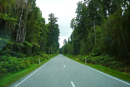
Rockfall Protection for Highways and Roads
Highways and roads, the lifelines of transportation, often traverse challenging mountainous terrains and steep cuttings, making them susceptible to the natural hazard of rockfall. In regions like Pune and the surrounding Western Ghats, the risk of falling rocks obstructing roadways and endangering commuters is a significant concern, especially during the monsoon season. Implementing robust rockfall protection systems is therefore crucial for ensuring the safety and uninterrupted flow of traffic.
The Perils of Rockfall on Roadways
Rockfall events, ranging from small debris to large boulders tumbling onto the road surface, can have severe consequences:
Direct Accidents: Vehicles colliding with fallen rocks can lead to serious injuries or fatalities.
Road Closures: Even smaller rockfalls can block lanes, causing traffic congestion, delays, and economic disruption.
Infrastructure Damage: Impact from falling rocks can damage road surfaces, barriers, and other roadside infrastructure, requiring costly repairs.
Increased Maintenance Costs: Regular clearing of fallen debris and repair work strain maintenance budgets.
Safety Hazards for Maintenance Crews: Personnel involved in clearing rockfall debris are themselves exposed to risk.
Effective rockfall mitigation strategies are essential to minimize these risks and create safer travel conditions for everyone.
Comprehensive Rockfall Protection Systems for Highways and Roads
A variety of engineered solutions are available to protect highways and roads from rockfall hazards, often employed in combination for optimal effectiveness:
Rockfall Barriers: These high-strength steel mesh structures, anchored to the slope, are designed to intercept and arrest falling rocks, preventing them from reaching the roadway. They come in various energy absorption capacities to handle different sizes and velocities of rocks.
Rockfall Netting Systems: Flexible wire mesh nets are draped over unstable slopes to contain loose rocks and prevent them from detaching. These systems can be either passive (simply containing falls) or active (anchored to provide greater stability).
Catch Fences: Installed at the toe of slopes, catch fences are designed to trap rocks that have already detached and are rolling or bouncing down the hillside.
Slope Stabilization Techniques: Addressing the root cause of instability is crucial for long-term protection. Slope stabilization solutions include:
Soil Nailing: Inserting steel bars into the slope to reinforce the soil mass.
Rock Anchoring: Using tensioned cables anchored deep into the bedrock to stabilize large rock blocks.
Shotcrete: Applying a layer of sprayed concrete to the slope surface to prevent erosion and minor rockfall.
Vegetation and Bioengineering: Establishing plant cover to bind the soil and reduce surface erosion.
Grading and Reshaping: Modifying the slope geometry to create more stable angles.
Debris Flow Barriers: In areas prone to debris flows (mixtures of water, soil, and rocks), specialized barriers are designed to intercept and retain this destructive material.
Early Warning Systems: Implementing monitoring systems with sensors to detect slope movement and trigger alerts can provide valuable time for authorities to close roads before a major rockfall event.
Choosing the Right Rockfall Protection System in Pune and Beyond
Selecting the most appropriate rockfall protection measures requires a thorough assessment of the geological conditions, slope characteristics, potential rockfall trajectories, traffic volume, and budget constraints. Consulting with experienced geotechnical engineers and specialized contractors is paramount to design and implement effective solutions tailored to the specific site conditions in regions like Pune.
Shree Sai Eco Solutions: Your Partner in Highway and Road Rockfall Protection
At Shree Sai Eco Solutions, based in India, we understand the unique challenges of rockfall hazards on highways and roads in regions like Pune. We offer a comprehensive range of rockfall protection systems and slope stabilization solutions, including the design, supply, and installation of rockfall barriers, netting, gabions, soil nailing, and more. Our experienced team is committed to providing effective and sustainable solutions that enhance the safety and reliability of your transportation infrastructure.
Investing in robust rockfall protection is a proactive measure that saves lives, prevents costly disruptions, and ensures the smooth flow of traffic on our vital highways and roads. Contact Shree Sai Eco Solutions today to discuss your specific rockfall mitigation needs and learn how our expertise can contribute to safer journeys in Pune and across the country.
#gabion manufacturer#slope stabilization solutions#rockfall protection & mitigation#gabion manufacturers#shri sai eco solutions
0 notes
Text
Slope Protection for Tunnels and Bridges
Tunnels and bridges are critical infrastructure components, often traversing challenging terrains with steep slopes. Ensuring the stability of these surrounding slopes is paramount for the safety and longevity of these structures. Failure of adjacent slopes can lead to costly damage, disruptions, and even catastrophic events. This is where robust slope protection measures become indispensable.
The Critical Need for Slope Protection
The areas around tunnel entrances and bridge abutments are particularly vulnerable to slope instability. Factors like rainfall, erosion, seismic activity, and the inherent geological conditions can trigger landslides, rockfalls, and soil erosion. These events can directly impact the structural integrity of tunnels and bridges by:
Obstructing access: Landslides and debris flow can block tunnel entrances and render bridges unusable.
Applying lateral pressure: Unstable slopes can exert significant lateral forces on tunnel linings and bridge supports, potentially causing structural damage.
Undermining foundations: Erosion and soil movement can weaken the foundations of bridges and tunnel portals, leading to settlement and instability.
Creating safety hazards: Falling rocks and debris pose a direct threat to traffic and maintenance personnel.
Therefore, implementing effective slope stabilization solutions is not just a matter of maintenance but a fundamental aspect of ensuring the safety and operational efficiency of tunnels and bridges.
Common Slope Protection Methods for Tunnels and Bridges
A range of techniques can be employed to protect slopes adjacent to tunnels and bridges, often used in combination for optimal effectiveness. Some common methods include:
Rockfall Barriers and Nets: In areas prone to rockfalls, high-strength rockfall protection systems like barriers and netting are crucial. Barriers are designed to arrest falling rocks, while netting systems can either contain loose rocks on the slope or guide them to a controlled collection area at the base.
Gabion Walls and Mattresses: These wire mesh structures filled with rocks provide flexible and permeable retaining structures, effectively stabilizing slopes and preventing erosion. They are particularly useful for reinforcing embankments and supporting bridge abutments.
Retaining Walls: Constructed from concrete, steel, or other materials, retaining walls provide robust support to unstable slopes, preventing soil movement and landslides. Different types of retaining walls, such as gravity walls, cantilever walls, and anchored walls, are chosen based on site conditions and load requirements.
Soil Nailing and Anchoring: These techniques involve inserting steel bars (soil nails) or tensioned cables (anchors) deep into the slope to reinforce the soil mass and increase its shear strength, preventing deep-seated failures.
Shotcrete and Concrete Linings: Applying a layer of sprayed concrete (shotcrete) or cast-in-place concrete can provide a protective skin to the slope surface, preventing erosion and minor rockfall. Reinforced concrete linings offer even greater stability.
Drainage Systems: Effective drainage is critical for slope stability. Surface drains, subsurface drains, and horizontal drains help to manage groundwater and prevent the build-up of pore water pressure, a major contributor to slope failures.
Vegetation and Bioengineering: Establishing vegetation on slopes can provide long-term erosion control. Plant roots bind the soil, and the foliage intercepts rainfall. Bioengineering techniques combine vegetation with structural elements for enhanced stability.
Choosing the Right Slope Protection System
Selecting the most appropriate rockfall mitigation and slope protection measures requires a thorough site investigation, including geological and geotechnical assessments. Factors such as slope angle, soil and rock properties, groundwater conditions, potential failure mechanisms, and the proximity to the tunnel or bridge structure must be carefully considered. Consulting with experienced geotechnical engineers and specialized contractors is essential to design and implement effective solutions.
At Shree Sai Eco Solutions, we understand the critical importance of slope protection for infrastructure projects like tunnels and bridges. We offer a comprehensive range of slope stabilization solutions, including the design, supply, and installation of rockfall protection systems, gabion structures, retaining walls, and erosion control measures. Our experienced team works closely with engineers and contractors to develop tailored solutions that ensure the long-term stability and safety of your infrastructure.
Investing in robust slope protection is a proactive measure that safeguards vital transportation links, minimizes maintenance costs, and, most importantly, protects lives. Contact Shree Sai Eco Solutions today to discuss your specific slope protection needs and explore how our expertise can contribute to the safety and longevity of your tunnels and bridges.
#gabion manufacturer#gabion exporters#slope stabilization solutions#rockfall protection & mitigation#shri sai eco solutions
0 notes
Text
How to Choose the Right Rockfall Protection System
Rockfall is a natural phenomenon that can occur in any area with steep slopes and loose rock. When rocks break free from a slope, they can pose a serious threat to people, property, and infrastructure. That's why it's important to have a rockfall protection system in place.
What is a Rockfall Protection System?
A rockfall protection system is a structure or device that is designed to prevent rocks from falling onto a roadway, railway, or other area. There are many different types of rockfall protection systems available, each with its own advantages and disadvantages.
How to Choose the Right Rockfall Protection System
When choosing a rockfall protection system, it is important to consider the following factors:
The size and type of rocks that are likely to fall.
The slope angle and height.
The distance between the slope and the area to be protected.
The type of vegetation on the slope.
The climate in the area.
The budget.
Once you have considered these factors, you can narrow down your options to a few different types of rockfall protection systems.
Common Types of Rockfall Protection Systems
Some of the most common types of rockfall protection systems include:
Rockfall barriers: Rockfall barriers are rigid structures that are designed to stop falling rocks. They are typically made of concrete or steel.
Rockfall nets: Rockfall nets are flexible barriers that are made of wire mesh. They are less expensive than rockfall barriers, but they are also less effective.
Rockfall fences: Rockfall fences are similar to rockfall nets, but they are made of a stronger material. They are more effective than rockfall nets, but they are also more expensive.
Slope stabilization: Slope stabilization is a process that is used to prevent rocks from falling in the first place. This can be done by planting vegetation on the slope, installing drainage systems, or anchoring the slope to the bedrock.
How to Find a Reputable Rockfall Protection System Supplier
Once you have chosen the type of rockfall protection system that is right for you, you need to find a reputable supplier. Be sure to ask for references and to get quotes from several different suppliers before making a decision.
Shree Sai Eco Solutions is a leading provider of rockfall protection systems in India. We have been providing our customers with high-quality, cost-effective solutions for over 10 years. We offer a wide variety of rockfall protection systems, including rockfall barriers, rockfall nets, and slope stabilization. We also provide installation and maintenance services.
If you are looking for a reliable and experienced rockfall protection system supplier, please contact Shree Sai Eco Solutions today. We will be happy to answer any questions you have and provide you with a free quote.
Additional Tips for Choosing a Rockfall Protection System
Get a professional assessment. It is important to get a professional assessment of the rockfall hazard before you choose a rockfall protection system. This will help you to determine the type of system that is right for you.
Consider the long-term costs. The cost of a rockfall protection system is not just the initial purchase price. You will also need to factor in the cost of installation and maintenance.
Choose a system that is aesthetically pleasing. If the rockfall protection system is going to be visible, you may want to choose a system that is aesthetically pleasing.
By following these tips, you can choose the right rockfall protection system for your needs.
Rockfall protection systems are an important safety measure for any area with steep slopes and loose rock. By choosing the right system, you can help to protect people, property, and infrastructure from the dangers of rockfall.
#gabion manufacturer#gabion retaining walls#slope stabilization solutions#rockfall protection & mitigation#shri sai eco solutions
0 notes
Text
Understanding Slope Failure: Causes, Types, and Warning Signs
Slope failure, also known as landslides, is a natural geological process that can have devastating consequences. Understanding the causes, types, and warning signs of slope failure is crucial for effective prevention and mitigation. This knowledge is especially vital for homeowners, developers, and anyone living or working in areas prone to landslides. Early detection and proactive Slope Stabilization Solutions can save lives and property.
Causes of Slope Failure:
Several factors can contribute to slope instability and eventual failure. These include:
Natural Factors:
Heavy Rainfall: Saturated soil becomes heavier and loses its shear strength, making it susceptible to sliding.
Earthquakes: Seismic activity can trigger landslides, even on relatively stable slopes.
Weathering and Erosion: The gradual breakdown of rocks and soil weakens slopes over time.
Geological Factors: Soil type, rock structure, and slope angle play significant roles in stability. Human-Induced Factors:
Deforestation: Removal of vegetation reduces root systems that hold soil together.
Construction Activities: Excavations, grading, and improper drainage can destabilize slopes.
Overloading: Adding excessive weight to a slope, such as from buildings or fill material, can lead to failure.
Improper Drainage: Poorly designed drainage systems can concentrate water in vulnerable areas.
Types of Slope Failure:
Slope failures can manifest in various forms, each with its own characteristics:
Falls: These involve the detachment and free fall of rocks or debris. Rockfall mitigation strategies, such as Rockfall barriers, are essential in areas prone to this type of failure.
Slides: Slides occur when a mass of soil or rock moves along a distinct failure surface. They can range from shallow debris slides to deep-seated rotational slides.
Flows: Flows involve the movement of soil or rock as a viscous fluid. Examples include mudflows, debris flows, and earthflows.
Creep: Creep is a slow, gradual downslope movement of soil or rock. While not as dramatic as other types of failures, it can cause significant damage over time.
Warning Signs of Impending Slope Failure:
Recognizing the warning signs of an impending landslide is critical for taking timely action. These signs may include:
Visible Cracks: New cracks or widening of existing cracks in the ground, roads, or structures.
Bulging Slopes: Noticeable swelling or bulging at the base of a slope.
Tilting Trees or Poles: Leaning trees, fences, or utility poles.
Water Seepage: Unusual or increased water flow from slopes or springs.
Soil Creep: Evidence of slow, persistent soil movement, such as displaced retaining walls or fences.
Changes in Drainage Patterns: Disruption or changes in surface water flow.
Sounds: Unusual noises, such as cracking, rumbling, or snapping.
What to Do if You Suspect Slope Failure:
If you observe any of these warning signs, it's crucial to act quickly:
Evacuate the Area: Immediately move away from the affected area and warn others.
Contact Authorities: Notify local emergency services and relevant authorities.
Avoid the Area: Stay away from the unstable slope until it has been assessed by professionals.
Preventing Slope Failure:
While some slope failures are unavoidable, many can be prevented or mitigated through proper planning and engineering practices. These include:
Geotechnical Investigations: Conducting thorough site investigations to assess slope stability.
Slope Stabilization Solutions: Implementing appropriate stabilization techniques, such as retaining walls, soil nailing, and geosynthetics.
Drainage Management: Designing and maintaining effective drainage systems to control water flow.
Vegetation Management: Preserving or planting vegetation to enhance slope stability.
Regular Monitoring: Monitoring slopes for signs of instability and taking proactive measures.
Understanding the causes, types, and warning signs of slope failure is essential for protecting lives and property. By being aware of the risks and taking appropriate precautions, we can minimize the impact of these natural hazards. If you have concerns about slope stability on your property, consult with Shri Sai Eco Solutions, Most Trusted Slope Stabilization Solutions company for professional assessment and recommendations.
#gabion manufacturer#gabion exporters#slope stabilization solutions#rockfall protection & mitigation#shri sai eco solutions
0 notes