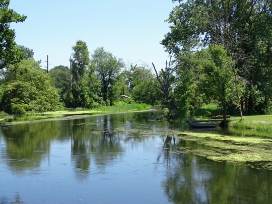
#tippecanoe river
Photo
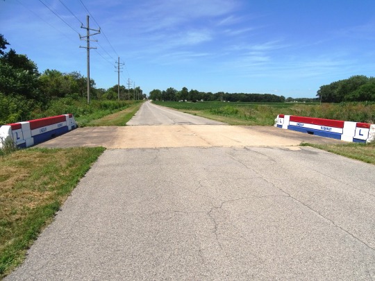
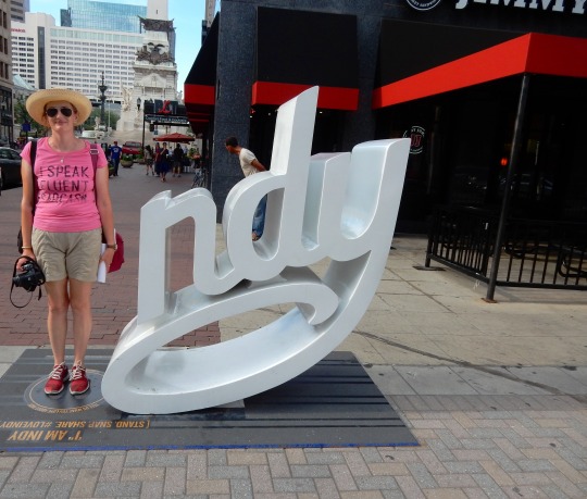
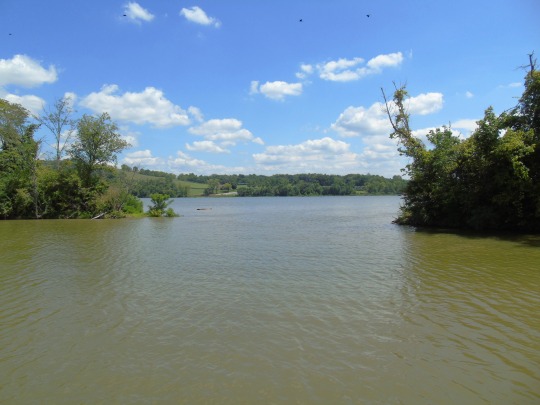
Indiana became the 19th U.S. state on December 11, 1816.
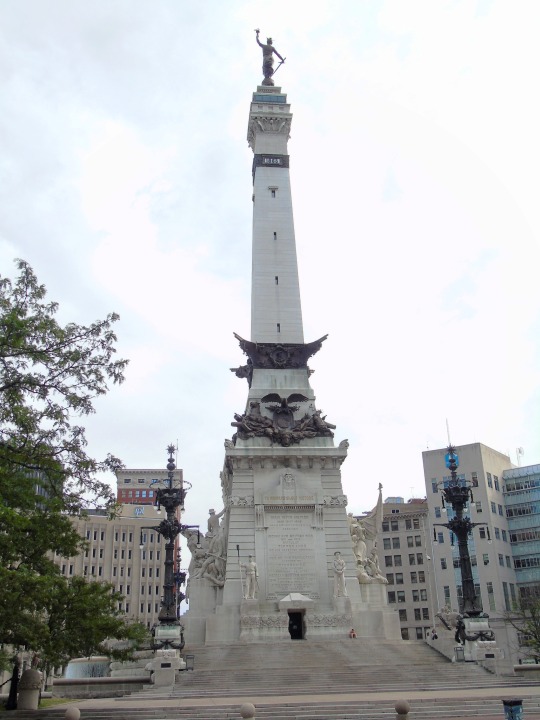
#Hanna#Lincoln Highway#landscape#cityscape#summer 2019#2016#USA#travel#vacation#Indiana#19 US state#11 December 1816#US history#original photography#Tippecanoe River#Warsaw#Munster#Pacific Monument by Omri Amrany#Community Veterans Memorial#Wolf Lake Memorial Park#Whiting#Old Chinworth Bridge#Indy#Indianapolis#Indiana State House#Soldiers' and Sailors' Monument by Bruno Schmitz#Ohio River#Switzerland County
1 note
·
View note
Text
Jay Munly is great but from time to time you'll hear a song that'll leave you there sitting like

6 notes
·
View notes
Text
closest to canon Hawkins we can get
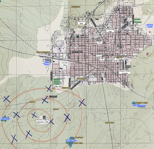
this is the map used in s2 and shows up in the canon show as well as in World's Turned Upside Down (also used as the base for most official artwork of Hawkins). as of now it's the most accurate map we have
there have been a few other maps on the show but those deviate a lot from what's seen in canon (like Bob's map showing a river near the town center that isn't really there). the only inconsistency with This map is that the County Coroner is a bit further south than in canon and that some locations that are referred to as "streets" in the show are marked as "roads" or "avenues" here. those are all minor changes though so as far as canon goes. this is the best map we've got
blue - bodies of water, white - buildings, green - residences, gray - streets, yellowish - speculative/not listed on the map but implied through the actual show
also, to explain further, i didn't make these locations up. all buildings in white and streets are already marked on the map, most of them are extremely hard to read and i just put more legible text on top. the Wheelers, Sinclairs, and Mayfields houses aren't listed but are easy to locate since their street names are on the map. only the yellow squares aren't explicitly confirmed on the map and are technically speculative since i added them based on canon information
(explanation of the reasoning for those placements under the cut for anyone that's interested. bc, personally, i hate seeing maps online that make plainly wrong claims without even trying to explain how they got there)
just starting off, almost every version of this map places the Wheeler and Sinclair home further north than me which is canonically false. those maps use a wrong scale. Lucas and Mike are almost next door neighbors (there is only One house number between theirs, but that house could also be located across the road from them, making them actual next door neighbors). also, Maple Street starts further south than a lot of people using this map seem to acknowledge. the actual order of the two houses is up for debate and could easily be switched though
Melvad's is technically also speculative since it isn't listed on the map (only the cinema and police station are). but looking at the town square in the show and the irl location of the stores you can pinpoint it's position
"Weathertop", the highest area in Hawkins, which is where Cerebro is located in s3. since the town is shown to be behind Starcourt when positioned on Wheatertop, the hill has to be located behind the mall
Hopper's trailer is shown to be next to a lake and only features in s1, the shape of the lake matches Lake Tippecanoe the closest but i'm not dead set on this
Benny's Burgers is canonically on Randolph Lane, the map doesn't feature this road but has a Randolph Way instead. it might be an entirely different road, or Randolph lane could be an unmarked offshoot of the marked Randolph Way. however, since Randolph Way leads out of Hawkins into a forested area near HNL and the forest the party looked for Will in, the general location of the road is probably a good guess for it's location
Mrs Driscoll's home is somewhere on Cornwallis Street. we don't know where on the street, but it's there somewhere. (the same also goes for the motel Billy and Karen wanted to meet up at, but since we never even saw the location i didn't mark it on the map)
the Brimborn Steelworks are on Cherry Oak Drive, accessible when driving down Cornwallis. the street Cherry Oak Drive also doesn't exist on the map. however, a street called Cherry Avenue conveniently directly connects to Cornwallis so i'm inclined to believe that's where the Steelwork is located (Cherry Oak Drive could also be an offshoot of Cherry Avenue or it could just be an inconsistency sploof)
the Byers home is marked twice on the map since it could be located on either road leading away from Mirkwood (Kerley or Cornwallis)
Skull rock and Reefer Rick's Cabin are both located at Lovers Lake but since we don't know their exact locations they're technically speculative
Garrot Street is only implied by canon and it's probably the loosest connection on here. Skull Rock is noted to be near "Cornwallis and Garrot". there is only two major/big roads noted near lovers lake, one of them is Cornwallis, the other one would then most likely be Garrot (also made likelier by the fact that the actual name of the road is completely illegible on the map and could be anything)
also note. the Eno River is also on this map, but i had to crop it a bit to fit a reasonable scale. it would be in the far northwest of the map (the south-most tip of it is still visible)
locations that become relevant later on and aren't marked on the map, that also aren't locatable through additional canon information would be things like Max's old home, the Roane Hill Cemetery, the Creel House on Morehead, and Pennhurst (even though we don't know if Pennhurst is actually in the Hawkins map are). also things like the community pool in s3 or town hall in s4 don't show up either
491 notes
·
View notes
Text
Mollusks,
INHS MOLLUSK COLLECTION
Illinois Natural History Survey • Prairie Research Institute
ELLIPSE Venustaconcha ellipsiformis (Conrad, 1836)
INHS 4137. Rock River, Illinois. Length: 2.9 inches (7.4 cm).

ELKTOE Alasmidonta marginata (Say, 1818)
INHS 11754. Blackberry Creek, Kendall County, Illinois. Length: 2.8 inches (7.1 cm)

PONDHORN
Uniomerus tetralasmus (Say, 1831)
INHS 7807. Mississippi River, Perry County, Missouri. Length: 4.0 inches (10.2 cm).

ELEPHANT-EAR, Elliptio crassidens (Lamarck, 1819)
INHS 2655. Ohio River, Pulaski County, Illinois. Length: 4.2 inches (10.7 cm).

ORANGE-FOOT PIMPLEBACK, Plethobasus cooperianus (Lea, 1834)
INHS 186. Cumberland River, Cumberland County, Kentucky. Length: 2.5 inches (6.4 cm).

MONKEYFACE, Quadrula metanevra (Rafinesque, 1820)
INHS 6221. Wabash River, Tippecanoe County, Indiana. Length: 2.4 inches (6.1 cm).

161 notes
·
View notes
Photo


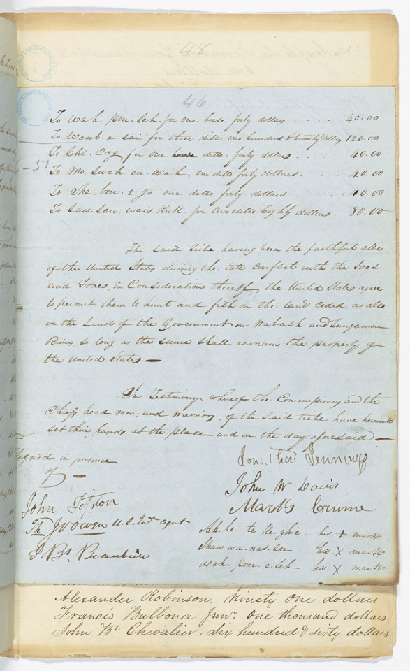
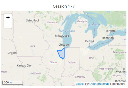
Treaty Between the United States and the Potawatomi Indians of the Prairie and Kankakee Signed at Camp Tippecanoe, Indiana, [p. 1, 2, 5] 10/20/1832.
Map of land ceded via the IDA Treaties Explorer.
File Unit: Ratified Indian Treaty 172: Potawatomi of the Prairie and Kankakee - Camp Tippecanoe, Indiana, October 20, 1832, 1789 - 1869
Series: Indian Treaties, 1789 - 1869
Record Group 11: General Records of the United States Government, 1778 - 2006
Image description: Map showing Cession 177. The land highlighted is a sizable chunk of Illinois, south of Chicago.
Transcription:
[crossed out] 27 [/] [underlined] 7 [/] 44
[in margin] Peaco [/]
Articles of a Treaty made and concluded at Camp
Tippecanoe, in the State of Indiana this 20th day of
October in the year of our Lord one thousand Eight
hundred and thirty two between Jonathan Jennings
John W. Davis and Marks Crome Commissioners on the
[blue circular stamp] THE NATIONAL ARCHIVES OF THE UNITED STATES [/blue circular stamp]
part of the United States of the one part and the Chiefs
and head men of the Potawatamie Tribe of Indians of
the Prairie and Kankakee of the other part,
Article 1st The said Potawatamie Tribe of Indians cede to the
United States the tract of land included within the following
boundary viz-
Beginning at a point on Lake Michigan ten miles
Southward of the mouth of Chicago River, thence in a
direct line to a point on the Kankakee River ten miles
above its mouth thence with said river and the Illinois
River to the mouth of Fox River, being the boundary of
a Cession made by them in 1816, thence with the Southern
boundary of the Indian Territory to the State line between
Illinois and Indiana thence North with said line to
Lake Michigan, thence with the Shore of Lake Mi-
=chigan to the place of beginning.
Article 2d From the Cession aforesaid the following tracts shall
be reserved, to wit-
Five sections for Shaw waw nas see, to include Little
Rock village-
#172
[page 2]
For Min-e-maung, one section, to include his village.
For Joseph Laughton, son of Wais-ke-shaw, one section, and
For Ce-na-ge-wine, one section both to be located at Twelve Mile
Grove, or Na-be-na-qui-nong.
For Claude Laframboise, one section, on Thorn creek.
For Maw-te-no, daughter of Francois Burbonnois, Jun'r. one
section, at Soldier's village.
For Catish, wife of Francis Burbonnois, Sen'r. one Section at
Soldier's village.
For the children of Wais-ke-shaw, two sections, to include the
small grove of timber on the river above Rock village.
For Jean B. Chevallier, one section, near Rock village, and
for his two sisters, Angelique and Josette, one half section each
joining his.
For Me-she-ke-ten-o, two sections, to include his village.
For Francis Le Via, one section, joining Me-she-ke-ten-o.
For the five daughters of Mo-nee by her last husband Joseph
Bailey two sections -
For Me-saw-ke-qua and her children, two section, at Wais-us-
kucks's village.
For Sho-bon-ier, two sections, at his village.
For Josette Beaubien and her children, two sections, to be located
on Hickory creek.
For Therese, wife of Joseph Laframboise, one section and
for Archange Pettier, one section, both at Skunk grove
[page 3]
[blue circular stamp] THE NATIONAL ARCHIVES OF THE UNITED STATES [/blue circular stamp] 46
To Wah-pou-seh, for one horse, forty dollars. 40.00
To Waub-e-sai, for three ditto, one hundred and twenty dollars. 120.00
To Chi-cag, for one ditto, forty dollars. 40.00
[in margin] 6-51 [/]
To Mo-swah-en-wah, one ditto, forty dollars. 40.00
To She-bon-e-go, one ditto, forty dollars. 40.00
To Saw-saw-wais-kuk, for two ditto, eighty dollars. 80.00
The said tribe having been the faithful allies
of the United States during the late conflict with the Sacs
and Foxes, in consideration thereof, the United States agree
to permit them to hunt and fish on the lands ceded, as also
on the lands of the Government on Wabash and Sangamon
rivers, so long as the same shall remain the property of
the United States -
In Testimony whereof the Commissioners and the
Chifs, head men, and warriors, of the said tribe have hereunto
set their hands at the place and in the day aforesaid -
[right column]
[signed] Jonathan Jennings
[signed]John W. Davis
[signed]Marks Crume
Ah-he-te-ke-zhie his x mark
Shaw-wa-nas-see his x mark
Wah-pon-e-seh his x mark
[left column]
Signed in presence
of-
[signed] John Tipton
[signed] Th. Jo. Owen, United States Indn agent
[signed] J. B. Beaubien
#archivesgov#October 20#1832#1800s#Native American history#American Indian history#Indigenous American history#treaties#Potawatomi#Illinois#land
29 notes
·
View notes
Text
Tecumseh
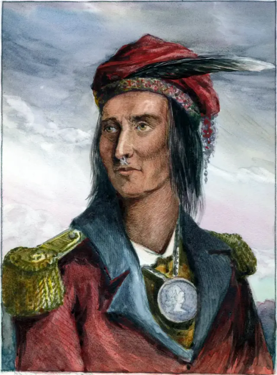
Tecumseh ⋆ Shawnee Häuptling ⋆ Leben und Legende
Tecumseh (1768 – 5. Oktober 1813) war ein Shawnee- Häuptling und Krieger, der gegen die Siedlungspolitik der Vereinigten Staaten auf dem Land der amerikanischen Ureinwohner Widerstand leistete.
Indigene Geschichten besagen, dass Tecumseh nach einer Sternschnuppe benannt wurde, die bei seiner Geburt am Himmel erschien.
Als überzeugender Redner reiste Tecumseh weit umher, gründete eine Konföderation der amerikanischen Ureinwohner und förderte die Einheit zwischen den Stämmen.
Obwohl seine Bemühungen, die amerikanischen Ureinwohner zu vereinen mit seinem Tod endeten, wurde er zu einem ikonischen Volkshelden der amerikanischen, indigenen und kanadischen Volksgeschichte.
Während Tecumseh am White River lebte, litten die amerikanischen Ureinwohner in der Region unter Krankheiten wie Alkoholismus, Armut, Landverlust, Entvölkerung und dem Niedergang ihrer traditionellen Lebensweise. Es traten zu dieser Zeit unter ihnen mehrere religiöse Propheten auf, die jeweils Erklärungen und Abhilfemaßnahmen für die Krise anboten.
Unter diesen war auch Tecumsehs Bruder Lalawéthika, ein Heiler. Lalawéthika forderte seine Zuhörer auf, europäische Einflüsse abzulehnen, mit dem Alkoholkonsum aufzuhören und ihre traditionellen Medizintaschen wegzuwerfen. Tecumseh selbst folgte ebenfalls den Lehren seines Bruders, indem er nur einheimisches Essen aß, traditionelle Shawnee-Kleidung trug und keinen Alkohol trank.
Tecumseh wurde im heutigen Ohio geboren, zu einer Zeit, als sich die weit verstreuten Shawnees in ihrer Ohio Country Heimat wiedervereinigten. Während seiner Kindheit verloren die Shawnees aber eine Reihe von Grenzkonflikten. Tecumsehs Vater wurde dabei 1774 im Kampf gegen amerikanische Kolonisten getötet.
Tecumseh wurde danach von seinem älteren Bruder Cheeseekau betreut, einem bekannten Kriegshäuptling, der auch 1792 im Kampf gegen die Amerikaner starb. Als junger Kriegsführer schloss sich Tecumseh sodann dem Shawnee Chief Blue Jacket bewaffneten Kampf an, weitere Vorstöße von amerikanischen Siedlern zu verhindern.
Im Jahr 1805 gründete Tecumsehs jüngerer Bruder Tenskwatawa, der als Shawnee-Prophet bekannt wurde, eine religiöse Bewegung, die die amerikanischen Ureinwohner aufforderte, europäische Einflüsse abzulehnen und zu einem traditionelleren Lebensstil zurückzukehren.
Im Jahr 1808 gründeten Tecumseh und Tenskwatawa sodann den Ort Prophetstown, ein Dorf im heutigen Indiana, das sich zu einer großen, multistämmigen Gemeinschaft entwickelte.
Tecumseh selbst reiste weiter ständig umher und verbreitete die Botschaft seines Bruders. Er verkündete, dass die amerikanischen Ureinwohner ihr Land gemeinsam besaßen, und forderte alle Stämme auf, kein Territorium mehr abzutreten, es sei denn, alle würden zustimmen.
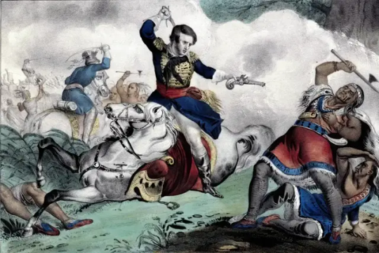
Seine Botschaft alarmierte sowohl amerikanische als auch einheimische Führer, die eine Einigung mit den Vereinigten Staaten suchten. Im Jahr 1811, als Tecumseh im Süden Verbündete rekrutierte, besiegten die Amerikaner unter William Henry Harrison Tenskwatawa in der Schlacht von Tippecanoe und zerstörten auch den Ort Prophetstown.
Im Krieg von 1812 schloss sich Tecumseh, seiner Sache wegen, den Briten an, rekrutierte Krieger und half im August 1812 auch bei der Eroberung von Detroit. Tecumseh führte etwa 530 Krieger an.
Einem Bericht zufolge ließ Tecumseh seine Männer wiederholt in einen Wald aus- und eingehen, nur um den Eindruck zu erwecken, dass sich Tausende von amerikanischen Ureinwohnern außerhalb der Festung befänden.
Einer der berühmtesten Vorfälle in Tecumsehs Leben ereignete sich nach der Schlacht. Amerikanische Gefangene waren zu einer nahe gelegenen Ruine gebracht worden. Als eine Gruppe Indianer begannen, Gefangene zu töten, stürmte Tecumseh herbei und stoppte das Massaker.
Durch diese Tat der Verteidigung der amerikanischen Gefangenen wurde Tecumseh schließlich zu einem Eckpfeiler seiner Legende, dem ultimativen Beweis seines angeborenen Adels, wie es hieß.
Als die US-Seestreitkräfte 1813 endlich die Kontrolle über den Eriesee übernahmen, zog sich Tecumseh widerstrebend mit dem Heer der Briten nach Oberkanada zurück, wo sie am 5. Oktober 1813 in der Schlacht an der Themse besiegt wurden. Hierbei kam auch Tecumseh ums Leben.
Sein Tod führte zum Zusammenbruch seiner Konföderation und die Ländereien, für deren Verteidigung er ein Leben lang gekämpft hatte, wurden an die US-Regierung abgetreten.
Tecumseh schließlich ging als einer der berühmtesten amerikanischen Ureinwohner in die Geschichte ein und sein Vermächtnis steht bis heute.
Tecumseh ⋆ Shawnee Häuptling ⋆ Leben und Legende - Tod
Read the full article
2 notes
·
View notes
Text
Update
For anyone who is interested and uses Tumblr on desktop (sorry mobile users, I have no clue why it won’t work on the app), I have been updating two indexes that I use to organize my 24k posts and counting.
The first is the smaller of the two, which is focused on destinations. On it you will find a list of all the larger stations I have posted to this blog, from terminal cities like Chicago, Seattle, Los Angeles, Washington DC and Tampa to midpoint cities like Lynchburg, Newark, Indianapolis and Salt Lake City. It’s still a work in progress as I find stations I’ve missed in the past as well as stations I discover with upcoming posts. They can all be found at the link below.
https://aryburn-trains.tumblr.com/destinations
As for the second and far larger index, it focuses on the individual trains I have posted organized by the railroads they operated under. This includes big named trains like the Super Chief, Coast Daylight, Empire Builder, Broadway Limited and the Silver Meteor, to smaller trains like the Red River, Blue Bird, Tippecanoe, Del Monte and the Orleanean even down to unnamed numbered trains. It’s not a perfect system as there were railroads who shared the same names of trains as well as numbers. The Owl, for example, will give you results for the Southern Pacific, the Lackawanna and Erie Lackawanna as well as the New Haven. There are then the trains that were carried over by Amtrak like the California Zephyr, Texas Eagle and the Metroliner. Then there’s trains like #4, of which you can take your pick from the Erie Lackawanna, the Santa Fe, the Louisville & Nashville, the Seaboard Air Line, the Southern, the Nashville Chattanooga & St Louis and the Spokane, Portland & Seattle. Regardless, if I have posted photos/videos of it (with the exception of commuter trains), the tags can be found at the link below.
https://aryburn-trains.tumblr.com/railroads
Hopefully this will be of use for someone other than just myself. 😂
Also, I thought I should tag onto the end of this a notice about my train gifs. I have seen a few comments as well have experienced myself that when you click/tap on the links to go to the websites where I source the individual gifs, the links do not work. On my end at least, they take me to an error page before being redirected to the discover page. Why Tumblr does this, much like why my index pages don’t work on the app, is beyond me other than to say it’s Tumblr and Tumblr is a very broken platform. In order to actually visit the links, I would instead recommend copying the text of the links and then opening them in a browser.
2 notes
·
View notes
Note
🏞️
The Tippecanoe River. Specifically sitting in it. It's so relaxing.
1 note
·
View note
Text
MIAMI?
WF UPDATE (5/13/24).
So far, our visit to Dayton is wonderful. I’ve taken two morning runs through the city, and it seems to be holding up OK. It’s in better shape than many other cities that we’ve visited. In the heart of the city, less than a mile from our lodging, there’s a ballpark that is home to the Dayton Dragons. They’re a minor league baseball team affiliated with the Cincinnati Reds. They hold a record that is unmatched by any professional sports team. Since their founding 23 years ago, they’ve sold out EVERY home game. That’s more than 1500 games! The stadium holds more than 7,000 fans. Any city that loves minor league baseball is A-OK with me.
Am I in Ohio or Florida? I keep getting confused. Let me explain.
There’s a big river that cuts through the center of Dayton. It’s called the Great Miami River. It’s named after the Miami Nation, which was a group of Algonquins who originally inhabited this area. The Miami name is widely used around here. The word Miami is worked into the name of all sorts of local stuff. It’s weird. To me, Miami isn’t an Ohio thing.
Our biking trail is called the Great Miami River Trail. I probably should have known that before we got here. I didn’t. I left all of the planning to Mrs. Bikingpartner. Now you understand why I’ve been so confused about the Miami stuff.
The trail is 93 miles long. Dayton is near the middle. The Miami Trail links to five or six other trails.
So far, we’ve done two rides. How are your legs holding up?
Yesterday, we biked south to a place called- - -Miamisburg. I’m not making that up. The round trip was 28 miles. Miamisburg has a nice little town center. For lunch, we shared a delicious rack of ribs at a busy sports bar. The ride was mostly rural and the river was always right next to us. The trail is fully paved and mostly flat. It was a great way to start this adventure.
Today, our round trip was 35 miles. We enjoyed a wider variety of scenery. The trail passed parts of the inner city, some light industrial areas, some farmland, some wooded areas, and a few small towns. We were along the river about 50% of the time. We had lunch on a nice little Main Street in a place called Tipp City. Once upon a time it was called Tippecanoe City. “Tippecanoe” was the nickname of an Ohio politician named William Henry Harrison. He eventually became President. He got the name Tippecanoe from a 1811 battle that he won- -along the Tippecanoe River- -when he was a military officer. Harrison defeated a group of Shawnee tribes. In his successful 1840 presidential run, Harrison’s running mate was John Tyler. Their campaign slogan was “Tippecanoe and Tyler Too.” At one point, Ohio had two towns that honored Harrison. One was called Tippecanoe City and the other, 185 miles away, was simply called Tippecanoe. In the 1930s, the Post Office ruled that the duplicate names were confusing. Tippecanoe City became Tipp City. That’s where we had lunch. The town is full of references to Tippecanoe.
We’ve had two great weather days. It might rain tomorrow. I’ll let you know. Is your rain gear ready?
0 notes
Text
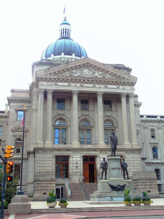
Traveling Across the USA Indiana
Exploring Indiana
A beautiful US state
Prophetstown State Park at the confluence of the Wabash and Tippecanoe Rivers features many different hiking trails for hikers of all abilities.
Within the park, you’ll find the 125-acre Farm at Prophetstown, a living history museum with a 1920s motif and hands-on experience with homesteading, gardening, and livestock feeding. It highlights the history of…

View On WordPress
0 notes
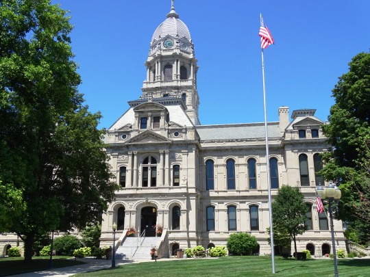
Photo


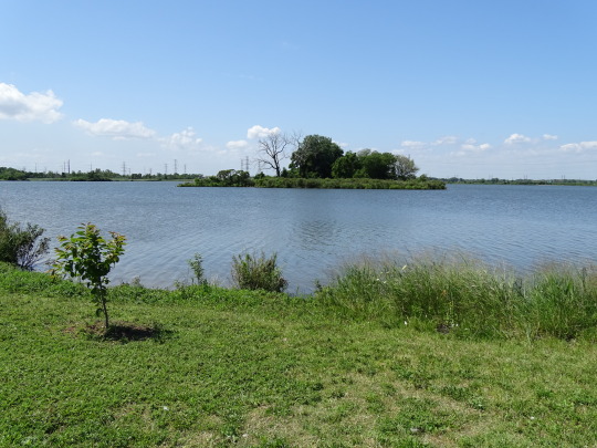
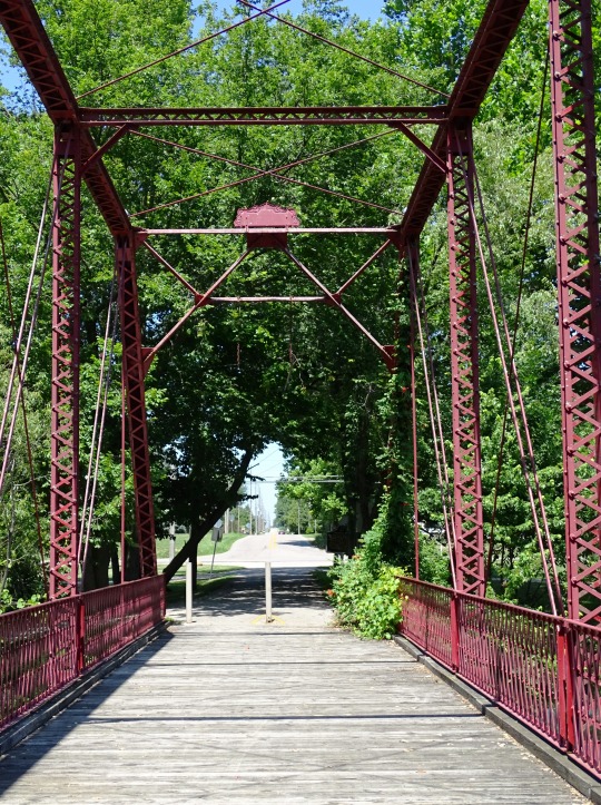
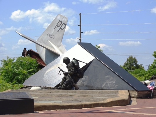
Indiana became the 19th U.S. state on December 11, 1816.
#Wolf Lake Memorial Park#Tippecanoe River#Warsaw#Hanna#Indiana#USA#19th US state#11 December 1816#anniversary#US history#travel#summer 2019#2016#original photography#landscape#cityscape#Lincoln Highway#Community Veterans Memorial#Munster#Switzerland County#Indy#Indianapolis#Soldiers' and Sailors' Monument by Bruno Schmitz#Old Kosciusko County Courthouse#Old Chinworth Bridge#architecture#Indiana Statehouse
17 notes
·
View notes
Text
Explore my work on @snapwire - an easy way to share and sell beautiful photos world wide.
HELP ME WIN!!! PLEASE! IM TRYING TO. WIN JUST 1 CONTEST,
Please...its for I can take my 90 yr old granny out of the nursing home & to the casino. For 1 night. She loved to play slots in Vegas I've been told😉
Here is a example:
TIPPECANOE RIVER, TIPPECANOE, INDIANA, USA 2017( I was kayak for 1st time👍)

#snapwire.com#photography#photography contest#river#tippecanoe#Tippecanoe River#tree trunk#trees#treeoflife#happy tree friends#roots#beautiful outdoors
2 notes
·
View notes
Video
over it by Cara Zimmerman
Via Flickr:
fire towerrrrr want to come back in the fall
7 notes
·
View notes
Text


Tippecanoe River State Park
5 notes
·
View notes
Text
Some wars that occured between 1622-1890 in North America between Native Americans and Colonists
Edit: Found some more wars
1622-1644: Powhatan Confederacy fought with Virginia Colonists
1637: Pequot War - Connecticut and Rhode Island - Narragansett and Mohegan tribes against Saybrook Colonies
1675-1678: King Philip War/First Indian War, the Great Narragansett War/Metacom’s Rebellion - Massachusetts and Rhode Island - Wampanoag, Nipmuck, Pocumtuck and Narrangsett Indians vs the New England Confederation
1754-1763: The French and Indian War - Virginia and Nova Scotia - Algonquins with the French and Iroquois with the British
1711-1715: Tuscarora War - North Carolina - British, German and Dutch Settlers against the Tuscarora Native Americans
1715-1718: Yamasee War - South Carolina - Yamasee vs British colonists
1763-1774: Lord Dunmore's War - Ohio River Valley - Shawnee and Mingo vs the Colony of Virginia
1811: Battle of Tippecanoe - at the Wabash and Tippecanoe rivers, near Lafayette, Indiana - Shawnee and Colonists
1813 -1814: Creek War/Red Stick War/Creek Civil War - Georgia and Alabama - Cherokee vs Colonists
1817-1818: First Seminole War - Florida - Seminole and Black Seminoles against US Army
1832: Black Hawk War - Black Hawk and his Sauk people vs the US Army
1835-1842: Second Seminole War - Florida Everglades - Seminoles vs US Army
1849-1863: Conflicts between Navajo in Arizona and New Mexico
1854-1891: Sioux Wars - Wyoming, Minnesota and South Dakota - Sioux against the US Army
1855-1856: Rogue River War - Oregon - Rogue River Tribes vs the US Army
1855-1858: Third Seminole War - Florida Everglades - Seminole vs the US Army
1858: Fraser Canyon War/Canyon War/Fraser River War - Fraser Canyon, British Columbia - New York Pike Guards and the Whatcom Company against the Nlaka'pamux
1861-1900- New Mexico, Arizona, Texas, and Mexico - Apache vs the US Army
1865-1923: Ute Wars - Utah - Ute people vs the US Army
1869-1870: Red River Rebellion/Red River Resistance - Around what is now Winnipeg -Métis against the Canadian Government
1872-1873: Modoc War - Northern California and Southern Oregon - Modoc vs the US Army
1874-1875: Red River War - Northwestern Texas - the US Army vs Comanche, Arapano, Cheyenne, Kiowa
1876: Battle of Rosebud - southern Montana - Crow and Shoshoni vs Lakota Sioux and Cheyenne
1877: Nez Perce War - Oregon, Idaho and Montana - Nez Perce Tribes vs the US Army
1885: Massacre at Frog Lake - Frog Lake, Alberta - Cree killed Canadian Civilians
1885: Battle of Cut Knife - Battleford, Saskatchewan - Mounted Police Militia and The Canadian Army vs the Cree and Assiniboine
1885: Battle of Batoche - Batoche, Saskatchewan - Métis and First Nations vs North-West Field Force
1885: Battle of Frenchman Butte - Frenchman Butte, Saskatchewan - Cree vs The Alberta Field Force
1885: Battle of Duck Lake - Near Duck Lake, Saskatchewan - North-West Mounted Police vs Métis
1885: Battle of Loon Lake - Steele Narrows, Saskatchewan - Canadian Army vs Ojibway and Anishinabe
1890: Wounded Knee Massacre - South Dakota - US Army against Lakota
Source: The Inconvenient Indian - A Curious Account of Native People in North America and many websites
#native american#aboriginal#indigineous people#indiginous#history#war#north american history#native american history#aboriginal history#indiginous history#us history#canadian history
20 notes
·
View notes
Video
instagram
Just need to get break out of my routine. #djlife #dj #djlife🎧 #blackman #studio #music #oklahoma #producer #producerlife #wvrlymb #mbmb #traktor #traktordj #mac #maudio #darkskin #darkskinmen #chicagodj #germany #london #austrlia #america #madewithlove #lovewins #instagood #instadaily #instagram #artistsoninstagram #chicago (at Tippecanoe River) https://www.instagram.com/p/CCwSz9BBzMr/?igshid=i1g6t9psufe4
#djlife#dj#djlife🎧#blackman#studio#music#oklahoma#producer#producerlife#wvrlymb#mbmb#traktor#traktordj#mac#maudio#darkskin#darkskinmen#chicagodj#germany#london#austrlia#america#madewithlove#lovewins#instagood#instadaily#instagram#artistsoninstagram#chicago
3 notes
·
View notes
Last Seen Blogs

pzycho-mess
Untitled

inu-spike
Oh, Stuff and Fluff...

purplesuitcasefriendeclipse-blog
Sans titre


dieandjerry
dieandjerry