
A personal travel blog by someone with a death wish --- Featuring a lot of clouds, some light shows, and maybe an abandoned trailer or two
Don't wanna be here? Send us removal request.
Statistics
We looked inside some of the posts by therecklessseeking-blog and here's what we found interesting.
Average Info
Notes Per Post
7
Likes Per Post
5
Reblog Per Post
2
Reply Per Post
0
Time Between Posts
5 days
Number of Posts By Type
Text
7
Last Seen Tumblr Blogs


Fun Fact
The average Tumblr user visits about 67 pages every month.
Text
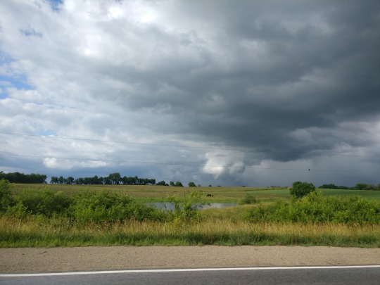
June 25, 2018 Funnel Chasing in Iowa
I woke up super early one Monday morning. By super early I mean 8 am, because I’m normally sleeping until noon or later easily. For some reason, the night before I was able to pass out in time for me to be well-rested.
The trip that day was a split-moment decision. I remember lying in bed cycling through the morning ritualized web pages- weather.org, the SPC, weather.us and then over to my favorite radar app to see what was currently underway.
What I saw was that nice yellow bubble at the top of Missouri into Iowa with a 5% chance of tornadoes, but for some reason I wasn’t actually in the mood to drive out that far. I have a desperation to teleport sometimes. I like road trips. I like being far away. I like the freedom that comes with tourism, and the lack of true obligation. God, are the usual routes boring though. You can only travel on 70 so many times before you’re numbed to the usual array of fields and impatient drivers.
I knew that I was leaving for somewhere though, and I get out of the house by 845 am. It wasn’t a bad turn around to get up, dressed and packed within 45 minutes. My hallmark is indecision, and that can waste a lot of my time.
What was eating at me though was exactly where to go. Sure, there was that nice spot to the north, but the soaring index on weather.us also hinted at the vast amount of severe storms that would move northeast across the Ozarks straight to my county. And the timing suggested that I could explore cave-ridden and creek-laden areas for a few hours before they really started to develop.
As I traveled further and further west down 70, I knew that I would have to make a decision- and to be honest, for some reason I was really fixated on what all the data was saying about the southern routes I had in mind. Places like Sedalia and back roads to the southwest. Plus, since the storms would develop within Kansas and move east, it would be a longer chase. A chase that followed me.
There was a lot of anxiety surrounding that decision though. At the last minute, I kept asking the universe to synchronize some sign into my life. And oddly enough, it appeared in the clouds itself. They hung low, and moved north. I saw the curls I like to see, and one cloud curled itself right into an arrow. North it is.
But f*** driving all that way into Kansas City. I hate city driving, and Kansas City is one of the worst I’ve ever been to yet. I feared more wasted time just based off the inevitable urban traffic.
I’d been looking at the radar every 20 to 30 minutes and I noticed that the low pressure system sitting over Nebraska had already spawned some storms moving up interstates 29 and 35 around St. Joseph, which was another hour and a half away from me. I’ll admit I wasted quite a bit of time getting food, getting lost on the way to food, and then-having a bit of that anxiety earlier -taking a bit too long staring at the radar at one or two exits to decide what I was doing. Oh well.
I figured that I’d make it to MO-13 and go north from there. It’s an older highway, and it goes through some towns you can tell have been raised and broken down in history. This included Lexington, stage of a huge battle during the civil war. The long, rolling fields were stunning. And time consuming. I still had the paranoia that I was driving farther and farther from home on a weak whim. At least everyone was speeding.
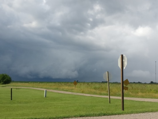
I knew that taking MO-13 far enough would lead me to Interstate 35, but apparently that road has been closed for a while just beyond Hamilton, so I decided to sit behind a Dollar General for a second and check out a map. US-36 west would solve that issue immediately, and save me a lot of time. Meanwhile, I get a notification on my phone that the storm chaser/patreon I follow, Pecos Hank, was also aiming for that slight risk zone. Based on the clouds I’d seen coming up 13 off to my west, and the winds in my favorite app, I felt an increasing confidence in my decision of North vs South, and I race on. I reach Interstate 35 by 1:20 pm.
Now, I don’t normally recommend speeding at all. I’m a 5-over-the-limit type of person any other time. But as I’m looking at both the radar and the sky more and more on the approach, I realize that the show is setting up. There’s a bit of convection to the east and west of me. They all just looked like heavy rain so far, but my anxiety was increasing. There was an active range of over 70-90 miles easily, with some storms steadily popping up and moving quickly in the east right over Princeton Mo, and then of course the storms that had already been active near the Kansas/Nebraska border much closer to the low pressure system.
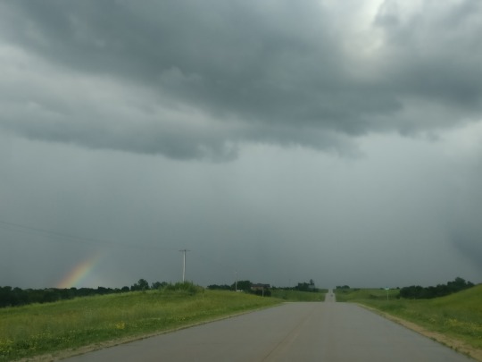
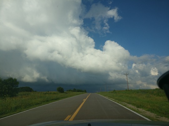
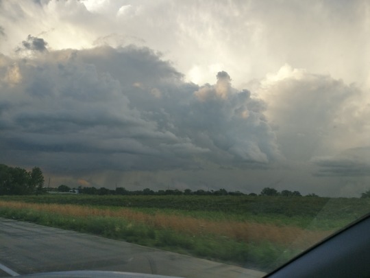
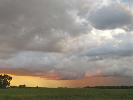
Just before 3 pm, I’ve reached Eagleville MO and jump off the highway to look at the radar. There's a new wave of convection to the south of me, filling in the rainless middle ground and heading north towards me. What I also notice is an organized line of storms approaching the Missouri river heading northeast. I’m near the convergence zone of these storms, and that’s exactly what I’m looking for.
Quickly, I choose a few roads to work their magic. North on US-69, west on MO-46, and not a car in sight I ride the hills to view the horizons bringing me the results. On a bend of 46, I manage to find a nice little hill to take a picture or two and check out any sheer in the clouds.
I still had just under an hour left though. The line to the west was moving much faster than the individual cells to the south and I could just barely make them out on the horizon, so my goal is to move more slowly to the converging point and stake out various places to watch the clouds set themselves up.
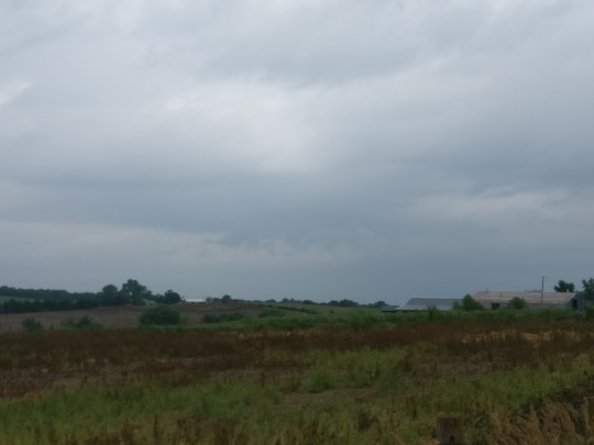
Hatfield showed some promise. Just a few houses, some of them abandoned:

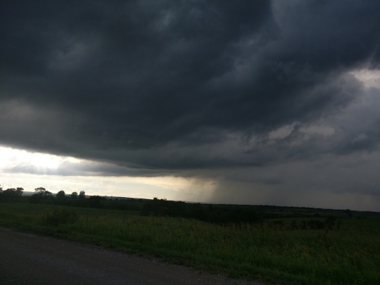
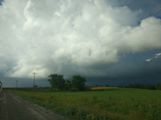
There’s a natural area an eighth of a mile south of Hatfield called Pawnee Prairie that did the trick. The parking area was a nice clear overlook on top of a treeless hill, with a few farmers fields surrounding the area. Google says I sat there for close to 30 minutes as I watched the cells approach me. My camera failed to record like I asked it to, but what I noticed was the signs of low pressure. Low hanging clouds rush in west ahead of the storms, as if they gravitated to something else. With all precipitation on the radar heading either north or northeast, there was definitely something hidden happening in the sky. I abandon Pawnee Prairie and continue west down 46, stopping to find a field or two to take more pictures
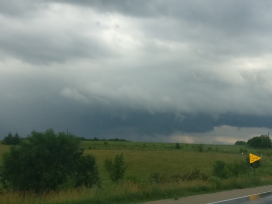
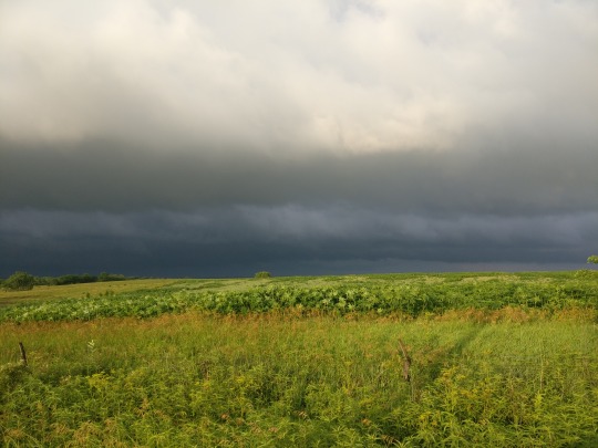
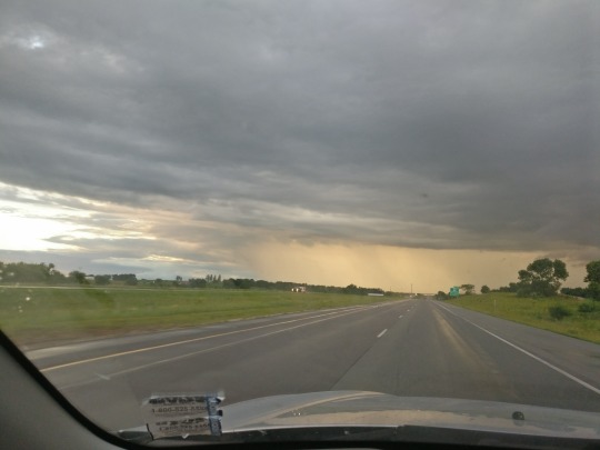
15 miles away, my actual target was around Grant City MO. The line I’d spotted earlier was only growing stronger and closing in, and it was a race to find a suitable space for viewing. Suitable here means “tall, clear hill with a drive-able road and space to pull off to the side.” None of which is ever guaranteed nor marked with a sign, and as I close in on Grant City, I realize just how close that storm in getting and just how massive that storm became.

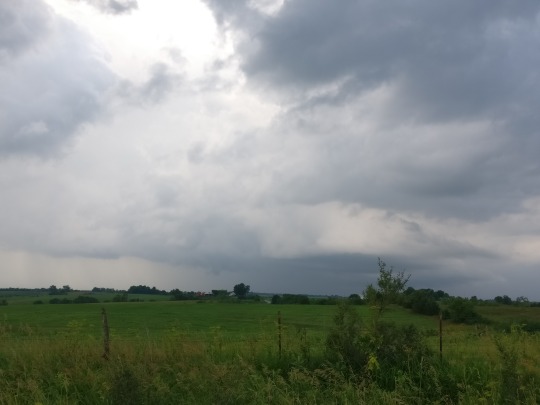
I still had no real intention on running into Iowa just yet though. The storms were only yet to arrive and something screamed “STAY!” Turning north onto US-169 I spotted the one road that would be suitable for my needs. North Lyon St (CR 286) is a dirt road springing off the top of Grant City, and right on top of the very hill that originally blocked the westward view from 169. It overlooked a large amount of the western fields, and although quite a bit of the southern sky was blocked by trees, I managed to get nearly 20 minutes of video of the wall cloud and heavily developing rain on the front end of the storm.
The thing was, while I spent so much time looking off to the west, I never moved myself to see what was to the south edge of the system. I had my prize view and signs of very minor rotation, and when I get that much, moving is paranoia. As the rain began falling over me my video quality was dropping, with auto-focus fixated on the droplets on my window. That’s when I checked radar.
Oddly enough, just south of me, a little hook echo had been forming, and I’m off speeding again. Trying to avoid the holes of this little dirt road in the rain was a challenge enough, but keeping my head clear as I race back south down 169 into Grant City was another challenge. I backed into someone’s driveway across from the second Dollar General of the day and began recording what eventually would form into the funnel I had been waiting for.
Now this video is a compilation of the whole event- from suitable hill to the chase it lead me on straight into Iowa up US-169. If you want the most interesting parts only, I guess my advice is to skip ahead 5 minutes
youtube
I’ll admit that parts of the audio are cut out to make it family friendly. When the funnel was forming straight ahead of me, there was still this vague aura of control over the situation. I had a southern escape route right across the street, and for a while, I felt not fear but exhilaration and joy. To think I could have missed the opportunity by going to Sedalia, right?
Any way, what I figured out was I’m completely silent until I repetitively cuss myself out for about 5 minutes in totality. No offense to myself, but what I realized after it passed over me and headed towards the hill was that it might really drop- in which case, I know better. That thing could have thrown any part of those trees at me. I had the legitimate warning of every storm chaser and meteorologist spinning around me faster than the funnel. While it’s great to have video of a tornado, it’s just stupid to film yourself getting hit by one.
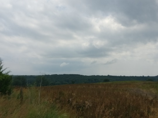
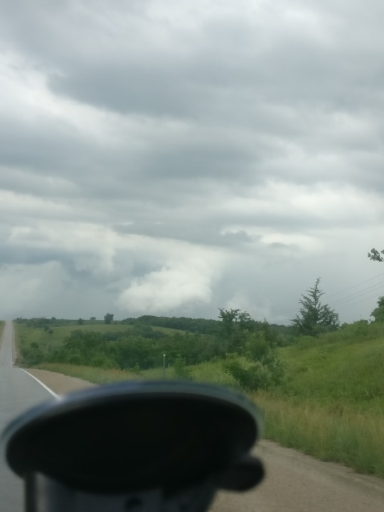
I stalk it up 169, cross the Iowa border, and she’s still rotating nicely. I’m trying to find some sort of country road that would let me see over all the bad hill-and-tree combos. I started to understand why chasing in Iowa was such a tease. It’s beautiful, and the twisters are willing to twist but they play “The Floor is Lava” better. It was probably all the hills causing that.
While there are definitely less trees than my part of Missouri and the Ozarks south, man are all the views sporadic. I found myself leaving 169 for a few minutes when I’d found a hill, realizing that the storm was progressing too far ahead of me, and then racing back to catch the ground I lost.
It was also these hills that let me realize this rotation was dying.


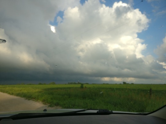
Everything’s just started though, and I’m getting a bit scrambled trying to trace where the rotation is trying to head off to while not getting caught in some downpour. There’s just something about the middle of nowhere that makes phones slower and vague and while I’d bought a road map book of everywhere I could possibly end up that day, unless I had some sort of radar on the top of my car strictly to run my own data, I’m running the majority of this chase on finding hills for views and then routes to get over there.


That’s pretty much were I detoured the wrong way- watching the sky too much and missing a turn that would have landed me in the dense rain that popped up to my east. Instead, my stubborn self caught the most vivid rainbow I’ve ever witnessed- on a route that led me on a scenic view of a town that had no good road to the main roads I was aiming for. I’m left with a phone camera that couldn’t necessary capture how grand it was, but I’ll always remember it.
Looking back, it was sort of a mixed blessing to view the storms at such a distance. I was never really caught in any rain, but the hesitancy I had to really approach from the main paved roads caused me to lose track of it. The problem was that the main highways ran straight into any cells path moving north, and these elongated monsters moved fast and heavy. Any parallel path I found though was slippery (dirt and water don’t let you move any faster than 40 miles per hour either) and always carried the greater risk of concealing the horizon behind trees.
I did manage to find a few hills that made me realize just how much rotation a slight risk area can involve. Looking across the valleys around me, I spotted at least three wall clouds either rotating or forming around me. Two belonged to the same elongated cell maybe a good 5 miles to the east that had dumped so much rain in front of me earlier on.
There it was again- that overwhelming need to teleport. The anxiety only increased with an overwhelming need to be everywhere at once too. Complete storm omniscience is all I was really asking for. It's so toxic that it's hard to make decisions, and made me increasingly impatient with myself to get going. I appreciate the view, but I always realize that I fall behind. Soon I'll lose the storms to the same hills and back roads I vouch for.
It's easier to just post a map outlining the route rather than explaining it, because I elected a ton of back roads filled with charming old buildings that only served to keep me out of the action, but still in view of something happening.

As I got closer to Des Moines, I realized two things:
A) Nighttime was approaching within the hour, and I didn't have the best camera for all the amazing lightning happening, nor would I be able to see any rain or tornadoes approaching me on my drive home B) My cell phone only has so much memory, AND I've literally filled it all with clouds and cat pictures. Not to mention several 10-13 minute long videos of rotation from this and previous chases. This phone brand doesn't even contain bloatware either, so I've definitely outdone myself.
Yet I still record
youtube
I find an exit off of interstate 35 just a few miles south of Des Moines to sit and stare over the clearest horizon I've found yet. I'm refusing to give up the fight. I start to delete selfies, apps, games- anything for just a bit of memory. I start spamming my snapchat story with videos knowing that I'd have 24 hours to download anything I uploaded. All for one of the greatest sunsets I've seen yet, and a lot of SLCs (too bad my snapchat segregated the videos into fragments).
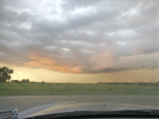
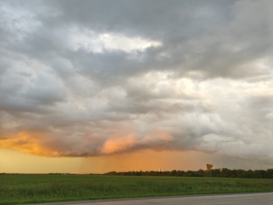


What I was most upset about was the phone thing. Nighttime storms are my favorite, and because night is the exact time that most severe storms roll through my area I was accustomed to chasing them more. This time I'd be left with nothing to show, nothing to save. The clouds glowed with rapid fire. I could tell with the intensity of each strike, these storms still had quite a while before they decided to retire, and I begrudgingly begin to drag myself down the highway home. It'll take me 5 hours- if I don't stop.
For a while I have to. Just a few miles out of Des Moines, I thought these tornadoes were coming for me anyway. There were still warnings active of course. There had been for a few hours. But I realized with the downpour, the radar, the split second views of scud to the north, and the fierce power of the wind under my car that I might very well have been in the draft suctioning into the storm. The rain fell sideways. In fact, it wasn't even falling. I stopped at a Casey's and even being under the shelter at the furthest point the rain could enter from, I was still absolutely soaked getting a literal seven dollars worth of gas. I gave up.
As I carry on, maybe an hour out, the sky is clearing, and I see the cloud tops of numbed cumulonimbus under a full moon and the active ones still firing off to the north. Dreamy, I think. Absolutely dreamy. I'd pull off to gawk, but something tells me the highway patrol won't like it too much with a “DO NOT PICK UP HITCHHIKERS” sign posted nearby.
Thanks for reading.
5 notes
·
View notes
Text
March 6th, 2017 The Tornado That Started It All
There’s an eerie feeling in the air when you know something’s coming.
I’d been watching the radar all day, which at the time is something I did at least once a day for a few months. Occasionally I’d take a screenshot, doodle on it, and drop it on my Snapchat story for my friends to see what I was nerding out about.
I draw out the winds with color-corresponding temperatures (kind of) since I couldn’t screenshot the animations. I happened to save one from 10 am that morning, setting the environment that would breed several tornadoes:

Dropping by the grocery store around 6 pm, the frayed clouds moving west were already hanging low against an overcast sky.
youtube
By that time, the storms presence was very apparent and rapidly moving through Kansas. Tippy-topped in Mid-Minnesota, the series of squall line storms continuously drew itself out longer and longer like pulling a string out of a sweater. After 5 pm, I was checking my phone or the computer more and more frequently. This was the first time I ever actively looked for live feeds from storm chasers. They seemed to be pretty caught up on this storms business.
It went a little something like this:

I’ve retyped the times to make the radar progression a bit clearer. At the time I exclusively used an app called MyRadar, which is great in with wi-fi access and data-accessible regions. It animates both the wind and smooths out the transitions between the radar scans, and that’s exactly what helped me spot out rotation heading straight for me down highway 70. At 8:15 pm, the storm well over Kansas City, I’ve drawn a thin arrow to a region of the storm rotating so fiercely that it produced a decent dent in the storm line. Watching the animation, it seemed to lighter precipitation seemed to keep pulling towards this area. I watched anxiously as it maintained this pattern all the way to Columbia.
At that point, I knew it was there but there were no confirmed reports yet. I absolutely obsessed with watching it and I wanted to go out. I had the boyfriend at that time over and we’d been relaxing after he cooked dinner. By 11:30 pm, I pressed the ultimatum: I was going to chase it and he could join, but the offer was refused for homework. He definitely wasn’t my ride or die.
By 11:45 pm, I’m filming distant lightning on my shitty broken phone camera. I’d watched the radar enough to know that once the storm reaches Warrenton Missouri, I’d be racing the clock for clear views off the highway. So, I get to Exit 200 at Wright City and crawl west down the North Service road watching the magnificent wall cloud approaching me:
youtube
From that point, the tornado hadn’t officially dropped. Well, this one hadn’t. The mesocyclone had formerly dropped a tornado just south of Warrenton- my original target (Seen just before the report on the Wentzville tornado here). And that thing was definintely still spinning. My biggest mistake was being so fixated on the cells to the north, since north of the highway contained more trees. The tornado was coming from the south.
My clue to run was a wall of rain. When the rain stops falling at an angle and starts to appear as if it’s floating- run.
My advantage was that as the wall cloud passed over me, I’d decided to angle myself on the entrance ramp to 70E. Going 90 down a deserted highway, I’m absolutely sure that even if a full tornado hadn’t already dropped between these two reports, it’s surface winds were still ever present. A wire snapped over the highway as I cross back under the bridge of Elm Street.
Feeling way too confident, I tried to pull off on an exit to catch the scenario I’d just run into, but realized as soon as I pulled out my camera there was absolutely nothing but a blur of rain speeding towards me to catch. I’ve waited too long, the winds have caught me, and I’m racing past the Fox 2 storm vehicle also making his escape.

At this point, the tornado and I are dancing. We criss-cross back and forth, and I make it to the Wentzville exit just as the tornado kills the power to all the lights. I was formerly at a red one, but with the wall of tornado literally at my back, I actually crossed in front of moving traffic to escape to the other side of the highway. I move parallel to the tornado as I try to race down West Pearce Blvd to my home. Unfortunately, cities contain people, and the person in front of me wouldn’t move faster than 20 literal miles per hour, so the tornado passed me and diminishes across the railroad tracks, just three blocks south of my house exactly.Once the tornado passed, my mother- awaken by the sudden high winds- and I were listening to the police scanner and realized that the hot spot was located so close. I could make out the damage in the darkness, gawked at it in two drive-bys, then parked and reached for my phone- charging slowly from the car battery, the only source of electricity we’d have for hours. Looking for tornado reports way too soon, I discovered my chance to become a storm spotter was within 2 or 3 weeks. But that’s another small story.
For pictures of the damage I took the morning after, look at this post
For the NWS report of the March 6-7th tornado outbreak, which includes the Wentzville tornado, click here.
Days before, on the 2nd, I’d captured a sunset with an odd looking cloud just across the railway from where the main event would eventually parade through. What an omen on the literal horizon.

Thanks for reading, friends.
0 notes
Text
March 6 2017 Wentzville Tornado Damage
For the story about how this tornado nearly ran me over, click here For the NWS report of the March 6-7th Tornado Outbreak, which includes this tornado, click here.
Map complements of the NWS survey. This tornado was upgraded to an EF1:

Wentzville’s sign at the intersection of Luetkenhaus Blvd and East Pearce Blvd, where the tornado began to die:

An old tree torn apart on South Linn Avenue:

The lumber yard of Chic Lumber, at the corner of West Main Street and South Church Street. Those two large metal sheets in the background of the last two pictures are the rooftops of the lumber storage unit seen in the first picture on the left-most side:


The fields of the Wentzville Community Club, about 700 feet from the lumber yard. Notice the tree limbs stacked behind the building:

Some trees with twisted trunks in the smaller neighborhood just west of the Community Club:

One of the houses caught in the path of the tornado:

The NWS report also includes pictures of the trailers that had direct impact after the tornado crossed over interstate 70 at the train tracks. These houses are located on a bare hill facing the west, and actually flipped. This tornado took out power for roughly 4 hours throughout historic Wentzville.
0 notes
Text
March 18, 2018 Stumbling Upon Don Robinson State Park
When I’m off work, I usually try to travel. It’s good for me. It clears my mind, especially when I’m worked up.
I remember feeling down that day. March 18th was really the first day that I tried something like a “Get Lost” project. No map, no pre-decided destination; I just simply decided to keep driving, volunteering to become the tourist that had absolutely no clue what they were doing. In theory, it’s not that difficult right? It’s easy to just start turning down random roads without checking the GPS. It took me a while to get to a place that I didn’t know though. Before I decided to take all these day trips, it’s not like I’m ignorant of the area. I decided to hit up the hills, so south of Chesterfield MO was my aim.
I kept driving until the road forced me to choose another direction, and then kept on. Taking Olive Street Road and then N Eartherton as it converges, I follow it to the cliff side lining the southern face of Chesterfield. Beyond that is 109, a winding and busy highway that leads straight through the hills of Wildwood to Eureka, and feeds into highway 100 and interstate 44. I’ve traveled both of these quite a bit, so I continue on south 109. Little did I know, once you cross over the Meramec River right out of Eureka, you reach a fork in the road.
Luckily, most of the day no one was around me, so I had time to decide and slowly approach the intersection. To the left is W, and to the right is FF. Right I go, seeing the sign off to the road saying there were a few conservations down that way. I like seeing conservations, because generally what the state is trying to conserve is worth seeing. However, I actually decided to pass up the two conservations in favor of the hills I was traveling through. They were absolutely stunning, and although I know that one of them, Young Conservation, sat throughout the valley of three hills, I felt like there was more I could see and that I would return to investigate at a later date.
Soon after passing that, I was faced with another decision. FF met with F, and it was a left or a right, and I turn left to keep the decisions even. What a nice one too. That side of F is known as Lynch Road. It travels the hilltops, providing endless views of the creeks and valleys in between. These areas were sparingly residential, with a few lots for sale on hillsides. Even though I cannot afford it, I got excited looking at an area that i would totally live in. I imagined my tiny little house built into the side of the hill, overlooking the southern sky and daydreaming about watching the storms that build and blow through there.
And then the road drops, and I meet another fork. This time its Byrnesville Road, and I take a right after seeing another sign for a peculiarly named park. That one, i think, is the park I want to stop by. It doesn’t take long to arrive either. The road is named to the park, and the park is definitely newer. Majority of the soil around the road is exposed, meaning that they’d created this road recently. The road winds around a hill.

I travel to the back of the park, and I see this strange house. It’s extremely old, and it sits right on the edge of the hill, overlooking the valleys around it. I’m stunned. The house has an overlook as its top level, and looks about as shabby as can be. I’m internally screaming though. Its the exact type of house that I’d live in. A small house literally built to look over the beautiful upper watershed of the LaBarque Creek .

The man who owned this house and land had died. He was thrifty, and he was an inventor. I figured all this out trying to figure out the parks name and location again, because it’s so isolated that its not marked on google maps.
What I also learned was that Don Robinson was an introvert to the extreme. He lived on this land to get away from people, and he loved it so much that he wanted to keep it away from people in the development sense. When he died, it was his will that it become a state park, and so it was donated. I’ve never admired someone so much for such a personal act of preservation, for now we get to enjoy the vast array of caves, creeks, and forest that mark this land.


My only regret was finding it so early in the year. I meant for that day mostly to be an “in-the-car” sort of trip because it was freezing that day, and I knew that I wouldn’t be able to enjoy the creeks of Young Conservation or the trails of Don Robinson to their full extent. I did sit for as long as I could next to the house looking at what Robinson held so dear though. I will absolutely return one day to seek out what the rest of his land holds. Additional information:
State Park Website Information about Don Robinson
#march 18 2018#don robinson#don robinson state park#missouri state park#missouri state parks#day trip#labarque creek#labarque watershed
0 notes
Text
June 11th, 2018 Distraction on a Day Trip
I had a pretty difficult day on the 10th and I thought getting myself away from my house would help change my overall attitude a bit. I managed to get quite a bit of sleep unlike the day before, and I headed out earlier than I normally get to.
As I’m driving away, I notice a new light on my dashboard. “Of Course” floats across my mind because of course I would get into my car with the intent of making myself happy--- only to see that I’m about to lose a tire. Anyways, the trip I took two days prior put a small hole in that sucker so I got to take a two hour detour to Walmart first.
The rest of the way was more than pleasant. The point of my day trips is to explore the area. Missouri is actually notable for its vast differences in terrain, even though the rest of the United States may consider it a flyover state. In the midst of all my rambling, there’s a reason why LDS founder Joseph Smith tried to declare Zion here twice. Not to mention its dense history and importance to the settling the Plains and the crazy “manifest destiny” BS.
The terrain also can end up making or breaking a storm here.
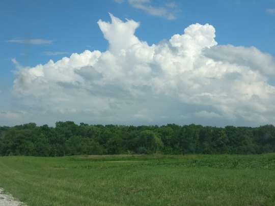
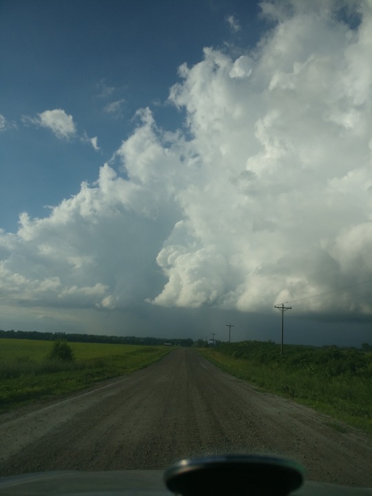
At the time, the SPC kind of nudged their original severe storm warnings ever so slightly east but it definitely remained mostly in Kansas and Nebraska. At the same time, there were plenty of storms popping off to the east, just over the Mississippi River. I began taking a lot of the country roads, making my way towards and away from highway 79 (a road that travels parallel to the river). I’d already seen 79 several times, but nothing else connected to it.

Needless to say it took me a while longer to travel north up the river, but it also allowed me to see the massive cumulonimbus growing from better distances, pictured above. Below is the radar for it, indicated by the massive zit below Jacksonville Illinois.

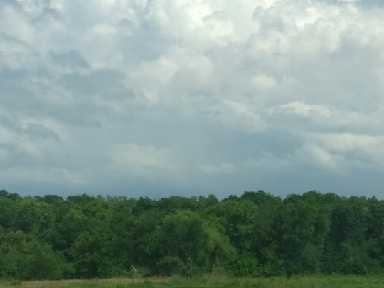
The routes I went on were beautiful. I stopped to take a video in one of the fields, but quite a bit of the trip was within the hills surrounding the area and my views were of the trees that covered them, and the occasional clearing let me see the convection around me.
youtube
I even managed to stumble into a cloud shaped like the tire light I had 3 hours prior :)

I make it to Louisiana Missouri when I realize the storm system is dragging quite a bit of action over NE Missouri too. I do remember seeing a chance for rain and maybe an isolated thunderstorm earlier, but both of my radar apps starting telling a different story. From Louisiana runs US-54 to a town called Bowling Green, a distance of about 11 miles. It has a decent population, probably because its at the cross section of two major-ish US highways, and also probably because one of the states correction facilities is housed there. And just north Bowling Green? Those lovely intensifying storms. Originally, I had planned to make it to Quincy, Illinois or just mess around near a few creek beds on the MO/IA border to crack open a few geodes but I took the chance that these storms wouldn’t collapse before I intercepted.
Man, did I waste exactly enough time. When I make it to Bowling Green, I take the first back road heading north. I have two choices: I can take a turn right at the end of it and cross in front of the prison to circle back down near the highway the cell might as well be driving down OR I can continue up “43″ on this tree covered, winding creek road towards the fields NW of me. My fear is that I won’t get to the fields in time, and even if I did, it would just be a heavy dose of rain to get stuck in (?). Decisions, decisions, and while I’m being indecisive, I pull upon a clearing that I manage to see eerie looking clouds and lightning ejected straight to the ground. I’d actually stumbled upon a struggling mesocyclone, and that’s when I started recording, although I missed most of the lightning:
youtube

Here’s a link to the adjacent post with more pictures of this storm and some others I ran into, and the map of the area I was in.
I think you should know by now that I took my chances and respectfully sped up the residential road with care to claim my prize. I had to edit out the audio because I sound like an idiot. An excited idiot.
And I wasn’t even done there, because while majority of the storms were dying in the sense of no more wind power, they were still dumping a lot of rain and maintaining some beautiful shapes.
youtube
Lets add a rainbow for the finale:


And the friend I made on the way home:

0 notes
Text
June 11th, 2018 The Tornado That Tried and More PhotoDUMP
These photos are in chronological order And a link to this days story here!


The top of the system before I realized that it was doing anything. Looking northwest on CR 43 just north of 54.

Heading west on U


Finally to my stopping place, the intersection of U and CR 36 (left then right side):


A look back at what I’m running away from:


Storm further west down 54, towards Vandalia:

Abandoned but still appreciated:


Jesus Lives and he wants you to go that-a-way:


0 notes
Text
Word to the Weather Wise
A few weeks after a tornado nearly hit my house and I, I discovered that there were already quite a free few storm spotter classes scheduled throughout the surrounding counties. A quick adjustment to my work schedule let me drop in on the closest one. These meetings are nice little community get-togethers with audiences of all ages. I’d brought the notebook I’d been using to research more about the warnings and storm structure I’d missed that night in the darkness.
For about two hours, we were receiving legitimate warnings about the weather most of us are blessed to take shelter from in the comfort of our homes. These classes are meant to make you a little more sensitive to the things that are happening and what actions to take if and when you happen to come across them. Without a doubt, the class itself should be required at some level- be it high school or with a drivers license. We would be much different as a society if we valued weather consciousness.
In addition to giving you information about what actual danger is, they also inform you about the things they really don’t give a shit about. Don’t report scud as 13 tornadoes. They don’t like it.
I grabbed the paperwork and filled out the form online in the auditorium. I also thought that I’d stick around to talk to the speaker. Since I’m not the most aggressive person ever, I’d waited out every ones questions and stories and found myself nervous to even be seeking a conversation.
I’ll tell you blatantly, this meteorologist is not on my list of things that inspired me to pursue my passion for the atmosphere. One day, sir, I’ll meet you again and tell you that. I’d had the section of videos I’d taken pulled up in the gallery on my phone in case the conversation got engaging enough. I felt pretty confident in myself because during the meeting I realized that I’d already compiled in the notebook nearly all of the information that was covered. The few notes that I took in the meeting were at points where I felt like they had a better diagram or I’d missed a term in my own research. I start by telling him that I’d been present for the tornado that passed through weeks prior, and I immediately sensed the demeanor of him change. It seemed to push away, even though the older gentleman welcomed with a spotlight on him before me had been talking about things he’d experienced too. So I move to my actual concern- information. Knowledge does not necessarily have to come with a price tag of thousands per semester, and I knew this. I wasn’t ready to absolutely invest into a major college, but I could sit and read with my god-given eye balls. I wanted to know what resources I could use short of heading off to a place like Norman and signing some paper of absolute intent to their program. -LOL- I knew I was dismissed before I asked, but he made no attempt to push me in any direction at all. I remember his disdainful attitude more than my initial excitement that evening.
I’m pretty sure the slang word for me among chasers is “yahoo,” but I think I coin myself as the disadvantaged and curious. Like the standard emergency services in our society, I consider storm spotters to be participating in a public service. Any one willing and able to safely keep their eyes on the sky helps protect the community.
If you’re reading this, I Do NOT advocate for every person, no matter their level of weather consciousness, to head out and chase a storm.
But of course, anyone can do anything at anytime, even with warning against it. After all there are addicts of various substances everywhere, and somehow a bankrupted, scam artist reality television show host won the ability to lead a nation. I do advocate for those interested in picking up on the nuances of storms, or maybe those who already are picking up on them like I had been, to actively seek as much information at possible- both about the weather itself, and how storm chasers operate. If a meteorologist won’t tell you anything, I will try my best to. For those who just like a good look at the horizon, YouTube and Google are sites you already use that have heaps of information at your disposal. To start, I really like this informational video by Skip Talbot for things like chasing or spotting severe weather rolling in.
youtube
On top of that, watch chasers. Keep watching chasers, and even treat yourself to a yahoos video who sat across the field unexpectedly running into a clear view of a massive tornado during their commute. Watch every video you can because people, and especially chasers, will tell you everything you need to know- like the importance of knowing North from South and East from West and the essential need of an escape route. More importantly, they have visual information and endless examples of weather patterns radar alone simply could never account for. Gaining the sensitivity for weathers many appearances can help you even when you yourself are not chasing, especially when it appearances can be deceptive.
For those of you who are taking this that step further, the basic knowledge of meteorology is more accessible than you may think. Many colleges do offer self-driven courses online for the fundamental classes- a smooth blend of physics, chemistry, and maths. I’m blessed enough myself to have two Half Price Bookstores in my area where I have bought the textbooks and training CDS to subjects like meteorology and geography, although I admit that a lot of my high school and college education filled out the basics mentioned above, and it has made learning a more integrated subject like meteorology possible.
Please be careful. After all, humans cannot warn against every hazard. Your enthusiasm and involvement is always welcome to the cause, however.
2 notes
·
View notes