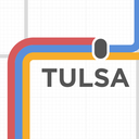
Redesigning Tulsa's transit map, mostly because it's an embarrassment. This project is not affiliated with Tulsa Transit. Opinions and ideas presented here are mine and mine alone. Contact me.
Don't wanna be here? Send us removal request.
Statistics
We looked inside some of the posts by transittulsa and here's what we found interesting.
Average Info
Notes Per Post
99
Likes Per Post
65
Reblog Per Post
31
Reply Per Post
2
Time Between Posts
5 months
Number of Posts By Type
Text
2
Photo
11
Link
2
Quote
2
Last Seen Tumblr Blogs


Fun Fact
Tumblr has a 66 index score for customer satisfaction in the US.
Text
Base Map
I’m to a point where the base map is ready for transit lines. I’ll likely want to finesse the labeling, but I want to wait until after the lines are in place to do so—I intend to make labeling more dense near the route lines.

3 notes
·
View notes
Text
Final Push

After a long hiatus, I’ve made it a goal to finish this project. I’ve been working on it extensively over the past couple of weeks, and I’ve got the end in sight now! I’ll be posting several posts to get the project up to speed over the coming days, sharing what I’ve learned, etc.
1 note
·
View note
Photo

Labels, labels, labels!
Just started labeling. Excited to bring typography into the map!
1 note
·
View note
Photo

Geography & Infrastructure
I learned at the very beginning of the project that drawing a successful transit map ultimately depended on drawing a good map in the most general sense. Nearing completion of the base map now: arterial streets, highways, parks, hospitals, universities, public areas.
The details are really the most fun part of the whole thing. The little swoop in 61st street to make room for Southern Hills Country Club, pictured in the center of the image above, the weird little bend on the same road at Turkey Mountain on the west side of the highway, and the way I-44 jogs south as it nears the river and takes over 51st street’s right of way.
Thoughts & Lessons
Tulsa has a perfect one-mile street grid, except where it doesn’t. The grid is maintained on both sides of the river, but there’s a strange spacing gap between Admiral / I244 and Pine on the north side of the city. This is actually reflected on the official transit map, but I’d never noticed it.
I find myself wanting to eliminate sharp corners both aesthetically and because streets rarely work that way. There’s something pleasing about things like this:

Smoothing out complex interchanges and streets that curve and meet at interesting angles.
I’m intentionally working on a very sparse canvas right now, with only two layers visible: Geography & Infrastructure (highways, roads, streets). I only turn labels on when I need to double-check something; I don’t want to get bogged down in styling the information right now while I finish the actual terrain and infrastructure.
1 note
·
View note
Photo

Style Guide
Styles for roads & routes. Developing standards for how routes align to roads, turn corners and interact with one another. NS routes on the bottom, EW routes above that, and turning routes on top for clarity.
A separate typographical style guide will follow. This image mostly just helped me visualize what these rules look like.
3 notes
·
View notes
Link
Two years ago, while riding a city bus in Tulsa, I had a thought. I'd been riding the bus off and on for a while. The service itself was really great — the buses ran on time, were generally clean, ...
Some thoughts on the project, as well as updates, on my blog-blog.
2 notes
·
View notes
Photo
I'm just itching to get back to work on this.

Type Testing
Arrived at a typeface for the map — Adobe’s brand new Source Sans Pro. The typeface was designed by Adobe as an example of open-source design, and therefore seems really appropriate for this project from an ethical standpoint.
Additionally it’s wonderfully readable, clean, modern and has a wide array of weights, which lends itself to information design (I see hierarchy of information as paramount to a project like this).
So this is just a little test. I’d been using Gotham for my mockups to this point, which is a fine typeface, but I’m loving the look of Source with the maps.
30 notes
·
View notes
Quote
"Really where we've been for several decades now is that [Tulsa's] public transit system is really funded at a level where it is by design a mode of transportation of last resort"
City Councilor G.T. Bynum
via http://www.kjrh.com/dpp/news/local_news/investigations/Tulsa-Transit-city-bus-service-called-lousy-waste-of-money-for-passengers#ixzz2lRgHMDZC
2 notes
·
View notes
Photo

Progress: drawing actual bus lines for the first time. Not surprisingly, the bus yard is in the very center of this map -- lots of the longer routes pass by on either 3rd or 6th so they can switch drivers.
A bit of Tulsa bus nomenclature (more of that to come): 1xx routes are out-and-back routes from the downtown station (the 100 starts downtown and ends on east Admiral Place in far east Tulsa) and 2xx routes connect the downtown station with the Midtown Memorial station* (the 222, likely the longest route in town, passes through north, south, east and midtown Tulsa -- it crosses / transfers to the airport line** four times, passes two large hospitals, both the OU and OSU campuses and a shopping mall -- which is why I felt it deserved a primary color).
This project gets more complicated by the minute. Attempting this project with a city I wasn't so intimately familiar with would be overwhelming.
*coincidentally not in midtown by most accepted boundaries
** probably the least sensical bus route in the city. Riding the bus from the downtown station to the airport takes about 40 minutes (you could do it in 10 in a car, even in pretty substantial traffic) as you spend a great deal of time snaking through north Tulsa neighborhoods. We're talking residential streets. I feel like they must have consolidated lines at some point or something. Another fun note from personal experience: the bus drives through the airport terminal loading zones (inbound and outbound) but doesn't stop if you don't pull the cord. I learned that the hard way, and ended up having to walk a half a mile with a rolling suitcase. I think maybe the 203 deserves its own post.
2 notes
·
View notes
Photo

Arterial streets in midtown Tulsa.
1 note
·
View note
Photo

Back from a hiatus. I'll get back to posting updates here shortly.
Downloaded AutoCAD last night, drawing a detailed map of the city which I'll then import into Illustrator for styling.
Whew.
1 note
·
View note
Photo
Type Testing
Arrived at a typeface for the map -- Adobe's brand new Source Sans Pro. The typeface was designed by Adobe as an example of open-source design, and therefore seems really appropriate for this project from an ethical standpoint.
Additionally it's wonderfully readable, clean, modern and has a wide array of weights, which lends itself to information design (I see hierarchy of information as paramount to a project like this).
So this is just a little test. I'd been using Gotham for my mockups to this point, which is a fine typeface, but I'm loving the look of Source with the maps.
30 notes
·
View notes
Quote
The Port Authority of New York and New Jersey is spending $3.8 billion on a single subway station at the World Trade Center designed by Santiago Calatrava, a Spanish architect known for his costly projects. If New York could build subways at the prices that Paris and Tokyo pay, $3.8 billion would be enough to build the entire Second Avenue subway, from Harlem to the Financial District.
U.S. Taxpayers Are Gouged on Mass Transit Costs
A great piece about why the U.S. is so, so bad at mass transit.
3 notes
·
View notes
Link
Interesting write-up about the 40-year anniversary of Vignelli's visionary/infamous NYC subway map; draws some nice comparisons / contrasts with Beck's map of the London Underground.
3 notes
·
View notes
Photo

Nightline color scheme. Tulsa has 6 bus lines that run at night -- completely separate from normal service. Despite having only 6 lines the system is rather comprehensive (and uses smaller-capacity buses). I'm excited to see the nightline map, it'll be far less cluttered and more stylized.
4 notes
·
View notes
Photo

Tentative cast of characters.
18 routes, 18 colors.
I need a drink.
4 notes
·
View notes
