#Obscura Jaunts
Text
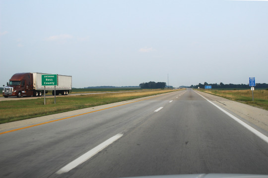
Leaving Bratislava, Slovakia 🇸🇰 ➡️ Carnuntum, Austria 🇦🇹 ➡️ Gyor, Hungary 🇭🇺 ➡️ Budapest, Hungary 🇭🇺 ➡️ Bucharest, Romania 🇷🇴
So in the space of 48 hours I have now set four in four separate countries: Slovakia, Austria, Hungary & Romania! This post concerns those past 48 hours as much has happened in such a short amount of time!
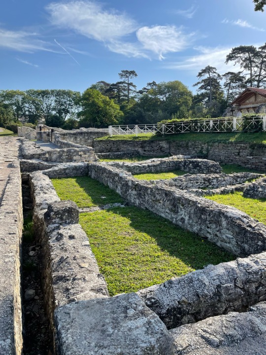
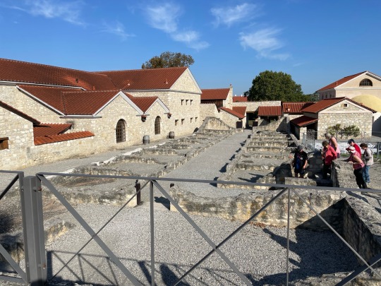
Yesterday morning we left Bratislava early, and made the shorty jaunt across the border into Austria. We then got a chance to visit the location of some partially restored Roman ruins, part of the northernmost outpost of the Roman Empire. We got to tour the ruins, and learn about the inter workings of the outpost, as well as how the Roman Legion lived and trained in this small village. We got to also step into some restored Roman baths as well as see a full reconstruction of the home of a village noble.
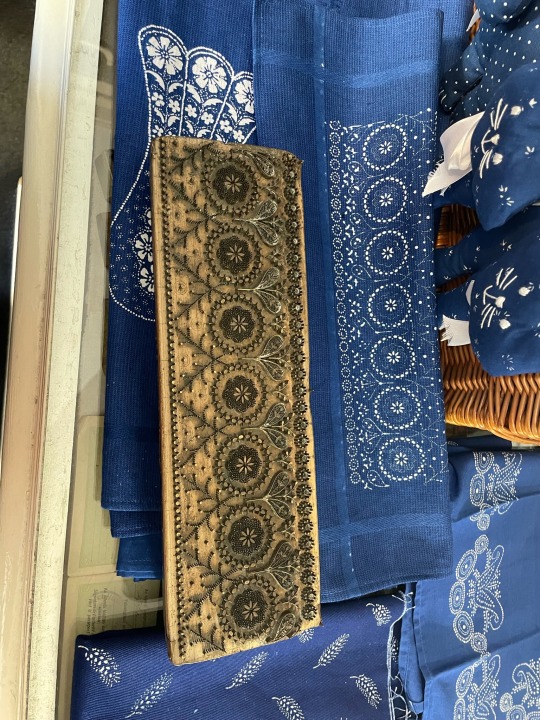
After touring the ruins, we hopped on the bus again and made our way across the border into Hungary. Our first stop in this country was Gyor, a small town which is famous for the ancient (and now UNSECO protected) craft of blue-printing on fabrics. The technique involves a wooden stamp print, then the fabric is dipped into the indigo dye, and then treated with acid or vinegar so the white print shows up against the blue. We got to visit a family owned business who still make their crafts by hand and got some handmade blueprinted fabrics.
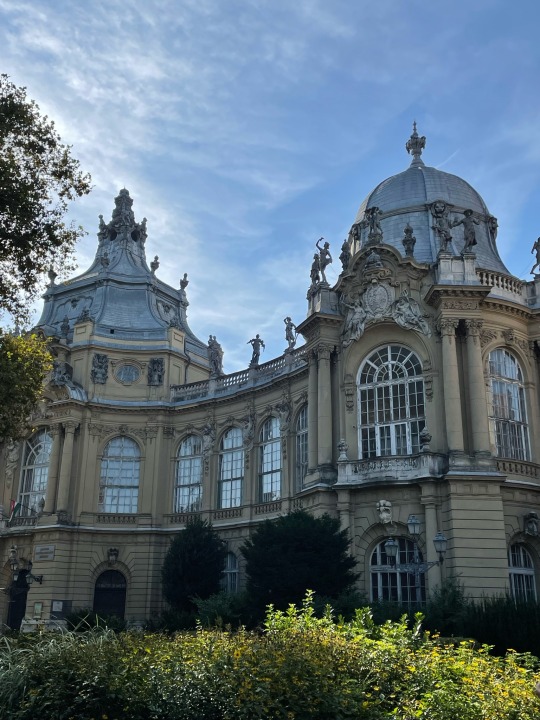
We made our way then into the busy streets of Budapest, and got to go to the top of the hotel roof where we got a brilliant view of the whole city. We were able to get some photos which some of the tour members who we had grown close to during our travels, which was nice because the three of us would be leaving the tour a day early tomorrow to make our way to Romania for our next tour.

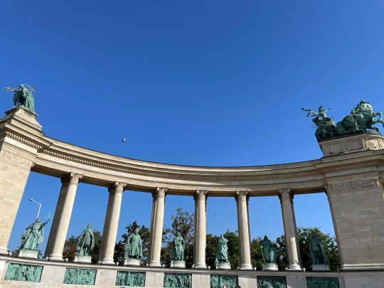
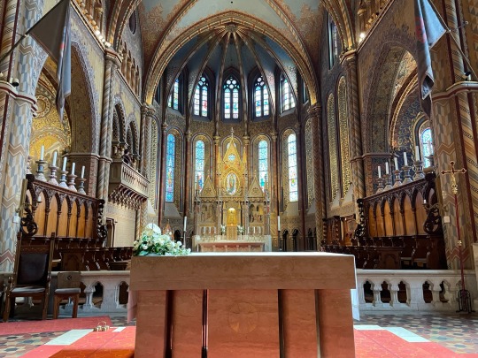
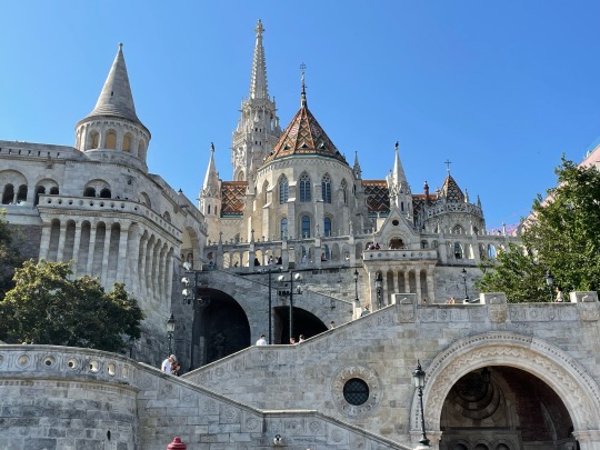
This morning we woke up early and were able to take a tour of the city with a brilliant local tour guide Daniel, who took us to Freedom Square where we got to see the statutes of the seven tribes which “founded” this area. We also learned first hand the brilliant snarky sarcasm of the Hungarians, which Mom, Pat & I got a big kick out of. We got to go up to the top of city to the castle, and Mom and I toured around the cathedral. Lunch we got to try some handmade strudel, before we all bid farewell to the rest of the tour, and Johanka got us to our cab for the airport.
I will say this for the Budapest airport that it was the quickest I have ever been through both security & Border Patrol, with it only taking roughly 5 minutes to get through both (interpret that as you will as not many people appeared to be flying out from Budapest). The three of us picked up a few snackies at Duty Free as it was the only place that would take Euros, so “dinner” consisted of Pringles and bottled water this evening.
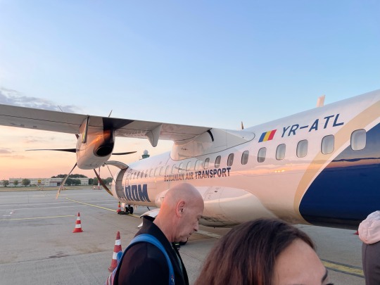
When we got through the gate, we took a short bus to the plane which turned out to be a propeller plane; Mom and Pat both remarked that neither of them had been on a prop-plane in 25 years so it did give us three a bit of pause. As you can now surmise, we did survive the flight but I would be lying if a few prayers & requests to The Almighty occurred during take-off and landing. However, I reminded Mom & Pat that they should not fear because as the great Malcom Reynolds from “Firefly” once said; “We are not going to die tonight. You wanna know why? Because we are too damn pretty”. There was another moment of slight panic after we landed as the three of us were concerned if our bags actually made it to Bucharest, but thank the heavens for AirTags as we were able to see they DID make it, it was just that Air Tarom was taking it’s sweet time getting them to the baggage claim. Nevertheless, all four of our checked bags did make it to Romania 😎
Thankfully Atlas Obscura had arranged a car to pick us up at the airport and drive us right to the hotel, because it was 10:00 at night by the time we had all our bags together. Once we got to the hotel and checked in, we were able to grab some food at the bar in the hotel, which put us all in better spirits. It felt like after the day we had had that we had been traveling for days instead of hours, so all three of us looked forward to crawling into bed and sleeping in tomorrow.
Tomorrow our adventure with Atlas Obscura begins so we will have a new tour leader & a new group of fellow travelers.
Until tomorrow then my friends, I bid you farewell.
Lowry💜
1 note
·
View note
Photo


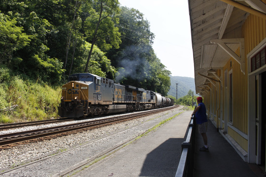
Railroading in West Virginia: Cass Scenic Rail Road - an Afternoon Excursion.
The funny thing about taking a train ride pulled by a logging industry steam engine is the speed -- or rather, the lack of it: the short-haul tourist train rolls along at about 3 MPH.

Pulling into a switchback.
Logging engines were built to haul weight on steep grades, and though three tourist cars hardly total the weight of a train-load of logs, the pace remains sedate.

“Camp” set-up at Whittaker Station. The small structures are replicas of logger’s housing, while the equipment in the distance was used to lift felled logs onto rail cars.
The twice daily short runs from Cass Station uphill some 800 feet to Whittaker Station cover about 4 miles round-trip and take two hours, including a 20 minute stop at the top for passengers to wander about. The once-a-day longer excursion from Cass to Bald Knob covers 22 miles round-trip, lasts over 4 hours, and rises over 2,000 feet -- but I wasn’t able to get to town in time to make that run, or I sure woulda’!

The Cass-to-Whittaker route (approximately).

West Virginia “hills” from Whittaker Station. The long run to Bald Knob goes “up there” somewhere.
The slower pace of the train’s movement is nearer to walking through the wood where there are no trails, with little intruding on the scene besides the train and tracks, and the couple of roads crossed.

It wasn’t supposed to be a psychedelic shot, but I wasn’t paying attention to my shutter speed; this was snapped at 1/5 sec., much too slow for clarity, though the exposure is sufficient!
Photos: R. Jake Wood, 2021.
Durbin & Greenbrier Valley Rail Road home.
Satellite view by Google Maps with annotation by Jake Wood.

Looking down into young trees from the right-of-way.
24 notes
·
View notes
Photo


Took a short little jaunt with Atlas Obscura friends to the Irish Hunger Memorial in downtown NYC this weekend. The memorial is dedicated to the million Irish who died during the Great Famine of the 1840s, but it is also dedicated to those today who are currently suffering from hunger.
The memorial is covered with plants that have been transported from Ireland, and includes blackthorn, foxglove and heather. It also features 32 rocks that are engraved with the name of Irish counties.
2 notes
·
View notes
Text
The Book Binder Artist

The Book Binder Artist
Erzebet Barthold Interview
Co-founder of Hadean Press and founder of Papaveria Press, Erzebet Barthold has been behind some of the more fantastic occult releases of the past handful of years. Jake Stratton Kent's "Pandemonium" and the phenomenal "The Book of St. Cyprian: The Sorcerer’s Treasure" by José Leitão are among those who have had her touch as editor and designer.
Her work as an artist & traditional bookbinder makes her one of those rare publishers who have their hands dirty at every level of the book making process. From fantastic fairy spellbooks, to delicate assemblage Erzebet is a bookbinding artist of high regard. I thought an interview was long overdue.
+++
What came first the bookbinding or the publishing world?
The bookbinding came first, though not by much. I had a vague suspicion that I wanted to bind books for years before I acted on it. I spent a lot of time hoarding materials, reading books on binding, and talking to people who had studied in the field. I was a single mother of three, so money was tight, which meant formal studies were out of the question. In 2001 I felt ready to start taking it all seriously. I created Papaveria Press, and released my first small book, a collection of my own micro-tales called "Simple Stories". My thinking was that if I messed it up, at least I wasn’t wrecking someone else’s work. It was pretty awful, but it was also encouraging, and it did wonders for my self-esteem, which had taken a battering in the previous years. I had achieved something - it may not have been brilliant, but I knew that if I kept going, I could only improve.
Your work is rather intimate in details. The tiny run of volumes you did from Folger ms Xd 234, "The Binding of the Fairies" was exquisite. Down to the last stitch beautiful, shame I missed getting it when it was released. What guides you in terms of your choices for the hand bound treatment?
Thank you, that one was a joy to bind. It’s always the text that guides me, what period it’s from, what it’s saying to me, what it’s saying about itself. Fairies, for example, demand a combination of seriousness and whimsy. That text made me laugh - the very idea of someone attempting to bind a fairy! That kind of thing never ends well. So it was with a sense of reverence as well as mirth that I set forth to find the materials that would, I hoped, bring that contradiction to the final work.

What is your favorite bound edition that you have done so far?
That's like asking me which is my favourite daughter! You'll get the same answer they get when they ask me this question -- all of them. Each book has posed a different challenge and led to a new triumph.
What future handbound magic do you have up your sleeve?
I thought I might, for fun, edit and reissue the very first book I released through Papaveria Press, but that's a maybe. After all these years, I'd like to do it justice. What I'm really looking for are more unique little snippets of manuscripts, like ms Xd 234, so if any of your readers can point me in the right direction I'd be grateful. I may also have one or two things coming in from authors, but I won't comment on those until they happen.
You operate both as Hadean Press and Papaveria Press, where is the distinction between the two?
The most obvious distinction is that Papaveria is for poetry and fiction, while Hadean is (so far) non-fiction only. One deals in fantasy and the other in magic, although some would say those two things are the same. Papaveria is for flights of fancy and fairy tales. Hadean is for the spirits of those living and dead.
Do you collect books yourself? Publishers tend to be all or nothing with collecting.
It’s difficult to resist collecting books when so many publishers are releasing such gorgeous editions into the world! I’m in the middle, where I spend my time being torn between buying books or buying the materials I need to make books.

Any particularly rare or interesting pieces in your library that you want to tell us about?
There is one that I love dearly, "The Book of the Shield: Ancient Saxon Wytchecrafte", published by Catweasel Productions, Highgate, London in 1982. With all of the grand bindings of occult literature, this one stands out for me because of its simplicity. It was bound by Ars Obscura, who should need no introduction here, and it smells utterly delicious, that combination of old leather and paper. Here is part of the copy from 1982:
"The Book of the Shield is rewritten from an old copy of the book owned by the present High Thegn of the Order. It has been rewritten and clarified to meet the requirements of the contemporary reader and to be clear and concise. Although the work of the Shield is very old, it is not at all difficult or hard to approach and learn. It contains the law of the Shield, the governing positions, ritual tools, garb, blessing of the salt and water, calling the elements, the anointing, raising the power, pentacle ritual, work by the moon, the seasons and festivals, the 3 charms or magicks being the stones, the knife and circle, and the Runes, traditions of gifts, tithes, courtship and Pagan Marriage."
You've come from America originally like myself. What storm washed you up on the shores of Britannia?
The spirits called me here, which sounds a lot simpler than it actually was. I had come as a tourist in the spring of 1998, and spent three glorious weeks here, mostly in Bath, with one wild weekend in Wales and a jaunt to Glastonbury on the side. I can’t say exactly why, but I fell in love with England during that time, and when I went back to the states I warned my daughters that someday I intended to move there. Maybe that set me up for the later call to these shores, for which I will be eternally grateful even though at the time it was incredibly annoying. I really don’t know any other way to put it, except to say the US had become bat country and I could not stop there.

I can relate to the experience of 'you can never go home' with the states. Where are you located in the UK? Your blog says West Yorkshire moors but I believe you recently relocated?
We have recently moved from Haworth to the neighbouring village of Oakworth, so we are still in the heart of Brontë country, just on the other side of the valley from where we were. I often think about moving farther south, but this area is very special to me.
How does being in the English countryside affect you as an artist and a bookbinder?
It affects me in every way imaginable. No matter where I live, I am a creature of the land, but I have long been seduced by the myths and legends of this particular land, and when I arrived here I felt immediately at home. Then came the years of learning the names of everything: glens, fells, dales, and moors (you can't imagine a moor until you've gotten lost on one). There is that language, and then there is the language of the seasons, the birds, the trees, of light and cloud, and of course the language of the spirits inherent in it all. I really don't know why I have such an attachment to this place, but I have found hope and healing here, and those are the best ingredients for my art as a whole.

Any announcements from Hadean you can give us the scoop on? I am looking forward to the deluxe binding of the St Cyprian and have heard a rumor of a new José Leitão work?
The St. Cyprian deluxe is the thing I'm most looking forward to myself. This is a work of devotion for me, as really all bookbinding is, but I owe this saint and his Book a great deal so this project is very dear to me. Most of my profits for that one will be donated to the Witchcraft and Human Rights Information Network (www.whrin.org), as are much of the proceeds from anything I do Cyprian-related, so that adds another level of importance to it, for me at least.
José Leitão's next title with us is the Bibliotheca Valenciana, and I'm going to break with my own tradition and offer a fine binding as well as our usual trade editions. It's a hefty work -- translations of three texts by Jerónimo Cortez which are relevant to the Cyprianic current: The Non Plus Ultra Do Lunario, Physiognomy and Various Secrets of Nature, and Treatise of the Animals. We also have two pamphlets which will be released quite soon, one an addition to our small catalogue of folk saints and the other on the art of invoking the serpentine spirits.
That sound absolutely wonderful! Looking forward to the upcoming Leitão especially!
Visit Erzebet to explore her work in more detail at :
erzebetbarthold.com/
#skeptical occultist#folkwitch#occultbooks#rarebooks#bookbinding#folklore#fairy#sidhe#fae#spirits#hadean press#hadean#leitao#st cyprian#cyprianos#catweazel#grimoire#curse#alchemy#necromancy#conjuration#conjure#witch#wtichcraft#traditional witchcraft#tradcraft#occult#magic#witchy
61 notes
·
View notes
Photo

July 2, 2017 | 183/365
Took a morning walk down Cowgate to the Vennel steps. A great view of the Castle and up to Flodden Wall, built in the 16th century and which once protected the city.
Hopped the train to Queensferry. A short jaunt but a fun way to get there. Not so fast though. Out of the first stop came to a halt for 15 minutes only to turn back to the station due to an unspecified incident. Back at Haymarket grabbed a taxi via the handy Gett app our friends introduced us to. Didn't take long to get with the program here.
Queensferry was bright overcast and moody. Quiet. Idyllic. The bridge. The Main Street through old town. Even though there was a constant stream of traffic life felt it moved slower here. One could sit and look at the Forth of Firth for hours it seems. And the famous bridge featured in Trainspotting.
Cabbed back to climb the 289 steps of the Scott Monument. A tight squeeze up the spiral steps. Navigating those coming down or up depending on your trajectory. Windy it was at the top. And a stunning town view. One can get a little dizzy spiraling up the steps.
We then took in Camera Obscura and capped our final full day off with dinner at The Sheep Heid Inn, in operation since 1360. Makes Portland's oldest restaurant at 1879 seem downright quaint.
1 note
·
View note
Text
Good morning, friends, and welcome to the …It’s been a long and ugly week, hasn’t it? I saw the sunshine for all of 7 minutes on … I think it was Wednesday, or perhaps Tuesday. Haven’t seen it since. Perhaps I scared it off when I started shrieking, “BRIGHT LIGHT … BRIGHT LIGHT!!!”
I have to tell you a sad story that crossed my path this week. No couple gets along all the time, but most couples who truly love each other manage to work through their problems. It seems that if a couple stays together for, say 30-40 years, they aren’t likely to split for any reason other than death. But the couple I’m going to tell you about today are the exception. They were together, as best anybody can figure, for around 90 years, and yet their relationship dissolved.
Both Bibi and Poldi were born in Switzerland in 1897 and became a couple during the Roaring Twenties. They later relocated to Austria in the 1970s. They shared a love of many of the same things, such as tomatoes. They seemed to have everything going for them until suddenly they began having troubles. Just a little spat, but unusual for them. After all, this was a couple that had made it through the Great Depression, two World Wars, and the millennium. Surely one little spat wouldn’t do them in.
They tried counseling, and eventually a temporary separation, with Poldi moving into his own bachelor’s pad after Bibi bit him one day in 2011, drawing blood! But the counseling didn’t work, and the ‘trial’ separation became a permanent one. Today, they live in side-by-side matched condos, but rarely even see each other.Did I mention that Bibi and Poldi are Galápagos tortoises?
The spat that dissolved a 90-year love affair
Bibi and Poldi reside at the Reptilienzoo Happ in Klagenfurt, Austria. It is a sad story, but also a fascinating one, and I encourage you to read the entire story at Atlas Obscura!
Poldi is looking for Bibi
Bibi loves her tomatoes!
Now that I’ve broken your hearts, let’s hop aboard the Filomobile for a quick jaunt, for there are a couple of things I really want to show you!
Welcome to Helix park, in Falkirk, in Scotland, and these two impressive statues are the Kelpies, sculptures that form a gateway at the eastern entrance to the Forth and Clyde canal, and the new canal extension built as part of The Helix land transformation project.
According to sculptor Andy Scott:
“The original concept of mythical water horses was a valid starting point for the artistic development of the structures. took that concept and moved with it towards a more equine and contemporary response, shifting from any mythological references towards a socio-historical monument intended to celebrate the horse’s role in industry and agriculture as well as the obvious association with the canals as tow horses.”
Pretty impressive, don’t you think?
While we’re on this side of the big pond, let’s hop over to Belgium and visit La Balade des Gnomes. What, you ask, is that? Well, it is a bed-and-breakfast, but a rather unique one, for it has ten themed rooms, no two alike. Let’s take a look, shall we?This is the exterior of the most famous suite, a stand-alone, two-story building in the shape of a Trojan Horse. The Trojan Horse suite has its own motorized drawbridge entrance.
The horse’s head is a room that can be moved around by levers inside. The whole building gives the feeling of being within a mythical, medieval, wooden, post-apocalyptic mobile home. There’s also a jacuzzi tub, as an added bonus.
Other rooms include the Macquarie Island room where your bed is a boat which appears to float on real water and there is a real beach with real sand in your room. The suites are filled with wooden toadstools, starry skies (glowing on your ceiling) and crooked windows.
This one is the Legend of the Trolls room …
Personally, I don’t think I would enjoy spending a night here, but I thought it would be fun to see!
Um … thanks, but no, I really don’t think I could sleep with those … things … above my head! The price isn’t bad as these things go, although it is out of my budget … 134 €, or about $151 USD.
Well, folks, I know it was a short jaunt this week, but it’s getting late and we all have things we need to do this weekend, so we better be getting back. I do hope you enjoyed the little trip, and we’ll take a longer journey soon … perhaps even next week!
Have a fun and happy weekend … by the way, Happy Family Day to my Canadian friends and enjoy your long weekend!
Saturday Surprise … A Sad Story And A Small Journey Good morning, friends, and welcome to the …It’s been a long and ugly week, hasn’t it? I saw the sunshine for all of 7 minutes on … I think it was Wednesday, or perhaps Tuesday.
#Andy Scott#Atlas Obscura#Bibi and Poldi#Durbuy Belgium#Falkrik Scotland#Galápagos tortoises#Kelpies#La Balade des Gnomes#quirky bed and breakfast
0 notes
Photo


On the Road to Thurmond, WV
I suppose you could break-out your John Denver single: these are country roads in West Virginia! Well, one of them is, anyway.

U.S. 19 as the “Mountaineer Highway,” part of a major highway improvement project that received the name of the man who shepherded the money through Congress: Senator Byrd.
I had driven well into West Virginia from Pennsylvania before I thought “Y’know, I should snap off a few shots to show what this part of the Appalachians looks like!”

From a scenic view turn-out off of U.S. 19.
Most of the several hours spent driving south were along wide, well-trafficked highways, first on I-79, then on U.S. 19, which for a considerable distance reconstructed to near-interstate specifications, though it did pass through a few towns and had some stop-lighted intersections – more as the way neared the National Park System reserves along the rivers.
As I got closer to the Gauley River and New River parks, the traffic increased: summer tourists looking to enjoy the season. Summersville, WV is aptly named, and U.S. 19 was bounded for a good stretch by “Zoned Commercial,” supplying gas, food, and lodging to those heading for the Great Outdoors.

WV Hwy 25 and rail road tracks near the small town of Harvey.
I stopped at the New River Gorge visitors center looking to find out just how to get to Thurmond – and a summer staffer highlighted the route to Thurmond for me on a Park Service hand-out map, which was exactly what I was after. What he told me, though, was unexpected: the name “Thurmond” appears not only on NPS signs (the brown ones) but is still present on ordinary highway signs! All I needed to do was look for the name and the noted directions, and so I did, finding myself on WV Hwy 25, a winding, narrow road that more-or-less parallels Dunloup Creek – the valley of which is also where rail road tracks were laid a century gone and more.

WV Hwy 25, with the road-weary saloon in the shade.

And looking back the other way.
Making my first attempt at Thurmond in the late afternoon, I toodled along in the shade of the surrounding forest, wondering just how far and how long I’d have to go before I found the rail-and-road bridge across the New River. Ignorance from lack of a proper map, unfamiliarity with the location – no signs to tell me the distance either – my perceptions were confounded by the twists and turns at the mighty speeds of about 30 MPH. I wondered “Am I even on the right road?!”

There are a number of turn-out spaces along Hwy 25 allowing tourists (like me!) to pull over and take in the scenery, as seen above.

Hwy 25 at the base of a rugged cliff. Dunloup Creek is just out of sight to the right.
After 15 minutes or so, and two or three “one lane bridge” crossings already behind, I suddenly entered the New River Gorge to see the old rail trestle. The distance covered from the unincorporated town of Glen Jean (just off U.S. 19) to Thurmond is a bit under 7 miles, but anticipation made it feel much longer.
Hwy 25 is paved, as seen in these photos, but the right-of-way is considerably narrower than would be allowed if it was new construction. Asphalt was put down over what likely was only a gravel track in the 1920s, and between the landscape and the rail road tracks, there’s little space to widen it, leaving just enough room for two vehicles to pass in some places.

Looking at the cliff face from across the road.
I mean, it’s fine by me; I’ve driven over roads so much worse. An NPS ranger at the Thurmond Depot told me that a fair number of people are surprised at the narrow-and-windiness of WV 25. All I could do was shake my head; try a properly dirt road in north-west New Mexico you want a bad road (but that’s so another story).

Driving beside Dunloup Creek I could totally understand the appeal of the forested landscape, though. I considered taking photos during my afternoon’s drive, but decided to forego until the following day. The light, I thought, would be better in the morning, and I was happy to see such was the case.

After over a year of “going nowhere,” it also took me a little while being "out” to get back in the frame of mind of “I’m on a road trip, so I should stop and shoot pictures!”

Today it’s pretty common for there to be automotive access along rail road right-of-way, but when the Chesapeake & Ohio was laying tracks through these valleys, there weren’t any automobiles! Any track construction and maintenance would have been done with labor “gangs” operating from work trains, so I suppose it’s no surprise that what is today Hwy 25 didn’t exist until the early 1920s: there was just no need for it – everything went by rail or on foot.


The New River at morning, complete with fisherman on the rocks (bottom right).
As I made my way back to the interstate mid-morning, I passed several event buses loaded with people, and quite a number of personal vehicles headed toward Thurmond. I thought for a few minutes that so many people would overwhelm the tiny town – then I realized that they were likely headed for the river to put-in rafts or canoes or kayaks for a shot at the rapids. On the west side of the river, across from Thurmond, there is an improved area with a boat ramp for the outdoor enthusiast who likes to be on the water, rather than ambling through a “ghost town.” The people on the buses would have parked somewhere, some miles down-river, to float and boat their way back.

The rail-and-road bridge from the Thurmond side. While the protective railings are likely improvements from, like, the 1970s, the road bridge-decking probably remains from the 1920s or maybe the 1940s.
The access via Hwy 25 is the only sure way to get to Thurmond; Amtrak still stops there but only three days a week; and while at least on a map there is a road today that leads up and over the mountain – I don’t doubt that that way is unimproved dirt, and drivers would need a 4X4 and permission from private land owners to pass through.

On the way out I was halted by a coal drag! I didn’t have to wait long, only about 5 minutes, but it was long enough to alight from the car and take a few photos as the rail cars passed by (they’re traveling from right to left in this view). No one was behind me, but out of sight here are a dozen autos waiting to cross the tracks heading into the river valley.
Photos: R. Jake Wood, 2021.

15 notes
·
View notes
Photo


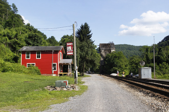
Railroading in West Virginia: The Cass Scenic Rail Road and the No 5. Excursion Train.
After my visits to Thurmond and the New River Gorge, I scrolled through the Atlas Obscura pages on West Virginia to see if there was anything else I might take in while in that state. Up to the northwest of Beckley, where I sat, was the town of Cass, and the Cass Scenic Rail Road, a division of the Durbin & Greenbrier Valley Rail Road Co.

I don’t know if the phrase “As the crow flies” was coined in the Appalachians, but it could have been. The way a crow might fly up out of a holler and over the ridge to the next holler would have been an apt description for an ease of travel not available to the human, on foot (or on a train), on the ground. From Beckley to Cass “as the crow flies” is maybe 90 miles, but there is no straight road between them -- barely any straight roads at all in the hills, for that matter. So the drive was over two hours.

A couple of the old buildings in Cass; much of the town is made up of “company housing,” left over from when the population was primarily logging company employees.
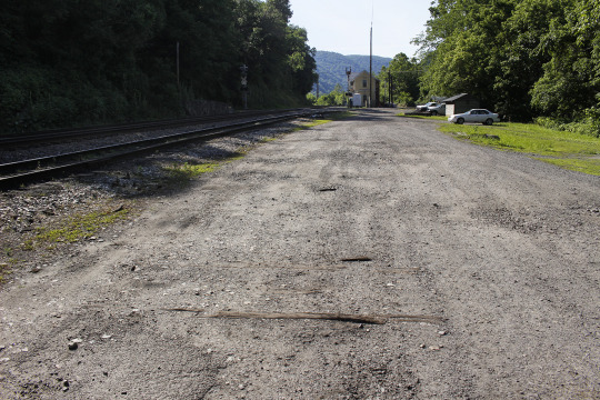
Cass Scenic runs three trains per day: two short-haulers of two hour-duration, and one longer run of 4+ hours. I got a ticket on the 2 PM short-run to Whittaker Station, a rail distance of around 2 miles one-way.

This is, I think, the largest building in Cass, and is home to the “Company Store,” a simulacrum of a dry goods emporium (read: touristy stuff), and a restaurant. The smaller house at the left is the local State Park office/visitor’s center.
Cass, as a town, found its place in history as one of the centers of West Virginia’s timber industry. Trackage was laid between Chesapeake & Ohio rails some 20 miles to the south, up to Cass, and then beyond into the hills -- all in less than a week, mind! -- and no sooner were there rails, there were also loggers and trains, pulling trees from the hills for milling and sending out finished lumber. The engines are mostly Shay type, as the No. 5 pictured here, specifically engineered to haul massive tonnage up and down steep grades.

Some of the other engines on the CSRR roster.
Even today, logging steamers can haul heavy loads up grades, up to 15%, that modern diesels can’t. The “secret” is an old and substantial version of “all wheel drive,” with pistons that deliver power to all the wheels, all the time. The Shay-type has side mounted pistons that made it a mechanic’s dream when maintenance was required -- and steam powered trains require near-constant maintenance. The ease of access to the moving parts made Shays the preferred locomotive to have as motive power in the timber industry.
Closer-up view of the side-mounted pistons of the Shay-type engine. The drive shaft sends power to all the wheel sets, and the boiler is mounted off-center to balance the weight of the machine on the tracks.
While logging engines might do 30 MPH flat-out with no load, their purpose was to do the weight on the inclines, and on often-torturous rail routes, so they didn’t necessarily move fast, but they did move the logs. Today they move people. The tourists’ excursion cars are converted from the flat cars that used to haul logs down the hills to the lumber mill, and some of the engines, including the No. 5, have never left these hills. Built in 1905 and brought to Cass, it has remained since, still blowing coal smoke and venting steam.

Remnants of the lumber mill; logs brought down from the hills were converted to finished lumber and stacked, where the car park is now, to await shipment to the big outside world.
Today, Cass is a West Virginia State Park holding, and the park and the rail road have a partnership in recreation and education. A number of the company houses in town are available as park lodging, some with room for up to 14 guests, and including most of the amenities one might expect from a small motor hotel (yes, including wifi). You can bet that a night in Cass is “on the list” of things to do.


Pulling away from a switchback.
The run from Cass for all of the excursions includes a section of tight turns and a brace of switchbacks to ease the way up the hillside. The short-haul to Whittaker Station (site of one of the logging camps) rises over 800 feet from town, and is up the side of the hill, while the longer, 4+ hour run to Bald Knob rises over 2,000 feet and, after the switchbacked hillside, proceeds along a ridge route to one of the highest points in the state (also “on the list”).

Looking up a curve in the wood on the route to Whittaker Station.
Photos: R. Jake Wood, 2021.
Atlas Obscura
Durbin & Greenbrier Rail Road Co.
Satellite views of West Virginia by Google Maps with annotations by Jake Wood.

This deer found an enticing spot to relax, and was lying there on the way up, and still there on the way back, not-quite two hours later, much to the delight of the passengers.

Blowing coal smoke and steam: the No. 5 pulls out from Cass Station on the way to the rail yard following the tourist excursion.
9 notes
·
View notes
Photo


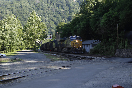
Railroading in West Virginia: CSX in Thurmond.
While in Thurmond on a July morning, I was pleasantly surprised to see quite of bit of rail road traffic through the little town, and more than just a coal drag on the main or a string of empty hoppers.

Rust and Spray Paint

Doin’ the Thurmond Shuffle.
Coming across the trestle was a long coal drag out of the valley headed by locomotive 374 that paused at the depot (allowing me a photo op whether they knew it or not), then moved on around the bend beyond town. The two locomotives swapped tracks, then swapped ends of the car string, but rested for some time while mechanics from a local rail road shop did -- well they did something with one of the engines. Meanwhile, other locomotives pulled that single tank car across and -- attached it to some other train?
From the other direction, a true, mixed freight-consist (headed by CSX 275) paused near the station for a few minutes before proceeding up the main line-tracks going north.

I don’t often see true, mixed-freight consists, and certainly few boxcars; the inter-modal trains with road trailers or shipping containers loaded on rail cars are more common today.
While Thurmond doesn’t see the rail action that it used to, the trackage that remains still allows for “doin’ the Thurmond Shuffle,” it seems: pausing and shifting cars and locomotives while consists are shaped up before taking the trains to points beyond the river valleys.
R. Jake Wood, 2021.

9 notes
·
View notes
Photo


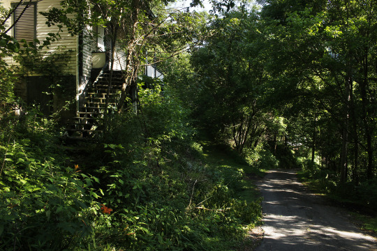
Thurmond, WV: Details and Loose Ends.
As near as I can tell, the mint green on the wall (I don’t know if that’s metal or embossed wallpaper, but probably wallpaper) was painted for the interior scene of the film Matewan. At a guess, it would have all been painted bright initially, but additional scenic elements -- a series of shelves and bead-and-board paneling -- were installed in front, and then the entirety was aged for the appearance of a couple of decades of use and coal smoke, which is why the color changes toward the wall and ceiling. The cornice and ceiling appear to be pressed tin, and probably original to the building.
The “crane shot” of the porch was me holding my camera up at arm’s length and shooting on auto, with the barest hope of recording an image of something; it turned out better than I thought it might. Given the deteriorating condition of the floor planks, I thought it better to stay off of the porch given that I was rambling solo.
R. Jake Wood, 2021.
5 notes
·
View notes
Text
Railroading in West Virginia: CSX in Thurmond.
While watching, and snapping shots of, the various trains moving about Thurmond, I saw a tank car that I was genuinely surprised was in a mixed freight consist:

Staley was the name of a company based in Illinois that, for about 100 years, processed corn into corn starch and corn syrup, as well as processing other products for the food industry. Staley was acquired by the English multi-national Tate & Lyle 30-odd years ago, and the name “Staley” was retired from the U.S.-based division in 2005. I’ve seen some of the remaining Staley tank cars moving around Indiana (there are two corn processing plants in Lafayette) but to see one in West Virginia, in Thurmond, was cause for a moment of “whaaat? Y’gotta’ be kiddin’ me.”
Note: the blurring of the name on the car is not because of the train’s motion; the paint job is so old the paint has blurred, vertically, in the weather.
Also: sometimes I think the name “Staley” is more appropriate, as the odors that blanket the town on occasion are pretty stale smelling when they hit my nose.
R. Jake Wood, 2021.
2 notes
·
View notes
Photo


The New River Gorge Bridge from various vantages, morning and afternoon of two different days, with and without tourists. In the last few years, I’ve found that there are times when my fellow tourists number so many and so frequently circulate at what-ever the scene that there’s no point in trying to wait for them to clear from the field of view -- so I just include them in the shot. I do my best to keep anything particularly identifying out of the photo (just in case) but they’re there, so sometimes they may as well be seen, too.
The steps down from the visitors center to the Overlook platform are many, but were built with places where people can stop and rest; not everyone can run stairs with ease:


R. Jake Wood, 2021.
2 notes
·
View notes
Text
More (yes more) on pool boats over on Jake Ponders n’at, mostly as an excuse to post photos of pool boats I found on the Library of Congress collections website.

Arthur S. Siegel, 1943: “Gallipolis, Ohio. Coal barges passing through locks.”
2 notes
·
View notes
Text
On America’s Roads and Highways
“Stay on target! Stay on target!”

Taking a moment to stretch; the blur is from my movement, the motorcyclist wasn’t really going anywhere.

“...stay on target...”

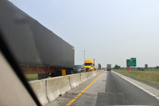
I-70 as car park: can we stack your traffic for you?
Heading back to West Virginia in July, I thought I’d take the chance and run through the road construction on I-70 east of Indianapolis -- and it turned out to be the grind promised by highway department signs: “heavy traffic - expect delays,” as seen above. Narrowing down to one lane in each direction, the traffic did not “zipper” together, but instead jammed up and jockeyed way too much, which slowed everyone down, or brought us to a dead stop a few times.
Much easier driving was had elsewhere:

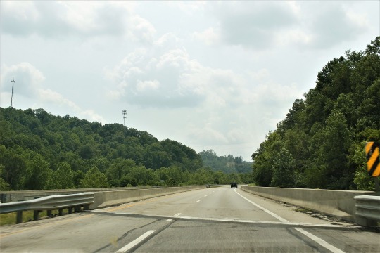
The two shots above are of Interstate 77, which runs north-south in western West Virginia. Away from Charleston, the traffic was pretty light, which I appreciated as long as it lasted. The hazy skies these were shot under are because of the wildfires. Smoke from Canada as well as some from the western U.S. was bent by the prevailing winds southeast across the Mid-Western states toward the South and Mid-Atlantic, the very high, thin layer hanging pale where there should have been blue sky.
U.S. 35 in Ohio, angling north-west to south-east, is over much of its length built to the standards of the interstates, though the three times I’ve been over it there was far less traffic -- at least once beyond the Dayton area. As seen below, the 4-lane appears like the early interstates must have looked once upon a time -- like in 1963:
In West Virginia, the Robert Byrd Highway System was also built to interstate standards, while keeping the (mostly) unrestricted access. U.S. 50 between Clarksburg and Parkersburg shows this:

If I didn’t know better I’d think it was a shot I’d taken from I-70 in eastern Ohio.
Where the interstates don’t go, or where Senator Byrd’s highways weren’t built, there were the smaller highways, like U.S. 60 in the Kanawha River valley east of Charleston:

Like the rail roads before them, many improved roads in the eastern mountains follow the river valleys -- it’s just easier building that way. Where the roads can’t follow a flowing stream, the option is to follow the contours of the hills themselves, as below:

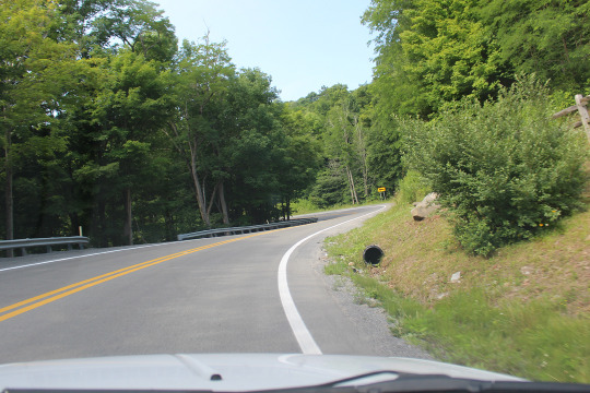
on West Virginia 66 west of Cass. I don’t have photos of the really twisty-turny hairpin turns ‘cause I was, like, steering n’shit. But many miles of up up up, down down down, left right left right left right were had touring through the central part of the state -- and those roads were improved by a great deal beyond the dirt tracks that they would have been before road improvement became a serious matter.
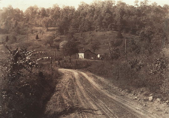
This image typical country road near Charleston in 1921 shows the condition of most roads in the U.S. prior to the 1950s. [1] Or, depicting some twisty-turny as well as some improvement -- it looks like it’s been macadamized and there are guard rails! -- is this shot of the National Pike near Hancock, Maryland, in 1922: [2]

Road improvement, even if it was only macadam and wooden rails, kinda’ started in the East and worked West. Trips, even by automobile, let alone with horses, much less by foot, were measured in days or weeks, not hours. I was able to make the run from western West Virginia back to north-central Indiana in less than 10 hours (allowing for one long-ish stop and road construction -- it is Orange Cone Season) rather than the week it might have taken in decades past. If y’wanted to go somewhere, you’d a took a train!
While improved over its condition of early travel, the Fayette Station Road in the New River Gorge is still narrow, twisty, and is today one-way over much of its length:


Descending from Lansing on the north, to the bottom of the valley, then back up again near Fayetteville on the south side of the gorge, the road still allows tourists access to what had been (until 1977) the only local road bridge over the New River:

With the opening of the New River Gorge Bridge (I suppose I might term it “the World Famous...”) travel time over the river was reduced from 45+ minutes to less than a minute.

Looking east from the New River Gorge Bridge: hard to know what you’re lookin’ at.

Fayette Station Road circa 1920: narrow, twisty and dirt. [3] If you met someone going the other way, one or the other of you would have to dare the edge, or back up to a wider spot to pass.

The new New River bridge from the old one. At 3,000+ feet the new bridge is not quite a mile long, but appears to the driver like most other bridges; the first time I passed over it, I didn’t even realize that I was traversing a famous bridge -- you really can’t tell it’s anything at 65 MPH. But it is “up there:” according to an NPS placard, “Two Statues of Liberty and one Washington Monument can fit under the arch with twenty feet to spare.” [4]

The second time I drove over it, I did know what I was driving on (”Oh, hey it’s The Bridge!”) and made like a tourist to stop and take photos:

like y’do.
Photos: R. Jake Wood, 2021 except
[1 and 2] Library of Congress Prints & Photographs Online Catalog:
[1] “Country view near Charleston, W.Va.” by Lewis Wickes Hine, 1921.
[2] “National Pike, west side of Sideling Hill Mountain, near Hancock, Maryland” by J.E. Feltner, 1922.
[3] National Park Service website, as shown on the Fayette Station Road Audio Tour page.
[4] National Park Service on-site placard graphic near New River Gorge Bridge, New River Gorge National Park and Preserve (photo by R. Jake Wood).
Of note is that the federal New River Gorge area was re-designated as a National Park and Preserve by act of Congress in December of 2020, something the gov’ment got right!

Looking west from the New River Gorge Bridge: worse than lookin’ east.
2 notes
·
View notes
Text
Thurmond, WV: the Unsung Star of John Sayles’ Matewan - Updated.
I’ll admit I’ve got kinda’ fixated on Thurmond, and since John Sayles used it as the principle location where his movie Matewan was filmed, I’ve also watched that -- and then went on to read his book about movie making. The text is, in general, about the crafting of a motion picture, but he uses Matewan as the case study.

A few minutes into the film, a steam engine pulls a train across a creek (above) [1] which sure looks like this shot I took of an old C&O trestle over Dunloup Creek, (below) just west of Thurmond [3].

While Sayles doesn’t dwell on all the details of the production design, he does write of Thurmond being a nearly perfect place to shoot: far from highways, not under airline routes, near enough to other municipalities (Mt. Hope and Beckley) to make on-location work possible. Unlike the real Matewan, there were no new sidewalks, telephone poles, TV aerials, or modern lighting to remove.

Chris Cooper walking into town from the depot. [1]

Thurmond in 1988, the year after the movie was released. [2]

Thurmond in 2021: the usual shot of the business district. [3]
Truly, Thurmond is the unsung supporting star of the film, its remaining buildings not exactly appearing like Matewan’s commercial strip, but damn close, the storefronts nearly blank canvases, inside and out, for dressing as 1920.

Chris Cooper and Nancy Mette at the depot. [1]

Chris Cooper with Thurmond in the background. [1]
Not all of Matewan was filmed in Thurmond; some locations had to be found elsewhere, but to keep costs down, all were within a certain radius of the “base” in Mt. Hope (which is maybe 10 miles away, allowing for the twisty roads). Besides the town, they found a row of old buildings that looked like miners’ houses, a mine entry that hadn’t been sealed up, a log cabin near Beckley for one character’s home, and the like. Interiors of existing Thurmond structures were revamped for filming or repurposed.

The store seen at right (above) was a facade built for the movie; later in the narrative it’s set on fire -- the proprietor of the store, C.E. Lively, was paid by the coal operators to spy on unionizing efforts; it’s situated where no building has stood since an Armour meat company building burned down in 1963. [1] The interior of the store was shot in the basement of the still-extant Union Church, which sits up the hill from the commercial row.

(Above) Lively’s store on fire; David Strathairn and Josh Mostel are in the foreground; (below) the Baldwin-Felts gunsels approaching the business district with the burnt timbers of Lively’s store to the far right; note, too, on the far left, the lack of vegetation around the coaling tower, and the presence of C&O tracks which are now gone. [1]


The coaling tower today: the trackage through- and around the tower has all been removed; only the through-tracks remain (in the foreground). The C&O wouldn’t let all the trees so close, either, and anyway, construction and coal smoke from the engines would have kept much of the vegetation at bay. [3]
The Fatty Lipscomb House as Elma Radnor’s Rooming House:

From left: Gordon Clapp, Kevin Tighe, and Mary McDonnell in a set-dressed dining room. [1]

Chris Cooper and Mary McDonnell [1]

Kevin Tighe, Will Oldham, and Gordon Clapp. [1]
What today is identified as the Fatty Lipscomb House portrayed the rooming house 35 years ago, the doubled first-flight of the front steps and the front porch doing yeoman's work in the film. Some of the interior rooms were cleaned up and dressed to portray the dining room and occupied lodging; a volunteer at Thurmond expressed mild surprise describing the set dressers putting up fresh wallpaper then spraying it all down for age! Yep, I thought, that’s the way it works (and I would know).

The Lipscomb place in 2021, the front yard much encroached by trees. [3]
Sayles reported that there were maybe 50 or 60 people still living there in 1986 during principal photography, and that the crew did work with them as they moved about, keeping them informed of when modern cars needed to be moved and the like. The production also coordinated closely with CSX to avoid any diesel powered-coal drags driving through while the cast walked around on the tracks -- and they did walk around on the tracks a good deal.

Baldwin-Felts “security” arriving for the climactic show-down. In the background are the Depot and the C&O rail-and-road trestle.
[1] Screen shots of the Warner Bros. (U.S.) 1987 release Matewan as captured from YouTube. Most of these shots are from an upload in 2020, and at least when I watched it, the sound left much to be desired. An HD upload in 2021 is also on YouTube -- the Criterion Collection release -- which looks to be of better quality, and was the source of some updated shots. All of the screen shots were given minor processing for better static viewing.
[2] Jet Lowe photograph of Thurmond for the Library of Congress’ Historic American Buildings Survey/Historic American Engineering Survey, 1988; from the Library of Congress Prints & Photograhs Online Catalog.
[3] Photos by R. Jake Wood, 2021.
Matewan on imdb.com.

Movie train crossing the New River on the C&O Thurmond trestle. [1]
3 notes
·
View notes
Photo
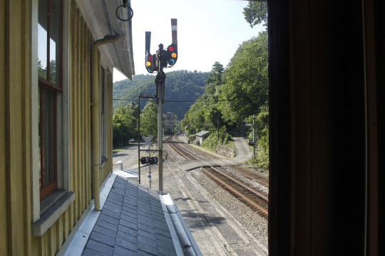


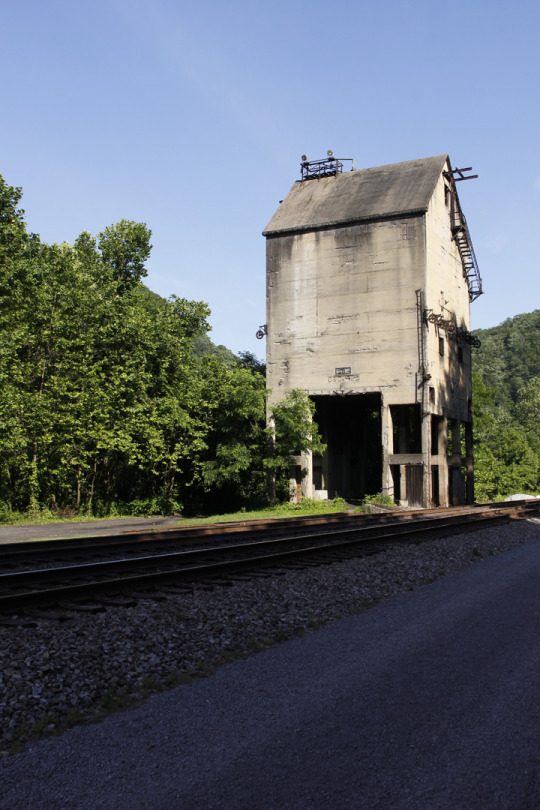
Thurmond, West Virginia: a Rail Road Town that the World Passed By, Then Found Again (sorta’) - Updated.
As I explained recently over a dinner with friends in town (for the first time in how long?!), Thurmond, West Virginia was south and west of Pittsburgh, so it seemed like a good option for a kind-of side trip on the way home from Pennsylvania. Little did I know how long the trip south would be, but glad I was to have done it.
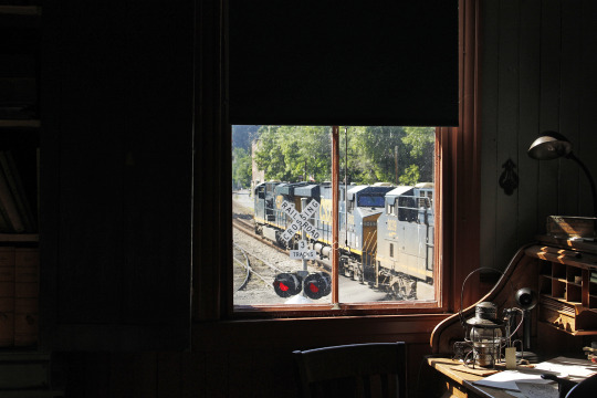
A CSX coal car drag passing the Thurmond Depot, as seen through the window of the yardmaster’s office. [1]
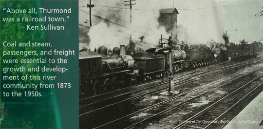
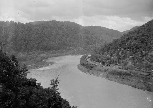
The town was founded by one Capt. W.D. Thurmond in 1873, the same year the Chesapeake & Ohio Railway completed main line track building through the New River Valley. The New River Valley was scene to intensive coal mining in the latter half of the 1800s and first half of the 1900s, and Thurmond was literally and figuratively at the heart of it all.
I believe the tall structure visible through the coal smoke and vented steam is the coaling tower. [2]

Thurmond in 1988. Conspicuously absent now are all the structures on the left side of the tracks -- as well as the tracks to the left. [3]
The New River Valley was also the scene of some of the worst of the “coal field wars:” the operators paid by weight, ran company towns and stores, and lured unsuspecting laborers into the valley with promises of good wages -- promises that never materialized. Instead, coal weight was shorted, company rents and store fees were exorbitant, and rules were enforced with extra-judicial posses, bought-off law enforcement officers, and state militia at times. Miners were repeatedly denied recognition of their unionizing efforts, scabs were thrown in between the simmering, or boiling, antagonists, and strikes devolved into shooting matches.

Thurmond in 1988. [3] Two generations of water towers (near center) holding hundreds of thousands of gallons of water for the thirsty steam-powered engines, and the post office building (at right) CSX removed the water towers in the 1990s.

Concrete footings for the water towers seen in the 1988 photo above. The post office building still stands (at far right), and is still U.S.P.S. property, though it is no longer in operation. [1]
Thurmond was the vital hub for the C&O and for all the various people who moved through the Valley throughout the coal mining years; in 1910, Thurmond moved more freight and passengers than any other town the rail road serviced. It’s hard to imagine today, but from its founding until the early 1920s, Thurmond could only be reached by rail, and thousands of people moved through or lived in the town, going to work in a mine, working for the C&O, or providing goods and services.

The Marilyn Brown house, with the roofline of the Fatty Lipscomb house beyond. [1]
At one time, Thurmond boasted many commercial structures, scores of houses (like those above), and was also a service hub for the C&O’s engines and rolling stock. Steam-powered rail road engines require daily maintenance, work that was effected in a large engine house that was perched above the river.
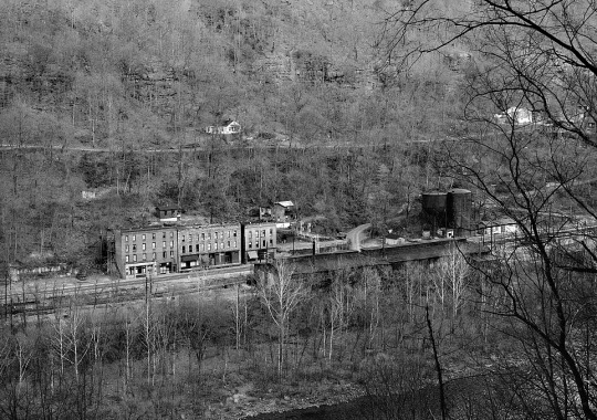
Thurmond in 1988. [3] The engine house is right of center in the mid-ground, behind the trees. Some of the remaining private houses can be seen uphill behind the commercial buildings, as well as the one “street” that wound across the face of the hill.
Like so many towns built around 19th century industries, Thurmond’s importance declined dramatically as the 20th century proceeded. The use of diesel rail road engines left steam engine mechanics unemployed; many of the mines played out, and those that remained (and remain still) employed far fewer miners to pull the coal from the seams -- or blast it from hill tops; and people who would have been passengers on the trains began driving automobiles. The world, if you will, moved on, and Thurmond dried up.
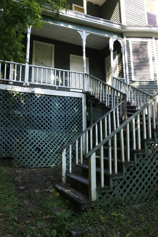

Two views of the Fatty Lipscomb house. [1]
As coal mining declined, though, tourism increased, and in the 1960s and 1970s, enthusiasts of outdoor sports found the U.S. Congress receptive to the idea of setting aside some of West Virginia’s landscapes for boating, hiking and camping. In 1978, a substantial swath of West Virginia was designated as the New River Gorge National River, and later, lands along the Gauley and Bluestone Rivers were conserved, designated as National Recreation Areas in 1988.
Another house, here perched on the hillside above the commercial district, and a stretch of the local roadway, looking downhill. [1]
Once the land along the rivers became national reserves, Thurmond basically passed into federal control, though up until the early 1990s, up to 50 people still resided there. The Chesapeake & Ohio had also declined, and became a foundational holding of today’s CSX Transportation rail road company. CSX still moves coal through Thurmond in long drags of hopper cars, either full and destined for power plants, or empty and heading back to the mines.
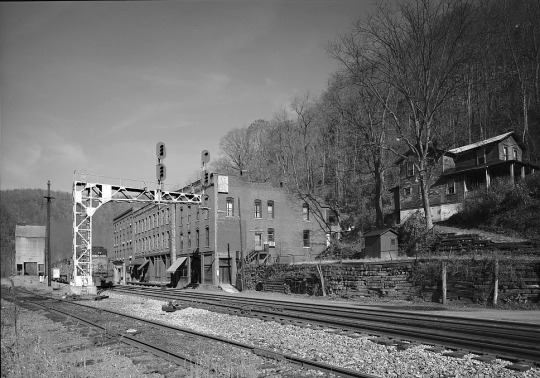
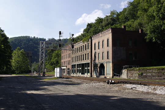
In 1988 (above) [3] and in 2021 (below). [1] The view below is perhaps the best known angle of the old commercial buildings. From right, these are: the Mankin-Cox Building, the oldest of the three, which housed a druggist and a bank; the Goodman-Kincaid Building, which housed a dry goods store as well as offices and apartments; and the National Bank of Thurmond Building; all held a variety of business concerns before business fled. To the upper right is the Erskine Pugh house. The track in the foreground has been removed.

Circa 1900 [2] The engine house is right of center, with the commercial buildings to the left. The large building at far left was a hotel, but it burned down and was replaced by an Armour meat company building -- which also burned, in 1963 . The depot (seen following photo) is at the far right, with the rail road trestle just in view.

The 1904 passenger depot, now the NPS visitors center (as of 1995), and yes, Amtrak does have Thurmond as a stop! [1]
The NPS owns most of the remaining buildings, and efforts began in the early 2000s to keep them from deteriorating further, with roof repairs and seals to keep out the weather. There are still 5 residents in Thurmond, all are on the town council, and in addition to being active within the park, they are also seeking ways to keep the town alive.
The red house at left is new construction, but on an old foundation, and where possible, older building materials have been recycled in its build-out. A project of Thurmond’s residents, the hope is to have it available for seasonal leases; my guess is it’ll wind up with a long wait-list -- and my name will be on it! [1]
Old rail road ties in the dirt: now an access road, the C&O service track that led to the coaling tower were once mounted here; the engine house would have been to the extreme right and partially out of view; the depot is dead ahead, and my road-weary car is parked near the trees. [1]
Maybe I was taken-in by the town because of the setting, nestled as it is among the hills and above the river; maybe it’s because the old buildings have that “certain something” that makes history buffs like me snap more photos than is reasonable; maybe it’s the potential that I can see in them (provided anyone ever coughed up the money to really rehabilitate them); if I was to get metaphysical about it, maybe it’s because of all the lives and history that occurred in the area and the energy left behind calls out still (y’know if I got metaphysical about it -- past lives anyone?); perhaps it’s all of those. What-ever the reason, I’ve been thinking of making a trip back in mid-Autumn, take a long weekend as the leaves are turning and it’s got chilly -- and shoot yet more photos than is reasonable.
The 1922 coaling tower (above), built by Fairbanks Morse (as noted on the sign below). [1]


The reason for the coaling tower: a pair of the last steam engines in Thurmond: 1953. [2]
I briefly stopped at the New River Gorge visitors center where I got directions, and figured I could at least find out where I was going before getting off the highway for the night. I arrived in Thurmond just before 5 PM, but even that later afternoon hour left plenty of daylight to walk about and take photos. My thought had been to simply find Thurmond, then make my stop-over somewhere nearby (Beckley, WV is less than 10 miles away) then return in the morning. That thinking quickly became “Oh! I can come back for more in the morning!”

Up the hill: the old church. [1] The church grounds now host the local triathlon and reunion events for those who once lived in Thurmond.
What I realized as I strolled around in the afternoon, was that the light would be dramatically different if I arrived early the next day (yeah: a “well duh!” moment if ever there was one), an effect of the changed daylight hours mixed with the topography that proved itself quite wonderfully -- and is why the images here show both the golden glow of evening and the cool white of morning.

Amtrak’s Cardinal route-train, on-time (or nearly) on a Friday morning. [1]
Standing by my car, having a sip of coffee, looking around as other visitors arrived or departed, I just, well -- “sighed with contentment” is an apt description.

A view of the ticket agent’s office. [1]
For more information on Thurmond:
The National Park Service’s web page for Thurmond, WV.
Thurmond, WV on Clio, a history and culture website.
Both of these share some of the same information, and each has additional images, both historical and contemporary.
A view of the New River Valley from the west side, across from Thurmond (note the houses and rail road cars on the far bank below the hill). [4]
The historical narrative written here was gleaned from the NPS hand-out for Thurmond, as well as from the Summer 2021 issue of National Parks magazine, published by the National Parks Conservation Association (“Miner’s Angel” concerning Mother Jones and the coal field wars of West Virginia, by Nicolas Brulliard). Identification of the Marilyn Brown house made possible by access to a PDF of the NPS’ structural assessment report of buildings in Thurmond, revised edition, published in 2002.

A view of the yardmaster’s office [1]
Atlas Obscura’s “22 of America’s Best Preserved Ghost Towns” Sorry, Mental Floss, you were forgot.

Looking south toward the depot past the three old commercial blocks. [1]
[1] Photographs by R. Jake Wood, 2021.
[2] Historic photographs displayed on-site by National Park Service, photographed on-site and edited for this posting by Jake Wood.
[3] Photographs by Jet Lowe, 1988, for the Library of Congress’ Historic American Building Survey/Historic American Engineering Record; retrieved from the Library of Congress’ Prints & Photographs Online Catalog, with minor editing by Jake Wood.
[4] Photograph by the Detroit Publishing Co., circa 1910; from the Library of Congress’ Prints & Photographs Online Catalog, with minor editing by Jake Wood.

The depot, alongside CSX trackage. [1]
CSX coal drag outbound with hoppers full of coal. The post office building is visible just beyond the engine. [1]
3 notes
·
View notes
Last Seen Blogs

raouxmarie
Marie-Josèphe

mygenderisknifu
I Am Plant, Watch Me Photosynthesize

binsenkan
便箋館

mistysblueboxstuff
i paint stuff.
