#nehalem river
Text
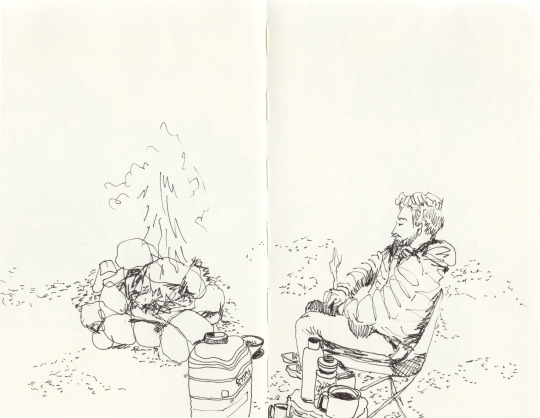
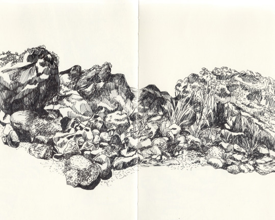
Camping (Nehalem River), 2023
#pen and ink#elizabeth arzani#elizabeth arzani drawing#artist on tumblr#figure drawing#camping#nehalem river#oregon#pnw#firepit#pdx artist#around the fire
1 note
·
View note
Text
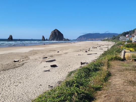
A trip to the Oregon Coast, 17-20 Feb 2023
The beach at Manzanita, Oregon, 18 February 2023. Minolta XD5/Minolta MD 50mm f/1.7 lens/Kodak Portra 400
It’s the annual tradition: Head to the small beach community of Manzanita in northern Tillamook County on President’s Day weekend. Emee’s son’s birthday is around this holiday weekend, so he brings a gaggle of friends to “the beach house” and we act as chaperones. This annual tradition is…

View On WordPress
1 note
·
View note
Text
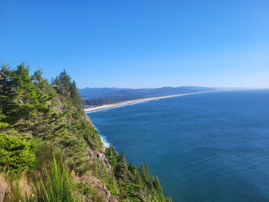
Day 1 - beautiful sunny day. Stopped to eat lunch on the mouth of the Columbia River on the WA side from Astoria, OR. Astoria is probably most well know for where the movies Goonies and Kindergarten Cop were filmed. It also has a very tall column you can climb up that sits on the hill overlooking the town and river.
Stopped in Seaside for some coffee, saw the beach. Stopped at a cool Lewis & Clark historical site. Stopped in Cannon Beach and took a pic of Haystack Rock. The last viewpoint pic is of Nehalem Bay Beach area and where I'm spending the night tonight. Made camp, no rain tonight so I thought I would forgo setting up the tent and just sleep under the canvas.
3 notes
·
View notes
Video
Columbia River Belt Line Railway #7 "Skookum" por Kevin Madore
Por Flickr:
After years of restoration efforts, Columbia River Belt Line Railway #7, the "Skookum" was finally able to perform for a Trains Magazine photo charter in March of 2019. Seen here running in the Nehalem River Canyon with a demonstration log train, #7 shows off her rare 2-4-4-2 configuration in equally rare Oregon sun. This image was captured near Roy Creek Park in the hamlet of Mohler, Oregon. Built by the Baldwin Locomotive Works in 1909 as their builder's number 33463, this unusual 2-4-4-2 articulated, compound Mallet was intended for the Little River Railroad in Townsend, TN as their number 126. Unfortunately, that railroad quickly determined that she was too long for the tight curves on their line and she was returned to Baldwin. In 1910, Baldwin managed to resell her to the Columbia River Belt Line Railway in Blind Slough, OR, where she was put to work as a logging engine. That railroad typically named their locomotives rather than number them, and this engine received the name "Skookum", which is apparently a Chinook term, meaning large, powerful or impressive. She served the Columbia River Belt Line from 1910 through 1920, before being sold to the Carlisle-Pennell Lumber Company, where she acquired the number 7. After a four-year stint there, she served 4 other railroads, including the Deep River Logging Company, where her long career came to a sudden end in 1955, when she rolled over with a string of empty log bunks. Since that line was in the process of shutting down, no attempt was made to recover her and she was left in place. In 1956, she was acquired by a man named Charles Morrow, who removed her from her wreck site in pieces....and she's spent the next 60 years in pieces, owned by several individuals and moved several different places. In 2005, she was acquired by Chris Baldo, who had her moved to the Oregon Coast Scenic Railroad, with the goal of restoring her. It's been a long road. Some pieces had been damaged when she was removed from the wreck site, and some pieces had been lost. Over the past 13 years, a restoration team has slowly and methodically restored her major components and re-assembled her into the condition you see here. She appeared in public for the first time at a Lerro Productions Charter in October of 2018, but alas, she was unable to perform for the photographers, because she still had some technical issues, including valve timing, which had to be tweaked and adjusted. After an additional 6 months of adjustments, repairs and break-in runs, she did make it out for the first of 2 photo charters organized by Trains Magazine, but alas, she still has some issues. She broke her second eccentric rod less than a week before the charter, and after additional repairs, suffered 2 tender brass failures during the charter. Each time, the railroad crews rapidly repaired her and she missed relatively little time during the event. Unfortunately, during her trip home on the second day, she broke her 3rd eccentric rod. Although repairs were initiated to get her ready for a second Trains event, the root cause of the issue had apparently yet to be found.
10 notes
·
View notes


Text
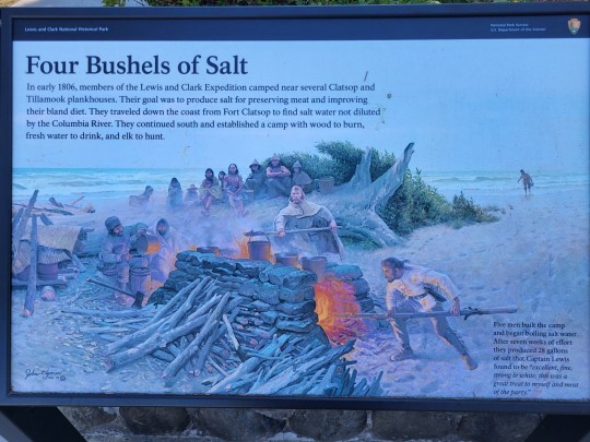
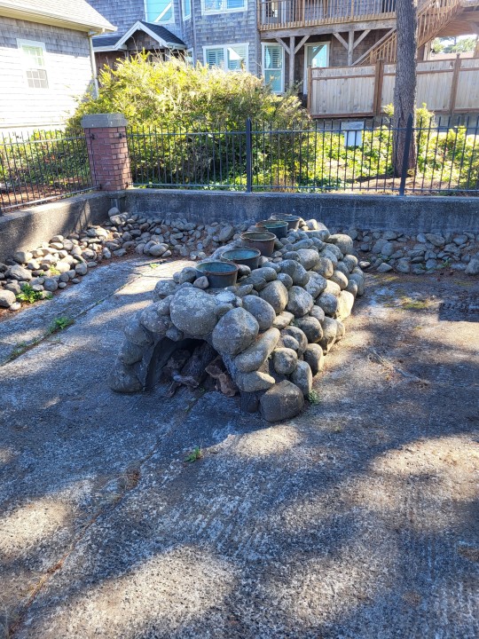
A Waxy Buildup in Nehalem
In December 2007, Loretta LeGuee was walking along the sand near Gold Beach after a storm when she spotted a large objects that turned out to be a ten-pound chunk of beeswax. Her find re-ignited interest in a centuries-old mystery of the Oregon coast involving the origin of thousands of pounds what appears to be beeswax that many people have collected over time. Most historians believe the wax came from one or more shipwrecks, but other people believe they're waxlike minerals that could lead to a fortune hidden under the sands near the Nehalem River.
European explorers and later settlers found there were no native wax-producing bees in North or South America, so they had to import beeswax. The Spanish, who had several rich colonies in Central and South America from the 1500s to the 1700s, in particular beeswax candles to celebrate Catholic Mass. Ocean currents between California and the Philippines enabled them to set up a network of ships (called Manila galleons by some) that sailed the route from 1572 to 1817, establishing trade of goods from the New World and bringing in important Old World supplies, including beeswax for candles. Several of these ships were wrecked or simply went missing, and it seems common sense that at least one, laden with beeswax, wrecked off the Oregon coast.
Native Americans might have been collecting the beached wax for some time to use in trade. Early explorers spoke of the Clatstop Indians and other coastal tribes trading beeswax with them. Sgt. John Ordway of the Lewis and Clark Expedition mentioned trading for some "small fish and a little bears wax" (some historians have corrected the spelling to "bees wax"). And American settlers arriving in Oregon traded with Native Americans for large quantities of the wax before they found deposits on the beaches near Nehalem themselves.
In the mid-and late 1800s, the people around Nehalem collected this waxy material, which was usually encrusted with sand. Some found what looked like candles with missing wicks, others found fist-sized pieces, and a lucky few found chunks weighing up to 150 pounds. There were strange symbols one some of these pieces, a few resembling Arabic characters and others that were more arcane. Historians' estimates the total amount recovered ranged from 1,500 pounds to over 100 tons.
Between 1890 and 1916, locals scavenged wood from a shipwreck exposed near the site of where most of the wax was recovered. This seemed to prove the shipwreck theory. Or did it?
In 1893, a piece of what was commonly called Nehalem wax was on display at the World's Columbian Exposition in Chicago. When the commissioner in charge of a nearby Austrian mineral display saw the Nehalem wax and examined a piece, he declared it to be a natural mineral called ozokerite, a petroleum product related to paraffin. Even though other chemists analyzed more Nehalem wax and said it was beeswax, many people still believe that it was ozokerite, suggesting that there was simply too much Nehalem wax taken out of the ground to have come from a ship.
For more than a decade, word spread among geologists and potential investors across the country, as ozokerite is sometimes found in and around oil deposits. Several petroleum engineers were convinced that if ozokerite were lying just below the sands of Nehalem, a rich oil deposit might lie only a few more feet down. Between 1909 and 1910, promoters sold mining stock to investors and erected an oil derrick over a spot where locals said huge deposits of wax had been recovered. The investors gathered a safe distance away and cheered as the drill bit cut into the sand. They waited all day for the gushers of oil that would make them all rich. And they waited the next day, and the day after that. It didn't take long for the money and their spirits to run out.
Reactions were mixed. Some wanted to cut their losses and put the whole boondoggle behind them. Others claimed fraud and tried to get their money back. Nobody was satisfied, and the only ones who made money were the people who owned the drilling rig.
After that no one seemed to doubt that Nehalem wax really was beeswax, and the history behind it faded into a local curiosity until recently. A group of volunteers and archaeologists began researching the Nehalem wax deposits and have conducted investigations, looking for the old wreck. As Weird Oregon goes to press, they haven't found it yet, but they are still looking. A search of records helped them pinpoint two likely candidates for the ship that wrecked along Oregon's shores. According to reports of the Naga Research Group, it seems likely that the Nehalem shipwreck was that of the Manila galleon San Francisco Xavier, lost sea in 1705. It's possible, but Weird Oregon has heard about some interesting investment opportunities drilling for offshore oil in Oregon . . .
To see pieces of Nehalem wax, visit the Tillamook Pioneer Museum in Tillamook and the Naga Group Web site (www.negagroup.org).
0 notes
Text
The Demise of America's National Parks
I wanted to write this while I was away, but it would have been full of emotion. Of course, I can't guarantee it still won't be, lol.
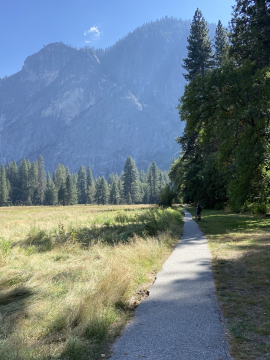
When I first started dating my now husband, he took me to Yosemite National Park for a couple of nights of camping. Full disclosure: at the time I thought, "really? I live in a beautiful place surrounded by mountains: what's going to be so special and different about this place?", but because we were dating, of course I humoured him. Reality: Yosemite is spectacular! Amazing! Incredible! But it's one of many national parks that is looking tired, and a bit tawdry at times.
America!!! These parks are legacy pieces. They are treasures. They are a gift to all of your people. However, from what we saw in two of them, (Olympic and Yosemite National Parks), they are almost on their knees as the cheapo third party contractors who now run them are making their money and letting things fall into disrepair. If you are a wealthy person, you can stay at the Awahnee Hotel, (which is being updated and maintained), but if you're an average Joe, (as we are), the campgrounds are falling apart. Here are our experiences:
We booked into Sol Duc Hot Springs and "Resort". We couldn't find the campsite that we paid $63.00USD/night, (so almost $100CDN/night) for, but we kept driving by what was obviously an overflow area for those poor people who couldn't get reservations. We finally stopped at the hot springs to ask where it was, and lo and behold, the place we thought was for overflow, was our "resort".

Our picnic table was falling apart, (we never used it). One early evening went to the hot springs, (you pay extra for them), and watched 3 life guards sitting side by side in plastic chairs, just shouting at people. There are 3 different pools, (a regular pool, and two hot springs at different temperatures), yet not once did these life guards get out of their chairs. They yelled so loudly that everyone was silenced and the "offender" whose crime was sitting on a bench of a fountain that was in the hot springs pool, (and honest mistake), that the poor woman was shamed in front of every single person there. It was horrible.
Moving on to Oregon, we were delighted at the state parks there: super organized, clean, and well maintained. We will definitely be back!

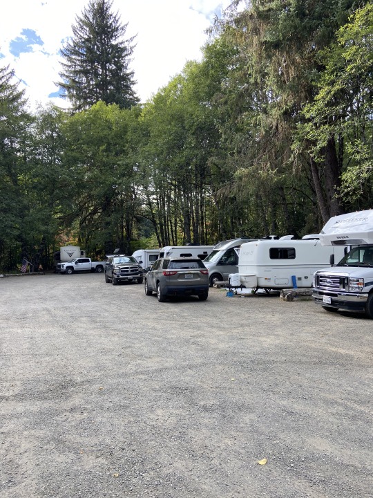
This was Nehalem Bay State Park, and while the Rogue River one by Grants Pass was beside the I-5 and loud, the sites themselves were beautiful!
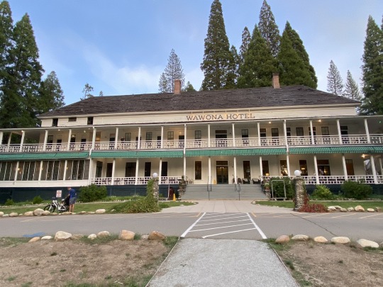
Onward to Yosemite. Here's my history with this park: my future husband first took me there in 1991 when we were dating, and let's just say it had me at hello! I was so enamored that I returned twice a year until 2003 when we moved back to Canada, (once for a week of outdoor education as a school coordinator, and once for a long weekend in November with friends). We had been back twice in the last 20 years, and I was psyched to get back this year. We were unable to get a camping reservation in the Valley, despite getting up and being online right when the reservations opened for our stay, so we were in Wawona campground. I didn't care: I was excited! It was my birthday when we were there, so we were going to go to the historic Wawona Hotel for my birthday dinner! What could be better? Well...at first glance the Wawona Hotel is still amazing, but the stairs, and outdoor wrap around porch was filthy. I have no idea when it was last swept and washed, but it certainly wasn't done daily, as we went one night to make our reservation, (which they then lost), and then again the next night for the dinner, and the same stains were on the decks. I will say, that after losing our reservation, (which we went and made in person), I was fairly unhappy. They eventually comped us each a glass of wine, but the server made sure to mention that as it needed to be included in our tip amount. The meal itself though was delicious!

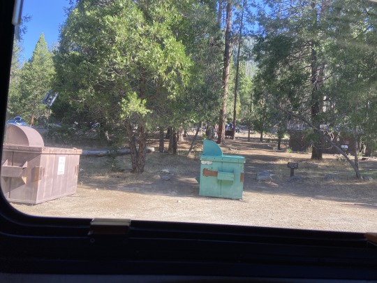
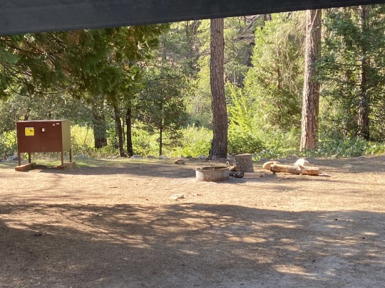

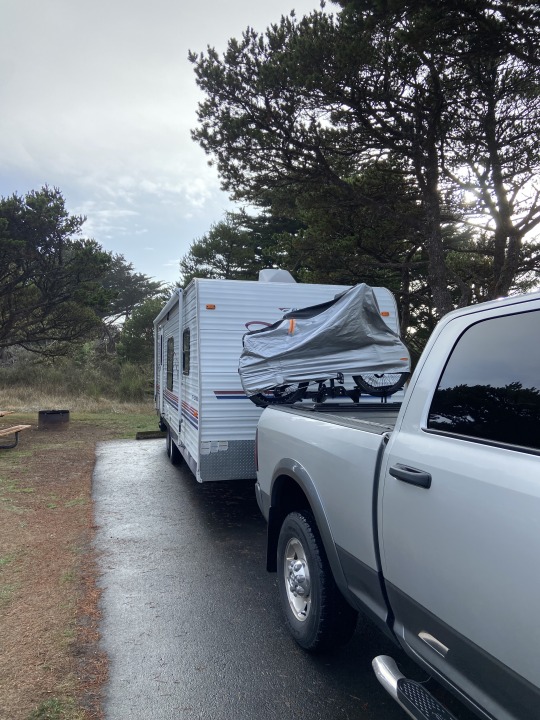
The last 3 photos above are of our "campsite". The site itself was blocked off by placed boulders, so you couldn't back your trailer in. Instead you had to park on the road, (in our case we had to drive in the wrong way or our door would open up into traffic). The dumpsters you see was the view from my bedroom window, and the 3, (yes 3), chemical toilets were also in our "site", (you can see the bed of our truck behind the trailer). While the site, (had we actually been able to access it), would have been amazing, (as it was on the river), it was this instead: people dropping off their garbage and using the toilets at all hours. When we asked for different site, (I said that I hadn't driven 1500 miles to camp on the side of a road with a portapotty), we were told that this was a "coveted site" and nothing else was available. Apparently the portable toilets were there because in the spring the regular flushing facilities didn't work, and because they were so expensive to rent, (tens of thousands of dollars), they decided to keep them for the season. Wow.
Yosemite is still spectacular for its views, but I don't feel the same joy at returning again. I do think the American people need to push hard for the money to restore these amazing places. While we were there, the US crashed an F-35 military jet, worth ..."For the air frame and mission equipment only, the Lot 15-17 cost of F-35s ranges “from $70.2 million to $69.9 million for the F-35A, $80.9 million to $78.3 million for the F-35B, and $90 to $89.3 million for the F-35C,” a Lockheed spokesperson said", yet no one freaked out. If you can absorb that cost, then put $70 million, (the low end cost of said jet), towards your national parks, and watch the transformation! I guarantee no one will say you lost a war because you were down a jet. Promise.


And Oregon State Parks: keep up the great work!
#us national parks#yosemite national park#olympic national park#US national park service#Oregon state parks
0 notes
Photo


Multicolor jasper from the Nehalem River, Columbia County, Oregon. May 10th, 2017.
155 notes
·
View notes
Photo
Bertie’s always been cool
Morrison Eddy, Nehalem River, Oregon 2021
3 notes
·
View notes

Photo

Nehalem.
NEW PHOTO.
Part of the ‘Vernonia’ Run.
#Nehalem#Lance#Hammond#photography#photo#picture#somethingphotography#somethingguy912#something#guy#912#waterscape#nature#river#snow#tree#vernonia#run
6 notes
·
View notes
Text
River Rocks (Nehalem River), 2023
#pen and ink#elizabeth arzani#elizabeth arzani drawing#artist on tumblr#nehalem river#oregon#camping#observational drawing#landscape#river rocks#pdxartist
0 notes
Text
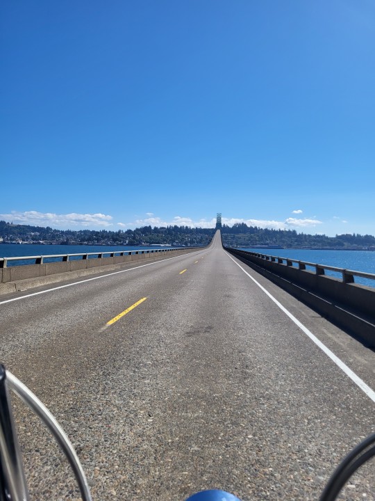
Portland is about 70 miles from the Pacific Ocean, at least “as the crow flies”. Close enough that we all know its there,* but still just far enough away that it’s not the easiest place to get to regularly. By car it’s a 90-120 minute drive. By bus, maybe three hours. By bike? At bare minimum, one long day of a ride.
And anyone who lives in Portland and bike tours hears the clarion call of the waves at least once a year. So plans to “go to the Coast”** are made. Now, one can take a couple different buses with bike in tow to get out there, but there’s that itch that can’t be scratched, called “biking to the coast”.
As I said, at bare minimum it will take you the better part of a day to get out there, and if you want to take it easy, two. The big problem is there is no great route to the coast. The most direct ways are the most busy, so to avoid them, you’re either doing something circuitous, or hard, or both. Some people go for the Advanced Studies of figuring out an all-gravel route over the Coast Range using the tangle of unmarked logging roads criss-crossing the slopes. While rewarding in its own badassitude (and solitude), it’s not for the faint of heart or those without good GPS units.
The weekend of May 20 was turning out pretty nice in Portland, which was really nice after such a damn long winter. Several days in a row without rain? Sign me up! Originally I was going to have a “three day weekend” starting Sunday the 21st, but at the eleventh hour it remarkably turned into a four-day one starting Saturday! Pack the bags, it’s time for a mini-tour!
With four days to play with, I had the time to take a two day ride out to the coast, and even ride back if I wanted to. There were many different options, but I decided to go with this one: Ride from my house over the St Johns Bridge and north on US 30 to Scappoose, then take the Crown Zellerbach Trail over the Nehalem Divide, then follow the Nehalem out to the ocean at Nehalem Bay. I’ve only done the Crown Zellerbach once before in 2014, so I was ready for another expedition. I had never been down the Nehalem all the way, though I almost did in 2013.
I got a late start on Saturday, pretty typical. The ride through North Portland and over St Johns Bridge was pretty smooth for a weekend day. US 30 was okay for a bit, but Dirty Thirty lived up to its name, as a piece of metal pierced my rear tire outside of Scappoose. Ugh. Yeah, I don’t know if I’m feeling the supple tire action for these conditions. I replaced the tube with my spare and soldiered on.
The Crown Zellerbach Trail was tougher than I thought it would be! It’s an old logging railroad, mostly unpaved, and used for years as a logging truck road. I had to get my loaded bike over a downed tree in the first couple miles and worried that this would be a regular occurrence. Thankfully that was the only one, at least on the section of trail I completed. The rest of the trail alternated between peaceful and sublime moments interspersed with steep climbs and mud. I reached the top of the Nehalem Divide, saw the “trail closed ahead” sign (most likely because of logging activity, but I heard afterwards there’s more downed trees on this section), and decided to descend on the paved Scappoose-Vernonia Hwy instead.
I ended the night at Anderson Park in Vernonia, almost fifty miles in.*** The nice thing about this park is it’s right on the edge of this small town, so all those conveniences are readily available. I ate dinner at a nice Mediterranean place, and in the morning had breakfast at the cafe. And…there was another bike tourist at the campground! Robyn was heading from Portland out to the coast, but instead of going to Nehalam, she was planning a 90 mile day using the Westport Ferry across the Columbia and then eventually to Astoria! It was tempting to join her, but I didnt’ feel like a 90 mile day**** and really wanted to check out the Nehalem. (But man, I do need to get to Astoria at some point!)
The road ahead was mostly peaceful, as I was following a river down to the sea. The route (OR 47 to 202 to 103) was mostly quiet too, though there was a vehicle at least every couple minutes. The “store”***** at Birkenfeld was open, which was surprising, as it’s often closed. I had a nice cold lager, which was so refreshing at that point. I took a break at the store in Elsie (junction of 103 and US 26), then grit my teeth for a couple miles of 26 until the turnoff for the fabled Lower Nehalem River Road.
This road is a secret back door to the coast, not well known and lightly trafficked. It was closed for a few years due to a washed out bridge, but another reason why it’s off the beaten path is because about 20 miles of it is gravel. The first five miles from 26 were paved, and brought me to Spruce Run Campground. The campground was pretty nice and besides the Nehalem. I was already 50 miles in and considered staying, but fuck it! I really wanted to see the ocean tonight! So I pressed on. Also, since I haven’t ridden a real long distance for a real long time, I wanted to push myself and see if I was still capable for the long haul.
The first section of the gravel was actually pretty nice and level, which lulled me into complacency. However, when I crossed into Tillamook County by the Salmonberry River crossing, things changed. The gravel got chunkier, and there were several small but very steep hills that sapped my energy. Plus, I saw signs for a road closure at Wolf Creek. Am I on Wolf Creek Road? I don’t think so, but nothing is well signed here and damn, I haven’t seen a car coming in quite some time. So then I started to panic, and push on harder. A road closure would mean the promise of the coast would be denied, and I would have to turn around and come back the way I came.****** I was not in a good mental state. Eventually, a car approached from the opposite direction and I flagged it down to ask the question. Yep, the road goes through to the coast! My mood was lifted for a bit…until I noticed my front end getting squishy. Damn. Slow leak? I hate them, since sometimes you can’t find the leak. And I had no spare tube. (I typically repair the damaged tube at camp, but I had forgotten that the tube I pulled out the rear had sealant in it. No go.) Plus, getting the tire on and off the rear was a total pain. Would the front be the same?
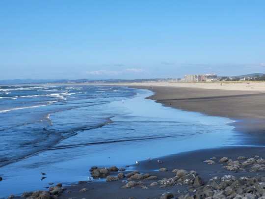
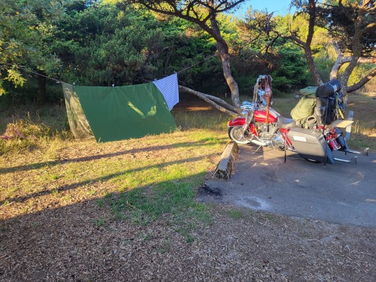
I put some air into the front. It seemed to hold, so I pushed on. Thankfully, the pavement began back up, so I didn’t have to worry about another rock causing a pinch flat or something. I rolled into the town of Nehalem around 7 pm, and found myself at a pizza place where I devoured a small pie. Then I rode the couple miles to Nehalem Bay State Park and dumped bike and gear at the hiker/biker campsite. I ran over to the beach, where I just missed the sunset. But it was still great to see the Pacific Ocean in all its glory!
There were people camped in the hiker/biker campsite, but no one was present or awake, which gave the place an eerie presence in the twilight as I set up camp. Exhausted after an 80 mile day, I slept good that night.
I awoke Monday morning, May 22, with no real plans. I knew I wasn’t going to ride all the way back to Portland, so I just needed to be in Tillamook by 1 PM on Tuesday to get home on time. I could stay here at Nehalem Bay for another night, but I decided I wanted to explore. First things first: fix the front flat. Thankfully, the front tire was easier to remove and mount, and the leak was obvious. I patched it and I was good to go.
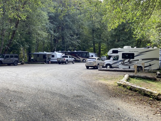
First I biked the couple miles into nearby Manzanita, a cute li’l beach town, where I got some supplies and got an underwhelming lunch. (My preferred option was closed.) I rode south along US 101 for about 20 miles to get to my destination for the night, Barview Jetty. Oh sure, I could have ridden another 25 miles to my favorite campsite on the coast, Cape Lookout. But I felt like taking it easy, and I had never been to Barview. Barview was a real nice campground, but expensive! I’m used to the state park hiker/biker sites costing $5 to $6 a night. But Barview is a Tillamook County park, and the site was $20! Yeeps! Still, I was really close to the beach, and I had a good sunset.
Tuesday morning I packed up camp, rode about 13 miles south on 101 to Tillamook and caught the bus home. My coast mini-tour was done.
All in all, it was a decent trip. But the ride to the coast was longer and tougher than I planned, at just about 130 miles. Since I hadn’t ridden anything that long in a long time, it felt harder. But it was nice to know that I could push myself to do this, especially with some good touring plans on the horizon. As it was, this was the first time I had camped two or more consecutive nights since my Vancouver Island-San Juans Tour in September/October. I had only done two consecutive nights then, so this trip was a good test of my touring setup and my ability to get a decent nights’ sleep on the road. And I did, at least after the first night. This shakedown gave me the confidence to go out on a longer tour soon.
And man oh man, I love the coast! It’s been too long, Pacific Ocean. At certain points in my life I was quite the “beach rat” and got to know some beaches on the Atlantic coast. The Pacific is more awesome in many ways, except for the fact I can’t swim in it. And I realize that I need to get out to the coast more often. Will I bike out the next time? Probably not. I’ll load my bike onto one of the buses to bring me most of the way, but the ride to the coast makes me realize how much I just want to be on the coast. The way out is nice at times, but there’s nothing spectacular, few points of interest. And there’s no perfect way. Yet.
They are working on the Salmonberry Corridor Trail, a path that would follow the abandoned Port of Tillamook Bay Railroad from Banks to Nehalem. This would mean a car-free way to the coast on a gentle rail grade. I’m really looking forward to its completion, though it’s going to take a few years. In the meantime, Washington State has the Willapa Hills Trail, and I need to get back there at some point. I can dream…
*Which is good for people like me who have never lived more than 70 miles from any ocean.
**If you say you’re “going to the shore” or “going to the beach”, everyone will know you’re from out of town.
***It would have been easier and more logical to end at Big Eddy Park, as going to Vernonia requires back-tracking. But Big Eddy was closed so I had to go with what was available. I passed by Scaponia Park on the way in, which I thought was closed, but it looked like it might be open.
****Of course, I ended up doing 80 miles as it was…
*****When I first visited it in 2001, it truly was a country store. Now it is basically a roadhouse/bar/music venue.
******Yeah, I could turn onto 26, but that road is too busy and narrow, and features some serious climbs.
A tour to the coast: May 20-23 2017 Portland is about 70 miles from the Pacific Ocean, at least "as the crow flies". Close enough that we all know its there,* but still just far enough away that it's not the easiest place to get to regularly.
#barview jetty county park#crown zellerbach trail#nehalem bay state park#nehalem river#Oregon Coast#pacific ocean
3 notes
·
View notes
Text


“The estuary is where the Neawanna, the Neacoxie and the Necanicum rivers all come together,” she said. “You can hear the ocean. ...You can see the coastal range. ... It’s an incredibly beautiful spot.”
The former tribal village site is at a busy intersection culturally and ecologically, along a tidal marsh at the confluence of three rivers, sandwiched between the ocean and a steady stream of cars and RVs driving through Seaside on U.S. Highway 101.
This place was so important to the Clatsop Tribe that when it signed a treaty in 1851 ceding their land, this was where they were guaranteed the right to fish and hunt indefinitely. Ultimately, though, they were fenced out and forced to leave.
Growing up in this area was a challenge, Basch said, as she confronted misguided interpretations of her tribe’s history and it’s very existence. “I often was told that the Clatsop people are now extinct. They don’t exist anymore,” she said. “And I, obviously, knowing I am a Clatsop person, knew that was wrong.” [...]
Their ancestors had longhouses here, in the place they called Ne-ah-coxie, or “place of little pines.” [...]
The Clatsop Tribe’s treaty ensuring them the right to fish and hunt was never ratified by Congress, so tribal members never got what they were promised. And as white settlers moved in, the Clatsop weren’t able to return [...]. “They put up fences and no trespassing signs [...].”

“Our people weren’t able to go to the place they gathered, and they were arrested for trespassing. Can you imagine that? The horror that they had to endure.” It wasn’t until earlier this year [2020] when the owner of 18.6 acres of land at that site decided to deed it back to the Native American people who used to live there [...].
Over the last two decades, the North Coast Land Conservancy has protected that 18.6 acres of property from development and restored its tidal marsh ecosystem. The land trust referred to the area as its Neawanna Point Habitat Preserve [...]. Katie Voelke, the conservancy’s executive director, said after years of talking with tribal members about their desire to own some of their ancestral land, her organization made the historic decision to deed its portion of the former village site back to the tribes. [...] “What we owned was one of the most important places to other people, and why would we own that when we know that those other people will care for it even more greatly than we would?” [...] The North Coast Land Conservancy’s decision to return the land means Clatsop-Nehalem tribal members have a place to call home [...], according to David Stowe, a council member with the Clatsop-Nehalem Confederated Tribes. [...]

The tribes have been denied federal recognition, so they don’t have full sovereignty or the right to self-governance. When they were forced to leave their homeland on Oregon’s North Coast, they didn’t have a reservation to go to. [...]
Standing on their newly transferred property with traffic on Highway 101 whizzing by, Stowe and Dick Basch talk with an architect about their plans to build a longhouse and museum at the site. [...]
“So we’re like, ‘Okay, now what do we do?’ We’re dreaming again ...”
-------
Headline, images, captions, and text published by: Cassandra Profita. “Clatsop-Nehalem tribes ‘dreaming again’ with return of ancestral land.” OPB. 15 December 2020.
2K notes
·
View notes
Text
From my high bluff on the coast I look east and the hills before me are a ragged range of clear-cut forests. To the south I see an estuary dammed and diked so that salmon may no longer pass. On the western horizon, a bottom-dragging trawler scrapes up the ocean floor. And far away to the north, the earth is torn open for oil.
Had the new people learned what Original Man was taught at a council of animals—never damage Creation, and never interfere with the sacred purpose of another being—the eagle would look down on a different world. The salmon would be crowding up the rivers, and passenger pigeons would darken the sky. Wolves, cranes, Nehalem, cougars, Lenape, old-growth forests would still be here, each fulfilling their sacred purpose. I would be speaking Potawatomi. We would see what Nanabozho saw. It does not bear too much imagining, for in that direction lies heartbreak.
Against the backdrop of that history, an invitation to settler society to become indigenous to place feels like a free ticket to a housebreaking party. It could be read as an open invitation to take what little is left. Can settlers be trusted to follow Nanabozho, to walk so that “each step is a greeting to Mother Earth”? Grief and fear still sit in the shadows, behind the glimmer of hope. Together they try to hold my heart closed.
But I need to remember that the grief is the settlers’ as well. They too will never walk in a tallgrass prairie where sunflowers dance with goldfinches. Their children have also lost the chance to sing at the Maple Dance. They can’t drink the water either.
Braiding Sweetgrass by Robin Wall Kimmerer
Got me fucking crying over here. Fuck.
60 notes
·
View notes
Link
Charlotte Basch sits on a piece of driftwood in the tall grass along the Necanicum River estuary, in Seaside where her Clatsop Native American ancestors used to live.
“The estuary is where the Neawanna, the Neacoxie and the Necanicum rivers all come together,” she said. “You can hear the ocean. ...You can see the coastal range. ... It’s an incredibly beautiful spot.”
The former tribal village site is at a busy intersection culturally and ecologically, along a tidal marsh at the confluence of three rivers, sandwiched between the ocean and a steady stream of cars and RVs driving through Seaside on U.S. Highway 101.
This place was so important to the Clatsop Tribe that when it signed a treaty in 1851 ceding their land, this was where they were guaranteed the right to fish and hunt indefinitely. Ultimately, though, they were fenced out and forced to leave.
Growing up in this area was a challenge, Basch said, as she confronted misguided interpretations of her tribe’s history and it’s very existence.
“I often was told that the Clatsop people are now extinct. They don’t exist anymore,” she said. “And I, obviously, knowing I am a Clatsop person, knew that was wrong.”
[Continue Reading]
100 notes
·
View notes
Last Seen Blogs

anny20107
𝑌𝑛𝑛𝑎

and-thenshejumped
I tried. I really did.

tylerhewitt551-blog
Untitled

wandyrlust-a
TOO SMART TO TALK TO GOD

justwannanap
catnaps