#sandra rendgen
Text

Illustration From The HISTORY OF INFORMATION GRAPHICS
Statistical Atlas of the population of Paris
Taschen via Sandra Rendgen
367 notes
·
View notes
Text
Ce qu'on peut montrer pour savoir
1798. History of Information Graphics, Sandra Rendgen, Julius Wiedemann
(Sandra Rendgen, Julius Wiedemann, History of Information Graphics) (Taschen, 2019)
⌘ Sandra Rendgen
0 notes
Text
Key features of a great infographic
Infographics are all about complexity and clarity. Creating them requires not only creative skills, but also analytical thinking. I think it is crucial that an infographic has a clear focus. The key message must be accessible quickly, in a clear visual structure.
Also, accuracy is essential. Are the infographics showing correct data and dimension units? Are proportions depicted properly? This may sound dull but is absolutely indispensable.
Aside from these basic rules – what we all want in the end is a great visual. We love maps and diagrams not the least because they look good. It is the design that makes us want to look at the data. […]
Continue reading here
0 notes
Text
Infografik als Kunst - Wie Weltereignisse und Kartographie in bunten Formen gepresst werden
Infografik als Kunst – Wie Weltereignisse und Kartographie in bunten Formen gepresst werden
Daniel Thalheim
Wie veranschaulicht man komplexe Systeme und Zusammenhänge? Systematische Zeichnungen, Karten und Karikaturen bringen uns seit dem Mittelalter näher, was wirtschaftlich, gesellschaftlich und politisch in unserer Welt passiert. Mit den regionalen Charakteristika eines Landes fängt es an, mit den schematischen Plänen des ÖPNV hört es auf.
Wie Karten unsere Welt erklären können
Wenn…
View On WordPress
#Geographie#Geschichte#Infografik#Julius Wiedemann#Kartographie#Mappae Mundi#Michael Stoll#Politik#Sandra Rendgen#Weltkarten#Wirtschaft
0 notes
Text
Full PDF The Minard System The Complete Statistical Graphics of Charles-Joseph Minard DOWNLOAD EBOOK
Full PDF The Minard System: The Complete Statistical Graphics of Charles-Joseph Minard DOWNLOAD EBOOK
The Minard System: The Complete Statistical Graphics of Charles-Joseph Minard

[PDF] Download The Minard System: The Complete Statistical Graphics of Charles-Joseph Minard Ebook | READ ONLINEhttp://read.ebookcollection.space/?book=B07K4TKKZT
Author : Sandra Rendgen
Publisher :
ISBN :
Publication Date : --
Language : eng
Pages :
To Download or Read this book, click link below:
http://read.ebookcollection.space/?book=B07K4TKKZT
[R.E.A.D]
Synopsis : Full PDF The Minard System: The Complete Statistical Graphics of Charles-Joseph Minard DOWNLOAD EBOOK
If you have any interest in information graphics, maps, or history, you know of the seminal flow map of Napoleon's 1812 march into Russia by Charles- Joseph Minard, made famous by Edward Tufte, and considered to be one of the most magnificent data graphics ever produced. The Minard System explores the nineteenth-century civil engineer's career and the story behind this masterpiece of multivariate data, as well as sixty of Minard's other statistical graphics reflecting social and economic changes of the Industrial Revolution in Europe and around the world. These stunning drawings are from the collection of the Ecole Nationale des Ponts et Chaussees in Paris and have never before been published in their entirety.
0 notes
Photo
C’est quand la dernière fois que vous êtes allés sur le site de B42 éditions ? ;-)
VISUALISATION. L’INTERPRÉTATION MODÉLISANTE. Johanna Drucker, 14.00€
LE SYSTÈME MINARD, ANTHOLOGIE DES REPRÉSENTATIONS STATISTIQUES DE CHARLES-JOSEPH MINARD, Joost Grootens et Sandra Rendgen, 36.00€
DES HIÉROGLYPHIQUES À L’ISOTYPE. UNE AUTOBIOGRAPHIE VISUELLE. Otto Neurath, 28.00€
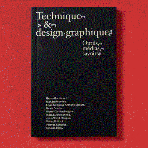
TECHNIQUE & DESIGN GRAPHIQUE, OUTILS, MÉDIAS, SAVOIRS, collectif,19.00€
UN DESIGN DE LIVRE SYSTÉMATIQUE ? John Morgan, Jost Hochuli, 19.00€
0 notes
Text
Information Graphics Reading Response
After reading a small excerpt from The Information Graphics, by Sandra Rendgen we can see how a graphic can say a million words about a certain topic, or it can give information about that specific topic. At the beginning of the reading we get a quote from Jacques Bertin, “a graphic representation is not merely a drawing, but often entails a heavy responsibility when deciding on how to proceed.” (page 2). When you first think of an infographic you think of a visual scientific graphic. An infographic can be something from a map to a statistic that is to inform the public. When reading this it made me think, how do we define what an information graphic is? Yes, it’s a statistical pattern that helps to inform the public, but is that all? Can an infographic also just be something that helps to inform the public without generating statistics behind it? In the reading, Sandra talks about how there is “’ suspicious data’, which are information graphics that are intended to explain how things really are.” (page 4) From that definition, I believe an information graphic does not have to only be something that has statics, but can also be something purely visual and artistic. However, within the illustration, there is also a clear depiction of something that can clearly inform the public, which also caries suspicious data within it. A good example of an artist that I believe creates information graphics is Banksy. His illustrations provoke conversation and make you think. He also shines a light on suspicious data without showing physical statistics.
0 notes
Text
26 April 2019
InCiSE-ive analysis
Which country has the world's most effective civil service? The latest International Civil Service Effectiveness Index (InCiSE), a collaboration between IfG and the Blavatnik School of Government with support from the UK civil service, was published yesterday and has some of the answers. It also has lots of interactive charts and the data behind them. I'm really pleased to have played a small part in the project - I think it's a great example of how data can enable the right conversations (we know an index can never be definitive, but it's prompted lots of talk about which countries should be learning what from elsewhere and what else would be worth including).
I think it's also a great example of a much-maligned chart type - radar charts - being used to convey data very clearly (here's a version from me). I'll write a short post on that soon (I already have some dreadful radar-related puns lined up, but further ones welcome). In the meantime, you can read a quick summary by me; an excellent comment piece from Blavatnik's Calum Miller on how the UK did so well despite, well, you know; a report from Civil Service World; and the report itself, the technical details behind it and some case studies of how the InCiSE framework could be applied to countries not included in the index. The 2017 version is here.
Elsewhere... Owen Boswarva took exception to DCMS describing data as 'fuel' (though I've definitely found myself accidentally calling it that from time to time...). It reminded me that Rachel Coldicutt started a spreadsheet to record such data metaphors. And that the ODI's strategy has some useful 'scenarios'. And that we once idly came up with some at the Institute, moving from data mining and data wrangling to data gardening (it's a wild world out there, you choose what to cultivate and how to landscape it) and data carpentry (you start with a big block of the whole world and then plane and shave it down, I think). I actually can't remember if we made all of those up or if we genuinely saw them somewhere.
It's just a few days until our next Data Bites event, which should (like the last one) be great fun as well as extremely interesting. Come! (And put Tuesday 4 June in your diary for the next one.)
Somebody said to me a few weeks ago that my hometown is only ever on the news when there are vox pops on Brexit to be conducted or something bad has happened. I'm therefore very relieved this morning that this wasn't a lot worse.
And I think, remarkably, that's the only mention of Brexit in this week's newsletter. Let's see how long that lasts...
Gavin
Today's links:
Graphic content
USA
Explore a detailed view of the Mueller report (Axios)
It's been at least five minutes since a bar chart race so here's one on Democratic candidates for president (Google Trends)
Everything's deadlier in the South (Axios)
Why you should never start a trade war with an autocracy* (The Economist)
Who’s Running for President in 2020?* (New York Times)
Elections
Spain's general election 2019: all you need to know (The Guardian -problem solved?)
Where are local elections taking place in England? (House of Commons Library)
Walt domination
Disney Faces Fresh Criticism After Heir Calls Iger’s Pay ‘Insane’*(Bloomberg)
Every Company Disney Owns (The Big Picture)
#dataviz and #ddj
The Upshot, Five Years In* (The Upshot)
Preview: The 20th Century in Infographics (May 2019) (Sandra Rendgen)
A very strange chart? (via Eric William Lin)
How we mapped rent affordability using the Ordnance Survey’s Open Zoomstack map tiles (BBC Visual and Data Journalism)
Everything else
Rich nations urged to prepare workers for age of automation* (FT)
Which countries eat the most meat? (BBC News)
What the Airbnb surge means for UK cities (BBC News)
Ministerial directions (IfG)
Sport
Can anyone break Alan Shearer's Premier League goals record? (BBC Sport)
The Premier League teams’ ineptitude index 2018-19 (The Guardian)
Meta data
Leadership
UK fails to fill role of national statistician* (FT - my take, Will's less critical though not contradictory one)
Pleased to see statistical leadership will be the focus of a systemic review by @UKStatsAuth as outlined in the new Office for Stats Regulation business plan (via Hetan Shah)
Long reads
The Fragmentation of Truth (danah boyd)
The Real Stars of the Internet* (New York Times)
One country blocks the world on data privacy (Politico)
Location
How can we bring transparency to urban tech? These icons are a first step. (Sidewalk Talk - although..., and indeed...)
Is data literacy being taken seriously enough in the UK? (diginomica)
Why Google Maps and Citymapper are terrible for walking directions*(Wired)
Geospatial Commission making geospatial data more accessible(Geospatial Commission - though as Owen Boswarva points out, one of its partner organisations is missing. This one)
AI, algorithms, automation
Western AI researchers partnered with Chinese surveillance firms* (FT)
A new alphabet for Europe: Algorithms, big data, and the computer chip(Brookings)
WE’VE BEEN WARNED ABOUT AI AND MUSIC FOR OVER 50 YEARS, BUT NO ONE’S PREPARED (The Verge)
Removing unnecessary processes the right way (MoJ Digital and Technology)
Complex automation won't make fleshbags obsolete, not when the end result is this dumb (The Register)
Some AI just shouldn’t exist (Vox)
This thread has quickly become a really great discussion on AI and government in history (via Michael Veale)
Everything else
What does it mean for NHSX to be an ‘open source’ organisation?(Technology in the NHS)
China’s unchecked expansion of data-powered AI raises civic concerns*(FT)
On openly publishing government algorithms (via Tom Forth)
You can lead a person to data, but you can't make them use it (Nesta - discussion here and here)
Government immigration database 'deeply sinister', say campaigners(The Guardian - although...)
The only way to rein in big tech is to treat them as a public service (Nick Srnicek for The Guardian)
Opportunities, etc
ODCamp is looking for a London venue (ODCamp)
JOB: Senior policy adviser, National Data Strategy (DCMS)
WORK: Help DfT scope out a data strategy (via Giuseppe)
OPPORTUNITY: Applications for @DataSciCampus sponsorship for UK public sector analysts to undertake the MSc in Data Analytics for Government starting in the 2019/210 academic year are now open (via Dave Johnson)
And finally...
Logos
Ranking UK Parties Logos (Election Maps UK, via Marcus)
Lost logos of the London Boroughs (@LCCmunicipal)
TV
32 Game of Thrones Data Visualizations (Jeffrey Lancaster, via in other news)
The Man Who Solved ‘Jeopardy!’ (FiveThirtyEight, via Tess)
Everything else
Perception (Steve Stewart-Williams)
The price of fish (via Devin Pope)
More Amazing Cutaways Of London Underground Stations (Londonist)
How did the qwerty keyboard become so popular? (BBC News)
Queen Elizabeth II just turned 93 years old. See her banknote evolution.(Norbert Elekes)
0 notes
Text
Language of the People
I recently read an article entitled “Information Graphics” by Sandra Rendgen who explains information graphics as a method for sharing qualitative relationships and “new raw material”, which to me indicates temporality and value. Rendgen discusses how data is highly accessible, and she argues data is only valuable when it is understood and analyzed.
Info. graphics receive criticism from both designers and scientists, however they are useful in bridging the gap between researchers and the general public by allowing a more fluid stream of communication. Why is communication between the two important? Or, in other words, why is the transfer of knowledge imperative? “Understanding is power” and leads to action (Wurman). Like Rendgen, Richard Wurman an information architect asserts the importance of communication, both visually with his acronym LATCH (Location, Alphabet, Time, Category, and Hierarchy) and logistically with the relationship between people in power (informed) and the public. I am fascinated by the fact that Wurman places power in the hands of the informed and not the more common association of political leaders. I would agree with his perspective, for one of my great uncles has a saying, “knowledge is the one thing they can’t take away from you”. What both Rendgen and Wurman are attempting to communicate is that data/knowledge has value; data must be accurate and legible, and it must be accessible to all.
Rendgen focuses her discussion more on changes surrounding the relationship between graphics and accessibility over time. For instance she explores cartography as a means of structuring knowledge in an intentional, informational, clear, and visual methodology. Rendgen states, “maps are designed to provide a full tableau of all the linguistic signs of the world...”, which reiterates the value in being able to foster a common understanding. One way of dispersing knowledge is through visualization, process of visual conversation, however there is often mistrust associated with graphics due to a long history of misuse and distortion of information (Rendgen). One critic, Tufte, is so against decorated graphics that he calls them “chart junk”. On the other hand of the spectrum people who are more progressively-minded see the causation between information and action.
Wurman additionally pushes the importance of being able to organize information in a constructive fashion, uses the metaphor “the tsunami is a wall of data” to highlight how we oftentimes don’t understand what is being presented to us and pretend to, and utilizes the Alphabet as an example of how pre-existing methods are oftentimes successful means of communication. One point that I wasn’t able to quite understand from Wurman’s argument was when he briefly mentions “modality”. So, what is Wurman’s purpose when he employs the term “modality”, and how does it strengthen his argument? I would guess that he is making some connection to the temporary experience.
Simon Roger’s concludes his article with the phrase “the language of the people”, and just before that he discusses the humanization of scientists and storytelling as one of the world’s oldest professions. I want to attempt to intersect these concepts in order to interpret his argument by breaking them down as such: accessible knowledge (language of the people), connectivity (humanization of scientists), and familiar process (story telling). Information graphics, in order to be successful, must be accessible, connective, and familiar/associable.
I thoroughly enjoyed engaging with these articles and their respective arguments. Going forward as a graphic designer and data collector I want to keep these suggestions in the forefront of my mind by asking myself the following same questions, which I crafted in response to this article, every time I create a composition.
Is my graphic informative? Accurate? Legible?
Does it apply Wurman’s LATCH technique?
Who is my audience? What is my purpose?
Does my graphic stimulation both comfort and discomfort?
Does my graphic evoke direct action? Reflection?
Is my graphic completing and does it offer a unique form of visual communication?
0 notes
Text
Infographics
“A two-page spread displaying an historical map of air currents, taken from the 1849 Johnston Physical Atlas. A DensityDesign Lab infographic ranking past and predicted global deaths attributed to disease and climate change. A Transparency International illustration of the world's most and least corrupt defence companies. A New York Times map displaying the eight countries with no paid maternity leave. Several Benjamin Hennig Views of the World data-driven maps depicting refugee trends, economic growth and happiness. An American History graph illustrating the historical ballooning of American home mortgage debt, from $962.3billion in 1980, to $10.4trillion by 2008. From Tibet to the Falkland Islands, the Arctic to Cyprus, a map of all disputed areas around the world.”-
UNDERSTANDING THE WORLD by Sandra Rendgen and Julius WiedemannTaschen
“There is also the danger, of course, that a publication such as this may very quickly become out-of-date; indeed, there are plenty of illustrations containing data several years old already, which the reader has no choice other than to assume are still reflective of the current situations.“
0 notes
Text
Charles Minard is known for the 'best graphic ever,' but he may have topped it with these maps
New Post has been published on https://nexcraft.co/charles-minard-is-known-for-the-best-graphic-ever-but-he-may-have-topped-it-with-these-maps/
Charles Minard is known for the 'best graphic ever,' but he may have topped it with these maps
Charles Minard was not a designer by trade, or at least not the kind of artsy mind we usually associate with creative genius. He was a civil engineer. He spent his career teaching at France’s premiere engineering school. He worked as the Inspector General of Bridges and Roads. It wasn’t until he retired at age 70 that he really began the work he would become best known for: infographics.
Minard’s most famous piece, reproduced below, was also his last. The bottom portion of the chart is the bit that esteemed infographic designer Edward Tufte said “may well be the best statistical graphic ever drawn.”
A great infographic is simultaneously data-dense and intuitive to read, even though those are generally opposing principles in a visual. Though Minard’s graph doesn’t reference Napoleon at all, it is in fact a representation of the French commander’s ill-fated Russian campaign of 1812. The thickness of each band indicates how many soldiers were in the army as they marched east towards Moscow, as well as how many retreated back to safety.
Part of the genius of Minard’s portrayal is that the general story is immediately clear with little to no explanation: the march begins with many soldiers, but ends with very few. In fact, most men are lost long before the army even reaches Moscow. But the more you look at the graphic (and the closer you’re able to zoom in on the image), the more information pops out. The bottom portion contains a temperature graph showing the progress of winter. The band itself contains annotations with crucial dates and locations. And it’s all overlaid onto a map, so you can see exactly where the army was positioned at every move. It’s simple, yet complex.
But despite his fame for this singular graphic, Minard wasn’t a one-hit wonder. A new book out this week, The Minard System by Sandra Rendgen, catalogues much of his other work and shows how many forms of infographic design he pioneered. Here’s just a small sample of those of those graphs. You’ll have to check out the full, beautiful book for the rest.
Cotton imports to Europe
One of the themes of Minard’s work is how frequently he went back to update maps as new data became available. Here we see just three pieces in a long series detailing the change in cotton imports to Europe during the course of the American Civil War.
In 1858, a few years before the war broke out, the U.S. is exporting much of the cotton into both Europe and Britain. But by 1864, one year into the war, it’s nearly shut down. Though the states were still producing some cotton, they were hardly exporting it. China responds by massively increasing the quantities they’re sending west. The war ends in the spring of 1865, imports from the U.S. spike. But by this time, plantations in Egypt are now sending a good chunk of cotton, and China continues to hold a strong place in the world’s cotton trade. The war has changed things and, as infographic historian R.J. Andrews explains in a video, Minard’s series beautifully captures one aspect of the fight.
Coal movement throughout France, 1857
Similar to his Napoleon map, this graphic shows both the amount of the fuel at each geographic point. You can’t read the legend at this scale, but each color indicates a different energetic source: blue for Belgium, green for England, and various other colors for different regions of France. This isn’t just looking at how much fuel each area is sending—it’s showing exactly where it goes. Sure, England sends plenty of coal. A pie chart could tell you that. Only a figure like this could tell you that most of Paris is fueled by English imports whereas Belgian coal travels much farther, all the way to Bordeaux.
Immigration in 1858
Not content to merely chart the import and export of goods, Minard also looked at the flow of humans. This map shows where people were emigrating to in 1858. Many headed to America, but Minard also captured an English outpouring to Australia, the Portuguese emigration to Brazil, and the slave trade out of Africa. The width of the lines here again indicates how many thousands of people were in motion, and a closer look reveals that Minard also annotated the precise numbers at certain points along the path that dwindle somewhat along the way, presumably as people died on their long journeys.
Whether forced enslavement could or should be called “immigration” is now contested. In Minard’s map, it’s unclear if any of the lines emerging from Africa include voluntary movement.
Movement of ancient languages in the modern era
This last piece is something of a departure for Minard. Though it’s still technically a flow map, it doesn’t have the bold lines or obvious directionality of his other work. This shows where various languages are spoken, with fine lines indicating how they’ve moved and annotations to explain certain phenomena. The cluster of blue in Ireland, Wales, and Scotland has a small note that the spread of these languages was limited by their ocean borders. The brown area indicating Persian notes that it’s the language of Iranians, and a close relative of Sanskrit.
Written By Sara Chodosh
0 notes
Last Seen Blogs

celesterosegrimaldi-blog
we were in screaming color

angolodisfogo
Perché il mio eco è l'unica voce che ritorna

spaceballoonchild-blog
confused blob


digitalmarketinginrudrapur
Untitled