#thomasfire
Text
Six years ago tonight, my hometown was ravaged by the Thomas Fire and forever changed. #thomasfire #venturastrong #fuckthomasfire #notahappyanniversary
0 notes
Video
Lightning, thunder, heavy rain, hail and strong wind late last night in Santa Barbara, California! . . . . . #California #SantaBarbara #Goleta #Montecito #Carpinteria #SantaMaria #SanLuisObispo #Lompoc #Nipomo #PasoRobles #SantaYnez #Ventura #Oxnard #LosAngeles #WoolseyFire #HillFire #ThomasFire #WhittierFire #SherpaFire #flood #flooding #rain #wind #lightning #thunder #thunderstorm #hail (at Santa Barbara, California) https://www.instagram.com/p/BurAbp6Hlh1/?utm_source=ig_tumblr_share&igshid=uygioi7720hh
#california#santabarbara#goleta#montecito#carpinteria#santamaria#sanluisobispo#lompoc#nipomo#pasorobles#santaynez#ventura#oxnard#losangeles#woolseyfire#hillfire#thomasfire#whittierfire#sherpafire#flood#flooding#rain#wind#lightning#thunder#thunderstorm#hail
2 notes
·
View notes
Text
The California Wildfires from Above
As massive wildfires continue to rage in southern California, our satellites, people in space and aircraft are keeping an eye on the blazes from above.
This data and imagery not only gives us a better view of the activity, but also helps first responders plan their course of action.

A prolonged spell of dry weather primed the area for major fires. The largest of the blazes – the fast-moving Thomas fire in Ventura County – charred more than 65,000 acres.
Powerful Santa Ana winds fanned the flames and forecasters with the LA office of the National Weather Service warned that the region is in the midst of its strongest and longest Santa Ana wind event of the year.
These winds are hot, dry and ferocious. They can whip a small brush fire into a raging inferno in just hours.

Our Aqua satellite captured the above natural-color image on Dec. 5. Actively burning areas are outlined in red. Each hot spot is an area where the thermal detectors on the satellite recognized temperatures higher than the background.

On the same day, the European Space Agency’s Sentinel-2 satellite captured the data for the above false-color image of the burn scar. This image uses observations of visible, shortwave infrared and near infrared light.
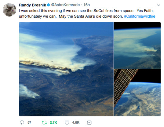
From the vantage point of space, our satellites and astronauts are able to see a more comprehensive view of the activity happening on the ground.
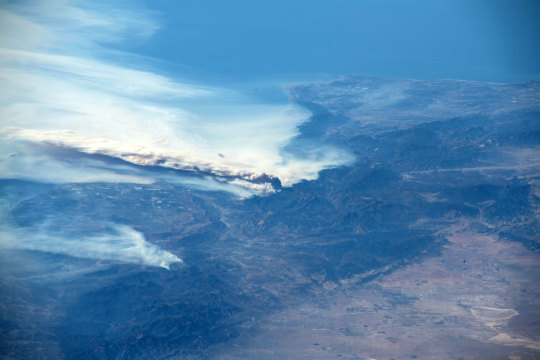
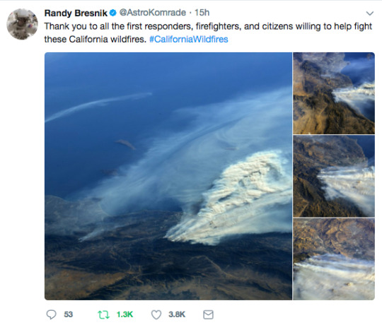
The crew living and working 250 miles above Earth on the International Space Station passed over the fires on Dec. 6. The above view was taken by astronaut Randy Bresnik as the station passed over southern California.
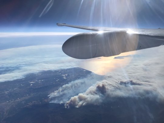
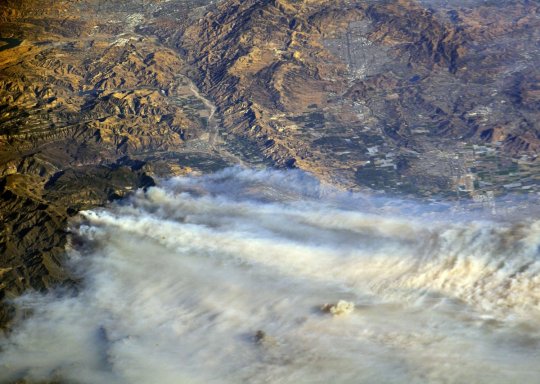
During an engineering flight test of our Cloud-Aerosol Multi-Angle Lidar (CAMAL) instrument, a view from our ER-2 high-altitude research aircraft shows smoke plumes. From this vantage point at roughly 65,000 feet, the Thomas Fire was seen as it burned on Dec. 5.
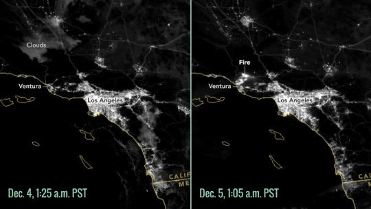
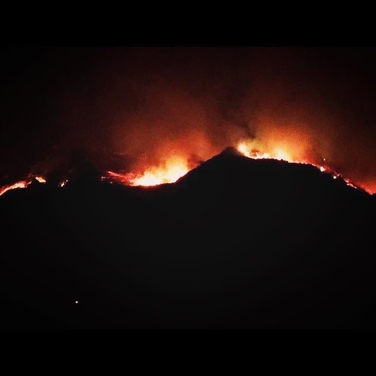
Our satellites can even gather data and imagery of these wildfires at night. The above image on the right shows a nighttime view of the fires on Dec. 5.
For comparison, the image on the left shows what this region looked like the day before. Both images were taken by the Suomi NPP satellite, which saw the fires by using a special “day-night band” to detect light in a range of wavelengths from green to near-infrared and uses light intensification to detect dim signals.
Having the capability to see natural disasters, like these wildfires in southern California, provides first responders with valuable information that helps guide their action in the field.
For more wildfire updates, visit: nasa.gov/fires.
Make sure to follow us on Tumblr for your regular dose of space: http://nasa.tumblr.com.
#nasa#space#earth#vantagepoint#wildfire#thomasfire#santaana#winds#wildfires#smoke#diablo#devilwinds#spacestation#satellites#aircraft#research#monitor#view
2K notes
·
View notes
Photo
What a year it has been since this time last year when the Thomas Fire, than the largest fire in California history, ripped through our community burning 281,893 acres, destroying 1,063 structures, displacing over 100,000 residents, caused two deaths, saw 8,500 firefighters, and caused over $2.2 billion in damages, during the 40 days it was active. Since then the 2018 wildfire season has been the most destructive and deadliest in California history. #venturastrong #thomasfire #wildfireseason2018 #thenewcalifornia #climatechange (at Ventura, California) https://www.instagram.com/p/BrAve-XBABN/?utm_source=ig_tumblr_share&igshid=1jjs86ifcrbzq
1 note
·
View note
Photo
119 notes
·
View notes
Text
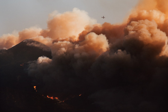
Ventura is Burning
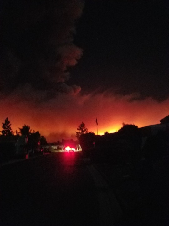
I know I don't post much but I live in Ventura, CA that is currently experiencing the worst fire ever so far. 26,000 acres, 7 hours, 0% containment. I don't do thoughts and prayers but if there are relief funds or you can send good thoughts please do. Many friends and family are losing their homes, businesses, half of the city might burn down, my house is in danger, and power outages are a plenty. If you know anyone in Ventura County please reach out to them, I had to wake up friends minutes before their house caught fire, please, we are not prepared. Send help.
65 notes
·
View notes
Photo

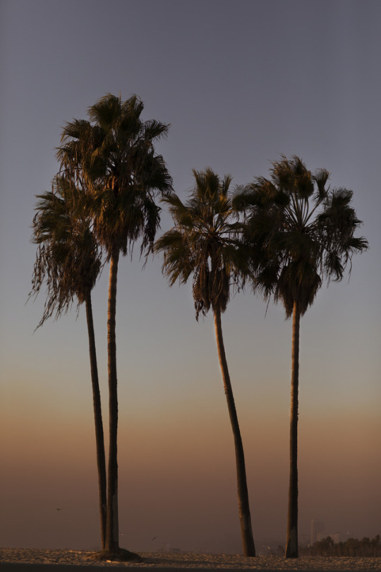
Beautiful hike today with @becky.98 💕👌🏻. . #hiking #hike #outdoors #love #loverher #fitness #twotrees #ventura #california #beach #thomasfire #parks #fitnessmotivation #instagood #goals #relationshipgoals #girlfriend (at Ventura, California)
#ventura#hike#love#fitness#girlfriend#fitnessmotivation#twotrees#thomasfire#goals#relationshipgoals#loverher#california#parks#hiking#beach#instagood#outdoors
2 notes
·
View notes
Text
First cigars I’ve rolled since the Thomas Fire began two weeks ago drowning this city in smoke and ash. The bad kind. The fire’s still burning but the air is a little less smokey. Here is a video of me wrapping these cigars:
https://youtu.be/VIYOvUSsLAs


27 notes
·
View notes
Text
Five years ago tonight, my hometown was ravaged by the Thomas Fire and forever changed. #thomasfire #venturastrong #fuckthomasfire #notahappyanniversary

0 notes
Video
Backyard #flooded up to the pavement and paving stones... over 2.67" of #rain and still #raining in Santa Barbara, California... Flash Flood Warnings continue... #California #SantaBarbara #Goleta #Montecito #Carpinteria #SantaMaria #SanLuisObispo #Lompoc #Nipomo #PasoRobles #SantaYnez #Ventura #Oxnard #LosAngeles #WoolseyFire #HillFire #ThomasFire #WhittierFire #SherpaFire #flooding (at Santa Barbara, California) https://www.instagram.com/p/BtY43nnnzHC/?utm_source=ig_tumblr_share&igshid=183sdqyd6q1ws
#flooded#rain#raining#california#santabarbara#goleta#montecito#carpinteria#santamaria#sanluisobispo#lompoc#nipomo#pasorobles#santaynez#ventura#oxnard#losangeles#woolseyfire#hillfire#thomasfire#whittierfire#sherpafire#flooding
3 notes
·
View notes
Photo


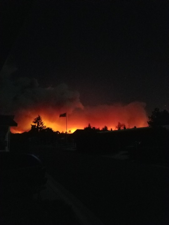
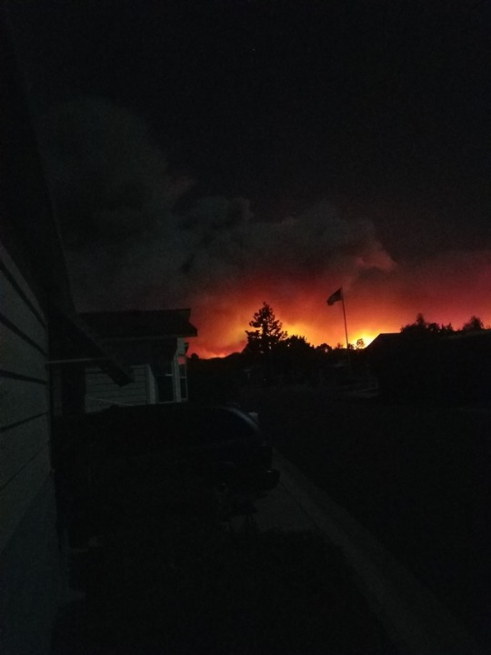
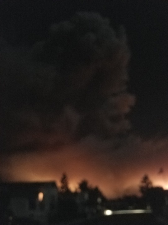
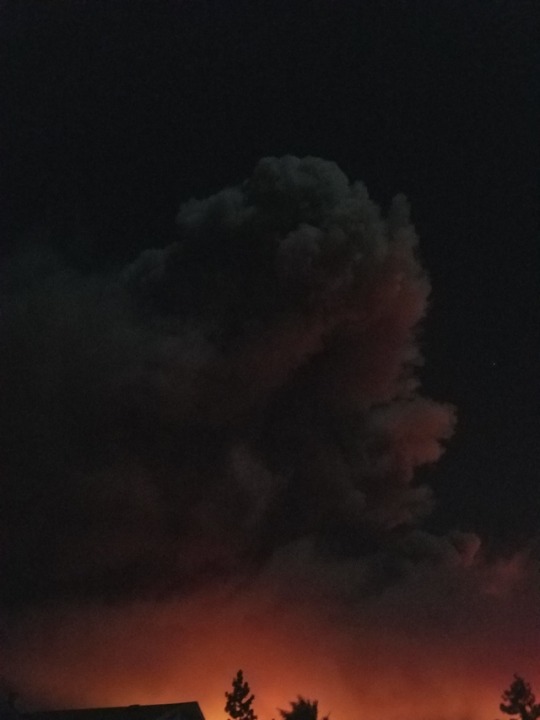

The view of from my house of the Thomas fire here in ventura/Ojai/Santa Paula.
21 notes
·
View notes


Photo
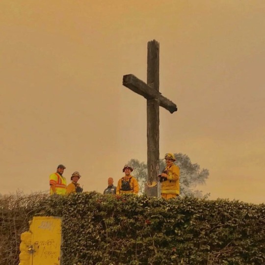
This is amazing. Although Im very saddened by all the damage this fire has done to my town, and this was my favorite place to hike. everything burned around it . And this cross should've burned . Its super old and made of wood. It should've been one giant torch . And it didn't . Just so greatful this was saved if anything was . Ventura isn't Ventura without it.
13 notes
·
View notes
Video
We absolutely agree with @tanksgoodnews ~> This is what bravery looks like #Repost @abcnews ・・・ Witnesses say this man pulled over to save a wild rabbit from flames along Highway 1 in Southern California as the massive #ThomasFire spreads toward Santa Barbara County. #rabbit #venturacounty #goodhumans #bravery #petsqui
12 notes
·
View notes
Video
Life's been crazy around Carpinteria the past week. We've got some t-shirt orders that will be delayed since we've been evacuated for over a week now. I've emailed everyone with late orders a heads up! Also Issue Three will be a little late as well, anyways send Santa Barbara, Carp, Ventura, Santa Paula and Filmore some prayers and good vibes 🙏 a ton of families have lost homes and everything here. #thomasfire
12 notes
·
View notes
Last Seen Blogs

omegazes
Unqualified Loser

adorableaizawa
Im not even sure if theres a real AdorableAizawa

glamurina-vibes
Your ankles. Hand 'em over.

sapinha17
Se Eu Te Amar

sanguinsin
𝕾𝖈𝖆𝖗𝖑𝖊𝖙 𝕿𝖍𝖎𝖗𝖘𝖙