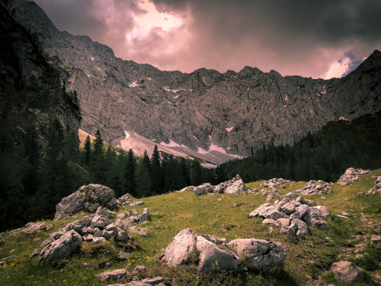
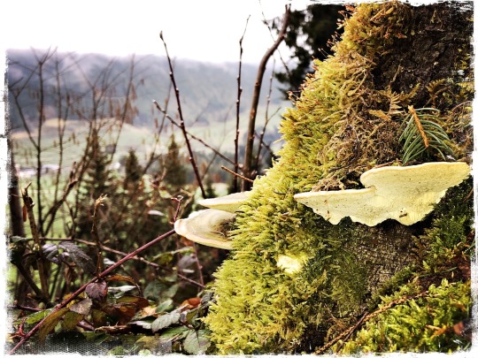
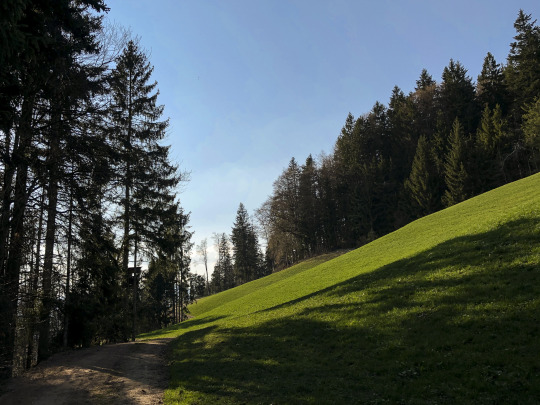
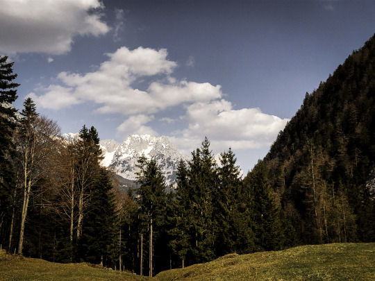
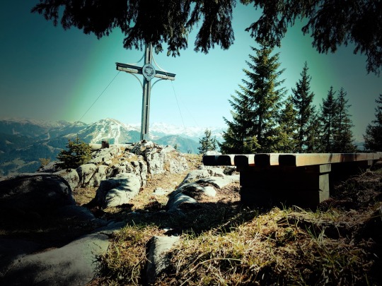
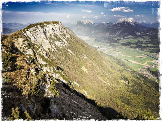
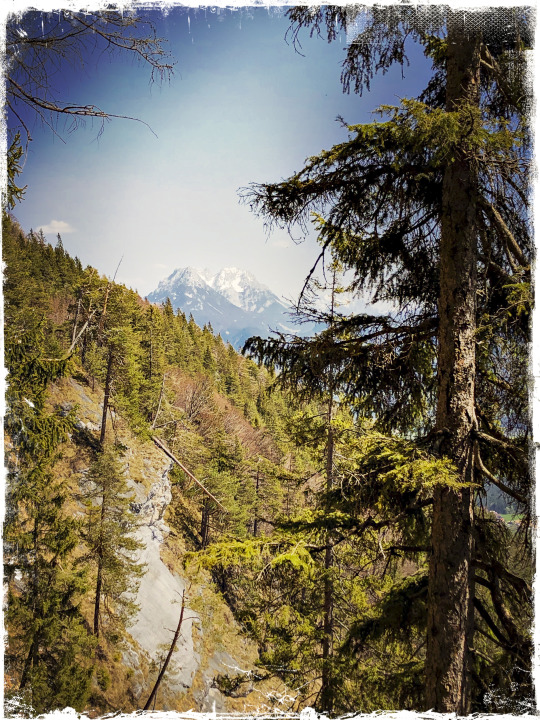
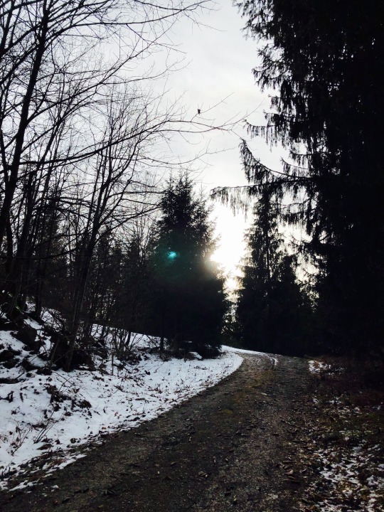
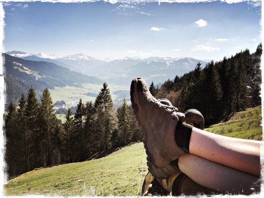
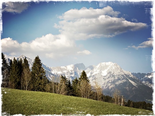
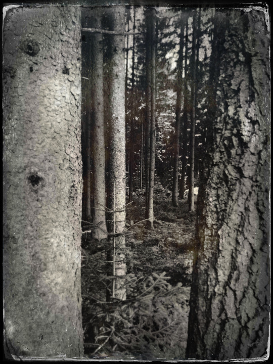
#tyrol-marmot
Text
#tyrol-marmot#hiking#outdoors activities#ounline#tirol#alpine sport#winter hiking#snowshoe hiking#snowshoe adventure#wilder kaiser#kaisertal#tyrol
6 notes
·
View notes
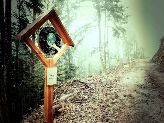
Text
See a Fox Spook a Marmot and More Award-Winning Wildlife Photographs
https://sciencespies.com/news/see-a-fox-spook-a-marmot-and-more-award-winning-wildlife-photographs/
See a Fox Spook a Marmot and More Award-Winning Wildlife Photographs

SMITHSONIAN.COM |
Oct. 18, 2019, 5:38 p.m.
The scene looks like something straight out of “Loony Tunes”: a snarling fox executes a successful sneak-attack on a marmot frozen in the most terror-filled Heisman pose nature’s ever seen.
The image, captured by Chinese photographer Yongqing Bao, is titled “The Moment,” and it’s one of the London National History Museum’s Wildlife Photographer of the Year winners. Now in its 55th year, the contest received more than 48,000 entries from 100 different countries. Judges narrowed the pool down to 19 winners in 18 categories.
“The Moment” attracted meme-worthy acclaim on social media for its comedic value, but sadly, the marmot in question died a few moments after the image was taken, says museum spokesperson Zoe Summers in an email to the New York Times’ Liam Stack.
“I can confirm that sadly the marmot didn’t survive,” Summers wrote. “The fox was successful in the attack and was able to feed some very hungry cubs!”
Bao was a joint winner in the mammal behavior category. Other categories include animals in their environment, animal portraits, earth’s environments, underwater, invertebrates and wildlife photojournalism.
One hundred images from the contest will be displayed at the South Kensington institution in London beginning today. Entries for next year’s competition can be submitted as of Monday, October 21.
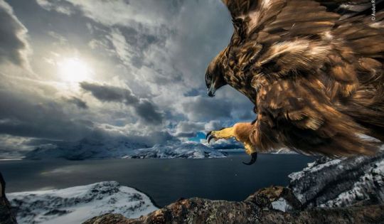

It took Audun Rikardsen three years of strategic planning and waiting to capture this image. With his camera fastened high in a tree with a motion sensor attached, he hid a short distance away and waited. And waited. Then, one day, a golden eagle grew used to the camera and began treating the branch as a look-out. In northern Norway, where the image was captured, golden eagles can be found on the coast, where they scavenge for prey ranging from fish to foxes.
(Audun Rikardsen / Wildlife Photographer of the Year)
More


Two male Dall’s sheep spar in the midst of a snowstorm. French photographer Jérémie Villet spent a month trailing the sheep during the animals’ rutting season. This image was taking while Villet was lying down in the snow, fighting against the fierce wind. The sheep’s battle ended in a draw when the blizzard proved too hazardous to withstand.
(Jérémie Villet / Wildlife Photographer of the Year)
More


German photographer Stefan Christmann captured this image of more than 5,000 male emperor penguins huddling to protect each of their delicate eggs. To snap the shot, Christmann braved the chilly -40 degree Fahrenheit weather on the sea ice of Antarctica’s Atka Bay, in front of the Ekström Ice Shelf.
(Stefan Christmann / Wildlife Photographer of the Year)
More


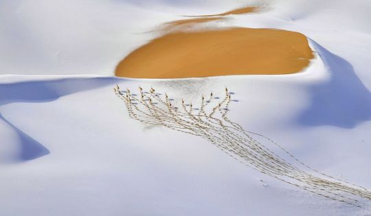
Chinese photographer Shangzhen Fan caught a small herd of male chiru—a type of high-altitude specialized antelope that sport slender black horns—leaving its tangled trail on a snowy hillside in the Kumukuli Desert of China’s Altun Shan National Nature Reserve.
(Shangzhen Fan / Wildlife Photographer of the Year)
More

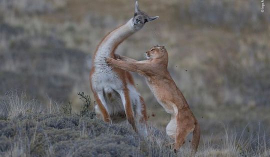

In the Torres del Paine region of Patagonia, Chile, a puma snags a guanaco. German photographer Ingo Arndt had spied the puma earlier, and the two had become comfortable with each other throughout the day. Arndt had the assistance of two trackers armed with binoculars and radio to keep the puma in sight. The puma spent 30 minutes creeping up on its prey before launching the attack.
(Ingo Arndt / Wildlife Photographer of the Year)
More


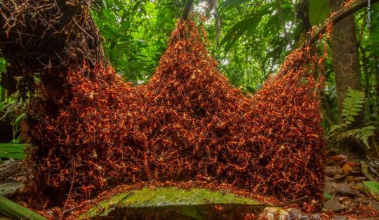
A colony of nomadic army ants constructs a brilliant new home for its queen. American photographer Daniel Kronauer watched as the insects used their own bodies to string links of ant chains, creating the scaffolding of their temporary home. Called a bivouac, the structure—almost resembling a crown—is certainly fit for a queen.
(Daniel Kronauer / Wildlife Photographer of the Year)
More
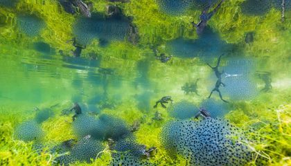
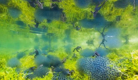

Italian photographer Manuel Plaickner followed the mass springtime migration of common frogs in South Tyrol, Italy, to capture the amphibians emerging from their winter hideaways and laying eggs. Each frog can lay up to 2,000 jelly-capsuled eggs. The frogs call most of Europe home, but local populations have suffered declines due to habitat loss, disease and pollution.
(Manuel Plaickner / Wildlife Photographer of the Year)
More
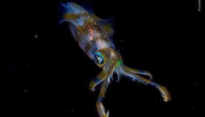

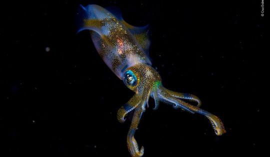
New Zealand’s Cruz Erdmann is just 14 years old. He was on an organized night dive in the Lembeh Strait off North Sulawesi, Indonesia, when he captured this fantastic photo of a bigfin reef squid. He had initially spotted two squids mating, but one took off before he snapped his lens. This one hung back, becoming the star of the show.
(Cruz Erdmann / Wildlife Photographer of the Year)
More


Indian photographer Ripan Biswas was stalking a red weaver ant colony in the subtropical forest of India’s Buxa Tiger Reserve, in West Bengal, when he spotted this critter. It, however, is not an ant—although it sort of looks the part, especially from a distance. Behold the ant-mimicking crab spider. The tiny predator deceives its prey with an evolutionary disguise before swooping in for the kill.
(Ripan Biswas / Wildlife Photographer of the Year)
More
#News
0 notes
Photo

Murmeltier by MaVo64
0 notes
Text
The Haunting Beauty of a Hut-to-Hut Hike in the Dolomites
With travel restrictions in place worldwide, we’ve launched a new series, The World Through a Lens, in which photojournalists help transport you, virtually, to some of our planet’s most beautiful and intriguing places. This week, Mónica R. Goya shares a series of photographs taken on an extended hike through the Dolomites.
Last August, long before the coronavirus pandemic descended across Italy, I set off on a hike following the Alta Via 1, a long-distance footpath that traverses the Dolomites from north to south.
A monumental mountain range in northeastern Italy, the Dolomites — a World Heritage Site since 2009 — are home to some of the world’s most majestic scenery: colossal vertical limestone walls, gloriously green valleys. There are several Alta Via routes, but the AV1, with fewer exposed sections, is ideal for less experienced hikers.
The trail runs south from Lago di Braies, a chilly Alpine lake in South Tyrol, to Belluno, a town in Italy’s Veneto region. The first few miles include both a ferocious ascent up a slope covered in scree and broad views of a vast plateau — a fitting preview of the striking contrasts to come.
The trail’s northern terminus lies less than 20 miles from the Austrian border, and many villages in its vicinity have both an Italian and an Austrian name — a reminder of the region’s linguistic peculiarities. (In addition to speaking Italian and German, many residents of the Dolomites also speak a language called Ladin.)
Over the course of my nine-day hike, the trail — mostly well marked — snaked its way up jagged bare peaks in picturesque formations: pinnacles, spires, towers. It also wound through lush Alpine grazing lands and valley floors carpeted with pine and fir trees. Largely because of the beauty of the pale dolomitic limestone, panoramic vistas were a constant.
Idyllic mountain huts, called rifugios, are spaced at day-hike intervals along the trail; there are about 30 altogether. (The 75-mile trek typically takes about 10 days to complete.) The trail reaches a maximum elevation of over 9,000 feet and includes a total elevation gain of more than 20,000 feet — which means that arriving early at the rifugios and catching up on rest often feels more like a necessity than a luxury.
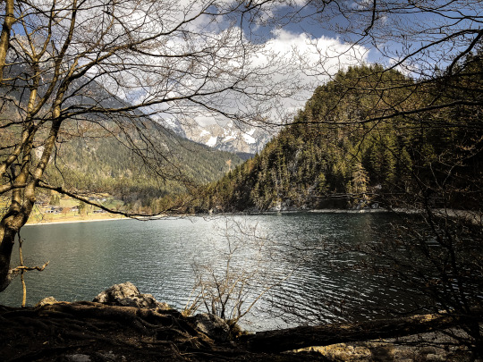
Once, while traversing a stretch of trail on my way to a stunning rock formation called the Cinque Torri, I found myself enraptured by the lofty views of Lago di Lagazuoi, a small mountain lake. But my wonderment didn’t last long: Soon after I sat down, apple in hand, the skies went dark with storm clouds.
Rifugio Lagazuoi, my destination for the night, was visible in the distance and appeared close at hand — less than two miles away as the crow flies. But, finding it separated from me by a very steep descent on switchback paths, plus one last backbreaking ascent, I panicked slightly, realizing there was no way to reach shelter before the storm would break. I pulled out my rain gear and soldiered on.
This mountainous heart of Europe, its trails now evoking sublime grandeur, was once the scene of one of the most treacherous battles of World War I — which is now commemorated at the Open Air Museum of Mount Lagazuoi. Andrea, a re-enactor dressed in a historical Tyrolean Rifle Regiment uniform, led us on a guided tour through various trenches and tunnels, describing how the Italian and Austro-Hungarian armies had turned the mountain into a fortress.
Down in Rifugio Città di Fiume, and back at tree-line level, after leaving behind the picture-perfect Alpine meadows of Cinque Torri, with its scattered sheep, cattle and marmots, the air was heavy with the refreshing scent of pine trees. There, gazing at the dramatic peak of Monte Civetta, I first experienced what a local hiker called “enrosadira,” an exquisite glow that happens at sunrise and sunset, when the dolomitic limestone is bathed in gorgeous peachy-pink hues.
Rifugios come in all shapes and forms, from spartan rustic buildings with cracking wooden floors to charming Alpine mountain lodges. But there are common threads among them — in particular the affable service and the chance to experience camaraderie with fellow backpackers from around the world. Facilities are basic, but most of them have a drying room and a coin-operated hot shower — which runs for two or three minutes, to prevent waste. And, yes, there’s Wi-Fi.
The rifugios are normally open from June to September — and they remain open this year, in spite of the coronavirus. But, since some are now operating at reduced capacity, advanced booking is mandatory. New regulations also require visitors to bring their own sleeping bags, slippers and masks. (In normal circumstances, only a sleeping bag liner is required, as blankets are provided.) And be prepared to have your temperature taken before checking in; hut wardens can deny access if your temperature is too high.
Nearly 150 years have passed since Amelia Edwards, an accomplished English journalist, wrote about being haunted by the Dolomites’ “strange outlines and still stranger colouring.” Much has changed since then — but much has endured, too.
The rhythm of a long-distance trek here — the exhaustion, the challenging simplicity of the routine — washes away mundane worries. Visitors are dwarfed by the ever-changing and imposing surroundings. And, all these years later, the splendor of these unique mountains still enchants, and haunts, those who take to its paths.
Mónica R. Goya is a London-based journalist and photographer. You can follow her work on Instagram.
Source link
قالب وردپرس
from World Wide News https://ift.tt/31fTMmT
0 notes
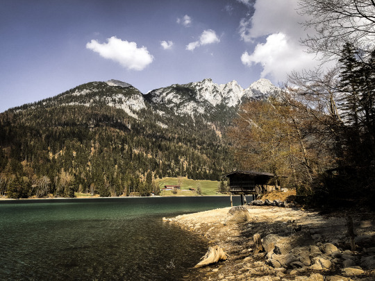
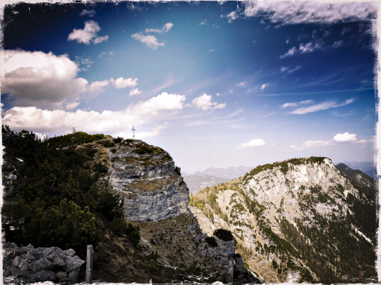
Photo


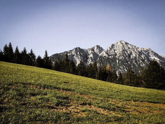
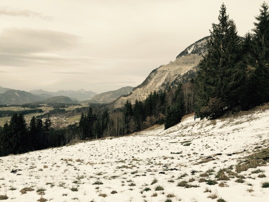
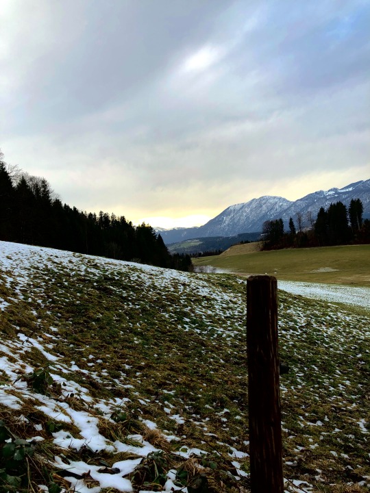
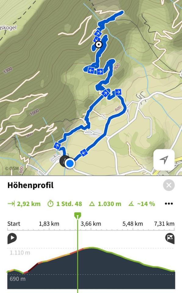
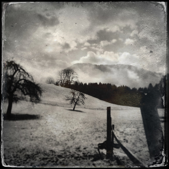
06-2020
Winkelalm
Die Winkelalm befindet sich auf 1.193 m auf der Nordseite des Kaisergebirges in Tirol. Sie ist von Durchholzen am Walchsee einfach zu erreichen und bietet sich als Familienausflugsziel an. Man sollte aber selber eine Jause mitnehmen, denn die Winkelalm ist eine Selbstversorgerhütte.
Wegbeschreibung
Vom Parkplatz folgt man der Almstraße mit der Nummer 90 bzw. 816 taleinwärts. Erst aber der Großpointneralm auf 928 m beginnt ein Steig, der durch den lichten Wald nach oben führt. Das letzte Stück führt über offenes Almgelände zur schön gelegenen Winkelalm auf 1.193 m.
Zustieg zum Heuberg (1603 m) und zur Pyramidenspitze (1998 m)
Keine Einkehrmöglichkeit!
#tyrol-marmot#Bergwandern#alpin sport#Wilder Kaiser#Zahmer Kaiser#walchensee#wanderslust#bergsport#klettersteig#Klettern#Tirol#climbing#outdoors activities#outdoor sports#hiking#ounline#winkelalm#Durchholzen#natur#alpin#berggehen#bergfex
26 notes
·
View notes
Photo


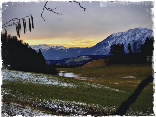
03-2020
Lengauer Besinnungsweg
Beschreibung: Leichte Wanderung
Wissenswertes über die „St. Anna Kapelle zu Lengau“ unterhalb des Großen Pölven und dem damit verbundenen Besinnungsweg. Diese Verbindung (Steig) fungierte früher als Übergang aus dem „Söll-Landl“ in das Inntal. Im Jahr 1664 erfolgte die erste urkundliche Erwähnung der Kirche. Der sakrale Bau steht im engen Zusammenhang mit der Bäderkultur des 17. Jahrhunderts. Zuerst Johannes dem Täufer geweiht, fand 1727 eine Neuerrichtung der Kapelle statt. Auch wählte man eine neue Patronanz, die der „Heiligen Mutter Anna“. 1870 veranlasste Messner Michael Vötter die Vergrößerung der Kirche und das Aufsetzen des mächtigen Dachreiters. 1994 erfolgte eine Generalsanierung unter Pfarrer Josef Gossner. Vor einigen Jahren wurde der „Sunnseit-Weg“ zu diesem Kleinod gemeindeübergreifend erweitert. 2018 erfolgte die künstlerische Gestaltung des Teilabschnittes Schwendt (Itter) durch den Söller Verein „Kunst und Kultur“. An verschiedenen Stationen stellen die Künstler bereits existierende Weisheiten, Sprüche und Gleichnisse mit einer Kombination aus Text und Bild dar.
Wegbeschaffenheit: Teils Spazier- und Waldweg, einzelne Abschnitte auf dem Asphalt (Fahrstraße), Schotterweg
Empfohlene Ausrüstung Rucksack, Wander/Bergschuhe, Wanderbekleidung (atmungsaktiv), Wechselbekleidung, Sonnenschutz (Sonnenbrille, Sonnencreme, Kopfbedeckung), Regenschutz (Hardshell), Kälteschutz (Handschuhe und Mütze), Trinkflasche, Verpflegung für Zwischendurch, ev. Wanderstöcke, Erste Hilfe Ausrüstung, Plastikbeutel für Abfall, Wanderkarte/Tourenbeschreibung (GPX-Track)
Anreise, öffentlicher VerkehrAnreise: Die Anfahrt erfolgt in der Regel über die A12 Inntal-Autobahn. Gute 10 km von der Autobahnausfahrt Kufstein Süd und weniger als 10 km von Autobahnausfahrt Wörgl Ost entfernt liegt die Salvistabahn Itter
Parken: Parkplatz Salvistabahn, Itter (Alte Bundesstraße 1, 6305 Itter) – kostenlos
#tyrol-marmot#ounline#hiking#Söll#Wanderlust#wandern#Wald#lengau#lengauer kapelle#Unterinntal#Tiroler Unterland#tirolisgeil#pölvenrundweg#entspannung#outdoors activities#alpin sport#Bergwandern#Tirol
44 notes
·
View notes
Photo


04-2020
Söll/Moorsee - Achleiten - Hintersteinersee - Tischleralm - Söll/Moorsee
Leichte Wandertour, sonnenseitig und aussichtsreich, ca.12 Km/500 hm. Empfehlenswert der Achleiten-Klettergarten mit Schwierigkeitsgraden 4b bis 9a+
Diverse Einkehrmöglichkeiten
Über den Moorsee geht es zum Gasthof Oberstegen, dann die Bundesstraße queren. Der Markierung Richtung Gasthof Achleiten folgen. Nun über “Schupfen” Richtung Hinterseiner See gehen. Beim Hintersteiner See über Seestüberl und Jausenstation Goingstätt weiter zur Tischleralm. Die Tischleralm queren und der Markierung Achleitenberg/Klettergarten folgen. Am Ende des Forstweges den Wanderweg nach Söll folgen.
#tyrol-marmot#ounline#mountenbiking#hiking#climbing#wilder kaiser#achleiten#hintersteinersee#tischleralm#scheffau#outdoor sports#outdoors activities#wanderslust#Klettergarten
32 notes
·
View notes
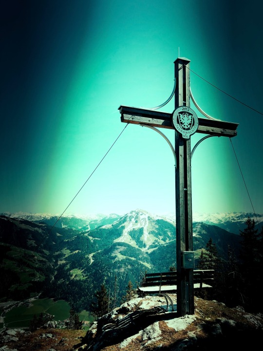
Text
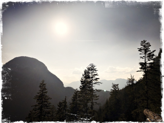
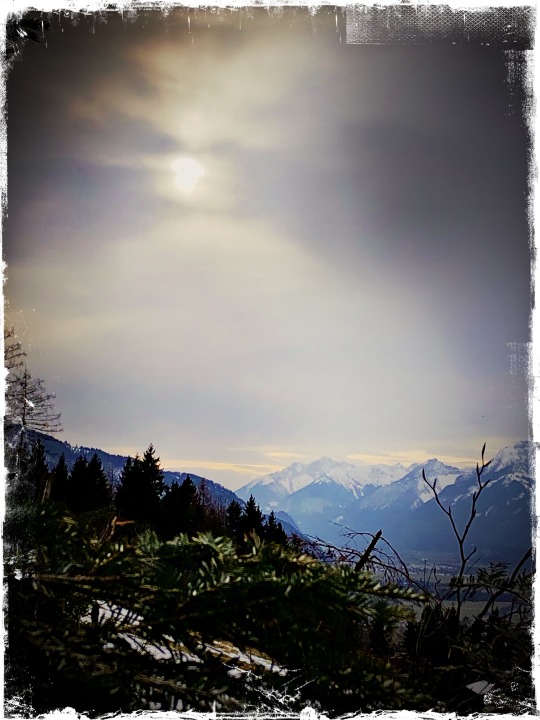
04-2020
Hundalmjoch
#tyrol-marmot#hiking#ounline#outdoors activities#alpine sport#wandern#outdoor#tirol#unterinntal#natur#wanderslust#unterland#bergfex#berggehen#bergsport#mountenbiking#climbing#kramsacher alpen#brandenberger alpen#adlerweg
25 notes
·
View notes
Text
04-2020
Söll Kleiner Pölven/Söllerkreuz
(1562m)
Traumhafte Aussicht
Steil! Bei Nässe und Dunkelheit nicht empfehlenswert.
Keine Einkehrmöglichkeit!
#tyrol-marmot#ounline#hiking#outdoors activities#alpine sport#wandern#outdoor#tirol#natur#unterinntal#söllland#Söll#Pölven#kleiner Pölven#climbing
24 notes
·
View notes
Text


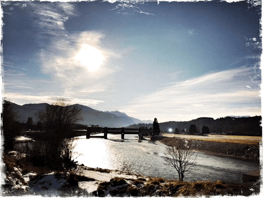
03-2020
Innschleife bei Kirchbichl, in Quarantäne
Leichte Wanderung
Bei Kirchbichl beschreibt der sonst gerade fließende Inn eine eigentümliche S-Schleife. Durch die Länge der Schleife kann ein Höhenunterschied von etwa acht Metern zur Energiegewinnung genutzt werden.
Barrierefreier Weg, sonnig
#tyrol-marmot#ounline#hiking#outdoors activities#alpine sport#wandern#outdoor#tirol#unterinntal#natur#kirchbichl#angath#inn river#inn radweg#inntalradweg#barrierefrei
26 notes
·
View notes
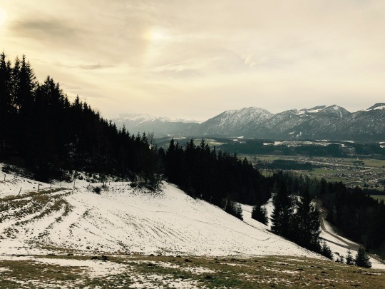
Photo


04-2020
Hundalm (1637m)
Entfernung: Rundweg ca. 14 Km (1050 hm)
Voraussetzungen: Gute Kondition
CHARAKTER: Das Hundsalmjoch ragt eindrucksvoll nördlich über Mariastein in die Höhe und bietet dadurch einen prachtvollen Ausblick über das Inntal. Ebenso weit nach Süden zum Alpenhauptkamm mit seinen vergletscherten Gipfeln.
Route: Vom ausbeschilderten Wanderparkplatz (Radinger Schottergruben), oberhalb vom Weiler Embach, hinab zur großen Übersichtstafel und von dort entlang der Forststraße zuerst noch in langgezogenen Kehren, zuletzt immer über enger werdende Kehren hinauf zu einem Straßenverzweig (1223 m). Dort rechts in angenehmer Steigung noch kurz durch lichten Wald zu den weiten freien Almflächen oberhalb der Baumgrenze, dort wo man auch alsbald den Almgasthof Buchacker (1450 m) erreicht.
Weiter entlang der Fahrstraße aufwärts in den Sattel zwischen dem Daxerkreuz und dem Aussichtsturm Adlerhorst, dort wo auch nach links der Wanderweg zur Hundsalm-Eishöhle abzweigt. Noch wenige Meter nach Nordosten dem Fahrweg folgen, bevor es leicht bergab geht rechts durch eine Grasmulde den Steigspuren folgend aufwärts in ein Waldstück. Dort durch Waldgelände aufwärts zu einer großen Lichtung, danach wieder durch Latschengelände nach Osten auf das Hundsalmjoch (1637 m) mit dem großen Gipfelkreuz und einer Sitzbank daneben.
Abstieg: Entlang der Aufstiegsroute. Es wäre auch möglich auf schmalem Pfad am Rücken weiter nach Süden abzusteigen wo man dann direkt bei der Daxerhütte rauskommt. Danach direkt unterhalb vom Daxerkreuz am Abkürzungswegs steil nach Süden abzusteigen, wo man dann beim "Buchacker Almweg" Denkmal wiederum in die Forststraße einmündet.
#tyrol-marmot#ounline#Alpine Sport#hiking#brandenberger alpen#kramsacher alpen#Buchacker#hundalmjoch#adlerweg#Tirol#Innschleife#Unterinntal#unterland#tyrol austria#mountenbiking#Bergwandern#bergsport#bergfex#Wanderlust#deutscher blog#deutsch#deutsche sprache#Berg#Austrian Alps#alpen#wandern
21 notes
·
View notes
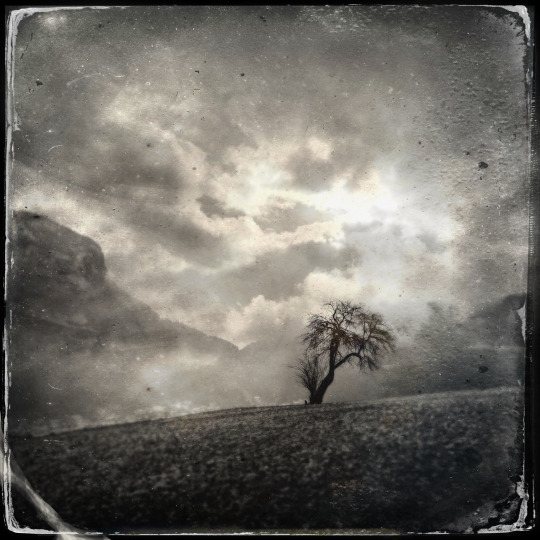
Photo


02-2020
Juffinger Jöchl, Bad Häring
Leichte Wanderung, keine Voraussetzungen, keine Einkehrmöglichkeit auf der Bad Häringer Seite. Wunderschönes Panorama, Aussicht u.a. auf den Großvenediger, sonnige Lage.
Gehzeit 1 Stunde 10 Minuten. Mountainbike geeignet.
#Bad Häring#tyrol-marmot#hiking#Bergwandern#Alpine Sport#alpen#tyrol austria#Inntal#inn river#Innschleife#Pölven#mountenbiking#tria#Austrian Alps#ounline
25 notes
·
View notes
Photo


04-2020
Reiteralm Söll Wanderung
Leichte Wanderung auf Forststraßen und Wanderwegen. Keine Einkehrmöglichkeiten aber schöne Aussichten auf die umliegenden Berge. Die Alm ist sonnig und gleichzeitig auch Einstieg zum Großen und Kleinen Pölven (sehr sehenswert).
#tyrol-marmot#outdoors activities#outdoor sports#ounline#Söll#reit-söll#söllland#hiking#Wanderlust#wandern#alpin sport#Tiroler Unterland
16 notes
·
View notes
Text
02-2020
Kirchbichl
#ounline#outdoors activities#alpine sport#outdoor#natur#tirol#unterinntal#wandern#hiking#tyrol-marmot#kirchbichl#inn river
33 notes
·
View notes
Photo

03-2020
Lengauer (Bad Häring)
Leichte Wanderung
Der Hof Lengau findet sich seit 1480 im Grabensteuerverzeichnis der Stadt Kufstein. Der jetzige Hof ist mit Baujahr 1740 in der Gemeinde Bad Häring verzeichnet. Der Dachfirst des Holzblockbaues zeigt die Jahreszahl und die Initialen des Erbauers: M W 1740 (Michael Wallner).
Die natürliche dunkle Färbung des Holzes ist als besondere Charakteristik erhalten - lediglich die Zierbretter der Dachpfetten und die Balkontürrahmen im 1. Stock und im Dachgeschoß sind in der Hauptfarbe Grün gestrichen bzw. mit wenig Weiß und Rot verziert. Die Hausecken des Blockbaues zeigen Schwalbenschwanzverbindungen, dort wo die Balken der tragenden Mittelwände in die Front bzw. Seite eingreifen, sind unterschiedliche Formen zu sehen, wobei Parallelogramme dominieren. Ein besonders breiter Holzrahmen mit einem kleinen Kreuz fällt bei der Eingangstüre mit dem Fischgrätmuster und dem Fenster in der Mitte auf. Der von außen zugängige Keller mit der Steinmauer entstand nachträglich. Auf dem Dach des Hauses ist ein Glockenstuhl mit einem Wetterhahn zu sehen. Neben dem Haus steht das Waschhaus als gemauerter Steinbau, bei dem das Dach erneuert wurde.
Einkehrmöglichkeit: Stallhäusl ca. 30 Minuten
#lengau#alpin sport#tyrol-marmot#bad häring#Pölven#pölvenrundweg#Tirol#hiking#Bergwandern#Wanderlust#wandern#Juffinger Jöchl#outdoors activities#ounline
17 notes
·
View notes
Photo
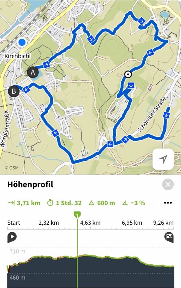


03-2020
Barrierefrei
Rundweg Kirchbichl - Bad Häring - Kirchbichl
Entspannungswanderung (leicht und barrierefrei) von Kirchbichl (Strandbad) nach Bad Häring und zurück.
Parkplätze kostenfrei vorhanden. Rollstuhl tauglich!
#tyrol-marmot#Alpine Sport#tyrol#barrierefrei#kirchbichl#bad häring#ounline#Inntal#hiking#Wanderlust#wandern#spaziergang#REHA#rehabilitation#sonnig#mountenbiking
18 notes
·
View notes
Last Seen Blogs

laundryunlimited
Laundry Unlimited

gloriousobjectking
출장마사지

twodiefour
2 DIE 4

myheartandheadgooutofsync
stayalive

inner-gal
may-be