
Don't wanna be here? Send us removal request.
Statistics
We looked inside some of the posts by taste2travel-blog and here's what we found interesting.
Average Info
Notes Per Post
0
Likes Per Post
0
Reblog Per Post
0
Reply Per Post
0
Time Between Posts
9 days
Number of Posts By Type
Link
1
Text
9
Photo
7
Last Seen Tumblr Blogs


Fun Fact
The average Tumblr user visits about 67 pages every month.
Text
Travel Quiz - 05 (USA)
A quick USA travel quiz from taste2travel. Good luck!
1. With a population of 7,700 - which is the least populated US state capital?

Pierre, South Dakota
Montpelier, Vermont
Augusta, Georgia
Concord, New Hampshire
Continue >>
2. The capital of Ohio is?

Cleveland
Cincinatti
Colombus
Toledo
Continue >>
3. The New York State capital building is located in which city?

New York City
Brooklyn
Buffalo
Albany
Continue >>
4. Which city would you be in if you were visiting the Space Needle?

Seattle
Portland
Chicago
Washington DC
Continue >>
5. The now-abbreviated 'Hollywood' sign in Los Angeles originally read?

Hollywood Hills
Hollywoodland
Hollywoodville
Hollywoodtown
Continue >>
6. In which US city would you find Anish Kapoor's 'Cloud Gate' aka - 'The Bean'?

Boston
New York City
Miami
Chicago
Continue >>
7. In which state would you be if you were watching ice cream being produced at the headquarters of Ben & Jerry's?

Maine
Vermont
New Hampshire
Massachusetts
Continue >>
8. The former residence of which famous author is now a tourist attraction in Key West?

Mark Twain
John Steinbeck
F. Scott Fitzgerald
Ernest Hemingway
Continue >>
9. Which city was the birthplace and childhood home of Michael Jackson and his siblings?

Indianapolis, Indiana
Gary, Indiana
Lafayette, Indiana
Cleveland, Ohio
Continue >>
10. The Chinese fortune cooking was first created at a Chinatown bakery in which city?

New York City
San Francisco
Los Angeles
Chicago
Continue >>
11. The Rock & Roll Hall of Fame is located in which city?

Cleveland, Ohio
Nashville, Tennessee
Memphis, Tennessee
Austin, Texas
Continue >>
12. The front of the New York Stock exchange is situated on which Manhattan street?

Broadway
Wall Street
Exchange Place
Broad Street
Continue >>
13. Which city would you be in if you were visiting Universal Resort in Florida?

Orlando
Miami
Fort Lauderdale
Tampa
Continue >>
14. The Statue of Liberty was gifted to the people of the United States from the people of which country?

Britain
Spain
Italy
France
Continue >>
15. What's the name of these giants which inhabit the coastal forests of Northern California?

Redwoods
Sitka Spruce
Yellow Cedars
Incense Cedars
Continue >>
16. The 'Indy 500' car race is held annually in which city?

Indiana, Pennsylvania
Indianola, Mississippi
Indianapolis, Indiana
Indio, California
Continue >>
17. In which city are the headquarters of the United Nation situated?

Washington DC
New York City
Boston
Chicago
Continue >>
18. Which body of water would you be observing if you were watching the sunset in Seattle?

Puget Sound
Prince William Sound
Long Island Sound
Washington Sound
Continue >>
19. Which state would you be in if you were visiting Hershey's Chocolate World?

New Jersey
Virginia
Pennsylvania
New York
Continue >>
20. The first US Presidential primary election is always held in which state?

Iowa
Washington DC
New York
New Hampshire
Continue >>
Travel Quiz – 05 (USA)
Sorry! You scored less than 50%. Better luck next time!
Share your Results :
Facebook Twitter Google+ VK
Travel Quiz – 05 (USA)
Not Bad! You scored less than 75%.
Share your Results :
Facebook Twitter Google+ VK
Travel Quiz – 05 (USA)
Very Good! You know your stuff.
Share your Results :
Facebook Twitter Google+ VK
Travel Quiz – 05 (USA)
Well Done! You're a modern day Marco Polo.
Share your Results :
Facebook Twitter Google+ VK
PLAY AGAIN !
About taste2travel.com
Travel Quiz – 05 (USA) was originally published on Taste2Travel
0 notes


Text
Iceland Travel Guide
Iceland Travel Guide
Date Visited: September 2017
Introduction
From Games of Thrones, Star Wars, Star Trek to Interstellar – whenever Hollywood director’s wish to shoot scenes in landscapes that are ‘otherworldly‘ they often turn to Iceland. The ‘Land of Fire & Ice‘ is a magical destination, full of incredible natural attractions (all of which are free to visit) set in landscapes which are totally surreal.
Iceland is an isolated volcanic island, located in the middle of the North Atlantic ocean at the top of the world (just below the Arctic circle) – an island of striking natural beauty with incredible geological marvels. If you have a yearning to travel somewhere completely different then Iceland is for you. From eerie, moss-covered lava fields, treeless landscapes, active volcanos, powerful waterfalls, erupting geysers, gigantic glaciers (including the largest in Europe), dramatic black-sand beaches and spectacular coastlines, Iceland offers up one astounding view after another.

View from the summit of Saxholl Crater.
The island sits atop the mid-Atlantic ridge – a submarine mountain range which (at 40,000 km in length) is the world’s longest mountain range. It is believed that Bermuda was once part of the ridge but has moved further west over millions of years to it’s current location. The only place where this ridge breaches the ocean surface is Iceland. The ridge, which runs diagonally across the island, marks the point where the Eurasian and North American tectonic plates meet, which makes Iceland one of the most geologically active places on Earth. In geographical terms, Iceland is a young country, having been formed some 18 million years ago and, in many respects, is still being formed. The island also sits above a hot-spot, the Iceland Plume, which is believed to have caused the formation of the island itself.

Mock-up of the Iceland Plume (viewed from underneath Iceland) at the LAVA Centre.
Just as the landscapes are ‘otherworldly’, so too, prices in the Iceland can seem ‘out of this world‘. Iceland is not a travel bargain, with the country constantly being ranked as one of the most expensive in the world. Despite the high costs, thousands of tourists (including backpackers) are streaming in – many taking advantage of Icelandair’s free stopover offer (see the ‘Getting there‘ section below for more).
While a budget guest house can cost in excess of US$100 per night, a restaurant meal US$40, a glass of craft beer US$15 or a cappuccino U$7 – costs can be reduced. Camper vans (see the ‘Getting Around‘ section below) equipped with beds are available for hire, while many guest houses offer kitchen facilities allowing guests to self-cater. Lonely Planet provides a useful travel cost guide for Iceland with a recommended daily allowance of US$180 for budget travel. All natural attractions are free of charge but where tickets are required, they are expensive. You can venture inside an extinct volcano which will cost you US$420 per ticket for the half day trip. You can go inside a glacier where the Classic tour will cost you US$190 for the 2-4 hour trip.

Iceland gull at Olafsvik.
Despite the high costs, there is something magical and enchanting about this cold, isolated, volcanic rock and everyone I met traveling there was firmly under its spell. If you ever have the chance to visit I recommend you do so.
One Degree of Separation…

Icelandic Flag
The world can seem like a small place at times, but in Iceland it really is a small place. According to the genealogy website islendingabok.is, everyone in Iceland is related, with the entire population of 334,000 being derived from the same family tree. The website (whose name translates as ‘Book of Icelanders‘), claims to be the only genealogy database in the world that covers a whole nation, with more than 95 percent of all Icelanders born since 1703 registered into the database.
The creation of the website spawned the development of a unique app – islendingaApp – which allows Icelanders to learn about their family tree. More importantly, the app features a “bump” feature which allows two smartphones to be bumped together to check how closely related two individuals are. If they are too closely related, an “incest alarm” discreetly warns both users – thereby providing a degree of comfort for Icelandic daters that they won’t run into their date at a future family reunion.
Location
Located at the top of the world, Iceland can be found at the confluence of the North Atlantic and Arctic Osceans, east of Greenland, west of Norway and 450 km north-west of the Faroe Islands.
History

Map of Iceland
Due to it’s remote location, Iceland was not settled until the 9th century when Viking explorers and their slaves arrived from Norway and the United Kingdom. Once discovered, Norwegian settlers (who were fleeing conflict at home) flocked to the island. In 930, these settlers established a form of governance, the Althing, which became the Icelandic parliament and is today the world’s oldest continuous serving parliament.

Viking ship rooftop decoration in Reykjavik.
The island managed to remain independent until the 13th century, when (due to internal conflicts weakening the country) it was subjugated to Norway. In the 16th century, the island became a Danish territory and remained so until the end of WWI. Following the end of the war, Iceland became a sovereign nation but remained attached to Denmark by sharing the Danish monarchy. During WWII, and following the fall of Denmark to the Nazi’s, allied forces – led by British and later American forces – peacefully occupied the island to prevent a Nazi invasion. Following the end of WWII, Iceland severed all ties with Denmark and declared full independence.

Stamps of Iceland
Since gaining independence, this remote, sparsely populated island has often punched above it’s weight, being a founding member of the United Nations and NATO. A more comprehensive history of Iceland is available on Wikipedia.
Iceland Today

The distinctive colored glass facade of the Harpa concert hall in Reykjavik is inspired by the basalt landscape of Iceland.
Until the 20th century, Iceland was among the poorest countries in Europe, but – thanks to strong economic growth – the country today is one of the most developed in the world and one of the greenest – deriving all power from renewable sources.
Prior to the 2007/ 2008 Global Financial Crisis, Iceland was ranked first in the world in the UN Human Development Index. During the financial crisis, the country made news headlines for all the wrong reasons, with its three largest banks collapsing under the weight of a debt burden which was estimated to be six times the nation’s gross domestic product. Despite entering a severe economic depression, the country slowly recovered thanks to the introduction of strict capital controls by the government and bailouts from the IMF and neighbouring Nordic countries.

Icelandic Krona
Iceland is not a member of the EU but is part of the Schengan Area (a single European country for international travel purposes). The official currency is the Icelandic Krona.
Sights

The land of fire and ice provides one stunning view after another.
Reykjavik

Lava fields outside of Reykjavik.
Located in the southwest of the island with a population of 216,000 – Reykjavík and the capital region are home to two-thirds of the entire population, with the city serving as a commercial, administrative, transportation and cultural hub. Fronted by the chilly, choppy waters of the North Atlantic and surrounded by towering, treeless mountains and barren lava fields, the city has a remote frontier feel to it.

Traditional architecture in downtown Reykjavik.
The downtown streets are lined with quirky, brightly coloured corrugated aluminium buildings, with the city having an unhurried, relaxed, sleepy atmosphere. There is no shortage of cafés, restaurants, bars, souvenir shops, museums and everything else you would expect to find in a capital city. Shopping is not for the faint hearted with most Made in Iceland products priced in the stratosphere (e.g. a pair of woolen socks for US$39).

‘Made in Iceland’ socks on sale for US$39.
Reykjavik Sights

Interior of the Harpa Concert hall, Reykjavik.
Located on the waterfront, it’s hard to miss the glass edifice of the Harpa concert hall. The award-winning architectural design features a distinctive colored-glass facade said to be inspired by the basalt landscape of Iceland. The interior walls and ceiling are made of glass panels which make for interesting photography.

Neon’s in Reykjavik.
Located on a hill at the other end of town, Hallgrímskirkja is a Lutheran church which is one of the city’s best-known landmarks. Designed in 1937, the church is said to resemble the towering Icelandic landscape with it’s vertical mountains and glaciers. The tower is open for visits which provides the best view of the city.

The towering Hallgrímskirkja.

Interior of Hallgrímskirkja
Near Reykjavik

The milky-coloured water of Blue Lagoon.
Set in the middle of a barren lava field, Iceland’s #1 tourist attraction is the ever popular Blue Lagoon. The lagoon is located in Grindavík, 45 minutes south of Reykjavik and 20 minutes from Keflavik airport. It’s best to visit the lagoon on your way to the airport – there’s no better way to relax before a flight than by spending a few hours in a giant warm, mineral bath.
The lagoon water is geothermal seawater which originates at a depth of 2,000m beneath the earth, traveling up to the surface through porous lava where it is used to run turbines that generate electricity at a neighbouring power station (all power in Iceland is derived from renewable sources). The run-off water from the power station is then fed into the lagoon for the tourist hoards to enjoy.

Blue Lagoon
More milky-coloured than blue, the water gets its colour from silicate minerals which, along with other minerals and algae, make the water ideal for both recreational and medicinal purposes. With the water temperature hovering between a comfortable 37 and 39°C, the lagoon feels like one big bath and is especially nice on a cold Icelandic day.

Blue Lagoon
Due to its immense popularity, it is essential that you pre-book your ticket well in advance, which you can do on the Blue Lagoon website . Ticket prices are not cheap, ranging from a Standard ticket (US$61 – excluding tax) to the Luxury package (US$520 for two – excluding tax). I chose the standard ticket which I would recommend, this includes a silica mud mask. You can reduce costs by bringing your own towel and drinking the tap water, which is actually glacier water. There’s a swim-up bar where you can refresh yourself with an ice cold beer, wine or cocktail.
Considering the effort required in getting there and the cost of the ticket you should allow half a day to make the most of your visit. I stayed for 4 hours which was an ideal amount of time. There are restaurants and luggage storage facilities for those heading to the airport.
Central Region
Most of the sites of the central region are accessible from the circuitous tourist route known as the Golden Circle. The circuit can be completed on a day trip from Reykjavik and is the most popular tourist route in Iceland with the remote road often congested with tour buses and hire cars. The main attractions are the Thingvellir National Park, Geysir, Gullfoss and Kerid Crater.

Thingvallavatn Lake, the largest lake in Iceland is part of Thingvellir National Park.
Þingvellir (Thingvellir) National Park
Thingvellir National Park, which is the first stop on the Golden Circle trip, is a UNESCO World Heritage Site, a Game of Thrones film location and the place where the Althing (the world’s oldest parliament) was established more than 1,000 years ago. The mid-Atlantic Ridge cuts through the park, separating the North American and Eurasian plates, creating a rift valley (the plates are moving apart). The centre piece of the park is Iceland’s largest lake – Thingvallavatn.

Cute to look at but often a road hazard – Icelandic sheep roam freely in Þingvellir National Park and all over the island.
Öxarárfoss
This 20 m high waterfall is said to be man-made, having been formed centuries ago when a river was diverted to provide drinking water. The falls cascade down the wall of a rocky fault line and are accessible via a boardwalk. A hiking trail allows you to walk the length of the canyon created by the fault.

Öxarárfoss.
Geysir

Composite image of Strokkur Geysir erupting.
About an hour up the road from Thingvellir National Park is Geysir, home to two gushing geysers – Strokkur and Geysir. The main geyser – Geysir – rarely erupts while the smaller – Strokkur – erupts every 5-6 minutes, sometimes reaching 30 metres! The English word – geyser – originates from Geysir, which comes from the Icelandic verb geysa, “to gush”.

Hot sulfur spring at Geysir.
Gullfoss

Spectacular Gullfoss.
A 10 minute drive up the road from Geysir brings you to the spectacular Gullfoss waterfall, a massive, two-tiered waterfall where the Hvita river cascades down an 11 m drop then a 21 m drop emptying into a 2.5 km long crevasse before continuing its journey.

Always a rainbow at Gullfoss.
Photos of the falls are impressive but there’s nothing quite like standing on the viewing platform next to the pounding, crashing waters – its raw, powerful nature at its best.
Kerid Volcanic Crater

Kerid Volcanic crater
Kerid crater is a stunning site, a sapphire-blue lake nestled in the bottom of a volcanic crater, the slopes of which are covered in red volcanic rock. If you wish to get a good photo of the crater you should visit in the middle of the day. I visited late in the afternoon when most of the crater was in shadow.

Friendly Icelandic horses on the Golden Circle.
South Coast
In a country full of spectacular sights it’s hard to nominate a favourite drive but the south coast was a highlight. I thought I could cover most sights on a day trip from Reykjavik but oh how wrong I was – at the end of my 1st day I was half way along my planned route, and needed to make a return trip to complete the journey. There are plenty of guest houses along the way (see ‘Accommodation‘ below) so there’s no need to backtrack to Reykjavik.
LAVA Centre

Interactive display at the LAVA centre.
A good starting point for any drive along the south coast is the LAVA Centre in the town of Hvolsvöllur. This elegant, contemporary, intelligently designed museum uses interactive displays to showcase Iceland’s volcanic heritage.

Orange circles on a map of Iceland at the Lava Centre indicate earthquake activity in the last 24 hours.
It’s here where you learn how the sights along the coast were formed, and it’s here you gain an appreciation of just how volatile and fluid the countryside around is, with up-to-the minute seismic & eruption readings.
Seljalandsfoss

Seljalandsfoss.
Shortly after the LAVA centre the beautiful Seljalandsfoss comes into view just off the ring road – marking the start of the geological attractions along the coast. This beautiful 63 m high waterfall is one of the highlights of the south coast with a walking trail which allows you to walk under a ledge, placing you behind the waterfall.

Behind Seljalandsfoss.
Skógafoss

Skógafoss
Just 20 minutes from Seljalandsfoss, you’ll find the spectacular Skógafoss, a dramatic 60 m drop waterfall which cascades over a cliff which was formerly part of the coastline. There’s something special about Skógafoss – it comes from the sheer majesty and power of the falls and the fact that they are so accessible – you can get right up close which is an overwhelming experience.

View from the top of Skógafoss waterfall.
Eyjafjallajökull

Eyjafjallajökull.
Eyjafjallajökull (volcano) gained notoriety during its last eruption in April, 2010 when, although relatively small for volcanic eruptions, it caused enormous disruption to air travel across western and northern Europe over a period of six days. The volcano is covered by a 100 km2 ice cap which feeds many surrounding glaciers.
Mýrdalsjökull

Mýrdalsjökull.
Mýrdalsjökull is the country’s fourth largest glacier, covering nearly 600 km2. The ice cap covers the Katla volcano, an active volcano which erupts on average every 40-80 years, with the last eruption being in 1918. A company at the base of the glacier offers walks on the ice.
Sólheimasandur

Sólheimasandur plane wreck
On November 24, 1973 a United States Navy plane crashed onto the black-sand beach at remote Sólheimasandurin. The crash was caused due to a sudden weather change but the pilot was able to land the plane without any fatalities. The U.S. military salvaged the usable pieces and left the rest on the beach. To reach the plane you must walk for 4-km across an old glacier plain to the wreckage (you should allow 40 mins each way).
Reynisfjara

Reynisfjara (black-sand beach) with the towering Reynisdrangar.
Reynisfjara is a stunningly beautiful black-sand beach, famous for its basalt sea-stacks (Reynisdrangar).

View of Reynisdrangar from inside the basalt column cave.
The black sand isn’t the only lava creation on Reynisfjara – looking like a pipe organ in a cathedral, Gardar is an enormous natural pyramid made of basalt columns. Beneath the columns is a cave which you can enter.

The perfectly formed basalt columns form a rocky pyramid known as Gardar.
Dyrhólaey

Dyrhólaey – a 120 m high arch carved out of a promontory.
Just along the coast from the black sand beach and close to the town of Vik is the Dyrhólaey peninsula whose name translates as ‘the hill-island with the door-hole’, named after a 120 m high arch carved out of the promontory.
There are two viewing areas on the peninsula – a lower and upper. A rough gravel road leads up a steep hill to the upper viewing area where you’ll find a lighthouse which affords panoramic views along the coast.

View along the coast from Dyrhólaey lighthouse.
A sealed road leads to the lower viewing area where you have a spectacular view of Arnardrangur or “Eagle Rock” which stands like a sentinel on Reynisfjara beach. The rock gets its name from the eagles that nested there until 1850.

Arnardrangur or “Eagle Rock” on Reynisfjara beach.
Vik

Church at Vik
Located on the coast, in the shadow of Mýrdalsjökull glacier and dominated by it’s hilltop church, Vík í Mýrdal is the most southern town in Iceland. Vik is the largest service centre along the south coast so it’s a good place to refuel your car and yourself. If you’re in town for lunch or dinner I recommend the delicious lamb leg served by the restaurant at the Icewear shop. If you’re heading further east you should ensure you leave town with a full tank of fuel.
Skaftafell

Cars passing in front of Skaftafellsjökull provide a sense of scale.
Part of the Vatnajökull National Park, Skaftafell is a hikers paradise, with trails leading to incredible sights such as the Skaftafellsjökull – a relatively small spur draining the massive Vatnajökull ice field, which at 8,100 km² is Europe’s largest ice cap. Vatnajökull covers 8% of the total territory or Iceland with average ice thickness being 400m.

Skaftafellsjökull, a small spur of the much larger Vatnajökull.
A hiking trail leads from the visitor’s centre to a high mountainside ridge which affords a stunning panoramic view of Skaftafellsjökull.
Snaefellsnes Peninsula
I made a day trip of the peninsula from Reykjavik but there is so much here it deserves a longer visit. If staying overnight you have options in Ólafsvík and Arnarstapi. The scenery is spectacular and the sights are breathtaking.

Scenery on the Snæfellsnes peninsula.
Budir

The black wooden Budarkirkja (church) at Budir
Budir is a tiny hamlet set amid the sprawling, barren Budahraun lava field which is known for it’s quaint black wooden church (Budarkirkja ), which stands alone on a small coastal hill
Raudfeldsgja

Entering the Raudfeldsgja ravine.
Located near to Arnarstapi, Raudfeldsgja (Rauðfeldsgjá) is a deep, high, narrow ravine in the cliffs south of the Snæfellsjökull glacier. The ravine gets its name from a family tragedy which is part of an Icelandic saga. From the nearby road, the massive natural crack doesn’t immediately seem to be accessible, however, as you approach an entrance is revealed. The walls of the ravine are a favoured nesting site for Northern Fulmar seabirds.

Northern Fulmar’s nest around the ravine.
Arnarstapia

View of the coast at Arnarstapi
Arnarstapi, or Stapi, is a quiet, quaint, remote fishing village located on the south side of the Snæfellsnes peninsula. With a dramatic coastline of cliffs and inlets, Stapi is a popular stop for tourists driving around the peninsula, offering a couple of hotels and restaurants. If you’re in town at lunch time I recommend the fish ‘n’ chips from the roadside kiosk on the road into town.

Arnarstapi coastline.
A walking trail along the coast offers incredible panoramic views along the peninsula. A series of deep basalt-columned chasms add an element of risk with one of them offering the chance to walk across a spectacular natural stone bridge

A natural bridge over a basalt chasm at Arnarstapi.
Djúpalónssandur Beach

Djúpalónssandur beach is surrounded by lava formations.
Located on the eastern side of the peninsula, Djúpalónssandur beach is set amid a giant lava field.
Saxholl Crater

The perfectly shaped Saxholl Crater has a stairway leading to it’s summit.
A metal staircase spirals to the top of Saxholl – a 100 m high crater, from where you have stunning views over the surrounding lava field.

View from the top of Saxholl crater.
Ólafsvík

Iceland gull flying at Ólafsvík.
Ólafsvík is the main service centre for the peninsula and a large fishing port. With a good selection of hotels and restaurants, it makes a good base for exploring the peninsula. The town is often buffeted by fierce winds which makes it easy to photograph the large population of seabirds which congregate on the beaches.

Iceland gull.
Accommodation
Not cheap! International chains have few footholds in Iceland, however there are plenty of guest houses and hostels in Reykjavík and around the island. I stayed at the Norðurey (Nordurey) guest house in downtown Reykjavík, where a standard room cost me US$110 per night (all rooms use shared bathrooms). Housed inside an old (drab on the outside) apartment block, the modern, crisp interior has been tastefully renovated using lots of IKEA products. The property is kept spotlessly clean by the friendly staff who come onsite each day. Included is a beautiful, clean kitchen which allows guests to self-cater – saving lots of money in a country where a sandwich can cost US$20.
If I had my time again I would not base myself Reykjavík, instead I would use it as a start and end point for a trip around the island. While Reykjavík is interesting for half a day, it’s not nearly as interesting as the natural sights located further afield. Each day I ventured into the amazing countryside, passing lots of guest houses along the way and then each evening I had to drive back to the capital – crazy!
A good starting point for booking accommodation is the accommodation.is website. Many Icelandic guest houses cannot be found on regular online travel sites but more and more are appearing on Airbnb.com.
Eating Out

No mass food production here.
From Minke whale to smoked puffin – like the country itself, the cuisine of Iceland is an adventure. Restaurants in Reykjavík offer all sorts of unique delicacies including whale meat which can be eaten raw or cooked. The meat is red and is more related to beef (no fishy taste at all!), albeit a healthier, leaner version. Icelanders will tell you that Minke whale is not an endangered species, but for many visitors it’s still whale and that’s a no-go. A good place to try a sampling of everything Icelandic is at Tapas Barinn in downtown Reykjavík.

Chip shop in Reykjavik
My personal favourites were Icelandic lamb (all of which is free range and very organic) and ling – a local member of the cod family which is plentiful in the waters around Iceland. The best lamb I tried was served at the new Icewear restaurant in the south-coast town of Vik.

Succulent lamb leg served at the Icewear restaurant in Vik.
The best ling I tried was served at Fish & More in downtown Reykjavík (their wall-sized World map is very cool!)
activeWorld map at the Fish & more restaurant in Reykjavik.
Skyr

Different flavours of Skyr.
Worth a special mention is Skyr, which is a low-fat dairy product that resembles yogurt but isn’t. It has the consistency of a cream mousse but contains hardly any fat! It’s a product that’s unique to Iceland and something I was hooked on.
Visa Requirements
Some nationalities require visas for Iceland, which is a Schengen state. Check your visa requirements prior to arrival.
Getting There
Despite its remote geographical location, getting to Iceland is relatively easy for those travelling between Europe and North America, all thanks to the national carrier – Icelandair – who have turned their hub (Keflavík International Airport) into a trans-Atlantic travel hub. There’s nothing like an inducement to motivate traveler’s and Icelandair’s free stopover offer is a big carrot that has proven very popular with tourists with arrival number’s increasing from 500,000 in 2010 to 1,800,000 in 2016.
By Air

Most visitor’s to Iceland arrive at Keflavík International Airport (KEF), the largest airport and the hub for the nation’s two main carriers – Icelandair and WOW Air. Located 49 km (30 mi) SW of Reykjavík, the airport can be reached by bus or car.
The following airlines operate regular scheduled services to and from Keflavík:
Air Berlin – flights to Berlin–Tegel, Düsseldorf
Air Iceland Connect – flight to Akureyri
Atlantic Airways – flight to Vágar (Faroe Islands)
British Airways – flight to London–Heathrow
Delta Air Lines – flight to New York–JFK
easyJet – flights to Edinburgh, London–Gatwick, London–Luton, Manchester
Icelandair – flights to Amsterdam, Bergen, Berlin–Tegel, Birmingham, Brussels, Boston, Chicago–O’Hare, Cleveland, Copenhagen, Denver, Dallas/Fort Worth, Frankfurt, Glasgow, Helsinki, London–Gatwick, London–Heathrow, Manchester, Minneapolis/St. Paul, Munich, New York–JFK, Newark, Orlando, Oslo–Gardermoen, Paris–Charles de Gaulle, Paris–Orly, Seattle/Tacoma, Stockholm–Arlanda, Tampa,Toronto–Pearson, Vancouver, Washington–Dulles
Lufthansa – flight to Frankfurt
Norwegian Air Shuttle – flights to Barcelona, Oslo–Gardermoen
Scandinavian Airlines – flights to Copenhagen, Oslo–Gardermoen
Wizz Air – flights to Budapest, Gdańsk, Katowice, Prague, Riga, Vilnius, Warsaw–Chopin, Wrocław
WOW Air – flights to Amsterdam, Baltimore, Berlin–Schönefeld, Boston, Brussels, Cincinnati Cleveland, Copenhagen, Detroit, Dublin, Edinburgh, Frankfurt, Gran Canaria, London–Gatwick, London–Stansted, Los Angeles, Miami, Montréal–Trudeau, Newark, Paris–Charles de Gaulle, Pittsburgh, San Francisco, St. Louis, Stockholm–Arlanda, Tel Aviv–Ben Gurion, Toronto–Pearson, Warsaw–Chopin
Reykjavík Airport (REK) is the second largest airport and is more conveniently located – just 3 km from downtown Reykjavík. The airport serves domestic flights and is a hub for Air Iceland Connect (a subsidiary of Icelandair) which operates flights to Greenland and the Faroe Islands (through Atlantic Airways).
The following airlines operate regular scheduled services to and from Reykjavík:
Air Iceland Connect – flights to Akureyri, Egilsstaðir, Ilulissat, Ísafjörður, Kulusuk, Nuuk (Greenland)
Atlantic Airways – flight to Vagar (Faroe Islands)
Eagle Air – flights to Bíldudalur, Gjögur, Húsavík, Höfn, Vestmannaeyjar
Mýflug – flight to Akureyri
Getting Around

Road on the Western Peninsula
Bus

Iceland Public Transport Map. Source: www.publictransport.is
Iceland has an extensive network of long-distance bus routes, all of which are detailed on the clickable, route map on the website www.publictransport.is
Bus Passports are sold on the icelandbybus.is website. A passport covering a journey around the entire ring-road currently costs 37,900 ISK. If you’re more than one person, it can be more economical to hire a car.
Taxi
Uber or Lyft have yet to make it to Iceland. Taxi’s can be found on ranks in downtown Reykjavík or can be booked in advance from one of the following companies:
Hreyfill (Tel:+354-588-5522)
BSR (Tel: +354-561-0000).
Train
There are no trains on Iceland.
Ferry
Seatours operate regular ferries to various islands.
Car

My rental car on the Ring road.
The best way to maximise your time on Iceland is to hire a car. I rented a car through Green Motion, who have an office near to Keflavík airport. Driving in a country like Iceland presents it’s own set of unique challenges, these are outlined here.

I did make some friends on Iceland, including these friendly Icelandic sheep. They surrounded my car so I couldn’t leave.
If you’re on a budget and don’t mind sleeping in your vehicle, there are plenty of companies which hire camper vans. A good place to start is happycampers.is who offer a range of vehicles, all of which are equipped with beds and rooftop solar panels.
About taste2travel.com
Iceland Travel Guide was originally published on Taste2Travel
#Althing#Arctic Circle#Arnardrangur#Arnarstapi#Blue Lagoon#Book of Icelanders#Budarkirkja#Budir#Djúpalónssandur Beach#Dyrhólaey#Eurasian Plate#Eyjafjallajökull#Faroe Islands#geysers#Geysir#Green Motion#Grindavík#Gullfoss#Hallgrímskirkja#Harpa concert hall#Iceland#Iceland gull#Iceland Plume#Icelandair#Icelandic Horses#Icelandic Krona#Icelandic Sheep#islendingaApp#islendingabok.is#Keflavik
0 notes
Text
Bermuda Travel Guide
Bermuda Travel Guide
Date Visited: July 2017
Introduction
Exploring Bermuda has been on my bucket list for some time, so when I found a cheap flight from New York City I snapped it up. I then turned to booking.com to book my accommodation and saw the few hotels on the island were charging upwards of $600 per night. Ouch! Where were the cheap guest houses and hostels? I turned to Airbnb.com and found a wonderful, comfortable room in a family home for less than $100 per night – a real bargain for this island.
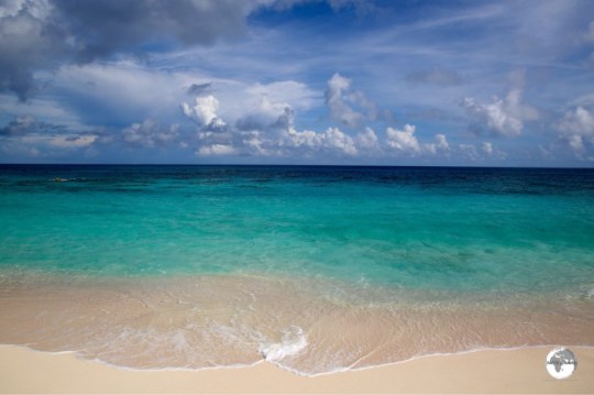
Warwick beach on the south coast.
Bermuda is one very expensive travel destination – a real challenge for those travelling on a budget. This British Overseas Territory doesn’t market itself as a budget-friendly destination, the island is all about 5-star resorts, fine dining restaurants and expensive boutique shopping – a destination for the well-heeled.
I originally planned to visit during June of 2017 but the already high prices were in the stratosphere thanks to Bermuda being the venue for the Americas Cup. I arrived two weeks after the cup and found retailers in town were still selling surplus clothing (from the cup) at full retail prices – there are never any bargains on this island.
South Coast beach.
Despite the scary prices, there are ways to keep costs down – such as eating in local cafes (where you can get a meal for around $12), or by shopping in supermarkets and self-catering.
If you choose to eat in tourist/ ex-pat restaurants, you should always be prepared for ‘sticker shock‘ when you receive the bill. In one cafe I paid $20 for a sandwich, which then came close to $30 once the gratuity and my drink was added. At the North Rock Brewing company, a small glass of one of their fine craft beers cost me $13.80 – that left a nasty aftertaste! I met a vacationing American family who had dinner one evening in a hotel restaurant. During their dinner the servers kept pouring water, which the family thought was house water. In the end they had a charge on their bill of $130 for water. You can read more about the high cost of living here.
Typical South Coast beach
If you can live with the high costs then Bermuda is a beautiful, engaging and rewarding destination and one not to be missed. On this well-ordered island, there is something for everyone – from a pristine environment, lots of history, a rich culture and so much more. Then there are the wonderful Bermudans – friendly, welcoming and always hospitable. Despite the budget-busting costs, Bermuda is a veritable paradise, one which I enjoyed and hope to return to again one day.
Bermuda Shorts
“The short-pant is a terrible fashion choice, unless it is from Bermuda.” So said Winston Churchill after a visit to Bermuda in the 1940’s.

Bermuda shorts in every colour of the rainbow at ‘Tabs’ in Hamilton
Bermuda shorts were originally designed by the British Army for wear in tropical and desert climates. During WWII, there was a shortage of clothing in Bermuda. At the time, the General Managers of two local banks (who were concerned that their male employees would not have suitable clothing to wear) arranged for a local tailor to make two pairs of formal shorts (modeled on the shorts of the British military), for each of their male employees. This was the beginning of Bermuda shorts as acceptable business attire in Bermuda. Since their inception, local designers have improved the design of the shorts, using better materials and brighter colours.
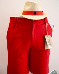
Bermuda shorts on sale at Tabs in Hamilton.
One thing I noticed while on the island is how popular the shorts are with local businessmen and government employees. Bermudans wear their shorts for all occasions – including weddings.

“How to wear your Bermuda Shorts” Source: “Tabs” – Authentic Bermuda Shorts
Men on Bermuda wear their Bermuda shorts in a variety of bright colours, always with long (knee-length) woolen socks – often in the same colour as their shorts. The look is completed with formal (black/ brown) shoes, a freshly ironed dress shirt with tie and a navy blue jacket.
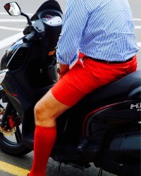
Bermuda shorts come in a variety of colours, with red (same colour as the flag) being especially popular.
Bermuda Triangle
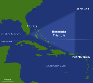
Boundaries of the Bermuda Triangle. Source: Wikipedia
A blog about Bermuda wouldn’t be complete without mention of the Bermuda Triangle. Since the 1950’s, writers have written fictional stories about ships and aircraft mysteriously disappearing in the vicinity of the triangle. The boundaries of the triangle were defined in a pulp fiction publication – Argosy – in 1964.
The area defined by the triangle is one of the busiest shipping lanes on the planet and while ships have become wrecked/ disappeared, there is no evidence to suggest that paranormal activity was responsible for any of these misfortunes. Either way, the story of the triangle has sold lots of books over the decades and (today) lots of tacky ‘I went to Bermuda and survived the Bermuda Triangle..’ souvenirs.
Heather Nova

Heather Nova in concert.
It would be amiss of me not to make mention of one of my favourite musicians, who happens to be a native of Bermuda – Heather Nova. I first saw Heather in concert in Zurich, Switzerland in 2009. The concert was a magical experience – from her enchanting, mystical voice, to the meaningful lyrics of each of her carefully composed compositions.
Heather was touring Europe while I was visiting Bermuda so no chance of seeing her perform at home. If you ever have the chance to attend one of her concerts (she is often touring Europe) I would recommend you do so – but be warned – there is a magical quality about her music and she will put you under her spell.
Location
Bermuda is an extinct, isolated volcano, located atop a seamount, far from anywhere, in the middle of the North Atlantic ocean. The closest landmass is Cape Hatteras (North Carolina), on the east coast of the United States – approximately 1,070 km (665 mi) to the north-east.
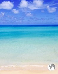
Bermuda Blues
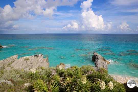
At different periods in history, the seamount has been completely submerged which has allowed marine organisms to form a limestone cap which covers the entire island and provides the white/ pink powdery sand beaches and turquoise water for which Bermuda is famous.
History
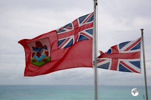
The Bermudan flag alongside the Union Jack.
Unlike its Caribbean neighbours to the south, remote and isolated Bermuda was never settled by indigenous Indians from the Americas. The island remained undiscovered until 1505 when Spanish navigator Juan de Bermudez passed by, while sailing back to Spain from a provisioning voyage to Hispaniola (present day Dominican Republic/ Haiti). The island was named after Bermudez who returned again in 1515 dropping off some pigs who could be used as food by anyone unlucky enough to be wrecked on the isolated outpost.
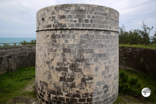
Martello Tower in St. Georges parish, part of line of defensive forts built by the British.
Bermuda continued to remain off the radar until 1609, when an English provisioning ship – the Sea Venture (captained by Sir George Somers) – would be deliberately ship wrecked on its reef. The ship was en-route to the new English colony of Jamestown, Virginia when it became caught in a fierce storm and was blown off course. When the reefs of Bermuda were spotted days later, the ship was deliberately run aground in order to save all survivors and allow them to salvage parts from the ship.
The survivors spent ten months on Bermuda, where they found plenty of food – including a thriving pig population. During this time, they were able to use tools and parts from the Sea Venture to build two new ships – Perseverance and Deliverance – one of which they filled with food stores sourced from the island. When the two new vessels were complete, most of the survivors set sail, completing their journey to Jamestown. Upon arrival they found a starving colony, which they were able to save using the supplies from Bermuda. Had this not happened, England’s new colony of ‘America’ would most likely have failed.
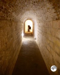
Tunnel in Fort St. Catherine – St. Georges Parish
When Somers departed Bermuda for Virginia, he left two volunteers on the Island to maintain Britain’s territorial claim. As a result, Bermuda has been continuously inhabited as a British territory since the wrecking of the Sea Venture in 1609, and claims its origin from that date, and not the official settlement of 1612.
Initially the island was run as a company, with land divided up between shareholders. Tobacco was the only agricultural crop grown but wasn’t profitable due to the small size of landholdings. Due to the lack of agriculture, slavery was not as important to Bermuda as it was on the ‘plantation’ islands in the Caribbean.
With almost no natural resources, Bermudans would eventually turn their attention to other sources of income. For centuries, Bermudan salt traders would spend six months of each year in the Turk & Caicos islands (TCI) where they harvested salt, which was then transported and sold in America (for further information on TCI, please refer to my TCI blog). Due to the Bermudan presence on the islands, Britain claimed TCI as a territory – a claim which continues today. Following territorial disputes with the Bahamas over the TCI and a change in salt markets, the Bermuda salt trade ended.
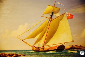
Bermuda Sloop.
In the 17th century, the islanders gave up on agriculture and instead turned their attention to the sea and everything maritime. For years, Bermuda Cedar had been used for ship building and the island had become famous for its shipyards. Design refinements led to the development of the famous ‘Bermuda Sloop‘ which sailed faster than any other boat at the time. These speedy sloops were perfect for pirates and privateers and Bermudian merchant vessels turned to privateering at every opportunity during the 18th century – preying on the shipping of Spain, France and other nations.
During the American War of independence, Bermudian sympathisers sold sloops to American rebels through third-country ports. It’s said these sloops greatly aided the American war effort, allowing the Americans to defeat the British.
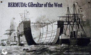
Towing the floating dockyard across the Atlantic Ocean.
After the war, Britain (who had lost control of all it’s ports on the US east coast) turned it’s attention to fortifying Bermuda and creating a strategic regional Naval Dockyard on the island, the centre piece of which was the world’s 2nd largest floating dockyard, which was constructed on the River Thames (London) over a period of three years then towed across the Atlantic to Bermuda in 1869. Today you can view the semi-submerged rusty remains of the dockyard in the mouth of Spanish Point.
Since WWII, Bermuda has positioned itself as a centre for Offshore Banking – the main industry on the island – with tourism being second. The official currency of the island is the Bermudan Dollar, which is pegged to the US dollar. Businesses on the island accept payment in both currencies.
The Bermuda Eastern Blue Bird is featured on the $2 note.
Architecture
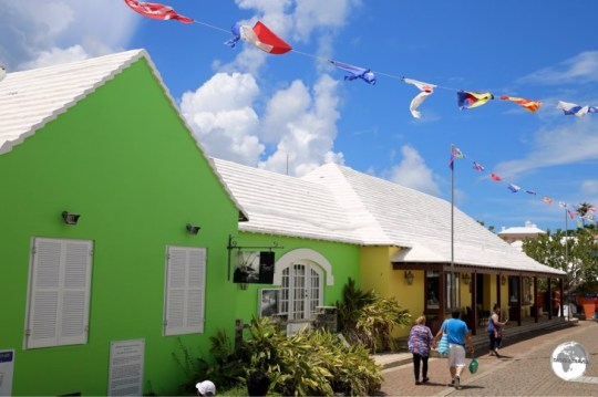
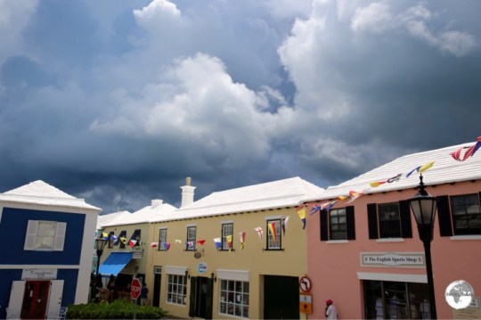
Shops in St. Georges town.
As I flew into Bermuda, I couldn’t help but notice all the blindingly white rooftops reflecting the dazzling tropical sunlight. White rooftops are a unique architectural feature of the island, with every type of building sporting the same white pointy cap. The reason for this is a very practical one – besides the fact that it also looks very pretty. On an island which lacks rivers or any other fresh water source, rainwater is the only source of fresh water and all rooftops are required (by law) to serve as rainwater catchments.
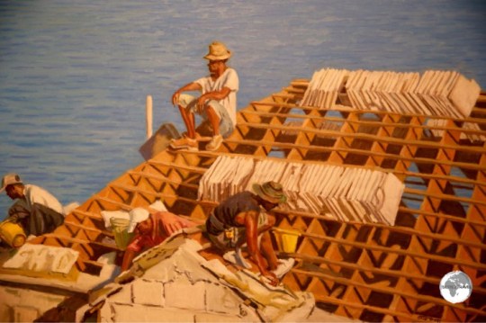
Painting at the Masterworks Art Gallery showing workers constructing a Bermudan rooftop.
Roofs are constructed using limestone slabs (a natural filter), which step down to a trough which then directs water into underground holding tanks. All homes are painted in pretty pastel colours with thick stone walls designed to withstand hurricane-strength winds.
[foogallery id=”3558″]
Sights
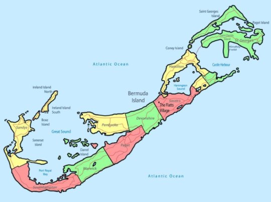
Parish Map of Bermuda
For a small island, Bermuda packs in a lot of sights – from historical towns, museums, galleries, gardens, old forts, stunning beaches, diving, snorkeling, sailing, hiking, bird watching and so much more. After ten days of zipping around on my scooter I still hadn’t covered everything.
Included here is a brief overview of sights from the most northern parish (St. Georges) to the most southern (Sandy’s):
St. Georges Parish
St. Georges town.
The UNESCO World Heritage listed St. Georges town was Bermuda’s first English settlement and served as the capital of Bermuda for its first 200 years. The town today is pleasantly renovated and offers a wealth of sights for visitors to explore:
St. Peters Church – the oldest Anglican church in the New World, which includes a segregated Slave Graveyard.
Somers Garden – where the heart of George Somers is buried.
Tucker House Museum – once home to Henry Tucker (former president of the Governors Council), this museum provides a view of life in a typical home from the 1700’s
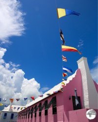
Colorful St. Georges.
Kings Square – the main square which includes the historic town hall.
Bermuda National Trust Museum – housed in the former Globe Hotel, this museum highlights Bermuda’s role in the American Civil War.
World Heritage Centre – Located on the waterfront, this renovated, former warehouse provides an overview of the history of St. Georges.
Apart from sightseeing, the town offers lots of boutique shopping, restaurants and cafes.
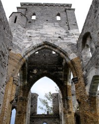
The Unfinished Church.
The Unfinished Church
Located on a hill overlooking St. George’s Town, construction of the Gothic-style Unfinished Church was commenced in 1874 but never completed due to lack of funds and disagreements between local parishioners. The site is administered by the Bermuda National Trust who have closed the grounds due to structural deterioration causing risks to visitors. You can walk around the perimeter fence from where you can take photos. The church is located on the aptly named Church Folly Lane.
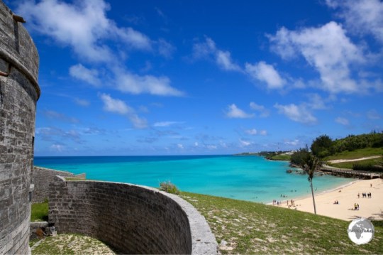
View of Catherine’s Beach from Fort St. Catherine.
Fort St. Catherine
Located over the hill from St. Georges town is beautiful St. Catherine’s Bay and Fort St. Catherine. The impressive fort is surrounded by a dry moat and accessed by a drawbridge and contains a large number of tunnels, towers and ramparts. Today, the fort houses a museum, which is one of the more interesting on the island. It was just offshore from the fort that the Sea Venture was wrecked in 1609. The entire crew came ashore where the Fort St. Catherine now stands. Further along the north coast are several smaller forts which you can visit.
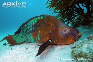
The Rainbow Parrot-fish is the largest herbivorous fish in the Atlantic with males reaching 1.2 metres. Source: www.arkive.org
The protected cove at St. Catherine’s Bay is ideal for swimming and offers good snorkeling. On the other side of the fort is the small, protected Achilles Bay. The bay offers good snorkeling and it’s here you have a chance of spotting the giant Rainbow Parrot fish. Further along the coast is the much more developed (and busier) Tobacco Bay.
Hamilton Parish
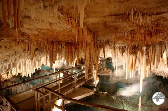
The main chamber of Fantasy Cave.
The Crystal Cave complex is comprised of two caves (tickets sold separately) – Crystal Cave and Fantasy Cave. The caves were discovered in 1905 by two 12-year-old boys searching for a lost cricket ball and have been a tourist attraction ever since.
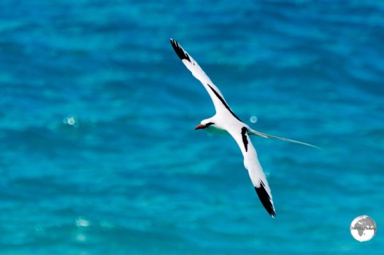
Native to Bermuda – the White Tailed Tropic bird is locally known as the Longtail – seen here on the north coast of Hamilton parish.
A great place to photograph the Longtail birds is along the north coast of Hamilton Parish – just to the north of Flatts village. This part of the coast is comprised of small cliffs where the birds have their nests.
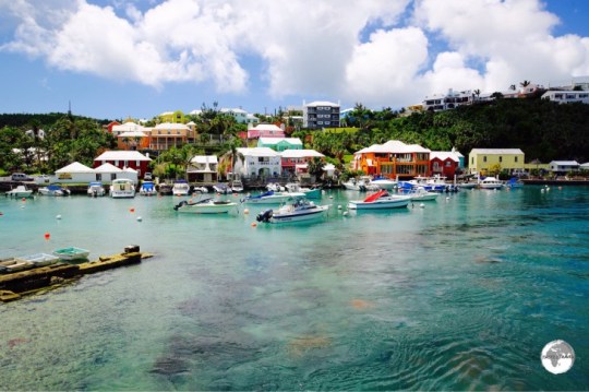
The picturesque Flatts Village.
Beautiful Flatts Village is located in a small inlet and is home to the Bermuda Zoo and Aquarium. It’s also home to the Village Pantry – a great place for breakfast and coffee (see ‘Eating Out’ below).
Smiths Parish
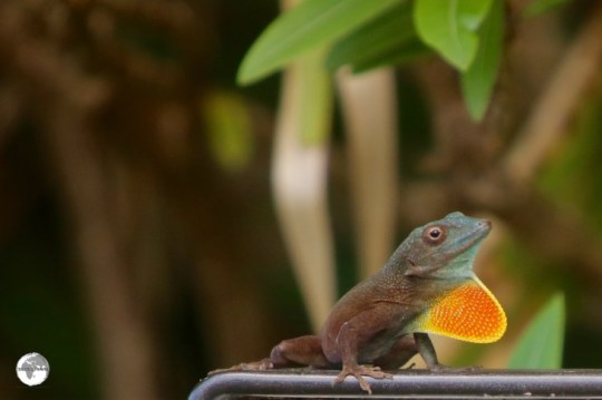
Jamaican Anole at Spittal Pond Nature Reserve.
Located on the south coast of Smiths Parish, Spittal Pond Nature Reserve is the largest reserve on the island and is a great place to see the fauna of Bermuda. The reserve stretches along south shore and features an 8-acre Spittal Pond, a large brackish pond (home to Egrets, Herons etc), surrounded by marsh and woodland areas.
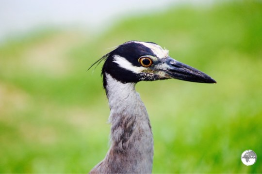
A recent introduction to Bermuda – the Yellow-crowned night heron at Spittal Pond Nature Reserve.
Devonshire Parish
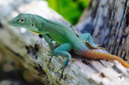
Jamaican Anole at the Arborteum.
One sight worth visiting in Devonshire Parish is the Arborteum. Once British army property, this national park covers 22 acres of trees, shrubs, meadows and forest. If you wish to photograph the Bermuda Eastern Blue Bird, you’ll find them here.
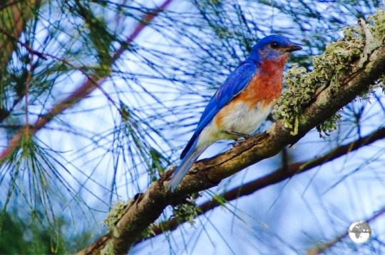
The Bermuda Eastern Blue Bird.
Pembroke Parish
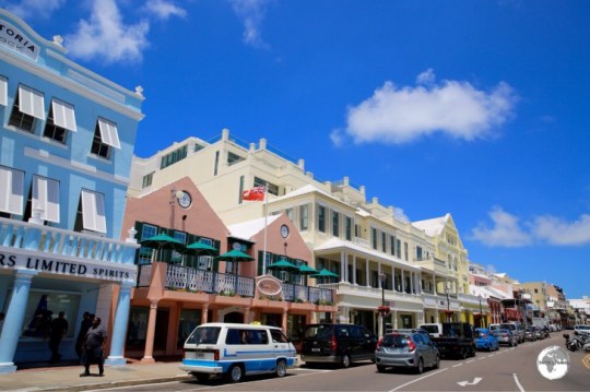
Front street in downtown Hamilton.
Capital of the island since 1815, Hamilton is a small, vibrant and a friendly city. It’s the heart and commercial hub of the island. Front Street runs along the waterfront and is the life and soul of the city. It’s here you’ll find shops, bars, cafes and restaurants.
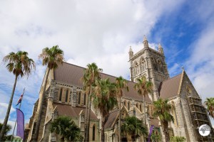
Cathedral of the Most Holy Trinity, Hamilton.
Away from the waterfront, you’ll find the Bermuda Cathedral of the Most Holy Trinity, City Hall and Bermuda Art Gallery.
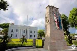
Cenotaph and the Cabinet Building, Hamilton.
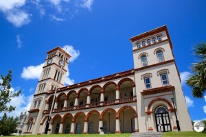
Courthouse in Hamilton.
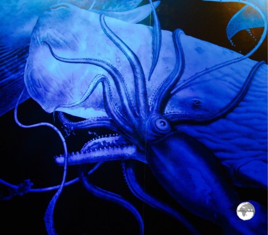
Artwork at the Bermuda Underwater Exploration Institute.
Located on the outskirts of Hamilton is the Bermuda Underwater Exploration Institute (BUEI), whose aim is to enhance understanding (through interactive exhibits) of the ocean including its diverse marine life, corals etc. The museum also includes information on Bermuda ship wrecks, including treasure found from diving expeditions.
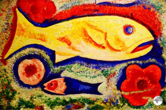
Artwork at the Masterworks Art Gallery.
Located inside the Bermuda Botanical Garden, Masterworks Art Gallery is a nonprofit organization dedicated to art made in and inspired by Bermuda. The gallery displays some 1400 masterpiece collections including paintings, photographs, drawings and maps. The gallery cafe is a wonderful place for lunch.
Warwick Parish
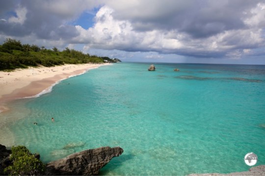
View of Warwick Long Bay.
Located on a quiet stretch of the south coast, Warwick Long Bay beach is a fabulous, beautiful half-mile stretch of pink sand. The pink hue is caused by the crushed shells of a microscopic organism called foraminifera. The turquoise water is ideal for swimming and there are plenty of quiet little coves either side of the main beach.
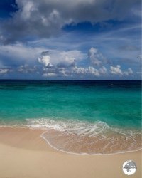
Warwick Beach
Southhampton Parish
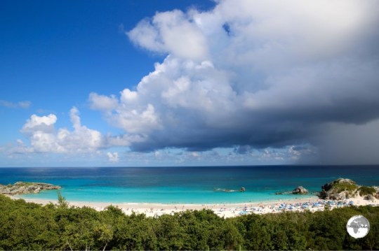
Storm approaching Horseshoe Bay Beach.
Ranked in 2016 by Conde Nast Traveller as one Top 20 beaches in the world – stunning Horseshoe Bay Beach features a curved stretch of pink sand against the blue waters of the Atlantic.
Gibbs Hill Lighthouse.
Perched high on a hill, overlooking everything in Southhampton Parish, is the Gibbs Hill Lighthouse – the tallest lighthouse on Bermuda and was one of the first lighthouses in the world to be made of cast-iron. For the most panoramic view of Bermuda, you can climb the 185 steps to the top outdoor viewing platform.
Sandy’s Parish
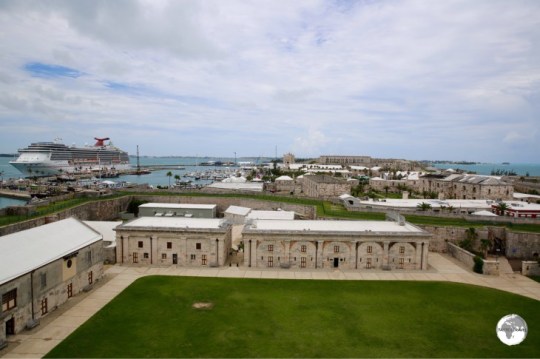
View of the Royal Naval Dockyard precinct from the Bermuda National Museum.
The Royal Naval Dockyard was once used as a British navy base but today plays hosts to cruise ships and hoards of cruise ship passengers. The area around the dockyard is home to the Bermuda National Museum, Clocktower Shopping mall (lots of tacky souvenir shops housed inside an impressive British Navy warehouse) and restaurants and cafes.
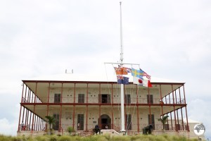
The Old Commissioners House at the National Museum of Bermuda.
The best museum on the island – The National Museum of Bermuda is housed inside an old fortress – The Keep – and provides a comprehensive history of the island and it’s culture. The centre-piece of the museum is the Old Commissioners House – the oldest cast iron house in the world – built in 1820 in the Georgian style. The house contains two floors of exhibits, including a photographic exhibit of the Longtail bird by former Bermuda resident (and famous Australian TV producer) Reg Grundy.
[foogallery id=”3601″]
Built in 1860, Somerset Bridge is the world’s smallest drawbridge. The bridge is made up of two halves with an 18-inch wide piece of timber placed between the spans to bridge the gap between the two. This piece of timber can be opened (by hand) to allow the masts of small sailing boats to pass through.
Diving
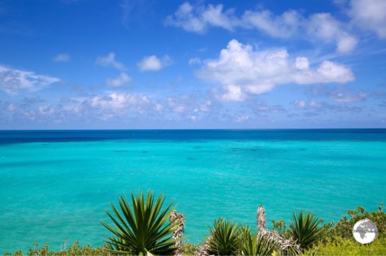
While it looks ideal, Bermuda is surrounded by a treacherous fringing reef which has claimed many ships in the past.
The fringing reef which surrounds Bermuda has claimed many ships over the centuries – all of which has created a diving playground. I did a two-tank dive with Dive Bermuda who have their shop at the Grotto Bay Resort in Hamilton Parish.
The dives cost just under $200 which included all equipment, boat transfers and as much water as you care to drink. Food is not provided on the (half-day) trip so if you get peckish between dives you should bring something along.
Our two dives were at the wreck of the Cristobal Colon (very fragmented/ dispersed wreck) and then North Rock -both a 50 minute boat ride from the island on the north-west side of the seamount. You can view a Franko map of Bermuda dive sites here.
Accommodation
In a word – expensive! Most hotels on the island are upscale resorts/ hotels catering to tourists with deep pockets. There are no budget hotels or hostels. If you are on a budget it’s best to look at options on either Couchsurfing.com or Airbnb.com
Eating out
There are a variety of restaurants on the island catering for all budgets. Most places which serve mainly tourists/ ex-pats charge high prices and additionally add a 17% gratuity to the bill. You can avoid all of this by eating in local cafes.
Local Restaurants
Of the local ‘cheapies’, my favourites include:
Rotisserie Grill (South road in Smith’s Parish) – Always popular, this restaurant offers roast chicken meals with mashed potato and salads for under $15. Homemade desserts are also available.
Pizza House Restaurant (several branches on the island) – makes a mean pizza and roast/ fried chicken meals with salads and vegetables.
The Spot Restaurant (Cedar Avenue in downtown Hamilton) – cooking here is hit and miss but its hard to beat their prices. One of the cheapest places in the heart of Hamilton.
Tourist Restaurants/ Bars
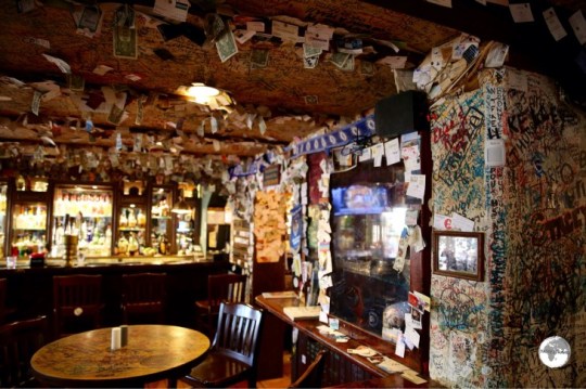
Bar at the Swizzle Inn
Of the tourist restaurants, the Swizzle Inn is a local institution, which was responsible for developing the national cocktail – the Rum Swizzle. For those who are thirsty, the good news is – there are two branches on the island – one in the north at Baileys Bay (the original pub – located across the road from the Crystal Cave) and one in the south on the South Shore Road. Apart from great cocktails, the food menu is very good with blackboards dinner specials every evening and trivia and other activities during the week – plus you can leave a permanent mark on the island by adding your scrawl to the walls.
Flanagan’s Irish Bar, Hamilton
Located on Front street in downtown Hamilton, Flanagan’s Irish Bar is popular with tourists and locals for its extensive food and drinks menu. A great way to soak up the ambiance of Hamilton is to have dinner on the balcony overlooking the harbour.
If you are looking for dinner or drinks in St. Georges, I would highly recommend the waterfront Wahoo’s Bistro & Patio. The menu at Wahoo’s combines local and European influences from the Austrian-born head chef (and joint owner) Alfred Konard. The fish here is especially good.
Cocktails
The national drink of Bermuda is the Rum Swizzle, which was developed by the folks at the Swizzle Inn but is sold all over the island.
How to prepare a Rum Swizzle:
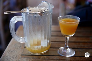
A Rum Swizzle at the Swizzle Inn
Ingredients (makes 6):
4 oz Gosling’s Black Seal Rum
4 oz Gosling’s Gold Rum
5 oz Pineapple Juice
5 oz Orange Juice
¾ oz Grenadine or 2 oz Bermuda Falernum
6 Dashes of Angostura Bitters
Method:
Into a pitcher ⅓ full of crushed ice – add Gosling’s Black Seal Rum, Gosling’s Gold Rum, pineapple juice, orange juice, Grenadine or Bermuda Falernum and Angostura bitters.
Churn vigorously until a frothing appears or mix in a cocktail shaker.
Strain into a martini glass.
Another favourite cocktail is the simple but tasty Dark ‘N’ Stormy – made with dark rum (the ‘dark’) and ginger beer (the ‘stormy’) served over ice and garnished with a slice of lime.
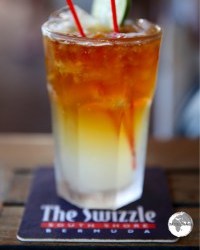
An island staple – the Dark ‘n’ Stormy cocktail.
Cafes
As with every other destination, I was on a mission during my 10 days to find the best coffee on Bermuda. Finding a good coffee is not easy but after an exhaustive search, I can say the best coffee is served at the Devils Isle Cafe in downtown Hamilton. The cafe is open from early morning, which is a good thing since their breakfast offering is also one of the best on the island.
If you’re anywhere near the Flatts village, you’ll be happy to know the folks from Devils Isle Cafe are also responsible for the Village Pantry. I was staying up the road, so I started most days with breakfast here and would recommend the Avocado Crush (like guacamole on toast) with a poached egg added on top.
The best coffee in St. Georges is served at the CV Cafe in downtown St. Georges.
Visa Requirements
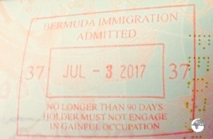
Despite being a British Overseas Territory, Bermuda maintains it’s own visa policy. All flight and cruise ship arrivals into Bermuda are from just three countries – United States, Canada and the United Kingdom. All visitors to Bermuda must have a return ticket and the right to re-enter one of those three countries. You can check your requirements here.
Getting There
By Air
Around 1/3 of tourists (235,000 in 2015) to Bermuda fly into LF Wade International Airport – the only airport on the island. The airport is located in the northern parish of St. Georges and (due to the fact that most flights are between the US and Bermuda) offers US immigration/ customs pre-clearance, which means US-bound passengers clear Customs & immigration in Bermuda so flights arriving in the US from Bermuda are thus treated as domestic flights. At the time of my visit a new, bigger terminal was being constructed.
The following airlines provide flights to the island:
Air Canada – Flight to Toronto–Pearson
American Airlines – Flights to Miami, New York–JFK, Philadelphia
British Airways – Flight to London-Gatwick
Delta Air Lines – Flights to Atlanta, Boston, New York–JFK
JetBlue Airways – Flights to Boston, New York–JFK
WestJet – Flight to Toronto–Pearson
By Sea
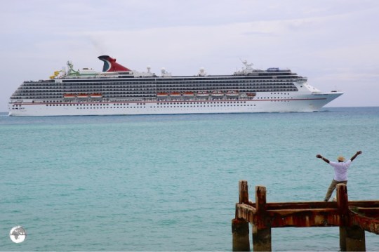
Most tourists to Bermuda arrive on a cruise ship from the United States.
Around 2/3 of tourists (385,000 in 2015) to Bermuda arrive on cruise ships (mostly American tourists on ships from the east coast of the US), which berth at either the Royal Naval Dockyard (2 berths) or in downtown Hamilton (2 berths). The two berths at Royal Naval Dockyard – Kings Wharf and Heritage Wharf occupy the same long pier, and is where most ships dock. The other two berths are located on Hamilton harbour alongside Front street but due to overcrowding in town (when ships are docked), authorities allow few ships to berth in the capital.
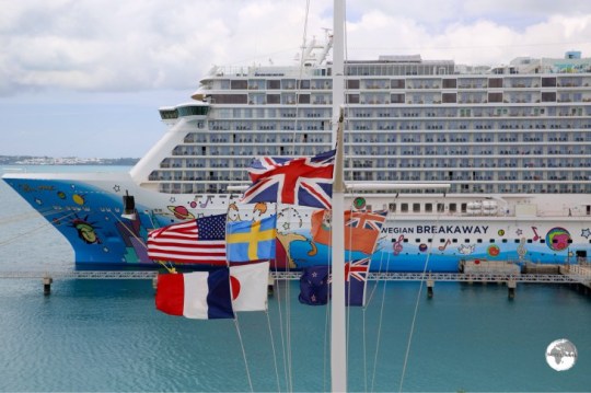
Cruise ship docked at the Royal Naval dockyard.
Bermuda is a sailing paradise and attracts yachts from around the world, hence a small number of visitors (less than 1%) arrive by private yacht.
Getting Around
Ferry
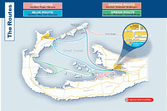
Bermuda Ferry Routes Source: http://www.bermudaforvisitors.com
There are four ferry routes operating in Bermuda – a Blue, Pink, Green and Orange route. While I was exploring the island on my scooter, I always looked to incorporate a ferry trip into my journey. Ferry journeys save a lot of time as distances across the water are considerably shorter than those on land where roads are narrow, windy and long. Passengers pay $5 a ticket and you are able to take your bike or scooter on-board for an extra $5. The ferry journey from Hamilton to Royal Navy Dockyard is 20 minutes, versus the road journey of almost an hour.
Bus
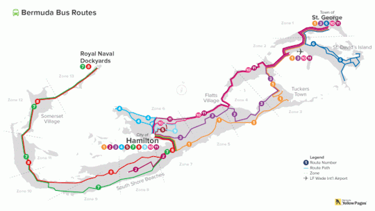
Bermuda bus routes Source: https://www.bermudayp.com
Government-operated pink (inspired by the colour of the pink sand beaches) public buses provide comprehensive coverage across the entire island on 11 different routes from the main terminal in Hamilton. Fares are very reasonable, buses run frequently (i.e. until 7-pm) and service is very good. Since there is no car hire on Bermuda and taxi’s can be expensive, bus is a good transport option for visitors who do not want to hire a scooter.
Taxi
Taxi’s are available for hire, but like everything else on Bermuda, they’re not cheap. A taxi from one end of the island (St. Georges) to the other (Royal Navy Dockyard) will cost around $78.
Car
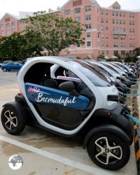
Renault Twizy’s at the Hamilton Princess Hotel
There is no car rental on Bermuda, however a small fleet of electric Renault Twizy’s are now available for rent from Current Vehicles, located in the car park at the front of the Hamilton Princess hotel in downtown Hamilton. The Twizy is an over-sized shopping trolley, able to carry two (smallish) passengers, with the second passenger tucked tightly in behind the driver. The cars were originally bought onto the island as support vehicles for the America’s Cup (June 2017).
Interior of the cosy Twizy.
Scooter
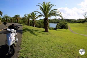
A scooter is the best way to maximise your time on Bermuda.
In the absence of car rental options (and apart from the recently introduced Twizy’s), scooter is the only rental option for those who wish to explore the island independently.
There are various scooter rental companies around Bermuda, all of whom seem to charge similar (i.e. high) rates. Prices start at $55 per day and reduce on a sliding scale, so the longer you hire the cheaper it becomes. I rented my bike through (and would recommend) Oleander Cycles – my ten day rental averaged out at $30 per day.
All companies will drop-off and pick-up their scooters from anywhere on the island and they require all drivers to do a short driving test before they will agree to rent you a scooter – they will not rent you a scooter if you appear to be less-than-confident on two wheels.
About taste2travel.com
Other blogs from the region – Cayman Islands Travel Guide, Bahamas Travel Guide, Turks & Caicos Travel Guide
Bermuda Travel Guide was originally published on Taste2Travel
#America's Cup#American War of independence#Bermuda#Bermuda bus routes#Bermuda ferry routes#Bermuda National Museum#Bermuda Shorts#Bermuda Sloop#Bermuda Triangle#Bermudan Dollar#British Overseas Territory#BUEI#Cabinet Building#Cathedral#Cenotaph#Courthouse#Current Vehicles#CV Cafe#Dark 'N' Stormy#Deliverance#Devils Isle cafe#Dive Bermuda#Fantasy Cave#Flanagan's Irish Bar#Flatts Village#Gibbs Hill Lighthouse#Grotto Bay Resort#Hamilton#Heather Nova#Horseshoe Bay Beach
0 notes
Text
Travel Quiz: 04 (Pacific Islands)
Click here to access –
Travel Quiz: 04 (Pacific Islands)
About taste2travel.com
Travel Quiz: 04 (Pacific Islands) was originally published on Taste2Travel
0 notes
Text
Travel Quiz: 03 (South America)
A quick South America travel quiz from taste2travel. Good luck!
01. How many countries/ territories share a land border with Brazil?

8
10
6
12
Continue >>
02. What is the capital of Suriname?

Georgetown
Caracas
Cayenne
Paramaribo
Continue >>
03. In which country would you be if you were visiting Kaieteur falls - the world's tallest single drop waterfall.

Guyana
Venezuela
Brazil
Peru
Continue >>
04. Where is the Kourou space centre located?

Suriname
Chile
French Guiana
Argentina
Continue >>
05. In which country is the Panama hat made?

Ecuador
Panama
Colombia
Peru
Continue >>
06. Easter Island is a part of which country?

Peru
Ecuador
Chile
Argentina
Continue >>
07. In which country would you be if you were flying over the pre-Colombian Nazca lines?

Uruguay
Chile
Peru
Brazil
Continue >>
08. The underground Salt Cathedral of Zipaquira (the world's largest) is located in which country?

Colombia
Venezuela
Ecuador
Paraguay
Continue >>
09. This is the flag of which country?

Uruguay
Suriname
Guyana
Paraguay
Continue >>
10. Which country was formerly a Dutch colony?

Suriname
Argentina
Peru
Colombia
Continue >>
11. The Galapagos Islands are a part of which country?

Colombia
Ecuador
Peru
Chile
Continue >>
12. What is the approximate length of Chile in kilometres?

2300km
3300km
4300km
5300km
Continue >>
13. This is the flag of which country?

Argentina
Paraguay
Uruguay
Suriname
Continue >>
14. At 10,582 square kilometers (4,086 sq mi), the Salar de Uyuni is the world's largest salt flat. In which country is it located?

Bolivia
Chile
Paraguay
Uruguay
Continue >>
15. Which country uses the US dollar as its official currency?

Uruguay
Paraguay
Argentina
Ecuador
Continue >>
16. In which capital would you be if you were spending Euro's (the official currency)?

Bogota
Paramaribo
Cayenne
Caracas
Continue >>
17. Which is the longest river in South America?

Plata
Amazon
Orinoco
Nile
Continue >>
18. Situated at 3,400 metres (11,152 feet), the Andean city of Cusco is located in which country?

Ecuador
Bolivia
Chile
Peru
Continue >>
19. Cerro Fitz Roy is the main star of the Fitz Roy National Park in Patagonia. The peak straddles the border of which two countries?

Bolivia/ Chile
Chile/ Argentina
Peru/ Bolivia
Ecuador/ Peru
Continue >>
20. This is the flag of which country?

Colombia
Ecuador
Paraguay
Venezuela
Continue >>
Travel Quiz – 03 (South America)
Sorry! You scored less than 50%. Better luck next time!
Share your Results :
Facebook Twitter Google+ VK
Travel Quiz – 03 (South America)
Not Bad! You scored less than 75%.
Share your Results :
Facebook Twitter Google+ VK
Travel Quiz – 03 (South America)
Very Good! You know your stuff.
Share your Results :
Facebook Twitter Google+ VK
Travel Quiz – 03 (South America)
Well Done! You're a modern day Marco Polo.
Share your Results :
Facebook Twitter Google+ VK
PLAY AGAIN !
About taste2travel.com
Travel Quiz: 03 (South America) was originally published on Taste2Travel
0 notes
Text
Travel Quiz: 02 (Caribbean)
A quick Caribbean travel quiz from taste2travel. Good luck!
01. What's the capital of Barbados?

Kingston
Georgetown
Bridgetown
Castries
Continue >>
02. By area, what's the smallest Republic on the planet?

Monaco
San Marino
Vatican City
Liechtenstein
Continue >>
03. What's the capital of North Korea?

Pyongyang
Seoul
Pusan
Kaeson
Continue >>
04. By area, what is the 2nd largest country in South America?
Argentina
Chile
Brazil
Peru
Continue >>
05. What's the name of the currency of Turkey?
Dinar
Dollar
Dirham
Lira
Continue >>
06. Which US state has the longest coastline?
California
Florida
Alaska
Hawaii
Continue >>
07. Which country is home to the Taj Mahal?
Nepal
India
Pakistan
Iran
Continue >>
08. Which country would you be in if you were visiting the Galápagos Islands?
Colombia
Peru
Chile
Ecuador
Continue >>
09. Which country shares a land border with Papua New Guinea?
East Timor
Soloman Islands
Indonesia
Australia
Continue >>
10. How many countries does China share a border with?
14
9
12
6
Continue >>
11. What's the capital of Guyana?

Georgetown
Paramaribo
Kingstown
Caracas
Continue >>
12. Which river flows through Rome?

Arno
Tiber
Elbe
Po
Continue >>
13. Which country would you be in if you were visiting the ancient city of Petra?
Syria
Israel
Egypt
Jordan
Continue >>
14. What's the name of the highest mountain in New Zealand?

Mt. Taranaki
Mt. Cook
Mt. Ruapehu
Mt. Tongariro
Continue >>
15. What's the capital of Tajikistan?

Dushanbe
Yerevan
Tblisi
Alma Ata
Continue >>
16. Which is the most populous city in South America?
Rio de Janeiro
São Paulo
Buenos Aires
Lima
Continue >>
17. Which country would you be in if you were watching the sunset from the capital of Port-au-Spain?

Barbados
Grenada
Jamaica
Trinidad & Tobago
Continue >>
18. Cayenne is the capital of which country?

Martinique
St. Martin
Guadeloupe
French Guiana
Continue >>
19. Which country is considered an 'atoll' nation?

Fiji
New Zealand
Sri Lanka
Kiribati
Continue >>
20. In which US city would you find Anish Kapoor's 'The Bean'?

Chicago
New York City
Seattle
Los Angeles
Continue >>
Travel Quiz – 01 (Worldwide)
Sorry! You scored less than 50%. Better luck next time!
Share your Results :
Facebook Twitter Google+ VK
Travel Quiz – 01 (Worldwide)
Not Bad! You scored less than 75%.
Share your Results :
Facebook Twitter Google+ VK
Travel Quiz – 01 (Worldwide)
Well Done! You're a modern day Marco Polo.
Share your Results :
Facebook Twitter Google+ VK
Travel Quiz – 01 (Worldwide)
Very Good! You know your stuff.
Share your Results :
Facebook Twitter Google+ VK
Powered by WordPress Quiz Plugin
PLAY AGAIN !
About taste2travel.com
Travel Quiz: 02 (Caribbean) was originally published on Taste2Travel
0 notes
Text
Travel Quiz: 01 (Worldwide)
A quick Worldwide travel quiz from taste2travel. Good luck!
01. What's the capital of Barbados?

Kingston
Georgetown
Bridgetown
Castries
Continue >>
02. By area, what's the smallest Republic on the planet?

Monaco
San Marino
Vatican City
Liechtenstein
Continue >>
03. What's the capital of North Korea?

Pyongyang
Seoul
Pusan
Kaeson
Continue >>
04. By area, what is the 2nd largest country in South America?
Argentina
Chile
Brazil
Peru
Continue >>
05. What's the name of the currency of Turkey?
Dinar
Dollar
Dirham
Lira
Continue >>
06. Which US state has the longest coastline?
California
Florida
Alaska
Hawaii
Continue >>
07. Which country is home to the Taj Mahal?
Nepal
India
Pakistan
Iran
Continue >>
08. Which country would you be in if you were visiting the Galápagos Islands?
Colombia
Peru
Chile
Ecuador
Continue >>
09. Which country shares a land border with Papua New Guinea?
East Timor
Soloman Islands
Indonesia
Australia
Continue >>
10. How many countries does China share a border with?
14
9
12
6
Continue >>
11. What's the capital of Guyana?

Georgetown
Paramaribo
Kingstown
Caracas
Continue >>
12. Which river flows through Rome?

Arno
Tiber
Elbe
Po
Continue >>
13. Which country would you be in if you were visiting the ancient city of Petra?
Syria
Israel
Egypt
Jordan
Continue >>
14. What's the name of the highest mountain in New Zealand?

Mt. Taranaki
Mt. Cook
Mt. Ruapehu
Mt. Tongariro
Continue >>
15. What's the capital of Tajikistan?

Dushanbe
Yerevan
Tblisi
Alma Ata
Continue >>
16. Which is the most populous city in South America?
Rio de Janeiro
São Paulo
Buenos Aires
Lima
Continue >>
17. Which country would you be in if you were watching the sunset from the capital of Port-au-Spain?

Barbados
Grenada
Jamaica
Trinidad & Tobago
Continue >>
18. Cayenne is the capital of which country?

Martinique
St. Martin
Guadeloupe
French Guiana
Continue >>
19. Which country is considered an 'atoll' nation?

Fiji
New Zealand
Sri Lanka
Kiribati
Continue >>
20. In which US city would you find Anish Kapoor's 'The Bean'?

Chicago
New York City
Seattle
Los Angeles
Continue >>
Travel Quiz – 01 (Worldwide)
Sorry! You scored less than 50%. Better luck next time!
Share your Results :
Facebook Twitter Google+ VK
Travel Quiz – 01 (Worldwide)
Not Bad! You scored less than 75%.
Share your Results :
Facebook Twitter Google+ VK
Travel Quiz – 01 (Worldwide)
Well Done! You're a modern day Marco Polo.
Share your Results :
Facebook Twitter Google+ VK
Travel Quiz – 01 (Worldwide)
Very Good! You know your stuff.
Share your Results :
Facebook Twitter Google+ VK
Powered by WordPress Quiz Plugin
PLAY AGAIN !
About taste2travel.com
Travel Quiz: 01 (Worldwide) was originally published on Taste2Travel
0 notes