#3d laser scanning & modelling
Explore tagged Tumblr posts
Visit Tumblr Blog
Explore Tumblr blogs with no restrictions, modern design and the best experience.
Last Seen Tumblr Blogs


Fun Fact
Tumblr was attacked by a cross-site scripting worm deployed by the Internet troll group GNAA on Dec 3, 2012.
Text
Architectural Laser Scanning for Building Renovation
3D Scanning Technology Revolutionizing Renovation Projects
In recent years, 3D laser scanning has become a game-changer for building renovation. By capturing highly accurate digital records of existing structures, this advanced technology streamlines the renovation process from planning through construction.
Architectural laser scanning not only accelerates project timelines—reducing them by up to 80%—but also plays a crucial role in preserving historical architectural details. Its precision and efficiency are redefining how architects, engineers, and contractors approach renovation projects.
Understanding Laser Scanning Technology
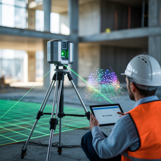

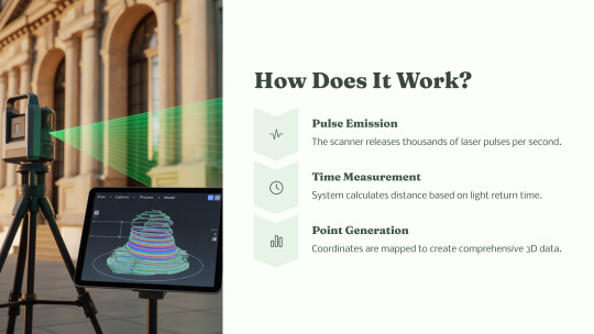
Laser scanning technology operates by emitting laser beams that reflect off surfaces and return to the scanner, capturing millions of data points known as "point clouds."
These dense point clouds represent the geometry of the scanned environment in 3D with a typical accuracy range of 2-3mm.
Key capabilities include:
Capturing comprehensive spatial relationships, material conditions, and architectural features.
Recording manufacturer-specific details such as door and window dimensions, HVAC equipment, and more.
Seamless integration with BIM (Building Information Modeling) and CAD platforms, enhancing digital workflows.
Delivering rich geographic and architectural data used for precise modeling and analysis.
Key Benefits for Renovation Projects
Laser scanning offers several distinct advantages over traditional surveying methods, especially for renovation and retrofit projects:
Enhanced Safety: Reduces the need for physical access to hazardous or hard-to-reach areas.
Speed: Approximately 40% faster than traditional hand-measuring or manual survey methods.
Accuracy: Delivers near-exact documentation of existing conditions, essential for accurate design and construction.
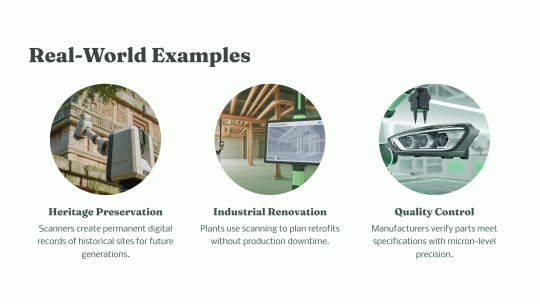
Historical Preservation: Ideal for capturing intricate details in heritage buildings, ensuring their preservation during renovations.
Reduced Errors: Minimizes on-site measurement mistakes, reducing costly rework.
Enhanced Project Planning
High-resolution point cloud data enables architects and engineers to begin the renovation process with a complete understanding of the existing structure. Benefits include:
Detailed site analysis with reliable structural data.
Insight into existing limitations, constraints, and irregularities.
Early detection of structural issues, such as sagging beams or misaligned foundations.
Creation of accurate as-built documentation for use across design disciplines.
Helps reduce rework and avoid costly surprises during construction.
Streamlining Design & Construction
One of the major strengths of architectural laser scanning is its ability to streamline design and construction coordination:
Seamless integration with BIM and CAD software platforms like Revit, AutoCAD, and Navisworks.
Provides a shared, accurate data environment for all stakeholders to collaborate.
Reduces change orders by up to 35% by ensuring that the design is aligned with real-world site conditions.
Facilitates complex structural modifications with confidence and precision.
Speeds up decision-making by providing detailed visual references and data-backed models.
Quality Assurance & Compliance
Laser scanning plays a pivotal role in quality control and ensuring compliance during renovation:
Verifies that construction aligns with architectural and structural specifications.
Helps teams ensure compliance with building codes and regulations.
Accurately documents as-built conditions for comparison against original designs.
Detects deviations or discrepancies between planned and actual structures.
Supports structural analysis and validation, ensuring safety and long-term performance.
Case Study: Historical Building Preservation
A notable application of laser scanning is in the renovation of historical buildings:
Enables precise documentation of delicate or intricate architectural features like moldings, columns, and cornices.
Supports accurate alignment of new structural elements with the original architecture.
Offers digital preservation of heritage details, ensuring they are retained for future generations.
Allows for virtual design testing using 3D models before making any physical changes.
Minimizes on-site disruption, making the scanning process less invasive than traditional surveys.
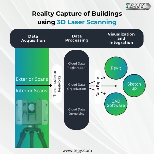
Implementation Process
The implementation of a laser scanning workflow typically includes the following steps:
Initial Site Assessment: Determines scanning scope and project requirements.
Scanner Placement Strategy: Ensures full coverage of the building, interior and exterior.
Data Collection & Point Cloud Generation: Field scanning produces millions of precise data points.
Data Processing & Integration: Point clouds are cleaned, registered, and integrated into BIM or CAD systems.
Ongoing Reference: The scan data remains available throughout the renovation to resolve design or construction queries.
ROI & Cost Benefits
Architectural laser scanning offers an impressive return on investment for renovation projects:
Reduces overall project timelines by up to 30%, allowing quicker project delivery.
Helps avoid expensive design changes mid-project by catching issues early.
Cuts labor costs for initial surveying by approximately 50%.
Prevents costly rework by providing exact existing conditions before construction starts.
Creates lasting digital documentation, useful for ongoing maintenance and facility management.
Conclusion: Transforming Renovation Projects
Architectural laser scanning is transforming the renovation landscape by introducing a new level of accuracy, efficiency, and insight. By providing:
Unprecedented documentation precision
Improved decision-making based on real-world data
Clear, consistent information for all stakeholders
Significant reductions in time and cost
Preservation of both structural integrity and aesthetic value
…it is rapidly becoming an essential tool in modern building renovation. Whether working on a historical structure or a commercial upgrade, 3D laser scanning ensures the highest level of planning, execution, and project success.
#building design#architecture#architectural laser scanning#historical structure#3d laser scanning#as built documentation#bim#building information modeling
0 notes
Text
What Is Scan to BIM? Benefits for Architects and Engineers

In today’s fast-evolving AEC (Architecture, Engineering, and Construction) industry, the demand for high-precision, time-saving, and cost-effective digital solutions is higher than ever. One revolutionary process transforming the way professionals work is Scan to BIM. With the fusion of 3D laser scanning and Building Information Modeling (BIM), Scan to BIM provides an accurate digital representation of a building’s current conditions — a game-changer for architects, engineers, and construction firms.
This article explores what Scan to BIM is, how it works, and why it is invaluable to professionals in architecture and engineering.
Understanding Scan to BIM

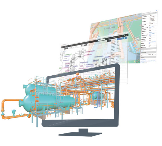
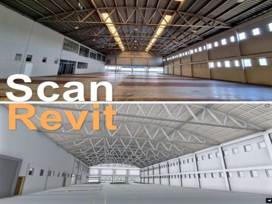
Scan to BIM is the process of capturing a physical building or site using 3D laser scanning and then converting the collected data (known as a point cloud) into a digital BIM model. This model can be used for planning renovations, retrofitting, documentation, or creating as-built conditions for construction.
This process typically involves:
3D Laser Scanning of a site or building using LiDAR equipment.
Processing the scan data into a point cloud to BIM workflow.
Converting point cloud data into a usable 3D BIM model using tools like Scan to BIM Revit.
Professionals can then use these models to streamline design, coordination, and construction phases.
Benefits of Scan to BIM for Architects
1. Accurate As-Built Documentation
One of the key benefits of Scan to BIM for architects is the generation of highly accurate as-built models. These models reflect the exact current conditions of a building, removing guesswork and reducing design errors. This is particularly useful for complex renovation or restoration projects where architectural drawings may be outdated or missing.
2. Design Precision and Efficiency
Working from a precise BIM model saves architects time and helps ensure their designs fit seamlessly into existing structures. This level of accuracy enhances project quality and minimizes costly rework, particularly when working with older or structurally unique buildings.
3. Enhanced Collaboration
Architects often work in collaboration with engineers, contractors, and stakeholders. With Scan to BIM services, they can share an exact digital replica of the building, making coordination more transparent and reducing miscommunication.
Benefits of Scan to BIM for Engineers
1. Structural Analysis and Load Assessment
Scan to BIM modeling services provide engineers with accurate geometry that is crucial for performing structural analysis and load assessment. Whether designing additional structural elements or verifying the stability of an existing framework, having a detailed BIM model streamlines the process.
2. Clash Detection and Coordination
Using 3D scan to BIM tools, engineers can identify clashes between different building systems early in the design process. Whether it's MEP, HVAC, or structural elements, engineers can address conflicts proactively.
3. Integration with Simulation Tools
BIM models generated from 3D laser scanning in construction are compatible with many simulation and analysis platforms. This allows engineers to perform energy modeling, load calculations, or environmental simulations more effectively.
Use Cases of Scan to BIM in the AEC Industry
Scan to BIM is not just a niche tool; it has widespread applications across various sectors:
1. Renovations and Retrofit Projects
Historic buildings or older structures with little documentation can benefit greatly from 3D laser scanning BIM processes. Architects can create reliable renovation plans by referencing highly accurate as-built models.
2. Facility and Asset Management
Facilities teams use BIM models for ongoing operations, maintenance, and asset tracking. With point cloud to BIM conversions, they get a comprehensive digital twin of the facility that’s easy to update and manage.
3. Heritage Preservation
Historical architecture requires meticulous detail. With Scan to BIM Revit, preservationists and architects can document every corner and crevice, maintaining the integrity of these priceless structures digitally.
4. Construction Verification
3D scan to BIM allows teams to verify if the construction is proceeding according to plan. Any discrepancies between the planned and actual construction can be spotted early, saving time and money.
Workflow: From Scanning to BIM Modeling
The typical scan to BIM workflow includes the following stages:
3D Laser Scanning: A laser scanner captures millions of data points in a space, creating a dense point cloud.
Registration: Multiple scans are combined into a unified dataset.
Point Cloud Cleaning: The scan data is cleaned to remove unnecessary elements like people or moving objects.
Conversion to BIM: Specialists convert the cleaned point cloud into a BIM model using tools like Revit, tailored to the desired Level of Detail (LOD).
Model Usage: The model is then used for design, documentation, simulation, or facility management.
Each stage is crucial and contributes to the accuracy of the final model.
Why Scan to BIM Revit Is Industry Standard
Scan to BIM Revit has become the industry standard due to its wide acceptance and integration capabilities. Revit allows seamless coordination between architects, structural engineers, and MEP professionals. The platform supports advanced modeling, clash detection, and scheduling features.
With plugins and workflows specifically designed for scan to BIM services, Revit makes it easier to translate point cloud data into intelligent building elements.
Advancements in Scan to BIM: The Role of BIM AR
One exciting development in the Scan to BIM space is the integration of BIM AR (Augmented Reality). Using AR technology, professionals can overlay BIM models directly onto physical spaces using smartphones or headsets. This innovation allows real-time, on-site validation, making project planning and verification even more efficient.
For example, architects can walk through a building and see proposed changes virtually overlaid onto the existing structure. Engineers can perform real-time clash checks in the field, enhancing decision-making and reducing site visits.
Choosing the Right Scan to BIM Services Provider
If you’re looking to implement scan to BIM in your next project, here are some factors to consider when selecting a provider:
Experience and Portfolio: Look for companies with extensive experience in your industry.
Software Expertise: Make sure they are proficient in tools like Revit, AutoCAD, and other BIM platforms.
Quality Assurance: Check if they follow rigorous quality standards in their modeling.
Customization Options: The ability to tailor models to specific LOD requirements is crucial.
SmartCADD is a trusted name in the industry, offering high-quality scan to BIM modeling services with attention to accuracy, customization, and detail.
Future of Scan to BIM
As the industry embraces digital transformation, Scan to BIM will play an increasingly vital role in how buildings are designed, constructed, and maintained. Emerging trends such as AI-assisted modeling, cloud collaboration, and BIM AR are poised to elevate the process further.
Automation tools are being developed to streamline point cloud to BIM conversions, making the process faster and more accessible. Additionally, tighter integration between scanning hardware and modeling software will reduce time from scan to model, improving project agility.
Final Thoughts
Scan to BIM is reshaping how architectural and engineering professionals work with existing structures. From improving accuracy and design coordination to streamlining renovation and facility management, the advantages are numerous and practical.
Understanding the fundamentals of the process—from 3D laser scanning to BIM model creation—helps ensure its effective application in real-world projects. If you're exploring how to adopt this method into your workflow, learning more about its real-life benefits is essential. A great starting point is SmartCADD's detailed overview of Scan to BIM and its benefits, which provides a deeper dive into use cases and industry-specific insights.
As more firms embrace digital transformation, the role of scan to BIM services will only expand—delivering smarter, safer, and more efficient outcomes across the built environment.
#Scan to bim#scan to bim services#scan to bim modeling services#3d laser scanning bim#3d scan to bim#point cloud to bim#bim ar#3d laser scanning in construction#scan to bim revit
0 notes
Text
The Impact of 3D Laser Scanning in Construction and Architectural Documentation
In the field of construction and architecture, precision is more than a goal — it’s a necessity. As projects grow in complexity and demands for efficiency increase, traditional surveying methods often fall short in meeting these modern challenges. That’s where 3D laser scanning has stepped in, offering a high-accuracy solution for documenting both new builds and existing structures.
Whether used during the early planning phases or to support detailed restoration, laser scanning enables teams to make confident decisions based on real, measurable data. For industries where accuracy drives outcomes, this technology has become a vital part of the workflow.
Enhancing Building Documentation with Laser Scanning
For many professionals — architects, engineers, and facility managers among them — understanding a structure’s current condition is critical. When blueprints are outdated or missing entirely, assumptions can lead to costly errors. 3D laser scanning for buildings offers a clear alternative by capturing every detail of the structure as it exists today.
Using this method, millions of measurements are recorded in minutes, creating a comprehensive digital model of the site. These point cloud files can be transformed into detailed 3D representations or Building Information Models (BIM). The result is a precise foundation for design work, structural assessments, and system planning.
Projects that use laser scanning early often benefit from smoother collaboration between stakeholders. Since everyone has access to the same data, teams can align faster, work more efficiently, and avoid misunderstandings that lead to rework or delays.
Laser Scanning’s Role in Construction Environments
Construction sites are dynamic, with variables that shift from day to day. 3D laser scanning construction workflows give professionals a way to track progress and verify that construction is proceeding as designed. By comparing laser scans against digital plans, deviations can be spotted and addressed before they evolve into larger problems.
Contractors also benefit from faster site documentation. Traditional surveying might take days and disrupt ongoing work. In contrast, laser scanning can be completed with minimal interference, even while operations continue. This ability to work around active environments makes it a practical choice for high-volume or tightly scheduled jobs.
The technology is especially useful when working with prefabricated components or coordinating multiple trades. Having an exact record of site conditions helps minimize installation errors and supports seamless integration of building systems.
Preserving Historic Structures with Digital Precision
Older buildings present their own set of challenges. Many have limited or no accurate documentation and their fragile nature makes them unsuitable for invasive surveying techniques. 3D laser scanning for historic buildings offers a non-contact approach to capture every element of the structure — down to the texture of a façade or the curvature of decorative molding.
This digital record allows preservation teams to assess damage, plan restorations, and replicate architectural details with remarkable accuracy. By creating a virtual twin of a historic site, teams can work confidently without compromising the physical structure itself. The scans also serve as permanent records that can be used for future reference or educational purposes.
PMC’s Expertise in Laser Scanning
Production Modeling Corporation (PMC) supports industrial, architectural, and construction teams with high-accuracy 3D laser scanning services. With over 40 years of experience and a team of more than 900 professionals, PMC delivers precise, project-ready data for a wide variety of applications.
From detailed scans of industrial plants to documentation of complex building layouts, PMC ensures that clients receive the insights they need to move projects forward efficiently. Their scanning services support digital transformation strategies, facility planning, and quality assurance in construction and preservation work.
Conclusion
3D laser scanning has become a cornerstone in building documentation, construction oversight, and historic preservation. Its ability to capture accurate data quickly, safely, and in detail makes it a powerful tool across multiple industries.
For organizations looking to improve their planning, reduce uncertainty, and preserve architectural integrity, laser scanning services — like those offered by PMC — provide a reliable and forward-looking solution.
#3D laser scanning#Production Modeling Corporation (PMC)#3D laser scanning for buildings#3D laser scanning construction#3D laser scanning for historic buildings
0 notes
Text
We specialize in offering cutting-edge 3D BIM modeling services in USA to the AEC industry. Whether you are working on new construction, renovations, or retrofitting projects, our AI-powered tools ensure the delivery of high-quality 3D modeling for construction. With extensive experience in 3D laser scan to BIM conversion, we provide highly accurate and data-rich BIM outputs that empower better decisions.
#3D BIM modeling services in USA#3D laser scan to BIM conversion#3D laser scan to BIM#3D laser scan to BIM Modeling Services#3D BIM Modeling
0 notes
Text
Digital Twin Technology - Almutlaq United
Connect with Al Mutlaq United to upgrade your projects! We offer Digital Twin and software for 3D design, along with 3D laser scanning and 3D modeling engineering services in Saudi Arabia and Bahrain.
#Warehouse Tracking System#3D Laser Scanning#3D Modeling engineering#VR AR (Virtual reality#Augmented Reality )#Cloud Consulting Services#Video Conferencing Systems#Digital Twin Technology
0 notes
Text
#3d laser scanning#bim modeling services#Stockpile 3D Scanning Survey#3D Modeling#revit modeling services
0 notes
Text
Transforming Indian Architectural Renovations with Laser Scanning Technology
In recent years, the field of architectural renovations in India has witnessed a transformative shift with the advent of laser scanning technology. This advanced technology, often referred to as LiDAR (Light Detection and Ranging), offers unprecedented accuracy and efficiency in capturing the intricate details of existing structures, thereby revolutionizing how renovations are planned and executed.
Precision and Accuracy
One of the most significant advantages of laser scanning technology is its ability to capture precise measurements and detailed 3D models of existing structures. Traditional surveying methods, while effective, often fall short of capturing the intricate details and nuances of complex architectural designs. Laser scanning, however, uses millions of laser points to create highly accurate and detailed representations of buildings. This precision ensures that renovation plans are based on exact measurements, reducing the risk of errors and discrepancies during the construction phase.
Time and Cost Efficiency
Laser scanning technology significantly reduces the time required for site surveys. Traditional methods can be time-consuming and labor-intensive, often requiring multiple visits to the site. In contrast, laser scanning can capture comprehensive data in a single visit, speeding up the surveying process. This efficiency translates to cost savings, as fewer resources are needed for data collection and fewer revisions are required due to inaccuracies in initial measurements.
Improved Planning and Visualization
The detailed 3D models generated by laser scanning technology enhance the planning and visualization of renovation projects. Architects and designers can explore the existing structure in a virtual environment, allowing them to identify potential challenges and opportunities before the construction begins. This level of visualization aids in better decision-making and facilitates communication with clients and stakeholders, who can easily understand and visualize the proposed changes.
Related blog: How Laser Scanning Solution Can Help In Renovation Projects Of Indian Architecture Buildings?
Enhanced Documentation and record-keeping
Laser scanning provides a comprehensive and permanent record of the existing conditions of a structure. This digital documentation is invaluable for future reference, maintenance, and further renovations. Having an accurate digital archive ensures that any modifications or repairs are based on reliable data, reducing the risk of unforeseen issues and preserving the architectural integrity of the building.
Sustainability and Preservation
In the context of heritage buildings and historical sites, laser scanning technology plays a crucial role in preservation. Many of India’s architectural treasures require careful and precise restoration to maintain their historical significance. Laser scanning allows for non-invasive documentation of these structures, capturing their current state without causing any damage. This technology ensures that renovations and restorations are carried out with utmost respect for the original design and materials, preserving the cultural heritage for future generations.
Conclusion
Laser scanning technology is revolutionizing architectural renovations in India by providing precise measurements, enhancing planning and visualization, improving efficiency, and aiding in preserving historical structures. As the adoption of this technology continues to grow, it promises to transform the landscape of architectural renovations, ensuring that India’s built heritage is preserved and enhanced for generations to come.
0 notes
Text
📡 5 Things to Know About 3D Laser Scanning in AEC 🏗️
Thinking about using 3D Laser Scanning for your next construction or renovation project? Here are 5 must-know facts that could save you time, money, and mistakes:
🔹 1. It’s All About Accuracy Laser scanning captures millions of data points to create precise point clouds with millimeter-level accuracy—ideal for as-built documentation.
🔹 2. Scan to BIM is the New Standard The point cloud data can be imported into software like Revit to create intelligent BIM models that reflect real-world conditions.
🔹 3. Time-Saver for Renovations & Retrofits Forget the tape measure—laser scanning speeds up surveys and helps avoid costly surprises during design and construction.
🔹 4. Perfect for Clash Detection Scan existing conditions to spot clashes between new and existing MEP, structural, and architectural elements before construction begins.
🔹 5. Great for Infrastructure & Civil Projects From bridges to railways, laser scanning captures complex environments quickly and integrates seamlessly with Civil 3D and GIS tools.


#building design#architecture#3d laser scanning#3d scanning#laser scanning technology#building information modeling#digital twin#architectural design
0 notes
Text
Discover how Scan-to-BIM modeling transforms the construction process by improving accuracy and efficiency. Learn how this cutting-edge technology converts laser-scanned data into detailed 3D models, enabling better project visualization, clash detection, and seamless collaboration across design and construction teams.
#3D Laser Scanning#3D Scan to BIM#BIM Modeling#BIM Technology#Building Information Modeling#Scan to BIM#scan to bim services
1 note
·
View note
Text
The Transformative Power Of 3D Laser Scanning In Construction And Preservation
In the realm of architecture, construction, and preservation, 3D laser scanning has emerged as a groundbreaking technology, redefining the way projects are planned, executed, and managed. By offering unparalleled precision and detail, this technology has become indispensable for professionals across various industries.
Benefits Of 3D Laser Scanning For Buildings
3D Laser Scanning for Buildings provides highly accurate measurements and digital models, streamlining processes such as design, renovation, and facility management. Capturing precise spatial data eliminates errors and ensures projects are completed with maximum efficiency. Architects and engineers benefit from detailed visualizations that help identify potential challenges before construction begins, saving both time and costs.
Preserving Heritage With 3D Laser Scanning
When it comes to preserving history, 3D Laser Scanning for Historic Buildings plays a pivotal role. This technology captures intricate details of heritage structures, creating accurate digital replicas. These models are vital for restoration projects, allowing experts to maintain structural integrity and authenticity. Additionally, it provides a permanent digital record, ensuring that historic landmarks can be preserved for future generations, even in the face of natural disasters or aging.
Enhancing Construction Projects
3D Laser Scanning Construction transforms the construction industry by improving accuracy and efficiency. It aids in creating detailed site surveys, ensuring proper alignment and integration of new structures with existing environments. From project planning to execution, this technology minimizes risks, enhances collaboration, and ensures adherence to project timelines.
Why Choose PMC For 3D Laser Scanning Services?
PMC (Production Modeling Corporation) stands as a leader in providing advanced 3D laser scanning solutions. With decades of experience and a commitment to innovation, PMC delivers precise digital models for buildings, historic landmarks, and construction projects. Their expertise spans across industries, making them a trusted partner for businesses and preservationists alike.
PMC’s services include reality capture, CAD drafting, and BIM integration, ensuring comprehensive solutions for clients. Whether it’s 3D Laser Scanning for Buildings, 3D Laser Scanning for Historic Buildings, or 3D Laser Scanning Construction, PMC leverages cutting-edge technology to meet unique project requirements. Their dedication to quality and customer satisfaction sets them apart, ensuring successful outcomes every time.
For businesses or organizations seeking reliable and innovative scanning solutions, PMC offers the perfect blend of expertise and technology. By choosing PMC, you’re not only investing in superior results but also a trusted partner committed to your project’s success.
#3D Laser Scanning for Buildings#3D Laser Scanning#3D Laser Scanning for Historic Buildings#3D Laser Scanning Construction#PMC#Production Modeling Corporation
1 note
·
View note
Text
Reality capture, also known as 3D laser scanning, is a powerful technology used to create highly detailed and accurate digital representations of buildings.
Applications of Reality Capture in Buildings:
Construction: Creates as-built models for verification, clash detection (identifying conflicts between building elements), and progress monitoring.
Renovations: Provides accurate documentation of existing conditions before renovation work begins.
Facility Management: Enables efficient space planning, maintenance scheduling, and asset tracking.
Historic Preservation: Creates digital archives of historical buildings for preservation purposes.
Overall, reality capture with 3D laser scanning offers a faster, more accurate, and more efficient way to capture and document building data for various applications.
0 notes
Text
Scan to CAD and point cloud to BIM modeling services
Introduction:
In the dynamic realm of architecture, engineering, and construction (AEC), leveraging cutting-edge technologies is paramount for efficiency, accuracy, and innovation. One such transformative process gaining significant traction is Scan to CAD and Point Cloud to BIM Modeling Services. These services offer a bridge between physical reality and digital design, revolutionizing traditional workflows and opening avenues for unprecedented precision and creativity. Scan to CAD and Point Cloud to BIM modeling services have emerged as transformative tools, revolutionizing how professionals conceptualize, design, and execute projects.
Introduction to Scan to CAD and Point Cloud to BIM Modeling Services:
Scan to CAD involves the conversion of scanned data from physical objects or environments into Computer-Aided Design (CAD) files. On the other hand, Point Cloud to Building Information Modeling (BIM) entails the transformation of three-dimensional point cloud data into intelligent BIM models. These services collectively offer a comprehensive solution for modern design challenges. Scan to CAD processes capture detailed spatial information of physical structures with remarkable precision. This data is then transformed into digital CAD models, providing designers and engineers with a comprehensive virtual representation of the scanned environment.
Enhanced Accuracy and Precision:
One of the key advantages of Scan to CAD and Point Cloud to BIM Modeling Services is their ability to capture intricate details with unparalleled accuracy. By utilizing advanced scanning technologies such as LiDAR (Light Detection and Ranging) and photogrammetry, every nuance of the physical environment can be accurately captured and translated into digital models, ensuring precise representation in the design phase.
Efficiency and Time Savings:
Traditional methods of manual measurement and drafting are not only time-consuming but also prone to errors. Scan to CAD and Point Cloud to BIM services streamline the design process by significantly reducing the time required for data acquisition and model generation. This efficiency translates into faster project delivery timelines and cost savings for stakeholders.
Seamless Integration with Existing Workflows:
These services seamlessly integrate with existing design workflows, enhancing collaboration among architects, engineers, and construction professionals. The compatibility of CAD and BIM models ensures smooth communication and data exchange throughout the project lifecycle, from conceptualization to construction and beyond.
Improved Visualization and Analysis:
By converting point cloud data into intelligent BIM models, designers gain access to powerful visualization and analysis tools. This enables them to explore different design scenarios, conduct clash detection, and simulate real-world conditions with greater accuracy, leading to informed decision-making and optimized design outcomes. Facilitating Renovation and Retrofit Projects:
Scan to CAD and Point Cloud to BIM services are particularly valuable for renovation and retrofit projects where accurate as-built documentation is essential. By capturing existing conditions in detail and creating precise digital models, designers can seamlessly integrate new elements into existing structures, minimizing disruptions and maximizing efficiency.
Supporting Sustainable Design Practices:
The ability to accurately assess existing building conditions and visualize the impact of design changes contributes to sustainable design practices. By optimizing energy efficiency, material usage, and building performance, Scan to CAD and Point Cloud to BIM Modeling Services play a crucial role in creating environmentally conscious and resource-efficient structures.
Enhancing Safety and Risk Mitigation:
Accurate documentation of existing conditions through point cloud scanning reduces safety risks associated with site visits and manual measurements. Moreover, by identifying potential clashes and design inconsistencies early in the process, these services help mitigate construction errors and costly rework, enhancing overall project safety and quality.
Adapting to Evolving Industry Trends:
As the AEC industry continues to embrace digital transformation, Scan to CAD and Point Cloud to BIM Modeling Services are poised to play an increasingly integral role. From augmented reality (AR) and virtual reality (VR) applications to the integration of artificial intelligence (AI) for automated modeling tasks, the possibilities for innovation are vast and evolving.
Conclusion:
Rvtcad represents Scan to CAD, and Point Cloud to BIM Modeling Services represents a paradigm shift in the way architectural and construction projects are conceived, designed, and executed. By harnessing the power of advanced scanning technologies and intelligent modeling algorithms, these services empower designers to push the boundaries of creativity while ensuring accuracy, efficiency, and sustainability in every project they undertake. Embracing these transformative capabilities is not just a choice but a necessity for staying competitive in today's rapidly evolving AEC landscape.
#Scan to cad#point cloud to bim modeling#scan to bim#point cloud to bim#bim services#3d laser scanning#bim laser scanning#scan to revit#as-built drawing#as-built drawings#point cloud to cad
0 notes
Text
Get the Best Laser Scan to BIM Services in Bristol, UK
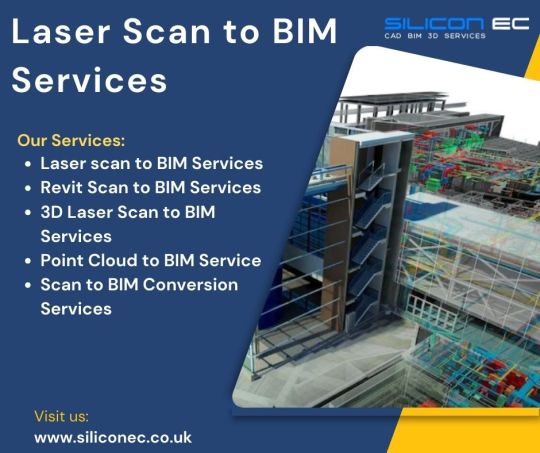
Silicon EC UK Limited offers comprehensive Laser Scan to BIM Services in Bristol, UK, catering to the evolving needs of the construction and architectural industries. Our experienced team of engineers and BIM specialists transforms raw scan data into intelligent 3D models, seamlessly integrating them into the BIM environment. Our team of experienced professionals utilizes state-of-the-art equipment to conduct comprehensive laser scans, generating highly detailed point clouds that serve as the foundation for creating accurate 3D models. Our services empower clients to streamline project planning, enhance construction coordination, and minimize errors, ultimately leading to improved project outcomes and cost savings. Our commitment to excellence, combined with a collaborative approach, ensures seamless communication and transparency at every stage of the BIM project.
Supports and software facility:
Our dedicated workforce comprises steadfast QC heads, proficient Team Leads, and experienced Engineers who possess extensive expertise. Our BIM Services adeptly utilize cutting-edge software, including AutoCAD, Tekla Structure, and Revit Structure, showcasing a commitment to staying at the forefront of technological advancements.
We are a BIM Engineering Company that presents BIM Engineering Services Bristol and other cities covering London, Liverpool, Manchester, York, Leeds-Bradford, Glasgow, Newcastle, Sheffield, and Sunderland.
Choose Silicon EC UK Limited for comprehensive Laser Scan to BIM Services in Bristol, UK, and experience the difference in precision, reliability, and innovation for your next Building project.
For More Details Visit our Website:
#Laser Scan to BIM Services#Revit Scan to BIM Services#3D Laser Scan to BIM Services#Point Cloud to BIM Service#Scan to BIM Conversion Services#Scan to BIM Services#BIM Services#Building Information Modeling Services#Building Information Modeling#BIM#BIM Services Bristol#BIM Engineering Services UK#BIM Services UK#Laser Scan to BIM Services Bristol#Scan to BIM Services UK#CAD Design#CAD Drafting#CAD Drawing#Engineering Services#Engineering Company#Engineering Firm
0 notes
Text
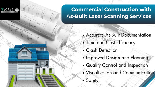
Commercial Construction with As-Built Laser Scanning Services
Want to enhance accuracy and efficiency of your commercial construction? Start using 3D Scanning for As-Builts. Our As-Built Laser Scanning for Buildings capture precise measurements and data, ensuring accuracy in your project documentation. With our expertise in As-Built 3D Scanning & Modeling Services, we transform point cloud data into detailed models and provide a comprehensive view of existing structures. Whether it's renovation, expansion, or facility management, our As-Built Measurement services guarantee the reliability for successful project outcomes. The future of construction documentation rests with our As-Built Laser Scanning for Buildings, where innovation meets precision for your commercial projects.
#tejjyinc#business#architecture#florida#maryland#as built drawing services#as built drawings#construction#Commercial As Built Services#Using 3D Scanning for As-Builts#As-Built 3D Scanning & Modeling Services#As-Built Laser Scanning for Buildings#As-Built Measurement
0 notes
Text
Revolutionizing Construction: The Power of 360 Field Documentation in Precision, Efficiency, and Collaboration
In the dynamic realm of construction, precision, accuracy, and effective communication are paramount. With the advent of cutting-edge technology, the construction industry has witnessed a revolutionary transformation in the way projects are documented and managed. One such groundbreaking innovation is 360-degree field documentation.

Definition of 360 Field Documentation in Construction
360 field documentation in construction refers to the comprehensive process of capturing visual and spatial data from all directions, creating a complete immersive view of a construction site or building interior. This is achieved through the use of specialized 360-degree cameras equipped with sensors capable of capturing images and depth information simultaneously. The result is a high-resolution, panoramic image that provides a complete visual record of the site.
Importance of Accurate Documentation in Construction Projects
Accurate documentation lies at the heart of successful construction projects. It serves as the foundation upon which decisions are made, progress is tracked, and issues are resolved. Traditionally, construction documentation involved extensive manual measurements, photographs, and written notes, which were not only time-consuming but also prone to errors. Inaccurate or incomplete documentation could lead to costly mistakes, delays, and disputes between stakeholders.
Brief Overview of 360-Degree Technology in Construction
360-degree technology, often associated with virtual reality, has found its application in construction through specialized cameras and sensors. These devices capture not only visual information but also depth data, allowing for the creation of accurate 3D models of the construction site. This technology eliminates the need for multiple photographs or measurements from different angles, providing a seamless and immersive experience for stakeholders involved in the project.
By embracing 360-degree technology, construction professionals can document their projects with unprecedented precision, leading to improved decision-making, enhanced collaboration, and streamlined workflows. In the following sections, we will delve deeper into the benefits, working mechanisms, applications, challenges, and future trends of 360 field documentation in construction, shedding light on its transformative potential in the industry.
Benefits of 360 Field Documentation
A. Improved Accuracy and Precision
Reduction in Errors and Rework: Traditional methods of documentation often led to errors in measurements and misinterpretation of data. 360 field documentation eliminates these errors by providing a holistic view of the construction site, enabling stakeholders to make precise decisions based on accurate visual data.
Enhanced Measurement Capabilities: 360-degree technology allows for accurate measurements of distances, areas, and volumes within the captured images. This level of precision is invaluable for tasks such as estimating material quantities, ensuring proper spacing, and validating adherence to architectural designs.
Time and Cost Efficiency
Streamlined Communication: 360 field documentation facilitates seamless communication among project teams. Stakeholders can remotely view the construction site in its entirety, reducing the need for on-site visits. This real-time access to visual data expedites discussions, approvals, and issue resolution, thereby saving valuable time.
Faster Decision-Making Process: Quick access to detailed 360-degree images and 3D models accelerates the decision-making process. Project managers, architects, and engineers can promptly assess project status, identify bottlenecks, and implement corrective measures, leading to faster project progression and reduced delays.
Enhanced Collaboration and Communication
Real-time Data Sharing: 360 field documentation allows stakeholders to share immersive visuals with team members, clients, and investors in real-time. This shared perspective fosters better understanding, enabling everyone involved to visualize the project comprehensively and contribute valuable insights.
Remote Collaboration Possibilities: With the rise of remote work, 360-degree technology enables professionals from different locations to virtually collaborate on projects. Architects can review designs, engineers can assess structural elements, and contractors can validate construction progress, all within a virtual environment, enhancing teamwork and productivity.
By harnessing the power of 360 field documentation, construction projects can significantly benefit from improved accuracy, efficiency, and collaboration, ensuring the successful execution of complex endeavors.
How 360 Field Documentation Works
Explanation of 360-Degree Cameras and Sensors
360-degree cameras used in construction are equipped with fisheye lenses capable of capturing images in all directions simultaneously. These cameras are complemented by advanced sensors, including accelerometers and gyroscopes, which ensure precise orientation data. Some cameras also feature LiDAR (Light Detection and Ranging) sensors, enabling the capture of detailed depth information, essential for creating accurate 3D models.
Data Capturing Process
Image Capturing: The 360-degree camera captures a series of high-resolution images, covering the entire construction site or interior space. These images overlap, ensuring seamless integration during the stitching process.
Data Stitching and Integration: Specialized software processes the captured images, stitching them together to create panoramic views. The integration of depth data obtained from LiDAR sensors enhances the precision of the resulting 3D models. These immersive visuals provide a comprehensive understanding of the construction site, enabling stakeholders to explore every detail remotely.
Software and Tools Utilized in 360 Field Documentation
Virtual Reality (VR) and Augmented Reality (AR) Applications: VR and AR applications allow stakeholders to immerse themselves in the 360-degree images. VR headsets provide an immersive experience, enabling users to navigate the construction site as if they were physically present. AR applications overlay relevant data on real-world views, aiding in on-site decision-making and problem-solving.
Cloud-Based Data Storage and Analysis Tools: Captured 360-degree images and 3D models are often stored in cloud-based platforms. These platforms offer secure storage and easy access to project data from anywhere with an internet connection. Furthermore, cloud-based tools facilitate collaborative analysis, enabling multiple stakeholders to annotate, measure, and comment on specific elements within the visuals, fostering efficient communication and data-driven decision-making.
By understanding the technical aspects of 360 field documentation, construction professionals can harness this technology to its full potential, ensuring accurate data capture, seamless integration, and meaningful analysis for their projects.
Applications of 360 Field Documentation in Construction
Progress Tracking and Monitoring
Visual Project Timeline Development: 360-degree images captured at various project stages provide a visual timeline of construction progress. Project managers can compare these visuals, ensuring that the project adheres to the planned schedule.
Monitoring Construction Milestones: Stakeholders can monitor the completion of significant project milestones, such as foundation laying, structural framing, and finishing touches. This real-time monitoring ensures that the project stays on track and allows for timely interventions if any delays occur.
Quality Control and Assurance
Identifying Defects and Issues: High-resolution 360-degree images enable close inspection of construction elements. Stakeholders can identify defects, structural issues, or deviations from the design plans, allowing for immediate corrective actions, thereby maintaining the quality of workmanship.
Ensuring Compliance with Design Specifications: By comparing the captured visuals with architectural and engineering designs, construction professionals can ensure that the built structures align with the specifications. Any discrepancies can be detected early, preventing costly rework and ensuring compliance with industry standards.
Safety Inspections and Risk Management
Hazard Identification: 360 field documentation aids in identifying potential safety hazards on construction sites. Safety professionals can use immersive visuals to pinpoint risks, plan safety protocols, and ensure that workers adhere to safety guidelines, thereby minimizing accidents and injuries.
Real-time Safety Protocol Monitoring: Construction sites are dynamic environments where safety protocols are crucial. 360-degree technology allows real-time monitoring of safety compliance. Safety officers can remotely observe workers' adherence to safety protocols and intervene promptly if unsafe practices are detected.
Challenges and Limitations
Technical Challenges
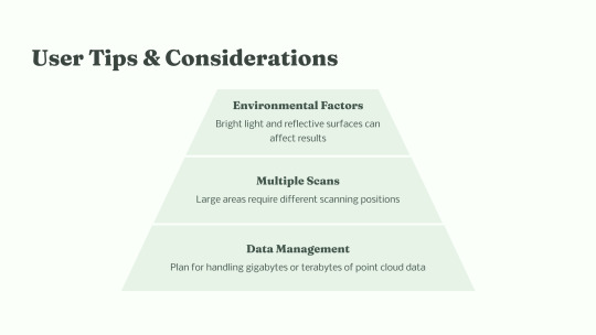
Data Storage and Management: Discuss the challenges related to storing and managing large volumes of high-resolution 360-degree images and 3D models. Explore solutions such as cloud-based storage and data compression techniques.
Hardware and Software Compatibility: Address compatibility issues that may arise between different 360-degree cameras, sensors, and software applications. Discuss the importance of standardized formats and interoperability in overcoming these challenges.
Privacy and Security Concerns
Data Privacy Regulations and Compliance: Explore data privacy regulations relevant to construction documentation. Discuss how stakeholders can ensure compliance with these regulations while sharing 360-degree images and project data securely.
Cybersecurity Risks: Highlight potential cybersecurity threats associated with cloud-based storage and data sharing platforms. Discuss encryption methods, access controls, and other cybersecurity measures that can mitigate these risks.
Training and Skill Development for Construction Professionals: Emphasize the need for training programs to educate construction professionals about 360 field documentation technology. Discuss the skills required to capture, process, and interpret 360-degree data effectively.
Future Trends and Innovations
Advancements in 360-Degree Technology
Integration with Artificial Intelligence (AI) and Machine Learning (ML): Discuss how AI and ML algorithms can analyze 360-degree images to automate tasks such as defect detection, progress tracking, and safety compliance monitoring. Explore the potential of AI-driven insights in enhancing project management.
Improved Data Processing Speeds: Highlight ongoing developments in data processing technology that enable faster stitching of 360-degree images and real-time rendering of 3D models. Discuss the impact of these advancements on project efficiency and decision-making speed.
Potential Impact on Construction Industry
Increased Adoption Rates: Predict the trajectory of 360 field documentation adoption within the construction industry. Discuss factors driving increased adoption, such as cost-effectiveness, improved project outcomes, and regulatory incentives.
Evolution of Construction Project Management Practices: Envision how 360-degree technology will shape the future of construction project management. Discuss how real-time data insights, immersive collaboration, and remote monitoring will become integral components of construction project management practices.
Conclusion
In conclusion, 360 field documentation stands as a transformative force in the construction industry. Its ability to provide accurate, immersive, and real-time visual data revolutionizes the way construction projects are planned, executed, and monitored.
By overcoming challenges, embracing innovations, and leveraging the full potential of 360-degree technology, construction professionals can enhance project outcomes, improve collaboration, and ensure the safety and quality of built environments. As the industry continues to evolve, the integration of 360 field documentation will undoubtedly play a pivotal role in shaping the future of construction practices.
Visit us: https://www.bimengus.com
#bim coordination services#360 field documentation#bimtechnology#laser scanning services#mep services#bim modeling services#clash detection#3d model
0 notes


