#Arapaho National Forest
Text
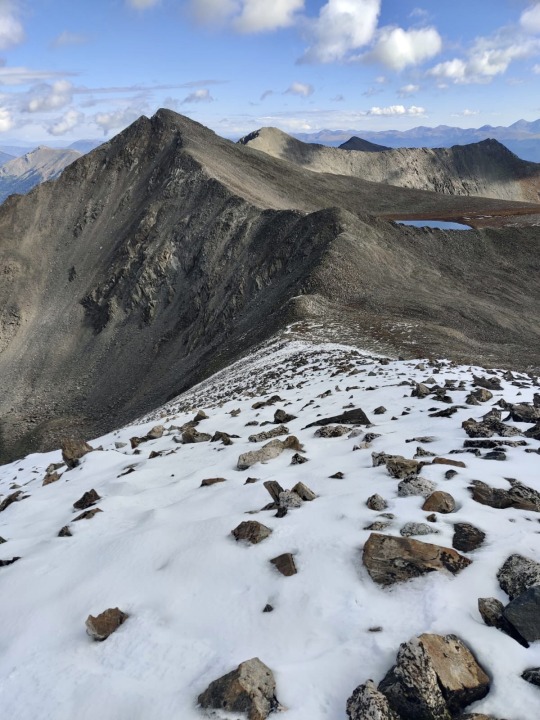
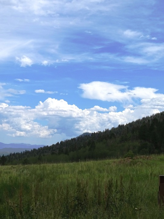
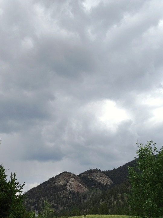
Mt. Pacific
Colorado
#mount pacific#pacific peak#mosquito range#Arapaho national forest#colorado#Rocky Mountains#mountain#mountain peak#summit#nature landscape#naturecore#nature#nature photography
20 notes
·
View notes
Text
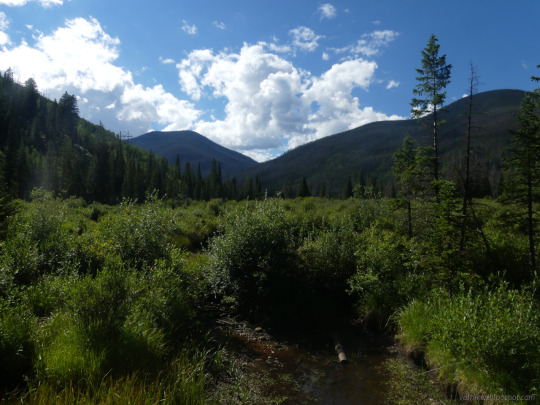


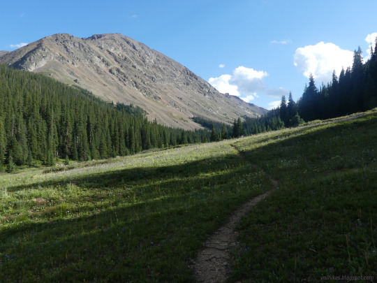

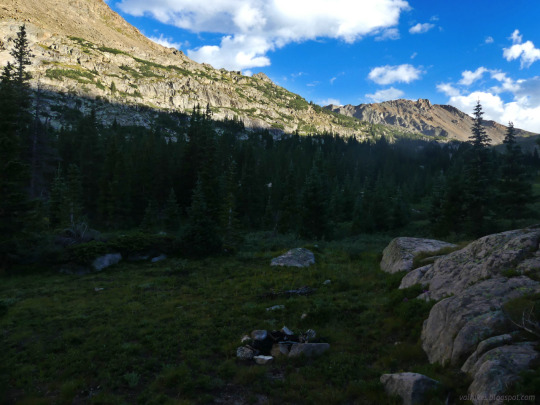
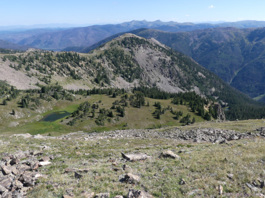
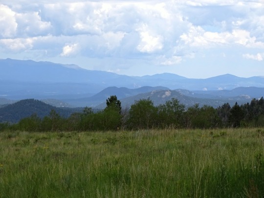
Arapaho National Forest, Colorado.
I went on a 3 day backpacking trip full of varied terrain and challenges, finishing with Ptarmigan Peak and a more successful attempt at Ute Peak.
This is the first day, canyons with soggy trails that was sometimes just a little bit missing.
#hiking#backpacking#outside#nature#nature photography#Colorado#Williams Fork#Arapaho National Forest#travel#landscape#hike#mountains#canyon#glacial canyon#South Fork Trail
4 notes
·
View notes
Text
7 Amazing Fall Hikes in Colorado
Fall is a fantastic time to explore Colorado’s natural beauty, and hiking is one of the best ways. If you’re searching for the most breathtaking hiking trails in the state, we’ve got you covered.
Here are seven of the best hiking trails you can explore this fall in Colorado. Each trail offers a unique experience, from towering mountains to stunning waterfalls and everything in between.
So, grab…

View On WordPress
#Arapaho National Forest#Archs Rock#backcountry#camping#Colorado#Colorado Trail#Denver#Dillon#Dillon Colorado#Durango#Empire#Estes Park#Falls hikes in Colorado#Family hikes#Fern Lake Trail#fishing#Flash of Gold Trail#Gem Lake Trail#Gore Range#hiking#Kenosha Pass#Mountain Biking#muntain biking#Pike National Forest#Piney River#Rocky Mountain National Park#Stanley Mountain#Stanley Mountain Trail#Steamboat Springs#Tenderfoot Mountain
0 notes
Text
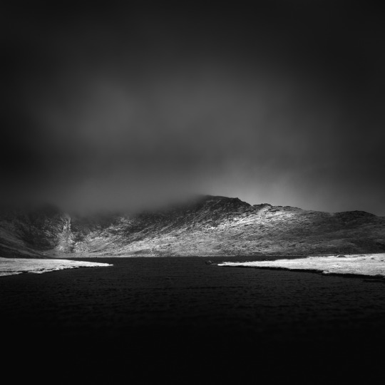
Summit Lake
Summit Lake (Elevation 12,380 ft), Arapaho and Roosevelt National Forests, Idaho Springs, Colorado, 2022 www.mabrycampbell.com #infraredphotography #landscapephotography #photography #fineartphotography #colorado #visitcolorado #viewcolorado #coloradolive #mabrycampbell #potd
Summit Lake (Elevation 12,830 ft)
Idaho Springs, Colorado, 2022
Summit Lake – Mabry Campbell
Photograph © 2022 Mabry Campbell
Mabry Campbell Photography: Website ⎟ Flickr ⎟ LinkedIn ⎟ Instagram
www.mabrycampbell.com
Fine art prints available through Catherine Couturier Gallery in Houston, Texas.
Catherine Couturier Gallery
2635 Colquitt Street
Houston, TX 77098
Tel: (713) 524-5070
Email:…
View On WordPress
#2022#Arapaho National Forest#black and white#Colorado#infrared#lake#landscape#mountain#Rocky Mountains#MabryCampbell#image#photography#photograph
1 note
·
View note
Text
The Transfer Seven (Rainbow High OCs) Bio 3: Sienna Goldfinch

COLOUR: Burnt gold
YEAR: Second
GENDER: Demigirl
FOCUS: Visual Arts & Photography
STYLE: Traditional. Regal. Artistic.
QUOTE: “Every picture’s worth a thousand words.”
BIO: Even though she’s always loved fashion, to Sienna nothing will ever be more beautiful than the natural world. Warm golden fields, watery blue skies, speckled bird’s eggs, delicate pink and orange flower petals—whatever it is, she’s determined to capture it all, with her lens or her paintbrush, and that’s how she became the camera and canvas queen of Black Forest High. She’s committed to her craft, meaning she’ll go out even in a blizzard just to get a perfect shot of a deep red holly branch against a fresh white snowfall. Now a rising star of the visual arts at Rainbow High, Sienna may be far away from her home and family, but she’ll never forget her roots, and she proudly incorporates traditional Cheyenne Native American symbols and motifs into her personal style.
OTHER:
-She’s definitely an introvert, preferring to be left alone with her paintings, but she still participates in school events for the sake of appearances and social standing.
-Her age is 16.
-Born in Colorado, she’s of the Cheyenne (on mom’s side) and Arapahoe (on dad’s side) nations.
-Wide open landscapes are Sienna’s favourite subject of painting and photography. Though she’ll occasionally do paintings/photos of small detail (like a single flower or a ladybug on a pebble), she mostly likes to go big (fields, mountains, forests) and capture the full beauty of the natural world.
-Of all the transfers, she’s closest with Coral, her roommate.
-She’s a passing acquaintance of Emi Vanda, and appreciates her dry wit.
-Though Sienna mostly keeps to herself, she’s good at talking and making friends one-on-one, and if someone looks lonely in the halls or at lunch, she’ll go over and introduce herself but allow the person to open up on their own terms.
-When it comes to drama, she hates to be in it but loves to watch.
8 notes
·
View notes
Photo

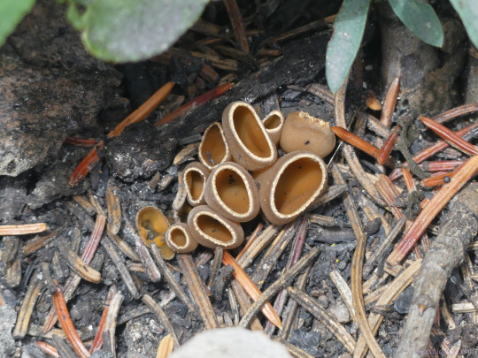
Crinkled snow lichen (Flavocetraria nivalis) in Arapahoe National Forest, Colarado, USA
by Ron Wolf
#fungi#mycology#lichens#Flavocetraria nivalis#flavocetraria#Parmeliaceae#Lecanorales#Lecanoromycetes#ascomycota
35 notes
·
View notes
Photo
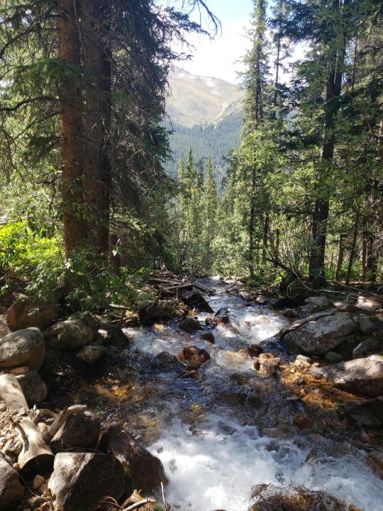
A small stream in the Arapaho National Forest, Colorado [4032x3024] [OC]
13 notes
·
View notes
Note
was a trail worker last summer in CO and spent four hours scrolling ur blog after I read the comic - idk what I came here to say other than thank you for making it was so nice to see something evocative of my experience and then to see all your lovely posts about outdoor work anyway highlight of my day so thank you I got the itch back gonna pick up a tool or sm btw just to weigh in on the tool debates pick maddock number one hands down I love him so much McLeod don’t hate him but don’t love the person who picks it first ykw I’m sayin ok also it’s spring where I am now and the daffodils are out and here’s a pic of a crab spider I think that’s what they’re called they’re all over the daffodils I think that’s they’re house hah
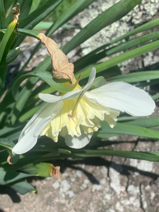
HELLO! I love this ask, I'm so glad you recognized our shared experiences in that comic! ♥️ What part of Colorado? I was up near the Arapaho & Roosevelt National Forest for a bit. I can respect the pickmattock, she has seen me through many a boulder removal. Or been my champion in battles with bedrock. Also I LOVE crab spiders I think they're so pretty... especially the little white and yellow ones. Gorgeous little guy.
10 notes
·
View notes
Conversation
U.S. Daily Low Temperature Records Tied/Broken 5/30/22
Unincorporated Pima County, Arizona: 41 (previous record 47 1953)
Cooskie Mt. summit, California: 36 (also 36 2000)
Ladder Butte summit, California: 29 (previous record 30 1990)
Unincorporated Lassen County, California: 26 (also 26 2011)
Unincorporated Lassen County, California: 31 (also 31 1998)
Unincorporated Mendocino County, California: 42 (also 42 2000)
Unincorporated Modoc County, California: 25 (previous record 31 2011)
Unincorporated Riverside County, California: 50 (previous record 52 2021)
Round Mt. summit, California: 31 (also 31 1991)
Unincorporated Siskiyou County, California: 36 (previous record 38 1991)
Unincorporated Siskiyou County, California: 27 (previous record 31 2011)
Six Rivers National Forest, California: 42 (also 42 1996)
Tulelake, California: 27 (also 27 2011)
Arapaho National Forest, Colorado: 24 (also 24 2019)
Copper Mt. summit, Colorado: 22 (also 22 2004)
Gunnison National Forest, Colorado: 29 (also 29 2010)
Unincorporated Mesa County, Colorado: 36 (also 36 2004)
White River National Forest, Colorado: 27 (also 27 2004)
Unincorporated Baker County, Florida: 47 (previous record 52 1988)
Unincorporated Cassia County, Idaho: 33 (also 33 2010)
Unincorporated Owyhee County, Idaho: 39 (previous record 41 2006)
Salmon, Idaho: 25 (previous record 29 1979)
Unincorporated Washington County, Idaho: 38 (previous record 41 2000)
Custer National Forest, Montana: 26 (previous record 27 1979)
Unincorporated Eureka County, Nevada: 27 (previous record 28 1998)
Fox Mt. summit, Nevada: 25 (previous record 28 2011)
Unincorporated Humboldt County, Nevada: 31 (previous record 34 1998)
Unincorporated Humboldt County, Nevada: 27 (previous record 29 1991)
Unincorporated Lincoln County, Nevada: 33 (also 33 2011)
Spruce Mt. summit, Nevada: 30 (previous record 31 1998)
Unincorporated White Pine County, Nevada: 22 (also 22 1985)
Chiloquin, Oregon: 27 (also 27 1988)
Unincorporated Deschutes County, Oregon: 26 (previous record 28 2011)
Fremont National Forest, Oregon: 23 (previous record 25 1988)
Unincorporated Harney County, Oregon: 27 (previous record 29 1988)
Unincorporated Harney County, Oregon: 25 (also 25 2000)
Hart Mt. National Antelope Refuge, Oregon: 17 (previous record 22 1974)
Unincorporated Jackson County, Oregon: 35 (previous record 36 2000)
Unincorporated Jefferson County, Oregon: 23 (previous record 24 1978)
Unincorporated Jefferson County, Oregon: 31 (also 31 1988)
Unincorporated Klamath County, Oregon: 26 (also 26 1988)
Unincorporated Klamath County, Oregon: 25 (previous record 30 2013)
Unincorporated Lake County, Oregon: 24 (also 24 1996)
Unincorporated Lake County, Oregon: 22 (previous record 27 2011)
Unincorporated Malheur County, Oregon: 37 (also 37 2000)
Morgan Mt. summit, Oregon: 34 (previous record 36 2000)
Ochoco National Forest, Oregon: 7 (previous record 27 1991)
Prineville, Oregon: 30 (also 30 1988)
Riddle Mt. summit, Oregon: 25 (previous record 28 1991)
Unincorporated Sherman County, Oregon: 34 (also 34 1991)
Unincorporated Sherman County, Oregon: 39 (also 39 1991)
Willamette National Forest, Oregon: 31 (also 31 1988)
Winema National Forest, Oregon: 23 (previous record 25 2000)
Altamont, Utah: 26 (previous record 27 1979)
Canyonlands National Park, Utah: 36 (also 36 1988)
Unincorporated Carbon County, Utah: 23 (also 23 2011)
Cedar City, Utah: 29 (previous record 31 2007)
Ephraim, Utah: 26 (previous record 30 2007)
Grand Staircase-Escalante National Monument, Utah: 24 (previous record 25 1988)
Unincorporated Iron County, Utah: 29 (also 29 2011)
Marysvale, Utah: 28 (also 28 1979)
Scofield, Utah: 25 (also 25 2011)
Unincorporated Tooele County, Utah: 31 (also 31 2006)
#U.S.A.#U.S.#Arizona#1950s#Colorado#Florida#1980s#Idaho#1970s#Montana#Nevada#Oregon#Utah#1990s#Crazy Things#Awesome
2 notes
·
View notes
Text
0 notes
Text
Guanella Pass, Arapaho Roosevelt National Forest, Colorado // kkart
Get lost in the scenic wonders of Guanella Pass, nestled in the picturesque Arapaho Roosevelt National Forest, Colorado. Photo credit: kkart.
0 notes
Text

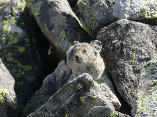
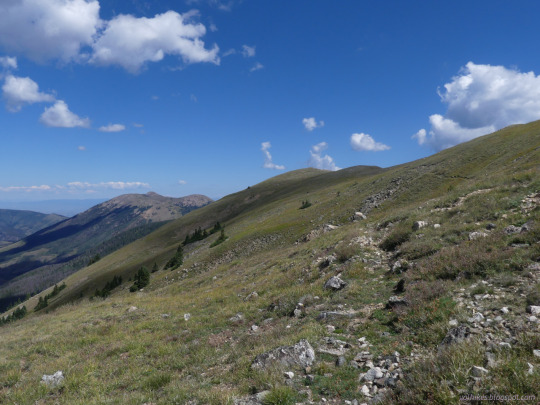

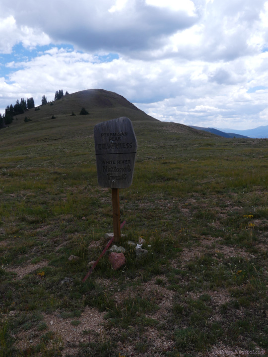


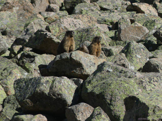
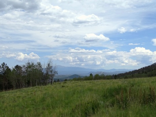
Arapaho National Forest, Colorado.
I went on a 3 day backpacking trip full of varied terrain and varied challenges, finishing with Ptarmigan Peak and a more successful attempt at Ute Peak.
This is the third day, a long ridge walk through alpine meadow with not so well defined trails and insufficient cairns to mark them.
#hiking#backpacking#nature#nature photography#loop hike#Ptarmigan Peak Wilderness#Colorado#Arapaho National Forest#landscape#travel#hike#outside#mountains#peak bagging#peakbagger#Ptarmigan Peak#Ute Peak#Ute Peak Trail#wildlife#pika#ridge walk#alpine meadow
3 notes
·
View notes
Text
Guanella Pass, Arapaho Roosevelt National Forest, Colorado // kkart

Immerse yourself in the tranquility of Guanella Pass, a hidden gem within Arapaho Roosevelt National Forest, Colorado. Captured by kkart.
0 notes
Photo


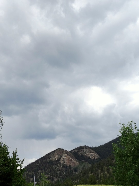

Wilkerson Pass, CO (No. 4)
Pikes Peak is the highest summit of the southern Front Range of the Rocky Mountains in North America. The ultra-prominent 14,115-foot (4,302.31 m) fourteener is located in Pike National Forest, 12 miles (19 km) west of downtown Colorado Springs, Colorado. The town of Manitou Springs lies at its base.
The mountain is named in honor of American explorer Zebulon Pike (though he was unable to reach the summit). The summit is higher than any point in the United States east of its longitude.
The band of Ute people who called the Pikes Peak region their home were the Tabeguache, whose name means the "People of Sun Mountain". Tava or "sun", is the Ute word that was given by these first people to the mountain that we now call Pikes Peak. It is thought that the Ute people first arrived in Colorado about 500 A.D., however their oral history states that they were created on Tava. In the 1800s, when the Arapaho people arrived in Colorado, they knew the mountain as Heey-otoyoo' meaning "Long Mountain".
Throughout its history, European peoples have called the mountain El Capitán, Grand Peak, Great Peak, James Peak, Long Mountain, and Pike's Peak.
Early Spanish explorers named the mountain "El Capitán," meaning "The Leader". American explorer Zebulon Pike named the mountain "Highest Peak" in 1806, and the mountain was later commonly known as "Pike's Highest Peak." American explorer Stephen Harriman Long named the mountain "James Peak" in honor of Edwin James who climbed to the summit during Long's Expedition of 1820. The mountain was later renamed "Pike's Peak" in honor of Pike. The name was simplified to "Pikes Peak" by the United States Board on Geographic Names in 1890.
Source: Wikipedia
#Front Range#Wilkerson Pass#Pikes Peak#Rocky Mountains#landscape#Pike National Forest#Park County#countryside#nature#flora#tree#fir#pine#aspen#alpine meadow#original photography#tourist attraction#USA#landmark#Colorado#Mountain West Region#blue sky#clouds#travel#vacation#summer 2022#rock#overcast
1 note
·
View note
Photo

A small stream in the Arapaho National Forest, Colorado [4032x3024] [OC] https://ift.tt/nm6MivD
0 notes
Text
3D Real Estate - Colorado Agricultural Land For Sale
3D Real Estate - Colorado Agricultural Land For Sale
Jefferson County
Jefferson County, or “Jeffco,” is a thriving business, industrial, recreational and residential community west of Denver. Named after Thomas Jefferson, the nation’s third president, Jeffco’s majestic landscape combines prairie grasslands and craggy rock formations with rugged mountains and tumbling mountain streams.
The county is home to a mix of mom-and-pop shops and major corporations, including Lockheed-Martin. Coors Brewery in Golden, two medical centers and Terumo BCT are additional significant employers.
The county’s nationally recognized Open Space program offers an extensive range of outdoor recreational activities. Jefferson County also contains parts of three national forests, including Pike and Roosevelt, as well as Golden Gate Canyon State Park. All offer miles of trails and spectacular backcountry hiking terrain.
Arapahoe County
As one of Colorado’s fastest growing counties, Arapahoe is home to vibrant urban, suburban and rural communities. Its 805 square miles encompass a diversity of cultures and lifestyles, with unparalleled open space and trails, major employment centers and a robust multimodal transportation network.
Arapahoe County residents take great pride in their community. They are committed to ensuring their children get the best possible education, embracing the outdoor opportunities that are a hallmark of the area and supporting local businesses.
The county is home to 13 cities and towns, 450 local improvement districts and nine school districts, and boasts one of the lowest property tax mill levies in the state. Its County government keeps only 15 percent of the funds it collects for itself, allowing most of the rest to go to schools, towns and special districts like fire and water.
Boulder County
Boulder County occupies only a hundredth part of the State of Colorado, but it is packed wonderfully full of the most varied and important material resources. Here are vast stores and great variety of building-stone, grindstone, limestone, gypsum and pottery clays; coal measures; and unsurpassed agricultural, horticultural and grazing lands.
Early settlement/pioneer agriculture developed in a very compressed time period, transforming wild prairie grassland into communities of farmers and ranchers. This was a period of growth in farming that experienced increased specialization, mechanization and national and international markets for farm products. Since the 1960s, the City of Boulder has emphasized preservation of local agriculture through its Open Space Program.
Denver County
Located along the Rocky Mountains, Colorado has become known for its picturesque vistas and diverse recreational opportunities. The state is also home to a number of fascinating businesses, from aerospace and JavaScript coding to tourism and education. Its cities offer residential communities with cozy beds on suburban roads, and the state’s economy continues to grow.
Investing in ranch land or Agricultural Land for sale Colorado can be a great way to build your equity and create long-term wealth. However, before purchasing land, prospective investors should carefully consider its suitability for the intended use. This can include assessing its zoning restrictions and soil suitability. Additionally, buyers should be aware of additional fees that may be associated with the purchase of farmland. These costs can include excavation and grading. These fees should be factored into the overall price of the property.
Adams County
Located in northeastern Colorado, Adams County surrounds Denver International Airport and is home to many thriving communities. Its borders extend from Weld and Morgan Counties on the north, Washington County on the east, Arapahoe County on the south, and Jefferson and Denver counties to the west and northwest. Its central section consists of mostly crop and grazing land.
The county seat is Brighton. Its population was 441,603 as of 2010. Adams County is named for Alva Adams, Governor of the State of Colorado. It began keeping birth records in 1902-06, marriage records in 1902, and death records in 1902-08. The county also kept court records in 1902-06. This week the county and city of Brighton teamed up to preserve 79 acres of farmland in Historic Splendid Valley, a region near the airport.
Why Choose 3D Real Estate When Buying Real Estate in Colorado
Our professional real estate brokers help people support their agriculture and development goals. We aim to help anyone have a smooth buying-selling property transition and make their experience a memorable one. We value everyone’s interests and dreams, ensuring your goals and expectations are met and exceeded. Through our years of experience and knowledge of real estate investing in Colorado, and market conditions, we want to help you maximize your investment.
We Make It Easier for You to Find Commercial Real Estate in Colorado
Finding the right commercial real estate broker in Colorado doesn’t have to be a daunting task. 3D Real Estate has the passion, mission, and experience you need to make it easier to find your next property in Colorado. Our professional real estate brokers update property buyers or sellers on the latest market conditions and always communicate with you. This will give anyone peace of mind, knowing their property is handled carefully while keeping their best interest in mind.
Contact us to learn how we can help make it easier for you.
3D Real Estate Brokered
Address : 2679 W. Main Street, #300-723 Littleton, CO 80120
Phone : 303-548-9659
Email : [email protected]
Website : https://3drealestate.co/
0 notes
Last Seen Blogs

doy127
¿

sadwsocc
Best Boys Re: Blog

birkacesyanvardibende-blog
Ağlamam zaman aldı

truking90
G. O. A. T.

vespertin-y
i think about kokichi ouma every day of my life _(:」∠)_