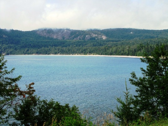
#Lake Huron Ojibwa
Text
Researchers say newly discovered archival records reveal an important connection between Ontario First Nations and Irish famine victims.
The Irish Potato Famine was a period of starvation and disease in Ireland, and one of the most traumatic events in modern Irish history. Year after year, the country's potato crop failed. By the time the worst was over, one million people had died of disease and starvation. Survivors were forced to emigrate. In the summer of 1847, Toronto gave refuge to 38,000 Irish famine victims — at a time when Toronto's population was only 20,000.
The part of this history that is virtually unknown is the contribution to the relief fund from Indigenous communities in Canada.
"At least 15 bands answered the call and requested that donations be deducted from their government annuities, added to the fund, and then sent to 'our suffering fellow subjects and Christian brethren in Ireland and Scotland,'' according to Mark McGowan's research. McGowan is a professor of history at the University of Toronto and has spent time going through the archival documents. [...]
Continue Reading.
Tagging: @politicsofcanada
#cdnpoli#First Nations#Foreign Policy#Ireland#Indigenous politics#Indigenous history#Ontario#Mohawks#Haudenosaunee#Chippewa#Delaware#Wyandotte#Mississauga#Saugeen#Lake Huron Ojibwa#Moravian Ojibwa
210 notes
·
View notes
Text

A few Fresnel lenses from my visit to the National Museum of the Great Lakes! This one is a fourth-order lens from the lighthouse on Ojibwa Island, Lake Michigan, made in 1891.
A cute little fifth-order lens, which was used in Sandusky Harbor, Ohio, in 1891.
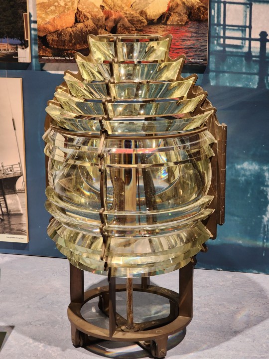
No first-order Fresnel lenses were used on the Great Lakes, and only five second-order lenses were placed. One of them was in the Spectacle Reef Lighthouse on Lake Huron in 1873, now in the museum:


My photography doesn't give a true sense of scale; that second-order lens is huge.
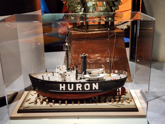
There is also a model of the lightship Huron, which is now a museum ship you can visit.
#great lakes#lighthouse#fresnel lens#naval history#age of sail#age of steam#national museum of the great lakes#lightship
435 notes
·
View notes
Text
Today we venerate Elevated Ancestor & Saint to many, War Chief Obwandiyag aka Pontiac on the 254th anniversary of his passing 🕊

A true legend among Great Lakes Nations leaders, Chief Obwandiyag is a Chief of Ottawa Nation and is a go-to for matters of justified warfare & diplomacy toward self-liberation. He is the great orator & mastermind who corralled several Great Lakes Nations in a major rebellion against thousands of British colonizers invading Turtle Island in what became known as, "Pontiac's War".
After their victory over the French, British Europeans began to infringe upon Indian-French trade routes & invade their land. This angered the Nations and quelled their contempt. Shortly after earning the title of War Chief, Obwandiyag became the honored head of The Council Of Three [Tribes] (the Ottawa, Potawatomi, & Ojibwa) in 1755. In 1762, he enlisted 18 bands across the Three Tribes (and the nearby Peoples of the Huron Tribe) to attack the British Fort Detriot nearest them (in present day Michigan), thus eliminating the British settlements in their territories by 1763. On May 7th 1963, War Chief Pontiac led an army of 300 warriors armed with weapons sheathed in blankets to lay seige on the fort in an attempt to catch them by surprise. They were met with an army of 120 British soliders braced for attack; their commander had received intel of the impending attack. War Chief Pontiac withdrew his army then returned two days later to lay seige on the fort in which they successfully captured & killed many British colonizers.
While War Chief Pontiac's army grew to 900+ warriors across 6 Tribes to drive the British from their lands, he dispatched messengers to other Tribal bands to attack other British forts & settlements across the region. Over the course of several weeks, they encircled the fort, blocking access to supplies & reinforcements. On July 31st, British troops attempted to break Chief Obwandiyag's hold on the fort at his encampment 2mi east in what became known as, the Battle of Bloody Run. Pontiac had been alerted of the attack & successfully killed 20 British soldiers, wounded 34 more - including a British Caption. This spurred the $200 bounty on War Chief Pontiac's head.
After months of battling back persistent waves of British Troops attempting liberate the fort, Chief Obwandiyag eventually withdrew to Illinois country; where 8 of the 12 British forts had been successfully destroyed. Pontiac continued to encourage resistance to the colonizing invaders over the next year, but suffered a blow when the French eventually began to back the British. In 1764, the British petitioned War Chief Pontiac to end his war.
In July 1766, he agreed to the Peace Treaty in Illinois Country. Though Pontiac's War was at an end, his success & influence drew the ire of some other Indian leaders who began to question the expanse of his authority. Chief Obwandiyag was increasingly ostracized. This led to his assassination by a nephew of Chief Makatchinga, a Peoria of the Illinois Confederation. Unfortunately, this spurred more violence & division between both nations and the eventual loss of their strongholds against their once common enemy.
We remember Chief Obwandiyag as more than a great leader of the Ottawa Nation. He was a titan & a hero who fought relentlessly for this sacred land and it's Indigenous protectors. He's seen the devil in a thousand eyes that met the blade of his ax, and he knows what it takes to unify the hearts of nations to beat as one while combating the legacy of White Supremacy that persists like a thorny weed in our side to this day.
"They came with a Bible and their religion. They stole our land and crushed our spirit, and now tell us we should be thankful to the Lord for being saved." - War Chief Obwandiyag
We pour libations & give Chief Obwandiyag his 💐 today as we honor him for his prowess, leadership, & cleverness that united Nations of Tribes & Bands against colonizing European entities to preserve the sancity of the land we stand on & to protect the Spirits of Earth. May be a beacon for those seeking organized self-defense to continue the fight against the legacy of White Supremacy.
Offering suggestions: tobacco/sweetgrass smoke, libations of water, & Ottawa Nation war drum music
*Note: offering suggestions are just that & strictly for veneration purposes only. Never attempt to conjure up any spirit or entity without proper divination/Mediumship counsel.
#hoodoo#hoodoos#the hoodoo calendar#libations#Ancestors#elevated ancestors#Hoodoo Saints#chief obwandiyag#Obwandiyag#Pontiac#chief Pontiac#Ottawa Nation#Ottawa Indians#the great lakes#great lakes nations#Pontiac's War#first Nations#first Nations history#Indigenous
26 notes
·
View notes
Text
The Great Lakes acronym spells homes
I chose titled topic by a fanciful whim,
nevertheless still consider my knowledge
of aforementioned material slim.
Housing multivarious biomes
register ecological syndromes
whereby constituents of NOAA
Great Lakes Environmental
Research Laboratory writ tomes.
Pellucid pearls in northeastern
North America since planetary birth
Comprise Lakes Superior, Michigan,
Huron, Erie, and Ontario dearth
Largest group of freshwater lakes on Earth
Straddle Canadian–United States border
tethering partial global girth
Constituting 21% of world's surface
freshwater species hearth
Total surface equals 94,250 square miles
And total volume equals 5,439
cubic miles immeasurable worth.
Lake Erie from Erie tribe, abridged form
of Iroquoian word erielhonan “long tail”
Lake Huron named by French explorers for
Wyandot or “Hurons” whence they did sail
Lake Michigan likely from Ojibwa word
mishigami “great water” aka outsize gold quail
Lake Ontario i.e. “Lake of Shining Waters”
shimmering like hammered coat of mail
Lake Superior coined from French “lac supérieur”
"upper lake", an emerald watery dale
Ojibwe people called it gitchigumi medicinal
to cure that, which might ail.
These five lakes each reside in separate basin
Form a single, naturally interconnected body
of fresh water caisson
Linking east-central interior of North America
to Atlantic Ocean akin to an escutcheon.
From interior to outlet at St. Lawrence River,
Water flows via Superior to Michigan-Huron
southward to Erie to avoid a shiver
Finally released northward to Lake Ontario
as like a well taut archer with his quiver.
The lakes drain a large watershed via many
rivers as an Olympic team
Populated with approximately 35,000 islands
this estimate not x stream.
The Great Lakes region contains many
thousands of smaller lakes,
Often called inland lakes undulating in
delving, cascading and brimming
analogous to a fluid ream
Lake Michigan the only one located
entirely within United States
While the others border between United States
and Canada – essentially a liquid seam.
Lakes Michigan and Huron
are basically a single lake,
Sometimes called Lake Michigan-Huron,
combined doth make
Total area of 45,300 square miles (117,000 km2)
Have the same surface elevation of 577 feet (176 m),
Connected by 295-foot deep Straits of
Mackinac Islands splayed like a rake.
Approximately 35,000 islands
extant throughout oceanic like sea
Largest among them
Manitoulin Island in Lake Huron
brushing up against Goliath knee.
The second-largest island is Isle Royale in
Lake Superior to boot
Both these islands
contain multiple lakes themselves
alive with creatures that hoot.
Unadulterated details gleaned courtesy
Mister Google, which website
buried under virtual sediment:
The Saint Lawrence Seaway
and Great Lakes Waterway connect
the Great Lakes to ocean-going vessels.
The move to wider ocean-going container ships —
which do not fit through the locks on these routes —
has limited container shipping on the lakes.
Most Great Lakes trade constitutes bulk material
and bulk freighters of Seawaymax-size
or less can move throughout
the entire lakes and out to the Atlantic.
The Great Lakes also connected
to the Gulf of Mexico
by way of the Illinois River
(from the Chicago River)
and the Mississippi River.
An alternate track is via the Illinois River
(from Chicago), to the Mississippi,
up the Ohio, and then
through the Tennessee-Tombigbee Waterway
(combination of a series
of rivers and lakes and canals),
to Mobile Bay and the Gulf.
Commercial tug-and-barge traffic
on these waterways quite heavy.
Pleasure boats can also enter or exit
the Great Lakes by way of
the Erie Canal and Hudson River in New York.
The Erie Canal connects to the Great Lakes
at the east end of Lake Erie
(at Buffalo, New York)
and at the south side of Lake Ontario
(at Oswego, New York).
The Great Lakes contain 21%
of the world’s fresh surface water:
5,472 cubic miles (22,810 km3),
or 6.0×10¹⁵ U.S. gallons (2.3×10¹⁶ liters).
This equals enough water
to cover the 48 contiguous U.S. states
to a uniform depth of 9.5 feet (2.9 m).
Although the lakes contain
a large percentage of the world's fresh water,
the Great Lakes supply only a small portion
of U.S. drinking water
on a national basis (roughly 4.2%).
Winter 2009–10 ranked somewhat mild,
the precipitation was below normal
for the Great Lakes Basin.
Mean lake levels then thought
to be slightly below
or at their levels of 2009.
An ice jam in February 2010
dropped the level in Lake St. Clair.
Since the jam got removed the level
has come back to its average.
As of March 2010, the lakes
were at the level, or slightly below,
where they were in March 2009.
The combined surface area
of the lakes equals approximately
94,250 square miles (244,100 km2)—
nearly the same size as the United Kingdom,
and larger than the U.S. states of New York,
New Jersey, Connecticut, Rhode Island,
Massachusetts, Vermont,
and New Hampshire combined.
The Great Lakes coast measures
approximately 10,500 miles (16,900 km);
however, the length of a coastline
impossible mission to measure exactly
cuz topographical feature not well-defined.
0 notes
Photo


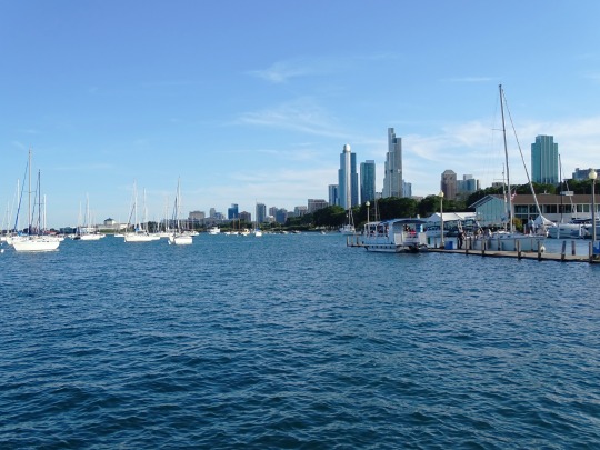
Great Lakes Awareness Day
Great Lakes Awareness Day celebrates the Great Lakes and highlights the issues they face, and how the lakes can be preserved. Events for the day have involved organizations such as schools, aquariums, and museums. There is not much information available online about how the day is celebrated or how it came to be.
There are five Great Lakes: Superior, Huron, Michigan, Ontario, and Erie. Together they make up the largest body of freshwater on Earth and stretch 750 miles from east to west. They are located on the border of the United States and Canada and touch the states of Michigan, Wisconsin, Minnesota, Illinois, Ohio, Indiana, New York, and Pennsylvania. It is believed that at one time the Great Lakes were covered by a glacier—it receded towards Canada and left depressions filled with water.
Lake Huron is named after the Wyandot Indians, also known as the Huron Indians, and its surface area is the second largest of the lakes. Manitoulin Island is located in it—the largest island in a freshwater lake in the world. Lake Huron connects to Lake Michigan by the Straits of Mackinac. Lake Michigan takes its name from the Ojibwa word for “large lake.” It is the third largest Great Lake in surface area, and the second largest in volume. It is the only Great Lake completely in the United States.
Lake Erie’s name comes from the Iroquoian word for “long tail.” It is the fourth largest Great Lake in surface area, but the smallest in volume. It is very shallow, averaging just 62 feet in depth. Lake Ontario takes its name from the Huron word for “lake of shining water.” It has the smallest surface area of the Great Lakes, but is very deep, holding four times the volume of water as Lake Erie. Lake Erie and Lake Ontario are connected by the Niagara River, on which Niagara Falls is located. Lake Superior is the largest Great Lake in surface area and volume, and it is the deepest of the lakes, reaching a depth of 1,332 feet. Its name comes from the French word for “upper lake,” and fittingly, it is the farthest north of the Great Lakes.
Vessels from the United States and Canada haul about 125 million tons of cargo on the lakes each year. They haul mined materials such as iron ore, coal, stone, and salt; agricultural products such as wheat, corn, soybeans, and oats; as well as other materials. About 3,500 species of plants and animals live in the Great Lakes Basin, including over 170 species of fish. The lakes are a large freshwater fishery, being a home for species such as salmon, trout, perch, walleye, bass, and herring.
The Great Lakes face many issues, such as pollution and invasive species, illustrating why a day is needed to raise awareness about them. Over 140 federal programs for environmental restoration and management take place on the Great Lakes. Amendments to the Clean Water Act were made in 1972, helping regulate water pollution in the lakes. The Great Lakes Quality Act, also from 1972, was signed by the United States and Canada to help protect and restore the Great Lakes.
How to Observe
See if any organizations or places near you are holding any events on the day. Learn about issues the Great Lakes face, and find ways to get involved to protect the lakes. Plan a trip to explore some of the wonders of the Great Lakes. Maybe you could even explore the lakes while driving one of the Great Lakes Circle Tours. It is believed that about 6,000 ships have sunk in the Great Lakes, with about 30,000 lives lost. You could spend the day learning about some of the shipwrecks by visiting the Great Lakes Shipwreck Museum. One of the most famous ships to have sunk is the SS Edmund Fitzgerald, which sank in a storm in Lake Superior on November 10, 1975, with all 29 of its crew members perishing. It was immortalized in song by Gordon Lightfoot.
Source
#Great Lakes Awareness Day#GreatLakesAwarenessDay#2 May 2022#travel#Monday of the first full week in May#Chicago#Lake Michigan#Illinois#USA#Great Lakes Region#Midwestern USA#Lake Superior#Ontario#Canada#Lake Ontario#Toronto#2012#summer 2015#2016#Toronto Islands#view#cityscape#landscape#seascape#architecture#tourist attraction#landmark#original photography#beach#driftwood
0 notes
Text
Spotlight: Washington Island
Washington Island rests off the tip of Wisconsin’s Door Peninsula in Lake Michigan. With an area of 35 square miles, it is the largest of the thirty islands in Door County, Wisconsin. While Washington Island is the largest in the county, it is actually part of a small island neighborhood just off of Wisconsin’s “thumb.” This island is made up of Plum Island, Detroit Island, Hog Island, Pilot Island, and Rock Island. Rock Island, just west of Washington Island, is Wisconsin’s only State Park located on an island. All of these islands dot the strait that connects Green Bay (often called “the Bay of Green Bay” by the residents of the city that bears the same name) to the rest of Lake Michigan. Although it’s only six miles wide, this strait was named “Porte des Morts” by French explorers. Now known by the English version of its name, Death’s Door is home to very turbulent currents. These currents, coupled with the strong winds of the Great Lakes, make for a dangerous passage.

Image from Google Maps, 2020. Pilot and Hog Island labels added by myself.
For a long time, Washington Island was an island of many names. The earliest known name for Washington Island is Wassekiganeso, an Ojibwa term meaning “his breast shining.” The Ojibwa name refers to the sun reflecting off of the limestone cliffs that are found on the island. While the history of Washington Island goes back thousands of years, the written history of the island was started by the French who explored the Great Lakes.
The French often referred to the islands found in Death’s Door as a group, opting not to name each individual island. The name of the island neighborhood changed depending on which group of Native Americans were found inhabiting the island. From 1650 to 1816 the most common name used was “Potawatomi Islands,” referring to the Potawatomi who usually inhabited the area at the time. The Potawatomi first came to the island group (as in, the first time the Potawatomi were recorded as the islands’ inhabitants by the French) around 1641.
Two other common names for the island group were the “Huron Islands” and “Noquet Islands.” Jesuit records used Huron Islands name in the early 1670’s and the islands were sometimes referred to as “Noquet Islands” after a small group of Ojibwa that lived just north of the island chain in Big Bay de Noq.
In the late 1600’s Robert La Salle makes his debut in the history of Washington Island. La Salle, a French explorer, was the owner of a flourishing fur-trade business. The fur trade was a lucrative business at this time as the demand for fur pelts in Europe grew. As part of his fur business, La Salle built a boat called the Griffin to bring fur pelts back to Europe. La Salle and the Griffin would not make much of a profit, however, as after the boat set off in 1679 neither were ever seen again.
In 1816 news broke that a new military fort was to be built at Green Bay, just a little further down the Door Peninsula from Death’s Door’s islands. As four ships made their way to the new Fort Howard, the Schooner Washington (the largest and flagship of the small fleet) was separated from the other three ships. The crew of the Washington anchored in what is now Washington Harbor on Washington Island to wait for the other ships. As they waited, the crew explored the island and decided to name the harbor they anchored in after President Washington, who had only recently died at this time. The crew also gave names to other islands in the area, opting to name them after other members of the fleet’s party. These names did not catch on right away, as the island group was referred to as the Potawatomi Island for many years.
A couple of decades later, the Town of Washington was founded on June 20, 1850 on Rock Island. The town included Washington and Detroit Islands, as well as Rock Island. A log schoolhouse was also established on the beach on the south side of Washington Harbor. Eventually, this beach would become known as Schoolhouse Beach. 1865 saw the first church built in the area. Bethel Seaman’s Chapel, as it was named, is still standing today.
Early Bethel Seaman’s Chapel, courtesy of Bethel Ev. Free Church
Just five years after the construction of Bethel Seaman’s Chapel, Washington Island gained some notable new residents. These residents, specifically four men from Iceland, moved to the small island in 1870. These men would eventually lead Washington Island to become the second oldest Icelandic settlement in the United States. After this first wave of Icelanders, more immigrants came to the area. The newcomers were primarily from Scandinavia and were primarily fishermen. Other than fish, the Washington Island community exported lumber, stone, potatoes, and maple syrup. As the islands’ population grew, the area would go on to become a popular retreat. So popular in fact, that many original “retreaters” now have descendants who still call Washington Island home.
Today, Washington Island is still a popular retreat and tourist destination. It is the only island community in Door County with a year-round resident population and economy, contributed to by its large number of residents of Icelandic descent. The island is still one of the oldest Icelandic communities in the United States and is among the largest communities outside of Iceland itself. Visitors to the island enjoy its scenic beauty, its arts community, and its lavender farm, which is the largest in the Midwest.
An interesting piece of Washington Island history often told to the visitors of the island is the island’s experience of Prohibition. During this time, the production, sale, and transportation of alcohol were outlawed in the United States. As one can imagine, this law did not go over well and did not last too long. However, during Prohibition’s thirteen year run, Washington Island found a loophole. Nelsen’s Hall, a tavern still operational today, would sell shots of Angostura Bitters to patrons for “medicinal purposes,” claiming it could cure stomach aches, headaches, and more. Even after Prohibition was repealed, the bitters found a permanent home on Washington Island. The “bitter” tradition has led Washington Island to consume more bitters than anywhere else.

Serving shots of bitters at Nelsen’s Hall, courtesy of Door County Visitors Bureau
---
Information gathered and post written by myself (sources available upon request). Did I miss something? Do you want to know more? Let me know!
117 notes
·
View notes
Text
Ayasha Brand
Ayasha is a new brand created by Indigenous Ojibwe Fine Artist and Designer Ayasha Loya. Ayasha Loya is a female, Native American, a veteran who developed her business from her creative strengths and cultural talents as a woman. Her goal is to provide culturally diversified products in a cultural connected creative fashion with the ability to "Empower Cultural Connection" through her designs. Ayasha embraces her Ojibwa roots in which the flower logo represents. An eastern woodlands tribe, Ojibwa has also spelled Ojibwe or Ojibway, also called Chippewa, self-name Anishinaabe, Algonquian-speaking North American Indian tribe who lived in what are now Ontario and Manitoba, Can., and Minnesota and North Dakota, U.S., from Lake Huron westward onto the Plains. Ayasha is from the great lakes state of Michigan. Their name for themselves means “original people.”Ayasha brand name offers a wide range of products to fit everyone's unique sense of design and style in today's modern world with a twist of traditional indigenous roots. Our designs are carefully curated to provide the latest trends to our customers in a uniquely deep-rooted cultural fashion. To keep our customers in style we post new arrivals daily.
1 note
·
View note
Photo


Fort Saint-Joseph, a British defense and fur trading post on the north shore of Lake Huron, held a key position defending what was then western Canada from the Americans at Fort Michilimackinac, now Mackinaw Island, Michigan. It was the staging ground for the outbreak of the War of 1812, where an army of British soldiers, Canadian Voyageurs, and approximately 400 Ojibwa, Odawa, Menominee, and Winnebago warriors captured the American position at Fort Michilimackinac on 17 July, 1812.
5 notes
·
View notes
Text
Ojibway man paddling around the peninsula for awareness


A 27-year-old man with roots at Saugeen First Nation has so far paddled Lake Huron’s shore from south Grand Bend to Saugeen Shores, on his way up the Bruce Peninsula and around into Georgian Bay then on to Collingwood.
The Picking Up the Bundles Canoe Journey around Saugeen Ojibway Nation’s traditional territory is part of a year-long advocacy project for Waasekom Niin, also called Edward George, who started paddling July 5 solo and sometimes with others.
This weekend a change of weather scrubbed plans to paddle up to Chief’s Point, north of Sauble, accompanied by Saugeen youths in canoes. Instead, Sunday they planned to walk there from the reserve next to Southampton.
It’s planned to be a 28-day trip, with stops at significant Indigenous sites along the way, beginning the first day after the full moon. But it was too dangerous on the water amid Saturday’s wind and thunder and Sunday’s rough water conditions.
Waasekom, which he said means the moment a lightning flash looks like daylight, started at the former Camp Ipperwash, part of the Chippewas of Kettle and Stony Point First Nation, where his father lives.
After paddling past the Bruce Power nuclear plant and pulling out at Port Elgin, he spent the weekend with his mother, Sonja George, at Saugeen, before setting out again Sunday.
He spoke about his trip during an interview at the mouth of the Saugeen River on a grey, breezy but pleasant Sunday morning.
He’s advancing while on the trip Anishinabek sensibilities: the importance of stewardship of the land and water and communal ownership of it; a rejection of colonialism, the effects of which have passed down through generations, and adoption of a philosophical and holistic view.
He noted a recent study found the Great Lakes’ temperatures are rising six to 10 degrees, meaning the ecosystem will be vulnerable to more parasitic and invasive species and algae blooms.
“Part of it is to cultivate different kinds of relationships with the water. So as we’ve been travelling we see people using the water for recreation,” Waasekom said. “People would say that this is just oh, a canoe trip.
“But we are moving ourselves through time and space in ceremony to cultivate better relationships with the water.”
He said the most natural way to see the land is by water, which was the traditional highway which brought settlers here, whose push into the territory left less and less land for the people who preceded them there.
He’s also drawing attention to Saugeen Ojibway Nation’s Bruce Peninsula land claim and aboriginal title claim to lands under waters within the territory, which went to court April 25, 2019.
The initial claim filed in 1994 seeks $80 billion in compensation, plus $10 billion in punitive damages.
The land claim is based on an alleged breach of fiduciary duty by the Crown in its handling of former Saugeen Ojibwa lands since 1854, when Treaty 72 was signed and most of the peninsula was opened to non-aboriginal settlement.
SON’s claim seeks the return of the approximately 10 per cent of land on the peninsula still owned by the Crown, including the national parks, all lake and rivers, road and shore allowances, and compensation for loss of use of the land and in lieu of privately held land. No private land is claimed.
The second part of the claim, brought in 2003 and merged with the original 1994 peninsula claim, seeks aboriginal title to portions of Lake Huron and Georgian Bay waterbeds in the full traditional territory from Tobermory to Goderich to Collingwood.
Waasekom quoted Ralph Akiwenze, the late Chippewas of Nawash Unceded First Nation at Neyaashiinigmiing, the partner community with Saugeen in Saugeen Ojibway Nation.
“He would say there is absolutely no reason why we should be beggars in our own territory. We are going through a lot in the communities and part of that is we don’t have access to our own territory.
“All the people that live here have benefitted from the resources, have benefitted from this space, this water, this land. And when is it going to be our turn?”
Waasekom has a filmmaker accompanying him, plus a few friends and two vehicles. People are welcome to offer support along the way, including places to stay, or to join them, if they are self-sufficient and can respect COVID-19 measures including physical distancing, he said.
They’ve been camping in tents at times and, he said, encountering racism when people objected to them being on private property.
There’s a Facebook site, https://www.facebook.com/SONCanoeJourney/, which features posts, including some dramatic photography of water views along the journey. Waasekom thought he would be arriving in Owen Sound about July 24.
Do you need a Injury Attorney in The Greater Toronto Area?
Neinstein Personal Injury Lawyers is a leading Toronto injury law practice. Our lawyers feel it is their duty to aid you to uncover the federal government and health organizations who can additionally aid you in your road to healing.
Neinstein Accident Lawyers has dealt with major injury claims throughout Toronto for over 5 decades. Its areas of expertise include medical, legal, and insurance coverage problems associated with healthcare negligence, motor vehicle catastrophes, disability claims, slip and falls, product legal responsibility, insurance coverage conflicts, and much more.
Neinstein Personal Injury Lawyers
1200 Bay St Suite 700, Toronto, ON M5R 2A5, Canada
MJ96+X3 Toronto, Ontario, Canada
neinstein.com
+1 416-920-4242

Visit Neinstein Personal Injury Lawyers https://neinstein.ca
Follow Neinstein Personal Injury Lawyers on Pinterest
Watch Neinstein on Youtube

Contact Michael Wolkowicz at Neinstein Personal Injury Lawyers
Read More
#Neinstein Personal Injury Lawyers#Ontario Personal Injury Lawyers#Greg Neinstein#bike accident lawyers
0 notes
Text
How Were the Great Lakes Named?
The Great Lakes are five freshwater lakes located in the central-eastern part of North America. Most people know this, but few also know the origin of their names.
Lake Superior
Its name is merely a reflection of its huge size - 82,100 square km and 12,100 cubic km, but probably also of its position, north of Lake Huron (“lac supérieur” in French means “upper lake”).
Lake Michigan
Its name comes from the Ojibwa Indian “mishigami”, which means "large lake." Lake Michigan is actually only the third largest of the Great Lakes, but its size is still impressive and it also has an unusual water flow.
Lake Huron
Lake Huron shares the same body of water with Lake Michigan and is the second largest (59,600 square km) of the Great Lakes. It was named after the Hurons (Wyandot Indians) who lived there.
Lake Ontario
In the language of Wyandot Indians, “Ontario” means "lake of shining water". Located at the base of Niagara Falls, Lake Ontario is the smallest of the five lakes (only 18,960 square km), but it is deep and holds about 1,600 cubic km.
Lake Erie
Its name comes from “erielhonan”, which in the Iroquoian language means "long tail". It has to do with the lake`s shape. Although it is slightly larger than Lake Ontario, it has the smallest water volume of the Great Lakes (only 484 cubic km).
Look for beautiful Great Lakes art created by Cap’n Jim Clary at Cap’n Jim’s Gallery in St. Clair, Michigan.
Article source here: How Were the Great Lakes Named?
0 notes
Photo


Two Museums Downtown St. Ignace
St. Ignace’s rich history of Native American settlement, the 1700s fur trade, and its history as a hub of railroad and maritime transportation at the Straits of Mackinac can be seen in two downtown museums, featuring an impressive collection of local artifacts and exhibits. Special performances, workshops in Native American crafts, walking tours, and tribal powwows take place here! Almost all are free of charge.
Museum of Ojibwa Culture
Housed in a historic church building (more than 180 years old) and is within a park that marks the grave of 1600s explorer Father Jacques Marquette. This is a state and national historic landmark. Nearby is the site of a long-ago Native American village that has been the site of archaeological study. Across State Street from the Lake Huron shore at Kiwanis Beach, downtown.
Fort de Buade Museum
Houses a rich collection of historical artifacts from the fur trade era and early St. Ignace. It is named after an early French fort established at St. Ignace. The exact location of this fort has been obscured by time and still remains unknown. The museum collection named after Fort de Buade is housed downtown on State Street.
0 notes
Photo


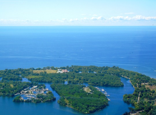


Great Lakes Awareness Day
Great Lakes Awareness Day celebrates the Great Lakes and highlights the issues they face, and how the lakes can be preserved. Events for the day have involved organizations such as schools, aquariums, and museums. There is not much information available online about how the day is celebrated or how it came to be.
There are five Great Lakes: Superior, Huron, Michigan, Ontario, and Erie. Together they make up the largest body of freshwater on Earth and stretch 750 miles from east to west. They are located on the border of the United States and Canada and touch the states of Michigan, Wisconsin, Minnesota, Illinois, Ohio, Indiana, New York, and Pennsylvania. It is believed that at one time the Great Lakes were covered by a glacier—it receded towards Canada and left depressions filled with water.
Lake Huron is named after the Wyandot Indians, also known as the Huron Indians, and its surface area is the second largest of the lakes. Manitoulin Island is located in it—the largest island in a freshwater lake in the world. Lake Huron connects to Lake Michigan by the Straits of Mackinac. Lake Michigan takes its name from the Ojibwa word for “large lake.” It is the third largest Great Lake in surface area, and the second largest in volume. It is the only Great Lake completely in the United States.
Lake Erie’s name comes from the Iroquoian word for “long tail.” It is the fourth largest Great Lake in surface area, but the smallest in volume. It is very shallow, averaging just 62 feet in depth. Lake Ontario takes its name from the Huron word for “lake of shining water.” It has the smallest surface area of the Great Lakes, but is very deep, holding four times the volume of water as Lake Erie. Lake Erie and Lake Ontario are connected by the Niagara River, on which Niagara Falls is located. Lake Superior is the largest Great Lake in surface area and volume, and it is the deepest of the lakes, reaching a depth of 1,332 feet. Its name comes from the French word for “upper lake,” and fittingly, it is the farthest north of the Great Lakes.
Vessels from the United States and Canada haul about 125 million tons of cargo on the lakes each year. They haul mined materials such as iron ore, coal, stone, and salt; agricultural products such as wheat, corn, soybeans, and oats; as well as other materials. About 3,500 species of plants and animals live in the Great Lakes Basin, including over 170 species of fish. The lakes are a large freshwater fishery, being a home for species such as salmon, trout, perch, walleye, bass, and herring.
The Great Lakes face many issues, such as pollution and invasive species, illustrating why a day is needed to raise awareness about them. Over 140 federal programs for environmental restoration and management take place on the Great Lakes. Amendments to the Clean Water Act were made in 1972, helping regulate water pollution in the lakes. The Great Lakes Quality Act, also from 1972, was signed by the United States and Canada to help protect and restore the Great Lakes.
How to Observe
See if any organizations or places near you are holding any events on the day. Learn about issues the Great Lakes face, and find ways to get involved to protect the lakes. Plan a trip to explore some of the wonders of the Great Lakes. Maybe you could even explore the lakes while driving one of the Great Lakes Circle Tours. It is believed that about 6,000 ships have sunk in the Great Lakes, with about 30,000 lives lost. You could spend the day learning about some of the shipwrecks by visiting the Great Lakes Shipwreck Museum. One of the most famous ships to have sunk is the SS Edmund Fitzgerald, which sank in a storm in Lake Superior on November 10, 1975, with all 29 of its crew members perishing. It was immortalized in song by Gordon Lightfoot.
Source
#Toronto Islands#Lake Ontario#Toronto#Great Lakes Awareness Day#USA#Canada#Lake Michigan#Lake Superior#GreatLakesAwarenessDay#water#Monday of the first full week in May#3 May 2021#summer 2015#2012#2019#Chicago#Agawa Bay#Ontario#Illinois#beach#landscape#cityscape#architecture#tourist attraction#landmark#countryside#flora#nature
20 notes
·
View notes
Text
Lake Michigan at sunrise
Lake Michigan is one of the five Great Lakes of North America and the only one located entirely within the United States. The other four Great Lakes are shared by the U.S. and Canada. It is the second-largest of the Great Lakes by volume and the third-largest by surface area, after Lake Superior and Lake Huron (and is slightly smaller than the U.S. state of West Virginia). To the east, its basin is conjoined with that of Lake Huron through the wide Straits of Mackinac, giving it the same surface elevation as its easterly counterpart; the two are technically a single lake. Lake Michigan is shared, from west to east, by the U.S. states of Wisconsin, Illinois, Indiana, and Michigan. The word "Michigan" originally referred to the lake itself, and is believed to come from the Ojibwa word mishigami meaning "great water". Lake Michigan is also the only one of the five Great Lakes not to share a shoreline with the Canadian province of Ontario, the only province in Canada that borders the Great Lakes.
Some of the earliest human inhabitants of the Lake Michigan region were the Hopewell Indians. Their culture declined after 800 AD, and for the next few hundred years, the region was the home of peoples known as the Late Woodland Indians. In the early 17th century, when western European explorers made their first forays into the region, they encountered descendants of the Late Woodland Indians: the Chippewa; Menominee; Sauk; Fox; Winnebago; Miami; Ottawa; and Potawatomi. The French explorer Jean Nicolet is believed to have been the first non-Native American to reach Lake Michigan, possibly in 1634 or 1638.
Lake Michigan is joined via the narrow, open-water Straits of Mackinac with Lake Huron, and the combined body of water is sometimes called Michigan–Huron (also Huron–Michigan). The Straits of Mackinac were an important Native American and fur trade route. Located on the southern side of the Straits is the town of Mackinaw City, Michigan, the site of Fort Michilimackinac, a reconstructed French fort founded in 1715, and on the northern side is St. Ignace, Michigan, site of a French Catholic mission to the Indians, founded in 1671. In 1673, Jacques Marquette, Louis Joliet and their crew of five Métis voyageurs followed Lake Michigan to Green Bay and up the Fox River, nearly to its headwaters, in their search for the Mississippi River. The eastern end of the Straits was controlled by Fort Mackinac on Mackinac Island, a British colonial and early American military base and fur trade center, founded in 1781.
With the advent of European exploration into the area in the late 17th century, Lake Michigan became part of a line of waterways leading from the Saint Lawrence River to the Mississippi River and thence to the Gulf of Mexico.[8] French coureurs des bois and voyageurs established small ports and trading communities, such as Green Bay, on the lake during the late 17th and early 18th centuries.
In the 19th century, Lake Michigan played a major role in the development of Chicago and the Midwestern United States west of the lake. For example, 90% of the grain shipped to Chicago traveled east over Lake Michigan during the antebellum years, and only rarely falling below 50% after the Civil War and the major expansion of railroad shipping. The first person to reach the deep bottom of Lake Michigan was J. Val Klump, a scientist at the University of Wisconsin–Milwaukee. Klump reached the bottom via submersible as part of a 1985 research expedition. In 2007, a row of stones paralleling an ancient shoreline was discovered by Mark Holley, professor of underwater archeology at Northwestern Michigan College. This formation lies 40 feet (12 m) below the surface of the lake. One of the stones is said to have a carving resembling a mastodon. So far the formation has not been authenticated.
#Straits of Mackinac#Pipeline transport#Michigan Technological University#Michigan#Lake Michigan#Lake Huron#Kalamazoo River#Great Lakes#Enbridge#Bill Schuette#Associated Press
0 notes
Text
electrician near me free estimate Elliot Lake Ontario
Contents
Current services archived services
Award winning service
Pages local listings. find
Mail address: zubenil5at vsnl.net
electrician services near me Elizabethtown Ontario electrician near me cheap Russell Ontario Priceline Save up to 60% Fast and Easy Russell Hotels Get deals at Russell’s best hotels online! Search our directory of hotels in Russell, ON, Canada and find the lowest rates. Our booking guide lists everything from the top 10 luxury hotels to budget/cheap hotels in Russell, ON, Canada .home electrician near me Ottawa Ontario current services archived services. E-mail: [email protected] CAMERON, RAYMOND. It is with great sadness that the family announces the passing of Raymond Cameron on December 30, 2018 at the age of 82 years old.Business Description: Since 1962, John Waters Inc. has offered award winning service to Louisville and Southern Indiana. We offer electrical, heating, air conditioning and indoor air quality services. Founded on hard work, dedication and a commitment to service, we are.
W G H Electric – Elliot Lake – phone number, website & address – ON – Electricians & Electrical Contractors.
The fund would provide $1,000 each month to Sevier.electrician near me free estimate Cobourg Ontario local electrician near me elliot lake ontario EDITOR’S note: ledger reporter Gary White recently accompanied local Rotary Club. a small village near Choloma, Honduras. The village’s mayor and other dignitaries have gathered to dedicate a well.
Call 1-800-400-2255 to locate underground electrical cables and.licensed electrician near me Elliot Lake Ontario Tim Henning, KE7WMZ, aboard Victory Cat near Greece. Ultimately. By mid-week, the online petition had gathered more than 850 signatures, primarily from Quebec and Ontario.
Important note: Because of the dangers and complexities involved, most electrical work falls far outside the DIY zone. Even if it’s a seemingly easy job, such as installing a light dimmer, you should consider bringing in a pro. Get free quotes from highly rated local electricians. When hiring an.
Electricians & Electrical Contractors in Elliot Lake ON. – Locate and compare Electricians & Electrical Contractors in Elliot Lake ON, Yellow pages local listings. find useful information, the address and the phone number of the local business you are looking for.
Elliot Lake is a city in Algoma District, Ontario, Canada It is north of Lake Huron, midway between the cities of Sudbury and Sault Ste Marie in the Northern Ontario regionPrior to the settlement of the city, an Ojibwa village existed near the present hospital site on the lake’s shoreline Read more about Elliot Lake real estate
handy electrician near me Concord Ontario 10/14/00. I am Capt.Sandip Kumar Mandal,an Indian citizen,looking for a job on cruise ship anywhere in the world.I have master mariner certificate from UK and total command experience of 24 months but never on cruise ship.So initially ready to accept job on cruise vessel as staff captain or first officer.My e-mail address: zubenil5at vsnl.net Please let me know if anything comes which can.
electrician contractors near me Elliot Lake Ontario All data about point of interest in Elliot Lake, Ontario to your scope in Nexdu, Business Directory of Canada. find the phone, the address, attention schedule and comments from customers of point of interest of Elliot Lake, Ontario point of interest near you, consult here the different.
the mining industry and is estimated to be worth about $30 billion. Inter- national. Agency27 on how to manage uranium mine tailings near Elliot Lake, Ont.
Miami Power Contractors is a team of commercial and residential electricians in Miami and Fort Lauderdale. With more than 175 electrical projects in our portfolio, we are electrical contractors ready to take on your next home or commercial electrical project in the Miami are and its surroundings.
from Free Elliot estimate Lake Ontario electrician - Allelectricalproducts https://www.allelectricalproducts.com/electrician-near-me-free-estimate-elliot-lake-ontario/
via https://www.allelectricalproducts.com
0 notes
Link
Indigenous Florals Ayasha Logo White Womens T-Shirt by Ayasha Loya Designs. Ayasha is a new brand created by Indigenous Ojibwe Fine Artist and Designer Ayasha Loya. Ayasha Loya is a female, Native American, a veteran who developed her business from her creative strengths and cultural talents as a woman. Her goal is to provide culturally diversified products in a personalized creative fashion. Ayasha embraces her Ojibwa roots. An eastern woodlands tribe, Ojibwa is also spelled Ojibwe or Ojibway, also called Chippewa, self-name Anishinaabe, Algonquian-speaking North American Indian tribe who lived in what are now Ontario and Manitoba, Can., and Minnesota and North Dakota, U.S., from Lake Huron westward onto the Plains. Ayasha is from the great lakes state of Michigan. Their name for themselves means “original people.”Ayasha brand name offers a wide range of products to fit everyone's unique sense of design and style in today's modern world with a twist of traditional indigenous roots. Our designs are carefully curated to provide the latest trends to our customers in a uniquely deep-rooted cultural fashion. To keep our customers in style we post new arrivals daily.
#style#indigenous#ojibwe#native#native American#fashion#womensclothing#buy t-shirt#best summer clothing#women's clothing#floral#flower#logo#inspiration#inspirational#roots#culture#branding
0 notes
Last Seen Blogs


anessayoncriticism901-blog
An Essay On Criticism

carriemebags
Skittles and science

mivirosales
María V. Rosales

mushroomates
half smart