#at least they HAVE platforms and my big local-scale issue is water which they were all good on
Text
not having a campaign website + profile through the state voter info site is almost always a disqualifier, but for the rare double whammy, be sure to have a heavy, unconnected internet presence revealed when i google your email where you are revealed to be 1) an insane bigot and 2) as seen on TLC
#politics#ink post#this time we had 4 websites of acceptable quality 2 insane bigots and 2 internet ghosts#i can't vote for you if i can't find ANYTHING about you except results for someone with the same name in another state!#those 2 i turned up maybe the right person's deeply ambiguous business#and probably the right person's affiliation w/ the county gop despite running as 'nonpartisan'#like i had problems with all 4 with websites but it was a close race for my 3 votes bc like. at least they seem competent#at least they HAVE platforms and my big local-scale issue is water which they were all good on#so it came down the level of passion for stuff like parks fire stations etc#and i put in the work! i do v thorough research! both for a personal desire to be well informed and bc my family all vote off my notes#if i click the 'view profile' button and you havent submitted a 5 minutes of effort profile i cant imagine the regular joe votes for you!#it's a good size city personal connections voting bc they know your name don't actually cut it alone!
5 notes
·
View notes
Text
The Sixteen Deadliest Tik Tok challenges Ever (DailyDot)
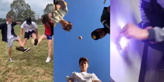
So, it’s not everyday a social media platform run by Chinese people and designed to basically duplicate snap chat, except video only, becomes popular, in fact tik tok is so popular, that it has millions of users, well, TikTok has 689 million monthly active users, whereas its twin Douyin (China’s version of TikTok) has 600 million daily active users. Combined, the TikTok/Douyin apps have over 1.29 billion monthly active users in 141 countries. Still, dumb, clout chasing teenagers have claimed this beloved social media sensation for themselves, however, clout is deadly, literally, people die from TikTok challenges, but hey, don’t take our word for it, check out the 16 dealiest tikrok challenges, with a 101% chance of decimating the insurance you wasted on your kids
The choking challenge
Anything that involves choking a friend—or yourself—into near-unconsciousness is, unsurprisingly, ill-advised. Considering this is the very idea behind the choking challenge, it’s safe to say that anyone and everyone should steer clear of this particular trend.
This challenge, in one form or another, has been around for a long time. Teens have been partially strangling themselves for decades, just to feel the brief euphoria that follows that first, desperate gasp of air. The game ebbs and flows in terms of popularity but reached its viral zenith in 2017. Since then, the dangerous challenge has cropped up on various social media platforms, including TikTok. Risks of participating in the choking challenge are pretty much what you’d expect. Do it too long, and participants risk loss of brain cells, permanent brain damage and even death.
The condom challenge
Another challenge that can lead to asphyxiation, the condom challenge hasn’t been around nearly as long as the choking game. This dangerous TikTok challenge requires a condom, some water, and at least two willing participants.
Performing the challenge is simple: One person fills the condom with water and drops it over the second person’s head. Thanks to the durability of most condoms, the dropped water “balloon” rarely pops. This means that many people participating in this challenge end up with an airtight seal over their noses and mouths. Bad idea.
The fire challenge
You might be wondering why anyone would ever participate in something called the fire challenge. Clearly, you don’t remember being a teenager. Most common among younger users, the fire challenge is exactly as dangerous as it sounds—which has in no way stopped people from attempting it.
Performing the challenge is as simple and foolish as you might assume. Participants douse a portion of their body—usually the chest or hands—with a flammable liquid. Then they light it up and record the effects, which often lead to first- or second-degree burns. Videos of badly burned teenagers are all over the web thanks to this particular viral challenge.
The skullbreaker challenge
The skullbreaker challenge is another fresh viral craze that, to most, seems completely ridiculous. The challenge has already proven itself immensely dangerous after a Venezuelan teen reportedly ended up in the ICU. Authorities have issued warnings about this particular trend, but that won’t stop some from attempting it.
You need at least three people to perform the skullbreaker challenge. All three stand in a row—in front of the camera, of course—and jump. The two on either side jump first, simultaneously, followed by the person in the center. When the center person’s feet leave the ground, however, their companions knock their feet out from under them. This typically leads to the middle person crashing backward to the ground, often striking their head in the process. It’s in the name, people: You can literally break your skull doing this. So don’t.
The outlet challenge
One of social media’s newest trends, the outlet challenge is also one of the more dangerous TikTok challenges we’ve seen. This viral sensation can easily result in electrical system damage, fires, and electric shock.
To perform the—extremely inadvisable—outlet challenge, people use a phone charger partially plugged into the wall. Then they touch a penny to the exposed prongs, creating a large spark. The challenge has already caused property damage at a high school in Massachusetts. Thankfully, the teens weren’t injured, but if this challenge keeps up for much longer, someone will doubtless get hurt.
The hot water challenge
Another dangerous challenge that can lead to severe burns and injury, the hot water challenge has been around for a while. Back in 2017, in fact, an 8-year-old girl died after attempting a version of this trend. The new version, which is just as dangerous, has been cropping up online.
The old version of the challenge involved drinking boiling water through a straw. The revamped challenge more often features participants pouring boiling water on themselves or their friends. Unsurprisingly, it has led to some serious injuries. One teen, whose friend poured boiling water on him while he slept, told Fox 59 that his skin “just fell off my chest.”
The snorting challenge
Some of these challenges are supremely dangerous. Others are upsettingly disgusting. The snorting challenge has the unfortunate privilege of being both. It involves snorting a foreign object—usually a condom—up your nose and pulling it out of your mouth. *shudder*
This dangerous TikTok challenge, like many others on this list, is nothing new. It has cropped up multiple times over the last few decades, but in the age of doing dumb shit for followers, it has reemerged. When this challenge goes wrong, it can result in infection or damage to the lining of the nasal passage, CBS News reported. In really bad cases, it has the potential for choking, which could cause far more severe issues. Even when nothing goes wrong, it looks painful and extremely uncomfortable, so… why?
Ghost pepper challenge
If you’re a big fan of hot food, the ghost pepper challenge—also called the hot pepper challenge—might be right up your alley. Blessedly less dangerous than many of its fellows, the ghost pepper challenge has nonetheless resulted in some major side effects among its participants.
Participation in this challenge merely requires that you locate and consume a hot pepper that lands high on the Scoville scale and upload your reaction online. Usually, people select between ghost, cayenne, and habanero peppers. The majority of people manage to walk away from this challenge unscathed, thankfully, but ghost peppers are nothing to mess with. Medical Daily reported in 2016 that a 47-year-old California man was hospitalized after he ate a ghost pepper–pureed hamburger during a local eating contest and ended up continuously vomiting and experiencing an esophageal rupture.
Pass out challenge
Anytime a person passes out, it has the potential for negative side effects. Teens, however, are all over the trend of forcing themselves to pass out. Rather than partially asphyxiate themselves—like in the choking challenge—this dangerous TikTok challenge just involves swaying your head repeatedly from side to side.
Based on the TikTok attempts at the challenge, it seems to work. Unfortunately, a number of risks go along with successfully knocking yourself out—including simply falling and injuring yourself.
Concussion challenge
Doesn’t this just sound like a great idea? The concussion challenge, also referred to as the “how to get a concussion” challenge, has been making the rounds on TikTok for several months now.
This utterly idiotic TikTok challenge requires a group. All the participants stand in a circle around the camera, which faces upward. Facing down, foolish teens then throw an object—which has ranged from a basketball to tricycles and ladders—into the air above their heads. The “challenge” is to stay put, risking a concussion when the object comes hurtling back to Earth. Why? Just… why?
The honorable mentions of dangerous challenges:
These challenges came around before TikTok made its global launch, but that doesn’t make them any less dangerous or worthy of a spot on this list. Absolutely idiotic, sometimes deadly and always painful, the internet is clogged with far too many of these viral challenges.
The Tide Pod challenge
We’ve likely all heard of the Tide Pod challenge. It swept the nation in early 2018, making headlines across the country. In case you were wondering, consuming soap in any form, no matter how colorful, is not a good idea. Complications from ingesting Tide Pods has led to serious health issues.
The Tide Pod challenge, as far as anyone can tell, started with a joke. Memes and jests about Tide Pods’ pretty colors and candy-like appeal were around long before people were downing the product itself. Then, people started doing just that. Younger YouTube users, in particular, fell victim to this ill-advised trend. Videos of teens and pre-teens eating laundry detergent packets briefly drenched the web before the pressing dangers of this challenge became common knowledge.
The blue whale challenge
Despite the clear danger, a few of the challenges on this list might seem tempting to try out. The blue whale challenge, which has allegedly been linked to deaths on far too many occasions, is not one of them. The actual number of deaths that can be attributed to this viral trend is questionable—some speculate it’s simply an internet hoax—but its brief time in the spotlight terrified parents nationwide.
The blue whale challenge is, to put it simply, a suicide challenge. Participants are given 50 tasks to complete over 50 days. The tasks, which begin as rather benign, gradually increase in danger. To complete the challenge, anyone taking part must ultimately kill themselves. Similar challenges have cropped up over the years, but few garnered as much attention as the blue whale challenge.
The Kylie lip challenge
Loads of online tutorials outline methods to mimic Kylie Jenner’s enviable look. Usually, this involves contouring and the careful application of makeup. Back in 2015, however, a very different method arose to try to imitate the young model’s full lips.
The Kylie lip challenge skyrocketed to popularity, mostly thanks to how easy it was to pull off. All participants needed was a small jar, cup, or shot glass. Placing the cup over their lips, they then created a vacuum by sucking all of the air out of the space. The intended result was puffy, pouty lips similar to Jenner’s. More commonly, people ended up with bruises and torn skin and risked permanent scarring.
The cinnamon challenge
Remember planking? Ah what an innocent, mostly safe internet trend. Since the days of planking, viral challenges have gone from dumb to painful to dangerous and worse. The cinnamon challenge may seem rather tame on the outside, but don’t be fooled.
Cinnamon challenge
TheButtingHeads/YouTube
This challenge first cropped up as early as 2001, but it didn’t reach viral status until 2012. The necessary steps are quite simple. Just eat a spoonful of cinnamon without drinking water. In 60 seconds. All while the camera is running. This challenge lasted a remarkably long time, considering the massive health risks it posed. Participants in the cinnamon challenge were at risk of choking and gagging on the cinnamon in mild cases, and in worse cases inhaling cinnamon could lead to vomiting and scarring of the lungs.
The salt and ice challenge
Thankfully, the salt and ice challenge hasn’t been overly popular since 2012. Still, fresh videos of people trying it out are always cropping up, despite multiple reports condemning the practice.
This challenge involves pouring salt onto moist, bare skin and then pressing an ice cube onto the area. Whoever endures the longest emerges victorious, but rarely unscathed. The resulting chemical reaction can lead to frostbite, first- or second-degree burns, and painful blisters. Warnings against participating in this painful challenge have, unsurprisingly, not made much of a difference.


2 notes
·
View notes
Photo

INTERVIEW by Sasa Danon for Lets Tackle Climate Change Together
Saša Šimpraga is a writer and an activist from Zagreb. He is the founder of 1POSTOZAGRAD (1 percent for the city), a Zagreb based platform focused on public space and commons. Alongside many small scale city improvements, such as numerous treelines or benches, its successes include the creation of a number of new public parks, urban gardens network and drinking water fountains networks for Zagreb. Its work also include changing the Zagreb’s masterplan in favour of a green areas. 1POSTOZAGRAD is not an NGO, but 100 percent volunteer initiative.
Why do you think building communities in urban environments is important?
In order to be relevant, any change needs to be local. Acting on one’s own can be less effective than creating a group or a network that advocates the same issue. Fundamentally, democratic process lies in the community.
How can citizens be more involved in creating urbant and resilient environments?
I can give you an example of how I created an active group and initiated small and big scale improvements in communal standard of Zagreb. Needing more activists to help 1POSTOZAGRAD intiatives, in 2016 I started a year long programme called Seminar for Walkers. I offered free themed walks once a month, while selected participants had an obligation to participate in one of the city initiatives we put together after each walk. Participants were selected by an open call at the very beginning of the year. It was a group of some 20 people. Those selected had an obligation which was very simple, for instance writing an e-mail to the municipality. All the walks were at the same time open to the general public which was also invited to participate in supporting the initiatives, but had no obligation to do so. Many joined. Each month one walk was held and one initiative was launched. As a result, in less than a year, a new drinking water fountains network was started to be put in place on the locations we suggested, one city park completely restored and a number of trees planted, to mention only some of the successful initiatives. Despite the fact that the whole programme was done 100 percent voluntarily, that is without any financial support whatsoever, we also managed to have at least one expert guest attending each walk. Those mostly being my friends. After the Seminar ended, some of the participants later on started their own initiatives in their respectful neighborhoods. I see Seminar for Walkers as an example of how to combine urban exploration, community building and commons in a fun and effective way.
What is your favorite project of community engagement in Croatia?
A local initiative in Zagreb, named Savica (name of the neighborhood) for Park was formed after city authorities announced that church complex is to be built on the location of a local public park, thus destroying it. Park in question is the only public park in the neighborhood, urbanistically planned in the center of the mostly housing settlement consisting of high rise buildings. Losing the park would be a huge and irreplaceable loss. Park for Savica is a grassroot initiative that stood on the forefront of public interest. It is important to emphasize that the organisation is not a formal NGO, but all their work was done strictly voluntary. Given the hugeness of the task and their success in preserving the park, their work is both impressive and inspiring.
What is your favorite project of community engagement abroad?
There are so many I appreciate, but say organizations like Park People in Toronto who initiate a number of various activities, both focused on environment and building communities related to local parks.
_
Published on 14th of August 2019 in Lets Tackle Climate Change Together.
2 notes
·
View notes
Text
THE TOOLMAKER
BY JONATHAN LERNER
Jack Dangermond built a tech colossus, and a fortune, from GIS. Now he’s sharing it all to save the world.
FROM THE APRIL 2017 ISSUE OF LANDSCAPE ARCHITECTURE MAGAZINE.
Jack Dangermond wears oversized tortoise-shell glasses. At 72, his hairline has receded halfway back on his head. For work, he dresses casually—open collar, v-neck sweater. His manner is gracious and energetic, but calm and notably confident. He tends to speak as if in final draft, which he credits to years of dictating correspondence. He is tall and rangy, but it’s quite possible that when he arrived at the Harvard Graduate School of Design (GSD) in 1967 to earn an MLA he would have been taken for a geek. His ulterior motive in going there, after all, was “to start playing with computer mapping”—when computer mapping barely existed.
The school’s pioneering Laboratory for Computer Graphics and Spatial Analysis had been founded two years earlier by the architecture professor Howard Fisher.
Dangermond says that on meeting Fisher, “He immediately hired me. Within an hour. Which was the luckiest thing that ever happened in my life.” Harvard was one hot spot of the era’s radical activism. “The Vietnam War was going on,” he says, “revolution in the air, protestors shutting down the university, creating all kinds of controversy. This big aha! moment came for my wife Laura and myself, who were both working there in the basement of Memorial Hall. We had a job making computer maps, doing air pollution studies and land-use suitability studies. The realization was, ‘We don’t want to go right or left; we just want to go forward with this idea of rational thinking and computerized, systems-based analysis.’ We simply said, ‘Let’s just double down and make that our life work.’ It’s funny when something like that comes into your mind—that you really would like to do something serious with your life—just one afternoon, sitting around.”
A map’s-eye view of an Esri staffer, who gazes through a digitizing puck. Digitizing transfers data from an analog map to a digital product. Image courtesy of Esri.
Dangermond never pursued conventional landscape architecture practice. In 1969, after Jack graduated, he and Laura returned to their hometown of Redlands, California, east of Los Angeles, and founded the Environmental Systems Research Institute (Esri) to explore “anything to do with mapmaking and computers.” (Laura has served as the company’s executive vice president ever since; she has a B.S. in social science.) At first they “eked out a little existence” with consulting subcontracts from landscape architects and engineers. Eventually people started asking to buy the software they were building. In 1982 they released ArcInfo, the first commercial geographic information systems program. (An arc, on a map, is a shape defined by connecting x, y coordinate pairs; counterintuitively, an arc may be curved or straight. The term has been incorporated into the names of Esri products ever since.) “We actually sold four copies the first year, which was just amazing to me,” Dangermond says. Esri soon transformed itself from a provider of contract mapping services to a developer of mapping products, including the extensive ArcGIS family of programs. Those have become all but essential for work in land-use planning, but also in fields as wide ranging as epidemiology, interior space planning, and package delivery. The products are powerful. And expensive—except to the schools and nonprofits that get them at deep discounts or for free.
By the end of 2016, Esri had 3,800 employees in 41 locations around the world, and the Dangermonds’ personal net worth was $3.4 billion. They still live in Redlands, which is closer and perhaps more akin to the Sonoran Desert than it is to Tinseltown. Both Redlands and Esri’s headquarters there are attractive, but the glam factor is minimal. The campus is a complex of clean-lined low-rises designed around gardens, courtyards, and atriums, all designed with Dangermond’s hands-on involvement. It’s a shady, verdant microenvironment in a dusty locale. The extraordinary lifestyle blandishments some tech companies provide employees—lessons in stand-up comedy, soundproofed jam rooms outfitted with drums, amps, and guitars—are not in evidence, nor are too many of the millennials such perks are supposed to attract. The vibe is relaxed, but mature. Kaitlin Yarnall, a cartographer and the deputy director of the Centers of Excellence in Photography, Mapping, and Journalism at the National Geographic Society, has been involved in Esri’s collaborations with National Geographic magazine, and says, “It’s run like a family business. Laura still does the books. They don’t have expense accounts. If you go out to dinner with Jack, it’s awkward—he’ll be like, ‘OK, how do we want to divide this up?’”
Privately, the Dangermonds have taken the Giving Pledge, by which enormously rich people promise to use the bulk of their wealth philanthropically. Esri, the company, also commits significant resources pro bono. Since 2010, it has provided more than 40,000 software licenses to nearly 5,000 nonprofits engaged in conservation, humanitarian, and sustainable-development programs in 134 countries. Most pay only an administrative fee amounting to 2 percent of retail. In conjunction with President Obama’s ConnectED initiative, Esri also invested more than $40 million in software, curriculum development, and support for teachers at K–12 schools, and some 4,000 American schools now use ArcGIS Online, a component of the company’s current flagship software package. And recently, at Jack Dangermond’s prompting, and to encourage sustainability planning, Esri has launched a free, open-access, web-based software platform and a trove of mapping data for the United States called the Green Infrastructure Initiative.
Screenshot from Esri’s Green Infrastructure Initiative website shows areas of prime U.S. farmland. Image courtesy of Esri.
An increasingly common understanding of green infrastructure is that it is a set of tactics, deployed at the local level, for things like managing stormwater or mitigating the heat island effect. Esri’s initiative is about green infrastructure as strategy—for larger areas like a county, a watershed, or even, at least conceptually, the entire continent. The idea is to identify and secure the critical remaining large cores of relatively unspoiled landscape. The two senses of green infrastructure aren’t unconnected; both are about ecosystem services. Small, low-tech tactical interventions like planted roofs and rain gardens, inserted into the gray infrastructure of your urban neighborhood, can help prevent it from flooding during rain events. Meanwhile, the naturally occurring systems of an untrammeled mountain valley can supply clean water for your entire city. The places that can support such big natural systems are spatially fragmented and increasingly diminished by population growth and development. It will take strategic thinking at the larger scales to protect, restore, and reconnect them.
That’s the conceptual underpinning of the Green Infrastructure Initiative—the web tool—which is meant to encourage practical efforts in that direction. It provides anyone concerned with sustainability a cost-free and easily accessible way to do mapping and map-based planning. (The nomenclature is awkward. Accurately put, the website with the open-access mapping data and software, in itself, is not an initiative but a tool of the initiative. The web address—http://www.esri.com/about-esri/greeninfrastructure—could be more intuitive, too.) “Jack realized that habitat loss happens at the local level,” says Hugh Keegan, who led the team that built it. Like Dangermond, Keegan trained as a landscape architect but has spent most of his career developing software at Esri, and currently manages its Applications Prototype Lab. “The place to try and influence is local government, local planning boards, local zoning boards. That’s who the target audience is,” Keegan says. “But GIS is a big fundamental hurdle for many small communities. Most don’t have it.” Neither do most nongovernmental organizations and citizen activists. Now anyone with a web browser can access and use the tool.
The map data, from sources such as the National Land Cover Database, identifies undeveloped areas, or cores, of at least 100 acres and at least 200 meters in width. So you can’t use it for fine-grained analysis, or for planning in urbanized places. But for working at larger scales, it can reveal patterns and systems that green infrastructure planning would protect, such as aquifers and wildlife corridors. The quality and detail of the data, which covers the continental United States, is uneven, depending on its origin. But users can supplement it with more accurate local data they may have. Using the apps that Keegan’s team developed for the site, which are simplified versions of ArcGIS software, you can manipulate the data layers you’ve selected to suit your goals. A particularly useful—and user-friendly—feature is the ability to assign and play around with the relative weight of the various sets of data you’re working with. That can reveal the relationships among them and also the implications of different planning scenarios. You can download the maps you create as PDFs. Also accessible through the website is a “Living Atlas” of maps other people have made and shared. These depict myriad features and conditions in specific regions, such as scenic trails and other cultural assets, topography and soil types, and sea-level-rise projections. The Living Atlas maps serve as examples of how GIS can inform green infrastructure planning, and information from them can be brought into maps you might be making with the initiative’s apps.
The interconnectedness of land, water, habitat, and infrastructure is made visible in Green Infrastructure Initiative maps. Image courtesy of Esri.
That is not to say that it is an especially easy and intuitive platform to work with. It’s no smartphone app. Those without GIS experience will face a learning curve. Nor does it make available for free the full, vast power of the programs Esri sells. Ambitious users will sometimes find themselves at a point where they can’t do what they want without making a software purchase. Right now, as its developers know, it needs refinement—more, and more detailed, data, and better guidance documentation for users—and they’re working on that. Still, over and above providing the software platform itself, there is enormous value in the many layers of national-scale data they have already assembled and rendered consistent and compatible. That’s because locating, acquiring, and matching up different categories of data can be the most time-consuming and expensive aspect of digital mapping. Even after it is enriched, the Green Infrastructure Initiative will not with a few clicks turn people into landscape architects, regional planners, or civil engineers. But it can “create that foundation that can get people going,” Dangermond says. “It’s going to take a million people that get together in their own communities and their own geographies, and stand up—not against the forces of destruction of nature; that’s probably too bold of a way to say it—but there’s got to be a counterforce, particularly at this time, that speaks with the voice of science.”
Because the Green Infrastructure Initiative web tool was only launched last June, is still being publicized, and is open access, it is difficult to know how many nonprofessionals have begun using it, for what, and who they are. However—and curiously, because this was not its express purpose—it is already being taken advantage of by planners, and by landscape architects at least in academic settings. Brian Orland, FASLA, a professor in the College of Environment + Design at the University of Georgia, says, “I want to bring the core concepts of geospatial thinking to students without spending the time of teaching them all the technicalities of a full-bore GIS program.” He finds especially valuable the ability to adjust the relative weight, or importance, of multiple factors, for example. “The information is coarse, but I’m trying to introduce the students to the idea of coarse relationships, and how the whole system works.”
Images from a 1980s Esri brochure. Image courtesy of Esri.
Dangermond has had something like this initiative in mind since Harvard. “In the idealism of the time, I began to think we could develop a database for the entire United States. Where would we locate new urbanization? What areas should be in conservation? People had thought about that concept for a hundred years, using plastic overlay maps. But it wasn’t realizable in any practical way.” There were too many kinds of data to correlate, and no ready way to illustrate the interrelationships for decision makers. Then in 2015, in Salzburg, Austria, he met Arancha Muñoz-Criado, who studied at the GSD a generation after him. She was giving a lecture about her work as the director general of landscape architecture and planning for the autonomous region of Valencia, Spain. Muñoz-Criado had championed a planning approach for the region and its 550 municipalities that, simply put, starts with an inventory of existing unspoiled areas, determines which of those would be most valuable if preserved and bolstered, and then directs growth to the already developed or more environmentally compromised spaces left over. In this approach, even for very localized planning decisions, knowledge about the larger scales is essential. Aquifers, forests, the ranges of species, and the impacts of climate change, for example, don’t conform to geopolitical boundaries. Besides, every species or ecosystem service needs a certain minimum amount of space to survive or function adequately—hence the emphasis on large intact cores.
Muñoz-Criado believes that Valencia was the first place where “the name, concept, and content of green infrastructure was introduced into the urban planning process and made mandatory.” Since then, the European Commission has endorsed green infrastructure planning; Muñoz-Criado herself is now helping define a nationwide policy for Spain. Dangermond brought her into Esri’s Green Infrastructure Initiative project; Keegan calls her “Jack’s muse.” She came with both a designer’s sensibility, not a typical strength of software brainiacs, plus, Keegan says, “a European perspective, which is that there are cultural elements of a community that have been in place for 500 years,” such as trails, viewsheds, and other heritage elements that tie people to their landscapes. These also exist in the comparatively young United States. She says, “Green infrastructure has three functions. One is the ecological function. The second is the framework for growth. And the third is about quality of life and access to nature, preserving those landscapes and corridors not only for animals, but also for people.”
Image from a 1980s Esri brochure. Image courtesy of Esri.
Muñoz-Criado says, “Jack knew that this was the future. He knew that green infrastructure was about transparency, about knowledge, about putting, in one map, everything together—and that it could be done now with the technology he had.” That technology has made Dangermond among the most successful people trained in landscape architecture on earth, measured by earnings and also, arguably, measured by the reach and potential impact of Esri’s products. Kaitlin Yarnall says, “Even though he has a tech company, because he comes from a landscape architecture background, it’s all about the application of the technology. To do something, to fix something. He really, actually believes that GIS, and landscape architecture, and green infrastructure, and smart planning and land use can change the world.”
Dangermond’s origins are rather more modest than such a sweeping vision might suggest. He grew up in Redlands where his Dutch immigrant parents, “a gardener and a maid,” as he describes them, “realized that they needed to get their kids an education, so they started a nursery.” The three sons all studied landscape architecture, enrolling at the nearby college now called California Polytechnic State University. Allen, the oldest, now deceased, quit school early to help run the family business. Pete, the next, who went on to become director of California’s park system and now has a private practice in Sacramento, is widely honored for helping expand parks and support conservancies and environmental causes across the state. Their sister, Marsha MacLean, has been a teacher in Redlands’ public elementary schools for 30 years. Dangermond says, “I learned everything about growing a tech business in a nursery. Because it’s making sure, contextually, that everything’s watered. Nurturing. Making sure things are weeded and fertilized. And then being able to sell. We learned customer service at a very young age. We learned how to figure out what was needed and wanted. It became a natural thing for us to do complex problem solving, which is what a garden and landscape designer does. It was very practical, because we would also have to sell the people on this concept. Sell them the plants. With the workers in the nursery, help them implement these concepts and make it come alive. It’s the DNA of public service that we grew up with.”
Lush plantings in Esri’s Redlands, California, headquarters reflect Dangermond’s background in landscape architecture. Image courtesy of Esri.
The culture inherited from this family business that not only sold things but engaged with customers about how to use them is replicated at Esri. Dangermond says that Esri “is set up fundamentally to support our users.” Once a year, he sends a questionnaire to all of them. “They give me a lot of guidance.” He himself responds in writing to the trends revealed in the feedback. “I spend a month at it, day and night. It’s my way to manage getting customer service in here. It’s a great management tool, but most people are scared to do it.” Hugh Keegan recalls, “The first 500 or 1,000 employees interviewed with both Jack and Laura. That happened up until I had been here 10 or 15 years. Every employee, whether you were interviewing to be a janitor, or whatever. There was no confusion about who you were working for.”
It’s telling that the Dangermonds have stayed in Redlands, once a citrus farming center but long since swallowed into the unfashionable sprawl of San Bernardino County, which has one of the highest poverty rates in the country. Esri is the largest employer in the town, and makes it “much more interesting than the adjacent communities, with a big cadre of international folks,” Keegan says. “We hire smart, well-educated employees who are married to smart, well-educated spouses.” Silicon Valley, “though it’s fun for a lot of people,” says Dangermond, “is fine for young people who are on the get-rich-quick fast track, but it’s not so interesting if you want to have a genuine life.” He also supplies this no-frills explanation: He and Laura were already there, and it was cheap. “We had no money, and to be able to start a company and make it go to our scale we just did very practical things, and we still do.”
In the office suite where Keegan’s lab is housed, just downstairs from Dangermond’s, there is an overhead “dashboard,” an array of monitors showing information such as how many people are currently interacting on the platform and how much information has been uploaded that day. Dangermond likes to step in and savor the numbers. He says, “Open data, open maps—every day between 10,000 and 15,000 new data sets are shared. It’s not Facebook, but yet it’s extraordinary. There are 3.2 million users, creating their maps, matching up their maps, and using other people’s maps.”
Some 350,000 organizations use Esri software. Dangermond suggests that the company’s greatest achievement has been disseminating the concept—even more than the tools—of spatial analysis into so many different fields. But his own grounding and passion remain in the natural world. He notes that the embrace of GIS in landscape architecture has been slower than in some arenas, but that this is changing. “It’s becoming a platform for designing alternatives,” allowing users to “interactively sketch on electronic boards, and quickly assess the impact of ideas.” That provides a way of “understanding the costs of externalities, of bad decisions, as well as the positive side of developing cities that really work.” Considering his possible legacy, Muñoz-Criado asserts that “green infrastructure has to be done at the political level, and I think his dream is to help decision makers and politicians to deliver this concept.” Dangermond, characteristically, assesses himself with modest intensity. “You want me to be inspirational, like I’m a leader. I’m not like that. I’m a very practical guy. But I believe in this deeply, that green infrastructure planning as a methodology can be a huge counterbalance to the continued systematic destruction of nature, and to population footprints that are wiping out so much of what we care about. I’m pretty riled up about that, I suppose.”
Contributing Editor Jonathan Lerner’s memoir of the Weather Underground, Swords in the Hands of Children: Reflections of a Radical Weatherman, will be published by OR Books in May.
from Landscape Architecture Magazine https://landscapearchitecturemagazine.org/2017/04/04/the-toolmaker/
0 notes
Last Seen Blogs

carolinarpaz
carolina paz

badbuild
Doing the thing.

lovelyluxury
kay ༉‧₊˚.

rosalinoramos
"Brains over Muscle. Always on your Hustle"
lovelyluxury
kay ༉‧₊˚.