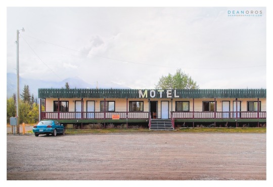
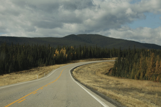
#haines junction
Photo
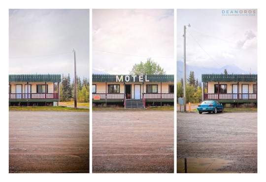
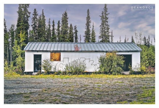
Above: Alaska Highway Roadhouse, Yukon Territory, Canada.
A RARE GLIMPSE OF A BYGONE ERA.
Welcome back. In the past couple of posts, I presented photographs showcasing the remote northern beauty of YUKON TERRITORY along the ALASKA HIGHWAY.
I’m happy to share more of the photography series with an introduction to a bygone era: the ALASKA HIGHWAY ROADHOUSE.
HISTORY: THE ALASKA HIGHWAY ROADHOUSE.
Many Alaska Highway roadhouses evolved from American military camps built during the construction of the 2,700 kilometre highway completed in 1942.
It may not look like much, however a roadhouse offered respite from harsh weather conditions with a place to sleep, meals and gasoline, and were spaced no more than a day's drive apart.
THE YUKON TERRITORY SERIES.
Originally photographed in 2015, it’s incredibly interesting to revisit these photographs almost 8 years later, and have the opportunity to perform more work on them. One of the details I’m taken with are the snow-capped mountain peaks. Though it was summer, snow is visible year-round.
SHOP FINE ART PRINTS.
Three versions of ALASKA HIGHWAY ROADHOUSE ONE are available.
1. ALASKA HIGHWAY ROADHOUSE ONE: TRI-FOLD
2. ALASKA HIGHWAY ROADHOUSE ONE: FULL FRAME
3. ALASKA HIGHWAY ROADHOUSE ONE: FULL FRAME ALTERNATIVE
Choose traditional silver-halide, archival giclée or gallery-wrapped canvas prints. Order via my online gallery or CONTACT ME. I’ll ensure you’re ordering exactly what you want.
Thank you for visiting. See you next time.
SEE MORE DEAN OROS FINE ART PHOTOGRAPHY.
Curated collections of my photographs are available to enjoy in your home, office or retail space.
Virtual Gallery: DEANOROSPHOTO.COM
Social: INSTAGRAM | FACEBOOK | TWITTER
#Alaska Highway#roadhouse#Haines Junction#dawson city#Yukon territory#landscape photography#whitehorse#photoart#Rocky mountains
4 notes
·
View notes
Text
Airstreaming to Alaska - Chapter 20: South to the Lower 48
Our Alaska overland adventure, beginning in San Diego, had finally come to an end - but endings don't come fast in Alaska. The adventure isn't really over until you reach the lower 48, almost 2,000 miles away. Click the link below to see beautiful photos.
View On WordPress
#100 mile house#Airstream#Airstream Blog#Airstream Life#Airstream Travel Blogs#Airstreaming#Beaubeaux#crowsnest vineyards#Full-time Airstreaming#Full-time RV Living#Full-Time RVing#Haines Junction#jade city#Living in Beauty#living simply#Living the Dream#mehan lake#simple living
0 notes
Text

Map of Yukon's municipalities. (Cities/Towns) Original Post:
#map#maps#geography#canada#canadamaps#yukon#city#town#dawson#mayo#carmacks#faro#Haines junction#Whitehorse#teslin#watson lake
1 note
·
View note
Text
i drove across bc/yukon in one night, during which i picked up 4 hitchhikers, was stopped twice by the rcmp, saw 4 grizzlies, ran out of gas and then hitched a lift fifty kms with an old woman and her orange cat mr. grumpypuss
#and now i am home#i’m my defense the town of haines junction ran out of gas for 4 hours so this wasn’t only a me problem
205 notes
·
View notes
Text
The North American Indigenous Games (NAIG) in Halifax, Nova Scotia has come to an end with Team Yukon finishing with 39 medals — 20 gold, 10 silver and nine bronze.
Team Yukon had a contingent of more than 130 athletes, coaches and mission staff. Eight Yukon communities including Watson Lake, Dawson City, Mayo, Teslin, Carmacks, Haines Junction, Pelly Crossing, Ross River and Whitehorse represented the territory.
The multi-sport competition had representatives from 756 Indigenous nations in North America to celebrate, share and reconnect through sports and culture.
The Games ran from July 15 to 23 in the territories of Kjipuktuk Dartmouth and Millbrook First Nations. Team Yukon represented the territory in 11 sports.
A July 24 release from the Yukon government said a cultural contingent and Yukon First Nation elders shared their stories with more than 3,000 participants from across North America. [...]
Continue Reading.
Tagging: @politicsofcanada
67 notes
·
View notes
Text
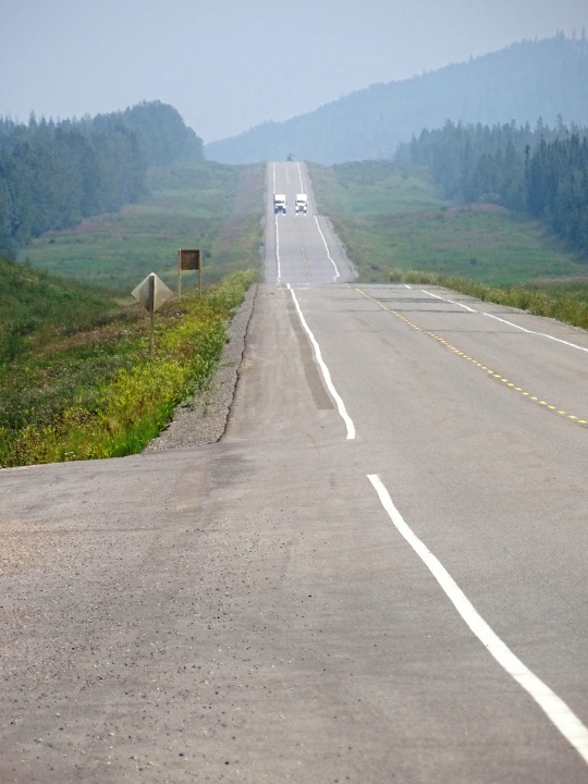


Alaska Highway, CDN (No. 5)
Rerouting continues, expected to continue in the Yukon through 2009, with the Haines Junction-Beaver Creek section covered by the Canada-U.S. Shakwak Agreement. The new Donjek River bridge was opened September 26, 2007, replacing a 1952 bridge. Under Shakwak, U.S. federal highway money is spent for work done by Canadian contractors who win tenders issued by the Yukon government. The Shakwak Project completed the Haines Highway upgrades in the 1980s between Haines Junction and the Alaska Panhandle, then funding was stalled by Congress for several years.
The Milepost shows the Canadian section of the highway now to be about 1,187 miles (1,910 km), but the first milepost inside Alaska is 1222. The actual length of the highway inside Alaska is no longer clear because rerouting, as in Canada, has shortened the route, but unlike Canada, mileposts in Alaska are not recalibrated. The BC and Yukon governments and Public Works Canada have recalibrated kilometre posts. The latest BC recalibration was carried out in 1990; using its end-point at the border at Historic Mile 630, the Yukon government has recalibrated in three stages: in 2002, from Mile 630 to the west end of the Champagne revision; in fall 2005, to a point just at the southeast shore of Kluane Lake, and in fall 2008, to the border with Alaska.
There are historical mileposts along the B.C. and Yukon sections of the highway, installed in 1992, that note specific locations, although the posts no longer represent accurate driving distance. There are 80 mileposts in B.C., 70 in Yukon and 16 in Alaska with a simple number marker of the original mile distance. There are 31 "historic signs" in B.C., 22 in Yukon and 5 in Alaska, identifying the significance of the location. There are 18 interpretive panels in B.C., 14 in Yukon and 5 in Alaska which give detailed text information at a turn-off parking area.
The portion of the Alaska Highway in Alaska is designated Alaska Route 2. In Yukon, it is Highway 1 (designated in 1968) and in British Columbia, Highway 97. The portion of the Alaska Highway in Alaska is also unsigned Interstate A-1 and unsigned Interstate A-2.
Source: Wikipedia
#Alaska Highway#street scene#travel#original photography#vacation#landmark#landscape#countryside#summer 2023#flora#nature#woods#forest#mountains#Canada#Alaska-Canadian Highway#ALCAN Highway#Alaskan Highway#the North#no traffic#tourist attraction#British Columbia#Racing River Bridge#river bank#Toad River#cityscape#Alaska Highway Memorial by Shala Dobson and Jim Dault#Charlie Lake#Dawson Creek#Mile 0 Cairn
11 notes
·
View notes
Text
The Haines Highway from Haines Junction, Yukon to Haines, Alaska was one of the most scenic yet! We drove it today and arrived in Haines this afternoon.
Check out the views!
Explore more…


7 notes
·
View notes
Photo
Haines Junction, Yukon, Canada. [OC] [2863x2868]
2 notes
·
View notes
Text
Canada cities
Yukon
Dawson City, Haines Junction, Whitehorse
------------------------------------------------------------------------------
Northwest Territories
Inuvik, Yellowknife
------------------------------------------------------------------------------
Nunavut
Alert Station, Grise Fiord, Resolute Bay, Iqaluit, Rankin Inlet
------------------------------------------------------------------------------
British Columbia
Victoria, Saanich, Saanichton, North Saanich, Nanaimo, Campbell River, Courtenay, Alert Bay, Prince Rupert, Prince George, West Vancouver, North Vancouver, Vancouver, Richmond, Delta, White Rock, New Westminster, Burnaby, Surrey, Coquitlam, Port Coquitlam, Mission, Maple Ridge, Pitt Meadows, Langley, Abbotsford, Chilliwack, Agassiz, South Sumas, Osoyoos, Oliver, Penticton, Kelowna, West Kelowna, Kamloops, Vernon, Salmon Arm, Cranbrook, Whistler
------------------------------------------------------------------------------
Alberta
Fort McMurray, Fort Mackay, Grande Prairie, Edmonton, Spruce Grove, Leduc, Red Deer, Calgary, Okotoks, Cochrane, Airdrie, Banff, Jasper, Lake Louise, Medicine Hat, Lethbridge, Drumheller, Lloydminster
------------------------------------------------------------------------------
Saskatchewan
Lloydminster, Prince Albert, Saskatoon, Regina, Moose Jaw, Swift Current, Weyburn, Estevan, Yorkton, Moosomin
------------------------------------------------------------------------------
Manitoba
Portage la Prairie, Brandon, Winnipeg, Norway House, Thompson, Churchill
------------------------------------------------------------------------------
Ontario
Thunder Bay, Sault Sainte. Marie, Timmins, North Bay, Greater Sudbury, OTTAWA, Nepean, Kanata, Kingston, Cornwall, Peterborough, Kawartha Lakes, Orillia, Barrie, Innisfil, Keswick-Elmhurst Beach, Midland, Orangeville, Newmarket, Oshawa, Ajax, Pickering, Whitby, Cobourg, Courtice, Scarborough, Etobicoke, Toronto, Markham, Vaughan, Richmond Hill, Brampton, Mississauga, Guelph, Kitchener, Brantford, Milton, Cambridge, Waterloo, Oakville, Burlington, Hamilton, Saint Catharines, Welland, Pelham, Niagara Falls, Niagara-on-the-Lake, London, Saint Thomas, Chatham-Kent, Chatham, Kent, Sarnia, Windsor
------------------------------------------------------------------------------
Quebec
Val d'Or, Gatineau, Salaberry-de-Valleyfield, Chateauguay, Mont-Tremblant, Sainte-Therese, Sainte-Catherine, Saint-Jerome, Boisbriand, Brossard, Repentigny, Charlemagne, Terrebonne, Laval, Longueuil, Montreal, Montreal-Est, Dorval, Boucherville, Saint-Jean-sur-Richelieu, Granby, Victoriaville, Beloeil, Saint-Hyacinthe, Drummondville, Saint-Georges, Sherbrooke, Vaudreuil-Dorion, Magog, Sorel-Tracy, Joliette, Shawinigan, Trois-Rivieres, Ville du Quebec (Quebec City), Levis, Saguenay, Rimouski
------------------------------------------------------------------------------
Newfoundland and Labrador
Labrador City, Saint John's, Saint Lawrence, Mount Pearl
------------------------------------------------------------------------------
Nova Scotia
Sydney, Halifax, Yarmouth
------------------------------------------------------------------------------
New Brunswick
Moncton, Fredericton, Saint John, Bathurst
------------------------------------------------------------------------------
Prince Edward Island
Charlottetown, Summerside
------------------------------------------------------------------------------
0 notes
Text
Skagway and the White Pass
Day 24 -

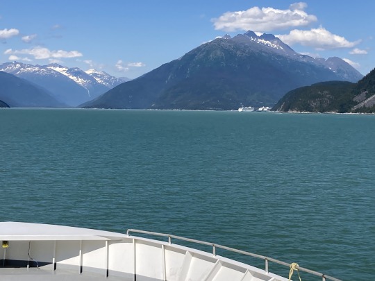
We said our goodbyes with Haines and drove out to the ferry terminal to find out that the ferry was late arriving. We decided to stay there and wait and I had my midday nap:) We loaded onto the ferry at 1:30pm and we were on our way to Skagway up the next fjord. The ferry ride was uneventful, which is nice and the weather was mild and sunny.
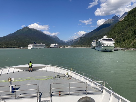
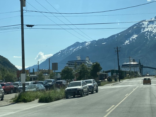
We arrived in Skagway where there were 4 cruise ships docked and the town was buzzing with tourists like we see in Banff.
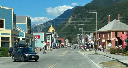
We were glad that we had spent the extra days in Haines. After a slow cruise through town we started on the road to the White pass.
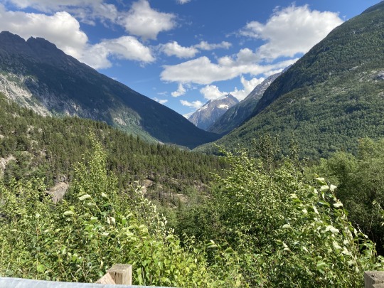
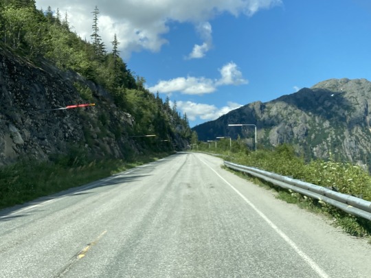
The terrain along this road is very different than it was driving from Haines Junction to Haines. The valley is very narrow and steep hillsides. There are several pullouts on the road with signage of the Klondike gold rush days and the hardships the Stampeders endured over 100 years ago.


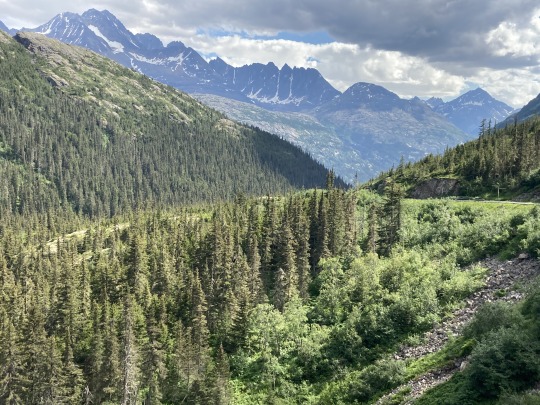
The White Pass railway runs along the opposite side of the river, along cliffs and over bridges. At one point the railway moves along a side valley to gain enough altitude to make it over the White Pass.


The roadway is in good shape all the way to the summit. We saw 2 bicycle groups, probably from the cruise ships, biking up the pass for an easy way down.


We crossed into Canada just past the summit of 3700’ above sea level and it was like we had arrived at another plateau. The terrain is very rocky with many small lakes along the way and then we came to the summit lake. The colour of the water was amazing and the hillsides are bare all the way to the top.

We drove along Tutshi and Tagish lakes, two large lakes just before we got to Carcross, a small town at a junction south, north and east. We arrived in Whitehorse in time to have dinner with our friends Will and Chanelle.
0 notes
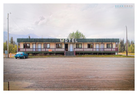
Photo
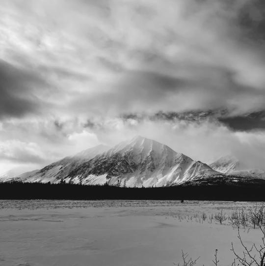
Above: Alaska Highway Roadhouse 3, Yukon Territory, Canada.
A THIRD RARE GLIMPSE OF A BYGONE ERA.
Welcome back. IN AN EARLIER POST, I presented the first photograph of a bygone era: the ALASKA HIGHWAY ROADHOUSE.
These roadhouse photographs are from a series showcasing the remote northern beauty of YUKON TERRITORY along the ALASKA HIGHWAY.
HISTORY: THE ALASKA HIGHWAY ROADHOUSE.
Many Alaska Highway roadhouses evolved from American military camps built during the construction of the 2,700 kilometre highway completed in 1942.
It may not look like much, however a roadhouse offered respite from harsh weather conditions with a place to sleep, meals and gasoline, and were spaced no more than a day's drive apart.
THE YUKON TERRITORY SERIES.
Originally photographed in 2015, it’s incredibly interesting to revisit these photographs almost 8 years later, and have the opportunity to perform more work on them. One of the details I’m taken with are the snow-capped mountain peaks. Though it was summer, snow is visible year-round.
ALASKA ROADHOUSE 3: SHOP FINE ART PRINTS.
One version of ALASKA HIGHWAY ROADHOUSE 3 is available.
ALASKA HIGHWAY ROADHOUSE 3 FULL FRAME
Choose traditional silver-halide, archival giclée or gallery-wrapped canvas prints. Order via my online gallery or CONTACT ME. I’ll ensure you’re ordering exactly what you want.
Thank you for visiting. See you next time.
SEE MORE DEAN OROS FINE ART PHOTOGRAPHY.
Curated collections of my photographs are available to enjoy in your home, office or retail space.
Virtual Gallery: DEANOROSPHOTO.COM
Social: INSTAGRAM | FACEBOOK | TWITTER
artistry + documentary
#Alaska Highway#roadhouse#haines junction#dawson city#yukon territory#landscape photography#whitehorse#photoart
0 notes
Text
There's a fat disgusting white pig in my cul de sac who some Washington asshole employs. I'm.sure it's Amazon, Google, Microsoft, Facebook, etc
This fucking hole will never be my home.
Here's my list of paranoia - 4 solid years of almost car accidents, some really close, getting a ticket for reckless driving, white apologies, more scumbag CBP & rude cops in 2 countries than any sane woman would want to.punch in the face. An almost divorce, having to raise two small children, get taxed up the ass, give to charity, school lockdowns, 2 kids with possible mild autism, imbeciles doctors, imbecile therapists, the creepiest neighbors on the planet eye raping at a pool and soooo much more. More ruined birthday parties, anniversary, vacations with obnoxious rude white women. Indian women are close second
Some female fuck lives with pig who smells like a repugnant shiny pedophile.
So again. Here's a fucking reminder of how many years of harassment that is. When you set a protective order against someone you fucking cunts. Try due process. It's not like your country is anything but a racist shit hole that sponsors terrorism. 🖕🖕
https://www.washingtonpost.com/world/2023/09/19/who-is-hardeep-singh-nijjar-sikh-canada-killed/
My favorite was when the car alarm across the street would go off whenever my husband and I would be having sex. Or how people would be standing outside my house at 3am in pissing rain when no animal is to be seen.
But I can pay more property tax and HOA fees for your welfare state to violate my rights..
A particular fuck you to the 'only India can produces engineers H1b visa program". Great science is done around the world.
Fucking ugly fat ugly revolting asshole. That would make me proud of myself too.
It would make me smug.
We've moved 2 times in the last 10 years. I don't want my children fucking near you disgusting fucking pigs.
No diversity training makes you a man, it doesn't stop marital rape, and hating of daughters. When an asshole stalks a child on your dime I'm fucking sure that's your liability. You can call me paranoid and delusional until your blue in the face you fucking pig. It doesn't make you anything more than the pathetic fuck you are.
Pay me out. I'm sure I won't see 20 uhauls in Haines junction if I fucking choose to live there.
I'm sick of being a man on your behalf.
PS I fucking promise you I WILL NEVER turn the other cheek again.
Evolution of an idiot. Ikea, fed governor at sfu, real estate bubbles, unfunded liabilities, water crises,GFC, foreclosures, bailouts, Facebook, Cambridge analytics, rcmp, Obama, go home, dumbing down stem in bc, Amanda Todd, white jeep, jeep, yellow jeep, raped Indian women, with umbrellas, fat depressed white women, ugly white pedophiles, see something say something, teach me a lesson, protective orders, Woodinville Washington, my mother's stroke, Oregon plates in bc. Just a taster of my beautiful mind.
Wow what a life of the mind. It's like the worst black mirror episode on the fucking planet.
Excuse the brevity of this response. I'm too tired being a responsible adult. I'm sure I could write a PhD about your corruption.
Did you fucking want to tell me about CASTE asshole.
Total plot twist and nail chewer
1 note
·
View note
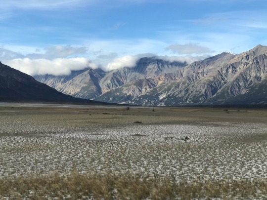
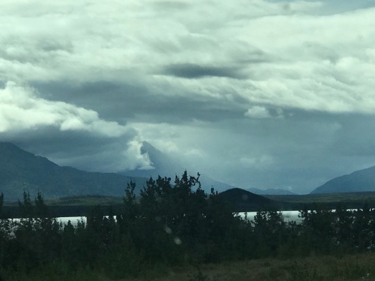
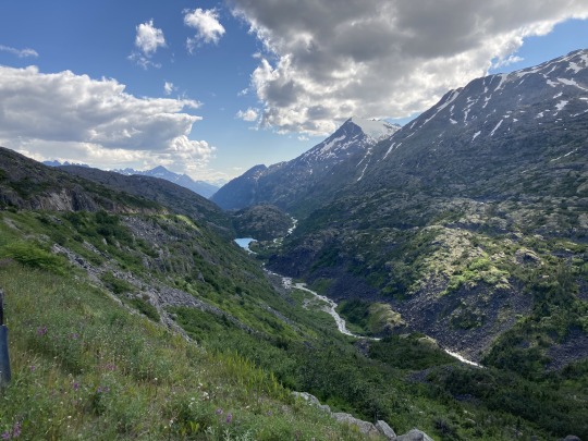
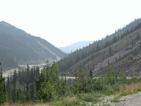
Photo

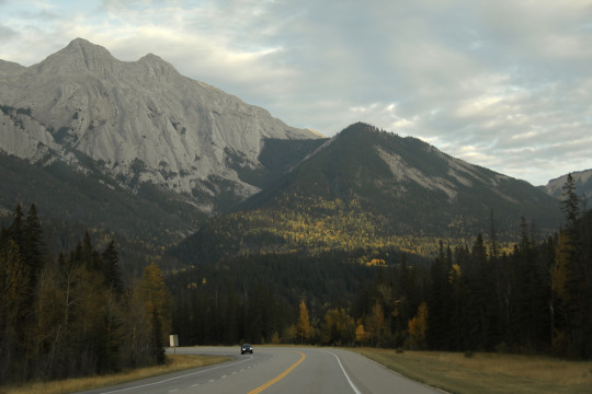
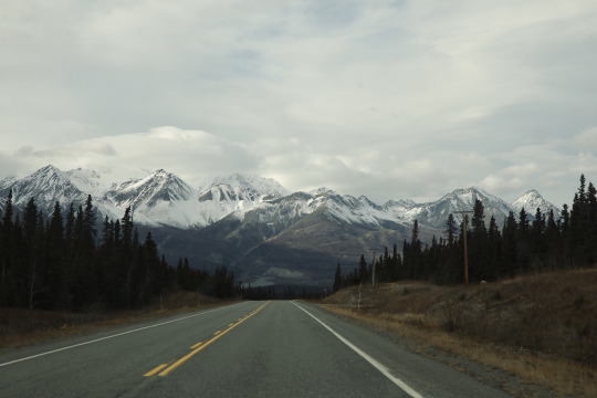

Highway views, Alberta to Haines Junction
Taken November 2022
720 notes
·
View notes
Text
July 29. Another slow going day as this is the worse stretch of roads. Tok to Destruction Bay YT. We went about300 miles. We had a 45 minute delay with road work!!
Camped along a river in Haines Junction YT. Quill Creek. Beautiful spot. The campgrounds that we would like were full


1 note
·
View note
Text


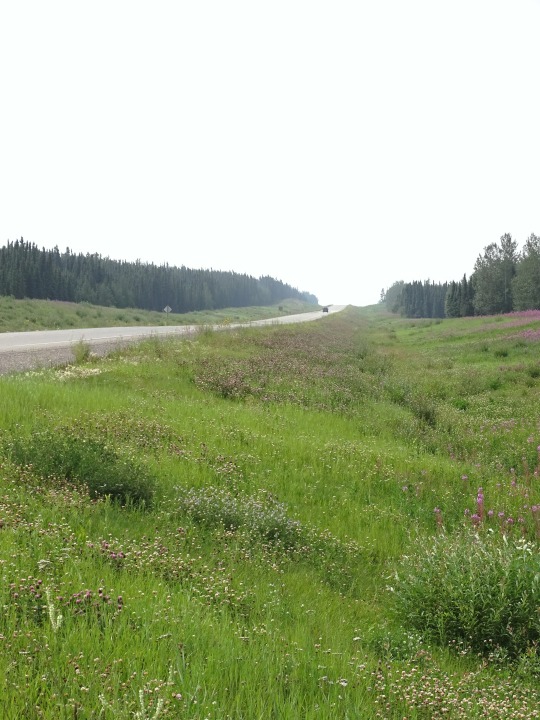

Alaska Highway, CDN (No. 4)
The original agreement between Canada and the United States regarding construction of the highway stipulated that its Canadian portion be turned over to Canada six months after the end of the war. This took place on April 1, 1946, when the U.S. Army transferred control of the road through Yukon and British Columbia to the Canadian Army, Northwest Highway System. The Alaskan section was completely paved during the 1960s. The lower 50 miles of the Canadian portion were paved in 1959, but the remainder was largely gravel. While the entire route is now completely paved (mostly with bituminous surface treatment), as late as the mid-1980s the highway still included sections of winding dusty road sandwiched between high quality reconstructed paved segments.
The Milepost, an extensive guide book to the Alaska Highway and other highways in Alaska and Northwest Canada, was first published in 1949 and continues to be published annually as the foremost guide to travelling the highway. The settlement of Destruction Bay was originally a work camp for the highway.
The British Columbia government owns the first 82.6 miles (132.9 km) of the highway, the only portion paved during the late 1960s and 1970s. Public Works Canada manages the highway from Mile 82.6 (km 133) to Historic Mile 630. The Yukon government owns the highway from Historic Mile 630 to Historic Mile 1016 (from near Watson Lake to Haines Junction), and manages the remainder to the U.S. border at Historic Mile 1221. The State of Alaska owns the highway within that state (Mile 1221 to Mile 1422).
The Alaska Highway was built for military purposes and its route was not ideal for postwar development of northern Canada. Rerouting in Canada has shortened the highway by about 35 miles (56 km) since 1947, mostly by eliminating winding sections and sometimes by bypassing residential areas. The historic milepost markings are therefore no longer accurate but are still important as local location references. Some old sections of the highway are in use as local roads, while others are left to deteriorate and still others are plowed up. Four sections form local residential streets in Whitehorse and Fort Nelson, and others form country residential roadways outside of Whitehorse. Although Champagne, Yukon was bypassed in 2002, the old highway is still completely in service for that community until a new direct access road is built.
Source: Wikipedia
#60th Parallel#Summit Lake#Watson Lake#Alaska Highway#street scene#travel#original photography#vacation#landmark#landscape#countryside#summer 2023#flora#nature#woods#forest#mountains#Canada#Yukon#bridge#Alaska-Canadian Highway#ALCAN Highway#Alaskan Highway#the North#no traffic#tourist attraction#British Columbia#Racing River Bridge#river bank
9 notes
·
View notes
Last Seen Blogs

travelingkai
The Best Is Yet To Come, My Friends
iknowartgood
I Know Art Good

abstractedthinking
The Road Goes Ever On And On

inevitable-sentir
Los Hijos de la Luna

thathotcoupleyouknow
thathotcoupleyouknow