#some other part of the sierra nevada mountain range i think just before Nevada
Text


Misc road trip pics! :-)
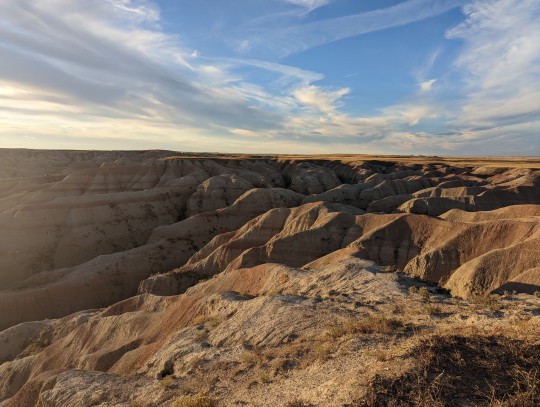
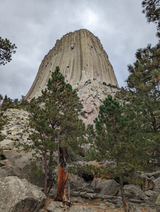
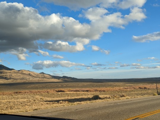
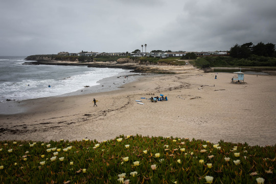
#trip pics#just preliminary ones! vant unload yhe good ones from my camera til i get back#fancy camera died yesterday tho :( so no good camera pics of the sierra nevada mtn range n yhe sequoia natl park sadly#top to bottom locations;#Badlands National Park in South Dakota#Devil's Tower in Wyoming#some random place in Wyoming bc its just. beautiful statw fr#Donner Lake in California#Capitola beach in California#King's Canyon in California#Sequoia National Park in California#the sierra nevada mtn range behind sequoia natl park#some other part of the sierra nevada mountain range i think just before Nevada#somewhere between death valley and the Mojave on the way to vegas but its rly pretty desert n look at all yhose joshua trees!!#anyway im having so much fun#there was a bear at our campsite last night which was less fun
22 notes
·
View notes
Text
The Red Flannel Dress | Kinktober 2023
title: rocky mountains
prompt: phone sex (courtesy of @flightlessangelwings)
pairing: eric/christine (as the seasons grey)
word count: 3393
masterlist | ao3 🍎

She paced about the room with her hands stuffed into her pockets. It was a cold, blustery afternoon on the first day of a Nor'easter and she worried about Alex. He had been caught up over at the school with some extra work, and the snow had begun to fall in thick white sheets straight from the darkening sky overhead. He vowed to call her once he came home given he had promised to give her and Eric a private session with his nylon guitar later that day, but she also wondered about spending a little more time with him as she hadn't seen him in a few days, not since Captain Howdy once again sank her claws into him and dragged him back down to proverbial hell.
She couldn't understand it. After everything that he had given to Christine, including the comfort and coziness of his body, he still fell for the demon that continued to haunt him, even though she could see it in his eyes.
She needed to be alone with him, not to give him an ultimatum but to show him what he missed when he was with Captain Howdy.
That would be it. That would be the move to take, just as Nelly had suggested to her. No blood, no guts, nothing too over the top, just the power of her own words.
Christine finally took her seat next to the arm of the couch, right where Alex usually took his spot whenever he came over to visit. There was a part of her that persistently thought about him in the worst way, the one that told her he was going to drive off the side of the road and hydroplane into the nearest storm drain, and more so the case as the streets of New York became utterly treacherous during a harsh blizzard such as that. If there was one glimmer of hope, it was that at least they weren't upon a tall mountain.
She thought about the views of the Coastal Range and the Sierra Nevadas back over in California, the stark mountains against the ocean as well as the towering cold giants in that respective order, and she couldn't help but shudder at the thought of Alex having to drive down one of those roads during a squall. It was interesting to think how he had lived over there for the first thirty years of his life, and there had only been a few times in which it snowed in the Bay Area.
“It doesn't happen often, but when it does, it does,” was what he told her.
The thought of cozying up next to him on a snowy day. There was nothing like it.
Christine glanced at her dark emerald green phone as it lay on the table between the arm of the couch and the recliner. It was like waiting for Chris to call again all those years ago, when she had to wait until he came home. It was exactly like waiting for Chris to call again.
She sighed through her nose and reached for the phone. She flipped it open and searched for him in her address book: right at the top, above her parents.
It rang once, twice, five times. And then—
“Hey, this is Alex, I'm not home right now—I'm either teaching a class, performing, or taking a nap. Leave a message and I'll get back to you.”
She hung up with a flip of the phone before she even so much as reached the beep part of it. Just so long as she heard his voice for a brief moment.
Christine gently opened her phone and searched for Eric's number in her address book: right behind her father.
It rang once.
“Hello?” His voice crackled on at the other end.
“Hi,” she replied. A brief pause on his end.
“Who's this?”
“It's Christine.”
“Oh, hi! I didn't recognize your number at first.”
“That's okay! It happens to me sometimes.”
“Uh... what's going on?”
“I just wanted to call you and ask if you've spoken to Alex at all,” she explained.
“It's really weird, I was just thinking about him.” Eric cleared his throat. “Is Alex even home?” he asked her: a crackling noise on his end made it sound as though he, too, had been caught up in the blizzard. “I, uh... actually tried to call him when I got home, and I got his voicemail.”
“I guess he's still at school,” Christine replied. “I can't remember why exactly, it's just he had some extra shit to do. I'm a little worried, if I'm honest.”
“How come?”
“Well... look outside. It's snowing like a bastard out there and I worry about him getting stuck over there. You know, he's just got that little car that looks like it could fall apart if he goes over a bump too hard.”
“Yeah, he finally had to put duct tape on the rear window. Remember when we got stuck with him again—”
“And Valentina and Lou were both with us that time, and the five of us were freezing our butts off?” she finished for him. “Oh, yes.” She shook her head at that, but then again, the brief silence on his end made her wonder if there was something else in the wings.
“I have to tell you something,” he said with a clearing of his throat.
“Go ahead,” she coaxed him. She heard him swallow and shuffle about on the other end. She could only imagine what he was doing.
“What're you thinking about right now?” he asked her, and he cleared his throat again.
“I'm thinking about a number of things,” she replied as she ran her fingers through her hair. “Why? Is it really that important?”
“I guess you could say that,” he began, that time in a lower tone of voice.
“Well... start slow,” she encouraged him. “I don't want you to get all caught up in your own thoughts. That happens to me all the time, and I'll admit that it can be a bit hard to come back home to your body—”
“I'm thinking about how you and Alex get together as often as you do,” he interrupted. “And I'm thinking about—you.” Christine nibbled on her bottom lip, and she glanced about the room, even though she was alone in her apartment. Wendy had gone up the street for a few errands, and Alex still hadn't called her or left a message in her call waiting.
Eric fell silent for a second, and she could only assume it.
“Eric, is there something you want to tell me?” she asked him in a small voice. Silence. “Eric? Are you there?”
“Yeah.”
“Is there something you want to tell me?” she repeated again, that time in a near whisper. He fetched up a sigh.
“Okay,” he began. “But... please don't tell Alex.”
“You know me,” she promised him. “Whatever it is, if it's something that you don't want him to hear, I promise you that I won't tell him. I won't tell Nelly, I won't tell Valentina, I won't tell my mom, I won't tell anyone.”
He sighed again, that time with a slight whistle after it.
“Okay,” he started again. “Please don't get upset with me.”
“Eric, you're my friend,” she assured him with a chuckle and a little twirl of her hair around her index finger, the same thing she would do whenever she spoke on the phone with Alex. “It's going to take a lot to upset me.”
She pictured him there next to her on the couch, with his head bowed and a piece of his black hair spread over his face to hide his gaze from her. It was something significant, and something that she had no idea as to what to do with once he said it, either.
“Sometimes I think about you, and I—I—” He stopped right in his tracks.
“Yes?”
“—touch myself.” Christine raised her eyebrows at that.
“Really?”
“Yeah...” He let out a low whistle, and he followed it up with a bout of heavy breathing. “Feels good to get that off my chest. Phew.”
“Oh, do you now?”
“Yeah. I'm sorry, that was too much.”
“No, no. It's okay. It's okay to feel that way. You know, if it's any comfort, sometimes I find myself doing the same thing thinking about Alex.”
“Really? Well, see, that, I understand, because you guys crush on each other big time. But… you and me, though. That's—that's, well—”
“What?”
“I really want to say 'unexpected',” he confessed. “I don't want to say 'weird', though.”
“It's unexpected,” she assured him. “Eric, I have seen you looking at me before. I know it when a guy looks at me, usually because they never did.”
“Really? You?”
“Oh, yeah,” she replied. “When I was a teen, I never got hit on or anything like that. I got lots of awkward smiles, but nothing to reassure me that I was a hot girl, though. Probably because I never did feel that way.”
“What if I told you that you're a hot girl now?” he asked her.
“I'd... be flattered,” she sputtered out. “And I would think that it's really sweet of you to tell me straight up that you jerk off to the image of me.”
He let out a low whistle right then.
“Is there something else you want to tell me?” she asked.
“What're you wearing?” he asked her.
“Oh, you know. Usual stuff. Jeans, fuzzy socks to keep my feet warm... I'm not wearing a shirt, though.”
“Oh?”
“Yeah. I'm wearing a black lace bra that I bought to share with Alex, but—I think I can make arrangements, though.”
“What size?” he asked her, and it sounded as though he was out of breath.
“What size? Forty triple D cup.”
“Holy shit. We're lucky fellas, me and Alex.”
“Indeed you are.”
“Oh, my god, those are like—like—you could walk around and dance for me and him on a stage with those.”
She giggled at that. “You would like that, wouldn't you?” she teased him. “I could dance and prance about on a neon lit stage with my tits out and let you boys pay with all the dollars you got on you.”
“Show us your ass and your legs, too,” he added.
“Would you rather I twirl about on the pole or would you rather I come to either of you?”
“You can take him first 'cause of familiarity, but you come to me because you'd be saving the best for last,” he said in a single breath, and she giggled at that.
“I like the way you think, Mr. Peterson,” she teased him.
“Hey, now, Mr. Peterson is my dad,” he scoffed.
“But I like the way you think, though,” she insisted. “It's... interesting.”
“Different change of pace, too?”
“More or less. Alex is so sweet, and so passionate. He's really sensual, too. It's like getting swallowed whole by ocean waves. Sometimes I do wonder about the boy with brown eyes, though.”
“I guess you could say I'm coming in hot,” Eric quipped with another clearing of his throat.
“Do you feel okay? You're clearing your throat an awful lot.”
“Oh, yeah. I'm just... kinda—nervous is all.”
“Don't be, hot stuff,” she insisted.
“'Don't be hot stuff' or 'don't be, hot stuff'?” he asked her.
“The second one,” she giggled.
“Oh, 'cause I was gonna say, how can I not be hot stuff?” She giggled some more at that.
“Are you really hot stuff, though?” she asked him.
“You tell me, 'cause you're the one giving me and Alex the lap dance.”
Christine ran her tongue along her bottom lip at that. There had to be something she could use to stimulate herself as well as him.
“So, tell me,” she started again. “What am I wearing at the strip club?”
“You tell me,” he insisted. “You're the stripper.”
“Hey, now, don't be greedy,” she scolded him. “I've got that black lace on over my boobs, as well as a—matching panties. They're really light so they're easy to see everything.”
“Everything?”
“Everything and you know it, baby,” she said. “I've got my ass on Alex's lap and I've got my feet up on yours.”
“Can I kiss your legs?” he asked her.
“Please. You can kiss my legs while Alex fingers me with those long guitar player fingers of his.”
“Can I finger you after he finishes?”
“Of course! As long as you let him kiss me on the chest.”
“Can I kiss you on the chest after he finishes?”
“Of course! As long as you boys can swap places.”
“Phew...” Eric moved away from the phone right then, and Christine couldn't help but run her tongue along her bottom lip again like that of a serpent.
And it was right then she had an idea. She stood to her feet and walked into the bathroom, still with the phone in her ear.
“Could we pay you now or later?” he asked her right then.
“Whatever you want,” she said with a shake of her head even though he couldn't see her. “Do you think maybe you two boys would want another lap dance or two after that, too?” She then held the phone to her ear with her shoulder as she switched the bathroom light on.
“God, you know I would,” Eric stammered, and it sounded as though he had choked on something. “Dunno 'bout him, but I think for sure that I would love that. I never realized how hungry I was before until I started talking to you.”
She opened her medicine cabinet and took out a bottle of lotion.
“I'm about to rub lotion on my body,” she told him, and she heard him gasp.
“What kind?”
“Really nice stuff, it smells like vanilla and cinnamon. It's so you remember me even after you and Alex leave the strip club.” She squirted out a little bit onto her palm and rubbed her hands together. “I'm rubbing it all over my belly and my boobs, too—going down inside my bra.”
“Whoa...” He gasped. “Are you in the bathroom?”
“Oh, you know I am,” she assured him. “You know I am, big fella.”
“You know, it's funny 'cause... I'm in the bathroom, too.”
“Oh, dear. What'cha doing in there?”
“You tell me,” he chided.
“Let me guess. You've found some tissues.” She reached behind her back to unhook her bra.
“I did, yes,” he said.
“You're putting them on you,” she said, and she lowered her voice to a near whisper. “You've got one hand on your dick and it's lined with a few of them.”
“Keep going...” he grunted out.
“You're looking at my tits,” she continued, and she let the straps of her bra slide off her shoulders. “I'm taking off my bra, and I'm doing it so slowly so you have a view of the areolas as they're coming out of hiding. You watch the straps fall off to my elbows, and you watch the tops of the cups fall right off my boobs. It's just you and me, baby.”
“Keep going...” It sounded as though he was holding his breath.
“You put your lips on my chest and you kiss the insides of my breasts. My skin is so soft and it smells like cinnamon.”
“Cinnamon girl, cinnamon girl... keep going, keep going...”
“I hold the back of your head so you don't let me go. You move your head to my nipples, and let me tell you, I love having my nipples kissed and touched.”
He gasped.
“But I'm going to tell you this now, though,” she said in a soft whisper as she rested her hand upon her chest. “I don't come easy. That's why Alex is as deliberate as he is. He knows that I don't come right away, nor am I a screamer.”
“What do you do then?” he asked her in a hoarse voice.
“I moan, I groan, I kiss you, I laugh, I shudder and shake, and I might yelp out, too.”
“I want to make you scream,” he insisted.
“You want to make me scream?”
“I want to make you scream so loud that it'll wake the dragons out of their lair,” he teased her.
“You mean wake the dead?”
“No, I mean the dragons. Make the dragons ravish and rage against your body. I come for you in shining armor and a sword on my belt.”
“You sure you won't use your sword on me?”
“I already have,” he whispered out, and then he made a sound that resembled to choking. “Oh, god—oh, god—oh, god—here it comes.”
She chuckled at that.
“Phew. That was a lot.” Eric breathed hard as if he had been running. Her phone clicked right then.
“There's my call waiting,” she told him.
“Oh, shit, what would Alex think?” he asked her.
“Let him use his imagination,” she advised him. “He's a big fella, too.”
A brief pause. “How big we talking?”
“Have you seen him with tight pants, Eric? He's always getting a hard on, it seems like.”
“How would you know?” he teased her.
“Oh, you don't think my eyes wander?” she scoffed. “It's like every day, he takes his seat at the front of the class with his legs wide open, and he shows off that nice juicy boner that I know is waiting for me from under that nice denim. And I imagine the same thing happening to you right now. You thinking about my tits and how they're still exposed right now.”
He snickered at that.
“Nice try but... I'm not a woman,” he scoffed back. “I can't orgasm more than once.”
“Are you sure?” she asked him.
“Positive.”
“Really? You don't think you can come another time for me?”
There was a pause on his end. “I refuse,” he stated.
“You refuse?”
“Yes. Even if I could orgasm a second time, I refuse to do it again for you.”
“Oh, really? You don't think I can't rub more lotion on my body and get you thinking, you bad boy?”
“Positive.”
“What if I sit on the edge of the bathtub and rub my clit with two fingers and breathed right into the phone?”
Another pause. “Would you?” he asked her.
Christine took her seat on the edge of the tub. With her free hand, still coated in a fine layer of lotion, she reached down the front of her pants.
“Wait, what about Alex?” he asked her, slightly worried.
“He can wait. Trust me, I have cock teased him a few times. He tries to brush it aside and say it's petty, but I know he loves it.” She slipped one finger under her hood. “I got a finger in. I'm right in front of your face. I've got my bra dangling off my chest still.”
“Am I coming for you in armor and with the sword?” he asked her.
“Yes. Yes, you are. You're coming for me, and you are down on your knees before me. Those thick fingers on my thighs. Your lips on my hood.” She barred her teeth as she dug in deep.
“How deep am I going?” he whispered.
“Quite deep... you've got your tongue on me and your sword out to protect me.”
“Am I going so deep that you shoot your arms up and show off those tits?”
“Always,” she said with two fingers in that time. She breathed harder at the gentle feeling. “Always. And we're at the top of the highest mountain, the chilliest of winters. The heart of the Rockies. It's cold and I am tight as a needle. You are ready for another round.”
“Indeed, I am!” Eric let out a low moan, and she knew that she made him come a second time, even though he swore that he would never do it. Christine laughed as the feeling welled up inside of her: a deep tickle that manifested into that familiar euphoria.
“Oh, god, I made another mess,” he groaned, and then he cleared his throat yet again.
“You better clean it up,” she teased him as she strove to catch her breath. “I've gotta see what Mr. Skolnick is doing.”
#kinktober 2023#kinktober#kinktober day 6#day 6#fanfic#fanfiction#as the seasons grey fanfic#as the seasons grey#testament fanfic#testament#testament band#oc tag#eric peterson#smut warning#smut#writing#also on ao3#text#80s thrash
3 notes
·
View notes
Link
This story is Part 1 of a series
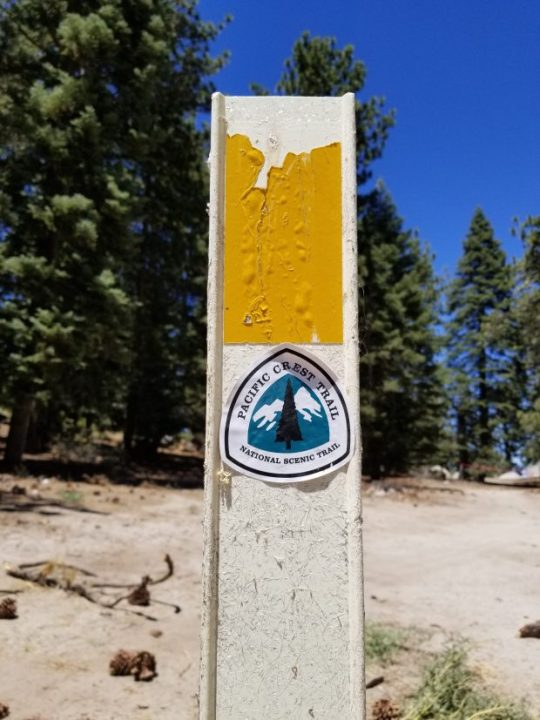
This is the last thing anyone knows for absolute certain about David O’Sullivan:
On the morning of April 7, 2017, the 25-year-old from Ireland checked out of a motel in the snowy mountain town of Idyllwild.
Sixteen days earlier, he’d set out hiking from the Mexican border. Nature and his own inexperience had made the 180 miles he’d covered, through deserts and up and down mountains, challenging.
In one of the last messages he would ever send, he told a friend that he was getting things sorted out, but it had been hard so far. “I knew it would be, but …” he wrote, cursing for emphasis.
“I love it.”
This was supposed to have been just the beginning of a 2,650-mile journey, following the Pacific Crest Trail through the iconic mountains of the American West all the way to the Canadian border.
Instead — as far as anyone knows — Idyllwild was the end.
He never met up with a friend in Santa Barbara, as he’d planned.
His bank activity stopped.
His parents never heard from him again.
Read the series
Part 1: The mysterious disappearance of Pacific Crest Trail hiker David O’Sullivan
Map: David O’Sullivan’s 180-mile Pacific Crest Trail journey
Part 2: Who’s looking for David O’Sullivan? At first, almost no one
More: Missing in the mountains: 4 families ache for those lost
Part 3: 4 years later, searchers seek an answer: What was David O’Sullivan’s fate?
But they had expected him to be out of touch for weeks at a time. That, combined with some incorrect information they received when they first started to worry, and the difficulties of being on another continent, resulted in it taking three months for O’Sullivan to be reported missing to local authorities.
By the time the Riverside County Sheriff’s Department got the case, their search efforts would not have been a rescue mission. Either he was missing on purpose, or they were looking for his remains.
Investigators spent a few months looking into both possibilities, including checking into a few reported sightings and conducting one official search, then closed the case when they concluded they’d run out of leads.
Four years later, O’Sullivan has never been found.
But a group of volunteers from across the U.S., none of whom ever actually met O’Sullivan, haven’t given up. Motivated by his family’s palpable grief and a desire to bring them closure, they’ve poured countless hours into searching for him.
A post marks the Pacific Crest Trail on the northwest end of Fuller Ridge in the San Jacinto Mountains. (Photo by Nikie Johnson, The Press-Enterprise/SCNG)
The pandemic interrupted their efforts in 2020. But in late 2019 and early 2021, the same people looking for O’Sullivan found the remains of two other people who’d gone missing in nearby regions, and their leader has started a nonprofit foundation to help them keep looking.
Though they can’t be certain, they don’t believe O’Sullivan made it out of the San Jacinto Mountains, the range that surrounds Idyllwild. They’ve focused their efforts around Fuller Ridge, a notorious 5-mile stretch of the Pacific Crest Trail that was still covered in ice and snow that April, and where numerous other 2017 hikers reported dangerous experiences sliding off the trail.
Maybe O’Sullivan — who had no experience in those conditions — fell and met a quick end, or was hurt but had no way to call for help. Maybe he got off track and hopelessly lost in the steep, forested wilderness. But the searchers are convinced his remains are out there, just waiting for someone to find them and send them home to his parents.
“I still wake in the middle of the night — not every night anymore, like I did in the beginning — just thinking, ‘Where is he?’” said his mother, Carmel O’Sullivan.
Inspired by ‘Wild’
David O’Sullivan was one of almost 4,000 people who got permits from the Pacific Crest Trail Association to hike the entire route in 2017. The association is a nonprofit that helps maintain the trail, provides information and issues long-distance permits, but does not keep track of hikers along the way or take responsibility for their safety.
The number of PCT thru-hikers, as they’re called, has increased steadily since “Wild: From Lost to Found on the Pacific Crest Trail,” the best-seller by Cheryl Strayed that tells of her life-changing experience, was published in 2012 and then turned into a movie starring Reese Witherspoon in 2014.
O’Sullivan was one of the many people inspired by Strayed’s memoir to attempt the trail.
“I think this was his way to find himself, which a lot of PCT hikers do,” said Cathy Tarr, the woman now leading the volunteer search efforts, who has become close with O’Sullivan’s family over the past four years.
“He wanted to do the PCT after college but before he got into the real world,” Tarr said. “Possibly proving to himself and to others that ‘I can do that.’”
O’Sullivan had grown up in the countryside outside Midleton, a town of about 12,500 people in Cork County in southwest Ireland. He went to University College Cork and graduated in 2014 with a degree in English, then moved back home.

David O’Sullivan, then 25, of Ireland, took this photo of himself while he was hiking the Pacific Crest Trail in Southern California in spring 2017. (Photo courtesy of the O’Sullivan family)
“I am often asked by our searchers ‘what was David like,’” Carmel O’Sullivan wrote in a Facebook post on the second anniversary of his disappearance. “As a child he was full of fun and mischief often making us laugh with his stand-up comedy. He performed on stage at youth theatre and in his school plays. He grew up to be a thoughtful, kind, and loving young man. He cared about a lot of issues including human rights and equality for everyone. …
“David’s other great quality was loyalty. Loyalty to his family, his employer and his great bunch of friends,” she wrote. “He met some of them his first days of school and they remained friends through all of their school years and beyond.”
He wasn’t an athlete, his mom said, but he did have a black belt in karate and enjoyed hiking and bicycling.
Once he’d set his sights on the Pacific Crest Trail, he spent about a year working at a gas station to save up money.
His parents were surprised — and not thrilled — when he told them about his plans in late 2016. By then he’d already done his research and started physically training.
But the mountains in Ireland are nothing like what he’d encounter in the U.S. They only get up into the 3,000-foot range, a fraction of the lofty elevations of the Pacific Crest Trail, and they rarely have much snow. He wouldn’t have been able to practice with equipment such as crampons or microspikes, which go on your shoes to improve traction, or an ice axe, which you can use to stop a fall if you start sliding downhill.
It was unfortunate, then, that when O’Sullivan applied for his PCT permit, he got an early-season start, on March 22, 2017. To minimize the environmental impact of thousands of hikers, each one is assigned a start day, with no more than 50 per day setting out from the southern end of the trail. Mid-April to early May is widely considered the best time to begin, the sweet spot when you have the best chance of hitting mountains that aren’t too snowy and deserts that aren’t too hot.
The “Wild”-inspired popularity of the trail happened to begin at the same time California entered a yearslong drought, so the PCT hikers who had filled the internet with accounts of their trips in recent years had been describing conditions that were very different from what O’Sullivan would encounter in 2017 — the year that drought finally ended.
“There’s been a lot of rainfall lately,” he wrote in an email to his dad a week into his hike. “It broke a drought the area has had for years. All the desert flowers are in bloom. I can often smell their perfume-like aroma as I hike. Most of the place is covered in green and there were streams everywhere for the first few days. It’s a weird time to be in Southern California. It’s not usually like this.”
He knew that the Sierra Nevada had received heavy snowfall, and that he wasn’t equipped for it. He planned a strategy that thru-hikers call flip-flopping: skipping over the Sierra portion of the trail initially, then returning later when enough ice and snow had melted for him to feel safe.
The San Jacinto Mountains can’t compare to the Sierra, but the conditions were dangerous enough. Up to 3 feet of snow still covered parts of the PCT by the time O’Sullivan came through, according to a San Jacinto Mountains trail report written by Jon King, an Idyllwild man who estimates he hikes about 5,000 miles per year in the local mountains and runs a website that describes current conditions.
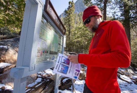
Jon King of Idyllwild posts a flyer with information about Pacific Crest Trail hiker David O’Sullivan, who has been missing since 2017, on Tuesday, March 3, 2020. (Photo by Andrew Foulk, Contributing Photographer)
King’s post from March 30, 2017 recommended using microspikes or crampons for traction and poles or an ice axe for support. By April 11, some snow had melted, but King wrote, “Many PCT trail posts above 8000’ remain hidden under snow drifts, making navigation somewhat difficult.”
At least four other hikers had to be rescued that March and April, according to the Riverside Mountain Rescue Unit, a volunteer group that often assists the local sheriff’s department. One was a PCT hiker who had fallen down the mountain near Black Mountain Campground, at the northwest end of Fuller Ridge, on March 30. He’d lost all his water and his stove in the fall and “had exhausted himself climbing back to the trail repeatedly,” rescuers wrote. On the way to get him, their own truck got stuck in the snow three miles from the trailhead.
Hardships, high spirits
O’Sullivan’s longest email was sent from Julian, a mountain town in San Diego County, a week after he set out from the trail’s southern terminus near the town of Campo. In the message, which Tarr shared with this news organization with his parents’ permission, he described some of the people he’d met so far and seemed surprised and disappointed there hadn’t been more.
(It’s not unusual for people to hike the PCT alone: About two-thirds of the people who responded to a survey by the Halfway Anywhere blog in recent years started solo. For many hikers, one of the appeals of the adventure is finding a “trail family” along the way.)
O’Sullivan also wrote about how he wasn’t covering the distances he’d hoped to. Someone he shared a campsite with on his third night — who had hiked in two days as far as O’Sullivan had in three — helped him realize his pack was too heavy.
“I got my kilos and pounds mixed up when I was measuring it,” he wrote.
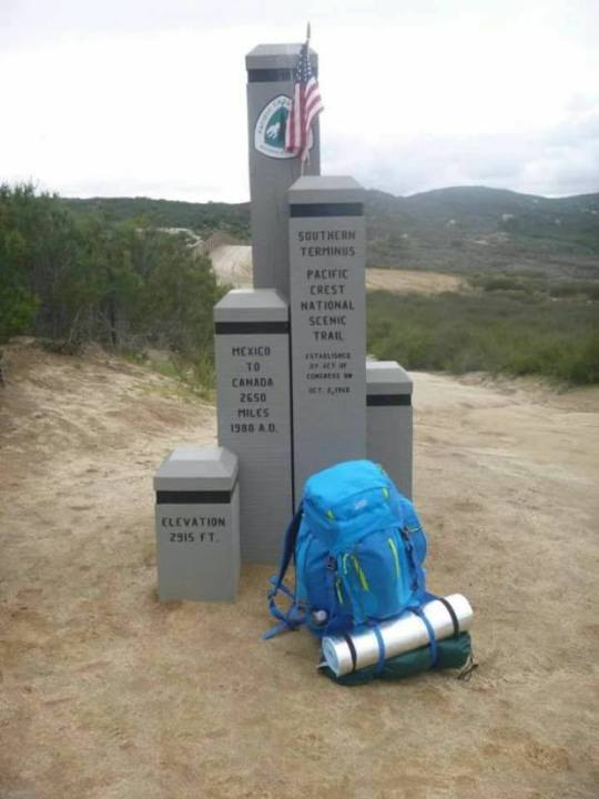
David O’Sullivan took a photo of his blue backpack at the southern terminus of the Pacific Crest Trail near Campo, California, just north of the Mexican border, when he set out to begin the 2,650-mile trail on March 22, 2017. O’Sullivan disappeared about 180 miles in. (Photo courtesy of the O’Sullivan family)
The next day, O’Sullivan met someone who worked at an outfitter in the town of Mount Laguna, who helped him pare down his load and sold him a new tent, sleeping pad and other items that would be lighter than what he’d purchased in Ireland.
“I’ve been flying ever since,” he wrote. “I think I’ve dropped about 12 pounds of equipment since day one and I can really feel it.”
His pace picked up in the hundred miles between Julian and Idyllwild — he managed 20 miles one of those days — but his struggles weren’t over. Another hiker who was on the trail at the same time as O’Sullivan, and who blogged about his trek, described a storm the night of March 31 that unleashed winds so strong they partially collapsed his tent and caused the rain to fall sideways.
That same hiker, Daniel Windsor, actually had lunch with O’Sullivan a few days later in Anza, at the southern base of the San Jacinto Mountains. They’d both stopped at the Paradise Valley Cafe, about a mile off the trail, whose burgers are mouth-wateringly famous among Pacific Crest Trail hikers.
“I sat down and talked to a fellow thru hiker, Dave from Ireland,” Windsor wrote in his blog. “Cracked lips and peeling skin attested to his story of losing his sun hat a few days ago. He had worked at a gas station for a long time to save up for this trip. Some people make some serious, long-term sacrifices to be out here.”
Windsor enviously described seeing O’Sullivan catching a ride from the cafe to the trail, while Windsor had to walk the mile back, and gave him a tragically ironic nickname: Lucky Dave.
O’Sullivan’s incredibly bad sunburn is one thing that stands out in his memory, Windsor said in an interview. Another is how unprepared O’Sullivan seemed.
“I got kind of a general feeling he was kind of getting slapped around by being out on the trail,” Windsor said. “That’s probably why I was trying to push him toward not trying anything he was not prepared for.”
He felt like O’Sullivan had romanticized the PCT as a place to escape to. Despite the rough reality, though, he said O’Sullivan’s spirits were high.
“He didn’t give any hints he wanted to quit, or escape the trail,” Windsor said. “He wasn’t miserable.”
He said hikers were aware there was still a lot of snow in the San Jacinto Mountains. Online, some who’d made it through portrayed Fuller Ridge as “the deadliest, iciest ridge on the planet, but others were saying it was nothing to worry about, you could do it in tennis shoes,” Windsor said.
He got the impression that O’Sullivan was going to try to skip some of the snowy sections up there, but he could have changed his mind depending on what he heard in town.
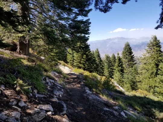
The Pacific Crest Trail cuts across the steeply sloped and thickly forested Fuller Ridge in the San Jacinto Mountains outside Idyllwild, Calif., in this August 2020 photo. In April 2017, when David O’Sullivan went missing, some hikers were running into trouble in the ice and snow that covered the ridge. (Photo by Nikie Johnson, The Press-Enterprise/SCNG)
Final days in Idyllwild
The San Jacinto Mountains tower over Riverside County’s sprawling suburban Inland valleys to the west and the Coachella Valley desert to the east. San Jacinto Peak, the high point, rises 10,834 feet above sea level. The mountains spread over hundreds of square miles of mostly public lands — national forest, national monument, state park, state and federal wilderness — and their granite ridges and valleys are covered by a tangle of trails that lay like yarn strewn across a map.
The network is dominated by the Pacific Crest Trail, which passes a couple of miles east of Idyllwild. Most PCT hikers take a detour into town to resupply and maybe sleep in a real bed.
O’Sullivan arrived April 5 and got a room at the Idyllwild Inn for two nights. In addition to the typical errands, he had a specific mission.
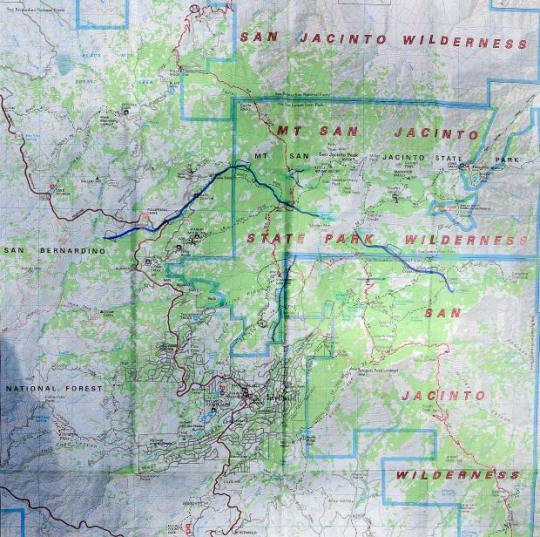
A map that’s been marked up by Cathy Tarr, who is leading volunteer search efforts for David O’Sullivan, shows the roads, trails and various public lands that cover the San Jacinto Mountains.(Photo by Will Lester, Inland Valley Daily Bulletin/SCNG)
He was traveling with very little technology: no cellphone, no GPS device to navigate, not even a rescue beacon to summon help in an emergency. He did have a Kindle, though he could only use it where he could connect to WiFi — and he hadn’t brought the right travel adapter, so he hadn’t been able to charge it.
He’d ordered a new adapter, but there was some sort of mix-up and it hadn’t made it to Idyllwild. He had to order another one, and complained in his final email to his parents, sent from the Idyllwild library on April 6, that he was going to get a later start back to the trail the next morning because he’d have to wait for the post office to open — a clue that he wasn’t planning on hitchhiking down the mountain, like Windsor thought he might have been considering.
The same day, O’Sullivan messaged his friend in Santa Barbara. The plan was to hike about 470 miles farther to the Ridgecrest area, where the trail transitions from the Mojave Desert to the Sierra Nevada, then catch a bus to Santa Barbara for a weeklong visit. He wrote that he thought he’d be there in about four weeks.
A month later, the friend messaged O’Sullivan again.
“Hey, when should I expect you to arrive here”
The next day, he tried again:
“Hello?”
Next in the series: Who’s looking for David O’Sullivan? At first, almost no one
-on May 26, 2021 at 01:05AM by Nikie Johnson
0 notes
Text
‘We’re Coming for You’: For Public Health Officials, a Year of Threats and Menace
[Editor’s note: This article contains strong language that readers might find offensive or disturbing.]
SANTA CRUZ COUNTY, Calif. — Dr. Gail Newel looks back on the past year and struggles to articulate exactly when the public bellows of frustration around her covid-related health orders morphed into something darker and more menacing.
Certainly, there was that Sunday afternoon in May, when protesters broke through the gates to her private hillside neighborhood, took up positions around her home, and sang “Gail to Jail,” a ritual they would repeat every Sunday for weeks.

This story also ran on This American Life. It can be republished for free.
Or the county Board of Supervisors meeting not long after, where a visibly agitated man waiting for his turn at the microphone suddenly lunged at her over a small partition, staring her down even as sheriff’s deputies flanked him and authorities cleared the room.
The letters, emails and cellphone calls that now number in the hundreds and inevitably open with “Bitch,” and make clear people know where she lives and wish her dead.
And that January meeting with Santa Cruz County Sheriff Jim Hart, after the vicious mob attack on the U.S. Capitol, when he recommended to a roomful of county officials that deputies do a threat assessment at each of their homes. Newel, who’d already been through the process, casually mentioned a New Year’s resolution to get more exercise and start walking to work. Absolutely not, Hart told her. She wasn’t walking anywhere without an escort.
Newel, 63, is the health officer in Santa Cruz County, a picturesque string of communities hugging California’s rugged Central Coast. In normal years, hers would be a largely invisible job that involves tracking measles outbreaks and STD infections, testing children for lead exposure, and alerting the public to tainted lettuce and unhealthy air. Covid has changed all that, in ways both expected and not. Newel, like health officials across the nation, has been thrust into an unwelcome spotlight and subjected to extreme scrutiny from politicians and the public over mask requirements, business closures and the extended interruption of travel and social gatherings.
Some of the dissent was understandable: the shocked response of residents asked to make unprecedented sacrifices during a time of great uncertainty. But in Santa Cruz and many other U.S. communities, legitimate debate has devolved into overt intimidation and threats of violence.
Public servants like Newel have become the face of government authority in the pandemic. And, in turn, they have become targets for the same loose-knit militia and white nationalist groups that stormed the U.S. Capitol in January, smashing windows, bloodying officers and savagely chanting “Hang Mike Pence.”
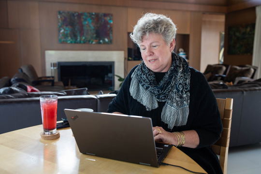
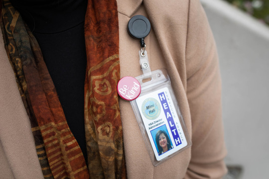
Over the course of a year, Newel and her boss, Santa Cruz County’s health services director, Mimi Hall, have seen their lives upended for reasons well beyond the exhausting workload that comes with battling a devastating pandemic. Their daily routines now incorporate security patrols, surveillance cameras and, in some cases, personal firearms.
They are public servants who no longer feel safe in public.
“When I do have days off, I don’t want to be out in the community. I’m intimidated to be out in the community,” Newel said. “I’m looking to see who might be close to me or to my car, who might be following me — looking to see if there’s any kind of situation that I might not be able to get out of or that might be dangerous to me in some way.”
***
Newel was born and raised in the city of Fresno in California’s Central Valley, a region known for industrial-scale farming and conservative politics. After completing degrees in medicine and public health, Newel returned home to work as an obstetrician. There, in addition to delivering hundreds of babies, she helped develop a lactation center, a program for pregnant women with substance abuse issues and a teen pregnancy program. After 30 years of “catching babies,” she’d planned to retire as a doctor’s wife in Santa Cruz, where her wife, also a physician, had taken a job.
The couple call themselves Central Valley refugees; they often felt unwelcome in Fresno County as a same-sex couple. With their adult children already out of the house, they bought a home in Santa Cruz and made plans to spend the rest of their lives there. Newel felt called to serve when the health officer in a neighboring county urged her to consider a second career in public health. She became Santa Cruz County’s health officer on July 1, 2019.
Newel developed an easy affinity with director Hall, who has the broader responsibility of managing all countywide medical, behavioral and environmental health programs. Hall, 53, was born in Myanmar, where her parents worked as doctors in a small hospital without running water or electricity. The family relocated to the U.S. when she was a young child. Hall has spent her entire adult life working in public health, the past 22 years in California county government. She worked in the heart of the Sierra Nevada before moving north to Plumas, a county bigger than Delaware but so sparsely populated that its county seat isn’t designated a city.
There, she said, she fought with elected officials who didn’t believe in her work. She said her children, among the few Asian Americans in Plumas, experienced racism and bullying. When Hall was hired by Santa Cruz County in 2018, she moved her husband and three kids to a seemingly bucolic home in the redwood forests of the Santa Cruz Mountains.
As health officer, Newel is part of a fraternity of greater Bay Area health officers who, since the early AIDS era, have met regularly to work on public health issues. Many of her local counterparts have deep knowledge of infectious diseases and, in the early days of the pandemic, she leaned on them heavily. In California, like many other states, every county is required to have a health officer. That person must have training in medicine, and, in emergencies, is granted broad authority to keep the public safe.
When Newel’s Bay Area counterparts issued the first sweeping stay-at-home orders in the nation on March 16, 2020, she was just hours behind in issuing one for Santa Cruz. It ordered most businesses to close and banned most travel and social gatherings. A few weeks later, in an effort to keep tourists away, she ordered the beaches closed as well.
It was a grueling time — both Newel and Hall went months without a real day off — but adrenaline-filled. They set up testing sites, organized data-tracking operations, coordinated with dozens of state and local groups on covid response and oversaw contact tracing for hundreds of cases.
And, as life-threatening pandemics go, they were off to a good start. Research suggests that lockdowns are most effective when initiated early, and that research is reflected in the Santa Cruz experience. Through June 2020, only a handful of people were diagnosed in Santa Cruz each week, and just two people had died from the virus in a county of 280,000, a fraction of the national death rate.
***
Santa Cruz County might seem an unlikely venue for menace. It’s known for its laid-back vibe and hippie communes. But it’s also a study in divergence: Multimillion-dollar estates are tucked into the Santa Cruz Mountains alongside the barricaded compounds of well-armed survivalists. Farmworkers tend to world-class strawberry fields in the southern part of the county alongside exclusive vacation rentals.
In the early months of the pandemic, the covid diagnoses mostly came from south county, among agricultural workers still tending crops and living in crowded housing. The complaints, however, were mostly from people in the wealthy beach communities, and out-of-towners deeply resentful of the highly publicized restrictions.
The pushback started with angry emails and voicemails, people who contested the beach closures, the intrusion on personal freedoms. But over time, it ventured further, into language that was personal and terrorizing. Newel remembers threatening letters that stated her address and the names of her children. Others included photographs of the front and back of her home from close range, and messages like “Look out; we’re coming for you.” The county clerk helped scrub her address from the internet.

Hall remembers obscene late-night phone calls, and a man who seemed to be casing her home. She took her cell number off her email signature.
Then came the Sunday protesters, who would surround Newel’s home with bullhorns and sirens blaring, their hostile rants making her — and, worse, her family — feel like hostages. “I’m willing to be a public servant, but I don’t think that includes having people trespass onto my private property,” she said. “I was quite worried for my family and for myself and our safety.”
Most local health officials in the U.S. are women and, as the pandemic wore on, the threats took on a clearly misogynistic tone. People used words like “bitch” and “cunt,” and made disturbing veers into sexually explicit references.
At a county Board of Supervisors meeting in late May, a young man, his voice thick with rage, accused Newel of ruining his life by closing the beaches. “You want me to stay inside, get fat, watch Netflix and masturbate?” The hearing was packed with people lobbying for a variance from state closure rules. As in previous meetings, people filmed Newel at close range. During the public comment period, they streamed to the microphone. Many removed their masks. People were visibly agitated, tapping feet, muttering swear words.
Then, a man started toward the mic, but made a beeline for Newel instead. Sheriff’s deputies surrounded him and whisked Newel and Hall out of the room, while a county executive evacuated the meeting. Feeling he could no longer ensure her safety, Sheriff Hart asked Newel to stop attending meetings in person.
In the days and weeks that followed, Hall, too, adopted new routines. She would leave work at 7 p.m., when the security guards ended their shift. On her way out of her office, she called her husband, staying on the phone with him until she was locked in her car. Once home, she checked the charge on the security cameras that provide a full-perimeter view of her home and greeted her dog, who works double time as family member and security detail.
Still, she didn’t know what to make of it all. “You’re not sure — is it really dangerous? You feel this feeling of, well, maybe we’re overreacting, you know?” Hall said.

***
Many of the people expressing the most vicious anger over the past year have histories of anti-government sentiment. There are the white supremacists, and groups with adopted militia names. The “sovereign citizens,” who view themselves as governed only by their own interpretations of common law. The people who oppose any government mandates to be vaccinated.
Still, things accelerated during the collision of Donald Trump’s presidency with the pandemic.
Membership in right-wing, white supremacist, anti-government and anti-vaccine groups was on the rise before 2020, under a Trump presidency seen as sympathetic to such ideologies and facilitated by the use of social media to draw in new adherents.
Then came the pandemic, which stranded people in their homes and transformed screens into their primary social gateways. Across chatrooms and websites, folks converged online to share grievances about perceived threats to personal freedoms. They found common cause in rebelling against closures and mask mandates and rallying around Trump. Groups that had previously protested vaccine requirements adopted militia language and imagery. Militias began organizing against health orders, and their tactics were adopted by yet more newly organized groups that formed online.
On April 17, Trump used his favored platform, Twitter, to send a series of calls to “LIBERATE MINNESOTA!” Then to “LIBERATE MICHIGAN!” and “LIBERATE VIRGINIA, and save your great 2nd Amendment. It is under siege!”
It set off a cascade of repercussions for health officials. Thousands of Facebook pages sprung up to organize against stay-at-home orders.
“They just erupted in rage at the lockdowns. [Trump] immediately undercut the credibility of public health officials,” said Heidi Beirich, co-founder of the Global Project Against Hate and Extremism and an expert on militia and white nationalist organizations. “He turned the public health sector into liars and enemies of his supporters.”
Public health is inherently not an individualistic endeavor. It’s the science of improving the health of populations, and more often than not, those improvements are of a collective nature. To bring down rates of smoking, we’ve taxed cigarettes and restricted where people can smoke. Workplaces were made safer through regulations limiting exposure to toxic materials and risky machinery. Infectious diseases are slowed to a crawl through vaccination requirements.
I never thought in my career that I would see professionals, doctors being threatened for doing their job.
Santa Cruz County Sheriff Jim Hart
It’s not surprising that health officials would become the recipients of the backlash associated with anti-government ideologies, said Jason Blazakis, director of the Center on Terrorism, Extremism and Counterterrorism at the Middlebury Institute of International Studies in Monterey. But the country hasn’t reckoned with how covid disinformation is animating those threats.
By the end of May, health leaders across the nation were quitting in droves. In California alone, eight public health officials had left top posts, including Orange County’s public health officer, Dr. Nichole Quick, who’d been given a security detail before she resigned. These were people with extensive training in public health, but also people with deep relationships in the community, the kind of expertise you can’t gain in school.
Just up the coast from Santa Cruz, the health officer for Santa Clara County, Dr. Sara Cody, was receiving so many credible threats by spring 2020 that she and her family were given 24-hour security details. A series of threatening letters were particularly disturbing. They were suspected of coming from the same anonymous author because of sentence structure, but also their “misogynistic content … and clear anti-government position,” a sheriff’s report said. One said: “You are fucking so many for no reason … you will pay a heavy price for your stupidity bitch.” Another read: “You must go no matter how you go … you stupid fucking bitch.”
Santa Clara’s sheriff’s office began investigating.

***
Sheriff Hart grew up in Santa Cruz and has been with the department for 33 years. It’s a rustic place without a lot of serious crime. Hart was aware of some members of white supremacist groups in the mountains, but largely considered them benign carryovers from a previous era. “I would always take threats, especially to myself and to some of our staff, with a grain of salt,” Hart said. “We’re in law enforcement; some people don’t like us. I get that.”
June 6, 2020, changed his thinking.
Seven months to the day before the siege on the U.S. Capitol, on a warm Saturday afternoon, a 911 call came into the sheriff’s office. A suspicious-looking van was parked on the side of a road in the mountain town of Boulder Creek, the caller said, and it matched the description of a van used in a drive-by shooting a week earlier in Oakland, when a federal security officer was killed during a Black Lives Matter protest.
Using the vehicle identification number to determine the owner of the van, Santa Cruz sheriff’s deputies made their way to his home, which was just up the road from Hall’s. There, a violent ambush unfolded.
According to law enforcement reports, Steven Carrillo, an active-duty Air Force sergeant, shot at officers with a homemade AR-15-style rifle and threw at least one explosive. He fled, hitting an officer with a car. Driving the backroads, he carjacked at least one person. The brutal episode came to an end when Carrillo was tackled by a young man while attempting to steal another vehicle.
Sgt. Damon Gutzwiller, 38, was fatally shot in the ambush, the first member of Santa Cruz County law enforcement to die on the job since 1983.
Authorities have since tied Carrillo to an active state faction of the Boogaloo Bois, a secretive and decentralized anti-government movement. Unlike many of the groups pushing back against public health measures over the past year, they are expressly anti-cop. One of their stated goals has been to infiltrate Black Lives Matter protests and cause violence that will be blamed on the left, to incite a civil war. Carrillo has since pleaded not guilty to multiple charges of murder in the Santa Cruz and Oakland attacks.
Hall immediately took down the signs from her fence celebrating her daughter’s graduation and declaring Black Lives Matter — anything that identified them — and installed more security cameras. “I started wondering, Who around me thinks this way? And how close are they?” Hall said.
Newel had a similar response: “Until that time, the threats seemed like nothing but threats. Like, oh, people might say these horrible things to me, but they’re not going to act on them. And then that one action completely changed how I thought about my community.”
Hart was devastated. He had known Gutzwiller since the deputy was a teenager. Before that day, Hart said, he realized that right-wing ideology existed but didn’t understand the level of cold-blooded commitment. He started rethinking the threats to Hall and Newel. “I never thought in my career that I would see professionals, doctors being threatened for doing their job. It’s been mind-boggling to me,” said Hart.
A month later, Hall received a chilling letter containing references to the Boogaloo movement. It began with “Hey, CUNT,” threatened her family and wished her a slow death. Similar letters had been sent to Sgt. Gutzwiller’s widow and the sheriff’s department.
Hart’s department put out a bulletin to other law enforcement, including details of the letters and information about the man they suspected might have sent them. In neighboring Santa Clara, the sheriff’s department noticed similarities to the string of letters their own health officer had been receiving since April.
When the suspect left work midday to mail yet another anonymous letter to Cody, a Santa Clara County sheriff’s deputy was tailing him, according to court records. The suspect, Alan Viarengo, was arrested and charged with felony stalking and harassment of a public figure related to the letters to Cody; he has pleaded not guilty. Detectives searched his Gilroy home and found more than 130 firearms, thousands of rounds of ammunition and materials to build explosives, according to law enforcement reports.
As the criminal case moved forward, Hart suggested that, in addition to security systems, the women acquire firearms. Hall’s husband came home with a shotgun. For Newel, who holds pacifist beliefs, it wasn’t an option. “I wouldn’t ever have a gun in my home,” she said.
That same month, adherents of a sovereign citizens movement the FBI characterizes as extremist and a form of domestic terrorism went to Newel’s home and served her “papers” claiming she’d broken the law. The same group, irate that Santa Cruz Police Chief Andrew Mills had supported Newel’s closure orders and mask mandates, left papers inside his home, on his bedroom pillow, according to law enforcement.

Throughout these episodes, Newel and Hall were still responding to the pandemic. Even as fires raged through the mountains, forcing them to evacuate their homes. Even as they were placed on furlough to make up for budget shortfalls.
When you ask Newel and Hall about the effects of living amid so much bile and unease, both say they are not ruled by fear. But they also describe sleepless nights when their spouses are out of town, and both have withdrawn from the community. Hall stopped joining her children’s school events on Zoom, afraid other parents would recognize her, and goes to the grocery store incognito, beneath a hat and messy ponytail. Newel just doesn’t go out much at all.
Since last April, 22 top health officials have left their posts in California. In December, just as vaccines were arriving, Hall seriously considered resigning. She’d gained 30 pounds and started taking blood pressure medication. She was bringing her laptop into bed every night and not spending enough time with family. Her children wanted her to quit. “There were days I just felt like, I can’t do this. I can’t do it anymore. I can’t get up tomorrow morning. I was mentally, physically, emotionally exhausted.”
She has stayed, not because she thinks things will necessarily get better, but because quitting wouldn’t make her life easier. It’d just teach people that if they’re loud enough and mean enough they can get what they want. If she had learned anything from her refugee parents, it was that she could go on, and so she must. “It’s not the idea that everything will turn out fine. It is that no matter what, you can survive this,” she said.
As for Newel, she said she’ll stick the job out because she’s stubborn that way. But she and her wife have rethought their retirement plans. “If we don’t feel comfortable being out in the community, or if we’re afraid to live here, we’re not going to want to stay,” she said. “And that’s something of a heartbreak.
This story was done as a collaboration between KHN and “This American Life.” Listen to the companion audio story here.
This story was produced by KHN, which publishes California Healthline, an editorially independent service of the California Health Care Foundation.
KHN (Kaiser Health News) is a national newsroom that produces in-depth journalism about health issues. Together with Policy Analysis and Polling, KHN is one of the three major operating programs at KFF (Kaiser Family Foundation). KFF is an endowed nonprofit organization providing information on health issues to the nation.
USE OUR CONTENT
This story can be republished for free (details).
‘We’re Coming for You’: For Public Health Officials, a Year of Threats and Menace published first on https://smartdrinkingweb.weebly.com/
0 notes
Text
‘We’re Coming for You’: For Public Health Officials, a Year of Threats and Menace
[Editor’s note: This article contains strong language that readers might find offensive or disturbing.]
SANTA CRUZ COUNTY, Calif. — Dr. Gail Newel looks back on the past year and struggles to articulate exactly when the public bellows of frustration around her covid-related health orders morphed into something darker and more menacing.
Certainly, there was that Sunday afternoon in May, when protesters broke through the gates to her private hillside neighborhood, took up positions around her home, and sang “Gail to Jail,” a ritual they would repeat every Sunday for weeks.

This story also ran on This American Life. It can be republished for free.
Or the county Board of Supervisors meeting not long after, where a visibly agitated man waiting for his turn at the microphone suddenly lunged at her over a small partition, staring her down even as sheriff’s deputies flanked him and authorities cleared the room.
The letters, emails and cellphone calls that now number in the hundreds and inevitably open with “Bitch,” and make clear people know where she lives and wish her dead.
And that January meeting with Santa Cruz County Sheriff Jim Hart, after the vicious mob attack on the U.S. Capitol, when he recommended to a roomful of county officials that deputies do a threat assessment at each of their homes. Newel, who’d already been through the process, casually mentioned a New Year’s resolution to get more exercise and start walking to work. Absolutely not, Hart told her. She wasn’t walking anywhere without an escort.
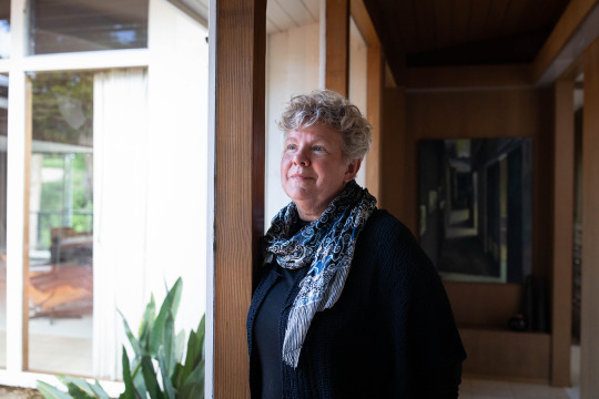
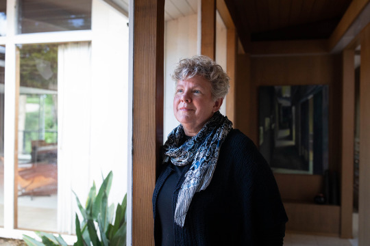
Newel, 63, is the health officer in Santa Cruz County, a picturesque string of communities hugging California’s rugged Central Coast. In normal years, hers would be a largely invisible job that involves tracking measles outbreaks and STD infections, testing children for lead exposure, and alerting the public to tainted lettuce and unhealthy air. Covid has changed all that, in ways both expected and not. Newel, like health officials across the nation, has been thrust into an unwelcome spotlight and subjected to extreme scrutiny from politicians and the public over mask requirements, business closures and the extended interruption of travel and social gatherings.
Some of the dissent was understandable: the shocked response of residents asked to make unprecedented sacrifices during a time of great uncertainty. But in Santa Cruz and many other U.S. communities, legitimate debate has devolved into overt intimidation and threats of violence.
Public servants like Newel have become the face of government authority in the pandemic. And, in turn, they have become targets for the same loose-knit militia and white nationalist groups that stormed the U.S. Capitol in January, smashing windows, bloodying officers and savagely chanting “Hang Mike Pence.”
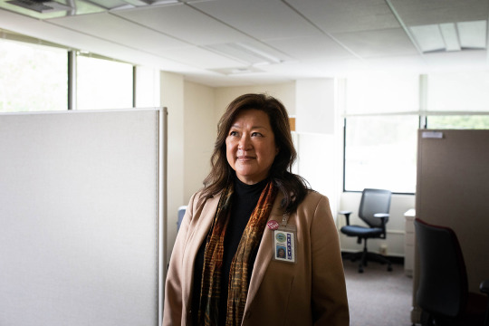
Over the course of a year, Newel and her boss, Santa Cruz County’s health services director, Mimi Hall, have seen their lives upended for reasons well beyond the exhausting workload that comes with battling a devastating pandemic. Their daily routines now incorporate security patrols, surveillance cameras and, in some cases, personal firearms.
They are public servants who no longer feel safe in public.
“When I do have days off, I don’t want to be out in the community. I’m intimidated to be out in the community,” Newel said. “I’m looking to see who might be close to me or to my car, who might be following me — looking to see if there’s any kind of situation that I might not be able to get out of or that might be dangerous to me in some way.”
***
Newel was born and raised in the city of Fresno in California’s Central Valley, a region known for industrial-scale farming and conservative politics. After completing degrees in medicine and public health, Newel returned home to work as an obstetrician. There, in addition to delivering hundreds of babies, she helped develop a lactation center, a program for pregnant women with substance abuse issues and a teen pregnancy program. After 30 years of “catching babies,” she’d planned to retire as a doctor’s wife in Santa Cruz, where her wife, also a physician, had taken a job.
The couple call themselves Central Valley refugees; they often felt unwelcome in Fresno County as a same-sex couple. With their adult children already out of the house, they bought a home in Santa Cruz and made plans to spend the rest of their lives there. Newel felt called to serve when the health officer in a neighboring county urged her to consider a second career in public health. She became Santa Cruz County’s health officer on July 1, 2019.
Newel developed an easy affinity with director Hall, who has the broader responsibility of managing all countywide medical, behavioral and environmental health programs. Hall, 53, was born in Myanmar, where her parents worked as doctors in a small hospital without running water or electricity. The family relocated to the U.S. when she was a young child. Hall has spent her entire adult life working in public health, the past 22 years in California county government. She worked in the heart of the Sierra Nevada before moving north to Plumas, a county bigger than Delaware but so sparsely populated that its county seat isn’t designated a city.
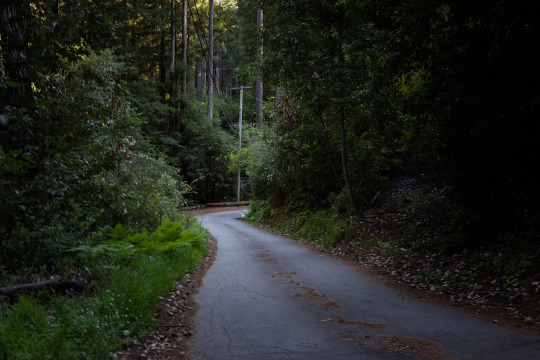
There, she said, she fought with elected officials who didn’t believe in her work. She said her children, among the few Asian Americans in Plumas, experienced racism and bullying. When Hall was hired by Santa Cruz County in 2018, she moved her husband and three kids to a seemingly bucolic home in the redwood forests of the Santa Cruz Mountains.

As health officer, Newel is part of a fraternity of greater Bay Area health officers who, since the early AIDS era, have met regularly to work on public health issues. Many of her local counterparts have deep knowledge of infectious diseases and, in the early days of the pandemic, she leaned on them heavily. In California, like many other states, every county is required to have a health officer. That person must have training in medicine, and, in emergencies, is granted broad authority to keep the public safe.
When Newel’s Bay Area counterparts issued the first sweeping stay-at-home orders in the nation on March 16, 2020, she was just hours behind in issuing one for Santa Cruz. It ordered most businesses to close and banned most travel and social gatherings. A few weeks later, in an effort to keep tourists away, she ordered the beaches closed as well.
It was a grueling time — both Newel and Hall went months without a real day off — but adrenaline-filled. They set up testing sites, organized data-tracking operations, coordinated with dozens of state and local groups on covid response and oversaw contact tracing for hundreds of cases.
And, as life-threatening pandemics go, they were off to a good start. Research suggests that lockdowns are most effective when initiated early, and that research is reflected in the Santa Cruz experience. Through June 2020, only a handful of people were diagnosed in Santa Cruz each week, and just two people had died from the virus in a county of 280,000, a fraction of the national death rate.
***
Santa Cruz County might seem an unlikely venue for menace. It’s known for its laid-back vibe and hippie communes. But it’s also a study in divergence: Multimillion-dollar estates are tucked into the Santa Cruz Mountains alongside the barricaded compounds of well-armed survivalists. Farmworkers tend to world-class strawberry fields in the southern part of the county alongside exclusive vacation rentals.
In the early months of the pandemic, the covid diagnoses mostly came from south county, among agricultural workers still tending crops and living in crowded housing. The complaints, however, were mostly from people in the wealthy beach communities, and out-of-towners deeply resentful of the highly publicized restrictions.
The pushback started with angry emails and voicemails, people who contested the beach closures, the intrusion on personal freedoms. But over time, it ventured further, into language that was personal and terrorizing. Newel remembers threatening letters that stated her address and the names of her children. Others included photographs of the front and back of her home from close range, and messages like “Look out; we’re coming for you.” The county clerk helped scrub her address from the internet.
Hall remembers obscene late-night phone calls, and a man who seemed to be casing her home. She took her cell number off her email signature.
Then came the Sunday protesters, who would surround Newel’s home with bullhorns and sirens blaring, their hostile rants making her — and, worse, her family — feel like hostages. “I’m willing to be a public servant, but I don’t think that includes having people trespass onto my private property,” she said. “I was quite worried for my family and for myself and our safety.”
Most local health officials in the U.S. are women and, as the pandemic wore on, the threats took on a clearly misogynistic tone. People used words like “bitch” and “cunt,” and made disturbing veers into sexually explicit references.
At a county Board of Supervisors meeting in late May, a young man, his voice thick with rage, accused Newel of ruining his life by closing the beaches. “You want me to stay inside, get fat, watch Netflix and masturbate?” The hearing was packed with people lobbying for a variance from state closure rules. As in previous meetings, people filmed Newel at close range. During the public comment period, they streamed to the microphone. Many removed their masks. People were visibly agitated, tapping feet, muttering swear words.
Then, a man started toward the mic, but made a beeline for Newel instead. Sheriff’s deputies surrounded him and whisked Newel and Hall out of the room, while a county executive evacuated the meeting. Feeling he could no longer ensure her safety, Sheriff Hart asked Newel to stop attending meetings in person.
In the days and weeks that followed, Hall, too, adopted new routines. She would leave work at 7 p.m., when the security guards ended their shift. On her way out of her office, she called her husband, staying on the phone with him until she was locked in her car. Once home, she checked the charge on the security cameras that provide a full-perimeter view of her home and greeted her dog, who works double time as family member and security detail.
Still, she didn’t know what to make of it all. “You’re not sure — is it really dangerous? You feel this feeling of, well, maybe we’re overreacting, you know?” Hall said.
***
Many of the people expressing the most vicious anger over the past year have histories of anti-government sentiment. There are the white supremacists, and groups with adopted militia names. The “sovereign citizens,” who view themselves as governed only by their own interpretations of common law. The people who oppose any government mandates to be vaccinated.
Still, things accelerated during the collision of Donald Trump’s presidency with the pandemic.
Membership in right-wing, white supremacist, anti-government and anti-vaccine groups was on the rise before 2020, under a Trump presidency seen as sympathetic to such ideologies and facilitated by the use of social media to draw in new adherents.
Then came the pandemic, which stranded people in their homes and transformed screens into their primary social gateways. Across chatrooms and websites, folks converged online to share grievances about perceived threats to personal freedoms. They found common cause in rebelling against closures and mask mandates and rallying around Trump. Groups that had previously protested vaccine requirements adopted militia language and imagery. Militias began organizing against health orders, and their tactics were adopted by yet more newly organized groups that formed online.
On April 17, Trump used his favored platform, Twitter, to send a series of calls to “LIBERATE MINNESOTA!” Then to “LIBERATE MICHIGAN!” and “LIBERATE VIRGINIA, and save your great 2nd Amendment. It is under siege!”
It set off a cascade of repercussions for health officials. Thousands of Facebook pages sprung up to organize against stay-at-home orders.
“They just erupted in rage at the lockdowns. [Trump] immediately undercut the credibility of public health officials,” said Heidi Beirich, co-founder of the Global Project Against Hate and Extremism and an expert on militia and white nationalist organizations. “He turned the public health sector into liars and enemies of his supporters.”
Public health is inherently not an individualistic endeavor. It’s the science of improving the health of populations, and more often than not, those improvements are of a collective nature. To bring down rates of smoking, we’ve taxed cigarettes and restricted where people can smoke. Workplaces were made safer through regulations limiting exposure to toxic materials and risky machinery. Infectious diseases are slowed to a crawl through vaccination requirements.
I never thought in my career that I would see professionals, doctors being threatened for doing their job.
Santa Cruz County Sheriff Jim Hart
It’s not surprising that health officials would become the recipients of the backlash associated with anti-government ideologies, said Jason Blazakis, director of the Center on Terrorism, Extremism and Counterterrorism at the Middlebury Institute of International Studies in Monterey. But the country hasn’t reckoned with how covid disinformation is animating those threats.
By the end of May, health leaders across the nation were quitting in droves. In California alone, eight public health officials had left top posts, including Orange County’s public health officer, Dr. Nichole Quick, who’d been given a security detail before she resigned. These were people with extensive training in public health, but also people with deep relationships in the community, the kind of expertise you can’t gain in school.
Just up the coast from Santa Cruz, the health officer for Santa Clara County, Dr. Sara Cody, was receiving so many credible threats by spring 2020 that she and her family were given 24-hour security details. A series of threatening letters were particularly disturbing. They were suspected of coming from the same anonymous author because of sentence structure, but also their “misogynistic content … and clear anti-government position,” a sheriff’s report said. One said: “You are fucking so many for no reason … you will pay a heavy price for your stupidity bitch.” Another read: “You must go no matter how you go … you stupid fucking bitch.”
Santa Clara’s sheriff’s office began investigating.
***
Sheriff Hart grew up in Santa Cruz and has been with the department for 33 years. It’s a rustic place without a lot of serious crime. Hart was aware of some members of white supremacist groups in the mountains, but largely considered them benign carryovers from a previous era. “I would always take threats, especially to myself and to some of our staff, with a grain of salt,” Hart said. “We’re in law enforcement; some people don’t like us. I get that.”
June 6, 2020, changed his thinking.
Seven months to the day before the siege on the U.S. Capitol, on a warm Saturday afternoon, a 911 call came into the sheriff’s office. A suspicious-looking van was parked on the side of a road in the mountain town of Boulder Creek, the caller said, and it matched the description of a van used in a drive-by shooting a week earlier in Oakland, when a federal security officer was killed during a Black Lives Matter protest.
Using the vehicle identification number to determine the owner of the van, Santa Cruz sheriff’s deputies made their way to his home, which was just up the road from Hall’s. There, a violent ambush unfolded.
According to law enforcement reports, Steven Carrillo, an active-duty Air Force sergeant, shot at officers with a homemade AR-15-style rifle and threw at least one explosive. He fled, hitting an officer with a car. Driving the backroads, he carjacked at least one person. The brutal episode came to an end when Carrillo was tackled by a young man while attempting to steal another vehicle.
Sgt. Damon Gutzwiller, 38, was fatally shot in the ambush, the first member of Santa Cruz County law enforcement to die on the job since 1983.

Authorities have since tied Carrillo to an active state faction of the Boogaloo Bois, a secretive and decentralized anti-government movement. Unlike many of the groups pushing back against public health measures over the past year, they are expressly anti-cop. One of their stated goals has been to infiltrate Black Lives Matter protests and cause violence that will be blamed on the left, to incite a civil war. Carrillo has since pleaded not guilty to multiple charges of murder in the Santa Cruz and Oakland attacks.
Hall immediately took down the signs from her fence celebrating her daughter’s graduation and declaring Black Lives Matter — anything that identified them — and installed more security cameras. “I started wondering, Who around me thinks this way? And how close are they?” Hall said.
Newel had a similar response: “Until that time, the threats seemed like nothing but threats. Like, oh, people might say these horrible things to me, but they’re not going to act on them. And then that one action completely changed how I thought about my community.”
Hart was devastated. He had known Gutzwiller since the deputy was a teenager. Before that day, Hart said, he realized that right-wing ideology existed but didn’t understand the level of cold-blooded commitment. He started rethinking the threats to Hall and Newel. “I never thought in my career that I would see professionals, doctors being threatened for doing their job. It’s been mind-boggling to me,” said Hart.
A month later, Hall received a chilling letter containing references to the Boogaloo movement. It began with “Hey, CUNT,” threatened her family and wished her a slow death. Similar letters had been sent to Sgt. Gutzwiller’s widow and the sheriff’s department.
Hart’s department put out a bulletin to other law enforcement, including details of the letters and information about the man they suspected might have sent them. In neighboring Santa Clara, the sheriff’s department noticed similarities to the string of letters their own health officer had been receiving since April.
When the suspect left work midday to mail yet another anonymous letter to Cody, a Santa Clara County sheriff’s deputy was tailing him, according to court records. The suspect, Alan Viarengo, was arrested and charged with felony stalking and harassment of a public figure related to the letters to Cody; he has pleaded not guilty. Detectives searched his Gilroy home and found more than 130 firearms, thousands of rounds of ammunition and materials to build explosives, according to law enforcement reports.
As the criminal case moved forward, Hart suggested that, in addition to security systems, the women acquire firearms. Hall’s husband came home with a shotgun. For Newel, who holds pacifist beliefs, it wasn’t an option. “I wouldn’t ever have a gun in my home,” she said.
That same month, adherents of a sovereign citizens movement the FBI characterizes as extremist and a form of domestic terrorism went to Newel’s home and served her “papers” claiming she’d broken the law. The same group, irate that Santa Cruz Police Chief Andrew Mills had supported Newel’s closure orders and mask mandates, left papers inside his home, on his bedroom pillow, according to law enforcement.
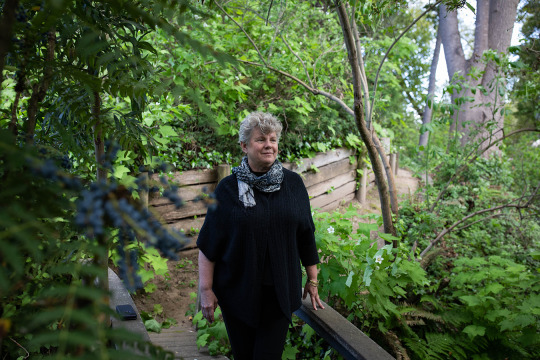
Throughout these episodes, Newel and Hall were still responding to the pandemic. Even as fires raged through the mountains, forcing them to evacuate their homes. Even as they were placed on furlough to make up for budget shortfalls.
When you ask Newel and Hall about the effects of living amid so much bile and unease, both say they are not ruled by fear. But they also describe sleepless nights when their spouses are out of town, and both have withdrawn from the community. Hall stopped joining her children’s school events on Zoom, afraid other parents would recognize her, and goes to the grocery store incognito, beneath a hat and messy ponytail. Newel just doesn’t go out much at all.
Since last April, 22 top health officials have left their posts in California. In December, just as vaccines were arriving, Hall seriously considered resigning. She’d gained 30 pounds and started taking blood pressure medication. She was bringing her laptop into bed every night and not spending enough time with family. Her children wanted her to quit. “There were days I just felt like, I can’t do this. I can’t do it anymore. I can’t get up tomorrow morning. I was mentally, physically, emotionally exhausted.”
She has stayed, not because she thinks things will necessarily get better, but because quitting wouldn’t make her life easier. It’d just teach people that if they’re loud enough and mean enough they can get what they want. If she had learned anything from her refugee parents, it was that she could go on, and so she must. “It’s not the idea that everything will turn out fine. It is that no matter what, you can survive this,” she said.
As for Newel, she said she’ll stick the job out because she’s stubborn that way. But she and her wife have rethought their retirement plans. “If we don’t feel comfortable being out in the community, or if we’re afraid to live here, we’re not going to want to stay,” she said. “And that’s something of a heartbreak.
This story was done as a collaboration between KHN and “This American Life.” Listen to the companion audio story here.
This story was produced by KHN, which publishes California Healthline, an editorially independent service of the California Health Care Foundation.
KHN (Kaiser Health News) is a national newsroom that produces in-depth journalism about health issues. Together with Policy Analysis and Polling, KHN is one of the three major operating programs at KFF (Kaiser Family Foundation). KFF is an endowed nonprofit organization providing information on health issues to the nation.
USE OUR CONTENT
This story can be republished for free (details).
‘We’re Coming for You’: For Public Health Officials, a Year of Threats and Menace published first on https://nootropicspowdersupplier.tumblr.com/
0 notes
Text
Making Our Way to Mammoth
This post was actually meant for yesterday, but the Internet here is slow.
About two weeks ago the husband messaged me out of the blue.
“Do you want to take a road trip over Memorial Day to Mammoth?”
I wish I could say that I immediately jumped upon this idea with gusto and the same fervent excitement I would have displayed pre-Tofu. Unfortunately, in this new post-Tofu world, lately my first immediate thought to anything that could throw off her routine is: “how much is this going to mess with her sleep...and my sleep?”
I really, really need sleep.
More so than I thought I did. But let me just say that nobody can appreciate the joy of sleep after losing it for six months of their life. Straight.
At any rate, after some hemming and hawing we decided to take the plunge. After all, one of the things we loved to do pre-Tofu was to take trips together. While it would take a lot more organizing and the pace would be much different, at the very least we wanted to not limit ourselves.
We originally had grand plans to wake up before the crack of dawn, gently lift and transfer her to her car seat, and then let her slumber peacefully while we knocked out the first two hours of the drive. Then stop for breakfast, drive a bit more, take a break, and BOOM arrive.
Yeah. That did not happen.
We ended up waking up early ourselves, but then after she woke up we realized we hadn’t fully packed. When all was said and done (after a much needed coffee and appeasing the toddler with a waffle - yes yes, we’re terrible parents that gave her processed sugar), we finally got out on the road at 7:30am.
The good thing about her waking up early and not napping very much the day before was that she basically fell asleep the first hour and a half. She ended up waking up just in time for us to arrive in the Mojave Desert around 9:30am and we decided to stop for second breakfast (seriously, toddlers eat like hobbits...hangry hobbits) at Denny’s where, luckily, she pooped.
I can’t believe that I would ever have considered myself lucky depending on the perfect timing of another human’s bowel movements but ... there you have it. For all the parents out there, it’s a big win. For others, I’m sure it’s just plain weird.
It is pretty ridiculous.
At any rate, we were making good time and for the next two hours she stayed awake (no car sickness throw ups, hooray).
I have to say, I’ve always appreciated how beautiful the Sierra Nevada is, but it had been a while since I had seen it. Moving from the Mojave to the sweeping mountains along the horizon really made me appreciate how lucky we are to live in California.

As we got closer to the small town of Lone Pine, we decided it would be best to take another stop. We did the typical search online and decided to go to Alabama Hill Cafe.
So, here’s the thing about me ... I can be pretty careless. Luckily, it’s usually with something small or inconsequential.
Nevertheless, the small and inconsequential mistake I made this time meant a 30 minute additional detour.
The positive thing out of this is at least we got to do a driving tour of Alabama Hills, which we learned was actually a thing. According to the trusted source Wikipedia, it’s a range of hills and rock formations near the eastern slope of the Sierra Nevada in the Owens Valley.
Neat.
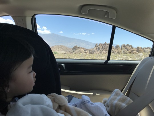
When I asked Tofu if she was interested in climbing the rocks I think her response was a curt “No.” Then again, it’s usually no.
Followed by “no no no no nooooooo.”
We finally managed to get to the cafe where Tofu quickly pointed out everything she wanted to eat.

After some more wandering around, the other highlight of her trip was... a laundromat.

Our kid doesn’t get out much, clearly.
We piled back into the car where Tofu promptly fell asleep again. This time she passed out for only 40 minutes and fortuitously managed to wake up when we reached Bishop, one of the main stopovers on the way to Mammoth.
I think there must be some special toddler radar because she managed to time it perfectly to where we were just a few streets away from a playground.
We spent a better part of two hours letting her swing.

We literally do the same thing at home.

I do have to say, Bishop is pretty lovely and it was great to stop with a toddler - and I imagine any kids, really.

We also stopped by Schat’s Bakery, which everybody and their second cousin told us to visit.

The vintage little coin operated cars and horses were a big hit. Even better? She enjoyed it even without me spending a coin.

The good news is that we were only 30 minutes away from our final destination.
When we arrived and checked in the hours from 5pm to 8pm seemed to blend and meld together. Somehow, miraculously, we got her fed, bathed, and in bed by bedtime. Even though she had a hard time adjusting to a new place (understandable and typical) she is now soundly asleep.
And I will be too.
But first, my reward.

All in all, some thoughts on our first *official* road trip vacation as a family (minus the dog):
It’s not an exaggeration when people say that a road trip with a toddler is basically more than double what you’d do on your own or with other fully functioning adults. Instead of the 4 hour drive, it ended up being a 10 hour trip. Whee!
I had no idea two well-timed poops would make me feel so relieved (and irrationally proud)
Even though the road trip was tiring and all we did was sit there, it was really nice to see her reaction even to silly things like a laundromat or doing things we’d normally do like going to a playground. Yes, that cliche is right: it’s about the journey, not the destination.
Let’s see what tomorrow brings!
1 note
·
View note
Text
Whorl Mountain via Horse Creek from Twin Lakes
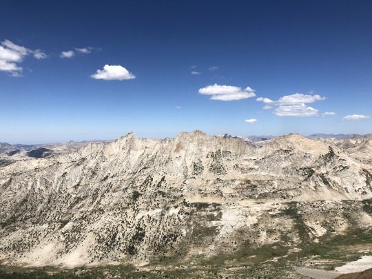
The California wildfires of 2020 were still raging, and the majority of the Sierra Nevada was closed. In my research, I was able to find that the Hoover Wilderness was still open. Even though this is in California, it for some reason lies under Nevada’s jurisdiction as this is part of the greater Humboldt-Toiyabe National Forest. No one wanted to come with me because the smoke was making the air quality bad, but the mountain gods promised me a good air quality index. I booked a room in Bridgeport and convinced Asaka to join me, stating that we needed to get Leif out of the perpetual smoke. Arriving in Bridgeport the night before, I could see the stars overhead. This was a good indication that we would have fresh air to breath the following day.
It was a cold morning in Bridgeport. Asaka and Leif woke up with me and we drove to the trailhead together. Asaka would drive back to the motel afterwards and try to sleep in a little. I walked through the campground on the western shore of Twin Lakes, looking for the Horse Creek Falls Trailhead. I got a little lost at the very beginning, but eventually corrected my path. At the wilderness boundary there was a “wilderness closed” sign. I just talked to the Bridgeport ranger station earlier that week and they confirmed it would be open, so I ignored the sign. I didn’t expect to see anyone on the trail today, and if I happened to run into a ranger, I had an alibi.
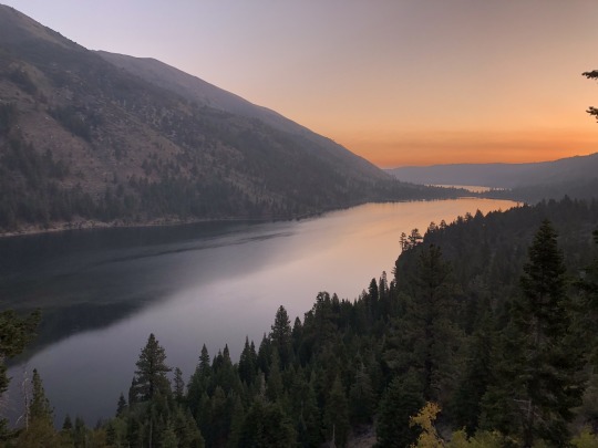
The morning sunrise and alpenglow was breathtaking. My discouragement of having to hike alone completely vanished.
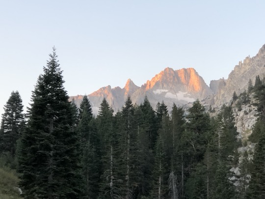
It had been many years since I last hiked this trail. It took me four attempts to climb Matterhorn Peak in my early hiking career, with one of those being almost fatal.
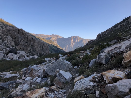
I aimed for the hourglass couloir, which this time of the year was nothing more than a plain boulder field.
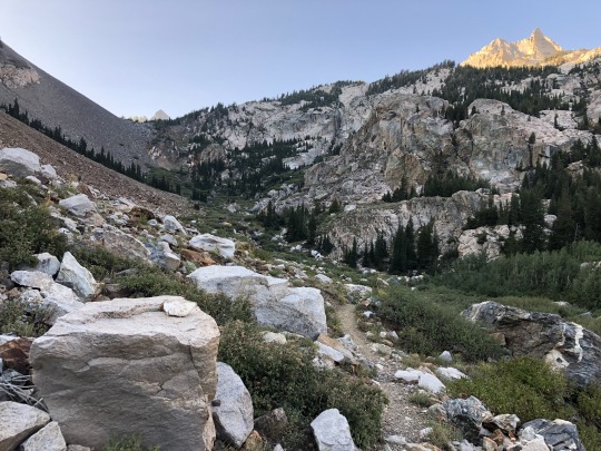
The trail was much worse than I remembered. I lost the trail several times and found myself having to consult my GPS track to get back on route. I aimed for Horse Creek Pass above.
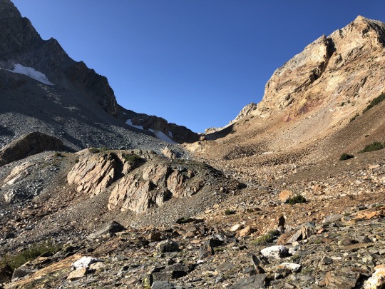
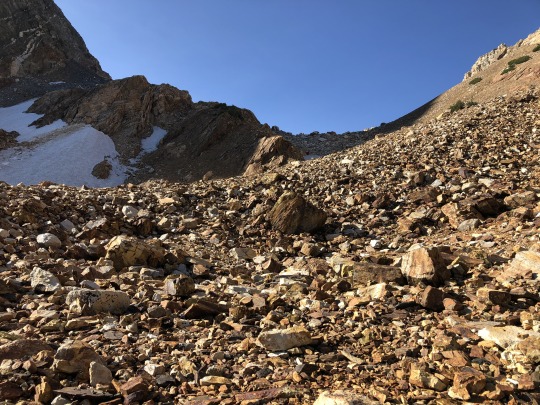
Once I reached the pass, Whorl Mountain came into view sticking out like an axe over the horizon. This was also the northern border of Yosemite.
I descended into the grassy Spiller Creek Canyon.
After descending a short distance across easy terrain, I found a flat ramp that allowed me to maintain elevation as I made my way to the eastern base of Whorl Mountain.
The ramp eventually ended and I found myself sidehilling across sandy slopes.
There are many route descriptions online with many details, but I will explain it here as simply as possible. There are three main chutes on the southeast side of Whorl Mountain. One's objective should be to start up the furthest left chute (Chute #3), which should be easiest chute to enter. This chute has a lot of shrubby trees, and climbing should be mostly class 2 with some class 3 moves needed from time to time. As you climb up Chute #3, you should be able to traverse into the next chute to the right (Chute #2). Some ways into the chute are easier than others, so its up to you to cross over via whichever ledge that you are comfortable with.
After climbing a short distance, you will again need to traverse further right into another chute (Chute #1). I crossed over via an exposed class 4 crack, but there was an easier class 2-3 chute slightly above me. I took this on the way down.
Once in the Chute #1, there is a chock stone above. By this point I was feeling very tired and lightheaded.
First I tried to climb through the chock stone, but I couldn’t get myself through. This ended up being the correct method, however I was looking to go through on the left side of the tunnel when the correct way was through the right side. I was lightheaded and out of it, and I simply missed it.
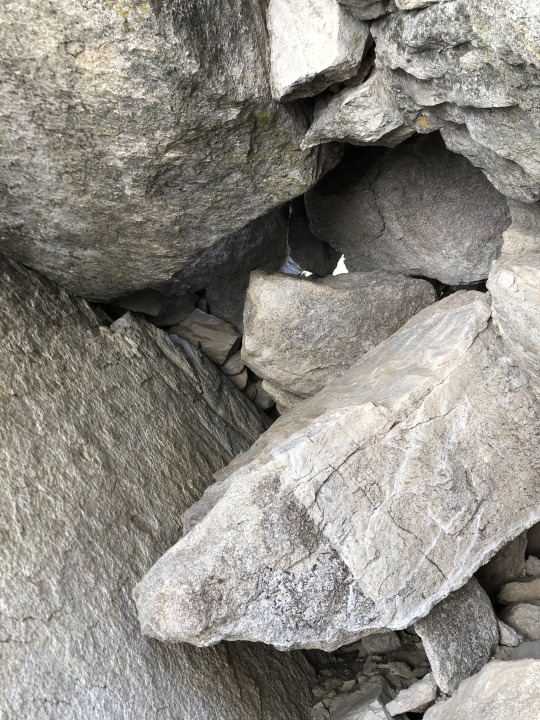
I backed off and tried climbing a series of exposed ledges to the right of the chock stone. This took me to some class 4 and class 5 options, so I backed off. I then started up to the left side of the chock stone. This was class 4 with some awkward holds, but I was able to get myself up to the top of the ridge. I had to go very slow because if I exerted myself too much I felt like I could even pass out. This was not the best terrain for that to happen to me.
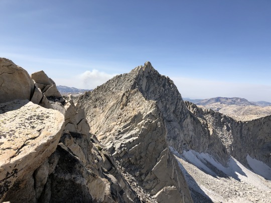
From there I turned north, following some large steps up the ridge.
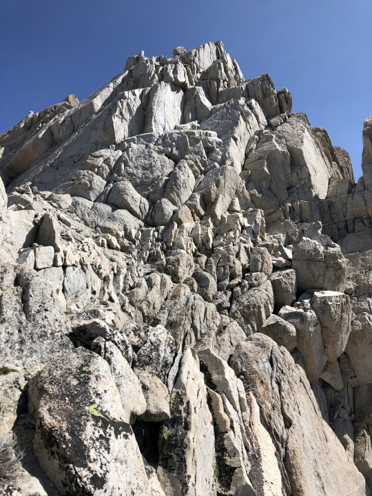
I followed an exposed but easy ledge that cut across the west side of the peak.
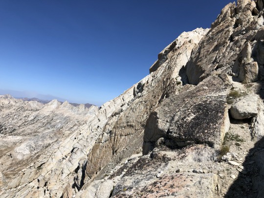
The remaining route to the summit was trivial, but I was feeling very weak for whatever reason. It was as if the nearby fires had burned up all the nearby oxygen. Once at the summit I sat down and focused on catching my breath. To the east were Twin Peaks and Dunderberg Peak.

To the southeast were Virginia Peak, Excelsior Peak, Mt Dana and Mt Conness.
In the far distance were Banner Peak, Mt Ritter, Mt Lyell and Mt Maclure.
To the south was Tuolumne Meadows.
The massive Creek Fire in the Sierra National Forest was raging beyond. Clouds Rest and the tip of Half Dome were barely visible. Tuolumne Peak and Mt Hoffman could be seen to the right.
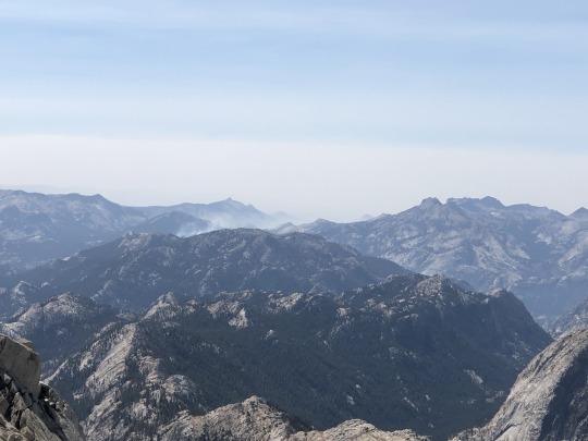
To the west was Piute Mountain.
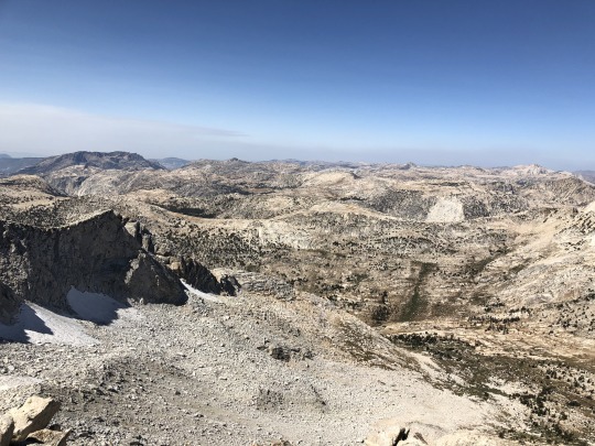
To the north was Matterhorn Peak.
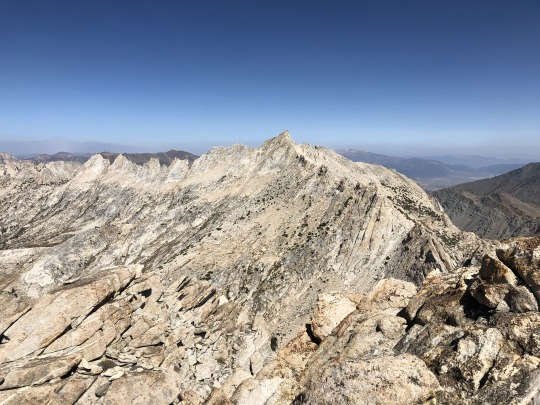
I wasn’t exactly thrilled to descend the same class 4 route to the chute, so I went through the register looking for route descriptions. I found one that described a class 3 route through the chock stone, so I decided to give it a second look on my descent.
I wanted to get the south peak as a bonus peak, but I wasn’t comfortable doing any extra climbing in my light headed state.
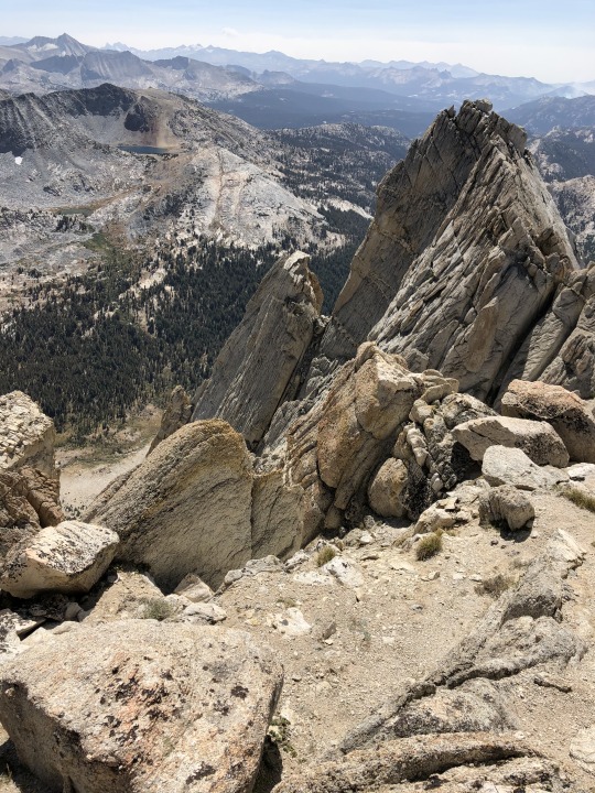
On my down climb I found the hole through the chock stone. I’m not sure how I missed it on the way up.
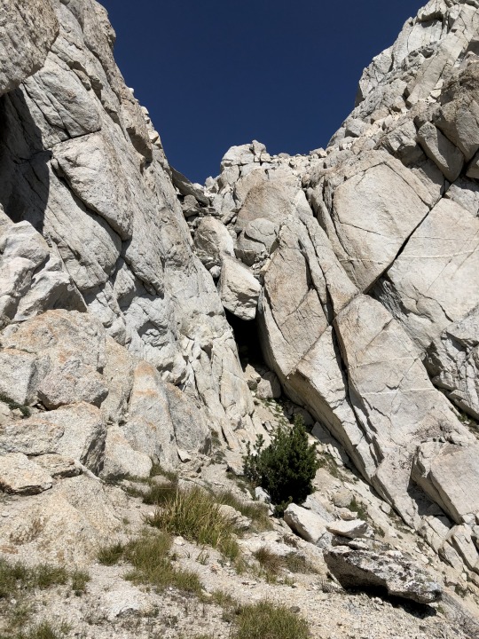
I then took the easier ledge from Chute #1 to Chute #2.
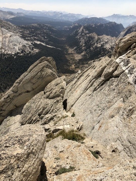
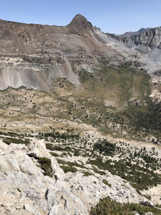
Once back to Chute #3, there was a lot of sandy heel plunging and sidehilling towards the ramp section.
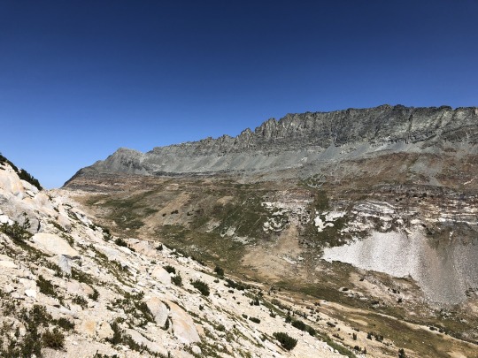
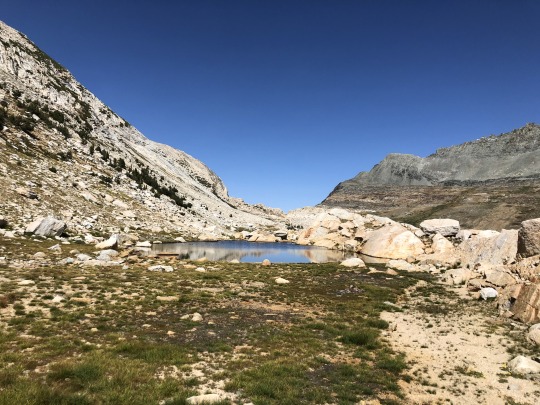
I stopped by a tarn to take a swim and refill my water. The water didn’t taste very good I assume due to high mineral content. It tasted what I imagine a Sierra boulder would taste like.
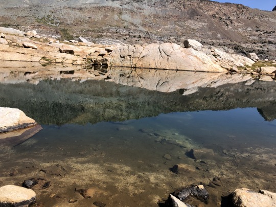
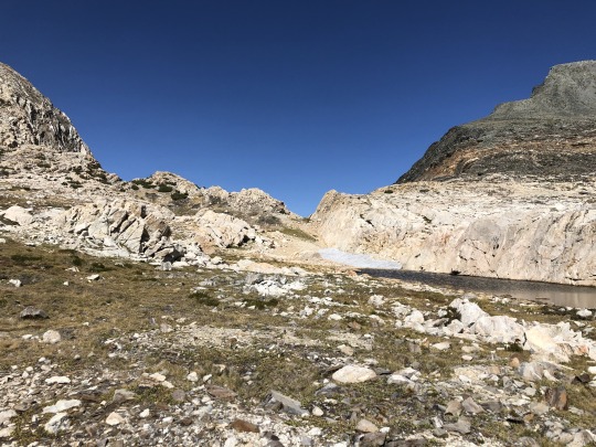
There was some uphill to reach the pass. The Sweetwater Range was visible to the north. The descent was very steep and tedious, but I didn’t lose the trail as much on the way down.
Eagle and Robinson Peaks stood across the drainage.
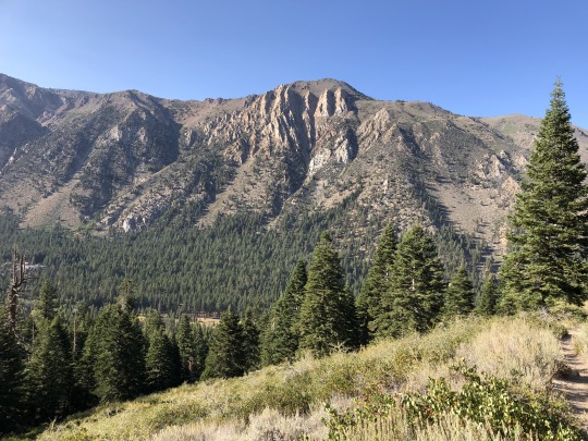
Once at lower elevations I started to feel better. I didn’t see another person the whole hike.
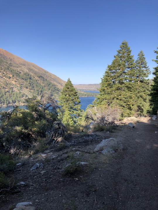
When I returned to the wilderness boundary, I found the “wilderness closed” sign ripped off. I found Asaka and Leif at the campground and after relaxing by the lake, we drove into town where we got a burger. Leif took an interest in the food we were eating. I think he’s ready for solids.
That evening we drove back to my family cabin in Twain Harte where we spent the night. I need to utilize this cabin more often!
0 notes
Text
Despair for Many and Silver Linings for Some in California Wildfires https://nyti.ms/2PrHL7U
Despair for Many and Silver Linings for Some in California Wildfires
(PURE, UNADULTERATED GREED by Corporations like PG&E to Boeing, to fill the pockets of shareholders and company CEOs, are DEVASTATING American citizens.)
Natural disasters are another prism through which California’s vast income inequalities can be viewed.
By Thomas Fuller, Julie Turkewitz and Jose A. Del Real | Published October 29, 2019 Updated, October 30, 2019, 9:27 AM ET | New York Times | Posted October 30, 2019 |
SANTA ROSA, Calif. — After a wildfire razed his spacious suburban home in the Sonoma hills two years ago, Pete Parkinson set out to rebuild. This time it would be an even better one. He reoriented the house toward vistas of a nearby mountain and designed a large kitchen with hickory floors and 16-foot windows under vaulted ceilings.
“We are now living the silver lining,” said Mr. Parkinson, a retired civil servant who moved into his new home 10 days ago. “It is a beautiful, brand-new home.”
California’s catastrophic wildfires have not discriminated between rich and poor. In recent years tens of thousands of people lost their homes, from trailer parks to mansions. But the aftermath of the fires has produced a spectrum of misery and recovery, ranging from the wealthy, who with insurance money rebuilt houses sometimes worth more than the ones that burned, to those who lost everything and years later still have nothing.
Like access to quality education and clean water, natural disasters are another prism through which California’s vast income inequalities can be viewed.
CALIFORNIA FIRES
Read our live updates about the Kincade and Getty blazes.
A lawyerly knowledge of the peculiarities of the insurance industry, a pool of savings to fall back on and the time and grit to deal with the state’s labyrinthine regulations have helped some in California bounce back from the infernos. Others have not been so lucky.
Jenn Wilcox worked at a residential care facility in the town of Paradise until Nov. 8, when the town was incinerated by fire last year. After she narrowly escaped, the uninsured cabin where she was living was destroyed; she also lost her job. Her life upside down, she split up with her boyfriend and returned to her home state of Georgia, where she is struggling to make ends meet as a home health aide.
“I’m a refugee,” Ms. Wilcox said. “I’m broke.”
On Tuesday, firefighters in Northern California braced for the return of strong winds, hoping to avoid the further spread of the Kincade fire, which has burned 75,000 acres in Sonoma County and was 15 percent contained. In Southern California, the Getty fire still burned while residents braced for extreme winds expected to reach 80 miles per hour. Thousands of structures are threatened.
Karen Orlando, a real estate agent in the Sonoma Valley, has seen the rebuilding process in Sonoma County play out in distinct ways between “the really wealthy and then those who are just getting by.”
Ms. Orlando said that for those with insurance and the means, rebuilding has been a kind of therapy after the trauma of losing a home; reclaiming those spaces is a way to soldier through grief, she said.
“Some people have decided to buy a lot maybe with a better view than what they had,” she said. “Some people want to rebuild on the lot but now they get the chance to build the home of their dreams. They get to pick out all the finishes and fixtures and imagine all the landscaping.”
After the Wine Country fires in 2017 destroyed their hillside home with a priceless mountain view, Joan and Nick Flint received $1 million for the rebuild, not enough to match what they once had. They ended up paying another $1 million out of pocket.
Standing outside their new home on Tuesday — white brick with an Escalade in the garage — Ms. Flint said she realized how lucky they were that they could afford to do that.
“We’re not a hard-luck story by any means,” she said. “We feel blessed.”
Fires this week in Southern California forced evacuations of celebrities like LeBron James and Arnold Schwarzenegger. Mr. James tweeted that he was driving around trying to find a hotel room after he fled his home. (His home did not burn, nor did Mr. Schwarzenegger’s.)
Less visible has been the fate of those hard hit in towns like Paradise in the Sierra foothills, razed by fire last year, and Lake County, where around 2,000 homes have burned over the past four years. In both places incomes were strained even before the fires.
Jim Steele, a former supervisor in Lake County, estimated that about 60 percent of residents in the county lacked insurance or were severely underinsured. Insurers are raising rates in areas vulnerable to fire and in some cases have declined to write policies.
“There’s a lot of risk and a lot of poverty,” he said. Many people were forced to move away after their homes burned down, especially older people who retired in picturesque but fire-prone hills surrounding Clear Lake.
“It has a lot to do with your age and where you are in your career,” Mr. Steele said. “Retired people have trouble — they just don’t have the resilience.”
A report published by the federal government two years ago said people with lower incomes were less prepared for natural disasters and were more likely to live in homes vulnerable to them. Low-income Americans are also more likely to become homeless after a disaster and have more difficulty obtaining loans after one, the report said.
Another study released by the Federal Reserve Banks of San Francisco, New York, Dallas and Richmond focused on small businesses affected by natural disasters. Insurance coverage for those businesses “appeared to be mismatched to the actual damage that occurred,” the report said.
Often disasters trigger a cascade of woes. For Gina Wheeler, whose grandparents moved her family to the Sierra Nevada from the Bay Area in the 1960s, the Paradise fire sent her into depression and financial peril. Ms. Wheeler, 44, was hospitalized for intestinal surgery in the days before the disaster. Then she lost her uninsured trailer that she rented on family land in the fire.
“Every place I’ve ever set foot in has been touched by fire,” Ms. Wheeler said. “I don’t think anybody that’s not gone through this will ever, ever understand what it’s like to lose your entire community.”
This fall, Ms. Wheeler moved into a trailer in a camp for fire survivors in the remote farm town of Gridley, where she must stretch a fixed income of $850 a month to rebuild her life. She struggles to pay for food and gas, sometimes turning to Facebook groups for help.
“I can’t even describe the empty feeling that we have,” Ms. Wheeler said. “I talk friends and family members out of suicide, and they talk me out of it.”
Mr. Parkinson, the resident of the Sonoma hills, says about 40 percent of his neighbors have not started to rebuild their homes, many of them because they cannot afford to. Although his new house is more hardened to fire, the area remains vulnerable, a dozen or so miles away from where the Kincade fire is burning.
Mr. Parkinson counts himself lucky not only because he was able to construct a 2,200-square-foot dream home but because he had the mental fortitude to deal with the disappearance of all but a handful of his possessions. When he fled his home with his wife and son in 2017 he carried only electronics, two guitars, photo albums and some clothing
“There was something about walking up to the pile of ashes that my house was reduced to and understanding the absolute finality of it,” he said.
His insurance money was insufficient to completely furnish the house so he went to Ikea with a pickup truck and held a furniture-assembly party with friends.
“I don’t have a lifetime’s worth of stuff anymore,” he said. “Everything is two years old and less.”
Thomas Fuller and Julie Turkewitz reported from Santa Rosa, Calif., and Jose A. Del Real from San Francisco. Lauren Hepler contributed reporting from Paradise, Calif. Alain Delaquérière contributed research.
*********
California Fires Live Updates: New Blaze Threatens Reagan Library
Dangerous Santa Ana winds were whipping Southern California as a new wildfire broke out near the Ronald Reagan Presidential Library and Museum.
By The New York Times | Published October 30, 2019 | New York Times |
Posted October 30, 2019 |
RIGHT NOW
A new fire that broke out in Ventura County prompts evacuation orders for an area that includes the Ronald Reagan Presidential Library and Museum.
Sign up here for our California Today newsletter.
Here’s what you need to know:
Strong winds could drive ‘extreme fire behavior’ in Southern California.
A fire threatening the Reagan Library has forced evacuations in Ventura County.
Electricity has been shut off for more than a million people.
Maps show where the fires are burning now.
As fires rage, schools cancel classes and events.
The Getty fire was caused by an ‘act of God.’
Strong winds could drive ‘extreme fire behavior’ in Southern California.
California was facing the worst kind of weather for wildfires on Wednesday — strong, gusty winds and very low humidity. Officials feared that the gusts could blow embers more than a mile away, complicating their efforts to contain new or existing fires.
In the southern part of the state, where gusts were expected to peak on Wednesday morning, a new brush fire broke out in Ventura County, threatening the Ronald Reagan Presidential Library and Museum and forcing evacuations.
And in the Los Angeles area, a 745-acre blaze known as the Getty fire has prompted the evacuation of more than 7,000 homes. Firefighters made progress overnight on the fire, which was 27 percent contained on Wednesday morning.
In Northern California, firefighters made inroads overnight in battling the Kincade fire, which has consumed much of the area around Santa Rosa over the last few days as it swelled to become the largest active wildfire in the state. The 76,000-acre fire is now 30 percent contained, up from 15 percent on Tuesday, and forecasters were cautiously optimistic that the winds in the area had died down and would not strengthen again for at least a few days.
At a morning briefing at the Sonoma County fairgrounds, where hundreds of firefighters packed into an event hall, officials thanked the crews for their work. “Really good progress,” said Charlie Blankenheim, a division chief working with Cal Fire, the state firefighting agency.
Danger remains, however. Many houses tucked into the woods are still at risk, and saving those will be a priority over the next few days, officials said. Already, the fire has destroyed 206 structures, including 94 homes.
A fire threatening the Reagan Library has forced evacuations in Ventura County.
The fast-moving fire near the Ronald Reagan Presidential Library and Museum in Ventura County forced evacuations early on Wednesday.
The fast-moving blaze known as the Easy fire quickly grew to more than 400 acres and led local officials to order an evacuation for parts of Simi Valley and Moorpark, two cities in the southern part of the county. Eric Tennessen, chief of the Ventura County Sheriff’s office, said deputies were knocking on doors and escorting people to safety. The evacuation area consists of ranches, farms and a golf course and is not densely populated, Chief Tennessen said.
Video from local news outlets showed smoke billowing from several distinct parts of the fire along hilltops as the sun rose, with the flames fanned by the wind. The fire approached the presidential library, which houses memorabilia including a former Air Force One plane inside, but was kept at bay by firefighters as of about 9 a.m.
Electricity has been shut off for more than a million people.
Santa Ana wind gusts topped 70 m.p.h. in elevated areas near Los Angeles, close to matching the speeds of a Category 1 hurricane, which has sustained winds of at least 74 m.p.h.
“When you have a fire form in these conditions, it can spread very quickly,” said Lisa Phillips, a meteorologist at the National Weather Service’s Los Angeles office. The combination of dry and windy weather, perfect for fires to ignite and grow, led the weather agency to issue an “extreme red flag warning” for much of Los Angeles and Ventura counties.
NWS Los Angeles
✔@NWSLosAngeles
Latest observation from Warm Springs at 12:53AM in the hills above Santa Clarita: ENE 38 mph Gusting 55 mph. Relative Humidity was down to 14% Expect Santa Ana winds to strengthen and become more widespread through this morning and continue through Thursday. #cawx #LAweather
4:10 AM - Oct 30, 2019
The threat posed by the winds has led the utility Pacific Gas and Electric to cut off power to about 1.5 million people in some 30 counties in Northern California in recent days, with about 1 million still without electricity since the weekend.
In the south, San Diego Gas & Electric and Southern California Edison reported preventively shutting off power on Wednesday to a total of about 200,000 people.
A new state web portal includes links to updates on fire status, evacuation zones, power outages, shelters and housing, road conditions and other information related to the fires, compiled by state agencies like Cal Fire and Caltrans and by utility companies.
Maps show where the fires are burning now.
(We’re continuing to update our page of maps showing the extent of the fires, power outages and evacuation zones.)
Maps: Kincade and Getty Fires, Evacuation Zones and Power Outages(SEE WEBSITE FOR EVACUATION ZONES)
Detailed maps show the current fire extents, power outage zones and areas under evacuation orders.
As fires rage, schools cancel classes and events.
With many school districts closed in Sonoma County and surrounding counties, parents have been left trying to entertain their children amid power outages and evacuations.
Parker Palizi, 9, did not mind getting a few days off from school, but the thought of staying home in Novato without working electronics was less than appealing. “There’s no fun stuff we can do,” he said. Still, Parker was more concerned about his pet bearded dragon, Spike, whom he was bringing in a glass tank to a hotel room in Carmel-by-the-Sea, where electricity beckoned.
“He needs the heat lamp to stay alive,” Parker said.
The Palizis, who live in Marin County, were supposed to be on a 7 a.m. flight from Los Angeles on Monday so Delilah could perform as an elephant in her second-grade play. “She was so excited,” said her mother, Brooke Palizi, who works for a nonprofit organization.
But Delilah’s star turn will have to wait. The Novato Unified School District canceled school on Monday, and then on Tuesday and Wednesday, the Palizis learned late Monday afternoon. By then they were driving a rental car the seven and a half hours home.
The Windsor High School girls volleyball team had been slated to play in the playoffs on Wednesday, until a mandatory evacuation order came for the entire town of 28,000 on Saturday morning, giving residents six hours to flee. With all the district’s schools closed this week, the town on lockdown and the team scattered, Coach Rich Schwarz said he and the athletic director made the difficult decision to forfeit the game.
The players responded to his group text announcing the decision with sad-face emojis and messages of support, said Mr. Schwarz, who is in his final year coaching the team.
“How do we play when we don’t have practice and don’t know where the girls are? said Mr. Schwarz, who is staying with his sister in the town of Rohnert Park. “We can’t tell parents to break into the town to get their uniforms. At what point does an extracurricular activity become way too much? We need to let families worry about whether their house is still standing.”
[The New York Times has photographers on the ground, documenting the California wildfires and the battle to contain them. Follow their work here.]
The Getty fire was caused by an ‘act of God.’
The Getty fire started when a branch broke off a tree and hit nearby power lines — an accident that Mayor Eric Garcetti of Los Angeles called an “act of God.”
The power lines began to spark and ignited nearby brush, Mr. Garcetti said at a news conference on Tuesday afternoon. He said investigators have not found any evidence that faulty equipment started the fire.
The fire, which has burned at least 650 acres and was 15 percent contained as of Tuesday night, broke out shortly after 1:30 a.m. Monday along the major freeway known as the 405, near the Getty Center. It quickly spread through neighborhoods north of Brentwood, destroying 12 homes and damaging five more.
The authorities determined the cause in part after seeing dash cam footage that showed an explosion on the side of the road early Monday morning, Mr. Garcetti said.
Reporting was contributed by Nicholas Bogel-Burroughs, Dan Levin, Thomas Fuller, Julie Turkewitz, Jose A. Del Real and Jacey Fortin.
*********
#wildfire#california#california wildfires#national news#national security#naturaldisasters#poverty#u.s. news#firefighters#trending topics#top news#top stories google news#tech news#news
0 notes
Photo
By Michael Lanza
After years of exploring all over Yosemite on numerous backpacking trips, I’ve learned two lessons about it: Few places possess Yosemite’s breadth and variety of scenery and inspire the same powerful sense of adventure. And its backcountry harbors such an abundance of soaring granite peaks, jagged skylines, rushing creeks, waterfalls, and shimmering alpine lakes—plus, over 700,000 acres of designated wilderness and 750 miles of trails—that you can take many, many trips in America’s third national park without running out of five-star scenery.
There’s only one Yosemite, and it unquestionably belongs on any list of the best national park backpacking trips.
Mark Fenton scaling Half Dome’s cable route in Yosemite.
This article describes the five best backpacking trips in Yosemite, based on my numerous trips exploring every quadrant of the park, from the core between Yosemite Valley and Tuolumne Meadows—including Half Dome—to the John Muir Trail, the Clark Range and southeast corner, and the vast wilderness of northern Yosemite. These trips range in length from three to four days and roughly 30 miles (with shorter options) to more than a week and nearly 90 miles, and from beginner friendly to serious, committing adventures into the park’s farthest reaches, demanding good fitness and skills.
Each trip described below includes a link to a story about it that provides more detail (reading those stories requires a paid subscription; click here to learn more about subscribing), and each also has a link to one of my e-guides describing that trip. Look at a trail map of the park while reading these descriptions, and you will see that the extensive trail system allows for variations on these routes—longer and shorter, and even combining all or parts of these routes.
Yosemite exceeds expectations in many ways, including this truth: Its reputation for crowds just doesn’t square with the reality of backpacking throughout most of the park. Yes, Yosemite Valley sees insane numbers of tourists, and a few of the park’s trails—like the Mist Trail and Half Dome—are among the most popular in the country. But wander into the park’s vast backcountry and you will find vistas that conjure the Valley, along with a surprising degree of solitude.
Half Dome, Liberty Cap, and Nevada Fall, along the route of “The Best First Backpacking Trip in Yosemite.” Click on photo to learn more about this hike.
Backpack in Yosemite and you will also connect with the history of America’s conservation movement and an idea that changed the world. In a real sense, this is where the 84-million-acre National Park System began.
In 1864, eight years before the designation of Yellowstone as the world’s first national park, President Abraham Lincoln signed a law granting Yosemite Valley and the Mariposa Grove of giant sequoias to the state of California—making them the first lands protected purely for scenic value. Yosemite became America’s third national park in 1890. Walk for days through the backcountry and you will understand what inspired John Muir and others to persuade the nation’s leaders and the public that America must preserve some places in an untarnished, natural state.
Plan your next great backpacking adventure in Yosemite and other flagship parks using my expert e-guides.
Looking northeast from Mule Pass in Yosemite National Park.
Understanding Yosemite’s Backcountry Permit System
Yosemite National Park issues free backcountry permits under a somewhat unique system based on trailhead quotas—allowing a specific number of backpackers to start their trip at each trailhead every day. For some of the most-popular trailheads—including Happy Isles in Yosemite Valley and most of the trailheads in the Tuolumne Meadows area and along Tioga Road—those quotas are often filled the first day that the park begins accepting permit reservations, which is up to 24 weeks (168 days) before a hike’s starting date. (For example, to start a trip in late July, submit your application in early February.)
But you may also be able to get a permit a day prior to starting a trip. For each trailhead, 60 percent of available permits can be reserved in advance, but the remaining 40 percent are available only on a first-come, first-served basis no earlier than 11 a.m. the day before starting a hike. Learn the tricks for getting a permit in Yosemite and other popular parks in my “10 Tips For Getting a Hard-to-Get National Park Backcountry Permit.”
Hi, I’m Michael Lanza, creator of The Big Outside, which has made several top outdoors blog lists. Click here to sign up for my FREE email newsletter, or enter your email address in the box in the left sidebar or at the bottom of this story. Click here to get full access to all of my blog’s stories. Follow my adventures on Facebook, Twitter, Instagram, and Youtube.
Tell me what you think of the trips described below or suggest your own favorite backpacking trip in Yosemite in the comments section at the bottom of this story.
And definitely don’t plan a backpacking trip in Yosemite without first seeing my e-guides to the best backpacking trips in Yosemite (and other national parks).
Jeff Wilhelm backpacking over Clouds Rest in Yosemite National Park.
Yosemite Valley to Half Dome, Clouds Rest, and Sunrise
Todd Arndt on “The Visor” of Half Dome in Yosemite.
Planning your first backpacking trip in Yosemite and want to hit all the famous highlights—on a route that’s also beginner-friendly? Take this 37.2-mile hike from Happy Isles Trailhead in Yosemite Valley. It loops through the core of the park, including the Mist Trail past 317-foot Vernal Fall and 594-foot Nevada Fall, the cable route up Half Dome, the spectacular summit of Clouds Rest, a section of the John Muir Trail, and a view of the Cathedral Range from your campsite at Sunrise.
This may be the most popular backpacking trip in Yosemite; it starts from the most popular trailhead, Happy Isles, and includes at least one night at the most popular backcountry campground, Little Yosemite Valley. Expect a lot of competition for this permit and plan alternative routes in case you don’t get it.
Read more about this hike in my blog post “Ask Me: Where to Backpack First Time in Yosemite,” and find detailed information on how to pull it off, including variations of this route and insider tips in getting a permit for it, in my e-guide “The Best First Backpacking Trip in Yosemite.” See also my tips on hiking Half Dome.
Want to read any story linked here? Get full access to ALL stories at The Big Outside, plus a FREE e-guide. Subscribe now!
Backpackers hiking to Vogelsang Pass in Yosemite National Park.
Tuolumne Meadows to Tenaya Lake
The roughly 30-mile traverse from the Rafferty Creek Trailhead at the eastern end of Tuolumne Meadows to the Sunrise Lakes Trailhead at Tenaya Lake features not only those two amazing spots, but the panorama of mountains from Vogelsang Pass, the beautiful canyon of the Merced River, the view of the Cathedral Range from Sunrise, and relatively quiet sections of trail.
This hike passes three of the park’s High Sierra Camps— Vogelsang, Merced Lake, and Sunrise—where you can stay in tent cabins and have all meals prepared for you, or stay in DIY backpacker campgrounds. This route is popular because it’s relatively accessible, scenic, and offers the convenience of using the free shuttle buses that operate between trailheads throughout the Tuolumne area.
This is described as an alternative route in my e-guide “The Best First Backpacking Trip in Yosemite,” which provides a wealth of information on how to prepare for and take a backpacking trip in Yosemite.
See some of Yosemite’s best scenery on any of “The 10 Best Dayhikes in Yosemite.”
A backpacker at dawn above the Lyell Fork Canyon of the Merced River in Yosemite National Park.
The Clark Range and Southeast Yosemite
This 65-mile hike south of Tuolumne Meadows is arguably the best trip in the park for backpackers who are ready for a remote wilderness trek but still want to tag some iconic, must-see landmarks like thunderous, 594-foot-tall Nevada Fall and two of Yosemite’s best summits: Half Dome high above Yosemite Valley, and Clouds Rest, with a 360-degree panorama from its nearly 10,000-foot summit that encompasses most of the park.
It shows off granite domes and peaks in places like Tuolumne and Vogelsang and crosses Red Peak Pass in the Clark Range—the highest pass reached by a trail in Yosemite—and the granite basins and tarns, lakes, and creeks at the headwaters of the Merced River.
I wrote about this trip in my feature story “Best of Yosemite, Part 1: Backpacking South of Tuolumne Meadows,” which has many photos and a video as well as trip-planning information. You will find much more detail on planning this trip in my e-guide “The Best of Yosemite E-Guide, Part 1: Backpacking South of Tuolumne Meadows.”
I can help you plan this or any other trip you read about at my blog. Find out more here.
The Grand Canyon of the Tuolumne River in Yosemite National Park.
The Grand Canyon of the Tuolumne River
Think of the Grand Canyon of the Tuolumne River as a wilderness version of Yosemite Valley—without the roads, buildings, cars, and throngs of people—that’s twice as long. The Tuolumne River plunges through innumerable waterfalls and swimming holes between towering walls of granite, and the trail variously follows the river and climbs high above it. With a shuttle between trailheads, you can hike the canyon on a three- to four-day traverse of a bit over 30 miles from Tuolumne Meadows to White Wolf (west of Tenaya Lake) via Glen Aulin; or in the other direction, White Wolf to Tuolumne.
The Grand Canyon of the Tuolumne River.
Or hike from Tuolumne Meadows down as far as you like into the canyon, then turn around and retrace your steps back out. That option is not only logistically easier, but it allows you to backpack partway down the Grand Canyon of the Tuolumne, grab one of the many great campsites for two nights, and dayhike farther down the canyon with a light pack on your middle day. If you hike from Tuolumne Meadows all the way to Pate Valley, at the southern end of the Grand Canyon of the Tuolumne River, and return the same way, the total out-and-back distance is 39 miles.
I wrote about the Grand Canyon of the Tuolumne as part of a longer trip in my feature story “Best of Yosemite, Part 2: Backpacking Remote Northern Yosemite,” which has many photos and a video as well as trip-planning information. Backpacking the Grand Canyon of the Tuolumne is also included in my e-guide “The Best of Yosemite E-Guide, Part 2: Backpacking Remote Northern Yosemite.”
Make your next backpacking trip better with my “Top 5 Tips for Better Ultralight Backpacking.”
A backpacker in Matterhorn Canyon, Yosemite National Park.
Northern Yosemite
When you’re ready to explore as deeply into the Yosemite backcountry as a person can wander, this 87-mile trek is the high adventure for you. It follows a meandering route north of Tuolumne Meadows, diving into the park’s biggest, loneliest, and most remote chunk of wilderness.
Its many highlights include the rock gardens of Matterhorn Canyon beneath 12,264-foot Matterhorn Peak; three 10,000-foot passes (including Burro Pass, shown in lead photo at top of story); the sprawling, sandy beach at Benson Lake; the Grand Canyon of the Tuolumne River; pretty May Lake; and the 10,850-foot summit of Mount Hoffmann, often described as having “the best 360 in Yosemite.” While you are likely to see other backpackers in camps, especially at lakes, northern Yosemite also gifts you with the longest stretches of solitude.
I wrote about this trip in my feature story “Best of Yosemite, Part 2: Backpacking Remote Northern Yosemite.” You will find much more detail on planning this trip in my e-guide “The Best of Yosemite E-Guide, Part 2: Backpacking Remote Northern Yosemite.”
Tell me what you think.
I spent a lot of time writing this story, so if you enjoyed it, please consider giving it a share using one of the buttons below, and leave a comment or question at the bottom of this story. I’d really appreciate it.
Find more details about how to get a wilderness permit in Yosemite at nps.gov/yose/planyourvisit/wildpermits.htm, and see my “10 Tips For Getting a Hard-to-Get National Park Backcountry Permit.” And see all of my stories about Yosemite National Park at The Big Outside.
Feeling inspired by this story? Get full access to ALL stories at The Big Outside. Subscribe now and a get free e-guide!
0 notes
Text
12/02/2017 – Ola from the Sierra Nevada!
Hello folks. Hope all is well in your worlds.
It’s been a big gap since the last post, which is usually a sign of how content we are with our day-to-day. We forget to even do the blog with so little in the way of responsibilities apart from the basics (shopping, washing, bog emptying etc). We’re now in one of my most anticipated destinations in Spain, the Sierra Nevada! The drive in was another interesting one, though nowhere near as bad as the run into the Pyrenees when we first got to Spain. Tight bends, narrow roads, huge drops off the side of the road and very steep hills! When we finally pulled into our campsite, just above a lovely little village called Laroles, we were at a dizzying 3900 feet (ish). With the altitude comes the most fantastic view and because no one comes up here this time of year, we got the pick of pitches. We went for the one closest to the edge and pulled up side on so our “patio” is overlooking the valley below. On top of the scenery, the lovely little campsite and the local mountain biking, it’s also much warmer than I’d expected. In the last post, I said I was expecting cold and that no one else could believe we were coming up this far. As it turns out it’s 15 degrees most days and because you’re so high up, the sun feels much warmer. Perfect! We like it so much that instead of the staying 1 week as planned, we’ve now negotiated a good price for the month and are probably staying till the end of February!
So, let’s get down to business. Mountain biking (everyone sighs). The mountain biking is very good but these Spanish boys are sadistic fuckers! They have BTT routes here in the Sierra Nevada, some of which pass right through Laroles. I think I mentioned these before as they had them in the Pyrenees and the Costa Brava. They’re basically cross country routes but are pretty variable. They can have good downhill sections, massive climbs, be very extreme, be very boring and vary from 5 miles to 50. Here at part way up the Sierra Nevada mountain range the climbing is just mental – as you’d expect I guess. On Friday I spent over 2 hours (a good bit of that resting!) riding 10 miles up a hill climbing 3100 feet in total and reaching a highest altitude of 6121 feet. For most people this is misery, as Erin reminded me, but I don’t mind it. I don’t try and break any records when climbing, for me it’s just a means to get fit and get to the good downhill bits. For the local riders, they just seem to want to ride up these ridiculous hills as fast as they can, causing themselves as much pain as possible! They literally get up these hills 2 or 3 times faster than I can and I know it must hurt. I just don’t know how they push themselves on like that!
I read somewhere the other day, that climbing on the bike doesn’t get easier, you just get faster. Same with running I guess. It does get a bit easier I reckon, but once you get half fit you push on harder which makes it hard as nails again. What goes through these guy’s minds when they’re climbing up gravel tracks that make Furry Way in Helston look like a gentle slope, I do not know. For me it was a bit of a slog but good fun. I pushed a few sections where I literally couldn’t keep the front wheel on the ground but rode most of it, then I reaped the rewards of my hard work with some wicked downhill. No falling off and no flat tyres. Just me, my bike, a long gravel track, some trees, some goats and even a bit of snow. Bleddy hansom!
Laroles is a lovely little place. Everything happens at a snail’s pace (apart from the driving!) and I like it! The shop has everything you need but without the choice overload. It’s not the best idea to try and do a full week’s shop in one hit. The secret is to go 2 or 3 times a week as they have different meats and veg in the shop of varying freshness on any given day, but I like that too! We’ve been trying to get to the village markets without much success, as this is where to get your veg. We were about to leave to a market on Sunday last week, but just before we were about to leave the wind got up. Before we knew it, we were packing away everything outside, battening down the hatches and riding out 30 – 40 mph winds! That was an interesting day! Then I headed out to a village on Monday but it was tiny. A few hundred people for a guess so there wasn’t much there. Next attempt was on Thursday and it was much better!
Orgiva is a town just over an hour’s drive to the west of us. It’s famous for the hippy community that resides in the area, so we had to have a look. The drive over was fun because ‘Sally Satnav’ took us on a diversion over the top of a bleddy mountain, but at least the views were good. It’s strange looking down at the sea from 4000 or 5000 feet because the horizon is so much higher up. On a hazy day, it’s hard to tell where the water ends and the sky begins! We pulled into the car park near the market and got the only space left. There were cars everywhere. The market was exactly what we’d hoped for! I left Erin in the car with the dogs and went on the hunt for food as we hadn’t eaten breakfast. I came back with exactly what I was looking for, a rotisserie chicken and portion of chips which is my favourite part of these markets. The chicken is so delicious! After that, we took Bear (and left Charlie because he hates dogs and busy places) and wondered around the market for an hour. It was so much fun. There were; veg stalls, spices, clothes, aromatherapy oils, handmade crafty stuff, sweets, and much much more. We stocked up on veg and got some goodies while soaking up the lovely relaxing atmosphere. It really was relaxing too. The hippies were exactly how hippies should be. Chilled to the core! There was a woman meditating on a car boot lid, hippies sat about chatting (and smoking!), some hippies dancing a tango in the town square to no music and I even got chatting to an English chap from Milton Keynes, who when it came to say goodbye, told me to “enjoy my journey”. Not trip, or travels, but journey! I liked that too! A good day was had by all, even Charlie, who chilled out in the shaded car without Bear pissing him off for an hour! I like to think he sat and read his book as I fancy Charlie as a bit of a book worm.
I also soaked up a little of the Spanish hospitality yesterday while Erin took an afternoon snooze. Some folks that stayed here last weekend from Almeria came back this weekend to collect their van. Like us, they have a manual car but unlike me, the guy can’t tow with a manual car. The hill out of here is pretty steep and instead of just getting the clutch out and powering up the hill, he made the fatal mistake of riding the clutch. There was soon a very clutchy odour and lots of people stood around the car with the bonnet up. Anyway, they came back to get the van this weekend and stopped one night. Before they left yesterday they did a big Paella for another couple and Tino (the campsite manager) and his wife on the communal BBQ. While they were cooking, they sent over their daughter to invite us “to eat paella with us”, which was lovely given we hadn’t even spoke to them before that. I left Erin in the van snoozing with the dogs and headed over to eat their food and even had half a glass of the local red! It was great having a natter with them, talking food and sampling the paella, blood sausage, rabbit and tapas for an hour before announcing my departure. Before I could leave, the wife of the guy who cooked the paella shot off and told me to wait. When she came back, she was carrying two massive Chinese takeaway containers which the husband loaded up with all the remaining paella. He handed both over to me, giving me instructions on how to microwave it for our evening meal! Like I said, Spanish hospitality, it was quite lovely.
Not much else to tell I don’t think. Will add all the pictures from the market, bike rides etc below. We’re here for another couple of weeks probably, depending on how the weather goes. We had a bit of rain yesterday and the forecast is starting to look a little worse. If we head back to the coast and towards Malaga, we’ll be in 20 degrees enjoying the sun every day. It is getting tempting as nice as it is in the mountains.
Thats all folks.
TTFN!!!
PS - Can’t get photos to upload. will try again later
1 note
·
View note
Text
California roads not designed to handle wildfire evacuations
PARADISE, Calif. — Californians got a deadly wakeup call when more than 27,000 Paradise residents trying to escape the Camp Fire got caught in a nightmare traffic jam. The 2018 catastrophe illuminated the grim reality that road systems throughout the state are not designed to handle a sudden evacuation.
A new USA TODAY Network-California analysis reveals the extent to which a fundamental problem in Paradise — too few escape lanes for too many people in vehicles — applies to other cities and neighbourhoods at great risk of wildfire across the state.
About 350,000 Californians live in areas that have both the highest wildfire risk designation, and either the same number or fewer exit routes per person as Paradise. From the mountains, lakes and forests of northern California, to the San Diego suburbs, some residents in the most fire-prone areas have far fewer evacuation routes than the vast majority of the state.
The ratio of people to exit routes doesn’t account for all the complexities of an actual evacuation, experts say, but it does serve as a shorthand for evaluating evacuation efficacy.
In the Gold Rush town of Sonora, about three and half hours southeast of the town wasted by the Camp Fire, Karl Rodefer thinks about Paradise. He worries more as the next dry season approaches.
“If that happens here, we’re going to have the same kinds of issues,” said Rodefer, a Tuolumne County supervisor. “There’s a lot of anxiety in the foothills now because of the Camp Fire.”
Both Sonora and Paradise are isolated communities with few roads leading into and out of town.
In Los Angeles County, an area already known for gridlock, the city of Glendale straddles the Verdugo Mountains with neighbourhoods, schools, and hiking trails carved into its base. The city’s 2008 emergency plan identified them as potential brush fire zones.
The roads can be narrow and some communities have only one way in and out. The plan notes that these conditions could make evacuation and emergency response difficult, but years of construction and development have made any kind of road widening “physically impossible” in those areas, city spokesman Dan Bell said.
The city’s police and fire agencies have conducted outreach in these communities and are strict about defensible space around homes. There’s also a new, targeted alert system.
“I think the only concern is people not evacuating when we ask them to evacuate,” he said.
Plus, Bell said, the area hasn’t seen a major wildfire in some time.
But it’s the big one that worries Glendale resident James Ward, 62. For 32 years he’s lived in Chevy Chase Canyon, a community of 1,600 homes in a cleft of the San Rafael Hills, which the city has also identified as a potential brush fire zone.
There are only two-lane roads that run through the canyon, with a single access point for many streets and only a few main arteries that let people out. But some neighbours don’t know all the ways out, Ward said.
“If 80% or 60% of the people thought the only way was Chevy Chase (Drive) and all the emergency vehicles were coming up, yes that’s gonna be an issue,” Ward said.
Evacuation routes came up at an annual community meeting in March with the police and fire departments because residents saw the tragedy in Paradise and had the same fears, Ward said. The co-president of the Chevy Chase Estates Association said the public safety officials acknowledged their fears but “their message was: be aware of your surroundings and if we ask you to leave, leave.”
California officially adopted fire code standards for roads in the 1990s, although they had been used in some areas for decades before that. They set rules for things like grades, road surfaces, passing areas, signage on dead-ends and “critical” secondary access to any subdivision, said Daniel Berlant, assistant deputy director with Cal Fire’s office of the state fire marshal.
But most of the road systems California communities like Glendale rely on were built before the widespread use of the standards.
There are also building codes that regulate room capacity and emergency exits, said wildfire evacuations expert Tom Cova. The same consideration should be applied to road infrastructure in communities, he said.
“We’re gonna see a lot of bad things happen I think … before we do something for communities that we did for buildings,” said Cova, director of the University of Utah’s Center for Natural and Technological Hazards.
Still, Cova and other experts see road capacity as just one element of a healthy evacuation system. Timely evacuation orders, residents’ willingness to obey them, traffic pinch points at intersections beyond the community and many other factors can also be a matter of life and death.
And road capacities can be sufficient, Cova said, if evacuations are gradual or limited. It’s when everyone tries to leave at once that escape routes are quickly overwhelmed.
——
‘THERE WERE JUST SO MANY PEOPLE’
Malibu transplant Kassidy Jones, 40, said that’s exactly what happened when he and his family fled their home in the city’s Corral Canyon neighbourhood the morning of Nov. 9. As the Woolsey Fire bore down, they packed two cars full of belongings and drove south down the windy, two-lane road to scenic Pacific Coast Highway. At the bottom of the canyon, they found bumper-to-bumper traffic.
“I don’t think there’s really another way out, especially because the fire was coming down the mountain,” Jones said. “There were just so many people. PCH can’t handle it.”
Work brought the Texas native to Los Angeles, but he never liked the city much. That’s why he moved his family to the remote neighbourhood where his backyard met the sprawling canyon and gave him a glimpse of the Pacific Ocean.
Now there he was stuck in traffic. He couldn’t go north. The flames were coming from that direction — just like in previous fires. Plus, north of Jones, the canyon road eventually empties into a network of hiking trails.
At the bottom of the canyon, it took 20 minutes to even turn onto the highway, Jones said. He parked one of the vehicles along PCH and planned to leave it there, figuring the fire wouldn’t spread that far. There, Jones rejoined his wife and their children, ages 6 and 8.
The kids became restless as the family’s car crept along the highway for two hours to go just two miles. Finally, they stopped at a park to stretch their legs, go to the bathroom and have some snacks.
They watched as the towering smoke plume from the Woolsey Fire changed direction.
“Before it was flowing west then it went south. Our neighbourhood was on the western edge of where the fire went. Unfortunately, it got our house,” Jones said.
——
WHERE DRIVERS COULD OVERWHELM EVACUATION ROUTES
For others like Jones, who choose to live in places prone to fire, whether in remote parts of rural California or in the “urban-wildland interface” that buffers California’s rugged wilderness and dense cities, a similar situation could await.
A USA TODAY Network-California analysis of populations, fire risk zones and roadways shows roughly one out of every 100 ZIP codes in California has a population-to-evacuation-route ratio that is near to or worse than that of Paradise and its neighbour Magalia.
Near the top of the list is South Lake Tahoe, a city west of the California-Nevada state line where vacationers come to camp along the lake that straddles both places. The town is relatively isolated, with only a few thoroughfares to facilitate emergency access for firefighting resources.
There, the number of people living in the “very high fire hazard safety zone” per roadway lanes out is almost three times the number for Paradise.
Interim South Lake Tahoe Fire Department Battalion Chief Jim Drennan said he wasn’t surprised to find out his community is in one of the most precarious fire evacuation locations in the state, given the small number of roads in and out of the Tahoe Basin.
Drennan said since Paradise burned, he hears the same question from people on a nearly daily basis: What are they going to do if a major fire breaks out? Evacuation plans fall primarily to police, he said, but his fire department is one of several agencies trying to plan for what feels like a looming threat. His fire department and other public safety agencies in the area are “on super high alert,” he said.
“The mindset here is: There’s no earthly way you’re moving the entire vacation population out of the basin all at once,” Drennan said. “If you have just one quirk, you’re going to end up with a lot of people stuck on the roads.”
The previous fire chief there wrote in a 2018 op-ed that it’s not a question of “if” but “when” a major fire will hit the area, and he pointed out the limited evacuation routes as a major concern.
Police, fire and city officials will hold a public meeting April 25, specifically to discuss fire preparedness and evacuation planning, partly in response to the anxiety many have expressed to him and others, Drennan said.
The Palos Verdes Peninsula in Los Angeles County, densely populated with some of the costliest real estate in the United States, has even more people and fewer lanes leading out, putting it at more than five times the population-to-lane ratio as Paradise.
The western-facing edge of the Sierra Nevada mountain range is full of areas with a low number of evacuation routes for the populations there. Places like Foresthill in Placer County, which has a worse population-to-lane ratio than Paradise, and Nevada City in Nevada County, and Sonora in Tuolumne County, are far worse than average.
The analysis identified some places in California where fires have already combined with jammed roadways, killing drivers attempting to flee. Paradise and its neighbour Magalia were among the areas identified as a populous area with limited routes out, and 2018’s Camp Fire proved the point. There, city and county officials had planned on having motorists evacuate using five two-lane roads and one four-lane road leading out of town. But fire forced officials to close three of those routes, further clogging the remaining roads, Paradise Mayor Jody Jones said.
The Cedar Fire, which burned 273,000 acres across the hills of northeastern San Diego in 2003, claimed 10 people trying to flee the blaze in their cars. The fire lashed the densely populated Scripps Ranch area, which has a limited number of roadways that lead to less fire-prone areas.
——
UNDETERRED
Many Californians clearly understand the risks. They’ve lived through wildfire evacuations, or have watched others. But that’s not enough to pry them from the places they love.
Greg Meneshian, 53, is one. He’s rebuilding the Bell Canyon home destroyed last year by the Woolsey Fire.
Meneshian moved to the gated, equestrian-oriented community just west of the bustling San Fernando Valley about five years ago. The sense of community he felt the night he evacuated, he said, is just more reason for him and his two daughters, 10 and 12, to stay.
There’s only one access point for the neighbourhood of 750.
Looking northwest from his driveway on the night of Nov. 8 he could see flames in the canyon. He and his neighbours met on the street in front of his home trying to figure out what they should do, Meneshian said.
“They were looking to me for answers as if I lived through this before,” Meneshian said. But he was in disbelief.
He woke up the girls and told them to pack a bag for a week. The power had been flickering on and off, and Meneshian knew that meant it was time to go.
Unlike Jones, whose wife had gotten an evacuation alert, Meneshian left before anyone told him to.
It was dark and smoky with nothing but the pockets of fire visible in the canyon, Meneshian said. Vehicles raced down his hilly street.
“It was really a scramble for our lives,” Meneshian said.
He’d find out the next day his home was destroyed.
But the self-proclaimed “nostalgic guy” likes the sense of togetherness in Bell Canyon, where the closest store is 30 minutes away so sometimes borrowing from a neighbour is usually the better bet.
The limited escape routes, he thinks, are just something to be aware of: “It’s probably a deterrent for some people (moving) in,” he said. “But it shouldn’t be.”
——
‘YOU HAVE TO MAKE THESE INVESTMENTS’
Before Paradise burned, there were already signs of problems with evacuation routes during major wildfires, said Assemblywoman Laura Friedman, whose district includes Glendale.
The 2017 Tubbs Fire in Santa Rosa, which killed 22 people and destroyed more than 5,600 structures, raised alarms.
Afterward, Friedman and her staff talked with academics about the lessons learned, and she introduced Assembly Bill 2911, which then-Gov. Jerry Brown signed into law in 2018. Among other things, AB 2911 requires that subdivisions with only one exit route, located in very high hazard zones for wildfire, undergo an assessment. The bill calls for developing safety recommendations.
State fire officials should begin the surveys around July 1, 2021, and continue every five years after.
Friedman’s bill is likely to have an impact back in her district. In Glendale’s 2008 emergency plan, bold, capitalized letters call attention to the Oakmont Woods and Whiting Woods communities and their single access roads. Both are within the state’s very high hazard zone.
“Any city that has those conditions could benefit and certainly it could be a legislative wake-up call to not only identify these areas but (to signal that) you have to make these investments to make the cities safer,” Friedman said.
Friedman hopes for more state funding for the assessments. She sees reason for optimism in Gov. Gavin Newsom’s declaration of a state of emergency ahead of the traditional wildfire season.
While there’s no unified approach to dealing with California’s wildfire evacuation problem, Friedman’s bill calling for assessments to begin two years from now is not the only potential improvement underway.
In March, Newsom fast-tracked 35 priority projects to remove years of dry, built-up vegetation and create fuel breaks for emergency routes. Those follow an effort by Caltrans since 2016 to remove dead and dying trees from state roadways.
—-
MORE THAN JUST LANES
Cova, the wildfire evacuations expert, said 25 years ago he became preoccupied with the idea that road congestion was the problem. But through his research he also learned it’s more complicated.
The direction the roads let out is also important. In most fire-prone areas officials know what historically contributes to large wildfires, such as Santa Ana or Diablo winds, and can plan to build roads in a direction those gusts are unlikely to push the fire, Cova said.
During an emergency, Cova said traffic routing and control makes a big difference. That can be especially important at the points where evacuation routes hit other roads. The Malibu example, where so many roads empty onto PCH, is apt.
The road issues are important because so many other human factors may decrease the amount of time people have to evacuate, he said.
“What really causes the problem is when you have too many people leaving in too little a time,” Cova said.
It can take officials a while to order evacuations. And residents often hesitate, contemplating whether they should leave, then take time packing.
Back in Malibu, Jones’ wife got an evacuation alert on her phone at 6 a.m. Sheriff’s officials came around on a loudspeaker at 7 a.m. It was around 8 a.m. when Jones actually left.
To speed things up, Cova encourages residents to have a go bag with medications, important paperwork, photographs and other irreplaceable items. And they should have a plan to round up pets, since critical time can be lost chasing dogs and locating cats.
“Being prepared to leave at a moment’s notice is a good idea,” Cova said.
——
Damon Arthur of the Redding Record Searchlight contributed to this report.
from Financial Post http://bit.ly/2GwDfz9
via IFTTT Blogger Mortgage
Tumblr Mortgage
Evernote Mortgage
Wordpress Mortgage
href="https://www.diigo.com/user/gelsi11">Diigo Mortgage
0 notes
Text
The Mountains Are Calling And I Must Go
John Muir ” The Mountains Are Calling And I Must Go “, born in 1838, was just one of America’s most popular and also prominent “Outdoor Lover,” which in his era, were called Naturalists. He remains one of California’s most important historical characters and is usually still known today as one of the Dad’s of our National Parks. He defined himself as, a “poetico-trampo-geologist-botanist and also ornithologist-naturalist and so on and so on !!!!”.
Famous documentary manufacturer Ken Burns recently stated, “As we got to know him … he [John Muir] rose to the pantheon of the greatest individuals in our country; I’m talking about the level of Abraham Lincoln, and also Martin Luther King, as well as Thomas Jefferson, and also Elizabeth Cady Stanton, Jackie Robinson– people that have had a transformational result on that we are.”.
Perhaps the best means to evaluate the continued gravity of both him and his inspiring quote is by its’ occurrence on the Internet’s universal peg-board, Pinterest.com. There you will locate a substantial directory of attractive, typographically stylized pictures with the quote decorated throughout each of them.
So where did this quote actually originated from? It, like several others, came from among his letters written to his sister, Sarah Muir Galloway. In it he creates:.
Yosemite Valley– September 3rd, 1873.
Dear Sibling Sarah:.
I have actually simply returned from the lengthiest and also hardest trip I have ever before made in the hills, having actually been looked at five weeks. I am tired, however resting quick; drowsy, however sleeping deep and also fast; hungry, however eating a lot. For two weeks I checked out the glaciers of the tops eastern of below, sleeping among the snowy hills without coverings and with but little to eat on account of its being so inaccessible. After my icy experiences it seems weird to be down here in so warm as well as flowery an environment.
I will quickly be off once again, established to use all the season in prosecuting my researches– will go next to Kings River a hundred miles southern, then to Lake Tahoe and surrounding hills, and also in winter months operate in Oakland with my pen.
The Scotch are slow, but someday I will have the outcomes of my mount mountain researches in a type in which you all will certainly be able to check out and also judge of them. In the mean time I create sometimes for the Overland Month-to-month, yet neither these publication posts neither my first publication will create any finished part of the clinical payment that I wish to make … The hills are calling as well as I should go, and also I will certainly work on while I can, studying ceaselessly.
My love to you all, David and the youngsters, as well as Mrs. Galloway who though came from sunshine yet, dwells in Light. I will certainly create again when I return from Kings River Canyon. The fallen leave sent me from China is for Cecelia.
Goodbye, with love eternal.
[John Muir]
Absorbed its original context as well as recognizing a little a lot more about him, It’s very easy to see an ambitious, regimented, and also extremely objective oriented boy; dedicated not just to the outdoors (as we generally see him) but additionally to his work. Yes, passionately, the Hills were contacting us to him as they do us, but the full quote genuinely speaks to his operate in those high places. Turns out, Muir had not been just speaking about treking for pure laid-back satisfaction, nor regarding those careless summer season outdoor camping vacations that so quickly enter your mind when one reads that quote. What Muir was actually talking about was the job he felt compelled to do in these incomparably stunning areas– he was determined to make a substantial “clinical payment” as a biologist. John Muir was operating in Yosemite, and functioning really hard no question. So while the preferred connotation attributed to his quote might not be totally exact, there is deep motivation to find in it still.
It appears that his love for nature was only equaled by his commitment to understanding and protecting it.
This essay initially ran in 2016 and is one in a collection of our most preferred articles that we put on top of our tale stream for new readers. With more than 3,000 evergreen stories, we want to see to it you don’t miss out on the goods!
The Mountains Are Calling And I Must Go
Run a Google search on biologist and preservationist John Muir and also you will swiftly show up one of his best-known, yet abbreviated, sayings: “The Mountains Are Calling And I Must Go.” It’s an engaging quote that says everything for many outdoor enthusiasts, which might discuss why it’s printed extensively on mugs, tee shirts, posters and fashion jewelry and also reworded by today’s travelers.
Nevertheless, the reduced quote doesn’t totally record John Muir or his desire to comprehend and also protect The golden state’s Yosemite– a grand glacially reduced valley with sheer 2,500-foot wall surfaces, now government shielded as one of the earliest of the Sierra Nevada’s 4 national forests.
As we mark the anniversary of Muir’s birth on April 21, 1838, we need to think about the full quote, which appears in an 1873 letter from Muir to his sister: “The hills are calling & I need to go & I will certainly work on while I can, examining persistently.” These words reveal a male who saw responsibility and also objective along with pleasure in the mountains. Muir was a master onlooker who enjoyed the consistent work of recognizing nature.
As the manager of John Muir’s documents at the University of the Pacific, I help researchers to “examine nonstop” these basic materials as well as obtain the full unabbreviated story. The documents reveal Muir’s decision to translate as well as protect nature, and also his critical function in the development of the National Park Solution which is commemorating its 100th wedding anniversary this year.
DID YOU KNOW JOURNEY JOURNAL DOESDECLINE PAID OR SPONSORED WEB CONTENT? RIGHT HERE’S WHY– AND HERE’S HOW YOU CAN BE A PART OF READER-RESPECTED POSTING.
You as well can take part in not only understanding Muir yet making him much more accessible by transcribing his handwritten journals. We are employing person managers to collect Muir’s words as well as make his journals keyword-searchable. Obviously, the payoff for the scribes is locating their own significant Muir quote.
Revelry as well as science.
Via Muir’s archives we can map how his thinking about Yosemite advanced over almost 50 years. He first pointed out the valley in an 1867 letter after an industrial mishap left him briefly blind: “I check out a summary of the Yo Semite valley in 2014 and also have thought about it most daily given that.”.
Muir, that was birthed in Scotland and matured in Wisconsin, went to college briefly and “botanized” every opportunity he might obtain. He made his living as a creator and efficiency expert, however the mishap realigned his thinking. As he would certainly later remember in his autobiography, he “made haste with all my heart, bade adieu to all ideas of designing equipment as well as figured out to commit the rest of my life to researching the creations of God.”.
Before acting upon those “each day” ideas and also mosting likely to Yosemite, Muir wanted to adhere to the footsteps of renowned naturalist Alexander von Humboldt to South America, so he got some books as well as a plant press, and also began his “thousand mile walk to the Gulf” of Mexico from Indianapolis. Nonetheless, a spell with malaria in Florida diverted his attention from checking out South America. He decided to make his way to California by means of steamship as swiftly as feasible.
Muir got to the granite high cliffs of Yosemite in the spring of 1868. He was short on money but high up on the majestic elegance of the granite encounters, the magnificent Giant Sequoia trees, and also the roaring falls. In a letter to mentor and also buddy Jeanne Carr, he created, “It is without a doubt the grandest of all of His special temples of Nature I was ever allowed to go into. It needs to be the sanctum sanctorum of the Sierras [sic]”.
The Sierra had called, as well as he went. Muir studied the “Range of Light” incessantly for the following five years while staying in Yosemite Valley. He recognized that his research studies could be dangerous– for example, he virtually dangled himself over the top of the 2,500-foot Yosemite Falls in order to observe the activity of the water– however expressed no fear, exclaiming “Where could a mountaineer locate an even more glorious fatality!”.
Muir’s extreme monitorings deepened his understanding of the natural world as well as called him better right into nature. Going into a grove of Giant Sequoias, the largest trees on the planet, he wrote what chronicler Bonnie Gisel considers Muir’s pledge of obligation to the wild:.
The King Tree and also me have actually sworn everlasting love, … and also I have actually taken sacrament with Douglas Squirrel [and also consumed alcohol] sequoia blood … I desire I could be a lot more tree-wise as well as sequoiacal, so I could preach the green brownish woods to all the dry masses.
Muir used his observations to translate the scientific research of Yosemite as well as the Sierra. Before Muir showed up, The golden state’s first rock hounds had supposed that Yosemite was created by tragic going down of the valley floor through violent quakes. Yet based on his researches as well as expedition, Muir concluded that glaciers had actually scratched Half Dome and carved the granite cliffs. Today geologists commonly concur that glaciers were key forces in the origins of the valley.
Maintaining the Sierra.
In the very early 1870s, Muir drew his Yosemite observations together and also published articles concerning the grand landscapes. He preached his concepts and called those “juiceless masses” to join him in the hills. Years later he wrote,” [T] ry the mountain passes. They will certainly kill treatment, save you from harmful passiveness, established you cost-free, as well as call forth every professors into energetic, enthusiastic action.”.
Muir also started to call for shielding Yosemite as well as the Sierra. He saw major dangers from loggers’ axes and the animals market’s “hoofed locusts”– his description of sheep that were overgrazing as well as ruining mountain meadows. 2 years after Yosemite National Park was produced in 1890, he cofounded the Sierra Club to maintain California’s greatest chain of mountains as well as make it a lot more available.
Muir’s books and posts helped to promote gratitude of wilderness, and brought in political interest. In 1903, Head of state Theodore Roosevelt visited Yosemite with Muir, wishing to “go down national politics definitely for 4 days and also just be visible with you.”.
In 1908 Muir joined an additional head of state, William Howard Taft, in Yosemite, looking for to quit a project by the city of San Francisco to construct a tank in the Hetch Hetchy Valley, which lay inside the national park. Muir stated in outrage,” Dam Hetch Hetchy! Too dam for water-tanks individuals’s basilicas as well as churches, for no holier holy place has actually ever before been consecrated by the heart of man.”.
The fight to preserve the glorious valley was shed in 1913 when Congress passed an expense accrediting the dam. The loss virtually killed Muir too, as well as he died of pneumonia in a Los Angeles hospital a year later.
Summing up Muir’s heritage with the declaration that “the hills are calling and also I have to go” can suggest that he viewed nature as a play area. When he included, “& I will work with while I can, studying ceaselessly,” we see an even more full image of Muir’s relationship with Yosemite. He checked out the Sierra with a mix of reverence as well as scientific fascination, yet comprehended that its future relied on his efforts. Reviewing Muir’s writing meticulously, we can identify our proceeding duty to observe, analyze, as well as commemorate the worth of his “sanctum sanctorum.”
The Mountains Are Calling And I Must Go
The post The Mountains Are Calling And I Must Go appeared first on Wonderliv.
0 notes
Text
Not Just a “Walk in the Park”!
Gardiner Basin/Sixty Lakes Basin Backpack (Kings Canyon National Park)

(July 24, 2018) Gardiner Basin/Sixty Lakes Backpack-Day 0
“If China had been endowed with a well-placed mountain range like that of the southern Sierra Nevada, its Great Wall would not have been necessary.” Eric Blehm, The Last Season

Ah! The Sierra Nevada. My favorite place to go. Earlier this year, my friend Richard Templeton suggested we backpack to Gardiner Basin. He has hiked extensively since a kid and the Gardiner Basin was his Dad’s favorite location. He thinks he backpacked there at about age 16, but is unclear on the details. With this suggestion, I looked at maps and online trip reports and decided that this was something we could do. The old USGS quad maps have a trail leading from Charlotte Lake, up over Gardiner Pass, into Gardiner Basin and ending at Upper Gardiner Lake. It looked like from there, it would be a relatively easy hike over Sixty Lakes Basin Col, into Sixty Lakes Basin and out via the PCT/JMT over Glenn and Kearsarge Passes. Trip reports I read indicated that the trail was unmaintained, and while traces may still be seen, it was pretty much non-existent. Yet, others had done this route and did not indicate extreme difficulties, and I was eager to try an off-trail adventure, so the trip was on. Richard of course was a participant, as was Anna Peterson, Marietta Gray, and Pat Shearer.
After work on Tuesday, I drove up to Independence, CA and then up to Onion Valley. We all met up there and stayed at a lovely walk-in campsite at Onion Valley Campground. Reservations were not that difficult to get just a few weeks earlier, probably since it was a weekday. It had rained earlier in the day, but the night was quiet and clear. We had the sound of a creek rushing by to lull us to sleep. This was the first time I had ever stayed at this location (elevation 9190 feet) and it’s a great place to stay the night before for any hike heading up Kearsarge Pass. “The mountains are calling” and we are ready to go!
(July 25, 2018) Gardiner Basin/Sixty Lakes Backpack-Day 1 (Wednesday)
“One step at a time is good walking.” Chinese Proverb
“That which does not kill us, makes us stronger.” Friedrich Nietzsche

After the obligatory “start of hike” picture, we started on the trail at 7:30 am and headed up towards Kearsarge Pass, 4.7 miles and 2645 feet higher (elevation 11,835 feet). The hike up Kearsarge Pass is not too bad, the grade is moderate, but the pass faces east and one gets the full sun exposure right away and it gets hot early on. There are a number of lakes that you pass on your way up:

—Little Pothole Lake

—Gilbert Lake
—Flower Lake (hidden and not visible from the trail)
—Heart Lake (you can look down on this lake from one of the many switchbacks),

—and lastly Big Pothole Lake.

We all made it up the pass, some a bit faster than others, but our packs were heavy and it was a bit of a slog.

After a short break at the top of the pass,

we then hiked down to the lovely Kearsarge Lakes, and stayed at the second of the lower Kearsarge Lakes. These are heavily used lakes/campsites, but it was not too crowded in the middle of the week and the sites were nice. Rain was threatening as we descended the pass and we had brief thunder and some sprinkles that held off just until we all got our tents up. Mileage for the day was 6.2 miles.
Anna had some mild altitude issues and struggled with the uphill, but with getting a little lower in elevation and a little help from Jack Daniel she was fine.

Quote of the day from the comforts of camp—by Anna— "if I could just skip the hiking part, I'd be fine. This is the good life!"
(July 26, 2018) Gardiner Basin/Sixty Lakes Backpack-Day 2 (Thursday)
“Off the beaten track is the real world.” Isabella Bird, as quoted by Jacki Hill-Murphy in Adventuresses: Rediscovering Daring Voyages into the Unknown

Leaving Kearsarge Lakes we hiked slightly downhill,

past Bullfrog lake to the junction of the JMT/PCT.
We then hiked a steep uphill 1/2 mile section to the junction of the Charlotte Lake trail. I’ve never previously been down to Charlotte Lake, so the scenery was all new for me. This section was lovely, through forest down to Charlotte Lake at 10,370 feet.

[looking down on Charlotte Lake]

We took a long break for a snack and swim. For me, swimming in a mountain lake is the good life!

We then headed on the next part of our journey which was heading toward Gardiner Pass. At this point we would be leaving all official trail. As I mentioned earlier, this trail is not maintained. Based on previous trip reports that I had read, I was unsure if we would find any trail or not. For the most of this first part we actually did find some trail, some faint, but mostly there.

[here the going was not too bad]

[and you can see a little bit of the old trail]
But after a while, the trail seemed less distinct, or divided and seemed to go lower than we wanted.

[looking toward Charlotte Dome in the distance]

The occasional cairn (duck) started appearing...but who knows who put it there and if it accurately indicates where the trail is/was.

There were obstacles on the trail.

At this point there was a lot of manzanita, and it was a lot easier to follow some trail than bushwhacking through the manzanita.

We were heading for a camp near a stream, but when we got to the stream, it was obvious that we were about 400 feet lower than we wanted to be and that we had probably been following a use trail for those going to climb Charlotte Dome. The solution: hike straight up through the brush and try to get to the elevation we needed to be. This was a hard, calf-burning climb to a bench with a few campsites next to the creek. Still no sign of a trail. This climb up the hillside was pretty steep, on somewhat loose terrain—sometimes it was one step forward, half a step back. It was definitely out of some of our group’s comfort zone, but there really was no other option unless we were to backtrack.

Rain threatened and sprinkled a bit just as we got into camp, but soon stopped. Richard started complaining about the lack of mosquitoes! In the mosquito department they were almost non-existent for the whole trip which was wonderful as I’m definitely not a fan. I didn’t get even one bite on the whole trip, although we did see a very few mosquitoes later on! 6.3 miles today.
(July 27, 2018) Gardiner Basin/Sixty Lakes Backpack-Day 3 (Friday)
“You came here to do something hard. That’s the whole point. It wouldn’t be an adventure if it didn’t challenge you.” Charlotte Austin http://www.staywildmagazine.com/news/2016/11/1/the-rules-of-adventure
From our camp, we started uphill in the morning, somewhat paralleling the creek in the hopes of meeting back up with the actual trail, but no such luck. We knew we were heading toward Gardiner Pass and just proceeded in the general direction.


We crossed through an extensive avalanche debris field so maybe that was where the trail went.


In any case, we slowly worked our way up to the pass, finally finding some intermittent ducks (cairns) that made steep short switchbacks. We continued on up to the obvious top, and worked our way a little to the east of the actual pass where the route down was easier.

[looking back]

The view of the lakes ahead was gorgeous.

For those of you who know Marietta, she left a little bit of Tony there at the top of Gardiner Pass. We don’t know if Tony ever was at this spot, but he did extensive hiking in the Sierras throughout his life and he would have loved this spot.
Quote of the day from Marietta (paraphrase): “Well, I can cross that pass off my bucket list…not that it was ever on my bucket list!”

There was steep, but present trail down from the pass


and we slowly worked our way down.

[looking back at the pass]

We passed many lakes,

[Anna took a tumble/roll and we had to help her up! We all fell at least once, but no one was hurt.]

stopping at one unnamed lake for lunch and a swim.


We continued down, sometimes on visible trail, sometimes not...

...and eventually made it down to the largest lake in the series (Lk 9530) for camp. We only hiked approximately 3.5 miles today! Crazy short distance...but it was hard hiking and we felt like we had hiked 10 or more miles.


After setting up camp, we had another refreshing swim. Richard went fishing and came through with 7 trout. Friday night fish fry—so very delicious!
(July 28, 2018) Gardiner Basin/Sixty Lakes Backpack-Day 4 (Saturday)
“Adventure is an overused word: it’s a conceit, a privilege, a contradiction. We’re collectively obsessed with it, because it puts us into situations where there are consequences instead of rules, where we can’t use Google to solve our problems, where we do hard things. Real adventure is painful. It’s terrible. It’s perfect.” http://www.staywildmagazine.com/news/2016/11/1/the-rules-of-adventure
We left camp and hiked off trail up a short ridge...

...and then a very, very steep down to Gardiner Creek.


Again there was a hint of a trail as we started, but this soon fizzled and we just went down.
The next part of the hike was to find and “follow” the old trail which crossed the creek for awhile and then recrossed back. The reason it crossed the creek was that there was cliff on the near side, and theoretically no way around.


We found a log crossing with rushing water a fair ways down so the “butt scoot maneuver” was the preferred mode of crossing for most of us.

We did not find the “trail creek crossing”, and for the whole time we were on the west side of the creek, we never found any trail. There was thick undergrowth of manzanita and buckthorn...

...and dense aspen thickets. By GPS location, we were “on the trail”, but it certainly wasn’t apparent on the ground. At one point we needed to cross a tributary creek, but the aspen growth was so dense that we struggled to get through. We looked higher and lower, but there was no good place to cross or get through. It’s hard to describe how difficult this section was, but it was very difficult.


Richard was in the lead, and once we got through the thick vegetation, after putting our hands and feet in all kinds of places, (at 9800 feet, no less), Richard tells us to watch out for the large rattlesnake! They are usually not at that high of elevation. Fortunately we didn't come across him as we were bushwhacking and we did not get close enough for a serious encounter.
Once we crossed back to the east side...it had taken us 4 hours to go just a couple of miles, we met another group of hikers, the first we had seen in a couple of days. They had stayed on the east side and had a much better time. Apparently there was a way around that did not involve what we went through. Not sure how much exposure this route had though. Pretty sure it had to be a better route than what we did!


We then climbed, sometimes on trail, sometimes following ducks up to a creek crossing where we had lunch. Skies were hazy with smoke, presumably from Yosemite to the north. We could smell the smoke a little, but it wasn’t bad.


After lunch it was more climbing, more route finding, more duck following...

...and more exhaustion.

We finally made it to the heart shaped, smaller of the Lower Gardiner Lakes and had a nice evening. We had a nice swim and were all in bed early! We were exhausted, but only did 5.25 miles today.
Quotes of the day:

from Anna: “ I don’t know enough English words to describe how hard this hike is. I don’t even know enough Chinese words to say how hard this hike is!”

from Marietta: “I knew this hike was off trail, but I was thinking that meant strolling through meadows!”. [kind of like the above photo--but this was only 1% of our off-trail travel!]

(July 29, 2018) Gardiner Basin/Sixty Lakes Backpack-Day 5 (Sunday)
“There’s all sorts of walking—from heading out across the desert in a straight line to a sinuous weaving through undergrowth. Descending rocky ridges and talus slopes is a specialty in itself. It is an irregular dancing—always shifting—step of walk on slabs and scree. The breath and eye are always following this uneven rhythm. It is never paced or clocklike, but flexing—little jumps—sidestep—going for the well seen place to put a foot on a rock, hit flat, move on—zigzagging along and all deliberate. The alert eye looking ahead, picking the footholds to come, while never missing the step of the moment. The body-mind is so at one with this rough world that it makes these moves effortlessly once it has had a bit of practice. The mountain keeps up with the mountain. The landscape can become both ritual and medication.” Gary Snyder, The Practice of the Wild


Leaving the Lower Gardiner Lakes, we hiked uphill, gradually working our way up to Upper Gardiner Lake.


We passed a couple of smaller lakes

and continued to climb


[looking back at Lower Gardiner Lakes]

and then arrived at Upper Gardiner Lake. This is a large, somewhat stark, but beautiful lake.


I had read that we needed to keep to the east and north of the lake (left side of above photo) and work our way around the talus near the shore to the base of our climb up class 2 Sixty Lakes Basin Col. As I looked at the lakeshore from a distance, it looked really sketchy, like there was no flat place to walk and you could fall into the lake.


But as we got going, it was not as bad as it looked. It wasn’t as steep as it appeared and there were large stable talus boulders that we had to scramble over. I actually enjoyed this section once I realized it wasn’t too hard. I’m not sure everyone had that same feeling though! It took us about an hour to get to the other side of the lake.

At that time, it was time to stop and “smell the roses" or in our case take a quick dip in the lake. Can’t pass up a lake when one is hot and tired! So refreshing.

Next was the climb across more talus the whole way up Sixty Lakes Basin Col. This was not easy.

We were unsure if there was a better route,

but we just worked our way up and after another hour or so, we were up at the top.


[looking down into Sixty Lakes Basisin]
The view from the top is always great!

After lunch, we headed down. The down side of Sixty Lakes Basin Col was a little easier (but not without some challenges)


with longer granite ledges and only some talus. It was quite a ways down though and we were looking forward to camp at Long Lake (Lake 10,840) which we could see.

Once down near Long Lake, there is a cliff on the west side that we had to go up and around. We first crossed the inflow of Long Lake just above some falls and then followed a use trail up and up over this rocky outcropping. This much up at the end of the day was not fun, but it wasn’t too bad. We went back down to the lake and set up camp at the north end of Long Lake. Total mileage for the day was 3.75 miles. Again very low mileage, but it sure didn’t feel that way!
(July 30, 2018) Gardiner Basin/Sixty Lakes Backpack-Day 6 (Monday)
There is Pleasure in the Pathless Woods, by Lord Byron
“There is a pleasure in the pathless woods,
There is a rapture on the lonely shore,
There is society, where none intrudes,
By the deep sea, and music in its roar:
I love not man the less, but Nature more,
From these our interviews, in which I steal
From all I may be, or have been before,
To mingle with the Universe, and feel
What I can ne'er express, yet cannot all conceal.”

[early morning view of Long Lake]
There may be pleasure in the pathless woods, but after 4 days of pathless mountainous travel, there is real pleasure in getting back on the trail! I mean REAL PLEASURE! The rest of our hike would be on trail and everyone was extremely grateful for that.
We hiked past a few of the sixty lakes in Sixty Lakes Basin.


I don't know if there are actually sixty lakes in this basin or not, but we saw or hiked past at least 10 of them, all lovely.


We climbed, on trail, gradually up 1200 feet out of Sixty Lakes Basin and were then treated to amazing views of Rae Lakes in the morning light. The pictures due not do the view justice. I had been to Rae Lakes before, but never from this vantage point and never having seen them look so beautiful.
We then descended down to Rae Lakes at 10,538 elevation, having hiked 4.7 miles for the day and arriving at 10:30 am.


We were due for an easy day and we swam and rested and relaxed for the rest of the day. It clouded up in the afternoon and rained for about 30 minutes.
(July 31, 2018) Gardiner Basin/Sixty Lakes Backpack-Day 7 (Tuesday)
“Benedicto: May your trails be crooked, winding, lonesome, dangerous, leading to the most amazing view. May your mountains rise into and above the clouds. May your rivers flow without end, meandering through pastoral valleys tinkling with bells, past temples and castles and poets’ towers …where something strange and more beautiful and more full of wonder than your deepest dreams waits for you—beyond that next turning of the canyon walls.” Edward Abbey, Desert Solitaire
And may you just have trails! (I can’t emphasize this enough--being on a trail is just so much easier. We enjoyed this hike up to this point, but the off-trail, cross-country travel was definitely much, much tougher.)

This morning’s hike was to get up Glen Pass, elevation 11,978 ft.,1.9 miles from Rae Lakes and with 1440 feet of elevation gain.


[looking back towards Rae Lakes]

It’s a long steady climb up Glen Pass, but not terrible, and we all made it up just fine.

[looking down onto Charlotte Lake]

[looking back at Charlotte Dome; back from where we had been a few days ago]
From there, we hiked back down to the Charlotte Lake junction, and then over to Kearsarge Lakes for our last night out. It again clouded up in the early afternoon and we were treated to actual hail and rainstorm in the last mile before camp. It ended up raining off and on for a couple of hours, but then cleared up for the evening.
(August 1, 2018) Gardiner Basin/Sixty Lakes Backpack-Day 8 (Wednesday)
“Backpacking forces one, by necessity, to walk the balance line, the edge of the sword, between disciplined deprivation and hedonistic gratification: a tiring, sweat-soaking day ends with a plunge into a cool stream; an arduous, lung-bursting climb is followed by a magnificent panoramic sweeping view; and there is the continuous contrast between life on the trail and civilized pleasures—a warm meal, a hot shower, clean dry clothes. It is by walking this line between sacrifice and satisfaction that one finds fulfillment.” Robert Browne, The Appalachian Trail

We decided on an early start up Kearsarge Pass and out as we were all eager for a shower, clean clothes, and real food. From this direction it is just a little over a mile and not quite 1000 feet of gain. We were all up to the top of the pass within 1 hour. For the first part of the 4.7 miles down to Onion Valley, the trail is an easy grade and with no steps and it almost feels like you can fly down the mountain. Certainly we were moving briskly! We made it down by about 10 AM; some of us rinsed off in the stream and changed clothes. Then it was off to Lone Pine for lunch at the Alabama Hills Café and then the drive back home.
Trip Summary: The scenery was awesome, the company was the best, but the hiking was hard and the consensus was that this was the hardest backpack that any of us had ever done! All and all an amazing adventure and a wonderful trip.
0 notes
Text
Getting off the beaten track in Ras Al Khaimah
My work with the airline Royal Brunei highlighted an unusual travel destination to explore: the Emirate of Ras Al Khaimah in the U.A.E. This article forms part of a project produced in partnership with Royal Brunei, RAKTDA and Ritz Carlton. As ever, as always, I kept the right to write what I like. Now let’s begin!
[divider style=’centered’]
So Where is Ras Al Khaimah?
[divider style=’centered’]
It’s a curious place, Ras Al Khaimah, with a curiously interesting name.
Swirling desert sands. A coastline awash with mangroves and pearls, and a natural wildlife menu that counts in oryx and flamingos among the compulsory cantankerous camel.
As the northernmost Emirate of the seven that make up the UAE, it’s also the one with the highest mountain peak.
Coffee with cardamom served from a traditional dallah in the desert, with dates on the side. Oh, and me getting all creative with a camera.
[divider style=’centered’]
Ras Al Khaimah: Adventure Sports, Nature and Family Travel
[divider style=’centered’]
It has spent the last few years building a reputation for adventure sports, luxe family resorts, and a quieter, more nature-based approach to life in the desert than its razzle-dazzle neighbour Dubai.
The world’s longest zip line opened this year to add a headline thrill to the constellation of hiking trails, via ferrata routes and mountain bike paths that thread around the Jebel Jais mountain range. And international giant Ritz-Carlton opened a new hotel, the Al Hamra Beach, while cranes on the coastline indicates more luxe places to sleep to come.
But of course, like most places in the Middle East, life in Ras Al Khaimah has been going on long before mankind decided to throw itself off a mountain top.
Or float their breakfast in a beautiful plunge pool.
Ras Al Khaimah: Building a Name for Luxury and Plunge Pools
[thrive_custom_box title=”So where and what is Ras Al Khaimah?” style=”dark” type=”color” color=”#ffffff” border=”#000000″]
Northernmost Emirate of the UAE Year round sunshine Slightly cooler than its cousins
Malaria Free* Zika Free*
[/thrive_custom_box]
[divider style=’centered’]
Ras Al Khaimah: 7000 Years of History
[divider style=’centered’]
Life here dates back 7000 years, give or take, with the nomadic Bedouin ranging through the dunes with camels and quiet fishing villages getting by through diving for pearls and trading with India and beyond.
Conquering forces have come and gone, with various levels of bloodshed.
The flag of the Emirates reflects it all: green for agriculture, white for peace, black for oil and red for, let’s euphemistically say, strength and power, rather than my first guess, blood.
A modern spin on things: dune bashing in the desert
[divider style=’centered’]
What makes RAK different from the rest of the UAE?
[divider style=’centered’]
But RAK, as sensible people with a penchant for shorthand say, wears a different identity to its neighbours.
Some customs are shared, some outlooks entwined, but certain others most definitely stand apart.
Each Emirate has a different ruler and with it a different level of interpretation when it comes to political and religious affairs.
RAK sells alcohol and allows women to dress how they like (although it remains a conservative country and it’s wise to cover knees, shoulders and cleavage beyond any hotel resort.)
It also has no oil, a little nugget of information that’s useful to know, as you separate out the identities of countries “in the Middle East.”
Ras Al Khimah: more seafood than elsewhere on the Arabian Peninsula
So, apart from the geography, why should you visit Ras Al Khaimah?
Well, it’s a great introduction to life in the Middle East and a relaxing base for some sunshine in a quieter, less ostentatious way than Dubai.
Oh yes. And if you fancy throwing yourself off a very tall mountain, it’s got that too.
[divider style=’centered’]
SUGGESTED ITINERARY FOR
A LONG WEEKEND BREAK OR 7-10 DAYS IN RAS AL KHAIMAH
[divider style=’centered’]
As usual, I’ll be writing my more colourful pieces here on this blog as well as bringing you up to speed with some recommended hotel reviews.
But first, an overview to help you find your bearings.
I’d recommend you split your time between the three key regions:
2-3 days on the coast
2-3 days in the desert
2-3 days in the mountains
Travelling distances are fairly short so you can pic ‘n’ mix from there and still have time to relax.
Clearly, some of the adventure sports aren’t suitable for young children but the country, its travelling distances and the hotels mentioned here are definitely family friendly.
Those desert dunes at sunset in Ras Al Khaimah
[divider style=’centered’]
Ras Al Khaimah: The Desert
[divider style=’centered’]
Until you’ve seen those deep-red dunes swirl before your very eyes, you live in danger of thinking it’s all a fancy photo filter.
I’ve you’ve never experienced Bedouin life before, then a trip to reconstructed Bedouin Oasis Camp serves as a bite-sized introduction.
If you have, then it’s still good fun to reconnect with camels, sandboarding, kohl and dune bashing and yet be able to get back to your hotel to sleep.
Ras Al Khaimah and Jebel Jais – home to the longest zip line in the world
[divider style=’centered’]
Ras Al Khaimah: The Mountains
[divider style=’centered’]
With the highest mountain in the Emirates in its repertoire, perhaps it was only a matter of time before someone attached metal to rock and set up the world’s largest zip line.
At 1680 metres above sea level, it’s a dizzying 2.83 km long and “jumpers” can reach speeds of up to 160 km/h (the company, Toro Verde, likes to call each jump a flight.”
It’s the pinnacle of the adventure sports available, but by no means the only one.
And if, er, for example, you’re in no mood or no shape for adrenaline-fuelled sports, the views on the way up deserve a visit in and of themselves.
The sharp, white sails of the canopies against a harsh blue sky and towering stratified rock make a striking sight, all teetering above the glimmering Arabian Sea.
The gorgeous coastline of Ras Al Khaimah
[divider style=’centered’]
Ras Al Khaimah: The Coast
[divider style=’centered’]
When you live on an island, 40 miles of coastline may not sound like much.
But when you’re in a country that’s mainly the desert, that coast becomes a lifeline.
Pristine beaches with soft white sand. Clusters of mangrove swamps where flamingos stand in their comical one-legged way.
And small fishing villages where boats bob and tilt and glisten in the sun.
Flying with Royal Brunei to Dubai to get to Ras Al Khaimah
[divider style=’centered’]
So how do you get to Ras Al Khaimah?
[divider style=’centered’]
While RAK does have its own airport, for choice and ease of connection, most people fly in to Dubai. From there it’s a 45 minute drive, which makes it faster than getting into central London from Heathrow on the Piccadilly Line.
I flew with Royal Brunei, an airline I’ve travelled with before.
[thrive_custom_box title=”Flying to Ras Al Khaimah with Royal Brunei Airlines (into Dubai)” style=”dark” type=”color” color=”#ffffff” border=”#000000″]
Royal Brunei Airlines, is the national flag carrier airline of Brunei Darussalam and operates one of the youngest long-haul fleets in the world.
It’s the only airline to guarantee a Boeing 787 Dreamliner service on all long-haul routes, to 18 different destinations. And it remains one of the few airlines to offer a Dreamliner service from London to Melbourne (via Dubai and Brunei).
Royal Brunei’s economy flights to Dubai start from £327, for more information about destinations covered by Royal Brunei and to book your flights, visit their website over here.
[/thrive_custom_box]
(As a side note, Brunei itself is not in the Middle East. It’s sandwiched between Malaysia and the South China Sea and just happens to be the richest country on earth. )
The Boeing 787 Dreamliner flight offers a quieter journey with larger windows that self-tint so you don’t have to argue with your neighbours about whether or not to have the shutter up or down.
Service is friendly and efficient and it’s one of the best value airlines when it comes to price-checking flights into Dubai.
Inflight Royal Brunei photos above from the ever-entertaining Travel Dave UK
It’s worth mentioning that the airline doesn’t serve alcohol (which may also make for a quieter and more restful flight) and screens out certain “adult” material on the in-flight entertainment. Families with young children are allowed to board first and it’s possible to book your seats in advance.
Seats have USB power points and on my six or so flights with them, the staff have always been exceedingly helpful and polite. What’s more, even the Economy seats have a generous 30kg check in luggage.
Travel to London Heathrow
From London Heathrow, the quickest way into the city is on the Heathrow Express which whizzes you in to London Paddington.
Fares start for as little as £5.50 if you book in advance on heathrowexpress.com. Children 15 and under travel for free at all times.
[divider style=’centered’]
Getting Around Ras Al Khaimah
[divider style=’centered’]
The roads are silky smooth with tarmac and the public transport is next to non-existent. So, hire a car or hire a driver, either through hotel transfers or through a dedicated on-the-ground tour. I’d recommend Safarak for customised tours, especially with Avas as guide.
Driving up towards the mountains, the roads are rather winding but they’re far, far better than driving in Morocco, the Italian coast or the Sierra Nevada in Spain.
[divider style=’centered’]
What to Eat in Ras Al Khaimah
[divider style=’centered’]
International food abounds in RAK, so you’ll need to make a bit of an effort to find some authentic Emirati cuisine.
The Emirates chain Al Fanar claims to be the only traditional restaurant left in Ras Al Khaimah, with segregated family rooms and smoky incense wafting between the cream pillars and carvings.
Expect hummus, flatbreads, tabbouleh and spiced meats and seafood, with honey-sweet baklava and camel and goat’s milk flavoured ice cream.
More about the luscious Ritz Carlton foodie offerings in the dedicated hotel reviews to come.
[divider style=’centered’]
What to Wear in Ras Al Khaimah?
[divider style=’centered’]
If I had to sum things up, I’d say conservative but casual and designed to keep you cool.
It is hot in the middle of the day so bring a hat and wear long sleeves and trousers to avoid sunburn and heat stroke. It can cool off in the evening, so a jacket or scarf can come in handy. The temperature doesn’t plummet here as it does in other desert environments so there’s no need for the fleece and down jacket with warm hat and gloves (ahem.)
Obviously, be practical for the adventure sports. Wear nothing loose that will flap up into your face or get caught in the cables and harness. Have gripping, sensible soled shoes and keep the heels for the rest of the trip.
Anything goes in the hotels and resorts but do keep skin to a minimum when roaming around.
Finally, a scarf comes in very handy for protecting yourself against the beautiful but abrasive swirling sand. There’s a reason why this style of dress caught on around here after all…
[divider style=’centered’]
In Conclusion: Visiting Ras Al Khaimah
[divider style=’centered’]
So there you have it, a bite-sized, nutshell, mixed-metaphor introduction to this northernmost Emirate in the UAE, the one with the curious name.
Yet explore just a little and you’ll realise it’s not so curious after all.
For Ras Al Khaimah translates to mean the one “at the top of the tent.”
The tallest mountain, the northernmost part.
It makes perfect sense to me.
I’ll be back soon with more…
Nature all around in Ras Al Khaimah – even in the plunge pool
Disclosure: This article forms part of a project produced in partnership with Royal Brunei Airlines, Ras Al Khaimah Tourist Development Authority and Ritz Carlton. Heathrow Express provided complimentary transfers.
As ever, as always, I kept the right to write what I like. Otherwise, what’s the point?!
*At the time of writing. But always, come on, you know this already, always check with your own medical professional before booking and travelling.
So how about you? Have you heard of Ras Al Khaimah? What would you like to know before you go?
So Where is Ras Al Khaimah and Why Should You Go There? My work with the airline Royal Brunei highlighted an unusual travel destination to explore: the Emirate of Ras Al Khaimah in the U.A.E.
0 notes
Text
JMT 2017: Part I - Trip Prep
This is the first of three two installments recounting our trip to hike the John Muir Trail, a long-distance trail through the Sierra Nevada Mountain Range (you can find part II here). The trail extends 210.4 miles from Mount Whitney (the highest point in the contiguous United States) to Happy Isles in Yosemite Valley. With the additional approach hike to Mount Whitney, we hiked around 240 - 250 miles. This first post will provide some background information and our preparation for the trip, the second post will cover our day-to-day experiences on the trail, and the third post will have some post-hike thoughts and data.
Typically, most people hike the JMT southbound (SOBO) from Yosemite NP to Mount Whitney. Hiking SOBO is generally seen as an “easier” hike due to: starting at a lower elevation allowing one to slowly acclimate to the increasing elevation as you head south, having more resupply points in the north allowing for a lighter pack to start, and generally an “easier” trail condition allowing for one to build conditioning as you head south.
Well, after our AT adventure, we are pretty much “NOBO 4 LYFE!” (AKA crazy) and decided to take the unconventional northbound (NOBO) route. Hiking the JMT requires permits (something that is uncommon on the east cost), and getting permits for a NOBO hike is much easier than a SOBO hike. Due to the increasing crowds of hikers wanting to hike the JMT, Yosemite NP has implemented lottery style permitting system along with a daily quota that makes it tough to get a permit. As a result, we decided to start at the Cottonwood Pass Trail Head that is about 30+ miles south of Mount Whitney (what’s an extra 30 miles, right?!). We were easily able to reserve a permit for this trail head for our planned dates back in February, and it even includes a permit to summit Mount Whitney (the official terminus of the JMT). Now the planning begins...
This trip required quite a bit more logistical planning than our AT journey. On the AT we had an open ended schedule, so it really didn’t matter where we were in 2, 3, or 6 weeks. The JMT required actual planning to make sure we could finish on time, but also to figure out our food resupply situation. After studying our trusty guide book, I came up with a sample itinerary that had us completing the trip in 18 days: 2 days to approach Mount Whitney, and 16 days to hike the JMT. Starting in the south meant we had to carry a significant number of days of food with us before we could reach our first resupply point. There are only a few resupply points on the JMT (unless you want to spend a day hiking out to a trail head along with a potentially long hitchhike), and each had their pros and cons. We knew from our experience on the AT that there is a certain amount of “town inertia” that is difficult to overcome when you go in for a resupply. The pull of all those burgers, beers, and beds can make it difficult to leave. For that reason, we chose a resupply point (Red’s Meadow) that was basically on the trail (0.3 miles off trail to a general store) and forced ourselves to not linger too much while there. As a result of that decision we needed about 14 days worth of food to get there (yikes!). We each had a large bear canister (they’re required along most of the JMT), and we could only fit 8 days of food in each of them - and that was working on a calorie deficit too. It looked like we were going to need some help.
The next logistical move ended up killing two birds with one stone. First, how are we going to get to the trail head? We needed to start and end in San Francisco, because we were also attending a wedding there at the end of the trip (all the more reason why we needed to schedule it just right). Getting from San Fran down to the closest town, Lone Pine, is a pretty long trip. A whole day of public transit, or if only we could rope someone else into this party... That’s where our backpacking buddy from the AT, Indie, stepped up. She was able and willing to come out to San Francisco, drive us out to the trail head, and join us at the beginning of our trip in summiting Mount Whitney! She came out with her boyfriend and they also graciously agreed to help carry a few days of food for us during the beginning (thanks Indie and PP!). Win, win, win! 11 days worth of food. 3 more to go.
As I mentioned above, we were tagging this hike on to a trip to San Francisco for a wedding. Our best friend, Kelly, was getting married over Labor Day Weekend. Kelly, her fiancé, and a few of their friends planned on taking a long weekend trip to the Rae Lakes area of the JMT. We were able to work it out to where we would meet them on the JMT on day 5 and hike a few days with them and enjoy some of the beautiful alpine lakes!. They also graciously agreed to pack in a few days of food for us, which now got us to our magic number of 14 days of food (thanks Drewbot for carrying all the food in!). Thankfully, due to the popularity of the region, there were some bear boxes around the Rae Lakes region that allowed us to store this extra food each night, so we didn’t have to worry about having room in our bear canisters.
The last hurdle was planning out how we would get back to the San Francisco when we finished our hike. Although we had a sample itinerary, one thing I know from experience is that they are most often subject to change. We decided to go with good old fashioned public transportation on this one. There are buses that you can catch in Yosemite Valley that take you out to the nearby town of Merced. From there you can catch the Amtrak train up to the bay area, and finally hop on the San Francisco BART to get into the city. Practically a rehashing of Planes, Trains, and Automobiles to get back.
Now we have the logistics set. We have our permit, our sample itinerary, transportation to the trail head, food resupply planned, and transportation back to civilization. Next up is the packing.
We’re not the minimalist of backpackers, but I also think we have a pretty good system for our needs that balances weight, durability, and comfort. Below is what we packed (the clothing list is just for me, not everything was in my backpack):
Backpack: Gregory Z55
Sleeping Bag: EMS Mountain Light 20 - Long
Sleeping Pad: Exped SynMat UL 7
Sleeping Pillow (they’re amazing!): Exped Air Pillow
Tent: MSR Hubba Hubba NX
Bear Canister: BearVault BV500
Clothing (including what I was wearing):
Quick Dry T-Shirt
Shorts (with liner)
Sun Shirt: REI Co-op Sahara Tech
Hiking Socks: Wright Socks - 2 pair
Compression Socks: Sockwell
Rain Jacket: Marmot PreCip
Mid-weight Wool Layer
Smartwool Beanie
Wool boxer-shorts
Baseball Cap
Sunglasses
Bandanna/Kerchief
Shoes: Brooks Ghosts
Cook-set:
Stove: MSR MicroRocket
Fuel Canister: 8 oz.
Pot: MSR Titan Kettle
Spork
Cleaning Rag
Water:
Bladder: Platypus 2L Big-Zip
Filter: Sawyer Squeeze (in-line with bladder)
Clean Bottles: Platy 1 L
Miscellaneous:
Guidebook: JMT Pocket Atlas
Journal pages + Pen
Compass
Headlamp
Multi-tool: Leatherman Squirt PS4
First-Aid/Toiletries:
Toothpaste
Floss
Toothbrush
First-aid kit (ibuprofen, band-aids, pepto, antibiotic ointment, tweezers, nail clippers, needle, thread)
Trowel: Deuce of Spades
Toilet paper, hand sanitizer, wet wipes
I think that about covers most everything. There may be a few other small incidental items I forgot to mention in the Misc. or First-Aid categories.
Our food was pretty much the same the entire trip (and not all that exciting). We supplemented a few different dinners (Mountain House or instant potatoes) on a few of the days that our friends carried in food, but otherwise this is pretty much what we ate the entire time:
Breakfast:
Oatmeal - packaged at home with nuts, flax, and brown sugar.
Lunch:
Tuna packets, peanut butter
Dinner:
Ramen (Sapporo Ramen is the best!)
Protein powder
Snacks:
Clif Bars, Snickers (a few per day)
I think that about wraps up our pre-trip planning. Next up will be a (big) post covering our the actual hiking!
0 notes
Text
Long distance Military Relationships....
So I’ve never been a serious blogger, but that might be changing here soon. Frankly, I think it takes too much time and effort. Up until now, I’ve seemingly had it all together with a pretty casual life. I’m almost 20 years old and currently dating a U.S. Navy Sailor... 2 years and counting.
The reason I’ve decided to take to Tumblr again? I’m lonely. My boyfriend left three days ago to head up to Washington, from there he’ll be going on his first deployment. He will only be gone for two to three months at a time with a two or three months being in, or that’s what I’ve been told so far. Things tend to change, but I don’t think this is one of those. Sorry, I’m not that good at being able to keep up with all these things.... All I know is I love him so I’m kinda just wingin’ it for him.
Anyways, so yeah, I’m lonely. He’s gone and I have no idea when the next time I will even be able to see him again. So that is the reason I’ve started this blog, to keep myself busy while he’s away.
It hit me extremely hard the first day he left, after 8 months of living together and getting to see him every night and on his days off (since he was in the schooling part) his sudden absence hit me like a train. Even while knowing this time was coming, I still wasn’t ready. I can’t describe this feeling and honestly, I’d rather not. Instead, I’m going to keep myself busy with this blog and staying positive for the future.
How we ended up meeting is kind of funny.
We both grew up in the same small town out in the middle of nowhere country part of Cali, with a population of 517, yet had no clue each other existed. I lived pretty much right around the block from him and I grew up knowing his father (a rather popular man around town for being a kinda handyman of sorts), but had no clue he had children my age. A daughter who’s two and a half years older than me, as well as a son who’s only two months older than me.
It took 17 years for us to find each other, on a camping trip. Odd since my mother and his father rarely do anything with each other (not that they don’t get along or anything, they just have different life styles and friends.), but we ended up on a camping trip with them some how anyways.
I met him early July time, knowing he’d be leaving to the Navy in a few months. Honestly, I didn’t expect things to turn into this.
Long story short, we hit it off pretty well. Even after he dropped me in a river on accident, I still make fun of him for that to this day. At the time it was just my mother, my younger brother, and me joining them in camping up at the Sierra Nevada Mountain Range. Joining a rather large group of 4 other adults, two teens, and 6 children. All together it might not have been the most enjoyable camping trip I’ve ever been on, but I had fun with the other two teens. Not knowing that I’d be best friends with one and dating the other.
After the trip, everything went back to normal and I figured I probably wouldn’t ever talk to them again. A few days later Johnny (15 years old at the time) added me into a group chat on Facebook with J (my future boyfriend), who was gone again on a summer camp thing for Eagle Scouts. Johnny and I blew up his phone with messages while he was away, a nice surprise for J when he came back into data range.
It all just ran together. For the first few weeks, I mainly talked to Johnny or in group chat (since I still wasn’t really talking much to J, I hit it off better with Johnny who is one of my best friends now). But soon J and I ended up texting, like all the time. It happened all at once, I don’t even remember how. In a few short weeks, we were texting from the time we woke up until bed time. Goodnight and morning texts flew by and so did the days we spent hanging out. Down at the river bottom outside of town, going for walks, hanging out at the small middle school playground, we did everything this small town could offer before eventually venturing out farther to like the beach and hikes.
Almost every day for the remaining month of summer was spent together, growing closer to the day he would be leaving for basic training (aka boot camp). By the end of September I was hopelessly hooked, when we were at his Mom’s going away party for him I ended up breaking down and crying outside with Johnny. He had already seen it coming I guess, evidently a lot of people had actually. Somehow I managed to pull it together and go back in to enjoy the rest of my time with him, the thought still pretty heavy on my mind.
He was leaving in a few weeks and after he got out of boot camp he’d go away and forget all about me because I was just that girl. Like a sappy story: girl falls for a guy, guy doesn’t know doesn’t care, guy leaves to climb up in the world, girl gets left behind and forgotten and spend the rest of her life in the same old rut of a small town. Right? Skylar Gray’s song “Tower” was on repeat in my head the whole time, not even joking.
The next weekend was his father’s going away party for him, he normally does things separately with them since his parents are divorced. This was when everything completely switched for me, for us. At the party, before everyone had arived there, a small group of us were hanging out upstairs. Johnny, J’s sister, J, and I. J and I had just walked in the room, standing rather close I guess. I’d gotten pretty used to being so close to him, I’d nearly be touching him. Not purposely, just without even thinking.
“So, are you two together yet?” The words fumbled out of Johnny’s mouth before he could stop them, he honestly hadn’t meant it to.
J and I kinda froze and looked at each other, I was so afraid of his answer. Neither I would have been satisfied with. “No” would have hurt more than ever, but if he had said “yes” I would have sternly said no and walked out. Bad experience with an ex in the past; my mother had asked him and he just answered yes, when honestly we weren’t even close to that.
Thankfully neither of those happened, something else did. Something that I respect so much to this day, I’d never had it before. Instead of answering, J nudged me out into the hall around the corner. I found myself leaning against the wall with him a little too close, or it felt that way at least. I was so nervous I couldn’t breathe or even think straight, I liked him so so so much. He was just as nervous as me, if not more. He kind of fidgeted and stumbled over words, looking back now it still makes my stomach feel all fluttery and bubbly.
“I’d like to,” was all he said. My heart felt like it was in my throat, I nodded. It was all I could do, I was nearly in tears and I still couldn’t breathe right. He smiled and asked if I really wanted to be his girlfriend, if possible getting even more fidgety. Of course, I did, I’ve liked him since I felt met him. I told him yes and bam, that’s how we started dating. A week before boot camp. It made him so happy, I was his first girlfriend. He was 18 years old but had been friend zoned all through high school, I was his first. (First everything, what a heavy weight to carry right? Like what if I wasn’t all he’d expected right? Like the first kiss and anything sexual is always a big thing people talk up, I didn’t want to disappoint.)
I was his first kiss.
We went on our first date, to the movies and after we got Starbucks and hung out at a small park while it was dark. I guess he tried to kiss me, I obviously hadn’t noticed and moved away. He thought I did it on purpose trying to avoid it, but I didn’t. After we’d been dating for a while he told me this and I felt really bad after. Our first kiss was a teary and boogerfull one, one that lead to many more. We didn’t kiss until the day before he left, he kissed me while I was in the middle of crying. First off it started that I couldn’t bring myself to look at him, I hate people seeing me cry. I hate it so much. But he forced me to look up at him and then kissed me, it wasn’t very smooth but he did better on the second kiss.
He left for boot camp in October, and it was one of the hardest things I’ve even been through. It’s the second hardest I’ve ever cried. I texted him while he was on his way to the airport, then when he landed in Chicago later the evening. It would be the last I talked to him for like two months, going from talking and hanging out almost every day to him being over 2,000 miles away with almost zero contact at all. I’d never had to go through something like that. It was always just a movie thing, that cute couple thing I never thought I’d be doing. How did I end up in a military relationship??
But once the letters started coming in and going out, it got a little better. I managed to keep myself busy somehow and the next thing I knew I was on a plane to Chicago, Illinois. For his boot camp graduation, he’d made it through and I was invited to travel all the way to watch his class ceremony. I’ve never done much traveling, much less without a family member by my side. So going with his sister and mother alone kind of scared me, I’d only barely met them once or twice and hadn’t really spent much time actually talking with them. (Later I’d grow to love them both so much, they’re both amazing people. His mother has done so much for me and him, I think she is an amazing person I wish I could be more like her for him.)
I found out Johnny was joining us as well as Braden’s mother and little sister, Braden being J’s best friend for high school who’d also joined the Navy at the same time. J and Braden had been in the same class group, so that was pretty cool. I got to meet Braden’s little sister, Hannah. We had a pretty good time in Chicago, even went ice skating (I am not a fan!).
From there both J and Braden were sent to a program in South Carolina, where they spent almost a full year. Braden ended up being sent to another place, he was pretty happy to be there.
8 months ago J finished the first part of the school, so I flew over with his mom and stayed after she left. From there he went into the second part, which he’d graduate from July 7th, 2017. I have to say that I’m so proud of him, I know I never would have been able to do what he did.
Looking back now.... We started dating a week before he left to boot camp, some people thought I was crazy. For a while, I secretly wondered if they were all right and maybe I was crazy. He could cheat on me, with all those ladies who chase men in uniforms... But two years later, no regrets and still as happy as ever. I couldn’t be happier, even though he had to leave for now. I can’t wait to see him again, I plan on making that happen soon. We’ve had our ups and downs, but all together we can make it through it.
I’ll have to write about the road trip from hell sometime, that was the trip coming home having to move all our stuff from a small apartment here so he could go to Washington. Worst. Trip. Ever.
Altogether things worked out, we made it home, and now he’s half way to Washington. We’ll see how this blog thing works out for me.
P.s. to any military girlfriend, wife, boyfriend, or husband out there reading this: Please stay strong, I know its hard but it’s well worth it.
-I am a Navy girlfriend and I am so proud of my sailor
0 notes
Last Seen Blogs

missoneminute
love in the trenches

nulinsdraws-blog
Nulin

yeeeeet56
Me!

butmomilovepeter
we won, mr. stark

deimosbreakfrost
Ripper's Husband (faggot Version)