#wlg22
Explore tagged Tumblr posts
Visit Tumblr Blog
Explore Tumblr blogs with no restrictions, modern design and the best experience.
Last Seen Tumblr Blogs


Fun Fact
Tumblr was acquired by Yahoo for $1.1B in 2013.
Text
A September Saturday in the Capital
Just a very nice morning walk.
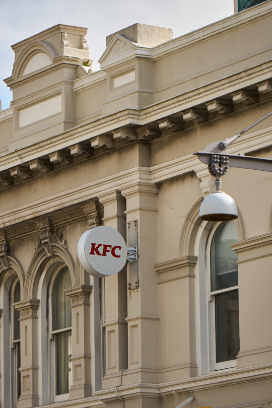
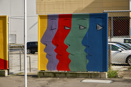
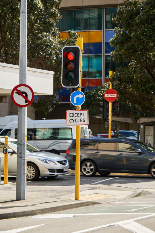

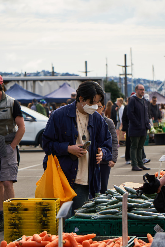

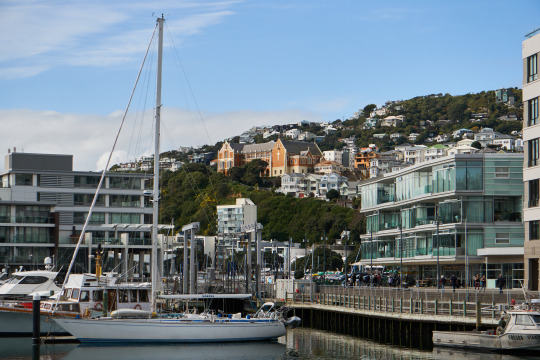

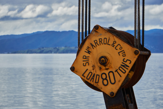
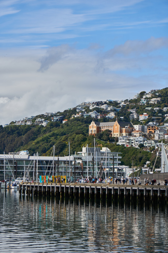
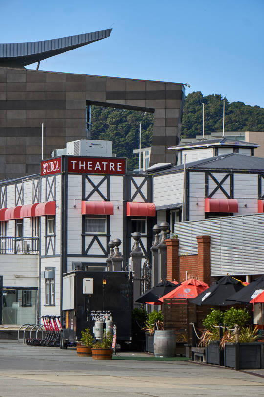
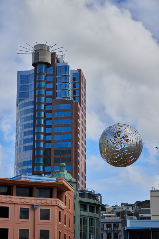


[11 September 2022]
#wlg22#wellington#poneke#te whanganui a tara#markets#kfc#streets#street photography#street art#people watching#waterfront#photography#photowalk#aotearoa#new zealand
25 notes
·
View notes
Text
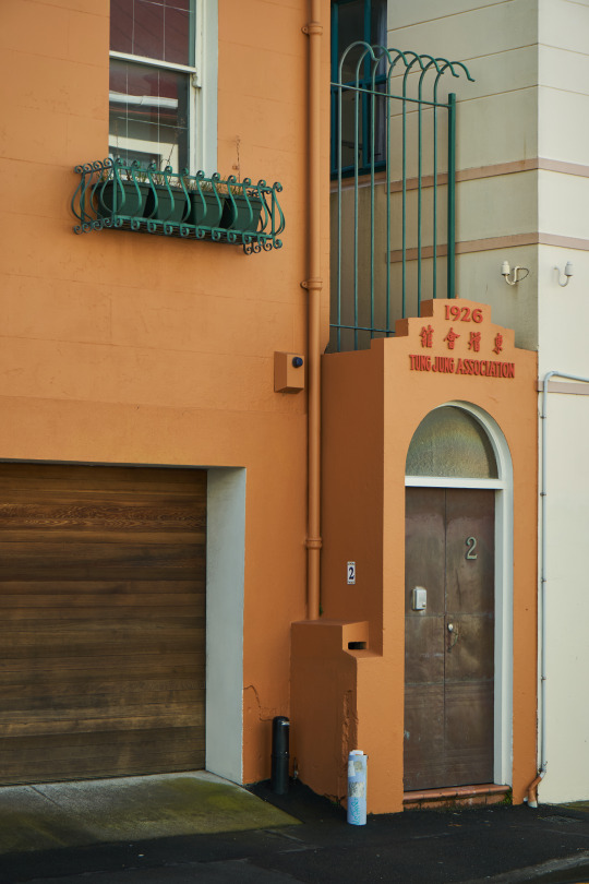
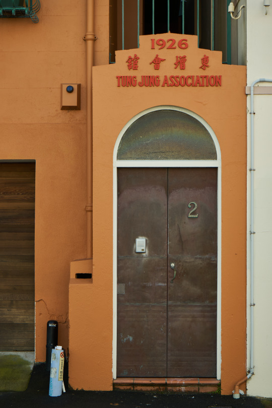
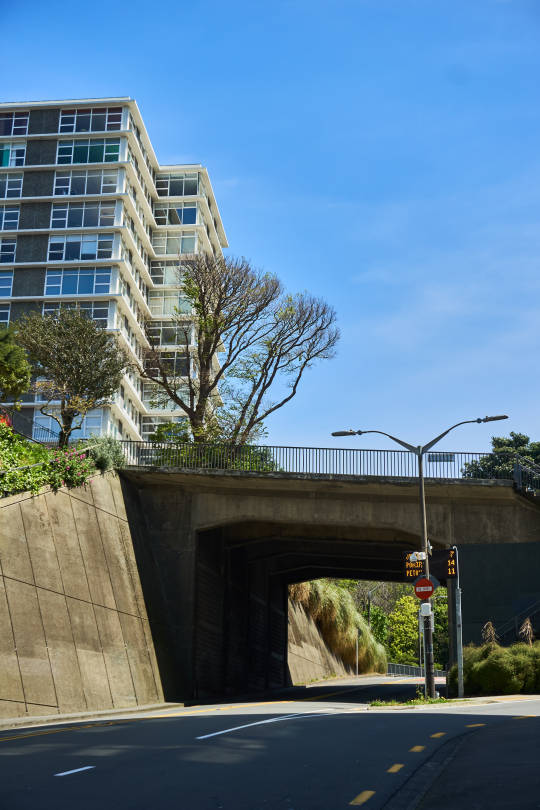
Wellington Architecture: the Central Spine
Following Route 3 "the Central Spine" from John Walsh's "Wellington Architecture: A Walking Guide" I went for a wander through the western part of Wellington's city centre.
This post doesn't cover every building, or even the exact route, but I highly recommend the book for an interesting way of exploring the capital.
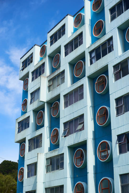
Starting with the Pukehinau Flats (1978) which remind me of LEGO.

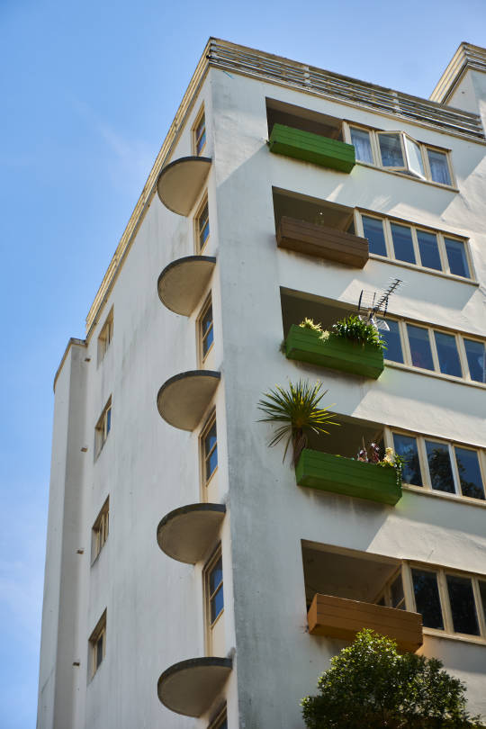
Then I headed towards Aro Valley and it's mix of character properties and mid-20th century towers.


The First Church of Christ (1983) has seen better days, and actually since going on this walk, has now been demolished.

St John's (1885) now sits in contrast with 111 Dixon Street, one of Wellington's better examples of urban high density that isn't a flat glass box.

Further up Dixon Street are the Dixon Street Flats (1944). Built as some of the first apartment-based public housing in the country, these now Historic flats are still part of the Kāinga Ora's public housing stock.
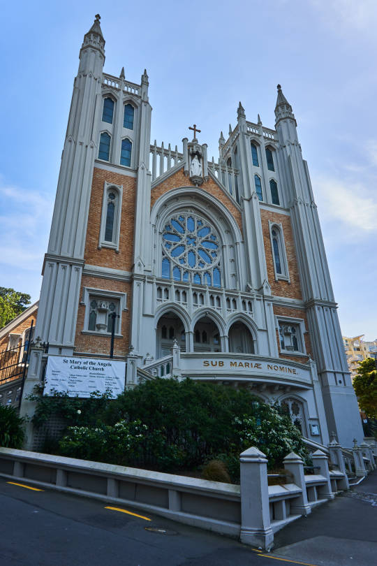
Not that I'm huge on churches but St Mary of the Angels' (1922) is, in my opinion, Wellington's most grand. At least from the outside.
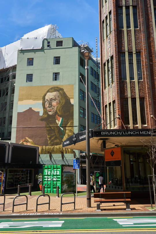
The Hibernian Building (1930, on the right) now marks one side of a small urban park along Willis Street, neighboured by the large Rita Angus mural.
There were many more buildings along the route with architectural interest but were either difficult to photograph or I had already captured them previously. Once again, highly recommend Walsh's book, there are also versions for Auckland and Christchurch now too!
[24 October 2022]
#wlg22#wellington#poneke#te whanganui a tara#architecture#buildings#urban#urbanism#urbanist#city#inner city#aotearoa#new zealand
6 notes
·
View notes
Text
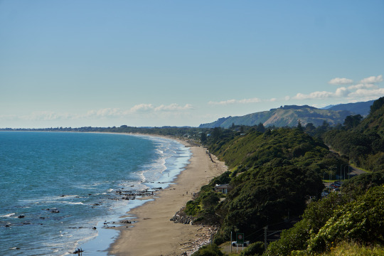
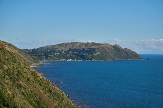
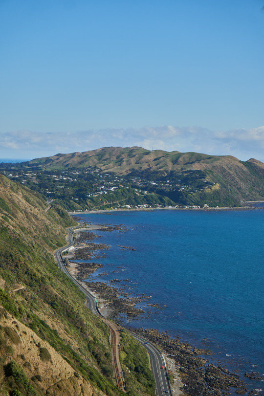
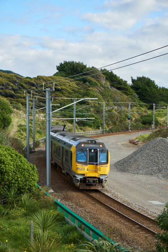
The Escarpment Track
High above what is now State Highway 59 on the side of Paekākāriki Hill, is the very scenic Escarpment Track.
Despite being well out of the city, this walk is easy enough to do by public transport.
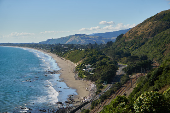
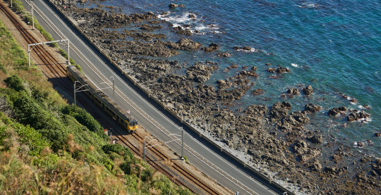
Simply take the train to Paekākāriki, then it's a short walk to the trailhead and off you go. The walk finishes at Pukerua Bay Station, perfect for the train back into the city.
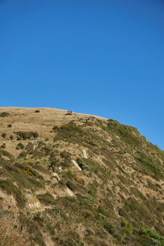
Two things worth noting about this walk are that there are many stairs and it is very high up with lots of exposed edges. For me, the former are fine but the latter are more problematic, so I was glad not to be doing the walk alone.

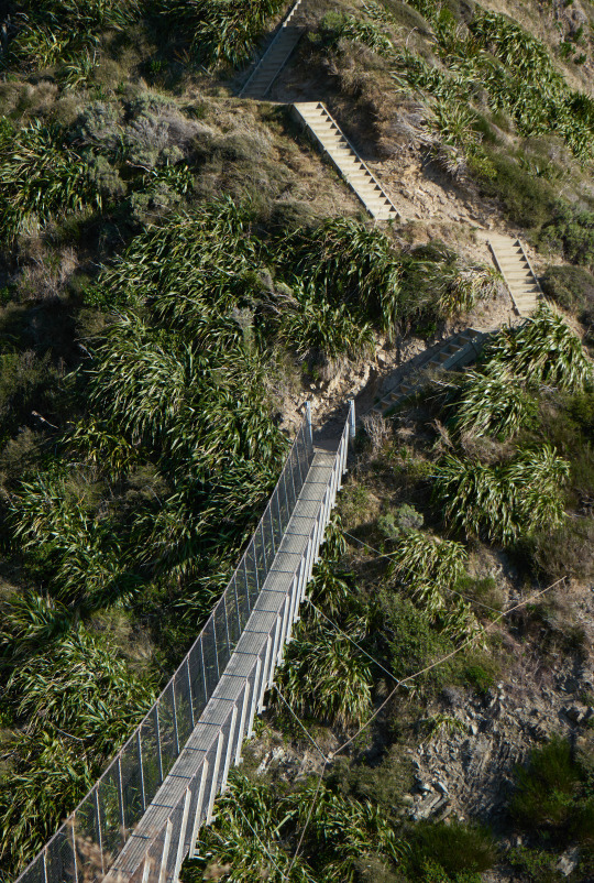
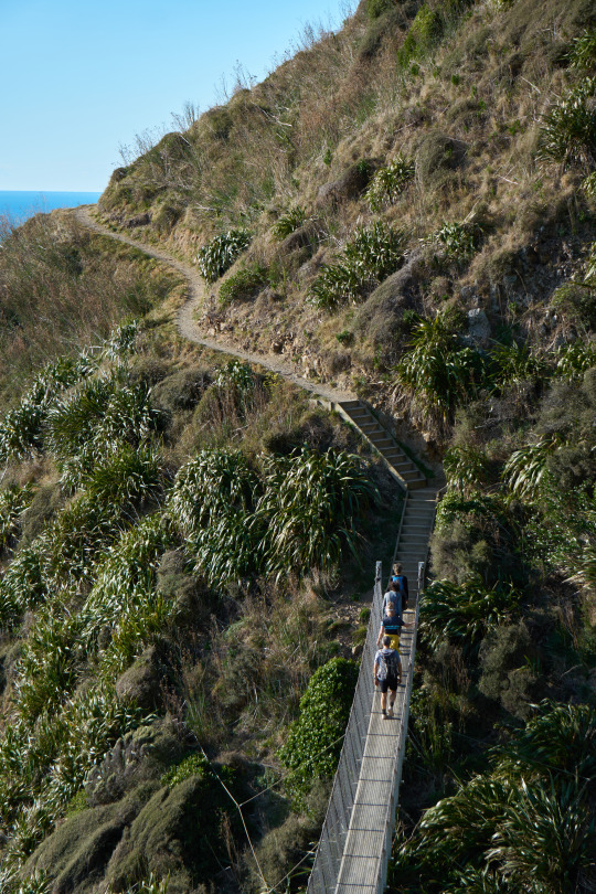
On the plus side, the views are gorgeous and the track is quite well kept with benches and rest areas. There was just one dodgy steep bit where there was a diversion due to a slip and you had to scramble a tad - hopefully that's been fixed since April.
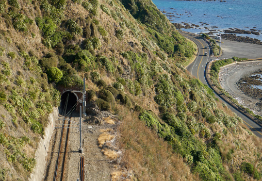
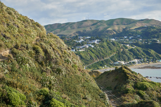
Once you begin to descend, you descend quite rapidly and the last couple of kilometres just follow the trainline into Pukerua Bay. I would definitely recommend going this direction as I think it is more manageable in terms of it getting better as it goes.
Overall it was a 7.9km walk and took just over 2 hours and 5 minutes with a snack break and plenty of photo stops.
[30 April 2022]
#wlg22#escarpment#escarpment track#Paekākāriki#pukerua bay#kapiti coast#porirua#wellington#poneke#te whanganui a tara#aotearoa#new zealand#walking#views#hiking#hike#trains#trainspotting#metlink
7 notes
·
View notes
Text
Proclamation of Accession

On Sunday 11 September 2022, on the steps of the New Zealand parliament, the Proclamation of Accession ceremony acknowledged King Charles III as King of the Realm of New Zealand.


The Realm consists of five countries and territories for which the monarch of New Zealand is the head of state. It consists of Aotearoa New Zealand, the Cook Islands, Niue, Tokelau and the Ross Dependency.
Being quite an important moment in history, I thought I'd head down and take a look.


The Proclamation itself was read in te reo by Parliamentary Kaumātua Kura Moeahu and in English by New Zealand Herald of Arms Extraordinary Phillip O’Shea.

At the heart of the ceremony was Dame Cindy Kiro, the Governor-General. She represents the monarch throughout the Realm, not just New Zealand.

The Prime Minister was also present and delivered words to the crowd.


The crowd was quite subdued, though one small group did fly Te Kara (the United Tribes flag) - which traditionally represents enduring Māori sovereignty.

#proclamation of accession#charles III#king#monarchy#new zealand#aotearoa#realm#realm of new zealand#flags#prime minister#governor general#jacinda ardern#cindy kiro#wlg22#commonwealth#beehive#parliament
2 notes
·
View notes
Text
Oriental Bay from Roseneath
From the summit of Mount Victoria, you can follow the Southern Walkway north to Roseneath for what I think are some of the best views of Oriental Bay and the harbour. And to top it off, you get to finish the walk by walking along the promenade by the shore.


[17 October 2022]
#wlg22#wellington#poneke#te whanganui a tara#oriental bay#oriental parade#mount victoria#harbour#southern walkway#walkway#walk#views#aotearoa#new zealand
0 notes
Text
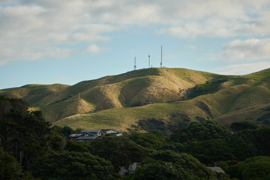
Mount Kaukau

On a slightly overcast day, I took the train up the Ngaio Gorge to Khandallah and walked up Mount Kaukau. From the summit you get expansive views over the Wellington Harbour, and also out over to the wind turbines in Makara.


[25 September 2022]
#mount kaukau#ngaio#khandallah#wellington#wlg22#poneke#te whanganui a tara#aotearoa#new zealand#walk#wind turbine#hills#citroen#harbour#view
0 notes
Text
Island Bay to Mount Albert
Starting from Island Bay, I walked round to Houghton Bay following the signposted Southern Walkway.

I have only ever cycled along this part of the coast, so it was nice to see it both on foot and heading in the other direction (I only cycle westbound but walked eastbound).

At Houghton Bay turn up the valley and head for Buckley Reserve. It's not a super obvious entry to the Southern Walkway and but just cross the grass field and trust me that it becomes clearer.

Up above Houghton Bay you reach a ridgeline offering expansive views cross to Lyall Bay and the Cook Strait. If you're lucky you can catch the Interislander entering the harbour.


Continuing on, you reach Mount Albert, a favourite spot of mine for watching planes coming in and out of Wellington Airport.


Mount Albert also gives views across Miramar over to the East Harbour and the Remutakas.
[28 May 2022]
#wlg22#wellington#poneke#te whanganui a tara#aotearoa#new zealand#southern walkway#island bay#houghton bay#mount albert#remutaka#harbour#airport#planespotting#ferry#interislander#cook strait
1 note
·
View note
Text
Northern Walkway: Simla to Wadestown


I took the very scenic Johnsonville Line train up to Simla Crescent in Khandallah then began my walk south towards Ngaio, where I was going to follow the Northern Walkway (southbound).

As you pass Ngaio and head towards Crofton Downs, you'll reach the entry to Trelissick Park, where the Northern Walkway becomes slightly more exciting than just the Khandallah Road footpath.


Through the lush Ngaio Gorge, there's a plethora of pathways to choose while you hear the distant trains chugging along the ridgeline above you.
Eventually though, you have to leave the trees and streams behind and head uphill, quite steeply, to reach Wadestown.

Here, at the foot of Hanover Street, where the Northern Walkway emerges from the park, you get an excellent view over the Ngaio Gorge. It also happens to present a great opportunity for trainspotting.
[24 April 2022]
#simla#wadestown#ngaio#khandallah#northern walkway#wellington#poneke#te whanganui a tara#aotearoa#new zealand#wlg22#walking#hiking#trainspotting#metlink#trains#gorge
0 notes
Text
From the city to Mount Albert and back
In March I got into a good habit of going for a big walk every weekend - and this was one of my biggest. Setting off from the city, I took the City-to-Sea walkway above Aro Valley, passing between Newtown & Brooklyn, past Berhampore. Before crossing Adelaide Road and scrambling up the side of Mount Albert to join the Southern Walkway, which I took north, through Truby King Park and down to Newtown to reach home.

Through this walk, I experienced Wellington’s full range of seasons, starting with cloud and drizzle.

Fortunately this quickly passed and blue skies appeared.

As I made my way up to Mount Albert’s ridgeline there were excellent views down to Island Bay and out over the Cook Strait. You can’t quite spot the South Island but it’s out there somewhere!

In the opposite direction, you can see back towards the city.


I couldn’t help but indulge in some plane spotting.

The Maranui Cafe at Lyall Bay sits on the edge of the beach in its Art Deco glory.


I accidentally timed this walk perfectly to get the gorgeous afternoon light for the final stretch home - perfect for photos from this pathway offering 360 degree views.

From Truby King park things started to get more shady, providing me with a frame for this shot over Kilbirnie.

Finally, I approached Newtown, with my legs well and truly knackered, so I took a short cut down Adelaide Road rather than continuing through the town belt.

#wlg22#poneke#te whanganui a tara#wellington#city to sea#walk#hike#promenade#aotearoa#new zealand#island bay#newtown#mount albert#kilbirnie#planespotting#cook strait#walking
0 notes
Text
Seatoun & Fort Dorset

On the eastern side of the Miramar Peninsula is a small flat suburb called Seatoun (pronounced Sea-toon) - Wellington’s wealthiest.

There is a coastal walk starting from the beach that takes you up onto the rocky cliffs at the southern end of the suburb - providing expansive views over the entry to the harbour and across to Pencarrow.


Once atop the cliffs, you pass through the ruins of Fort Dorset, which was once the main coastal defence fort for Wellington - guarding the entry to the harbour.

From here you can look down to Breakers Bay.

At the end of the walk, you reach this cutting where the coast road was dug through the hillside... you can then wander back through Seatoun’s quiet streets to complete the loop, if you’d rather not return the way you came.

[20 March 2022]
#wlg22#poneke#te whanganui a tara#wellington#aotearoa#new zealand#fort dorset#seatoun#harbour#cook strait#walking#cliffs#beach
0 notes
Text
Miramar Peninsula

Taking advantage of having my parents visit with their car in March, we went for a scenic drive around the Miramar Peninsula.


Along the western coast of the peninsula there are a number of pull-over bays which served as excellent photo spots, especially on such a calm day in the harbour.

Point Halswell Lighthouse’s checkerboard paint job was ensuring the fishers stayed in the shade while those on boats enjoyed the water.


I quite liked this combo shot of the Interislander, police boat and jet coming in, all with Mount Kaukau’s transmission mast in the background.

[20 March 2022]
#wlg22#poneke#te whanganui a tara#wellington#aotearoa#new zealand#miramar#point halswell#interislander#ferry#air new zealand#a320#planespotting#police boat#boats#lighthouse#harbour
0 notes
Text
Te Ahumairangi

Sitting above Thorndon is a part of the Wellington town belt called Ahumairangi, after the hill it includes - Te Ahumairangi. Back in March, I went for a wander up.

It’s a steep but short walk up from Tinakori Road to get to the lookout, giving expansive views over the city and suburbs.

Unlike the more classic Mount Victoria lookout you get some interesting views over the more western & northern suburbs like Northland and Karori.

That’s not to say you don’t also get excellent views of Oriental Bay, and the comings and goings of the Interislander.

[13 March 2022]
#wlg22#poneke#wellington#te whanganui a tara#new zealand#aotearoa#ahumairangi#te ahumairangi#town belt#lookout#vista#view#interislander#wellington harbour
0 notes