#thrust faults and orogeny
Explore tagged Tumblr posts
Visit Tumblr Blog
Explore Tumblr blogs with no restrictions, modern design and the best experience.
Last Seen Tumblr Blogs


Fun Fact
In 2020, 44% of users from Denmark used Tumblr daily.
Text
I have a geology degree, let me tell you it is SO funny watching well-meaning straight men struggle when we first learn about dikes
straight guy geologist describing a vertically oriented igneous intrusion to his buddy: it’s a . well. i’m not sure i can reclaim this one just get over here
153K notes
·
View notes
Photo


Meet a thrust fault
Thrust faults are the key feature that helps build mountain ranges. Whether you are walking through a modern mountain range like the Himalayas or an ancient range like the Scottish Highlands, those mountains grew on thrust faults.
Thrust faults are fractures in rock units that take lower, older rocks and push them up on top of younger rocks. This setup often results in “repeating of units” as shown schematically in the diagram of a thrust fault in this post. Going vertically in the center of the image, the “green” unit repeats – it is there twice, once below the fault where it was originally deposited and again above the fault where it has been thrust into place. Thrust faults accommodate shortening of layers in the upper crust. These layers started as sedimentary and metamorphic units, with the layering inside them almost flat-lying. Something started squeezing these units from the side, causing them to fold, buckle, and then fracture. When the rocks fracture, the lower rocks are squeezed upwards along a ramp until they find another level where they can spread out. The rocks slide over the upper layer as a thrust sheet – literally flat-lying rocks with a fault in-between. The lower image in the schematic shows a "balanced cross section" - a geologist has calculated the thicknesses of the layers and used those meausrements to reconstruct the original position of the layers prior to motion on the thrust fault
The outdoor picture shows a thrust fault near Glencoul in Scotland. The upper part of the hill is Precambrian metamorphic rocks above the Glencoul thrust fault, just below the fault sits younger, Cambrian sandstones that have also been metamorphosed. The fault itself almost looks like it is in the sedimentary sequence. The most prominent layer in this sequence, which dips a bit off to the left, is the Cambrian quartzite. The fault surface sits at the very top of this prominent outcrop, and the more mossy area on top is the overlying gneisses. In this site, the fault literally sits at the top of a flat layer; the older gneisses ramped up to the east and then spread out at this flat level.
This fault links into the larger Moine Thrust fault sequence that forms much of the Scottish Highlands. That fault system has, in places, accommodated over 100 kilometers of motion across it. In other words, the rocks above that fault have in places been moved horizontally by over 100 kilometers.
-JBB
Image credits: https://flic.kr/p/nToF8d Butler, 2010: http://sp.lyellcollection.org/content/335/1/293.short
#Fault#geology#thrust fault#rock#nature#scotland#landscape#travel#glencoul#moine thrust#orogeny#the earth story
145 notes
·
View notes
Photo


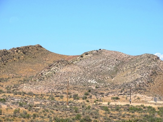
Field Course Update... 5? I have already lost track.
And, I missed updating yesterday. To say the least I was pretty exhausted after yesterday and was not going to even try to write this. But here I am!
Yesterday was very very busy and more of a stressful day for me for some reason. From the start of the day I felt very all over the place and felt like I had absolutely no idea what was happening. But, I did, and I was just getting overwhelmed with so much information bouncing around this little head of mine.
Our first stop was supposed to be the day before but we were off schedule. It was just in the weis parking lot? Like in the area that cars pull into the parking lot so we were pretty inconvenient for drivers during this time. We saw limestone and calcite veins, apart of the Jacksonburg formation in the Ordovician period. I forgot to bring my phone on this adventure so sadly no photos for this one. It was pretty interesting for me because during this trip so far I have realized I really enjoy stratigraphy. his is apart of the taconic orogeny, suggests a marine depositional environment.
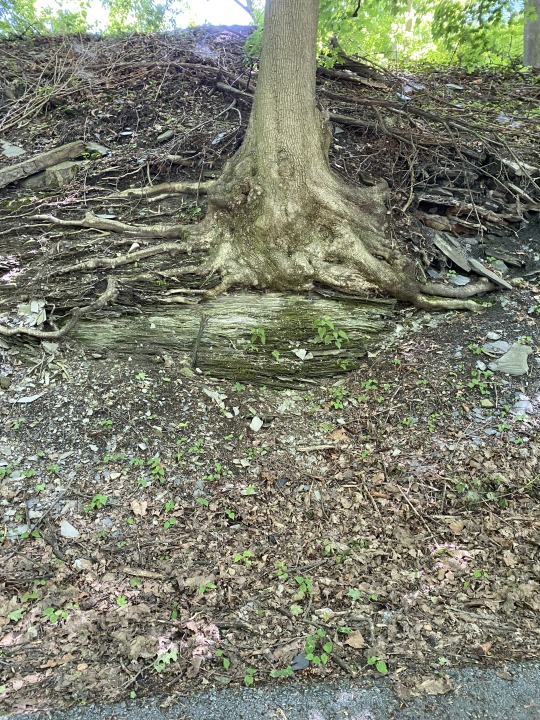
Our second stop was also just on the side of another parking lot. We called this one Iron Run Beverage just because there was a store named that pretty close to the outcrop. We spent so much time at this stop... I enjoyed it a lot but we were already so far behind our schedule, I think this kind of stressed me out a little bit just because I like to know what we are going to be doing, ya know? This was also apart of the Jacksonburg formation and showed varieties of limestones and calcites. First two photos are from this location. Second picture is one of my favorites, the light brown/ tan colored material on top is actually older than the stuff below but was apart of a thrust fault and also assisted in the taconic orogeny. Evidence points towards this area was once apart of a foreland basin.
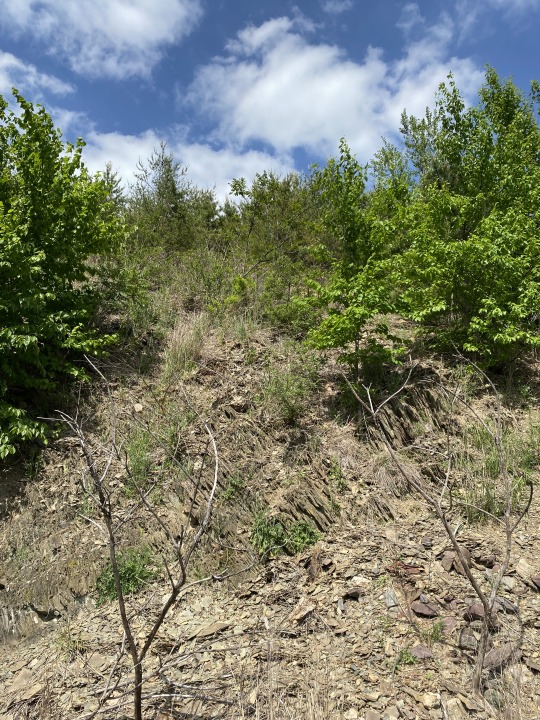
Our third stop was pretty magnificent. This was in Slatington PA (ha, wonder why...) The third and fourth photos are from this stop, the fourth photo was just on the walk back but thought it was pretty neat. The third picture really doesn't do this location justice. Some major folding and deformation is going on here, thicker bedding of slates and shales are here. There was also some mini waterfall action which I love to see because moss! We had some additional time here to explore which was very nice. We found a plastic bag and used it to pick up trash in the area. Apart of the Martinsburg formation, so it is older than the last two stops I am describing. There was no calcite found at this location like the previous two. We also learned how to take paces here and convert your number of paces taken to feet travelled. This is where things took a turn.
Our last stop. We were supposed to be here three hours prior, but again, we got even more off time as the day went on. It was very very sunny and I was uncomfortable and confused about mapping. The last picture is from this location. We basically spent this time more focused on recording strike and dips of the bedding and mapping them on a map of the area based on our paces taken, as well as practicing a lot of our field note taking skills here. At first I was kind of confused because I had never done strike and dip in a field setting before but by the end of the day here I got the idea. I was so stressed and just wanted to leave at this point. I felt like I did not know anything, and was not looking forward to the next day (which is now when I am writing this, oops) because we were continuing this mapping process for a while. But, it did get a lot better!! This is is apart of the Martinsburg formation.
At the end fo the day we had an activity that had to do with Google Earth Pro and using it to map our locations we were at, and would basically be a part of this much larger project we are doing throughout the course. I enjoyed this part, the program is really nice so far. This day was a lot, and very stressful for me, but it was really fun and at the end of the day I did learn a lot and used it for the next day (today, when writing this). I am also excited for this large project because while it will be a lot of work, I get to do mine about stratigraphy!
Also, these posts are everywhere. I cannot keep a straight mind when writing on here. Thank you to the people actually reading these and engaging, it is so fun to see! :)
#geologist#geology#introduction to geology#geography#biology#science#environment#mapping had me so so stressed me out at first i was so worried but I am so glad it all came out in the end pretty well
3 notes
·
View notes
Text
Great Basin National Park: a Historical Rundown
The Great Basin lays just South of the 6 and 50 highway in the US, close to the border of Utah and covers much of Northern and Central Nevada, small parts of Wyoming, Idaho, Organ and California. The area is hardly populated with Baker, NV being the closest town.
In the 1800′s George Montague Wheeler led expeditions in the area as a topographer for the U.S. Army Corps of Engineers, along side him was GK Gilbert; who was the first to write a geological report of the area.
Later on in the 1800′s Absalom Lehman came to the basin in search for gold and other valuable minerals. However, he was unsuccessful and lived life as a rancher selling supplies and food to the miners that came through. By 1855 he made the marvelous discovery of caves above his ranch and began to give tours.
The caves and their tours became a staple of the area and was pronounced the Lehman Caves National Monument in 1922. About 64 years later the Great Basin was named a National Park in 1986.
Let it be told that the history of the Great Basin does exceed that of its story of becoming a national park, or any other instances of human history within it. It is within the rocks that the Great Basin tells its tales.
The Great Basin starts its story in a Neoproterozoic, Cambrian ocean that existed all the way until the Pennsylvania. Through out this time, the ocean levels rose and fell, which is told by the transgression and regression sequences in the ancient sedimentary rocks. It wasn’t until the upper Paleozoic that the tectonic activity shifted the continental shelf environment.
Unconformity lies within the early Mesozoic Era and has not yet been added to the narrative but the story continues on into the Late Mesozoic Era in which faulting and igneous intruding was present due to the Sevier and Laramide Orogenies. The activity of crustal thickening and shortening along with plutonic intrusion was carried out throughout the Early Tertiary Period in the Paleogene Epoch. Low grade metamorphism during the Mesozoic burial beneath thrust sheets occured in the Pole Creek Limestone, Prospect Mountain along with other older rocks from the Neoproterozoic and lower Paleozoic.
Throughout the Cenozoic Era there was much andesitic volcansim. The Snake Range accumulated ash flows, tuffs and conglomerates. Most of the Volcanoes are about as old as the Oligocene of the late Paleogene. From the Oligocene Epoch to the Miocene Epoch of the early Neogene, there is a major extension of Snake Range. The displacement of the Snake Range detachment fractured the upper plate rocks on the South side and exposed the lower plate to the Metamorphic Core Complex
From the Miocene, the entire region was uplifted and broken up by a series of normal faults the created the tilted Basin and Range, along with block faulting. Any further volcanism was of basaltic composition.
As far as the Quaternary climatic changes go, there was multiple instances of Alpine Glaciation, that occurred in the area. Their glacial decomposition left the Lehman Creek moraine at 8100ft and the Dead Lake moraine at 9500ft. The Pleistocene glaciation formed the Lehman Caves. They also eroded the summits of Snake Range. Constant down slope erosion continues to create immense weathering, along with snow that collects in the summit’s hollows. There is still a glacier left to be found in the cirque of Wheeler Peak, along with a rock glacier.
#historical#historical geology#historic#geology#great basin#great basin national park#historical geology of great basin#what is the great basin#what happened in north america#what is the geology of north america#north american great basin#what is#geolgoy#geo#great basin fun facts#nevada#california#idaho#utah#organ#wyoming#nation#national#national parks#usa#united states of america#united states of america national parks#usa national parks#parks#great
4 notes
·
View notes
Text
[Henry Oak: Intro]
This one goes out to M.O.G
Mercedes Oak Garcia
Mi esposa
Mi corazon
Mi leona
[Verse 1: Henry Oak]
In 1824, in Cummington town
Word on the street was gettin’ around
About a new mineral dug up from the ground
When you hear the name you’re gonna love the sound
They called it Cummingtonite
[Bridge: Adrian Javon Martin]
Ooo, you gonna love the way it sounds
Ooo, you gonna love the way it sounds
[Verse 2: Henry Oak]
Flash forward two-hundred years
And I’m whispering into your ear
The words I know you want to hear:
“We’re all alone and the kids aren’t here.”
You’re cumming tonight
[Bridge: Adrian Javon Martin]
Ooo, I dropped the kids at Tae Kwon Do
Also gave them twenty bucks for froyo
[Verse 3: Henry Oak]
Ding dong it’s your friends from work
Gina, and Greg, and Jane, and Kirk
With candles and oils and toys and feathers
Like Pangea we’re coming together
We’re cumming tonight
[Bridge: Adrian Javon Martin]
Pangea was a supercontinent that existed
During the late Paleozoic and early Mesozoic eras
[Verse 4: Henry Oak]
Strip down to your ankle socks
And I’ll slip off my Birkenstocks
And as you’re grinding on my D
I keep my cool by thinkin’ bout geology
I think about Cummingtonite
[Bridge: Adrian Javon Martin]
I got a Ph.D - A pretty huge dingaling
And I’m so rock hard. Ooo, you make me so rock hard
[Verse 5: Henry Oak]
Thrust faults and orogeny zones (ooo)
Cleavage and aureoles (very nice)
Intrusion, contraction, compression, compaction (uh)
Eustatic movements, effusive eruption (Krakatoa)
Magnesium iron silicate hydroxide
I feel your tongue, I yearn to take you higher on a cock ride
The monoclinic form is a lot like anthophyllite
I'm on your clit it's warm, girl, it's got my man pole sky high
Composition similar to alkaline amphiboles
New position filling your canal with my animal
Crystalline formations make the solubility low
Deep within your cave is where you'll make my willy blow
I’m cumming tonight
[Bridge: Adrian Javon Martin]
Ooo, you make my willy blow so freaking hard
Yeah girl, talking about eruption
[Verse 6: Henry Oak]
It’s 3 AM or so says the clock
You gotta get up early for the “Rock Block of Bach”
But you want some more, so here’s a proposition
I’ll eat your pussy til the Morning Edition
[Vocal Autotune Solo]
Oh, Dee Dee. Dee Dee Bridgewater
Kai Ryssdall
Prairie Home Companion
You’re my American life
Wanna fuck my American wife
Steve Inskeep
Linda Wertheimer and Carl Kassel, baby
Do the numbers, do the numbers
Ira Glass, do the numbers
Marketplace
Gotta know about the shows I watch
With my wife she’s so fucking hot
Gonna eat her pussy all night long yeah
thinking about hit song 'cummingtonite'
33 notes
·
View notes
Text
Geology gets real inappropriate
I just wanted to take a moment to draw your attention to some of the best terminology used in Geology.
Cleavage - the angle and shape a mineral naturally breaks at. A classic for dirty jokes.
Intertonguing/interfingering - a lateral change between beds of sediment or rock where the two layers form interpenetrating wedges. Just sounds dirty no matter what you do.
Orogeny - process of lateral compression causing folding in the crust to form mountain ranges. Sounds like a sex act.
Thrust fault - a low-angle reverse fault. You know why it's included.
Spreading ridge - where the oceanic crust is fractured, allowing magma to be brought to the surface of the crust. Sounds like something to go with thrust faults.
Cummingtonite - a brown mineral. I'm not kidding.
This xkcd comic is posted in the Geology undergrad room here.

23 notes
·
View notes
Photo
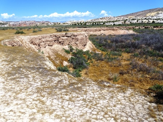
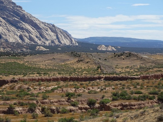
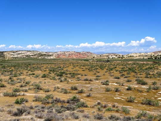
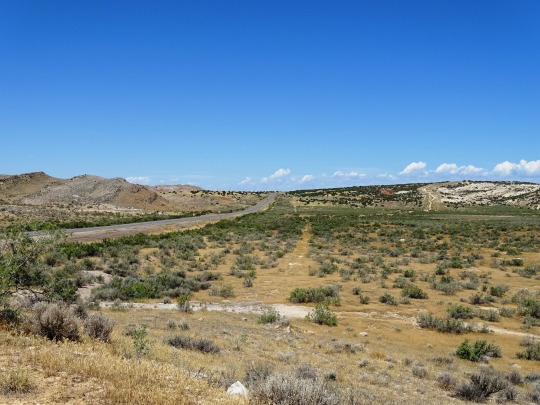
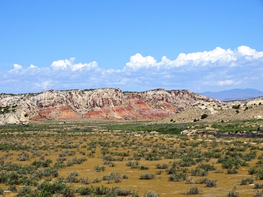
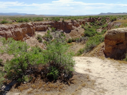
Musket Shot Springs Scenic Overlook, UT (No. 4)
The Uinta Basin forms a geologic structural basin, and is the source of commercial oil and gas production. Separated from the Piceance Basin by the Douglas Creek Arch, both basins formed during the Laramide Orogeny, and are bounded by the Charleston-Nebo thrust fault, the Uinta Basin boundary fault, and the Grand Hogback monocline. The Uinta Basin includes the Wasatch Plateau. According to the USGS Uinta-Piceance Assessment Team, "The black-shale facies of the Green River Formation is the main petroleum system of Tertiary age whereas the Mahogany zone of the Green River Formation is a minor component. The Cretaceous Mancos Group and equivalent rocks are the main source of Cretaceous oil and a major contributor of gas in the basin, whereas the Upper Cretaceous Mesaverde is a lesser contributor of oil but a significant source for gas. Ferron Sandstone coals are known to be a source of coalbed methane. The most prominent source of oil from Paleozoic rocks is the Permian Phosphoria Formation.
During the Laramide Orogeny along the Wasatch Mountains, the north-south trending coast during the Late Cretaceous was receding eastward, at the same time the area where the basin is located was subsiding, creating a lacustrine environment. A clastic wedge consisting of the North Horn, Colton, and Wasatch was deposited northwards. These sediments interfingered with organic-rich lacustrine clays and carbonate muds of the Green River and Flagstaff facies. Later, deposits originated from the Uinta Mountains from the north, forming a southward-thinning clastic wedge. A carbonate sediment consisting of an organic-rich oil shale was deposited from the middle Eocene into the Oligocene. The basin is also known for solid-hydrocarbon-filled fractures consisting of ozocerite, gilsonite, and wurtzilite.
In 1948, oil was discovered in the Paleozoic portion of the basin at Ashley Valley. Tertiary discoveries followed in 1948 at Roosevelt, and then the Red Wash Field and Duchesne Field in 1951. The Bluebell Field was discovered in 1967 and the Altamont Field in 1970. The Altamont-Bluebell structural trap occurs where the Wasatch sandstone pinches out.
Source: Wikipedia
#Musket Shot Springs Scenic Overlook#Uinta Basin#Uinta Mountains#USA#Uintah County#near Jensen#landscape#countryside#Rocky Mountains#Utah#summer 2022#original photography#tourist attraction#landmark#Birch Creek#Western USA#desert#vacation#travel#flora#nature#grass#canyon
1 note
·
View note
Text
Process of Neplese mountain Formation.
Our continents are carried by a series of tectonic plates located in the earth’s lithosphere. These plates collide with and separate from each other at different rates determined by a process known as convection. Directly below the lithosphere is the inner mantle known as the asthenosphere. Convection currents are generated in the earth’s inner mantle as molten rock forms from the radioactive decay of elements. As hot gas and liquid is produced it moves upward, displacing the cooler and denser gas and liquid. As this convection process happens, those circulations push the lithosphere’s plates (and the seven continents that sit on top of them), slowly shifting the globe’s landscape over time. The direction and rate of movement is totally dependent on what kinds of convection currents are at work below.The Himalayan range is one of the youngest mountain ranges on the planet and consists mostly of uplifted sedimentary and metamorphic rock. According to the modern theory of plate tectonics, its formation is a result of a continental collision or orogeny along the convergent boundary between the Indo-Australian Plate and the Eurasian Plate.
About 60 million years ago, during the Upper Cretaceous period, the north-moving Indo-Australian plate (which has subsequently split into the Indian Plate and the Australian plate) was moving at about 15 cm per year. About 50 million years ago this fast moving Indo-Australian plate had completely closed the Tethys Ocean (which some scientists regard as a classic geosyncline - or less elegantly - a big catch bucket), the existence of which has been determined by huge thickness of sedimentary rocks settled on the ocean floor, and the volcanoes that fringed its edges.60 million years ago, India was approximately 6400 km (3968 miles) south of the Eurasian plate. Separating the two was the Tethys Sea. The Indo-Australian tectonic plate – containing the continent of Australia, the Indian subcontinent, and surrounding ocean – was pushed northward by the convection currents generated in the inner mantle. For millions of years, India made its way across the sea toward the Eurasian plate. As India approached Asia, around 40 million years ago, the Tethys Sea began to shrink and its seabed slowly pushed upwards. The Tethys Sea disappeared completely around 20 million years ago and sediments rising from its seabed formed a mountain range. When India and Tibet collided, instead of descending with the plate, the relatively light sedimentary and metamorphic rock that makes up the subcontinent of India pushed against Tibet, forcing it upwards, and created a massive mountain fold. The Himalayas.
Both of these two plates are composed of low density continental crust; they were thrust faulted (pushed upwards) and folded into mountain ranges rather than subducting (pushed downward (if they were higher density oceanic crust)) into the mantle along an oceanic trench. The summit of Mount Everest is made of marine limestone from the ancient ocean Tethys. Today, the Indian plate continues to be driven horizontally at the Tibetan Plateau, which forces the plateau to continue to move upwards. The Indian plate is still moving at 67 mm per year, and over the next 10 million years it will travel about 1,500 km into Asia. About 20 mm of the India-Asia convergence distance is absorbed by the thrust faults along the Himalayan southern front. This absorption pushes the Himalayas up about 5 mm per year, making them geologically active. The movement of the Indian plate into the Asian plate also makes this entire region seismically active, leading to earthquakes (some major) from time to time.
The mountain range grew very rapidly in comparison to most mountain ranges, and it’s actually still growing today. Mount Everest and its fellows actually grow by approximately a net of about a centimeter or so every year. And it’s also important to note that the fault line that this created between the asian and indian plate lies just below Nepal where the energy trapped due to the supermassive collision of continents and sliding off the crust from time to time comes roaring up as a massive earthquake in this general fault line area, in case of Nepal.
1 note
·
View note
Text

Old Chief Mountain!
Glacier National Park in Montana is home to many geological treasures but this peak at the eastern border of the park bears testament to the huge thrusting forces involved in mountain building. It forms the leading edge of the Rockies, where the huge nappes of rock that detached from the rocks below along faults and were pushed up over younger rocks due to the force of tectonic compression caused by the Laramide orogeny. The entire leading edge of the Rockies is known as the Lewis overthrust, running from central Montana up into Alberta in Canada.
The Chief is an outlier, a chunk of Precambrian limestone that has been separated from its peers by the forces of erosion after their rise. It was thrust over younger grey shales dating from the Cretaceous. Nappes often detach at mudstone units, as the water and clay mineral content lubricate them. Their slipperiness becomes the weak point along which the tectonic forces will accommodate. Such orphaned chunks of rock are known as klippes to geologists. It rises 1,500 metres over the Great Plains, the first outpost of the mountain chain.
The peak is sacred to the Native Americans, known for example as Nínaiistáko to the Blackfoot tribe. Ceremonies still occur there every year, attracting tribes from both sides of the border. First nation legends say a Great White God will emerge from the mountain to announce the end of days. Lewis and Clarke also described it on their exploratory forays across the continent.
0 notes
Text
It’s a Geological Life: Spain Edition
Day 6: Geology of Pineta Valley, Ordesa and Monte Perdido National Park
This was the day my professor realized that ¾ of the class were not mountain goats like here and said, if we made to the first big waterfall (where we would have our geology lesson), that we were done for the day, could go hike around and make it back to the bus by 2:00pm. It was a FUN day because Avery and I went fossil hunting.

While the Pineta Valley was glacially carved during the Quaternary, it has so great and complex geological history. The Pineta Valley contains multiple thrust sheets stacked one on top another. The thrust faults are the reactivated Lower Cretaceous normal faults. These faults were reactivated during the Upper Cretaceous due to the Alpine orogeny (the convergence of the Afro-Iberian and European plates).

Looking down to the Pineta Valley, you can see it’s clear glacially-carved, U-shaped profile. The many waterfalls are runoff of the active glacier of the Monte Perdido, which is the third largest glacier in the Pyrenees. The Monte Perdido glacier has been retreating drastically since the beginning of the 20th Century.


The Cinca Waterfall from the Pineta Glacial Cirque
Estrecho Formation

These limestones contain fossils of Rudists, which were bivalves (mollusks) that lived affixed to the substrate. Rudists went extinct at the end of the Cretaceous.
For Day 5…
107 notes
·
View notes
Text
Which plate bottoms depends on the disposition of the plate. For example...
The thinner oceanic plate usually bottoms, it's really, really dense; very hard and very heavy. Once it meets a continental plate, the oceanic plate drags down in a gentle curve, bowing under the greater bulk of the continental plate its running into. It'll slide right under that thick, bulky, continental plate, rubbing their edges together, and creating thrust faults and reverse faults. And it moves maddeningly, teasingly slow. The oceanic plate is so heavy and dense that edge under the continental plate takes a long, long time to melt. But melt it does. In fact, it gets so fucking hot down there that as it's melting under the commanding, sultry weight of the continental plate, the oceanic plate releases a ton of fluids. Those fluids rise up and mix with the warm underbelly of the continental plate, lowering the melting point of the hard silicic rock there, and creating vast wet pools of hot magma. The liquid rock builds and builds, creating an unbearable anount of tension, until erupting to the surface in a violent explosion of hot, fast moving lava and ash; a thick slurry of materials that flows over everything. Coating it. Marking it. Forever.
These releases happen over and over and over again. One long orogeny.
@needmorefiction
SCIENCE!!!
one tectonic plate approaching another
“so are you a top or a bottom?”
364K notes
·
View notes
Photo

The Colorado Mineral Belt The area of Colorado, running from Denver and Boulder heading southwest, is a geologic puzzle. It is loaded with economic ore deposits, and has been a key mining target for nearly 2 centuries. Why all these ore deposits sit here is something of a geologic enigma, and in fact it has even left its mark on the state's map. Denver, Colorado sits very near the northeastern end of the line of mines and the Geological Society of America (GSA) even houses its headquarters nearby in Boulder, Colorado. Why does Colorado host enough mineral mines to redraw their map? The answer is the Colorado Mineral Belt.
The Colorado Mineral Belt is a belt of igneous rocks deposited between about 75 and 33 million years ago that runs from the Four Corners region in Arizona northeast to the Rocky Mountain front range just west of Denver, as shown in this map. These igneous rocks mostly formed as plutons of felsic rock – blobs of magma with compositions close to granite – that moved up through the crust and deposited ore bodies as they crystallized. Some of the highest peaks in Colorado are made from magmas formed during the growth of the Mineral Belt. This pulse of magmatism literally made fortunes; one database below shows over 8000 separate mines in Colorado. Once the first mining pulse began in the Denver area, mining spread throughout the Mineral Belt. Supplies came in through Denver and spread out to dozens of mining boomtowns and smelters throughout this region. Although its importance to geology is such that the GSA literally sits right there…there is still debate about the origin of the Colorado Mineral Belt. In fact, based on the big picture events in the Western United States over the past 100 million years, it really shouldn’t be there. 100 million years ago, a piece of oceanic crust called the Farallon plate was subducting beneath North America. As it subducted, it gave off fluids that caused the mantle to melt, eventually creating large igneous mountain ranges such as the Sierra Nevada and the Idaho Batholith. However, about 80 million years ago, something changed. Although the Farallon plate continued subducting, the volcanoes shut off across half the continent. Subduction usually triggers volcanoes, so a 1000+ kilometer gap above a subduction zone with no volcanoes is extremely unusual. Most geologists believe this volcanic shutoff relates to the path the Farallon plate took as it subducted. For igneous rocks to form, a plate must sink far enough into the mantle to reach hot rocks – typically at a depth of about 100 kilometers. If the plate was too light, it wouldn’t sink and the volcanoes would shut off. This volcanic shutoff is also associated with the Laramide Orogeny – a unique period of faulting in the Western U.S. where deeply buried basement rocks are suddenly thrust upwards into mountains. This whole scenario makes sense if the Farallon slab got too shallow – the volcanoes shut off and the Laramide faults formed because the Farallon plate was pushing upwards on the bottom of the continent. No volcanoes, deeply rooted faults pushed almost straight up. Right in the middle of this general picture is the oddity of the Colorado Mineral Belt. It sits right in the middle of this volcanic gap, nowhere near any spot that was producing volcanoes over the subduction zone, in an area where there shouldn’t be any volcanism, and yet a 500 kilometer long volcanic province suddenly appeared. The Colorado Mineral Belt owes its origin in part to this subduction process, but how it happened is still a matter for debate. The Farallon slab became shallow and extended deep into the continent, supplying fluids into areas of North America that hadn’t seen them before. These fluids were concentrated in the area of the Colorado Mineral Belt and produced magmas rich in gold and other trace elements that they then brought up to the surface. But why right here? Part of the answer may be extremely ancient. The North American continent assembled over several billion years as different pieces of crust stuck to the continent. Every one of these collisions was violent, creating mountain ranges and a series of faults that cut through the entire length of the crust. Geologic mapping indicates that there are several ancient, Precambrian aged faults in this region, a relic of a collision on the growing North American continent 1.6 to 1.8 billion years ago. These faults could penetrate the entire crust and provide pathways that could carry the mineral belt fluids and magmas up to the surface. An alternative idea was published in recent years arguing instead that the old faults play only a minor role in shaping the Mineral Belt. Instead, that scientist proposed that the reason the mineral belt is so long is that it is the remnant of a fracture in the Farallon plate. If the Farallon plate tore in two as it moved beneath North America, that tear would allow hot mantle and fluids to rise up in-between the two pieces of the plate and would create a line of igneous rocks tracing out the relative motion path between the two plates. The Colorado Mineral Belt is a unique feature in the Western U.S. and maybe even around the world. Although there are gold and mineral deposits elsewhere, this strange lineament right in the middle of a magmatic gap represents an amazing accumulation of mineral wealth. -JBB Image credit: http://bit.ly/1PkLquE. Darker inner area shows main mining districts. References: http://gsabulletin.gsapubs.org/content/74/8/991 http://pubs.usgs.gov/of/2003/ofr-03-046/ https://www.geosociety.org/GSA/About/Who_We_Are/GSA/About/Who_We_Are.aspx http://www.expertgps.com/data/co/mines.asp http://geosphere.gsapubs.org/content/8/1/28.short
#Science#precambrian#mineral#mine#mining#ore#district#geology#denver#geography#boulder#gsa#geological society of america#the earth story
71 notes
·
View notes
Photo

Garden of the Gods Natural Landmark This striking photograph shows just some of the delightful outcrops found in Garden of the Gods National Natural Landmark and park, outside of Colorado Springs, Colorado.
The most distinctive feature of the area is termed by geologists a “hogback”. This structure forms when sedimentary rocks of different strength are deposited and steeply tilted by faulting.
Once they’re exposed to the elements, the weaker layers weather away, leaving the stronger layers to stand high as angled hills or even as almost individual layers as seen here. Like many places in western North America, these rocks record sedimentary processes associated with the growth of the Rocky Mountains. The most prominent outcrops in the park are made of 2 formations – the Fountain formation which was deposited between Pennsylvanian and Permian time (~325 to 275 million years ago) and the Lyons Sandstone, deposited during the Permian (~275 to 250 million years ago). The rocks standing the tallest in this photo are made of Lyons Sandstone, a formation deposited in desert-like conditions. That unit contains cross bedding and erosional unconformities as are commonly found in sand dunes and is made of well-cemented, quartz-rich sand. That sandstone is likely about the same age and tells a similar origin story to the Coconino Sandstone near the top of the Grand Canyon; the formation of a giant desert while Pangaea was assembled (http://tmblr.co/Zyv2Js1NYukEi). Before these sandstones were heavily deformed, other sedimentary units were deposited on top of them. A chalky, limestone layer sits directly in contact with those units and then it is followed by an unconformity representing about 50 million years of missing time. That limestone probably represents the intrusion of the actual ocean into this area followed by its retreat and erosion before new sediments began arriving. In the Jurassic and Cretaceous, several additional sedimentary units formed. The Morrison Formation is found throughout the western U.S. and is famed for containing dinosaur fossils – true at this park as well. The Morrison contains sediments eroded from a growing mountain range to the west that were carried by rivers and deposited near the shorelines of lakes and the ocean as it rose onto the continent. Cretaceous-aged sandstones and even a shale sit atop the Morrison – both formed by this same interaction between rising sea levels and sediments shed from the growing mountains. The sandstone represents sediments close to a beach and the shale represents deeper, quiet water; sediments deposited when the Western Interior Seaway covered much of the Great Plains. Finally, to form these hogbacks, the rocks had to be tilted. The earlier pulse of mountain building in the Rocky Mountains happened to the west of this site. It was known as the Sevier Orogeny and it formed stacks of faulted rocks similar to those seen in mountain ranges like the Andes today. The deformation during that mountain-building event stayed fairly close to the Western U.S. coastline for tens of millions of years, building high mountains but not extending into the continent. That deformation pattern changed during the Cretaceous, when an event called the Laramide Orogeny occurred. The Laramide and the Sevier orogenies represent 2 distinct styles of mountain building in the Western U.S. The Sevier Orogeny involves faults forming in sedimentary rocks, building a mountain range style that we call a fold and thrust belt, with lots of folded and faulted sedimentary rocks. The Laramide was different. During the Laramide Orogeny, some of the deepest rocks in the continent; the ancient, crystalline granites and metamorphic gneiss basement rocks were faulted. These faults extended much deeper than those of the Sevier Orogeny and they also moved much farther inland. For example, the Sevier Orogeny faults can be found in areas like Idaho and Western Montana while the Laramide Orogeny extended all the way to the Black Hills in South Dakota, about 500 kilometers to the East. Both of these mountain building pulses were driven by subduction of an oceanic plate called the Farallon plate off the western coast of North America. The same subduction zone also caused the formation of the large igneous rock provinces in the Sierra Nevada Mountains, Idaho, and even Western Colorado. Although they had the same cause, something different must have happened between these 2 mountain building events. Some geologists believe the Farallon plate became shallow as North America approached a ridge, causing the Farallon plate to push on the bottom of the continent and creating the Laramide Orogeny. Others believe the Laramide Orogeny occurred when part of a large oceanic plateau was subducted beneath North America; pieces of that plateau could have been too buoyant to sink into the mantle and similarly pushed upward on the bottom of the crust, creating the Laramide faults. During the Laramide, crystalline basement rocks like those found on Pike’s Peak to the west were pushed upwards. As those rocks moved, the sedimentary layers sitting on top of them were twisted and bent upwards as well. Flat-lying sedimentary rocks that once sat on top of these deeply buried granites were folded and tilted, in some cases to nearly vertical. That’s how these rocks acquired the tilt they see today. Finally, once they were exposed at the surface they were exposed to weathering. Weathering by rain and wind will often grind away at fine-grained, weak rocks like shales while sandstones tend to stand taller. Sandstones are mostly composed of the mineral quartz, which is very hard and does not erode easily, and the grains of those sandstones are often cemented by that same quartz, giving those layers extra strength not found in the limestones or shales. Thus, coarse grained sandstones stand tall in this park and create many of the hogback features that led to it being designated a National Landmark. -JBB Image credit: Dixie Lawrence https://flic.kr/p/6BeES3 References/Read more: Geologic map: http://bit.ly/1G5Ky6G http://bit.ly/1He9Fbn http://bit.ly/1UxwUnV http://bit.ly/1IHzx1V http://bit.ly/1JSsBO5 http://abt.cm/1J2UhNc
#Colorado#laramide#hogback#garden of the gods#sandstone#erosion#landmark#nature#fault#granite#uplift#mountains#pike's peak#plateau#the earth story
121 notes
·
View notes
Photo
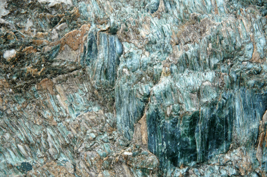
Vermont Serpentinite Serpentinite is a common rock on Earth, and probably throughout the solar system. It is a type of metamorphic rock, produced when one of the most common minerals in the planet – olivine – gets exposed to water near the surface of the Earth, which of course happens all the time. A bit of water and a bit of pressure and the mineral structure changes, turning it into a soft, easily deformed rock.
Many serpentinites have a fibrous appearance like this one from Vermont. There can be two factors driving this appearance; first, these rocks are so soft that they can deform easily in response to the stresses of mountain building. In that case, these lines are slickenlines, reflecting one part of the rock grinding against another. Alternatively, some (But not all) serpentine minerals can grow in a habit where they form long needles; minerals that grow in this habit are lumped together as asbestos minerals. Serpentine-bearing rocks therefore can naturally host asbestos, and mines in the area where this rock came from in Vermont produced asbestos for more than half a century. Serpentinite rocks and serpentine minerals are most often found where little bits of Earth’s mantle get thrust up onto the continent, creating a feature we call an ophiolite. These are commonly produced when continents collide or when continents run into island arcs, as a bit of the mantle gets trapped in the collision zone. The serpentinites in Vermont are the remnant of the Taconic Orogeny, a mountain building event 440 million years ago where a volcanic island arc was thrust upon what is today New England, folding and faulting much of the area in the process. -JBB Image credit: James St. John https://flic.kr/p/2iE3pj4Reference https://bit.ly/2BhQPrk Previous TES series on Asbestos and health problems: https://www.facebook.com/TheEarthStory/photos/a.352867368107647.80532.352857924775258/778584158869297
#Serpentine#vermont#olivine#ophiolite#taconic#orogeny#serpentinite#mineralogy#fiber#mineralmonday#asbestos#the earth story#science#geology
92 notes
·
View notes
Photo

Stress and strain
The rocks in question are Palaeozoic (540-250 million years old) from the isle of Sardinia, and were squished during the Variscan Orogeny, a mountain building event that accompanied the continents meeting and merging into Pangaea, over 300 million years back. These phenomena happen at many scales, from the tiny shown here to the huge nappes thrust over the continents to form such ranges as the Alps or Himalayas, revealing the fractal (repeating across different scales) nature of geological processes.
Loz
Image credit: R. Carosi/Outcropedia
136 notes
·
View notes
Photo
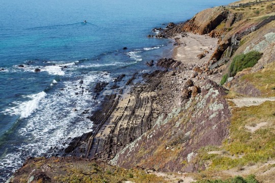
Hallett Cove - 600 million years of history at a single glance!
Depicted in these photos is the stunning geology at Hallett Cove, South Australia.
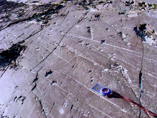
600 million years ago this entire area was submerged in the sea. Silts and sands were deposited in a deep marine, passive margin environment and then, 500 million years ago, folded and uplifted during a period of mountain-building. This mountain-building event is known as the Delamerian orogeny and was the result of stress transfer during the formation of the supercontinent Gondwana. From my understanding, the energy generated by the impact of Gondwanan formation was conducted through the crust, allowing the plate to “crumple”, causing folding and thrust faulting. The first image depicts the Wave-cut Platform, which is the eroded limb of a massive fold under Black Hill. Those bumpy, black lines are actually sedimentary beds which are now lying almost vertically due to folding.
Between 500-280 million years ago, there is an unconformity. An unconformity is essentially a record of erosion, and the parts that are “missing” can tell us a great deal about what happened to the region between the time of erosion and the next depositional event. This particular unconformity records the erosion of the Delamerian Highlands (a mountain range) into low hills.
During the Permian (280 million years ago) Australia was covered by an ice sheet, similar to that which covers Antarctica at present. As the ice sheet moved toward the north-west over southern Australia, it scoured the surface and left glacial pavements. Glaciers usually pick up all kinds of rock fragments and sediments which become embedded in the underside. These etch the surface of whatever material the glacier’s underbelly comes into contact with. Because the striations are straight, we can also get a basic sense of the direction in which the glacier was moving. A world-class example of the striations made by a glacier can be seen atop Black Hill and is shown in photo #2.
Between 280-3 million years ago, Australia began to warm and the ice started to melt. Deposits of soft, pale glacial sediments and ‘drop stones’ (also called ‘erratics’) were deposited. Drop stones are larger rock fragments that are found amongst finer-grained sediments in sedimentary rocks and can be diagnostic of past glacial activity. Photo #3 depicts evidence of glacial melting as recorded by the Sugarloaf, a large, white, cone-like structure. The Sugarloaf was formed when sediments accumulated in a lake formed by melting glaciers. There is also an unconformity here that records the period where Hallett Cove underwent a subsequent period of erosion and much of the glacial sediment was removed.
At 3 million years ago, the area underwent downfaulting, which means that it sank in relation to its surrounds. This type of faulting occurs due to extensional events where essentially, the ground pulls apart and shears apart or detaches along weak points in the Earth’s crust. Then, the newly detached material slides down to fill the void created by extension. This sunken area is also known as a ‘graben’. At Hallett Cove, the downfaulted area was submerged in a shallow, warm sea. This is evidenced by the thin layer of fossiliferous white sandstone that overlies the remaining glacial sediments. Before long, the neighbouring Mt. Lofty Ranges began another period of uplift and Hallett Cove was exposed as land yet again.
2 million years ago, a thick layer of alluvial silt and clay was deposited as a floodplain by rivers flowing down to the coast from the Mt. Lofty Ranges. Further uplift of the area (which continutes today) has resulted in even more erosion, giving the formation its characteristic ‘badlands’ appearance. Today, this feature is known as the Amphitheatre. It has a striking red colouration, caused by iron oxides (which can be seen in photo #3) and is capped by a layer of hard calcrete, which is formed when calcite-rich waters permeate calcareous soil or regolith, precipitating as a hard crust when the water evaporates at the surface. It is common in arid and semi-arid environments.
YK
Image credits: The Wave-cut Platform - “rock beach” by sunphlo (c) 2011. (https://flic.kr/p/aT9SRg). Used under creative commons licensing. The Sugarloaf - “The Hump::HDR” by Ikhwan Zailani (c) 2012. (https://commons.wikimedia.org/wiki/File:The_Hump_HDR_(8297135638).jpg). Used under creative commons licensing. Glacial Pavement atop Black Hill - "Glacial rock scrapings" by sunphlo on flickr, creative commons
Further reading: http://www.mindat.org/article.php/957/Overview+of+Hallett+Cove+Geological+History https://www.marion.sa.gov.au/hallett-cove-conservation-park http://austhrutime.com/delamerian_orogeny.htm http://crcleme.org.au/RegLandEvol/MtLofty.pdf http://www.indiana.edu/~geol105b/images/gaia_chapter_6/unconformities.htm http://users.sa.chariot.net.au/~littoral/hallettcove/geology.htm
118 notes
·
View notes