#Photogrammetry 3D scanning
Explore tagged Tumblr posts
Visit Tumblr Blog
Explore Tumblr blogs with no restrictions, modern design and the best experience.
Last Seen Tumblr Blogs


Fun Fact
There were a total of 171.5 billion posts on Tumblr in 2019.
Text
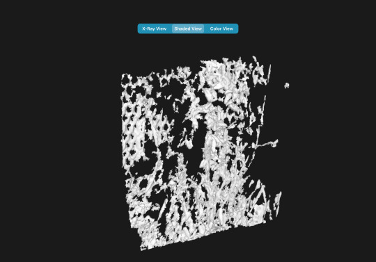
Photogrammetry 3D scanning
Point Precise uses photogrammetry and your iPhone’s device sensors to convert your scans into precise 3D point clouds.
0 notes
Photo


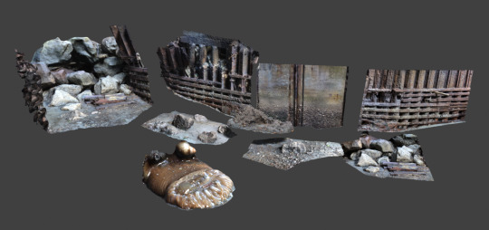
Anton Ek
Senior Environment Artist
artstation linkedin
More from «Artstation» here
#antonek#hypogeum#necropolis#foggy#ruins#underground#roots#abandoned#forest#trees#artist#Anton Ek#autumn#Photogrammetry 3D Scanning#Games and Real-Time 3D Environment Art#fall#mossy#misty#unreal engine#rocks#mist#skeleton#catacombs#nature#overgrown#art#leaves#nordic#horror#artstation
26 notes
·
View notes
Text
Exciting progress on 'photogrammetry of very small things' this evening: I have devised a simple, but effective rostrum for photographing tiny subjects from every angle.

Rostrum made from a flower pot, 2 cardboard circles and a wine cork. Lighting from a very small torch fastened to the rig by a rubber band; there is a white sticky label on the light to make the lighting more diffuse.

Subject: a shrivelled, dry Cladonia caespiticia specimen. Small… and very frilly. The ruler is in cm, not inches.

Here is one of the 60 source photos used to construct the 3d model.
...and the result:

A really quite detailed 3d model generated from 60 photos taken from various angles. I used Apple's free 3d Scanner App which is easy to use and the results seem okay so far. :0)
Follow this link to see the model in a 3d viewer.
Here's another one done on a cloudy day with no artifical lighting:

This is a seastorm lichen - Cetrelia cetraroides - you can view it in 3d here.
You can download the model files from this dropbox if you would like to view them with a VR headset or other 3d application.
29 notes
·
View notes
Text
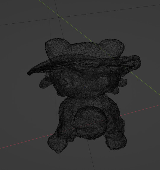
I did a 3d scan of Niko Oneshot

11 notes
·
View notes
Text
https://www.tejjy.com/3d-bim-laser-scanning-vs-photogrammetry/
#construction#building design#architecture#laser scanning#photogrammetry#3d scanning#bim laser scanning
0 notes

Text
What Is Aerial Infrastructure 3D Planning?
Aerial infrastructure 3D planning is detailed planning of urban development. A detailed study is done to plan development and every care is taken to make sure that the development work is carried out without disturbing the environment. It starts with accurate measurement of the land where development is planned and the land is surveyed with 360-degree images.
Visit us - https://kavmedidaseo.blogspot.com/2024/08/what-is-aerial-infrastructure-3d.html
#aerial scanning#aerial photogrammetry services#aerial 3d mapping#land surveying#drone surveying#mobile 3d mapping#surveying companies
1 note
·
View note
Text
Cleaned up some scans I did, put them up on Google Drive if anyone wants 'em: Here
0 notes
Text


Berlin on Sketchfab
1 note
·
View note
Text


Roca Ceramic piece of a rock from 2021, digital photographs and photogrammetry / 3D scanning and 3D animation. 2023
0 notes
Photo


Robert Berg
Senior Environment Artist
artstation
More from «Artstation» here
#vegetation#Game Art#Robert Berg#Foliage#noai#unreal#art#steroscopic#artstation#Nanite#photogrammetry#Photogrammetry 3D Scanning#photoscanning#Games and Real-Time 3D Environment Art#artist#gameart#pixelgoat#drawing
3 notes
·
View notes
Text
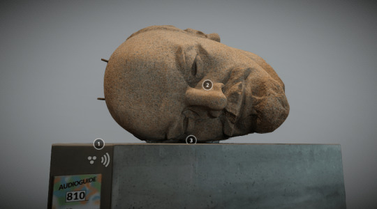
What they are doing here is called Photogrammetry!

It means that they are doing a 360° scan of his body so they can create a 3D model!
If you want to read more about this process, you can look into this site, it explains it perfectly:
https://www.newworlddesigns.co.uk/full-body-photogrammetry-scanning/
144 notes
·
View notes
Note
Are there any primitives or operations you wished parametric CAD software had?
This is tricky, because parametric CAD is what I learned to design on so its feature set feels "natural".
I don't really think so! Most of the obvious innovations are already covered, SolidWorks can take a model back and forth between parametric and primitives modelling in its own weird way, Inventor has really great design for manufacture features, from what I've seen SolidEdge has done some clever stuff with the solver to help you design parts that are customizable as you go down the chain. Who knows what's going on in NX these days, not me. There's definitely some holes in the sense of individual packages lacking features, but almost anything you can ask has been implemented somewhere, by someone.
Good quality design for manufacture tools really do help, I remember doing sheet metal stuff in Inventor back before they cut off free Inventor access and being able to see your generated sheet and bend allowances so clearly was great, and now even OnShape has pretty solid design helpers.
A thing small shops and hobbyists would probably like is better handling of point clouds and photogrammetry for matching parts, since you're much more likely to be working with parts and projects where you didn't do all the design, I've spent many hours trying to accurately model a mating feature, but even that's like. Pretty good these days, importing 3D scans into an editor is pretty standard and the good CAD packages will even let you pick up holes and clean up point clouds directly from the scan.
I'm not that much of a mech eng, and never really was, my CAD is mostly self taught for simple tasks, real mechanical designers no doubt have better opinions on this, @literallymechanical probably has thoughts on T-splines.
37 notes
·
View notes
Text
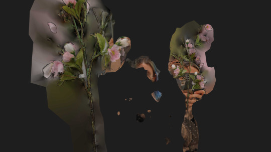

[140823]
#diary#sketches#anna malina#3d scan#photogrammetry#artists on tumblr#selfportrait#colour#2023#violet#stones#flowers
66 notes
·
View notes
Text
What purpose does a construction monitoring system fulfil?
Construction monitoring system involves land surveying with the latest tools such as drones, mobile devices, and laser scanners. Vehicles mounted with mobile mapping devices are deployed to collect data about construction activity. This system helps fulfill regulatory compliance.
Visit us - https://www.kav-medida.co.il/index.php?dir=site&page=services&op=category&cs=15
#aerial photogrammetry services#aerial 3d mapping#mobile 3d mapping#aerial scanning#land surveying#urban planning#aerial mapping companies#drone surveying
0 notes