#dolphinengineers
Explore tagged Tumblr posts
Visit Tumblr Blog
Explore Tumblr blogs with no restrictions, modern design and the best experience.
Last Seen Tumblr Blogs


Fun Fact
The Tumblr app for Google Glass was released on May 16, 2013.
Text
#dolphinengineers#infrastructuredevelopment#surveyingtechnology#dronetechnology#minesurveying#surveyingservices#engineeringexcellence#miningindustry
0 notes
Text
How Mines Survey Helps in Mineral Exploration and Resource Management

The mining industry relies so much on getting the correct data in the right conditions for locating mineral deposits and managing them effectively. Surveying is a critical input here in this process, as it offers the necessary measurements and mapping information for exploration, planning, and extraction. Companies, for example, Dolphin Engineers, contribute to this field by offering reliable surveying solutions to aid in optimizing mining operations.
The Role of Mines Survey in Mineral Exploration
Mineral exploration is the first step in any mining operation. Before extraction begins, surveyors assess the land to determine the presence of valuable minerals. Advanced surveying techniques help geologists and engineers analyze terrain, estimate deposit sizes, and evaluate the feasibility of mining activities.
Modern surveying tools, including GPS, drones, and LiDAR technology, allow for high-accuracy data collection. Mining companies can then make informed decisions based on the data. Dolphin Engineers specialize in using these technologies to provide precise geological and topographical information. Their expertise ensures that exploration activities are conducted efficiently, reducing unnecessary expenses and environmental disruption.
Accurate Mapping and Data Collection
A well-conducted survey provides detailed maps that are crucial for planning mining operations. These maps outline mineral-rich zones, geological structures, and potential hazards, helping engineers design efficient extraction plans.
Mine surveyors use remote sensing and geophysical survey techniques to measure dimensions and depths of ore bodies. This information plays an essential role in optimizing drilling locations and minimizing waste. Dolphin Engineers excels as a producer of accurate mapping solutions that advance mining operations, providing maximum output at minimal risk.
Resource Management and Sustainability
The efficiency of resource use is key in extending the mine's lifespan while minimizing impacts on the environment. Surveying can be helpful in monitoring depletion, controlling waste disposal, and planning rehabilitation.
Regular mine surveys track excavation progress, providing data on the amount of material extracted and that which remains. This continuous assessment keeps mining activities within regulatory limits and ensures that resources are used responsibly. Companies like Dolphin Engineers provide the line of monitoring solutions that can help keep the mining activities within compliance levels of environmental and safety standards.
Safety and Risk Mitigation
Mining operations are hazardous and involve potential risks such as land subsidence, rockfalls, and structural failures. In this regard, surveying plays a crucial role in identifying all the potential hazards before they reach critical levels.
Geotechnical monitoring, slope stability analysis, and underground mapping enable mine operators to take pre-emptive measures. There is a minimum chance of accidents and the mine infrastructure remains stable with accurate surveys. Dolphin Engineers provides specialized safety assessment services, ensuring that mines maintain secure work environments.
Recent Technological Improvements in Mine Surveying
With the advancement of cutting-edge technology, mine surveying has developed greatly. High-resolution cameras on drones along with LiDAR sensors create high-definition 3D models of mining sites. Satellite imagery and geospatial analysis improve the planning and monitoring of mining activities.
This in itself has improved efficiency in surveying, reducing human error and increasing productivity. Dolphin Engineers remains at the forefront of this advancement, maintaining the latest innovations to support the mining industry.
Conclusion
Mines surveying is an indispensable element of mineral exploration and resource management. This in itself ensures proper data accumulation, supports efficient mining, and promotes sustainable resources utilization. Companies such as Dolphin Engineers keep the mining sector abreast with the latest innovations in surveying technology, bringing about more precise, reliable, and safe ways of exploration in the industry. Advanced surveying techniques help to improve efficiency within mining companies in a way that is not just safe and clean but also responsibly productive.
#dolphinengineers#Mining#MineSurveying#MineralExploration#SurveyingTechnology#GeospatialMapping#LiDAR#DronesInMining#ResourceManagement#SustainableMining#MiningSafety#GeotechnicalSurvey#MiningInnovation#TopographicalMapping#MiningIndustry#MiningSolutions
0 notes
Text
The Role of Bathymetric Surveys in Hydropower and Port Development

Bathymetric surveys are shaping modern infrastructures especially in hydropower projects and port development. It holds significant underwater data that inform the decisions of engineers and planners. Precise depth measurements, seafloor mapping, and sediment analysis are crucial in both power generation and maritime operations.
Understanding Bathymetric Surveys
A bathymetric survey is a mapping of underwater terrain using sonar, GPS, and other advanced technologies. It reveals details about depth variations, underwater structures, and sediment distribution. This information helps engineers assess underwater conditions before constructing ports, dams, or hydroelectric plants.
One of the key players in this field is Dolphin Engineers, a company known for its expertise in hydrographic and bathymetric surveying. Their work helps industries navigate complex underwater challenges with accuracy and efficiency.
Bathymetric Surveys in Hydropower Projects
Hydropower relies on a steady water supply, and understanding underwater topography is crucial in planning dams and reservoirs. Bathymetric surveys provide insights into:
Reservoir Capacity Assessment – Accurate depth measurements help determine water storage capacity and identify sediment accumulation areas. Over time, sediment buildup can reduce reservoir efficiency, making periodic surveys necessary.
Dam Foundation Studies – Before constructing a dam, engineers must analyze the stability of the riverbed. Bathymetric data helps assess potential risks such as erosion and weak soil layers.
Hydraulic Modeling – It is crucial to understand the water flow patterns while designing hydropower plants. The bathymetric surveys help in modeling the movement of water, thus ensuring the turbines are efficient.
Dolphin Engineers through precise underwater mapping supports sustainable hydropower development with reduced environmental impact and long-term performance improvement.
Importance in Port Development Ports are significant hubs for global trade, and their construction requires an in-depth understanding of underwater landscapes. Bathymetric surveys help in:
Harbour Design and Expansion – Basin seabed mapping avoids hazardous vessel operation, for example, with shallow areas, submerged hazards, and detection of possible dredging locations.
Dredging Operations – Sediment accumulation results in a shallower water depth, affecting the ability to navigate ships. Regular surveys guide dredging so that channels still have passage.
Structural Integrity Analysis – Underwater examinations of piers, breakwaters, and docks identify possible wear and tear. Predictive surveys avoid structural failures at a significant repair cost.
Environmental Considerations – Ports need to balance development with the preservation of marine ecosystems. Surveys help detect habitat changes, ensuring compliance with environmental regulations.
With extensive experience in hydrographic studies, Dolphin Engineers supports port authorities and shipping industries in planning efficient, long-lasting infrastructure.
Technological Advancements in Bathymetric Surveys
Modern bathymetric techniques have significantly improved data accuracy. Technologies such as:
Multibeam Sonar – Provides high-resolution seafloor imaging, capturing precise underwater contours.
LiDAR - Pliable in shallow waters and provides quick topographic information
Autonomous Survey Vessels - It reduces operational risks because data could be collected remotely.
Firms such as Dolphin Engineers also adopt these technologies to reduce data collection hassles, hence increasing the success of projects.
Conclusion
Hydropower and port development are basic bathymetric surveys. This helps ensure that the infrastructure is safe, resources are managed efficiently, and sustainable growth is promoted. With their specialized expertise, firms like Dolphin Engineers play a very important role in delivering accurate underwater assessments, which helps industries plan and build with confidence.
By using advanced survey techniques, these projects can be more efficient and stable in the long run, thus helping economies and communities dependent on them.
#BathymetricSurvey#Hydropower#PortDevelopment#SeafloorMapping#HydrographicSurvey#Dredging#MaritimeInfrastructure#ReservoirManagement#SonarTechnology#UnderwaterMapping#EnvironmentalSustainability#HarbourEngineering#SedimentAnalysis#MultibeamSonar#CoastalEngineering#InfrastructureDevelopment#WaterResourceManagement#DolphinEngineers#SurveyTechnology#MarineEngineering
0 notes
Text
Exploring the Depths of Bathymetric Survey and Trusting Dolphin Engineers for Expert Solutions
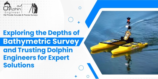
Bathymetric surveys are essential in understanding and mapping the underwater topography of oceans, seas, rivers, and lakes. The process involves measuring the depths and shapes of underwater features, which can provide invaluable data for various industries, including marine construction, navigation, environmental studies, and resource exploration.
Understanding Bathymetric Surveys
Bathymetric surveys utilize advanced technologies such as sonar systems, echo sounders, and GPS equipment to develop highly accurate maps of underwater surfaces. Such maps enable the determination of depth variations, sediment buildup, and any underwater structures. Such data is vital for the planning of maritime construction projects such as ports, bridges, or pipelines. It further helps in ensuring safe navigation for vessels, understanding marine ecosystems, and detecting potential hazards beneath the water surface. These surveys also significantly add to scientific research when they provide insights into underwater geological formations and aquatic habitats. For example, knowing the dispersion of sediment in a river gives one a chance to discover erosion patterns and aid in the proper design of flood control systems.
Why Choose Dolphin Engineers for Bathymetric Surveys
Dolphin Engineers is the most trusted name in the industry when it comes to bathymetric surveys. Here's why they are the best fit for your project:
Accuracy and Reliability Dolphin Engineers uses high-tech equipment and tested methodologies to ensure highly accurate results. The team ensures that every data point is carefully recorded and analysed to provide reliable information for decision-making.
Experienced Professionals The company has a team of experienced professionals who have extensive experience in conducting complex bathymetric surveys. Their experience allows them to handle various challenges, whether it is surveying shallow rivers or deep ocean floors.
Customized Solutions Dolphin Engineers understands that each project has different requirements. It works closely with clients to come up with the survey plans aligned with specific goals and challenges that result in meeting expectations.
Commitment to Safety is a top priority for Dolphin Engineers. Their operations comply with all industry standards and regulations, ensuring that both personnel and the environment are protected throughout the survey process.
Dolphin Engineers delivers comprehensive services other than data gathering, including the processing, analyzing, and generating reports. This is done so that the deliverable will be friendlier to its users, ensuring that the end clients can work with the finding properly.
Cost-Effective Options Despite providing premium-quality services, Dolphin Engineers offers competitive pricing. They strive to deliver value for money by optimizing resources and streamlining processes.
Applications of Bathymetric Surveys
Bathymetric surveys have numerous applications in various fields:
•Marine Construction: It provides foundational data for the construction of harbors, oil rigs, and underwater tunnels.
•Environmental Monitoring: Assessing aquatic ecosystems and tracking changes over time.
•Resource Exploration: Identifying underwater mineral deposits or potential fishing zones.
•Navigation Safety: Updating nautical charts to prevent accidents.
•Flood Management: Studying riverbeds to predict and mitigate flooding risks. Conclusion
Choosing a reliable bathymetric survey partner is indispensable to achieving very accurate and useful results. This is because the company, with Dolphin Engineers advanced technologies, experienced professionals, and service commitment to ensuring that every single project is handled to the high standards of success, will give a client the needed confidence in what they receive-quality and accurate underwater data.
#BathymetricSurveys#DolphinEngineers#MarineSafety#SonarTechnology#UnderwaterMapping#PrecisionMapping#NavigationSolutions#EchoSounding#MarineSurveying#SurveyingExperts#FloodManagement#AdvancedSurveyTech#Oceanography#AccurateDataSolutions#ResourceExploration#GeospatialAnalysis#HydrographicSurveying#TrustedSurveyPartner#EnvironmentalConservation#SmartMapping#EnvironmentalMonitoring#SedimentAnalysis#MarineConstruction#CoastalEngineering#InfrastructurePlanning#WaterResourceManagement
0 notes
Text
Why Dolphin Engineers Should Be Your Top Choice for Drone Survey Solutions

Drone surveys are revolutionizing industries by providing accurate, efficient, and reliable data collection methods. Among the numerous service providers, Dolphin Engineers stands out as a leader in this field. Here's why Dolphin Engineers should be your go-to choice for drone survey needs.
1. Experience and Expertise
The experience of Dolphin Engineers in delivering quality drone survey solutions across various industries has been very well proven. The team with years of experience in drone technology and survey methodologies understands the intricacies and details of different projects, ensuring precision every time. 2. Advanced Technology
Dolphin Engineers uses the most advanced in drone technology for excellent service. Its drones, coupled with high-resolution cameras, thermal imaging sensors, and LiDAR systems, can take clear images with a level of detail that no one else can, and with the accuracy of the data obtained, it will definitely be reliable for decision-making purposes. 3. Customized Solutions
Being cognizant that each project requires specific needs, Dolphin Engineers will customize its service delivery to answer individual needs. The company could map the land, monitor construction processes, conduct agricultural surveys, and inspect inaccessible regions among other tasks while providing an optimum outcome in any application. 4. Cost-Efficiency
Traditional surveying methods are quite costly, in terms of time and resources. The drone surveys provided by Dolphin Engineers are cost-effective without compromising on quality. Drones are efficient in reducing manpower and time, thus saving costs for clients. 5. Safety and Accessibility
One of the most important advantages of using Dolphin Engineers is their ability to conduct surveys in hazardous or inaccessible areas. From inspecting tall structures to surveying disaster-affected regions, their drones can operate in environments where manual surveying is unsafe or impossible. 6. Compliance and Accuracy
Dolphin Engineers complies with all regulations and guidelines that establish the legality and ethics of its operations. The firm commits itself to precision and compliance, making sure data is accurate and set up within the boundaries of industrial requirements. 7. Timely Deliverables
Time is an essential factor in any project. Dolphin Engineers ensures that all surveys are completed and delivered within the agreed timelines. Its efficient workflow and advanced processing capabilities minimize delays, keeping clients on schedule. 8. Environmental Responsibility
Dolphin Engineers are environmentally friendly as they conduct drone surveys. This reduces the use of heavy machinery and minimizes ground disturbance, thus making their services sustainable in data collection and site analysis. 9. Wide Range of Applications
Dolphin Engineers caters to a broad spectrum of industries, including construction, agriculture, mining, urban planning, and more. Their versatility ensures that clients from various sectors can benefit from their expertise, regardless of the project’s scale or complexity. 10. Proven Client Satisfaction
The trust and loyalty of their clients speak volumes about Dolphin Engineers' commitment to excellence. In fact, there are many testimonials and repeat partnerships, which speaks of their consistency in delivering what they promise.
In conclusion, The Dolphin Engineers' combination of experience, technology, affordability, and reliability cannot be easily beaten. They will help you create accurate maps, inspect your entire area, and provide you with a comprehensive analysis of the data gathered. Dolphin Engineers are up to the challenge, and doing so with great professionalism and efficiency. Quality, innovation, and commitment to exceeding client expectations will drive your choice of Dolphin Engineers for your drone survey needs.
#DroneSurveys#DolphinEngineers#AdvancedTechnology#PrecisionMapping#AerialData#CustomSolutions#CostEffective#SurveyInnovation#DroneTechnology#EnvironmentalResponsibility#EfficientDataCollection#SafetyFirst#TimelyDeliverables#IndustryLeader#ClientSatisfaction
0 notes
Text
The Importance of Road Surveys in Infrastructure Development

Road surveys hold a prime position in the making of an infrastructure landscape. These surveys give the information and knowledge needed for planning, designing and constructing roads in such a way that they are effective and durable. Dolphin Engineers is one of the most popular names in the field of highway and road surveys, providing very accurate and reliable surveying services for any infrastructure development project. What is a Road Survey? A road survey involves the systematic collection of data related to the terrain, existing structures, and environmental conditions of a proposed or existing road site. This data will help the engineers and planners to make some informed decisions in regard to the alignment, construction, and maintenance of roads. Advances in technology have developed road surveys. Currently, with modern tools such as GPS, GIS, total stations, and drones, there is less chance for error and thus shortening of the time that a project requires. Dolphin Engineers uses these advanced tools for comprehensive and accurate surveys, especially on complex projects. Key Steps in Road Survey Reconnaissance Survey This is the preliminary stage whereby a general overview of the area is carried out. The general layout of the area is assessed, the challenges are identified, and preliminary alignments are proposed. Preliminary Survey It is a stage whereby the detailed measurements and data collection take place. This includes contour mapping, topographic surveys, and soil investigation to understand the terrain and subsoil conditions. This final stage involves meticulous data collection to finalize the road alignment and prepare for construction. This includes marking boundaries, determining gradients, and locating utilities to ensure smooth execution of the project. Benefits of Road Surveys Accurate Planning: Road surveys provide a clear picture of the existing conditions, enabling planners to choose the most efficient route and design. Safety Assurance: Identification of potential hazards, such as unstable soil or flood-prone areas, allows for the implementation of safety measures in advance. Cost Optimization: With precise data, project managers can predict potential challenges and reduce the amount of unexpected costs and delays. Dolphin Engineers: Expertise in Road Surveys Dolphin Engineers has built a reputation in providing quality survey services. Its team of professional engineers, with the latest tools and techniques, will guarantee the success of road projects-from feasibility studies to detailed mapping, end-to-end solutions are offered by Dolphin Engineers for every specific project need. Their commitment to accuracy and timely delivery has made them a preferred partner for various infrastructure development initiatives. Dolphin Engineers ensures that clients achieve the best possible outcomes for their road construction projects by adhering to industry standards and maintaining transparency. Conclusion Road surveys are part and parcel of infrastructure development as they form the foundational stage to reveal much-needed insights to have efficiently safe roads. Companies such as Dolphin Engineers work closely to ensure reliable and accurate survey services, ensuring confidence among planners and engineers as projects are carried out for community growth and connectivity.
#RoadSurvey#InfrastructureDevelopment#HighwayPlanning#DolphinEngineers#CivilEngineering#SurveyingServices#ConstructionPlanning#SmartInfrastructure#RoadConstruction#GIS#GPS#DronesInSurveying#EngineeringExcellence#ProjectPlanning#SustainableDevelopment#AccurateSurveys#ModernTools#SafetyFirst#ConnectivityMatters
0 notes
Text
Understanding the Changing Landscape of Mine Surveys: Trends, Opportunities, and Challenges

Mine surveying, a critical aspect of the mining industry, has witnessed significant shifts in recent years. These changes are driven by advancements in technology, environmental concerns, and the need for precision and safety. Dolphin Engineers, a key player in the field of mine surveys, offers valuable insights into the evolving trends, the rise of innovative methodologies, and the challenges shaping this domain.
The Rise of Technological Integration
The incorporation of cutting-edge technology has redefined mine surveying practices. From drones to LiDAR systems, technology is streamlining operations, reducing costs, and improving accuracy. Drones, for instance, allow surveyors to access hard-to-reach areas, capturing high-resolution imagery and topographic data. Similarly, LiDAR provides detailed 3D mapping, helping surveyors visualize complex terrains with unparalleled clarity.
Another notable advancement is the integration of Geographic Information Systems (GIS) and Global Positioning Systems (GPS). These tools enable precise data collection, real-time monitoring, and efficient data management. With such capabilities, companies like Dolphin Engineers can deliver results with exceptional accuracy, ensuring projects stay on track.
Environmental and Sustainability Considerations
Environmental awareness has become a significant factor in mine surveying. Companies are now required to minimize their ecological footprint while maintaining operational efficiency. Surveyors play a crucial role in this by using methods that reduce environmental disruption. Techniques such as non-invasive surveying, along with remote sensing technologies, help achieve these goals.
Sustainability initiatives are also influencing mining operations. Accurate surveys ensure that resources are extracted responsibly, aligning with global efforts to protect natural ecosystems. Dolphin Engineers is at the forefront of adopting sustainable practices in their mine survey projects, balancing industrial needs with environmental responsibility.
Challenges in Modern Mine Surveying
Despite technological advancements, the industry faces numerous challenges. Safety remains a primary concern, particularly in underground mines. Complex geological conditions, limited visibility, and hazardous environments require surveyors to rely on robust equipment and techniques.
Moreover, the industry grapples with data management and analysis. The influx of vast amounts of data from various technologies necessitates efficient processing systems. Surveyors must also stay updated with new tools and software, as the fast-paced evolution of technology leaves little room for outdated practices.
Economic fluctuations and regulatory changes further add to the complexity. Mining companies must adapt to varying market demands while adhering to strict legal frameworks. These factors underscore the importance of expertise and adaptability in mine surveying.
Emerging Trends Shaping the Future
The future of mine surveying is set to be defined by automation and artificial intelligence (AI). Automated equipment and AI-driven analytics are transforming how survey data is collected, processed, and interpreted. Autonomous drones, for instance, can conduct surveys without human intervention, enhancing safety and efficiency.
Blockchain technology is another trend gaining traction. By ensuring data integrity and transparency, blockchain can revolutionize data sharing and verification processes in mining operations.
Dolphin Engineers: Pioneering the Way Forward
As the industry navigates these shifts, Dolphin Engineers continues to play a pivotal role in advancing mine survey practices. Leveraging state-of-the-art tools and a commitment to precision, the company addresses challenges head-on, setting benchmarks in safety, accuracy, and sustainability.
By embracing innovation and focusing on client needs, Dolphin Engineers remains a trusted partner in the mining sector. Whether through deploying advanced technologies or adopting eco-friendly practices, the company is dedicated to shaping a future where mine surveys meet the highest standards of excellence.
Conclusion The dynamic field of mine surveying reflects the broader changes in the mining industry. With technological advancements, increased environmental awareness, and evolving methodologies, the landscape is undergoing a transformation. Companies like Dolphin Engineers are leading this journey, combining expertise with innovation to redefine what’s possible in mine surveying. As the industry moves forward, staying adaptable and embracing change will be key to navigating its complexities and seizing new opportunities.
#PrecisionSurveying#MiningSustainability#BlockchainInMining#MiningData#FutureOfMining#MiningTrends#MiningChallenges#AutomationInMining#AIInMining#MiningSafety#EnvironmentalResponsibility#SustainableMining#GISMapping#LiDARTechnology#DroneSurveying#TechnologyInMining#InnovationInMining#DolphinEngineers#MiningIndustry#MineSurveying
0 notes
Text
The Backbone of Water Supply: Unveiling the Science of Canal and Dam Surveys
Often water is referred to as the essence of life, so it is also the backbone of agriculture, industry, and daily living. As populations grow and climate change alters precipitation patterns, the demand for reliable water supply systems has never been more critical. At the heart of effective water supply management lies the intricate science of canal and dam surveys. In this blog, we will explore the importance of these surveys, the methodologies involved, and how Dolphin Engineers play a pivotal role in ensuring sustainable water management.
Understanding Canal and Dam Surveys
Canal and dam surveys are comprehensive assessments conducted to evaluate the design, construction, and maintenance of water conveyance and storage systems. These surveys provide essential data that informs engineers, planners, and policymakers about the current state of water infrastructure and its capacity to meet future demands.
Why Are Canal and Dam Surveys Important?
Resource Management: Accurate surveys help in understanding water availability, distribution, and storage capacities. It is very crucial to have effective resource management, especially in regions that are prone to drought or flooding.
Safety Assessments: Dams are critical structures that must be regularly assessed to ensure they can withstand environmental stresses. Surveys help identify potential weaknesses and inform necessary reinforcements.
Environmental Impact: Surveys assess the ecological impact of water infrastructure on surrounding ecosystems. This information is vital for sustainable development practices that balance human needs with environmental preservation.
Regulatory Compliance: Governments and regulatory bodies often require detailed surveys to ensure compliance with safety and environmental regulations. This ensures that water supply systems operate within legal frameworks and adhere to safety standards.
The Survey Process: Techniques and Technologies
Canal and dam surveys involve a combination of traditional surveying techniques and modern technology.
Here are some of the key methods to apply:
1. Topographic Surveys:
Using total stations and GPS technology, engineers create detailed topographic maps of the land surrounding canals and dams. This data is crucial for understanding the terrain and planning construction or maintenance activities.
2. Hydrological Studies:
Hydrological surveys assess water flow, quality, and availability. They involve collecting data on rainfall, evaporation, and river flow rates to predict how much water can be stored or diverted.
3. Geotechnical Investigations:
Understanding the soil and rock composition is vital for dam stability. Geotechnical surveys involve drilling and sampling to analyze the ground conditions where dams and canals will be constructed or maintained.
4. Remote Sensing and Drones:
Advancements in drone technology and remote sensing allow for aerial surveys that can cover vast areas quickly and efficiently. This technology provides high-resolution images and data that can be analyzed for various purposes, including vegetation mapping and land use analysis.
5. Structural Assessments:
Regular inspections of existing structures are essential to identify wear and tear. Engineers use various tools, including ultrasonic testing and structural health monitoring systems, to evaluate the integrity of dams and canals.
Dolphin Engineers: Pioneering Water Management Solutions
At Dolphin Engineers, we recognize the critical role that canal and dam surveys play in sustainable water management. Our team of experienced engineers and surveyors employs cutting-edge technology and innovative methodologies to ensure that water infrastructure is resilient, efficient, and environmentally responsible.
Our Commitment to Excellence
Expertise: With years of experience in the field, our team is equipped to handle projects of any scale, from small irrigation canals to large-scale dam constructions.
Sustainability: We prioritize sustainable practices in all our projects, ensuring that our water management solutions benefit both communities and the environment.
Collaboration: We work closely with local governments, communities, and stakeholders to develop tailored solutions that meet specific water supply needs.
Conclusion
The science of canal and dam surveys is vital to ensuring a reliable and sustainable water supply for future generations. As we face increasing challenges related to water scarcity and climate change, the role of engineers and surveyors in this field becomes even more critical. At Dolphin Engineers, we are committed to advancing water management practices through innovative surveying techniques and a deep understanding of the complexities involved. Together, we can build a more sustainable future, one survey at a time.
For more information on our services and how we can assist with your water management projects, visit us at https://www.dolphinengineers.com/.
#WaterManagement#SustainableWater#CanalSurvey#DamSurvey#Hydrology#WaterEngineering#InfrastructureSafety#EnvironmentalSustainability#ResourceManagement#ClimateResilience#DolphinEngineers#HydrologicalStudies#GeotechnicalSurvey#RemoteSensing#StructuralIntegrity#DroneTechnology#WaterResources#SustainableFuture#CivilEngineering#WaterSupply
0 notes
Text
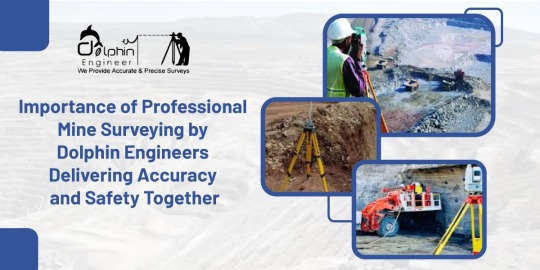
Importance of Professional Mine Surveying by Dolphin Engineers: Delivering Accuracy and Safety Together
Precision is the one thing that matters in mining operations. The tiny mistake that can be made may result in a major mishap: not-so-effective resource extraction and potential danger for the workers themselves. This is where mine surveys play into action. Detailed and professional mine surveys will ensure safe, cost-effective, and hassle-free mining operations. Dolphin Engineer takes pride in providing superior mine surveying services to enable our clients to go about their projects with complete confidence.
Mine survey is the accurate measurement and mapping of land surface and subsurface, which helps to guide mining operations. The process helps determine the layout, volume, and quality of mineral deposits, thus enabling efficient extraction by the mining firm.
Furthermore, safe mine surveys are considered an important source for the workers and machines to work with precision regarding planned operations.
Safety: Another foremost priority area in mining is safety. Mines always deal with hazardous environments, and an accurate survey anticipates potential risks that may likely happen. Proper mine surveying assures the integrity of the tunnels and underground structures, reducing the chances of accidents like cave-ins or gas leaks.
It ensures cost efficiency since the organization makes the right decisions regarding mining and utilization of resources. Material wastage is reduced to its minimum, whereas the more valuable materials are available, thus saving time and money.
Compliance and Reporting To the Government: The regulations require submitting a report that shows several of the surveys, with absolute surety. A mine survey ensures that complies with all of these regulations by providing accurate information regarding land use, safety standards of the organization, and extraction of resources.
Long-Term Planning: In addition to any direct operational requirement, a mine survey is also of benefit in long-term planning. The data surveyed could be used to guide future development such as an organization can plan expansion or decommissioning at a time.
How Dolphin Engineers Produces High-Accuracy Mine Surveys
Dolphin Engineers we realize the complications of mining work and the critical need to get everything in the survey right. With the latest technology: GPS and laser scanners and drones, our experts offer complete and accurate mapping solutions.
Our service offerings consist of:
Detailed surface and subsurface mapping We avail the latest technologies to map surface and underground areas, ensuring accuracy at every stage during mining. Tailored Solutions We treat each mining site as different and implement customized survey solutions based on the particular needs of your project. Conformity to the regulations and industry safety standards: Our operations ensure that all our work adheres to the latest regulations and safety standards in the industry and that the entire project remains compliant and risk-free. Ongoing Support: Our relationship with clients doesn't come to an end after the survey is over. They get updates and consultations to drive long-term success in your mining operation.
Dolphin Engineers: Your Partner for Mine Surveys Dolphin Engineers has a rich experience of many years in the mining industry with an adherence to giving the best. Our professionals will ensure each detail in your mining business is optimized for maximum success. Be it a new mining venture or an already existing one, our mine surveys will help you make decisions with confidence.
For more information about how Dolphin Engineers can meet your mine surveying needs, please visit our website at https://www.dolphinengineers.com/ or contact us today for a consultation.
#MineSurveying#MiningSafety#MiningPrecision#ResourceExtraction#SafeMining#CostEffectiveMining#MiningTechnology#MineMapping#DolphinEngineers#MiningIndustry#SurveyingSolutions#AccurateMapping#MineralExtraction#LongTermPlanning#MiningConsulting#LaserScanning#GPSMapping#MiningCompliance#MiningServices#SurfaceMapping#SubsurfaceMapping#CustomizedSurveySolutions#MiningSupport#MiningOperations#MiningEfficiency
0 notes
Text
Bridge Survey: Ensuring Safety and Efficiency with Dolphin Engineers
Being one of the infrastructural developments that bridge communities and make transportation easy, bridges, like any other structure, degrade with time and may present different hazards to public safety and traffic flow. It is in this regard that the importance of bridge surveys becomes evident. Therefore, this blog looks at why bridge surveys are so important, the process involved in them, and how Dolphin Engineers, is a leading provider of bridge survey services.
Why Bridge Surveys are Indispensable
Bridge surveys form part of the maintenance and management of bridges. It generally consists of careful inspection of the bridge condition, listing defects, damages, or other hazardous conditions that may be found. The main aims of a bridge survey include: To ensure public safety by identifying potential risks and hazards To assess the structural integrity of the bridge To give priority to maintenance and repair works To optimize bridge performance and extend its operational life
The Process of Bridge Survey A comprehensive bridge survey would take into account the following various aspects:
Visual Inspection: This refers to a process in which, on the whole, the superstructure, substructure, and other components of the bridge are looked at to detect any visible signs of damage or deterioration.
Non-Destructive Testing: Specialized equipment is used in testing without causing damage to the bridge. The NDT methods might include ultrasonic, radiography, and acoustic emission testing.

Data Analysis: The data visual inspection and non-destructive testing, comes along with the study of any trends, patterns, or alarming information. Detailed reporting and recommendations that involve identifying work that needs to be done for maintenance and repairs, and a work schedule.
Dolphin Engineers: The Experts in Bridge Survey Services
Dolphin Engineers is one of the leading companies in bridge survey. Dolphin Engineers offers a wide array of services and ensures that bridges are safe and fit for the proper purpose. With a panel comprising engineers and technicians, among others,
Dolphin Engineers offers the following:
Detailed Bridge Surveys This covers the critical eye and assessment of bridges for verification of possible defects and recommend maintenance and repair work.
Specialized NDT Services: Advanced NDT methods to find out the condition of bridges in a non-destructive way.
Bridge Management Services: Design bridge management plans for enhancement in bridge performance and maximizing its service life.
Conclusion
Bridge surveys form one of the critical activities in the maintenance and management of bridges. A bridge survey determines the potential risks or hazards, prioritizes work based on requirements arising out of maintenance and repairs, and improves the performance of the bridges to ensure public safety and efficiency. M/s Dolphin Engineers stands competent to offer comprehensive services in bridge survey matters with its expertise and experience in the field, for their clients. Whether it is the owner, manager, or just an operator of a bridge, Dolphin Engineers can help keep your bridges safe and efficient.
#BridgeSurveys#BridgeInspection#InfrastructureSafety#BridgeMaintenance#StructuralIntegrity#NDT#NonDestructiveTesting#CivilEngineering#TransportationSafety#BridgeManagement#PublicSafety#DolphinEngineers#BridgeSafety#InfrastructureDevelopment#StructuralHealth#TransportationEfficiency
0 notes
Text
About Dolphin Engineer: Leading the Way in Surveying Solutions
A survey is a method of collecting information by doing relevant research and using technology to analyze the data, and condition of a specific area or mapping out the construction area. This data is important for planning, designing, and constructing different projects. Dolphin Engineer understand the importance of surveys in various industries. The survey is an essential part of our service, we have been providing accurate reports and reliable results to our clients for over two decades.
Who We Are Dolphin Engineers was established on the principles of innovation, expertise and customer satisfaction. Our team is composed of seasoned surveyors and engineers who have amassed years of experience working in the industry. We are dedicated to advancing our knowledge so we can remain at the cutting edge of modern techniques and technologies. Our goal is to make sure that every client we work with has the most precise information they can get their hands on, which would allow them to make sound judgments without hesitation.
What We Do Dolphin Engineers offers a plethora of surveying services tailored to meet our client’s individual needs. We boast vast knowledge in both land surveying and mapping as well as construction surveys that involve monitoring amongst other things hence giving us enough resources for handling projects varying in size or complexity. We use state-of-the-art equipment such as GPS systems, LiDARs (Light Detection and Ranging units), and drones among others when collecting topographic data so that accuracy precision and timeliness are ensured.

Our Values
At Dolphin Engineers, we're committed to: Quality: We strive for quality surveying services that are based on the highest levels of precision as well accuracy. Innovation: We also constantly seek for ways of improving what we do through use of new technology or devising new techniques. Customer Satisfaction: Always ensuring all our customers get what they need from us is one policy we follow religiously. Integrity: We are honest, clear-cut, sincere people who do not tolerate dishonesty from anybody.
Why Choose Dolphin Engineers? So why choose Dolphin Engineers for your surveying needs? Here are just a few reasons: Experience: Our team has a wealth of industry experience spanning many years and has worked on projects of various sizes and challenges. Expertise: We specialize in modern surveying technologies and methodologies, consistently striving to be ahead in this field. Quality: At all times, we provide premium level surveying services n according to extensive accuracy and precision requirements. Customer Service: With us, customer satisfaction is always paramount, thus we willingly provide excellent service to all our clients.
Get in Touch Dolphin Engineers is your ideal survey company if you are in search of a provider of precise, trustworthy and prompt information. Contact us today in order find out more about what we do and how we may be of assistance in achieving your objectives. To find out more about our services and see who’s part of our team, please visit our website at https://www.dolphinengineers.com/ . We hope to work together soon!
#SurveyingServices#Engineering#DolphinEngineers#LandSurveying#ConstructionSurvey#Mapping#TopographicSurvey#LiDAR#GPSSurveying#InnovationInSurveying#CustomerSatisfaction#PrecisionEngineering#ModernTechnology#EngineeringExcellence#AccurateData#SurveyingExperts#DronesInSurveying#ConstructionPlanning#SurveyingSolutions
0 notes
Text
Engineering Excellence: Dolphin Engineers and the Science of Surveying
Are you searching for a company that does surveys like land, Water supply, Solar power plants or drone surveys? In this blog post, we'll Explore the story of Dolphin Engineers and the driving force behind our success.
Who We Are
Dolphin Engineer started its journey in 1999 with a team of dedicated and true professionals. We are specialists in accurate engineering set out for major projects. We have an array of modern equipment, software and expertise to deliver what you require to make your project run successfully and accurately.
Our Services:
1. Land Survey: Dolphin Engineers specializes in accurate land surveys using advanced technology. Our comprehensive reports provide the exact insights necessary for planning and development. It includes boundary marking, cadastral mapping, ensuring compliance with regulatory requirements and facilitating informed decision-making for our clients.
2. Topographical Surveys: Using drone technology, Dolphin Engineers conducts detailed topographical surveys. Our unique approach provides detailed topography analysis for various engineering and environmental applications. Our precise mapping and contour analysis support engineering design, urban planning, and environmental assessment projects, delivering valuable insights for informed decision-making and sustainable development.
3. Drone Survey: with the advanced technology and experienced team we can conduct a drone survey. A drone survey reduces the fieldwork and also helps in finding out the exact results.

4. Water Supply Survey: Pipeline survey is the initial step in planning and installing a safe water, gas or oil pipeline. Dolphin Survey Engineering provides a significant and lucrative alignment for pipe laying and prepares the necessary land accusation planning by Cadastral.
5. Solar Power Plant Surveying: Dolphin Engineers provides surveying services tailored to solar power plant projects. From site suitability assessments and shadow analysis to layout planning and construction monitoring, our precise survey data supports the development of sustainable renewable energy infrastructure, optimizing energy production and project efficiency.
What Sets Us Apart:
So, what sets Dolphin Engineers apart from the rest? Our commitment to innovation, our passion for excellence, and our dedication to delivering exceptional results. We're not just engineers – we're problem-solvers, thinkers, and creators. We're driven by a desire to make a difference, to leave a lasting impact on the world. Proven Track Record With 25 years of experience and a portfolio of successful projects, Dolphin Engineer consistently delivered high-quality results, Earning the trust and satisfaction of our clients throughout our Solution.
Conclusion:
In conclusion, Dolphin Engineers remains committed to staying at the forefront of these developments, integrating cutting-edge technology into our service offerings to deliver superior results to our clients. Whether you're embarking on a new project or seeking to optimize existing operations, our drone surveying solutions are poised to meet your needs with precision and efficiency.
Visit our website at https://www.dolphinengineers.com/ to explore our services.
#DolphinEngineers#LandSurvey#TopographicalSurvey#DroneSurvey#WaterSupplySurvey#SolarPowerPlantSurvey#EngineeringServices#InnovativeEngineering#SurveyingSolutions#AccurateSurveying#ProfessionalSurveyors#SustainableDevelopment#PipelineSurvey#RenewableEnergy#EngineeringExcellence#TechnologyDriven#SurveyingInnovation#ProjectPlanning#EnvironmentalAssessment#InfrastructureDevelopment
0 notes
Text
Mapping from the Clouds: The Impact of Drones in Surveys
In recent years, technological advancements have revolutionized the field of surveying, making tasks that were once time-consuming and labor-intensive more efficient and accurate than ever before. Among these innovations, one of the most transformative has been the integration of drone technology into survey operations.
The Rise of Drone Surveying
Traditionally, surveying involved ground-based methods using instruments like total stations and GPS receivers. While effective, these methods often faced limitations in terms of accessibility, especially in challenging terrains or remote areas. Enter drones — unmanned aerial vehicles equipped with high-resolution cameras and advanced sensors capable of capturing detailed images and data from above.
Dolphin Engineers, we have embraced this cutting-edge technology to enhance our surveying capabilities. Our drone surveying services leverage state-of-the-art UAVs to collect geospatial data with unprecedented speed, accuracy, and safety. Whether it's mapping large-scale construction sites, monitoring infrastructure projects, or conducting environmental assessments, drones provide a bird's-eye view that traditional methods simply cannot match.

Advantages of Drone Surveying
Speed and Efficiency: Drones can cover large areas in a fraction of the time it would take traditional survey teams. This rapid data collection accelerates project timelines and reduces overall costs.
High Precision: Equipped with GPS and advanced imaging technology, drones produce highly accurate 3D maps and models. This level of precision is crucial for planning, design, and decision-making processes.
Enhanced Safety: By minimizing the need for personnel to access hazardous or hard-to-reach areas, drones improve safety conditions on-site while still delivering comprehensive survey data.
Environmental Benefits: Reduced fuel consumption and minimal disturbance to natural habitats make drone surveying an environmentally friendly choice compared to traditional methods.
Applications Across Industries
The versatility of drone surveying extends across various industries:
Construction and Development: Monitoring progress, managing resources, and ensuring compliance with design specifications.
Mining and Natural Resources: Mapping terrain, monitoring extraction activities, and assessing environmental impacts.
Infrastructure and Utilities: Inspecting pipelines, power lines, and other critical infrastructure with unparalleled detail.
Looking Ahead
As technology continues to evolve, so too will the capabilities of drone surveying. Advances in AI and machine learning are enabling drones to not only capture data but also analyze and interpret it in real-time, providing actionable insights to stakeholders.
Dolphin Engineers, we remains committed to staying at the forefront of these developments, integrating cutting-edge technology into our service offerings to deliver superior results to our clients. Whether you're embarking on a new project or seeking to optimize existing operations, our drone surveying solutions are poised to meet your needs with precision and efficiency.
Explore more about our drone surveying services and how they can benefit your next project on our website-https://www.dolphinengineers.com/drone-survey.html. Contact us today to discover the power of mapping from the clouds with Dolphin Engineers.
#DroneSurveying#SurveyingTechnology#UAVSurveying#GeospatialData#ConstructionTech#InfrastructureInspection#EnvironmentalAssessment#DolphinEngineers#InnovationInSurveying#MappingTheFuture#TechInConstruction#SmartSurveying#DroneMapping#EngineeringExcellence
0 notes
Text

Road Survey in JaipurExhaustive & distinguished Experience in Different Disciptires of topographic survey, wind energy plant survey, DGPS survey, water supply and gas pipe line survey, contour survey, national highway survey, bridge details survey, LAY OUT MARKING SURVEY, solar power plant survey etc. Our Organization Named "Dolphin Engineer" was established 1999. Aim of Organization is to Provide Quality Services with in the specified time using Highly Skilled, Qualified & Experienced Manpower in Infrastructure & other development Project in Civil Engineering, to the entire Satisfaction of the Client.
#landsurveying#surveyingtechnology#landdevelopment#dolphinengineers#propertyboundaries#constructionplanning
0 notes
Text
Exploring the Basics and Importance of Land Surveying!
Land surveys are important tools in the realm of real estate, construction, and land development. They serve as the foundational blueprint for understanding and utilizing pieces of land effectively. A land survey involves the precise measurement and mapping of a property's boundaries, topography, and features. These surveys are conducted by licensed land surveyors who employ various techniques to provide accurate and reliable data. What is Land Surveying?
Land surveying is the process of measuring and mapping out the land. Surveyors use a combination of mathematics, technology, and physical observation to determine the boundaries and features of a piece of land. This information is crucial for creating accurate maps, planning construction projects, and resolving property disputes.

What, Exactly, Does a Land Survey Find? Here's a Step-by-Step Look at How Our Experienced Team at Dolphin Engineers Conducts a Land Survey: First, it allows you to determine the precise boundaries of your property. This information can allow you to identify the locations of structures, additions, and improvements to your property. Second, it can find the slopes and other geographic features of a property. This information may be helpful for a property owner who is planning to build more on their land and needs to know its features. Third, it finds the locations of easements and utilities. Easements offer the right to use someone else’s property for specific reasonsFinally, a land survey can identify whether the land is a floodplain. This is very good information to know before buying a property, to avoid accidentally acquiring property that is prone to flooding.
Tools and techniques used for major land surveys include theodolites for measuring angles, GPS units for location data, and total stations that integrate the functionalities of both. Drones are used for aerial surveys, capturing detailed images and data. These tools and techniques enable highly accurate and reliable surveys. Why Choose Dolphin Engineer for Your Land Surveying Needs? At Dolphin Engineer, we pride ourselves on our accuracy, professionalism, and commitment to customer satisfaction. Our team of experienced surveyors uses the latest technology to provide precise and reliable surveys for all your needs. Whether you're planning a new construction project, resolving a property dispute, or simply need an accurate map of your land, we're here to help. At Dolphin Engineer, we're dedicated to providing high-quality surveying services that you can trust.
If you have any questions or need a survey, don't hesitate to contact us. visit our website for information- https://www.dolphinengineers.com/.
#LandSurveying#PropertyBoundaries#LandDevelopment#ConstructionPlanning#DolphinEngineers#SurveyingTechnology#AccurateSurveys#PropertyDisputes#TopographicSurveys#Easements#FloodplainIdentification#ProfessionalSurveyors#RealEstateSurveying#SurveyingServices
0 notes
Text
How Solar Power Surveys Ensure Optimal Energy Generation and Sustainability
This summer, the temperatures are so high that you can't get by without turning on the AC or fan, leading to hefty electricity bills that can be a real shock for your pocket. Experts predict this demand will keep rising as temperatures increase. Higher electricity demand often leads to power cuts and an irregular power supply, making the situation even worse. Installing solar panels on your rooftop can help you avoid these problems. With solar panels, your rooftop becomes your power supply house. You can stay cool without worrying about high electricity bills. Plus, you won't have to deal with power cuts because you’ll have a more reliable power source. Installing a solar power plant on the roofs of your homes and housing societies, commercial spaces or industrial spaces can result in significant financial benefits.
The Solar Power industry in India is gaining more and more importance every day as the other natural resources are growing expensive. The domestic on/off-grid industry is picking up speed too. People are installing solar panels to utilize the free resource for their daily needs. Dolphin engineers understand the significant benefits of installing solar power plants on residential and commercial rooftops. In the installation process, conducting a solar power plant survey is important. This survey allows for the assessment of factors such as sunlight exposure, potential obstacles, and energy needs, ensuring optimal placement and performance of the solar panels.
Why does Solar Power Plant Survey is Important-
Surveying solar power potential on planets is important for several reasons. At Dolphin Engineer, we understand which planets could sustain life or potentially host human colonies in the future. Firstly, it helps identify suitable locations with optimal sunlight exposure, ensuring efficient energy generation. Solar power is a renewable energy source, so knowing where it's viable can guide us in selecting suitable locations for settlements or space missions. Additionally, studying solar power potential can aid in planning missions.

How We Conduct Surveys-
First, we check the climate condition of the site, and we check the temperature and the variation in wind speed at the site so that we should consider the worst wind load on the panels. Then we check the property and its roof, A roof can be flat with a specific potential to carry the weight of panels. Then we consider the location of the solar PV array, Shade Analysis, Space availability, Size and location of existing electrical connection, and the Location for mounting solar system components. At Dolphin Engineer expert and experience team will survey your solar power plant. The team will analyze and give you an accurate report of the surveys.
Conclusion-
Making sure to do a detailed site survey is super important. If you miss or don't get all the right info during the survey, it could mess up how well your solar system works. That means it might not make as much energy as it could, or it might not work right. So, we suggest getting help from a team who knows what they're doing. At Dolphin Engineer our site managers are good at doing thorough surveys. we have over 25 years of experience in doing surveys. Get in touch with us, and we'll give you a quote and guide you through getting solar power for your place.
For more information and query visit our website-https://www.dolphinengineers.com/
#SolarPower#RenewableEnergy#GoGreen#SustainableLiving#CleanEnergy#SolarPanels#RooftopSolar#EnergySavings#EcoFriendly#GreenEnergy#SolarEnergy#ClimateChange#EnergyEfficiency#Sustainability#SolarInstallation#DolphinEngineers#SolarSurvey#HomeImprovement#ReduceBills#EnvironmentallyFriendly#SolarSolutions#PowerCuts#SolarPowerPlant#EnergyIndependence#IndiaSolar#FutureEnergy#SmartEnergy#EcoSustainable#GreenTechnology#EnergyManagement
0 notes