#raster cloud
Explore tagged Tumblr posts
Visit Tumblr Blog
Explore Tumblr blogs with no restrictions, modern design and the best experience.
Last Seen Tumblr Blogs


Fun Fact
Tumblr’s website traffic is steadily declining.
Text

* ( ❀ ˆ꒳ˆ˵ ) ♡ Ꮺ 𝗧𝗜𝗡𝗬𝗧𝗢𝗪𝗡𝗦 — 𝖯𝖱𝖤𝖳𝖳𝖸𝖴 ੭

— introducing prettyu , the latest template from tinytowns. this can be treated as a banner or pinned graphic &. is an alternate version of my pang! template which can be found here &. is the final product of my super! template series which can again be found here ❀ inspired by manga + comic aesthetics with halftone patterns + playful speech bubbles , though you are absolutely free to take creative liberty &. customize it to your tastes as long as credit to tinytowns is somewhere ❀ experience in photoshop is required to edit this template effectively as it utilizes clipping masks , shapes + rasterizing layer styles to achieve the stroke effect - but help is always available through ask ❀ download link is in the source code + below the read more along with fonts used + icon credits ❀ please consider a like + reblog on this post if you found this resource helpful ( ˘͈ ᵕ ˘͈ ♡) ~
❀ DOWNLOAD.
prettyu! template - here
font used is arista 2.0 alternate - here
❀ EDITING TIPS.
when changing the name make sure to make the first name layer invisible so you can edit the one behind it ( gives it the black stroke effect )
remember to use a mask to crop your model pngs so that they don't spill over the edges ( do this after you've done all the strokes )
to achieve the stroke i did a first white layer stroke of 4 and then right clicked my model png layer + rasterized the layer style , then adding a 1 px stroke of the same grey on the borders .
❀ CREDITS.
sparkle icon - Sparkle icons created by SeyfDesigner - Flaticon
cloud icon - Cloud icons created by Freepik - Flaticon
star icon - Star icons created by Smashicons - Flaticon
folder icon - Folder icons created by Good Ware - Flaticon
flower icon - Flower icons created by Freepik - Flaticon
cursor icon - Click icons created by Freepik - Flaticon
#supportcontentcreators#photoshop#free rpc#free rph#rph#rpc#photoshop templates#muse template#photoshop template#pinned template#ps template#template psd#template#resource#rph resources#rpc resource#free resource#free psd#rph template#rpc template#tinytowns#m: template#m: resources#m: super series
253 notes
·
View notes
Text
@raster-rest you need to be killed by a ravenous cloud of mosquitoes . Which are me
5 notes
·
View notes
Text
Top Tools for Creating High-Impact 3D Map Illustrations in Architecture

Mastering the Landscape: Top Tools for Creating High-Impact 3D Map Illustrations in Architecture
In the dynamic world of architecture and urban planning, communication is key. Whether you're pitching a master plan, showcasing a new development, or explaining complex infrastructure, conveying spatial relationships and contextual nuances is paramount. While traditional 2D maps provide basic information, they often fall short in capturing the imagination or truly illustrating the depth and impact of a project within its environment. This is where high-impact 3D Map Illustration steps in, transforming flat data into compelling, easily digestible, and aesthetically rich visual narratives.
This blog will explore the leading software and workflows that empower designers to create high-impact 3D Map Illustration for architectural projects, ensuring their visions are understood and embraced.
The Power of 3D Map Illustration in Architectural Communication
Before diving into the tools, it's essential to understand why 3D Map Illustration is so vital in architecture:
Holistic Understanding:
It provides a bird's-eye view of a project within its entire context, including existing buildings, topography, and proposed developments. This is crucial for large-scale urban planning projects or complex architectural complexes.
Enhanced Clarity:
Complex spatial relationships, pedestrian flows, and vehicular routes become immediately apparent, simplifying otherwise intricate data.
Stakeholder Engagement:
Visuals are universally understood. A powerful 3D Map Illustration can bridge the gap between technical details and public understanding, fostering buy-in from diverse audiences, including investors, city officials, and local communities.
Design Validation:
Architects can use these maps to test and refine their designs in a real-world context, identifying potential issues or opportunities before construction.
Foundation of Precision: 3D Vector Maps Software
The bedrock of any high-impact 3D Map Illustration is accurate, scalable geographic data, best handled by software that generates 3D Vector Maps. Unlike raster images, vector data can be scaled infinitely without losing quality, making it ideal for maps that need to be viewed at various zoom levels.
Here are the top tools for creating and working with 3D Vector Maps:
GIS Software (e.g., ArcGIS Pro, QGIS):
Geographic Information Systems are the gold standard for handling spatial data. They allow architects to import real-world topographical data (like LiDAR point clouds or DEMs), aerial imagery, and existing building footprints. GIS software can then process this data to create accurate 2D and 3D base maps. While not directly creating the artistic render, they provide the precise foundation of the 3D Vector Maps from which the illustration will emerge. QGIS is a powerful open-source alternative, making professional-grade 3D Vector Maps accessible.
CAD Software (e.g., AutoCAD, MicroStation):
These can be used to generate precise 2D and 3D building outlines, roads, and landscape elements, which can then be imported into more specialized 3D modeling environments. While primarily used for technical drawings, their precision is vital for the accuracy of 3D Vector Maps in an architectural context.
Vector Graphics Software (e.g., Adobe Illustrator, Affinity Designer):
While not inherently 3D, these tools are invaluable for refining the 2D elements that often form part of 3D Vector Maps. They can be used to create clean lines, labels, icons, and legends that enhance the clarity and aesthetic appeal of the final 3D Map Illustration.
Sculpting the Vision: Architecture Illustration Tools
Once the precise 3D Vector Maps are established, the next step involves bringing the architectural elements to life with artistic flair and realism. This is where dedicated 3D modeling and rendering software, often used for Architecture Illustration, plays a crucial role.
Here are the leading tools for crafting detailed Architecture Illustration:
Autodesk Revit / ArchiCAD (BIM Software):
Building Information Modeling (BIM) software is increasingly becoming the starting point for architectural projects. Revit and ArchiCAD allow architects to create intelligent 3D models of their buildings, complete with material information and structural data. These models can then be directly exported or linked to rendering engines to create the core of the Architecture Illustration. Their ability to manage complex building data makes them ideal for ensuring accuracy in the Architecture Illustration embedded within the 3D Map Illustration.
Trimble SketchUp:
Known for its user-friendliness and intuitive interface, SketchUp is excellent for quick 3D massing studies, conceptual design, and creating detailed architectural components. While it may require plugins for advanced rendering, its ease of use makes it a popular choice for rapidly prototyping the architectural elements that will populate the 3D Map Illustration.
Blender:
This Cycles and Eevee render engines can produce stunning photorealistic results, making it a highly versatile tool for creating every aspect of a detailed Architecture Illustration. The active community and constant development make Blender an increasingly popular choice for professional Architecture Illustration.
Autodesk 3ds Max / Maya:
These are industry-standard 3D software packages renowned for their advanced modeling, animation, and rendering capabilities. They offer unparalleled control over scene setup, lighting, and material creation, making them ideal for producing the highest quality photorealistic Architecture Illustration for complex projects and large-scale 3D Map Illustration. Their extensive feature sets allow for meticulous detail and artistic expression.
Bringing it All Together: Rendering and Compositing for High-Impact 3D Map Illustration
The final step in creating a high-impact 3D Map Illustration involves bringing together the precise 3D Vector Maps and the detailed Architecture Illustration elements, then rendering them with compelling lighting and post-production effects.
Key rendering and compositing tools include:
V-Ray / Corona Renderer
These are highly regarded photorealistic rendering engines that integrate with various 3D modeling software. They offer advanced lighting, material, and camera controls, allowing artists to achieve stunning realism, depth, and atmosphere in their 3D Map Illustration.
Twinmotion / Lumion (Real-time Renderers):
These tools are gaining immense popularity due to their speed and ease of use. While perhaps not reaching the absolute pinnacle of photorealism as offline renderers, they produce excellent results quickly and are fantastic for iterating on the overall look and feel of the 3D Map Illustration or creating short animations.
Adobe Photoshop / Affinity Photo (Image Editing/Compositing):
After rendering, post-production is crucial for refining the final 3D Map Illustration. These image editing software packages allow artists to adjust colors, contrast, add atmospheric effects (like fog or haze), integrate labels, legends, and other graphic elements, and even subtly enhance certain details to make the Architecture Illustration truly pop within the overall map.
Conclusion
Creating high-impact 3D Map Illustration in architecture is a multidisciplinary art form that blends technical precision with artistic vision. By leveraging the power of software that generates accurate 3D Vector Maps, sculpts detailed Architecture Illustration, and refines the final image through advanced rendering and compositing, architects and visualization transform urban plans into easy-to-understand visual narratives.
0 notes
Text
End-to-End Pipeline: Integrating Deep Learning with ArcGIS and Raster Analytics
The convergence of deep learning and geospatial technology is revolutionising the processing and analysis of spatial data. Businesses may create scalable, automated, and intelligent geospatial data pipelines by combining deep learning models with ArcGIS and Raster Analytics. Advanced application cases in urban planning, agriculture, disaster response, environmental monitoring, and other fields are made possible by this end-to-end integration, which enables real-time, cloud-based processing of massive raster datasets.
https://www.geowgs84.ai/post/end-to-end-pipeline-integrating-deep-learning-with-arcgis-and-raster-analytics
0 notes
Text
Earth Engine in BigQuery: A New Geospatial SQL Analytics

BigQuery Earth Engine
With Earth Engine directly integrated into BigQuery, Google Cloud has expanded its geographic analytics capabilities. Incorporating powerful raster analytics into BigQuery, this new solution from Google Cloud Next '25 lets SQL users analyse satellite imagery-derived geographical data.
Google Cloud customers prefer BigQueryfor storing and accessing vector data, which represents buildings and boundaries as points, lines, or polygons. Earth Engine in BigQuery is suggested for processing and storing raster data like satellite imagery, which encodes geographic information as a grid of pixels with temperature, height, and land cover values.
“Earth Engine in BigQuery” mixes vector and raster analytics. This integration could improve access to advanced raster analysis and help solve real-world business problems.
Key features driving this integration:
BigQuery's new geography function is ST_RegionStats. This program extracts statistics from raster data inside geographic borders, similar to Earth Engine's reduceRegion function. Use an Earth Engine-accessible raster picture and a geographic region (vector data) to calculate mean, min, max, total, or count for pixels that traverse the geography.
BigQuery Sharing, formerly Analytics Hub, now offers Earth Engine in BigQuery datasets. This makes it easy to find data and access more datasets, many of which are ready for processing to obtain statistics for a region of interest. These datasets may include risk prediction, elevation, or emissions. Raster analytics with this new feature usually has five steps:
Find vector data representing interest areas in a BigQuery table.
In BigQuery image assets, Cloud GeoTiff, or BigQuery Sharing, locate a raster dataset that was created using Earth Engine.
Use ST_RegionStats() with the raster ID, vector geometries, and optional band name to aggregate intersecting data.
To understand, look at ST_RegionStats() output.
Use BigQuery Geo Viz to map analysis results.
This integration enables data-driven decision-making in sustainability and geographic application cases:
Climate, physical risk, and disaster response: Using drought, wildfire, and flood data in transportation, infrastructure, and urban design. For instance, using the Wildfire hazard to Communities dataset to assess wildfire risk or the Global River Flood Hazard dataset to estimate flood risk.
Assessing land-use, elevation, and cover for agricultural evaluations and supply chain management. This includes using JRC Global Forest Cover datasets or Forest Data Partnership maps to determine if commodities are grown in non-deforested areas.
Methane emissions monitoring: MethaneSAT L4 Area Sources data can identify methane emission hotspots from minor, distributed sources in oil and gas basins to enhance mitigation efforts.
Custom use cases: Supporting Earth Engine raster dataset imports into BigQuery image assets or Cloud Storage GeoTiffs.
BigQuery Sharing contains ST_RegionStats()'s raster data sources, where the assets.image.href column normally holds the raster ID for each image table. Cloud Storage GeoTIFFs in the US or US-central1 regions can be used with URIs. Earth Engine image asset locations like ‘ee://IMAGE_PATH’ are supported in BigQuery.
ST_RegionStats()'s include option lets users adjust computations by assigning pixel weights (0–1), with 0 representing missing data. Unless otherwise specified, pixels are weighted by geometry position. Raster pixel size, or scale, affects calculation and output. Changing scale (e.g., using options => JSON ‘{“scale”: 1000}’) can reduce query runtime and cost for prototyping, but it may impact results and should not be used for production analysis.
ST_RegionStats() is charged individually under BigQuery Services since Earth Engine calculates. Costs depend on input rows, raster picture quality, input geography size and complexity, crossing pixels, image projection, and formula usage. Earth Engine quotas in BigQuery slot time utilisation can be changed to control expenses.
Currently, ST_RegionStats() queries must be run in the US, us-central1, or us-central2.
This big improvement in Google Cloud's geospatial analytics provides advanced raster capabilities and improves sustainability and other data-driven decision-making.
#BigQuery#EarthEngine#EarthEngineinBigQuery#GoogleCloud#CloudStorage#News#Technews#Technology#Technologynews#Technologytrends#govindhtech
1 note
·
View note
Text
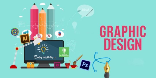
Essential Tools Every New Graphic Designer Should Know
Starting a career in graphic design is an exciting journey filled with creativity, challenges, and endless opportunities for growth. However, one of the biggest questions new designers face is: Which tools should I learn first?
The world of design is vast, but mastering the right tools early on can give you a strong foundation and help you stand out from the competition. In this blog, we’ll cover the essential graphic design tools every beginner should know, along with how you can kickstart your creative journey with expert guidance from DigiAdgency.
Why Are Design Tools Important for Beginners?
Graphic design is more than just creativity — it's also about execution. The right tools help you:
Bring your ideas to life more effectively.
Work faster and more efficiently.
Collaborate better with teams and clients.
Keep up with industry standards.
Deliver professional-quality work that meets client expectations.
Whether you're planning to work as a freelancer, join a creative agency, or build your own brand, having a strong grasp of essential design tools will give you a massive head start. (Need help growing your freelance career? Explore DigiAdgency’s digital marketing freelancer services.)
Essential Tools Every New Graphic Designer Should Learn
1. Adobe Photoshop
Best for: Photo editing, digital painting, and compositing.
Adobe Photoshop is considered the king of photo manipulation and raster graphics editing. It’s a must-know tool for any graphic designer. With Photoshop, you can create everything from simple image adjustments to complex designs and high-end graphics.
Key Features:
Photo retouching
Layer-based editing
Advanced filters and effects
Custom brushes and tools
2. Adobe Illustrator
Best for: Logo design, vector graphics, and illustrations.
Unlike Photoshop, Illustrator works with vector graphics, meaning your designs can scale up or down without losing quality. It's essential for creating logos, icons, typography, and complex illustrations.
Key Features:
Precision drawing tools
Advanced typography options
Powerful vector editing
Artboards for multiple designs
3. Canva
Best for: Quick designs, social media graphics, beginners.
Canva is a user-friendly, web-based tool perfect for beginners who want to create stunning graphics quickly. With thousands of templates, fonts, and stock images, Canva makes professional-looking designs accessible to everyone.
Key Features:
Drag-and-drop functionality
Free and premium templates
Collaboration features
No design experience required
(If you’re managing social media for yourself or clients, Canva can be a game-changer. For more growth tips, check out DigiAdgency’s services.)
4. Adobe InDesign
Best for: Print layouts, ebooks, magazines.
InDesign is a powerful tool for designers who work on multi-page layouts. It’s ideal for creating brochures, flyers, newsletters, and even long-format books.
Key Features:
Master pages for consistent designs
Text and image management
Export to PDF or digital publishing formats
Interactive PDF creation
5. Figma
Best for: UI/UX design, web design, team collaboration.
Figma has quickly become a favorite for web and app designers. It's cloud-based, which means multiple designers can work on a project at the same time. It’s perfect for UI (User Interface) and UX (User Experience) design projects.
Key Features:
Real-time collaboration
Prototyping tools
Responsive design features
Version history tracking
6. Affinity Designer
Best for: Vector and raster design alternative to Adobe products.
Affinity Designer is an affordable alternative to Illustrator, offering professional-level features for a one-time fee (instead of Adobe’s subscription model). It’s perfect for freelancers and small businesses.
Key Features:
Seamless switching between vector and raster workspaces
High-performance editing
User-friendly interface
No subscription fees
7. Procreate
Best for: Digital painting and illustration (iPad users).
If you love drawing or illustrating, Procreate is one of the best apps out there. It's intuitive, powerful, and designed specifically for touch devices like the iPad.
Key Features:
Vast brush library
Layered editing
Quick rendering speeds
Easy sharing of artwork
8. Trello or Asana (for Project Management)
Best for: Organizing design projects and client work.
Being organized is just as important as being creative. Tools like Trello and Asana help you manage design projects, keep track of deadlines, and collaborate with clients or team members effectively.
Key Features:
Task management
Project tracking
File attachment
Real-time updates
(Professional project management helps agencies like DigiAdgency deliver high-quality work efficiently.)
9. Google Fonts and Adobe Fonts
Best for: Access to professional typography.
Typography is a major part of design. Using high-quality, readable fonts can make or break your design. Tools like Google Fonts (free) and Adobe Fonts (subscription-based) give you access to hundreds of beautiful typefaces.
Key Features:
Wide variety of fonts
Easy integration into designs
Commercial use licenses
10. Wacom Tablet (Hardware)
Best for: Precision drawing and photo editing.
A Wacom tablet gives you the hand-drawn feel while working digitally. It’s a great investment if you’re serious about illustration, detailed editing, or custom artwork.
Key Features:
Pressure sensitivity
Natural pen feel
High precision for detailed work
How to Choose the Right Tools as a Beginner
Choosing the right tools depends on:
Your goals: Are you focusing on branding, web design, or social media?
Your budget: Some tools are free or affordable alternatives to premium software.
Your workflow: Choose tools that integrate well together.
Industry expectations: Familiarize yourself with the tools most commonly used by professionals.
Starting simple is key. Master one tool at a time before moving to the next.
Final Thoughts
Learning the right tools is essential to building a successful career in graphic design. From Photoshop for image editing to Figma for UI design and Canva for quick projects, each tool serves a unique purpose in a designer’s toolbox.
Consistency and practice are the real secrets behind mastering these tools. Start small, experiment often, and don’t be afraid to invest time in learning new skills.
If you’re looking to fast-track your journey as a graphic designer, team up with experts! Visit DigiAdgency for professional guidance. Whether you’re seeking freelance opportunities, exploring digital marketing services, or searching for the best digital marketing agency, we’re here to help you grow.
Start your creative journey today — because the world needs your designs!
Written by: Varsha Kohli Graphic Designer | Digital Marketer | Storyteller Visit DigiAdgency
0 notes
Text
High-Performance Geospatial Processing: Leveraging Spectrum Spatial

As geospatial technology advances, the volume, variety, and velocity of spatial data continue to increase exponentially. Organizations across industries — ranging from urban planning and telecommunications to environmental monitoring and logistics — depend on spatial analytics to drive decision-making. However, traditional geospatial information systems (GIS) often struggle to process large datasets efficiently, leading to performance bottlenecks that limit scalability and real-time insights.
Spectrum Spatial offers a powerful solution for organizations seeking to harness big data without compromising performance. Its advanced capabilities in distributed processing, real-time analytics, and system interoperability make it a vital tool for handling complex geospatial workflows. This blog will delve into how Spectrum Spatial optimizes high-performance geospatial processing, its core functionalities, and its impact across various industries.
The Challenges of Big Data in Geospatial Analytics Big data presents a unique set of challenges when applied to geospatial analytics. Unlike structured tabular data, geospatial data includes layers of information — vector, raster, point clouds, and imagery — that require specialized processing techniques. Below are the primary challenges that organizations face:
1. Scalability Constraints in Traditional GIS
Many GIS platforms were designed for small to mid-scale datasets and struggle to scale when handling terabytes or petabytes of data. Legacy GIS systems often experience performance degradation when processing complex spatial queries on large datasets.
2. Inefficient Spatial Query Performance
Operations such as spatial joins, geofencing, and proximity analysis require intensive computation, which can slow down query response times. As the dataset size grows, these operations become increasingly inefficient without an optimized processing framework.
3. Real-Time Data Ingestion and Processing
Industries such as autonomous navigation, disaster management, and environmental monitoring rely on real-time spatial data streams. Traditional GIS platforms are often unable to ingest and process high-frequency data streams while maintaining low latency.
4. Interoperability with Enterprise Systems
Modern enterprises use diverse IT infrastructures that include cloud computing, data warehouses, and business intelligence tools. Many GIS solutions lack seamless integration with these enterprise systems, leading to data silos and inefficiencies.
5. Managing Data Quality and Integrity
Geospatial data often comes from multiple sources, including remote sensing, IoT devices, and user-generated content. Ensuring data consistency, accuracy, and completeness remains a challenge, particularly when dealing with large-scale spatial datasets.
How Spectrum Spatial Optimizes High-Performance Geospatial Processing Spectrum Spatial is designed to address these challenges with a robust architecture that enables organizations to efficiently process, analyze, and visualize large-scale geospatial data. Below are key ways it enhances geospatial big data analytics:
1. Distributed Processing Architecture
Spectrum Spatial leverages distributed computing frameworks to break down large processing tasks into smaller, manageable workloads. This allows organizations to handle complex spatial operations across multiple servers, significantly reducing processing time.
Parallel Query Execution: Queries are executed in parallel across multiple nodes, ensuring faster response times. Load Balancing: Workloads are dynamically distributed to optimize computing resources. Scalable Storage Integration: Supports integration with distributed storage solutions such as Hadoop, Amazon S3, and Azure Data Lake. 2. Optimized Spatial Query Processing
Unlike traditional GIS platforms that struggle with slow spatial queries, Spectrum Spatial utilizes advanced indexing techniques such as:
R-Tree Indexing: Enhances the performance of spatial queries by quickly identifying relevant geometries. Quad-Tree Partitioning: Efficiently divides large spatial datasets into smaller, manageable sections for improved query execution. In-Memory Processing: Reduces disk I/O operations by leveraging in-memory caching for frequently used spatial datasets. 3. High-Performance Data Ingestion and Streaming
Spectrum Spatial supports real-time data ingestion pipelines, enabling organizations to process continuous streams of spatial data with minimal latency. This is crucial for applications that require real-time decision-making, such as:
Autonomous Vehicle Navigation: Ingests GPS and LiDAR data to provide real-time routing intelligence. Supply Chain Logistics: Optimizes delivery routes based on live traffic conditions and weather updates. Disaster Response: Analyzes real-time sensor data for rapid emergency response planning. 4. Cloud-Native and On-Premise Deployment Options
Spectrum Spatial is designed to work seamlessly in both cloud-native and on-premise environments, offering flexibility based on organizational needs. Its cloud-ready architecture enables:
Elastic Scaling: Automatically adjusts computing resources based on data processing demand. Multi-Cloud Support: Integrates with AWS, Google Cloud, and Microsoft Azure for hybrid cloud deployments. Kubernetes and Containerization: Supports containerized deployments for efficient workload management. 5. Seamless Enterprise Integration
Organizations can integrate Spectrum Spatial with enterprise systems to enhance spatial intelligence capabilities. Key integration features include:
Geospatial Business Intelligence: Connects with BI tools like Tableau, Power BI, and Qlik for enhanced visualization. Database Interoperability: Works with PostgreSQL/PostGIS, Oracle Spatial, and SQL Server for seamless data access. API and SDK Support: Provides robust APIs for developers to build custom geospatial applications. Industry Applications of Spectrum Spatial 1. Telecommunications Network Planning
Telecom providers use Spectrum Spatial to analyze signal coverage, optimize cell tower placement, and predict network congestion. By integrating with RF planning tools, Spectrum Spatial ensures precise network expansion strategies.
2. Geospatial Intelligence (GeoInt) for Defense and Security
Spectrum Spatial enables military and defense organizations to process satellite imagery, track assets, and conduct geospatial intelligence analysis for mission planning.
3. Environmental and Climate Analytics
Environmental agencies leverage Spectrum Spatial to monitor deforestation, air pollution, and climate change trends using satellite and IoT sensor data.
4. Smart City Infrastructure and Urban Planning
City planners use Spectrum Spatial to optimize traffic flow, manage public utilities, and enhance sustainability initiatives through geospatial insights.
5. Retail and Location-Based Marketing
Retailers analyze customer demographics, foot traffic patterns, and competitor locations to make data-driven site selection decisions.
Why Advintek Geoscience? Advintek Geoscience specializes in delivering high-performance geospatial solutions tailored to enterprise needs. By leveraging Spectrum Spatial, Advintek ensures:
Optimized geospatial workflows for big data analytics. Seamless integration with enterprise IT systems. Scalable infrastructure for handling real-time geospatial data. Expert guidance in implementing and maximizing Spectrum Spatial’s capabilities. For organizations seeking to enhance their geospatial intelligence capabilities, Advintek Geoscience provides cutting-edge solutions designed to unlock the full potential of Spectrum Spatial.
Explore how Advintek Geoscience can empower your business with high-performance geospatial analytics. Visit Advintek Geoscience today.
0 notes
Text
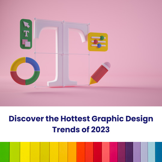
The Best Graphic Design Software of 2023
Graphic Design Software For Designers In 2023: Q & A Tutorial
1. What are the top graphic design software options for designers in 2023?
Top graphic design software options in 2023 include Adobe Creative Cloud (Photoshop, Illustrator, InDesign), CorelDRAW, Canva. Each offers unique features for different design needs, from photo editing to vector graphics and layouts. For web and UI design, tools like Adobe XD is also popular among designers.
2. How has graphic design software evolved in 2023?
In 2023, graphic design software has evolved with enhanced AI integration, offering features like automated design suggestions and advanced image editing tools. Cloud-based collaboration has improved, allowing real-time teamwork. User interfaces have become more intuitive, and tools for 3D design and animation have expanded. Additionally, accessibility features have increased, catering to a broader range of users and skill levels.
3. What features should designers look for in graphic design software in 2023?
In 2023, graphic designers should look for software with user-friendly interfaces, robust collaboration tools, cloud integration, advanced editing capabilities, and support for various file formats. Features like AI-driven design suggestions, customizable templates, and cross-platform compatibility are essential, along with strong customer support and frequent updates to stay current with design trends.
4. What is the difference between vector and raster graphic design software in 2023?
Vector graphic design software uses mathematical equations to create images, allowing for infinite scalability without loss of quality. Common examples include Adobe Illustrator. Raster graphic design software, like Adobe Photoshop, works with pixel-based images, which can lose quality when resized. In 2023, both types are essential for different applications, with vectors favoured for logos, illustrations and rasters for detailed images.
5. Are there any new graphic design software launches for 2023?
Yes, several new graphic design software and updates were launched in 2023. Notable mentions include Adobe's updates to Creative Cloud applications, the release of new features. Additionally tools and received significant enhancements. Always check official websites for the latest information on features and releases.
Visit: VS Website See: VS Portfolio
0 notes
Text

As geospatial technology advances, the volume, variety, and velocity of spatial data continue to increase exponentially. Organizations across industries—ranging from urban planning and telecommunications to environmental monitoring and logistics—depend on spatial analytics to drive decision-making. However, traditional geospatial information systems (GIS) often struggle to process large datasets efficiently, leading to performance bottlenecks that limit scalability and real-time insights.
Spectrum Spatial offers a powerful solution for organizations seeking to harness big data without compromising performance. Its advanced capabilities in distributed processing, real-time analytics, and system interoperability make it a vital tool for handling complex geospatial workflows. This blog will delve into how Spectrum Spatial optimizes high-performance geospatial processing, its core functionalities, and its impact across various industries.
The Challenges of Big Data in Geospatial Analytics Big data presents a unique set of challenges when applied to geospatial analytics. Unlike structured tabular data, geospatial data includes layers of information—vector, raster, point clouds, and imagery—that require specialized processing techniques. Below are the primary challenges that organizations face:
Scalability Constraints in Traditional GIS
Many GIS platforms were designed for small to mid-scale datasets and struggle to scale when handling terabytes or petabytes of data. Legacy GIS systems often experience performance degradation when processing complex spatial queries on large datasets.
Inefficient Spatial Query Performance
Operations such as spatial joins, geofencing, and proximity analysis require intensive computation, which can slow down query response times. As dataset size grows, these operations become increasingly inefficient without an optimized processing framework.
Real-Time Data Ingestion and Processing
Industries such as autonomous navigation, disaster management, and environmental monitoring rely on real-time spatial data streams. Traditional GIS platforms are often unable to ingest and process high-frequency data streams while maintaining low latency.
Interoperability with Enterprise Systems
Modern enterprises use diverse IT infrastructures that include cloud computing, data warehouses, and business intelligence tools. Many GIS solutions lack seamless integration with these enterprise systems, leading to data silos and inefficiencies.
Managing Data Quality and Integrity
Geospatial data often comes from multiple sources, including remote sensing, IoT devices, and user-generated content. Ensuring data consistency, accuracy, and completeness remains a challenge, particularly when dealing with large-scale spatial datasets.
How Spectrum Spatial Optimizes High-Performance Geospatial Processing Spectrum Spatial is designed to address these challenges with a robust architecture that enables organizations to efficiently process, analyze, and visualize large-scale geospatial data. Below are key ways it enhances geospatial big data analytics:
Distributed Processing Architecture
Spectrum Spatial leverages distributed computing frameworks to break down large processing tasks into smaller, manageable workloads. This allows organizations to handle complex spatial operations across multiple servers, significantly reducing processing time.
Parallel Query Execution: Queries are executed in parallel across multiple nodes, ensuring faster response times. Load Balancing: Workloads are dynamically distributed to optimize computing resources. Scalable Storage Integration: Supports integration with distributed storage solutions such as Hadoop, Amazon S3, and Azure Data Lake.
Optimized Spatial Query Processing
Unlike traditional GIS platforms that struggle with slow spatial queries, Spectrum Spatial utilizes advanced indexing techniques such as:
R-Tree Indexing: Enhances the performance of spatial queries by quickly identifying relevant geometries. Quad-Tree Partitioning: Efficiently divides large spatial datasets into smaller, manageable sections for improved query execution. In-Memory Processing: Reduces disk I/O operations by leveraging in-memory caching for frequently used spatial datasets.
High-Performance Data Ingestion and Streaming
Spectrum Spatial supports real-time data ingestion pipelines, enabling organizations to process continuous streams of spatial data with minimal latency. This is crucial for applications that require real-time decision-making, such as:
Autonomous Vehicle Navigation: Ingests GPS and LiDAR data to provide real-time routing intelligence. Supply Chain Logistics: Optimizes delivery routes based on live traffic conditions and weather updates. Disaster Response: Analyzes real-time sensor data for rapid emergency response planning.
Cloud-Native and On-Premise Deployment Options
Spectrum Spatial is designed to work seamlessly in both cloud-native and on-premise environments, offering flexibility based on organizational needs. Its cloud-ready architecture enables:
Elastic Scaling: Automatically adjusts computing resources based on data processing demand. Multi-Cloud Support: Integrates with AWS, Google Cloud, and Microsoft Azure for hybrid cloud deployments. Kubernetes and Containerization: Supports containerized deployments for efficient workload management.
Seamless Enterprise Integration
Organizations can integrate Spectrum Spatial with enterprise systems to enhance spatial intelligence capabilities. Key integration features include:
Geospatial Business Intelligence: Connects with BI tools like Tableau, Power BI, and Qlik for enhanced visualization. Database Interoperability: Works with PostgreSQL/PostGIS, Oracle Spatial, and SQL Server for seamless data access. API and SDK Support: Provides robust APIs for developers to build custom geospatial applications. Industry Applications of Spectrum Spatial
Telecommunications Network Planning
Telecom providers use Spectrum Spatial to analyze signal coverage, optimize cell tower placement, and predict network congestion. By integrating with RF planning tools, Spectrum Spatial ensures precise network expansion strategies.
Geospatial Intelligence (GeoInt) for Defense and Security
Spectrum Spatial enables military and defense organizations to process satellite imagery, track assets, and conduct geospatial intelligence analysis for mission planning.
Environmental and Climate Analytics
Environmental agencies leverage Spectrum Spatial to monitor deforestation, air pollution, and climate change trends using satellite and IoT sensor data.
Smart City Infrastructure and Urban Planning
City planners use Spectrum Spatial to optimize traffic flow, manage public utilities, and enhance sustainability initiatives through geospatial insights.
Retail and Location-Based Marketing
Retailers analyze customer demographics, foot traffic patterns, and competitor locations to make data-driven site selection decisions.
Why Advintek Geoscience? Advintek Geoscience specializes in delivering high-performance geospatial solutions tailored to enterprise needs. By leveraging Spectrum Spatial, Advintek ensures:
Optimized geospatial workflows for big data analytics. Seamless integration with enterprise IT systems. Scalable infrastructure for handling real-time geospatial data. Expert guidance in implementing and maximizing Spectrum Spatial’s capabilities. For organizations seeking to enhance their geospatial intelligence capabilities, Advintek Geoscience provides cutting-edge solutions designed to unlock the full potential of Spectrum Spatial.
Explore how Advintek Geoscience can empower your business with high-performance geospatial analytics. VisitAdvintek Geoscience today.
0 notes
Text
High-Performance Geospatial Processing: Leveraging Spectrum Spatial for Big Data Analytics
As geospatial technology advances, the volume, variety, and velocity of spatial data continue to increase exponentially. Organizations across industries—ranging from urban planning and telecommunications to environmental monitoring and logistics—depend on spatial analytics to drive decision-making. However, traditional geospatial information systems (GIS) often struggle to process large datasets efficiently, leading to performance bottlenecks that limit scalability and real-time insights.
Spectrum Spatial offers a powerful solution for organizations seeking to harness big data without compromising performance. Its advanced capabilities in distributed processing, real-time analytics, and system interoperability make it a vital tool for handling complex geospatial workflows. This blog will delve into how Spectrum Spatial optimizes high-performance geospatial processing, its core functionalities, and its impact across various industries.
The Challenges of Big Data in Geospatial Analytics Big data presents a unique set of challenges when applied to geospatial analytics. Unlike structured tabular data, geospatial data includes layers of information—vector, raster, point clouds, and imagery—that require specialized processing techniques. Below are the primary challenges that organizations face:
Scalability Constraints in Traditional GIS
Many GIS platforms were designed for small to mid-scale datasets and struggle to scale when handling terabytes or petabytes of data. Legacy GIS systems often experience performance degradation when processing complex spatial queries on large datasets.
Inefficient Spatial Query Performance
Operations such as spatial joins, geofencing, and proximity analysis require intensive computation, which can slow down query response times. As dataset size grows, these operations become increasingly inefficient without an optimized processing framework.
Real-Time Data Ingestion and Processing
Industries such as autonomous navigation, disaster management, and environmental monitoring rely on real-time spatial data streams. Traditional GIS platforms are often unable to ingest and process high-frequency data streams while maintaining low latency.
Interoperability with Enterprise Systems
Modern enterprises use diverse IT infrastructures that include cloud computing, data warehouses, and business intelligence tools. Many GIS solutions lack seamless integration with these enterprise systems, leading to data silos and inefficiencies.
Managing Data Quality and Integrity
Geospatial data often comes from multiple sources, including remote sensing, IoT devices, and user-generated content. Ensuring data consistency, accuracy, and completeness remains a challenge, particularly when dealing with large-scale spatial datasets.
How Spectrum Spatial Optimizes High-Performance Geospatial Processing Spectrum Spatial is designed to address these challenges with a robust architecture that enables organizations to efficiently process, analyze, and visualize large-scale geospatial data. Below are key ways it enhances geospatial big data analytics:
Distributed Processing Architecture
Spectrum Spatial leverages distributed computing frameworks to break down large processing tasks into smaller, manageable workloads. This allows organizations to handle complex spatial operations across multiple servers, significantly reducing processing time.
Parallel Query Execution: Queries are executed in parallel across multiple nodes, ensuring faster response times. Load Balancing: Workloads are dynamically distributed to optimize computing resources. Scalable Storage Integration: Supports integration with distributed storage solutions such as Hadoop, Amazon S3, and Azure Data Lake.
Optimized Spatial Query Processing
Unlike traditional GIS platforms that struggle with slow spatial queries, Spectrum Spatial utilizes advanced indexing techniques such as:
R-Tree Indexing: Enhances the performance of spatial queries by quickly identifying relevant geometries. Quad-Tree Partitioning: Efficiently divides large spatial datasets into smaller, manageable sections for improved query execution. In-Memory Processing: Reduces disk I/O operations by leveraging in-memory caching for frequently used spatial datasets.
High-Performance Data Ingestion and Streaming
Spectrum Spatial supports real-time data ingestion pipelines, enabling organizations to process continuous streams of spatial data with minimal latency. This is crucial for applications that require real-time decision-making, such as:
Autonomous Vehicle Navigation: Ingests GPS and LiDAR data to provide real-time routing intelligence. Supply Chain Logistics: Optimizes delivery routes based on live traffic conditions and weather updates. Disaster Response: Analyzes real-time sensor data for rapid emergency response planning.
Cloud-Native and On-Premise Deployment Options
Spectrum Spatial is designed to work seamlessly in both cloud-native and on-premise environments, offering flexibility based on organizational needs. Its cloud-ready architecture enables:
Elastic Scaling: Automatically adjusts computing resources based on data processing demand. Multi-Cloud Support: Integrates with AWS, Google Cloud, and Microsoft Azure for hybrid cloud deployments. Kubernetes and Containerization: Supports containerized deployments for efficient workload management.
Seamless Enterprise Integration
Organizations can integrate Spectrum Spatial with enterprise systems to enhance spatial intelligence capabilities. Key integration features include:
Geospatial Business Intelligence: Connects with BI tools like Tableau, Power BI, and Qlik for enhanced visualization. Database Interoperability: Works with PostgreSQL/PostGIS, Oracle Spatial, and SQL Server for seamless data access. API and SDK Support: Provides robust APIs for developers to build custom geospatial applications. Industry Applications of Spectrum Spatial
Telecommunications Network Planning
Telecom providers use Spectrum Spatial to analyze signal coverage, optimize cell tower placement, and predict network congestion. By integrating with RF planning tools, Spectrum Spatial ensures precise network expansion strategies.
Geospatial Intelligence (GeoInt) for Defense and Security
Spectrum Spatial enables military and defense organizations to process satellite imagery, track assets, and conduct geospatial intelligence analysis for mission planning.
Environmental and Climate Analytics
Environmental agencies leverage Spectrum Spatial to monitor deforestation, air pollution, and climate change trends using satellite and IoT sensor data.
Smart City Infrastructure and Urban Planning
City planners use Spectrum Spatial to optimize traffic flow, manage public utilities, and enhance sustainability initiatives through geospatial insights.
Retail and Location-Based Marketing
Retailers analyze customer demographics, foot traffic patterns, and competitor locations to make data-driven site selection decisions.
Why Advintek Geoscience? Advintek Geoscience specializes in delivering high-performance geospatial solutions tailored to enterprise needs. By leveraging Spectrum Spatial, Advintek ensures:
Optimized geospatial workflows for big data analytics. Seamless integration with enterprise IT systems. Scalable infrastructure for handling real-time geospatial data. Expert guidance in implementing and maximizing Spectrum Spatial’s capabilities. For organizations seeking to enhance their geospatial intelligence capabilities, Advintek Geoscience provides cutting-edge solutions designed to unlock the full potential of Spectrum Spatial.
Explore how Advintek Geoscience can empower your business with high-performance geospatial analytics. VisitAdvintek Geoscience today.
0 notes
Text
VeryPDF Cloud REST API: Best Online PDF Processing & Conversion API
VeryPDF Cloud REST API: Best Online PDF Processing & Conversion API
In today's digital world, handling PDF documents efficiently is crucial for businesses, developers, and organizations. VeryPDF Cloud REST API is a powerful, reliable, and feature-rich service that enables seamless integration of PDF processing capabilities into your applications and workflows. Built using trusted Adobe® PDF Library™ technology, this API simplifies PDF management while maintaining high-quality output and security.
Visit the home page: [VeryPDF Cloud REST API] https://www.verypdf.com/online/cloud-api/

Why Choose VeryPDF Cloud REST API? VeryPDF Cloud REST API is one of the world's most advanced PDF processing services, developed by digital document experts with over 55 years of experience. With its extensive set of tools, it allows users to convert, optimize, modify, extract, and secure PDFs effortlessly.
Key Features of VeryPDF Cloud REST API
Powerful PDF Conversion Easily convert files between formats while maintaining high accuracy and compliance with PDF standards.
PDF to Word – Convert PDFs into fully editable Microsoft Word documents.
PDF to Excel – Extract tabular data and convert PDFs into Excel spreadsheets.
PDF to PowerPoint – Create editable PowerPoint presentations from PDF slides.
Convert to PDF – Transform Word, Excel, PowerPoint, BMP, TIF, PNG, JPG, HTML, and PostScript into standardized PDFs.
Convert to PDF/X – Ensure compliance with print-ready PDF/X formats.
Convert to PDF/A – Convert PDFs to PDF/A formats for long-term document preservation.
PDF to Images – Generate high-quality images (JPG, BMP, PNG, GIF, TIF) from PDFs while preserving color fidelity.
PDF Optimization Enhance PDFs for specific use cases with powerful optimization tools.
Rasterize PDF – Convert each page into a rasterized image for consistent printing and display.
Convert PDF Colors – Adjust color profiles for optimal display on different screens or printing.
Compress PDF – Reduce file size while maintaining document quality.
Linearize PDF – Enable fast web viewing by optimizing document structure.
Flatten Transparencies – Improve printing performance by flattening transparent objects.
Flatten Layers & Annotations – Merge layers and annotations into the document for better compatibility.
PDF Modification Tools Edit and customize your PDFs to fit your needs.
Add to PDF – Insert text, images, and attachments without altering the original content.
Merge PDFs – Combine multiple PDF documents into one.
Split PDF – Divide a single PDF into multiple files as needed.
Advanced PDF Forms Processing Manage static and dynamic PDF forms with ease.
XFA to AcroForms – Convert XFA forms to AcroForms for broader compatibility.
Flatten Forms – Lock form field values to create uneditable PDFs.
Import Form Data – Populate forms with external data.
Export Form Data – Extract form data for external processing.
Intelligent Data Extraction Extract valuable content from PDFs for data analysis and processing.
Extract Images – Retrieve high-quality embedded images from PDFs.
OCR PDF – Apply Optical Character Recognition (OCR) to make scanned PDFs searchable.
Extract Text – Extract structured text data with style and position details.
Query PDF – Retrieve document metadata and content insights.
Secure Your Documents Protect sensitive information and prevent unauthorized access.
Watermark PDF – Apply visible watermarks using text or images.
Encrypt PDF – Use strong encryption to protect documents with passwords.
Restrict PDF – Set access restrictions to control printing, editing, and content extraction.
Get Started with VeryPDF Cloud REST API VeryPDF Cloud REST API offers a free trial to help you explore its features and seamlessly integrate them into your applications. With an intuitive interface and detailed documentation, developers can quickly implement PDF processing capabilities into their projects.
Take your PDF handling to the next level with VeryPDF Cloud REST API**—the ultimate solution for converting, optimizing, modifying, extracting, and securing PDFs effortlessly.
[Start Using VeryPDF Cloud REST API Today!] https://www.verypdf.com/online/cloud-api/
0 notes
Text
The Best Graphic Design Tools for Beginners and Professionals

Graphic design is all about creativity, and the tools you use can make all the difference. Whether you're just starting out or have years of experience, choosing the right design software is key to bringing your ideas to life. In this blog, we’ll look at some of the best graphic design tools, from simple options for beginners to powerful software for seasoned professionals.
For Beginners: Easy-to-Use Tools to Get Started
If you’re new to graphic design, you need tools that are simple to use but still allow you to create professional-looking work. Here are some great options for beginners:
1. Canva: Simple and Accessible
Canva is perfect for beginners. It’s user-friendly, with a drag-and-drop interface that makes designing easy, even if you have no experience. Whether you're creating social media posts, flyers, or presentations, Canva has plenty of templates to help you get started.

Why it's great for beginners:
Free and Easy to Use: No design experience required.
Templates for Everything: Tons of pre-made templates for quick and easy designs.
2. Crello: Similar to Canva
Crello is another tool that’s similar to Canva, offering easy-to-use features and a wide range of templates. It’s great for beginners who want to experiment with both static and animated designs.

Why it's great for beginners:
Lots of Templates: A variety of design options, including social media posts and advertisements.
Animation Options: You can add simple animations to your designs.
3. Gravit Designer: Vector Design Made Simple
Gravit Designer is a free vector-based tool that’s great for creating logos, icons, and other scalable designs. It’s simple enough for beginners but still offers powerful features to help you create professional designs.
Why it's great for beginners:
Cloud-Based: Works on any device, so you can design anywhere.
Straightforward Interface: Easy to use with an intuitive layout.
For Professionals: Advanced Tools for Complex Designs
As you grow in your graphic design career, you’ll need more advanced tools to handle intricate projects. Here are some of the top tools used by professional designers:
4. Adobe Photoshop: The Classic Design Tool
Adobe Photoshop is one of the most well-known design tools. It’s the industry standard for photo editing, digital painting, and graphic creation. Whether you're working on images, posters, or advanced designs, Photoshop gives you complete control.

Why it's great for professionals:
Powerful Features: Ideal for photo manipulation and creating detailed designs.
Industry Standard: Trusted by professionals worldwide.
5. Adobe Illustrator: Perfect for Vector Art
If you're designing logos, illustrations, or anything that needs to be scalable, Illustrator is the tool you want. It’s known for creating clean, precise vector graphics that won’t lose quality, no matter how much you resize them.
Why it's great for professionals:
Precision: Offers fine control over vector-based designs.
Ideal for Branding: Perfect for creating logos and brand assets.
6. Affinity Designer: A Budget-Friendly Alternative
If you’re looking for a more affordable option to Illustrator, Affinity Designer is a great choice. It offers many of the same features as Illustrator but at a one-time cost, making it a budget-friendly alternative for professionals.
Why it's great for professionals:
Affordable: No subscription required, just a one-time purchase.
Versatile: Great for both vector and raster designs.
7. Sketch: For Digital Product Design
Sketch is a top tool for UI/UX design, especially for web and mobile app projects. It’s specifically made for creating user interfaces and prototypes, making it a go-to tool for digital product designers.
Why it's great for professionals:
Focused on UI/UX: Great for creating digital interfaces and prototypes.
Efficient Workflow: Makes designing for digital products easier and faster.
Bonus Tool: Figma (Great for Both Beginners and Professionals)
Figma is a cloud-based design tool that’s become popular for both beginners and professionals. It’s perfect for creating web and app designs, and its collaboration features allow multiple people to work on the same file in real-time.
Why it’s great for both beginners and professionals:
Cloud-Based: Work on designs from any device, anytime.
Collaboration-Friendly: Multiple people can edit and comment on the same project at the same time.

Conclusion: Find the Right Tool for You
Choosing the right design tool depends on your level of experience and what you need to create. If you're just starting out, tools like Canva or Crello are easy to use and great for learning the basics. As you gain more experience, you’ll likely want to switch to advanced tools like Adobe Photoshop or Illustrator for more complex designs.
Remember, the best tool for you is the one that suits your creative process and helps you get the job done efficiently. So, don’t be afraid to experiment with different tools until you find the one that works best for your style and workflow. Happy designing!
0 notes
Text
Earth Engine in BigQuery: A New Geospatial SQL Analytics

BigQuery Earth Engine
With Earth Engine directly integrated into BigQuery, Google Cloud has expanded its geographic analytics capabilities. Incorporating powerful raster analytics into BigQuery, this new solution from Google Cloud Next '25 lets SQL users analyse satellite imagery-derived geographical data.
Google Cloud customers prefer BigQuery for storing and accessing vector data, which represents buildings and boundaries as points, lines, or polygons. Earth Engine in BigQuery is suggested for processing and storing raster data like satellite imagery, which encodes geographic information as a grid of pixels with temperature, height, and land cover values.
“Earth Engine in BigQuery” mixes vector and raster analytics. This integration could improve access to advanced raster analysis and help solve real-world business problems.
Key features driving this integration:
BigQuery's new geography function is ST_RegionStats. This program extracts statistics from raster data inside geographic borders, similar to Earth Engine's reduceRegion function. Use an Earth Engine-accessible raster picture and a geographic region (vector data) to calculate mean, min, max, total, or count for pixels that traverse the geography.
BigQuery Sharing, formerly Analytics Hub, now offers Earth Engine in BigQuery datasets. This makes it easy to find data and access more datasets, many of which are ready for processing to obtain statistics for a region of interest. These datasets may include risk prediction, elevation, or emissions.
Raster analytics with this new feature usually has five steps:
Find vector data representing interest areas in a BigQuery table.
Find an Earth Engine raster dataset in BigQuery image assets, Cloud GeoTiff, or BigQuery Sharing.
Use ST_RegionStats() with the raster ID, vector geometries, and optional band name to aggregate intersecting data.
To understand, look at ST_RegionStats() output.
Use BigQuery Geo Viz to map analysis results.
This integration enables data-driven decision-making in sustainability and geographic application cases:
Climate, physical risk, and disaster response: Using drought, wildfire, and flood data in transportation, infrastructure, and urban design. For instance, using the Wildfire hazard to Communities dataset to assess wildfire risk or the Global River Flood Hazard dataset to estimate flood risk.
Assessing land-use, elevation, and cover for agricultural evaluations and supply chain management. This includes using JRC Global Forest Cover datasets or Forest Data Partnership maps to determine if commodities are grown in non-deforested areas.
Methane emissions monitoring: MethaneSAT L4 Area Sources data can identify methane emission hotspots from minor, distributed sources in oil and gas basins to enhance mitigation efforts.
Custom use cases: Supporting Earth Engine raster dataset imports into BigQuery image assets or Cloud Storage GeoTiffs.
BigQuery Sharing contains ST_RegionStats()'s raster data sources, where the assets.image.href column normally holds the raster ID for each image table. Cloud Storage GeoTIFFs in the US or US-central1 regions can be used with URIs. Earth Engine image asset locations like ‘ee://IMAGE_PATH’ are supported in BigQuery.
ST_RegionStats()'s include option lets users adjust computations by assigning pixel weights (0–1), with 0 representing missing data. If no weight is given, pixels are weighted by geometry position. Raster pixel size, or scale, affects calculation and output. Changing scale (e.g., using options => JSON ‘{“scale”: 1000}’) can reduce query runtime and cost for prototyping, but it may impact results and should not be used for production analysis.
ST_RegionStats() is charged individually under BigQuery Services since Earth Engine calculates. Costs depend on input rows, raster picture quality, input geography size and complexity, crossing pixels, image projection, and formula usage. Earth Engine quotas in BigQuery slot time utilisation can be changed to control expenses.
Currently, ST_RegionStats() queries must be run in the US, us-central1, or us-central2.
This big improvement in Google Cloud's geospatial analytics provides advanced raster capabilities and improves sustainability and other data-driven decision-making.
#EarthEngineinBigQuery#BigQuery#EarthEngine#geospatialanalytics#SQL#BigQueryanalytics#technology#TechNews#technologynews#news#govindhtech
0 notes
Text
Top Graphic Design Tools Used by Professionals Today
Graphic design is an essential element of branding, marketing, and communication. Professionals in this field rely on an array of powerful tools to bring their creative visions to life. Whether you're designing a logo, social media post, website layout, or marketing material, the right tools can significantly impact the quality and efficiency of your work.
In this article, we'll explore some of the top graphic design tools that professionals use today, their features, and how they enhance the design process. Additionally, we'll discuss how AdxVenture, the best graphic design company in Dehradun, can help you leverage these tools to boost your branding and social media presence.
1. Adobe Photoshop
Overview: Adobe Photoshop is undoubtedly one of the most popular and powerful graphic design tools in the industry. It is primarily known for photo editing, but it also offers a vast range of features suitable for creating graphics, web layouts, and even 3D designs. Photoshop is widely used by professionals to create high-quality visual content, including posters, website mockups, and social media visuals.
Key Features:
Advanced photo manipulation and retouching tools
Extensive library of brushes and filters
Support for creating animations
High-quality text and typography tools
Versatile file format support
Why Professionals Use It: Photoshop’s flexibility and extensive features make it the go-to tool for creating detailed designs. Whether you’re working with raster images or creating compositions, Photoshop gives designers full control over the creative process.
2. Adobe Illustrator
Overview: Adobe Illustrator is another industry-standard tool, specifically designed for vector-based graphic design. Unlike Photoshop, which works with raster images (pixel-based), Illustrator uses vectors (lines, shapes, and curves) to create scalable images. This makes it ideal for logo design, illustrations, and any project that requires resizing without losing quality.
Key Features:
Vector graphics editing and creation
Precision drawing tools for logos and illustrations
Customizable brushes and patterns
Seamless integration with other Adobe Creative Cloud applications
Extensive typography tools
Why Professionals Use It: Illustrator’s vector capabilities allow designers to create logos, icons, and scalable illustrations that maintain sharpness across various sizes. It’s especially useful for branding and designing assets that need to be printed on a variety of materials.
3. Adobe InDesign
Overview: Adobe InDesign is the premier desktop publishing software used for designing print and digital documents. It’s particularly valuable for creating multi-page documents such as brochures, magazines, newsletters, and eBooks. InDesign offers powerful layout tools and precise control over typography, which is essential for professional publishing.
Key Features:
Layout design for print and digital media
Master pages for consistent design across pages
Integration with Photoshop and Illustrator
Rich typography options
Tools for interactive PDFs and digital publishing
Why Professionals Use It: InDesign is the go-to tool for creating complex layouts and multi-page designs. Its collaboration with other Adobe tools allows for seamless workflows, making it a top choice for designers working on print materials and digital publications.
4. Canva
Overview: Canva is a user-friendly, web-based design tool that allows even beginners to create professional-quality designs. While it’s not as powerful as the Adobe suite, Canva is an excellent option for quick, simple designs like social media posts, presentations, posters, and more. Its drag-and-drop interface and vast template library make it accessible for non-designers as well.
Key Features:
Pre-designed templates for social media, posters, and flyers
Easy-to-use drag-and-drop interface
Access to stock photos, icons, and illustrations
Collaborative features for team projects
Cloud-based, making it accessible from anywhere
Why Professionals Use It: Canva is perfect for quick, straightforward projects that don’t require advanced design skills. Its ease of use and vast library of templates and assets make it an efficient tool for designers working on time-sensitive projects or creating content for clients with limited budgets.
5. Affinity Designer
Overview: Affinity Designer is a robust alternative to Adobe Illustrator, offering vector graphic design capabilities without the Adobe subscription cost. It is ideal for logo design, illustrations, and interface design, with advanced tools that rival the Adobe suite in terms of functionality.
Key Features:
Powerful vector and raster design capabilities
Full support for CMYK, RGB, and Pantone colors
Precision drawing tools and brushes
Multiple artboards for efficient workflow
Affordable one-time payment
Why Professionals Use It: Affinity Designer offers a high-quality design experience at a fraction of the cost of Adobe Illustrator. Its versatility and powerful features make it a popular choice for designers who need advanced tools but want to avoid the ongoing subscription fees.
6. CorelDRAW
Overview: CorelDRAW is another professional vector graphic design tool that has been around for decades. It’s popular among designers in industries such as print, embroidery, and sign-making due to its strong layout and vector drawing capabilities. CorelDRAW provides excellent tools for creating logos, illustrations, and print-ready artwork.
Key Features:
Powerful vector illustration and page layout tools
Extensive file compatibility
Real-time editing and collaboration
Web and mobile design features
Easy learning curve for beginners
Why Professionals Use It: CorelDRAW is known for its simplicity and efficiency in producing professional-quality designs. It’s especially well-suited for designers who work with vector-based designs and need compatibility with a wide range of file formats.
7. Sketch
Overview: Sketch is a vector-based design tool that has gained popularity in the web and app design community. It is often preferred by UX/UI designers for its streamlined interface and powerful features for creating wireframes, prototypes, and high-fidelity web designs.
Key Features:
Real-time collaboration with cloud integration
Smart objects and reusable components
Vector editing and artboard management
Prototyping tools for web and mobile apps
Integration with third-party plugins
Why Professionals Use It: Sketch is ideal for web and mobile interface design due to its intuitive, lightweight interface. Its ability to create responsive, scalable designs makes it a favorite among professionals working in the tech industry.
How AdxVenture Can Help You with Graphic Design
As the best graphic design company in Dehradun, AdxVenture offers professional graphic design services that can elevate your brand’s identity and digital presence. Whether you're a small business or a large corporation, our team of skilled designers uses the latest tools and technologies to deliver high-quality visual content tailored to your needs.
1. Custom Branding Solutions
Our design team specializes in creating unique, impactful logos and branding assets that resonate with your target audience. From typography to color schemes, we ensure every aspect of your brand reflects your vision and values.
2. Social Media Graphics
We helps businesses craft engaging social media graphics that capture attention and encourage interaction. We create visually appealing posts, banners, and advertisements that align with your brand’s style and messaging.
3. Web and Print Design
Whether you need a sleek website design or eye-catching marketing materials, AdxVenture provides comprehensive design solutions that help you stand out in both the digital and physical worlds. We work with tools like Adobe Photoshop, Illustrator, and InDesign to create cohesive designs that drive results.
4. UX/UI Design
We specialize in creating seamless user experiences and interfaces that are intuitive, functional, and aesthetically pleasing. Using tools like Sketch and Adobe XD, we design responsive websites and apps that deliver an exceptional user experience.
5. Comprehensive Design Services
From the initial concept to the final design, We offers end-to-end graphic design services. Our expertise ensures that every design element works together to achieve your business goals, whether you’re looking to increase brand awareness or drive conversions.
Why ChooseAdxVenture?
Choosing AdxVenture as your graphic design partner comes with several benefits:
Creative Expertise: Our team is skilled in using industry-leading tools and techniques to deliver exceptional designs.
Tailored Solutions: We take the time to understand your brand’s needs and customize designs to meet your objectives.
Quality and Consistency: We deliver high-quality designs that are consistent across all your branding and marketing materials.
Affordable Services: As the best graphic design company in Dehradun, we offer competitive pricing for businesses of all sizes.
Conclusion
The right graphic design tools are essential for professionals to create high-quality, impactful designs. Whether you're using Adobe Photoshop for photo manipulation or Canva for social media graphics, the tools you choose can significantly enhance your work. If you're looking for expert graphic design services to boost your branding and online presence, AdxVenture, the best graphic design company in Dehradun, is here to help. Contact us today to start transforming your visual identity with creative and professional designs.
1 note
·
View note
Text
What software is best for creating professional logos?
Professional logo creation requires precision, creativity, and a blend of technical tools. Whether you’re brainstorming logo design ideas or implementing intricate motion graphics for animated logos, using the right software can make all the difference. Here’s a detailed guide to the best tools for creating professional logos, widely used by graphic design services to produce exceptional results.
1. Adobe Illustrator
Adobe Illustrator is the industry standard for professional logo design and widely favored by graphic designers. Its vector-based approach allows logos to be resized without losing quality, ensuring they look sharp on everything from business cards to billboards.
Features:
Advanced shape and typography tools for unique and scalable designs.
Wide range of color options, gradients, and effects.
Seamless integration with other Adobe products like Photoshop and After Effects.
Best For: Designers working on detailed or intricate creative logo design ideas that require precision.
2. CorelDRAW
CorelDRAW is another powerful vector-based design software known for its user-friendly interface and flexibility. It’s a popular choice among beginners and professionals alike.
Features:
Extensive customization options for colors, fonts, and effects.
Intuitive tools for creating clean and professional logos.
Easy-to-use interface for quick logo creation.
Best For: Small businesses or freelance designers looking to produce high-quality logos efficiently.
3. Canva
Canva is an excellent option for those seeking simplicity. While not as advanced as Illustrator or CorelDRAW, Canva’s drag-and-drop interface and pre-made templates make it accessible to beginners and non-designers.
Features:
A large library of templates and icons to inspire logo design ideas.
Simple tools for adding text, shapes, and colors.
Collaborative features for teams.
Best For: Quick mockups, brainstorming creative logo design ideas, or for users with minimal design experience.
4. Adobe After Effects
If your branding strategy requires animated logos with motion graphics, Adobe After Effects is unmatched. This software is widely used by professionals to create engaging logo animations for video intros, advertisements, and social media.
Features:
Tools for creating dynamic animations and 3D effects.
Integration with Adobe Illustrator for seamless logo imports.
Support for motion tracking and visual effects.
Best For: Brands or designers focusing on animated or video-based logo design.
5. Affinity Designer
Affinity Designer is a cost-effective alternative to Adobe Illustrator and offers both vector and raster graphic capabilities. It’s ideal for creating detailed logos with advanced visual elements.
Features:
Smooth user interface for beginners and pros.
Support for creating both pixel and vector graphics.
Compatibility with other Affinity products for a seamless workflow.
Best For: Designers looking for professional results on a budget.
6. Inkscape
Inkscape is a free, open-source alternative for vector graphic design. It’s packed with features for creating professional logos, making it a great choice for beginners or businesses on a tight budget.
Features:
Advanced path and node editing tools for precise logo creation.
Support for exporting designs in multiple formats.
Extensive community support and tutorials.
Best For: Beginners seeking a no-cost option for professional-looking logos.
7. Gravit Designer
Gravit Designer is a web-based design tool with a focus on simplicity and usability. It supports vector-based designs and offers features to create sharp and scalable logos.
Features:
Cloud-based storage for easy access and collaboration.
Flexible tools for shapes, paths, and layers.
Compatibility with multiple devices and platforms.
Best For: Remote teams or individuals who prefer web-based solutions.
How Professional Graphic Design Services Use These Tools
Professional graphic design services leverage a combination of these tools to deliver high-quality, versatile logos that meet clients’ needs. For instance, they may use Adobe Illustrator for intricate designs, Adobe After Effects for motion graphics, and Canva for brainstorming or mockups. This multi-software approach ensures flexibility and precision at every stage of the design process.
Choosing the Right Software for Your Needs
For Beginners: Canva and Inkscape are user-friendly and offer templates to kickstart your creativity.
For Professionals: Adobe Illustrator, CorelDRAW, and Affinity Designer provide advanced tools for detailed and scalable designs.
For Motion Graphics: Adobe After Effects is the top choice for creating animated logos.
For Budget-Conscious Users: Inkscape and Affinity Designer offer professional results without high costs.
Innovating Creative Logo Design Ideas
By combining powerful software with creative thinking, designers can craft logos that are visually stunning and aligned with a brand’s identity. Whether it’s brainstorming fresh logo design ideas or incorporating cutting-edge motion graphics, the right software ensures professional outcomes.
Conclusion
The best software for creating professional logos depends on your expertise, project requirements, and budget. Tools like Adobe Illustrator, CorelDRAW, and Canva each offer unique features that cater to diverse needs. Professional graphic design services seamlessly blend these tools to deliver logos that stand out, providing a lasting impact for businesses and brands.
#Graphic Design Services#Logo design Ideas#creative design#branding services#motion graphics#logo design#scribe&sigil
0 notes
Text
Unleashing the Power of Adobe Illustrator's Essential Tools
Image editing using adobe illustrator: Common Queries Answered
1.What are five tools used on Adobe Illustrator?
Five tools commonly used in Adobe Illustrator are:
1. **Selection Tool**: Selects and moves objects.
2. **Pen Tool**: Creates custom paths and shapes.
3. **Type Tool**: Adds and edits text.
4. **Brush Tool**: Draws freeform lines and shapes with various brush styles.
5. **Shape Tool**: Creates basic geometric shapes like rectangles, circles, and polygons.
These tools help users design and manipulate vector graphics effectively.
2. How to blur in adobe Illustrator?
To blur an object in Adobe Illustrator, select the object you want to blur. Then, go to the top menu and click on **Effect** > **Blur** > **Gaussian Blur**. A dialog box will appear where you can adjust the blur radius to achieve the desired effect. Preview the changes, and once satisfied, click **OK**. Alternatively, you can create a blurred effect by duplicating the object, applying a blur, and adjusting its position or opacity for a more customized look. Don't forget to save your file!
3. Do professionals use Adobe Illustrator?
Professionals in design industries frequently utilize Adobe Illustrator for creating vector graphics, logos, illustrations, and typography. Its advanced tools and versatility make it ideal for both print and digital media, with industries like advertising, branding, and web design relying on it for high-quality visuals. The software's integration with other Adobe Creative Cloud applications also enhances workflow efficiency, making it a staple in the design community.
4. What is the main use of adobe Illustrator?
Adobe Illustrator is a powerful tool used for creating scalable vector graphics, such as logos, illustrations, and typography. It is popular among graphic designers for its precision and versatility, allowing for the creation of high-quality artwork suitable for print and digital media. With tools for drawing, coloring, and editing, Illustrator is essential for branding, advertising, and web design projects.
5. What are the disadvantages of adobe Illustrator?
Adobe Illustrator: steep learning curve, subscription required, sluggish performance on old hardware, large file sizes. Lacks features of raster-based programs, limited versatility. Collaboration is challenging due to compatibility issues.
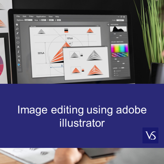
Visit: VS Website See: VS Portfolio
0 notes