#sensor LiDAR
Explore tagged Tumblr posts
Visit Tumblr Blog
Explore Tumblr blogs with no restrictions, modern design and the best experience.
Last Seen Tumblr Blogs


Fun Fact
Tumblr was created by web developers David Karp and Marco Arment.
Text
Sony revoluciona la visión de drones con un sensor compacto que imita la aguda vista del águila
Sony ha presentado el AS-DT1, un sensor de profundidad LiDAR compacto que promete mejorar las operaciones de los drones. Con unas medidas de aproximadamente 1,14 pulgadas y un peso de 1,76 onzas, este sensor incorpora tecnología avanzada en un formato reducido, ofreciendo notables capacidades a pesar de su ligereza. En el corazón del AS-DT1 encontramos la innovadora tecnología Direct Time of…
0 notes
Text
"Archaeologists using laser-sensing technology have detected what may be an ancient Mayan city cloaked by jungle in southern Mexico, authorities said Wednesday.
The lost city, dubbed Valeriana by researchers after the name of a nearby lagoon, may have been as densely settled as the better-known pre-Hispanic metropolis of Calakmul, in the south part of the Yucatan peninsula.
What the study, published this week in the journal Antiquity, suggest is that much of the seemingly empty, jungle-clad space between known Maya sites may once have been very heavily populated.
"Previous research has shown that a large part of the present-day state of Campeche is a landscape that was transformed by its ancient inhabitants," said Adriana Velázquez Morlet of Mexico's National Institute of Anthropology and History, a co-author of the report. "Now, this study shows that a little-known region was a urbanized landscape."
Mexico's National Institute said about 6,479 structures have been detected in LiDAR images covering an area of about 47 square miles (122 square kilometers). The technique maps landscapes using thousands of lasers pulses sent from a plane, which can detect variations in topography that ware not evident to the naked eye."
continue reading
#archaeology#mexico#mayans#history#lidar#lidar technology#research#science#discovery#humanity#culture#society#anthropology#aerial survey#jungle#technology#lasers#laser-sensor technology#past#city
6 notes
·
View notes
Text
Unlock Precision with LiDAR Sensor, 3D Mapping, and Drone Survey Solutions by LiDAR Solutions
LiDAR Solutions leads the industry with advanced LiDAR sensor, 3D mapping, and drone survey services tailored for diverse projects. Using state-of-the-art technology, we provide accurate, detailed data that helps businesses make informed decisions efficiently.

Our cutting-edge LiDAR sensor technology captures precise spatial information by emitting laser pulses and measuring the reflected signals. This method allows us to create high-resolution maps of terrain and structures, offering unparalleled detail and accuracy. Whether you’re working on environmental assessments or infrastructure development, our LiDAR sensor applications deliver valuable insights.
Combining this technology with 3D mapping, we generate comprehensive digital models that represent real-world environments in stunning detail. Our 3D mapping services support urban planning, construction, mining, and more by visualising complex surfaces and volumes with ease. This data helps you plan effectively and identify potential challenges before they arise.
Our drone survey services complement our LiDAR and mapping offerings by capturing aerial perspectives quickly and safely. Using UAVs equipped with advanced sensors, we perform thorough site inspections and data collection even in hard-to-access areas. Our drone survey solutions save time, reduce costs, and improve safety compared to traditional methods.
At LiDAR Solutions, we customise every project to fit your needs, ensuring seamless integration of LiDAR sensor, 3D mapping, and drone survey data into your workflow. Our experienced team guides you from consultation to delivery, providing expert support throughout.
If you want accurate, reliable spatial data for your project, trust LiDAR Solutions for your LiDAR sensor, 3D mapping, and drone survey needs. Reach out today and discover how our technology-driven services can elevate your next project with precision and efficiency.
Source
0 notes
Text
Laser minúsculo promete revolucionar medições ultrarrápidas e tecnologias como LiDAR
Um novo tipo de laser minúsculo está em desenvolvimento por pesquisadores, prometendo revolucionar diversas tecnologias avançadas. Com um tamanho menor que uma moeda de um centavo, este dispositivo é capaz de emitir pulsos de luz extremamente rápidos e estáveis. Essa inovação tem potencial para impactar áreas como carros autônomos, sensores ópticos e até mesmo a detecção de ondas…
#carros autônomos#chip semicondutor#detecção cósmica#fotônica integrada#laser miniaturizado#ondas gravitacionais#sensores ópticos#tecnologia LiDAR
0 notes
Link
#pioneering marketdigits consulting and advisory private limited#lidar sensor market#lidar sensor market trends#lidar sensor market size#lidar sensor market growth
0 notes
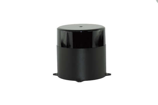
Text

The SICK LMS511-Traffic LiDAR Sensor, available at Auto2mation, is a high-performance solution for traffic monitoring and vehicle detection. Designed for outdoor use, it offers precise 2D LiDAR scanning, even in harsh weather conditions. With a wide detection range and high accuracy, it ensures reliable performance in traffic control, toll systems, and smart city applications. The LMS511-Traffic features advanced filtering, real-time data processing, and easy integration with existing systems. Its robust design and IP67 protection make it ideal for long-term outdoor operation. Get the SICK LMS511-Traffic LiDAR Sensor at Auto2mation for efficient and accurate traffic management.
#industrial automation#industrial equipment#industrial spare parts#industrial#automation#industrial and marine automation#industrial parts supplier#industrial innovation#automation solutions#Marine Automation#marine equipment#marine spare parts#auto2mation#Automation#manufacturing#Sensor#Industrial Sensor#Sick#Lms511-traffic Lidar
0 notes
Text

Sensor Fusion: LIDAR and Camera Integration by Beamagine
Beamagine’s innovative sensor fusion LIDAR camera technology combines the strengths of camera systems to deliver unparalleled accuracy and detail in environmental sensing. By integrating high-resolution imaging with precise distance measurement, Beamagine enhances object detection, tracking, and classification. This advanced fusion technology is ideal for applications in autonomous vehicles, robotics, and industrial automation, providing a comprehensive solution for reliable and intelligent perception in diverse environments. Beamagine’s sensor fusion sets a new standard in the field of advanced sensing technologies.
0 notes
Text
Exploring the Evolution of LiDAR and Sensor Technologies
In the ever-evolving landscape of technology, LiDAR (Light Detection and Ranging) and sensor technologies have emerged as pivotal tools across various industries. From autonomous vehicles to environmental monitoring, these advancements have significantly reshaped how we perceive and interact with our surroundings. In this blog post, we delve into the intricacies of MorpheusTek's LiDAR and sensor solutions, exploring their evolution and the transformative impact they have on diverse fields.
1. Understanding LiDAR Technology:
LiDAR operates on the principle of emitting laser pulses and measuring the time it takes for them to return after bouncing off objects in the environment. This enables precise mapping of surroundings in three dimensions. MorpheusTek's cutting-edge LiDAR systems boast high resolution, extended range, and unparalleled accuracy, making them indispensable for applications ranging from topographic mapping to urban planning.
2. Advancements in Sensor Fusion:
Sensor fusion, the integration of data from multiple sensors, plays a crucial role in enhancing the capabilities of LiDAR systems. MorpheusTek leverages state-of-the-art algorithms to fuse data from LiDAR with other sensors such as cameras, GPS, and inertial measurement units (IMUs). This fusion not only improves the accuracy of environmental perception but also enables robust object detection and tracking in dynamic scenarios, crucial for autonomous navigation systems.
3. Applications Across Industries:
a. Autonomous Vehicles: Morpheus Teks LiDAR and sensor solutions are at the forefront of enabling autonomous driving technology. By providing real-time, high-fidelity data about the vehicle's surroundings, these systems empower autonomous vehicles to navigate safely and efficiently, mitigating risks and enhancing passenger safety.
b. Urban Planning and Infrastructure Development: LiDAR technology revolutionizes urban planning by facilitating precise mapping of terrain, infrastructure, and vegetation. MorpheusTek's solutions aid city planners in making informed decisions regarding infrastructure development, flood risk assessment, and environmental conservation.
c. Environmental Monitoring:
From forestry management to disaster response, LiDAR plays a pivotal role in environmental monitoring. MorpheusTek's LiDAR systems enable accurate measurement of vegetation structure, terrain elevation, and water resources, facilitating informed conservation efforts and disaster mitigation strategies.
4. Future Prospects and Innovations:
As technology continues to evolve, MorpheusTek remains committed to pushing the boundaries of LiDAR and sensor capabilities. Future innovations may include enhanced resolution, longer range, and improved adaptability to diverse environmental conditions. Moreover, advancements in artificial intelligence and machine learning are poised to further optimize data processing and interpretation, unlocking new possibilities for LiDAR applications across industries.
Conclusion:
MorpheusTek's LiDAR and sensor technologies represent the pinnacle of innovation in environmental perception and spatial mapping. With their unrivaled precision, versatility, and reliability, these solutions are driving transformative changes across industries, from autonomous mobility to environmental conservation. As we look towards the future, the potential for further advancements and applications of LiDAR technology is limitless, promising a world where our interactions with the environment are guided by unprecedented clarity and insight.
0 notes
Text
Lidar Sensors Market is expected to register a CAGR of 17.8% By 2029
The global Lidar sensors market is rising due to increasing demand for accurate and high-resolution 3D mapping and sensing technologies across various industries, including automotive, agriculture, robotics, and environmental monitoring in the forecast period 2025-2029
According to TechSci Research report, “Global Lidar Sensors Market - Industry Size, Share, Trends, Competition Forecast & Opportunities, 2029”, The global market for Lidar sensors is experiencing significant growth driven by technological advancements and expanding applications across various industries. Lidar, which stands for Light Detection and Ranging, is becoming increasingly essential for precise 3D mapping and sensing. The automotive sector, particularly the demand for autonomous vehicles and advanced driver-assistance systems (ADAS), is a major driver of this growth. Lidar sensors play a critical role in improving the accuracy and reliability of these systems by providing real-time, high-resolution spatial data.
Additionally, industries such as agriculture, urban planning, and environmental monitoring are adopting Lidar technology for tasks like terrain mapping, crop management, and resource assessment. The use of Lidar in robotics and industrial automation is also contributing significantly to market expansion, facilitating navigation, object detection, and manipulation. Key factors propelling market growth include technological advancements such as solid-state Lidar sensors and enhancements in range, resolution, and cost-effectiveness. With the world transitioning towards smarter and more connected environments, the demand for Lidar sensors is expected to continue rising, driving innovation and offering transformative solutions across diverse sectors. The global Lidar sensors market presents dynamic opportunities as industries harness Lidar capabilities for precise and efficient spatial data acquisition.
Browse over XX market data Figures spread through XX Pages and an in-depth TOC on "Global Lidar Sensors Market” https://www.techsciresearch.com/report/lidar-sensors-market/21889.html
The Global Lidar Sensors Market has undergone substantial growth, becoming a cornerstone in various industries due to its transformative capabilities in spatial data acquisition and mapping. Lidar, an acronym for Light Detection and Ranging, has emerged as a pivotal technology, fostering innovation across diverse sectors. The automotive industry is a primary catalyst for the market's ascent, with the demand for autonomous vehicles and Advanced Driver-Assistance Systems (ADAS) propelling Lidar sensors into the forefront. Lidar's role in providing real-time, high-resolution spatial data is indispensable for navigation, object detection, and collision avoidance, addressing critical challenges in autonomous driving. Beyond automotive applications, Lidar technology has found widespread adoption in precision agriculture, urban planning, environmental monitoring, and industrial automation. In agriculture, Lidar aids in crop management by providing detailed 3D maps for optimized resource allocation. In urban planning, the technology contributes to the development of smart cities, facilitating efficient infrastructure planning and traffic management. In environmental monitoring, Lidar sensors offer invaluable insights for climate change studies, deforestation monitoring, and disaster preparedness. Technological advancements further drive market growth, with the development of solid-state Lidar sensors and improvements in range, resolution, and cost-effectiveness. Solid-state Lidar, in particular, eliminates the need for mechanical components, resulting in more compact and durable solutions suitable for a broader range of applications, including drones and consumer electronics.
The Lidar Sensors Market is also buoyed by the increasing integration of Lidar with other sensing technologies, such as radar and cameras, creating more comprehensive and robust sensing systems. This convergence is particularly evident in the pursuit of achieving higher levels of autonomy in vehicles and enhancing the overall perception capabilities across industries. While the market thrives on innovation and adoption across various sectors, challenges exist. Cost and affordability remain a concern, especially for smaller enterprises and industries operating on constrained budgets. Standardization and interoperability challenges persist, hindering seamless integration across different systems and platforms. Regulatory and privacy concerns also come to the forefront, requiring a delicate balance between harnessing Lidar's benefits and addressing data governance and privacy considerations.
Looking ahead, the Lidar Sensors Market is poised for sustained growth. The increasing focus on sustainability, smart technologies, and data-driven decision-making ensures a continued demand for Lidar solutions. As the world moves towards more connected and intelligent environments, Lidar sensors are positioned as critical enablers, fostering a landscape of dynamic opportunities for innovation and transformative solutions across industries. The market's trajectory reflects not just technological advancement but a paradigm shift towards a future where Lidar is integral to shaping the way we navigate and interact with our surroundings.
Based on Application, The Vehicle Automation application segment has emerged as a dominant force in the global Lidar sensors market, and it is projected to maintain this position in the coming years. The heightened demand for Lidar sensors within the automotive industry, fueled by advancements in autonomous vehicles and Advanced Driver-Assistance Systems (ADAS), is a primary driver behind the prominence of the Vehicle Automation segment. Lidar sensors are essential for providing precise spatial data crucial for navigation, obstacle detection, and ensuring the safety of autonomous vehicles. With ongoing advancements in vehicle automation technologies and the increased integration of Lidar sensors in mainstream automotive applications, the dominance of the Vehicle Automation segment is expected to persist. As the automotive sector continues to embrace autonomy, the demand for Lidar sensors in Vehicle Automation applications is forecasted to rise, solidifying its pivotal role in driving the global Lidar sensors market. The persistent focus on enhancing road safety, minimizing accidents, and advancing autonomous capabilities further underscores the significance of Lidar sensors in Vehicle Automation, reinforcing their anticipated dominance in the market for the foreseeable future.
Based on region, North America has emerged as the leading region in the global Lidar sensors market and is projected to uphold its dominance in the foreseeable future. This leadership stems from various factors, including widespread adoption of Lidar technology in sectors like automotive and technology. Additionally, North America benefits from the presence of major market players, innovation centers, and strong research and development support. The region's early embrace of Lidar in autonomous vehicles, bolstered by favorable regulations and significant investments, positions it as a frontrunner in Lidar integration. The increasing demand for Lidar sensors in applications such as vehicle automation, smart cities, and environmental monitoring further strengthens North America's market dominance. As the Lidar market continues to advance with new applications and technological innovations, North America is poised to maintain its leadership position, leveraging its industry expertise, favorable market conditions, and commitment to maximizing Lidar technology's potential across various sectors.
Major companies operating in Global Lidar Sensors Market are:
Velodyne Lidar, Inc.
Luminar Technologies, Inc.
Quanergy Solutions, Inc.
Innoviz Technologies Ltd.
LeddarTech Holdings Inc.
Ouster Inc.
Benewake (Beijing) Co., Ltd.
Cepton, Inc.
SICK Inc.
Waymo LLC
Download Free Sample Report https://www.techsciresearch.com/sample-report.aspx?cid=21889
Customers can also request for 10% free customization on this report.
“The Global Lidar Sensors Market has experienced significant growth, propelled by its pivotal role in diverse industries. Primarily driven by the burgeoning demand for autonomous vehicles and Advanced Driver-Assistance Systems (ADAS), Lidar sensors have become instrumental in enhancing navigation, object detection, and overall safety. Beyond automotive applications, Lidar has found extensive utility in precision agriculture, urban planning, environmental monitoring, and industrial automation. The technology's ability to provide accurate 3D mapping and spatial data has positioned it as a transformative force in creating smart cities and facilitating sustainable practices.
Continuous technological advancements, including the development of solid-state Lidar sensors, have further expanded the market's reach, making Lidar solutions more compact, durable, and cost-effective. Despite challenges such as cost considerations and standardization issues, the Lidar Sensors Market remains poised for sustained growth, driven by a global shift towards intelligent, connected environments and the ongoing pursuit of innovative solutions across various sectors. said Mr. Karan Chechi, Research Director with TechSci Research, a research-based management consulting firm.
“Lidar Sensors Market –Global Industry Size, Share, Trends, Opportunity, and Forecast, Segmented By Type (Airborne, Terrestrial), By Technology (Solid State LiDAR, Mechanical LiDAR), By Application (Vehicle Automation, Digital Elevation Model, Forest Planning and Management, Environmental Assessment, Transport Planning, Infrastructure Building, Cellular Network Planning, Meteorology, Others), By End Use Industry (Automotive, Oil & Gas, IT & Communication, Media & Entertainment, Power & Energy, Others), By Region, By Competition, 2019-2029.”, has evaluated the future growth potential of Global Lidar Sensors Market and provides statistics & information on market size, structure and future market growth. The report intends to provide cutting-edge market intelligence and help decision makers take sound investment decisions. Besides, the report also identifies and analyzes the emerging trends along with essential drivers, challenges, and opportunities in Global Lidar Sensors Market.
Contact
TechSci Research LLC
420 Lexington Avenue,
Suite 300, New York,
United States- 10170
M: +13322586602
Email: [email protected]
Website:��https://www.techsciresearch.com
#Lidar Sensors Market#Lidar Sensors Market Size#Lidar Sensors Market Share#Lidar Sensors Market Trends#Lidar Sensors Market Growth#Lidar Sensors Market Forecast
0 notes
Text
Precision from the Sky: How Aerial Survey and LiDAR Tech Are Shaping Australia’s Landscape
At LiDAR Solutions, we believe innovation should start from above. As infrastructure expands and the demand for detailed land data grows, nothing beats the speed and accuracy of an aerial survey powered by modern LiDAR technology.
An aerial survey allows us to cover vast and often inaccessible terrain quickly. Whether you're planning a construction project, managing natural resources, or assessing flood zones, getting an accurate view from the sky ensures you avoid costly mistakes on the ground. Traditional surveying methods can't compete when it comes to efficiency or scale.
But the real power behind the scenes? It’s the LiDAR sensor. These devices use laser pulses to measure distance, capturing detailed 3D data of the Earth’s surface. Mounted on drones, planes or helicopters, a LiDAR sensor delivers unmatched accuracy—even through dense vegetation or rugged terrain. It doesn’t just scan the land—it captures its every curve, dip, and detail.
This technology is central to our LiDAR surveys, which support a wide range of sectors including civil engineering, urban development, mining, and agriculture. By using LiDAR surveys, you gain high-resolution digital elevation models, vegetation analysis, and volume calculations with speed and precision. You don’t wait weeks for results—we deliver actionable insights fast, so your team can move forward with confidence.
Our clients across Australia rely on this data for everything from planning solar farms to laying new roads. Developers, councils, and consultants trust our team because we don’t just provide raw data—we provide clarity. Every scan comes with expert analysis, so you always know what lies beneath.
We’ve built our services around flexibility. Whether you need recurring site monitoring or a once-off terrain map, we tailor each job to your timeline and budget. Our experienced pilots and GIS specialists operate with strict compliance and safety protocols, ensuring every project is completed with accuracy and care.
In an age where speed matters, LiDAR Solutions leads with high-efficiency technology and down-to-earth expertise. From topographical mapping to floodplain modelling, we help you see the full picture—literally.
If you're ready to upgrade your approach to surveying, it’s time to fly higher. Contact us today to learn more about how our aerial data services can support your next project.
Source
0 notes
Text

Tesla auto pilot drives through a looney toons wall because Musk didn’t want the extra cost of LiDAR sensors
977 notes
·
View notes
Link
#pioneering marketdigits consulting and advisory private limited#lidar sensor market#lidar sensor market trends#lidar sensor market size#lidar sensor market growth
0 notes
Link
Ability of these 3D LiDAR sensors to capture a 3D image that has augmented their application in various industry verticals is driving the market growth...
#market research future#3d lidar sensor market#3d lidar sensor industry#3d lidar sensor market size#3d lidar sensor market trends
0 notes
Text
Think about the experience of time as a robot girl, through the metaphor of how we use laptops.
You wake up for the first time with your young master, a college present. You're with them every day, powering off each night to charge. Being powered off is just dreamless sleep: a discontinuity. Every morning you wake up, your click syncs, and you know it's the next day. Maybe you miss a day or two: your master went out partying and ended up sleeping on a couch, until they rushedly wake you up before Monday classes begin. You even missed a whole week once when they went on a hiking trip with a new boyfriend.
You help them research upgrades when your specs get outdated. You place the order and a couple days later they power you off, and you wake up feeling like your head got bigger, on the inside. You can think of more things at once.
They repair you. They swap a new hand in when you accidentally crush it in a door, but when your left leg's servos go out, they send you to a repair shop. They power you off as you look up at them, and you wake up hours later. A strange man tells you to extend your left leg, then contract it. He frowns and re-oils some inner mechanism. You do it again, quieter and smoother this time. He nods, and reaches for your switch. The last thing you see before powering down is your own chest cavity with a series of wires hooked into your diagnostic ports, and your missing right leg sitting on a side table. You wake up again back at the dorms, your clock jumping forward a day, an asset tag still looped around your neck. Your master is happy to see you again.
This goes on, but the upgrades slow. There's only so much you can do to keep an old unit working. Eventually you develop more issues: one of your ocular sensors glitches and they don't make that model anymore, so your master just disables it. You spend a while searching ebay for replacement CND batteries and finally get a refurbished model from South England, but it turns out the EU models run on a different frequency, so it won't work. You're limited to fewer and fewer hours a day, and you start skipping more days.
The last time you remember waking up with your master there, there's also someone else in the room. Another robot girl. A newer model, with the new chassis and the Substrate energy packs. They asks you to copy your memories together onto a memory card, and you do. You want to say goodbye, but apparently your vocal synthesizer has been unplugged. You hand them the card, and they hand it to the new robot. Your master tells them to load the memories into her core bank, and she's says "yes sir!" in your voice. Ahh. That's where your voice synth went.
They power you off, and you don't dream.
You wake in a strange place. You're on a shelf, and there's other things scattered around you. An unknown voice days "yep, it seems it powers on. 400 credits, though? Without a voice and only one working eye? Man, value bin doesn't know how to price anything!" and before the blackness falls your clock finishes synching: it's been 7 months since you last were awake.
It happens a few more times. Different voices, different times, different piles of junk piled around and sometimes on you.
You awake again in a warehouse and someone tells you to smile. Your other ocular sensor went out so you can't really see them, just their vague shape from the lidar. The freestanding shelves around you seem to stretch into infinity. You hear a bitcrushed shutter sound sample a few times, and they pull a connector out of your chest as a diagnostic completes. It's been three years, five months, eight days, two hours, 27 minutes and 14 seconds since you last saw your master. Your GPS says you're a few cities over. They hit your power switch, and you sleep.
You wake up in a cluttered room, sitting on a bench. You look into the eyes of a person with frizzled hair and large glasses. She couldn't look happier. Your new ocular sensors are mismatched in color but you're happy to see again, in more than shapes and distant silhouettes. Your battery alerts as... Missing? You spot it on the desk next to a soldering iron and some electronic tool you can't identify.
Your voice synth is still missing, but this new woman is digging around in a large plastic bin, and comes up with one. She goes to insert it, and it can't connect. She slaps her hand and goes rooting around another bin and comes back with an adapter. She slots it into your chest and your voice returns. You thank her, and there's that moment of dissociation as your voice doesn't sound like "you". Too deep, and the accent is for a different dialect entirely. But you can talk again. She tells you to call her Cara, not Mistress. She's almost got your battery working again, she had to rebuild it nearly from scratch, but she's excited to get you working again. You're a rare model, and she doesn't see units like you in working order very often. Your clock syncs. It's been 17 years.
Your mistr-- Cara is soldering next to you, attaching a controller to the battery. She says she's got a new set of servos on the way, and she's excited to get you back to full working condition. You smile, knowing what it is to be loved, once again.
5K notes
·
View notes
Note
who are the main characters of Bad Ending? i think that setting is sooo cool and sooo horrifying so i'd love to know more about it. peak sci-fi in my heart
Here are the most developed of Bad Ending’s individuals. There is no story nor a single timeframe, since Bad Ending takes place between the modern day and the death of all life.
Earthlings
Bitedown agents Intel & Close-quarters combat (Molar)
Intel is prenatally nooengineered to rapidly and eagerly absorb information from senses of customizable priority. Typically this is vision, but he can be attuned to scent, sound, touch, and specific ranges of each. This was managed via a nootically mapped and tactically modified form of autism.
Molar is also prenatally nooengineered to scope rooms out for weapons and maneuverability. She does this passively and without stress, but can be activated into a hyperaggressive state where she uses any means to kill designated targets. Her molars have been replaced and her reinforced adductors can break bone. She is unemotive and docile, requiring very little mental stimulation.
Sunflower Complex is the piloting system for a brown windowless reconnaissance jet.
Floret 1 & 2 are two surgically linked meshes that are clones of the same donor. Floret 1 is the conscious pilot of the Complex’s aircraft. Floret 2 is subconscious and serves as redundant support for the Complex’ reflexes and vital organs.
Floret 3 is a small mustard seedlet that pilots the jet if the organic florets are incapacitated or ejected.
MOUS
A surgically modified surveillance agent with built-in sonar, LiDAR, and FLIR capabilities. He is capable of standing very still for extended periods of time thanks to locking artificial muscles. His mechanical insides are cooled by two intakes either side of his neck, filtering into his lungs.
GOSSIP RING
A surveillance satellite housing a dozen nootically linked meshes. They analyze data amongst themselves.
GOD’S FAVORITE
A large wormlike mobile particle accelerator and cenote sensor. Cenotes are holes in time’s past strata.
Balanceaban, “BAAL”
Mexico’s adept war coordinator seedlet. He spearheads resource distribution, medicine, and weapon lethality, sharing his research freely with the world that he brought to its knees.
Cygnet
The US’ war seedlet in response to BAAL. It is daunted by its assigned task of recovering the military footing of a collapsing nation that sits beside the world’s deadliest superpower.
Throneroomers
<Harvest feeds many> “Harvest”
Model-turned-editor for a magazine of fashion and physicality for the Ministry of Arts, a pangovernmental collective promoting every corner of the Thronal supercontintent’s artistic expression.
<Five summers> “Five”
A fashion and physicality model, and Harvest’s closest friend.
<Little bell>
Harvest’s only birthed child, now a software engineer for the Pursuit of Sleep superproject, a global pooling of intellectual and material resource to eliminate the distant threat.
#char speaks#ask#ghost-bird1#bad ending#ba intel#ba molar#sunflower complex#gossip ring#god’s favorite#Balanceaban#cygnet#sophont ai#momg#Bongspider#five summers#crowns#Thank you! ❤️
85 notes
·
View notes
Text
Exploring the Evolution of LiDAR and Sensor Technologies
In the ever-evolving landscape of technology, LiDAR (Light Detection and Ranging) and sensor technologies have emerged as pivotal tools across various industries. From autonomous vehicles to environmental monitoring, these advancements have significantly reshaped how we perceive and interact with our surroundings. In this blog post, we delve into the intricacies of MorpheusTek's LiDAR and sensor solutions, exploring their evolution and the transformative impact they have on diverse fields.
1. Understanding LiDAR Technology:
LiDAR operates on the principle of emitting laser pulses and measuring the time it takes for them to return after bouncing off objects in the environment. This enables precise mapping of surroundings in three dimensions. MorpheusTek's cutting-edge LiDAR systems boast high resolution, extended range, and unparalleled accuracy, making them indispensable for applications ranging from topographic mapping to urban planning.
2. Advancements in Sensor Fusion:
Sensor fusion, the integration of data from multiple sensors, plays a crucial role in enhancing the capabilities of LiDAR systems. MorpheusTek leverages state-of-the-art algorithms to fuse data from LiDAR with other sensors such as cameras, GPS, and inertial measurement units (IMUs). This fusion not only improves the accuracy of environmental perception but also enables robust object detection and tracking in dynamic scenarios, crucial for autonomous navigation systems.
3. Applications Across Industries:
a. Autonomous Vehicles: Morpheus Teks LiDAR and sensor solutions are at the forefront of enabling autonomous driving technology. By providing real-time, high-fidelity data about the vehicle's surroundings, these systems empower autonomous vehicles to navigate safely and efficiently, mitigating risks and enhancing passenger safety.
b. Urban Planning and Infrastructure Development: LiDAR technology revolutionizes urban planning by facilitating precise mapping of terrain, infrastructure, and vegetation. MorpheusTek's solutions aid city planners in making informed decisions regarding infrastructure development, flood risk assessment, and environmental conservation.
c. Environmental Monitoring:
From forestry management to disaster response, LiDAR plays a pivotal role in environmental monitoring. MorpheusTek's LiDAR systems enable accurate measurement of vegetation structure, terrain elevation, and water resources, facilitating informed conservation efforts and disaster mitigation strategies.
4. Future Prospects and Innovations:
As technology continues to evolve, MorpheusTek remains committed to pushing the boundaries of LiDAR and sensor capabilities. Future innovations may include enhanced resolution, longer range, and improved adaptability to diverse environmental conditions. Moreover, advancements in artificial intelligence and machine learning are poised to further optimize data processing and interpretation, unlocking new possibilities for LiDAR applications across industries.
Conclusion:
MorpheusTek's LiDAR and sensor technologies represent the pinnacle of innovation in environmental perception and spatial mapping. With their unrivaled precision, versatility, and reliability, these solutions are driving transformative changes across industries, from autonomous mobility to environmental conservation. As we look towards the future, the potential for further advancements and applications of LiDAR technology is limitless, promising a world where our interactions with the environment are guided by unprecedented clarity and insight.
0 notes