#Muncho Lake
Text
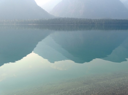


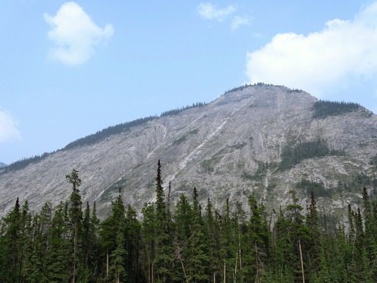
Muncho Lake, BC (No. 3)
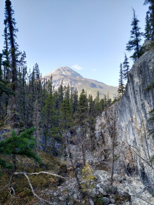
Muncho Lake Provincial Park is a provincial park in British Columbia, Canada, located on the Alaska Highway as it transits the northernmost Canadian Rockies west of Fort Nelson. The park is part of the larger Muskwa-Kechika Management Area.[2] It is named after Muncho Lake, which is in the park and is both the name of the lake and of the community located there.
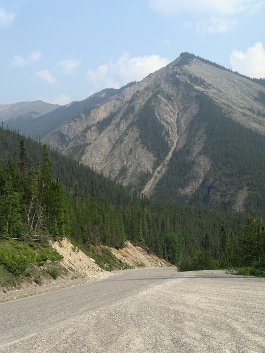
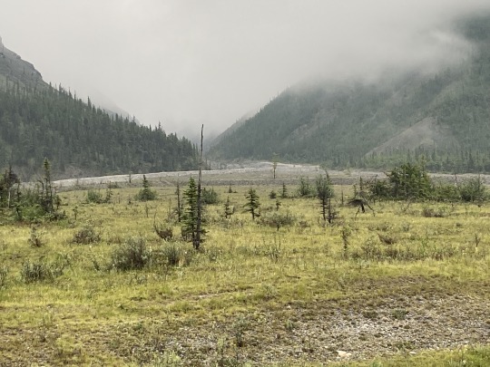
Folded mountains, geological formations, are visible above the road in the southern part of the park.
Source: Wikipedia
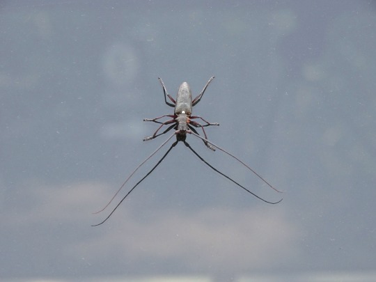
#White-spotted sawyer#Muncho Lake#Muncho Lake Lookout#Sentinel Range#BC#travel#original photography#vacation#tourist attraction#landmark#landscape#countryside#British Columbia#woods#forest#nature#flora#tree#wildfire smoke#summer 2023#Canada#boreal forest#Canadian Rockies#Rocky Mountains#Northern Rockies#Alaska Highway#rocks#insect#reflection#Muncho Lake Provincial Park
21 notes
·
View notes
Text
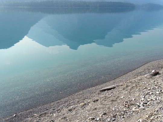
Dried creek bed, near Muncho Lake British Columbia, Canada
#photography#nature#landscape#creek bed#mountains#british columbia#canada#muncho lake#conifers#alpine#north#my photos
2 notes
·
View notes
Text
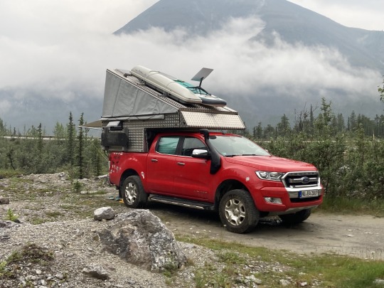
Airstreaming to Alaska - Chapter 10: The Alaska Highway
We finely made it to the Alaska Highway! The AlCan was born to be a military supply route, but it grew up to be a story-teller. This unforeseen attribute – like an E-ticket ride at Disneyland – had us riveted from Mile-0.
Posted October 7, 2022 – Narrated by Carmen
To listen to the podcast, click the play button
Chapter 10 of the “Airstreaming to Alaska” series.
“To travel hopefully is better than to arrive, and the true success is to labour.”Robert Louis Stevenson from the essay, El Dorado
The Alaska Highway was born to be a military supply route, but it grew up to be a story-teller.
Just Leaf Me Bee by…

View On WordPress
#Airstream#Airstream Blog#Airstream Life#Airstream Travel Blogs#Airstreaming#alaska highway#AlCan#Beaubeaux#Chetwynd#Dawson Creek#Fort Liard#Full-time Airstreaming#Full-time RV Living#Full-Time RVing#liard river hot springs#Living in Beauty#living simply#Living the Dream#muncho lake#Peace river#simple living
2 notes
·
View notes
Text
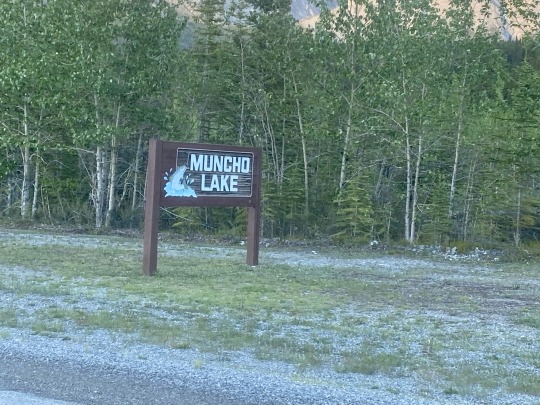
Muncho Lake, British Columbia, Canada
1 note
·
View note
Text

muncho lake provincial park, bc
#muncho#lake#provincial#park#muncholakeprovincialpark#northern#bc#britishcolumbia#Rockies#glacier#mountains#nature#roadtrip#adventure#summer#July#2022
16 notes
·
View notes
Photo
Muncho Lake [OC] [4898 × 3265]
3 notes
·
View notes
Text
Hey travellers and (so-called) Western Canada residents of tumblr!
I’m planning a road trip with a bunch of friends throughout BC, Canada and into the NWT and Yukon…I want to be able to tell spooky stories at campfires about local legends and haunts, but LITERALLY all anyone talks about is how haunted Vancouver and Victoria are, as if that’s some kind of secret. Some places I’m totally stumped on are:
Prince George, BC (note: I do already know a fair amount about the highway of tears)
Fort St. John, BC
Dawson Creek, BC
Muncho Lake, BC
Fort Liard, NWT
Watson Lake, YK
Carcross (note: I know about the hotel and hope they’re open again when we go!), YK
Kluane National Park Reserve, YK
Atlin, BC
Anywhere along the Stewart-Cassiar Highway
The Hazeltons
Nisga’a Territory
I’d super appreciate any stories you’ve got to tell! Share your spookies!
#scary stories#haunted bc#British Columbia#northern bc#strange encounters#share stories#travel#travel stories#western Canada#Northwest Territories#Yukon territory#northern Canada#haunted Canada#ghost stories#ghostly encounters
4 notes
·
View notes
Text
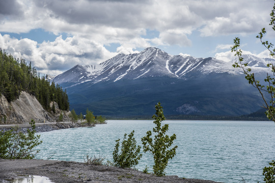
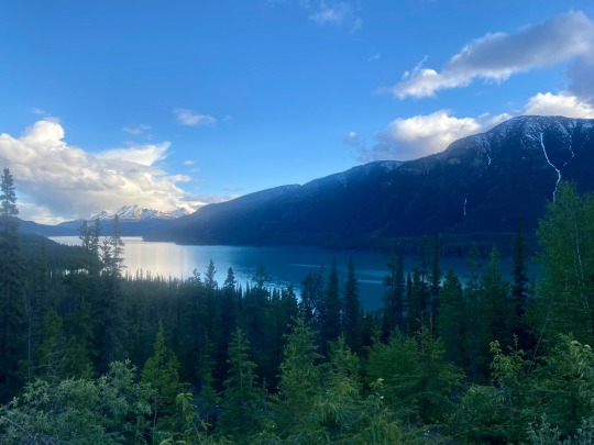
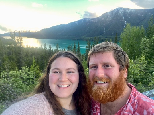
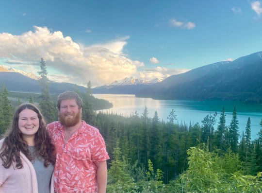
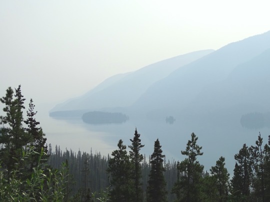
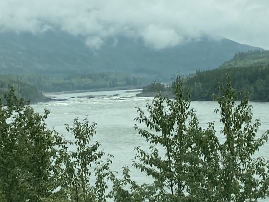
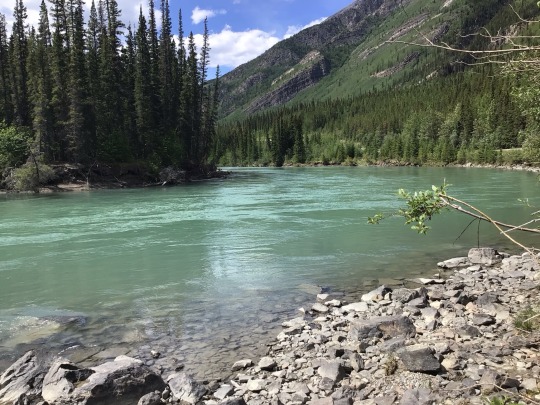
We then made our way to the Muncho lake lookout and it was absolutely gorgeous. Amazing turquoise water surrounded by mountains. So pretty 😍
June 12, 2022

3 notes
·
View notes
Text


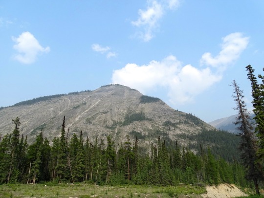
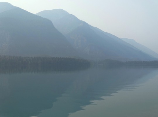
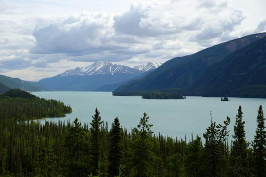
Muncho Lake, BC (No. 1)
Muncho Lake is a highway services community in northern British Columbia, Canada, located at Mile 462 on Highway 97, the Alaska Highway, within Muncho Lake Provincial Park and on the south end of the lake of the same name. The community consists almost entirely of travel and tourism-related businesses such as lodging, game outfitting, restaurants, gas stations and fishing outfitting.
Source: Wikipedia
#Muncho Lake#Muncho Lake Lookout#Sentinel Range#BC#travel#original photography#vacation#tourist attraction#landmark#landscape#countryside#British Columbia#woods#forest#nature#flora#tree#wildfire smoke#summer 2023#Canada#boreal forest#Canadian Rockies#Rocky Mountains#Northern Rockies#Alaska Highway#rocks
24 notes
·
View notes
Text
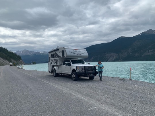
Alaska Highway
Day 26 -
It rained during the night, so our awning and carpet were wet when we got up. We packed up started on our way to Liard Hot Springs, grey skies and it looked like nasty weather ahead and sure enough, we drove through some heavy rains.
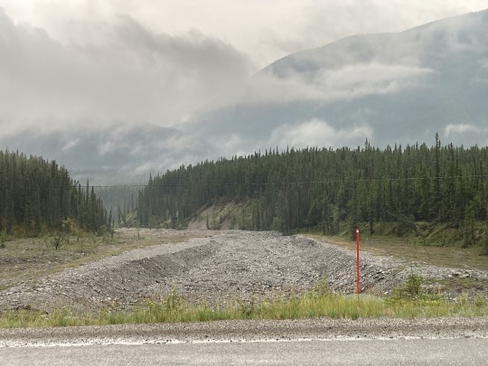
At around KM990 of the Alaska Highway we came upon a road washout which was mostly repaired. The cause of this washout made international news due to the fact that this was caused by the break of a massive beaver dam up river, which released the water from a substantial lake formed by this beaver dam. The wall of water came down through the gorge and wiped out 150m of highway. The Canadian Beaver strikes again!
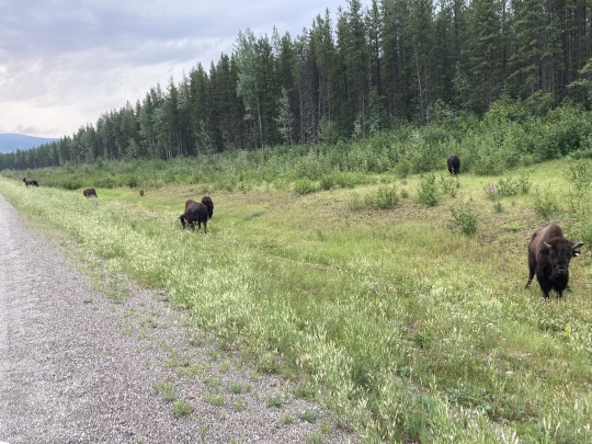

We came upon a small heard of buffalo grazing along the road, beautiful animals and looking healthy. Campers and motorhomes all stopping to take pictures. It was the most wildlife we saw in one place during the whole trip.
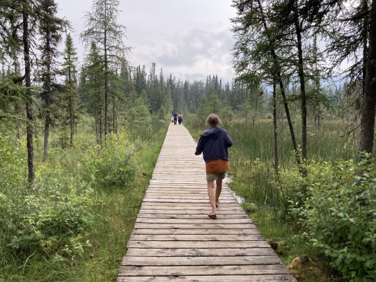
We arrived at Liard Hot Springs around 10am for a soak, paid $5 each for the park entry. There is a small campground here, fenced off with an electrified 2m high fence to keep out the bears and the campers safe. We walked through a gate and then along a boardwalk across some wetlands for 10 minutes to arrive at the pool, it’s actually a pond in the forest fed by the hot spring.


The water was about 38-39c, very pleasant. There are little side arms in the pond where some cold water trickles in, beautiful. We met friends from Kimberley, who were on their way north to Fairbanks Alaska.
Shortly after leaving Liard we drove through the the north end of the Rocky mountain range where we encountered some heavy rains until well past Muncho Lake. The highway crossed over some major washouts that happened in the past. What surprised me was the frequency of these washouts they came down from every side valley. It must be caused by heavy rains during spring run off. The low hanging clouds and fog deprive us of all the beautiful mountain views.

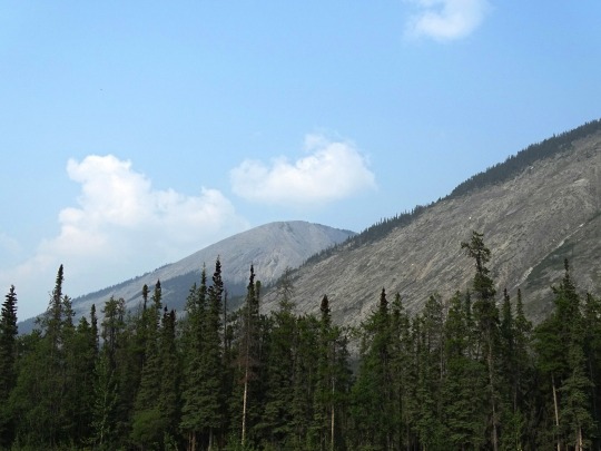
We drove past Toad River and through Stone River Provincial park. The mountain sides and side valleys are all very steep and rocky. At the Summit Lake there is camping and lots of hiking trails into the side valleys and around the lake. There were lots of campers set up for a stay.

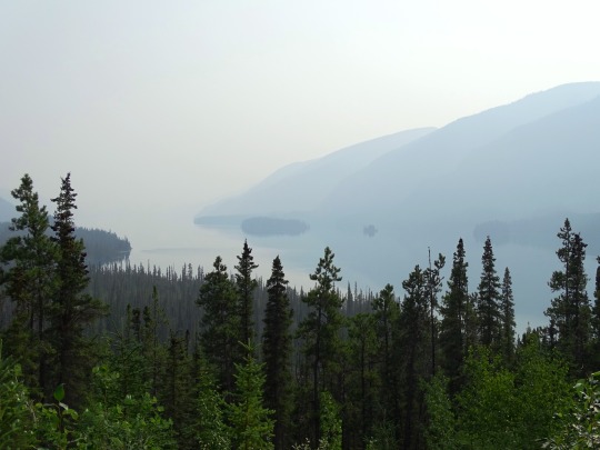
From Tetsa River to Steamboat we’re getting into the foothills of the rockies and the smoke is getting thicker from the forest fires to the NE of here. The rain is easing off as we got to Beaver Lake and then another 30k to Fort Nelson where it was dry.
We stayed overnight at the Blue Bell Inn and Campground. The campground was a bit sketchy but the bathrooms and showers were nice and clean. There was a bit more rain overnight.
0 notes
Text
Apply now: https://canadianjobbank.org/front-desk-clerk-hotel-2/
0 notes
Text
Day 19 June 15 Liard Hot Springs - Toad River 120kms
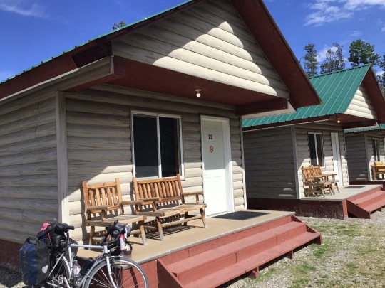
Fortunately the marauding bears didn’t make an appearance last night. Apparently the ranger had chased them away.
I think I managed quite well with my rustic accommodations yesterday but I can tell you, I’m absolutely loving tonight because my cabin is perfect! It’s not cheap but I finally has everything and even a view of the lake out the window.
However…..I really earned it today.
The first 40kms crawled by today. There were nice views of rivers, but the road ahead showed what was coming.

At 35kms was a very long, quite steep climb. As usual I just put Shirley in granny gear and crawled up. I was rather stressed thinking that there would be more of these hills ahead.
I was looking forward to a break today at Muncho Lake. I didn’t realise how absolutely stunning the lake would be.

On the downhill approaching Muncho Lake Lodge there were these goat things.
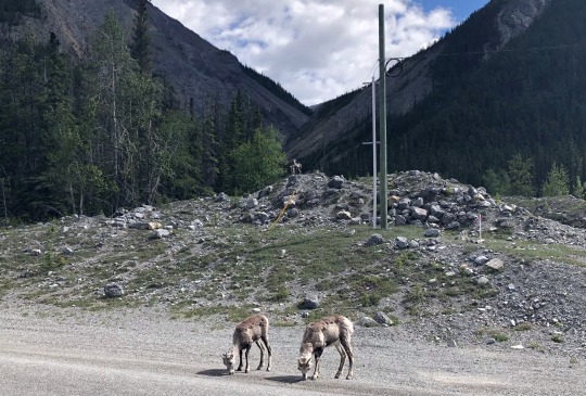
I was amazed at how brazen they were. They didn’t even run away when a huge semi trailer drove by. The traffic here is very conscious of wildlife and either stop or go very slowly when there is anything near the road. I shared a smile with the semi driver as he tried to manoeuvre his huge vehicle past the goats without scaring them away. He succeeded!
The lodge was just down the road a few kms past another abandoned place.
There are a lot of these here. It’s a bit sad that so many have gone out of business…especially for me. I need them!
I was looking forward to some good cake but there was only an ice cream to go with my coffee. At least I had coffee and a nice lounge to sit on. It would have cost about $300 Australia to stay the night at that place so obviously, I had to go further.
The ride around the lake was not a hardship.
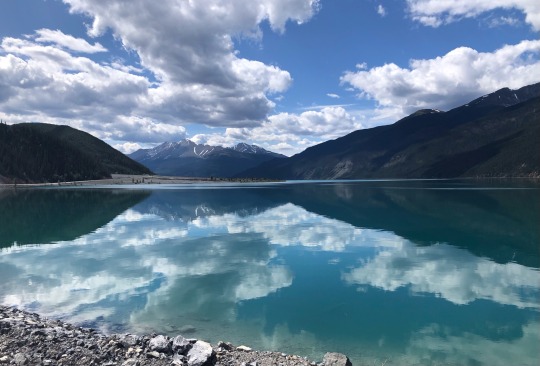
It was a blissful flat ride looking at the amazing jade colour of this beautiful lake.

There was another place a bit further on which had accommodation. If I had a phone that worked I probably would have booked it. Since I am usually under pressure, using someone else’s phone , I just book the first thing I can get.
It was at 67kms and I really wanted to stop there for the day but the people were not very welcoming. I went in and purchased this incredible cinnamon scroll.
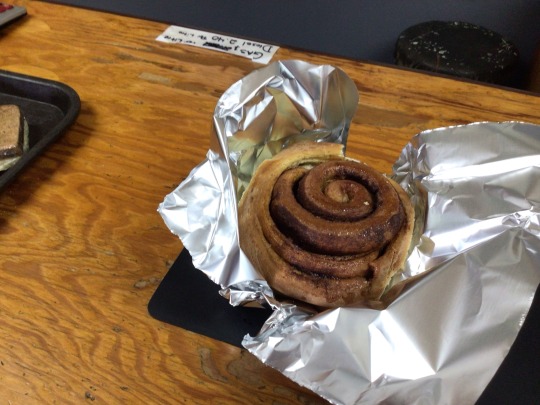
All the bakers here compete to make the best scroll. This one was pretty good. I had a nibble before I pushed on to try to improve my mood. My heart just wasn’t in cycling another 50 something kilometres. I grumped my way up the next kms dreading another steep hill like the morning. I would have been really happy to accept a lift if anyone had offered. They didn’t.
After about 10kms of slow going I reached the top and was rewarded by a fantastic downhill run. This lifted my spirits a lot and I allowed myself another break sitting on a rock looking and listening to this gorgeous crystalline river….and nibbling some more of my scroll.
Only 25kms to go I pushed on with a much more positive attitude. The road was running along the river

so I began to stop dreading another huge climb. There were a few bumps but nothing major.
It was a great relief to finally reach this place and find a well equipped spacious cabin…..with a really good shower!!
I don’t have anything to cook for dinner except some broccoli. I’ll have that as an entree then head over to the restaurant.
Here is the photo of the bison which came through from my phone.

I might even wander around the RV’s and see if anyone is going my way tomorrow!
0 notes
Text
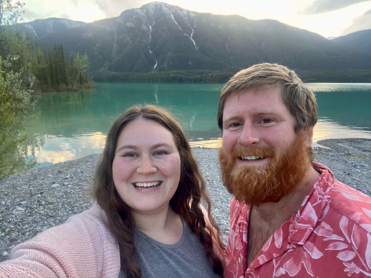
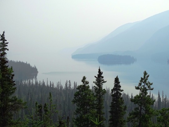
Muncho Lake, British Columbia on the Alaska Highway.
3 notes
·
View notes
Photo
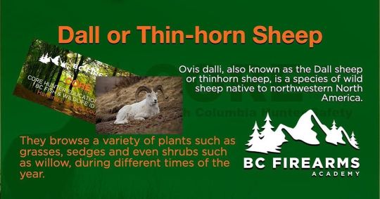
STONE'S SHEEP The Stone's sheep or stone sheep is the more southern subspecies of thinhorn sheep, Ovis Dalli. BOOK YOUR CORE EXAM HERE The global population of Stone's sheep is primarily found in Northern British Columbia. It can often be seen licking minerals along the side of the Alaska Highway in areas such as Summit Lake, Stone Mountain Provincial Park, and Muncho Lake Provincial Park. Pelage colour variations range widely, from slate grey-brown with a white rump patch, dark tail and white on the inside of the hind legs, to an almost entirely white/grey-white coat with a dark or black dorsal surface on the tail. Horns are curved in form and vary in colour from yellowish-brown to dark brown horns. (at BC Firearms Academy - Surrey) https://www.instagram.com/p/CmhpmY_yVgB/?igshid=NGJjMDIxMWI=
0 notes
Text
Unusual cold in store for B.C.'s north, Lower Mainland this weekend: Environment Canada
Environment Canada is expecting unusually cold temperatures and frigid winds across northern B.C. and the Lower Mainland this weekend, warning conditions up north could decline to extreme cold and "dangerous" wind chill in the next week. A series of special weather statements on Friday said Arctic air, blasting wind, and plummeting temperatures would settle over the far north and stick around for several days.
"Temperatures will remain extremely cold through next week," said meteorologist Derek Lee, adding that wind chill values could be "dangerous."
"The coldest temperatures are likely to be from Monday to Wednesday," Lee said, adding that the area from Peace Region to Fort Nelson could see overnight lows of -40 C. Overnight lows of -35 C are possible in Prince George and the Cariboo.
The weather statements cover Haines Road, Atlin, Teslin, the Cassiar Mountains, Dease Lake, Watson Lake, Muncho Lake Park, and Fort Nelson in the far north. Similar alerts are also in place further south, where cold winds are expected to hit the Williston and Peace regions. Prince George could see temperatures as low as –28 C over the weekend.
Further south, snow is in store for the Lower Mainland over the next few days. Vancouver is expecting a combination of rain and snow over the weekend and throughout much of next week, with a daytime maximum of –5 C on Tuesday. Environment Canada said precipitation will fall Saturday as light flurries or showers. The amount will depend on temperature and elevation, but the agency said residents can expect roughly two to four centimeters of snow on average.
An Arctic front from the B.C. Interior will bring "a period of heavy flurries" to the South Coast on Sunday. "The cold will linger up to midweek next week," said Lee.
"The daytime temperatures don't really make it above freezing, and even colder are the nights, so any precipitation that falls during this time, beginning this weekend, has a high chance of being flurries or snow."
The province said drivers on the South Coast should stay off the road in poor conditions. If they must travel, they should pack an emergency kit and make sure their vehicle has proper snow tires. "Drivers are reminded to plan ahead and drive according to weather and road conditions." "Commuters should be prepared for delays and potential service disruptions on transit routes," it said Friday in a statement.
The statement said health authorities should be sharing information on shelters and warming centers across the province.
Lee said meteorologists aren't sure exactly when that snow will arrive, but up to five centimeters of fresh snow is possible for Metro Vancouver and up to 10 centimeters in the Fraser Valley. Temperatures will drop to five or 10 degrees below the seasonal average, the agency added.
People who live in any of the affected regions should continue to monitor alerts and forecasts, Environment Canada advised.
A bigger dump of up to 25 cm blanketed the south coast and Vancouver Island at the end of November, leading to rush-hour crashes that blocked major roads. Surrey County Councilwoman Linda Annis was one of those trapped in the Nov. 29 gridlock. She says it took her 9.5 hours to get from Vancouver to South Surrey.
"A very, very long, frustrating trip." And for me, I quickly realized that I had no way to get home. "All the access points for going over the Fraser River were closed or stuck with vehicles,'' she said.
Annis and New Westminster City Councilman Daniel Fontaine are calling for a "snow summit'' to come up with ways to avoid a repeat. They want to involve the province, Metro Vancouver, municipalities, first responders, and road maintenance contractors. Annis and Fontaine wrote to Transportation and Infrastructure Minister Rob Fleming and the chair of Metro Vancouver's regional district pitching the idea last week but have yet to hear back.
The Ministry of Transportation and Infrastructure says in a statement that it is aware of the request, but neither it nor Fleming have been formally invited to participate. The ministry says it reviewed its response to the November snowfall and has worked with Lower Mainland contractors to improve the deployment of plows and tow trucks.
"Ministry staff have also already reached out to their counterparts in Lower Mainland municipalities to discuss winter weather response, strengthen communication lines, and share information on our level of preparedness based on available weather forecasts,'' it said.
0 notes
Text
Dtawing Challenge
So I decided to do something pretty crazy and do a project based around the concept of the Pan-American highway. It'll involve my OC Josephine journeying up from the (well one of them, at least) southern terminus all the way up to the north of Alaska. I've also planned it such that it will be done within 100 drawings exactly. There will be a surreal twist to this, and a friend (or two) may join her along the way.
Here is the full list of locations in order (also I like funny names):
CHILE
Quellon
Puerto Montt
Los Angeles
Concepción
Santiago
Valparaiso
Viña Del Mar
Antofagasta
Iquique
PERU
Tacna
Lake Titicaca
Cusco
Machu Picchu
Nazca
Lima
Piura
ECUADOR
Machala
Guayaquil
Manta
Quito
Middle of the World City
Tulcan
COLOMBIA
Pasto
Cali
Bogotá
Medellín
Turbo
PANAMA
Darién Gap
Yaviza
Bayano Lake
Panama City
Panama Canal
Santiago de Veraguas
David
COSTA RICA
Paso Canoas
Uvita
Cartago
San José
Peñas Blancas
NICARAGUA
Rivas
Jinotepe
Managua
Esteli
El Espino
HONDURAS
San Marcos de Colon
Choluteca
Tegucigalpa
San Lorenzo
El Amatillo
EL SALVADOR
San Miguel
San Salvador
Santa Ana
GUATEMALA
San Cristobal
Jutiapa
Cuilapa
Guatemala City
Quetzaltenango
La Mesilla
MEXICO
Comitán
San Cristobal de las Casas
Tuxtla Gutiérrez
Salina Cruz
Oaxaca
Tehuacán
Puebla
Mexico City
Tampico
Ciudad Victoria
Monterrey
Nuevo Laredo
UNITED STATES (CONTIGUOUS)
Bigfoot
San Antonio
El Paso
Truth or Consequences/Elephant Butte
Albuquerque
Santa Fe
Colorado Springs
Denver
Cheyenne
Billings
Helena
Great Falls
Sweet Grass
CANADA
Lethbridge
Calgary
Red Deer
Edmonton
Dawson Creek
Fort St. John
Muncho Lake
Whitehorse
Destruction Bay
Canada-Alaska Border
UNITED STATES (ALASKA)
Northway Junction
Delta Junction
Fairbanks
E. L. Patton Yukon River Bridge
Coldfoot
Prudhoe Bay
0 notes
Last Seen Blogs
spookebich
Lesbian Gutter Brain

katawl
⊹ ࣪ ˖ KATA

communicores
communicores

the-arty-one
TheArtyONE!

knoxyb
Ad Astra Per Aspera