#Satellite image
Text

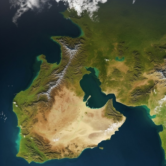
Los Angeles harbours, 1982. AD Los Angeles special episode
Scan
568 notes
·
View notes
Text
Saharan Dust
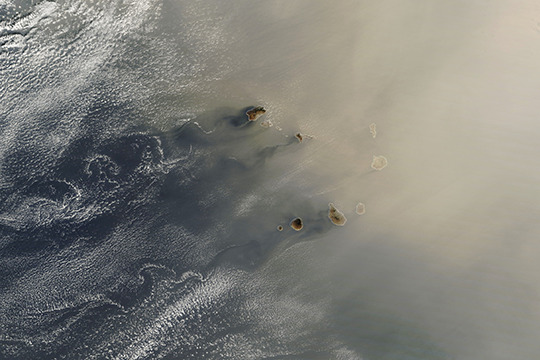
In late January, dust from the Sahara blew westward toward the Cabo Verde archipelago before turning northward toward Europe. During winter and spring, Saharan dust tends to stay at lower altitudes, where it can be carried by the northeast trade winds. (Image credit: L. Dauphin; via NASA Earth Observatory)
Read the full article
136 notes
·
View notes
Text

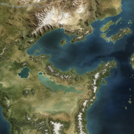


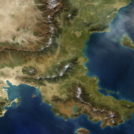
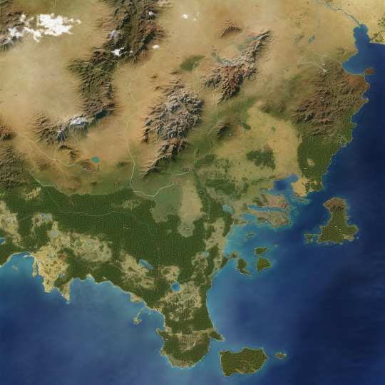
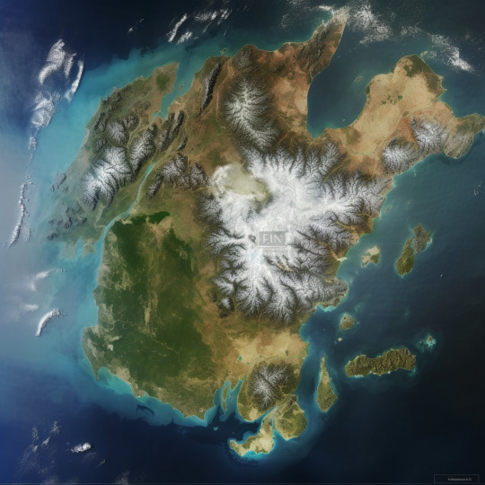
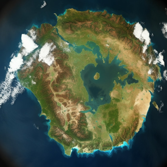


Did you know you can use AI to make fantasy world maps?
I used the /blend function with satellite images, mainly of Europe and parts of Europe. Then I used /imagine with a fairly basic command to make a 'fantasy map.'
The results speak for themselves.
I have quite a few more. The fact that I haven't posted them doesn't mean they were poorer. There are just too many.
Nevertheless, you can still see where real world geography pokes through. The outline of Arabia is obvious in at least two maps and you can see where the Japanese Islands and the Korean Peninsula were the source maps for an eastern coastline.
By Midjourney
#AI Art#Midjourney#satellite image#image blend#fantasy world map#world map#fantasy map#Asdaricus MJ Fantasy World Map
8 notes
·
View notes
Text

mozambique
3 notes
·
View notes
Text
Australian volcano near Antarctica captured on satellite spewing lava
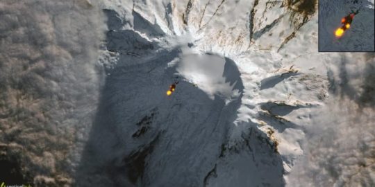
(image source)
“One of Australia’s two active volcanoes on an island near Antarctica – known as Big Ben – has been spotted by satellite spewing lava.
The lava flow on the uninhabited Heard Island, about 4,100 kilometres south-west of Perth and 1,500km north of Antarctica, is part of an ongoing eruption that was first noted more than a decade ago.
The image was caught by the European Space Agency’s Copernicus Sentinel-2 satellite on 25 May [2023] and is a composite of an optical picture and an infrared image.”
continue reading article
#antarctica#volcano#lava#ice#volcanic activity#australia#ESA#infrared#infrared image#composite photography#earth#volcanism#earth core#earth magnetic field#sun#solar energy#solar system#satellite image#nature#energy
2 notes
·
View notes
Photo
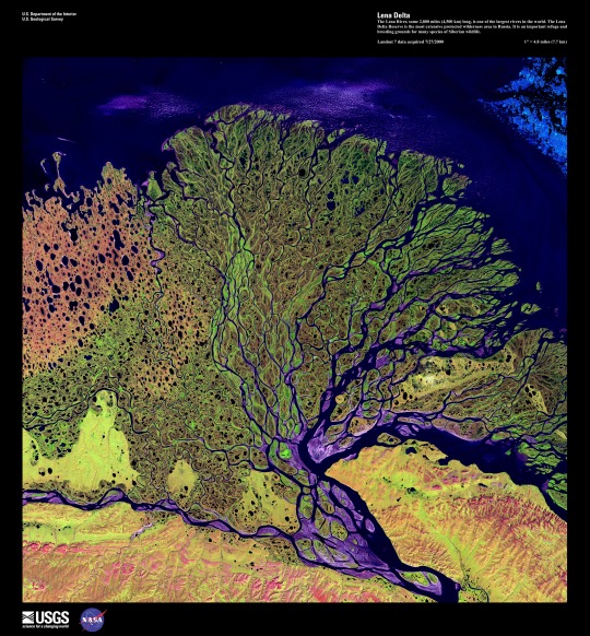
#usgs#nasa#river#gis#remote sensing#environmental engineering#lena delta#color composition#satellite image
1 note
·
View note
Photo
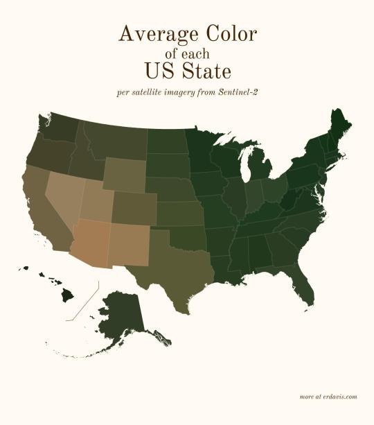
Average color of US states based on satellite imaging.
96K notes
·
View notes
Text


https://botsin.space/@weirdsatellite
1 note
·
View note
Video
Wildfires in Sicily da European Space Agency
Tramite Flickr:
Wildfires around the city of Palermo in Sicily, Italy, captured by the Landsat-8 mission on 25 July 2023. Data from the mission's SWIR bands, which penetrate the smoke of the fire, has been overlaid on the optical image to provide a clearer view of the fire front and affected area at the time of the acquisition. Credits: USGS/ESA
#ESA#European Space Agency#Space#Space Technology#Earth from Space#Observing the Earth#Earth Observation#Earth Explorer#Satellite image#Wildfires#Sicily#Sicilia#Italy#Italia#Palermo#Fire#Landsat-8#flickr
0 notes
Text

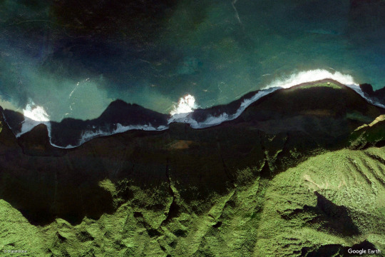
earth views
#nature#photography#mountains#google earth#satellite images#green#blue#ocean#beach#sea#landscape#landscapes
8K notes
·
View notes
Text


So that comic huh
#Toontown Corporate Clash#TTCC#Bellringer#Benjamin Biggs#Satellite Investors#Plutocrat#Cosmo Kuiper#Shitpost#I debated on whether to include the last image since it's literally unedited#Only included it to complete the meme
435 notes
·
View notes
Text
I wish there was a chill farming/crafting/exploring rpg type game based on Dinotopia.
The initial premise of the books is PERFECT for it really.
You wash up on a mysterious island, and have to learn to fit into the society because returning home is impossible....
Your initial choices determine which area of Dinotopia you're directed to to live, and what life you make.
Its been so long since i read the books but they're so BRIGHT and joyful and creative! Plus DINOSAURS. And the dinosaurs are fellow people!
#idle thoughts#Dinotopia#i've been wistfully looking at the books on the author's website#i waaaant them#i think it works better if Dinotopia is like– an alternate reality reached through a one way portal tho#than an actual island on earth#just bc i think it would be noticed by now with satellite imaging and all that since it kind of a BIG island
65 notes
·
View notes
Text
Fire in Ice
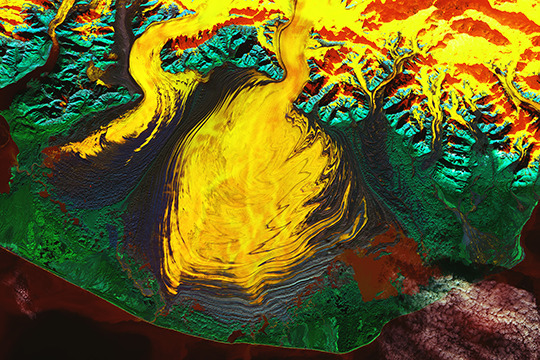
This false-color satellite image of Malaspina Glacier (Sít’ Tlein) is a riot of color. Composed of coastal/aerosol, near infrared, and shortwave infrared bands from Landsat 9, the colors highlight features otherwise hard to identify. (Image credit: W. Liang; via NASA Earth Observatory)
Read the full article
72 notes
·
View notes
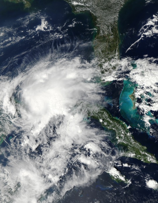
Text


Images showing the eye of Major Hurricane Beryl Category 4 captured by the Sentinel-2 satellite yesterday. If you look closely you can see whitecaps on the ocean!
#hurricane beryl#hurricane season#hurricane#storm#photography#satellite#weather#space#cyclone#radar#image#photo
55 notes
·
View notes
Text

New profile pic
#elden ring#spiritcaller snail#you would not believe how high res that moon actually is#I have a blend file with 2 gb of satellite imagery maps to create an actual moon that I rendered for this image#why did i not get it from google?#great question!#next question
26 notes
·
View notes
Last Seen Blogs

packetsofbones
|May2022|⚠︎ᗴ𝕕|
frostsummer
???

pierre-asianman
題名未設定

emommy
emmy

arsenalsquid
🔞meow meoww🔞