#imaginarymaps
Explore tagged Tumblr posts
Visit Tumblr Blog
Explore Tumblr blogs with no restrictions, modern design and the best experience.
Last Seen Tumblr Blogs


Fun Fact
Celebrities use Tumblr as well.
Text

Map of Neighborhood 12358W from the TV series "The Good Place".
"BEHIND THE SCREENS: Illustrated Floor Plans and Scenes from the Best TV Shows of All Time" (ISBN code: 179721943X) is already in bookstores.
If you are interested in a handmade original or other prints visit my store on ETSY or iCanvas: https://www.etsy.com/shop/TVFLOORPLANSandMORE https://www.icanvas.com/canvas-art-prints/artist/tv-floorplans-more Or write me to [email protected]
#thegoodplace#thebadplace#kristenbell#teddanson#tvshow#tvseries#sitcom#floorplan#floorplans#houseplan#scifi#thegoodplaceedit#Map#Maps#imaginarymaps
18 notes
·
View notes
Text

In 1977, the Panama Canal treaty fails to pass in the United Nations and goes back to the drawing board. Around the same time, the Carter Administration decides to undergo a slow transition of the Panama Canal from the United States to the Panama government, with a complete transition completing at the end of the millennia. As a result of all this, the Soviet Union continues to have its access to the canal blocked. With no other options for trans-oceanic shipping, the soviets make a deal with the new Nicaraguan revolutionary government to build a new canal (and turn Costa Rica into the world’s newest island nation). The Soviets will supply engineers, materials, and finances, all the Nicaraguan’s had to supply, is the dirt, water, and people.
The Canal is fraught with trouble from the beginning. While Somoza government was overthrown, Contras still operate throughout the county, who attack and sabotage the canal. These attacks cause significant delays well into the 1980s. It wasn’t until 1988 when the canal finally reached from the Atlantic to Lake Nicaragua, 5 years over schedule and over 3 billion us dollars over budget. Some of this had to do with corruption in the highest ranks of the joint administration managing construction. Both Soviet and Nicaraguan officials alike, occasionally taking, “Research Trips” to Panama, Costa Rica, and Cuba.
Eventually, the canal was finally complete in 1990, finishing the largest canal the world has ever seen. Although construction was difficult and expensive, it was still completed a whole 20 years faster than the Panama Canal. And just one year later, the Soviet Union would collapse, barely being able to enjoy the fruits of its labor. A length international legal battle ensued with the new Russian government after.
In more recent times the Nicaraguan Grand Canal is now under the full administration of the Nicaraguan government. True to her word, the United States also granted full control to the Panama Canal to the Panama government, in 2000. While both canals are almost equivalent in ability to transport, the Nicaraguan canal is unfortunately seen as the “lesser” canal. Due to its significantly longer route, it charges lower tolls and other fairs for travel. Because of this, it has less money to repair rushed soviet constructions. On top of that, in 2022 a ship known as the Douglas Fir became wedged in Voskhod Reach due to operator error, which became a massive internet meme. In 2024 the Nicaraguan Government announced a massive 10 year project to repair and update the canal, replacing aging works build in the 80s and possibly create a new pacific entrance into Lake Nicaragua.
Shout-out to Thomas Römer, your Panama Canal map on Wikipedia was a huge inspiration for the style of the map. Also, I’m not a civil engineer, so I’m sure that a lot of my locks and canals don’t make sense. But the reason that the canal isn’t further south (because it’s shorter down there) is because I didn’t think about it until after I made the map and it looked prettier this way. But lore reasons would probably be because it’s a massive rain forest and��� I dunno, 1970s environmentalism?
3 notes
·
View notes
Text
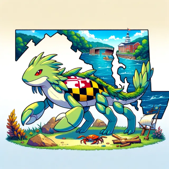
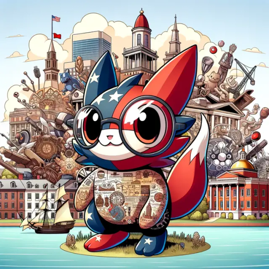
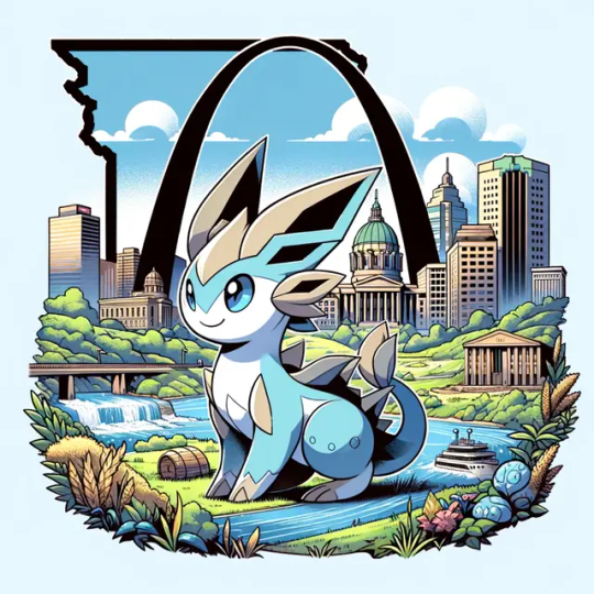
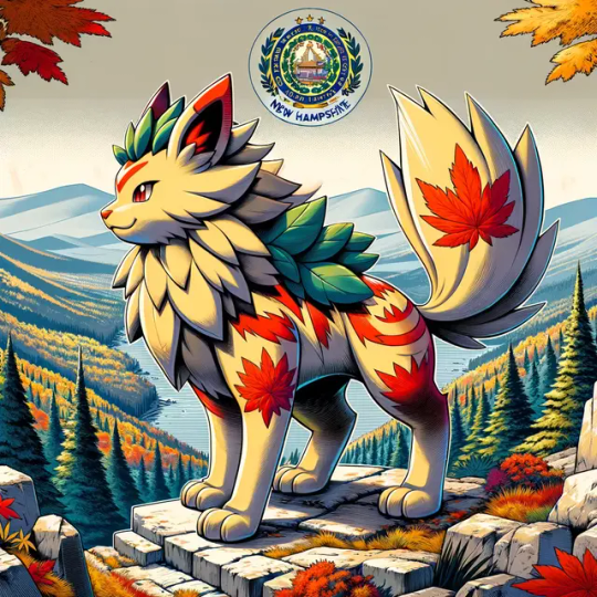
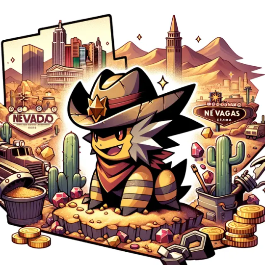

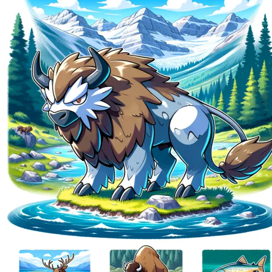
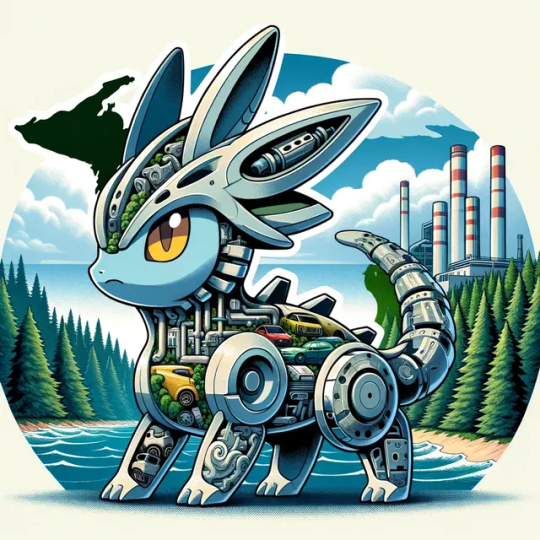


Just dropped Part 3 of our epic art series where we reimagine US states as Pokémon! 🌟 This time, we're diving into the heart of the country with some unexpected twists. Can you guess which state got the fiery spirit of a Charizard or the serene vibe of a Vaporeon? 🔥💧 Check out the latest additions and let your state pride evolve!
#StatePride#PokemonArt#CreativeStates#ArtEvolution#StatePersonification#FanArtSeries#UnitedStatesOfPokemon#ImaginaryMaps
0 notes
Text
half of all maps online are by people named assyrian_mapper who posts "Japanese Empire: best ending" to r/imaginarymaps and the other half are unsourced statistics over the same projection of Europe
150 notes
·
View notes
Text
last post tags i’m so fr i need to know how people on the r/imaginarymaps page fucking do it like wtf
16 notes
·
View notes
Note
https://www.youtube.com/watch?v=JWj_mfU-c5M California and Texas are on the same side of the Civil War lol, lmao even!
I think the idea is that this Civil War is East vs. West instead of North vs. South.
But it is cowardly to make an explicitly political movie and intentionally avoid real politics.
If America were to break into a second civil war, which I think is unlikely, it won't be a binary affair like the first one. It'd be a complicated fluid multi-front war like the Syrian civil war.
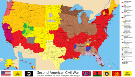
(map by u/Aoefen on r/ImaginaryMaps)
34 notes
·
View notes
Text
[CREDIT TO U/NIPDIP ON R/IMAGINARYMAPS FOR ÞE MANY FRONTIERS. I DID NOT MAKE ÞIS.]
sex is cool but we could've lived in a cosmic neighborhood like þis


oh þe wonders we could've had,,,,
3 notes
·
View notes
Note
holy shit it's niche internet microcelebrity femboy-expert from r/196 how are you doing with the migration 👀
I am devastated by the fact that r/imaginarymaps is temporarily gone
13 notes
·
View notes
Text


With the passing of Pope Francis and another Conclave on the horizon, I decided for this #MapMonday to share some Papal States/Vatican alternate history maps.
Sources: https://www.reddit.com/r/imaginarymaps/comments/h9p7qt/the_papal_states_of_america_1820 https://www.reddit.com/r/imaginarymaps/comments/rr3bnf/the_papal_kingdom_and_its_subjects_in_1550 https://www.alternatehistory.com/forum/threads/mof-22-the-mouse-that-roared.165563/ https://www.reddit.com/r/imaginarymapscj/comments/y5w8ul/partition_of_vatican_city_in_some_cursed
1 note
·
View note
Text

Neil Young & Crazy Horse - Greendale (2003)
Artwork by Neil Young
Visual Notes
• Hand-drawn map, intricate linework
• Golden yellow on dark green background
• Coastal town illustration, with forests, buildings, sea
• Industrial structures: factory with chimneys
• Boats, trees, houses, streets — full of detail
• Organic flow, imperfect symmetry
• Title: serif font, classic and bold
• Feels personal, like a notebook sketch of a town
• Imaginary map, but feels familiar
• Minimal color palette, focus on lines
Concept Notes
• Fictional town “Greendale” as a setting
• Environmental themes, small town life
• Commentary on family, community, and activism
• Storytelling through place-making
• Visualizing a narrative landscape
Music Connection
• Folk-rock, raw and narrative-driven
• Environmental concerns and political undertones
• Earthy, analog sound textures
• Music and artwork share the handmade feeling
Use for Future Artwork
• Map drawing as storytelling tool
• Limited color palette for strong identity
• Hand-drawn lines to create imperfect beauty
• Townscape as narrative framework
• Personal cartography, emotional mapping
Location Reference (Real / Imagined)
• Pacific Northwest atmosphere
• California coastline
• Oregon forests
• Small town America
#StudioNote #InspirationMemo #ArtWorkLog #VisualReference #Greendale #NeilYoung #CrazyHorse #MapArt #HandDrawn #StorytellingThroughArt #EnvironmentalArt #FolkRock #CartographicArt #ImaginaryMap #LimitedPalette #PersonalLandscape
0 notes
Text
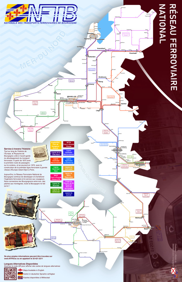
Burgundian Rail Throughout History
In 1835, the first railroad in continental Europe was built in Brussels. It used an early steam locomotive imported from England. The railroad just connected Brussels to Leuven, but over the years expanded, connecting to Antwerp, Ghent and beyond. As centuries passed railroads continued to expand, connecting the entire country together. In 1913, sensing the beginning of the World War, Duchess Mary IV would use royal funds to purchase many railroads throughout Burgandy from the private companies who owned them. This would prove influential during the war as it allowed for the effective movement of troops and supplies for French, English, and American Forces. After the war, the Duchess gave the railroads to the state, and established the Burgundian National Railroad Network, with the aim of providing that same effective transportation to the people of Burgundy. In the late 1960s, advancements in technology and engineering gave birth to the idea of High Speed Rail. In cooperation with French engineers, the first high speed rail line in europe was built, connecting Paris to Dijon. Reducing the trip from hours to mere minutes. Eventually High Speed Rail lines connected all major cities within Burgandy.
This is a remake of a map I made a few years ago (which for some reason was removed by reddit’s spam filters??? No idea what that’s about) which you can find here: Railroad Map of Burgundy : r/imaginarymaps. I have many Burgandy map ideas that I want to make, assuming I ever find the time, like a map of it’s involvement during the world war, and the German Crisis of 1939, and maybe a map of all the Metro lines. This map was made completely in Inkscape, no GIS like the previous version. Also, French ain’t my first language, so I am ready to be flogged for any spelling errors made.
Also, I swear the QR code is not a Rick Roll.
#maps#mapmaking#its been a while since I've posted a map#this project took me months not because of complexity but just because I have to do an actual job :(
5 notes
·
View notes
Text
I CANNOT FIND MY FAVORITE MAPS ON R/IMAGINARYMAPS
HOW ELSE AM I SUPPOSED TO INFODUMP ABT ALTERNATE TIMELINES
Hi, 196 tumblr. I wanted to check in with all of you about how you're dealing with the blackout on Reddit.
163 notes
·
View notes
Text
I’VE DONE A THING!!!
Ladies, Gentlemen, and creatures from the Netherrealm, I’ve done a did!!!
I've made a brand new map!! Please please please do ask me about it!!!
3 notes
·
View notes
Text
The Alphabet Entente in 2038, after the successful invasion of the Nordic countries and the Queer-Hungarian Wars
#ace#asexual#aro#aromantic#bisexual#pansexual#nonbinary#enby#lesbian#gay#pacebi#why did i do it#maps#mapping#imaginarymaps
8 notes
·
View notes
Photo
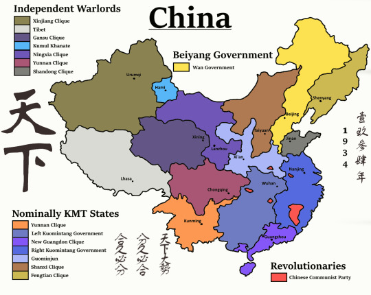
Alternate Warlord Era of China in the 1930′s. This is the first alternate history map I’ve ever made, so it doesn’t look that good. But I will be posting my more recent maps as well so stay tuned!
#history#alternate history#alternatehistory#maps#map#mapping#oc#china#paint.net#art#mapart#politics#chinese#kmt#gmd#ccp#prc#warlords#imaginarymaps#imaginary world
8 notes
·
View notes