#lone pine
Text
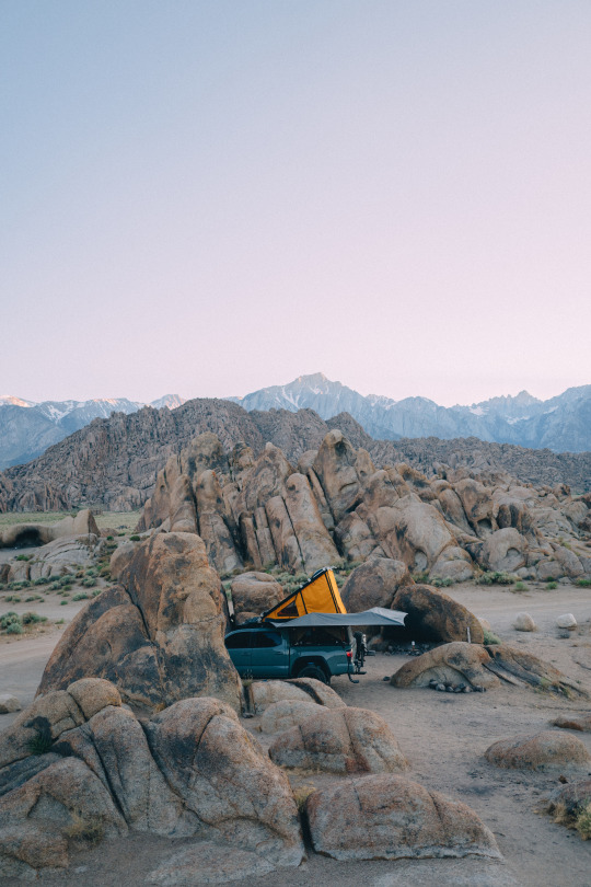
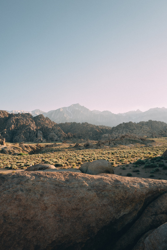
Alabama Hills
439 notes
·
View notes
Text

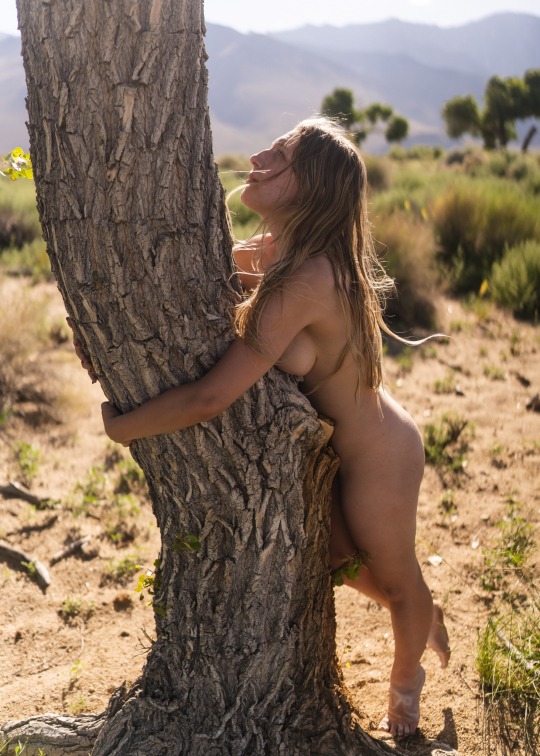
TREE OF LIFE
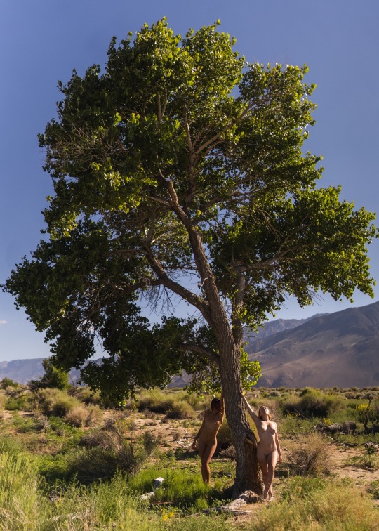
#tree of life#tree huggers#treelovers#trees and forests#california desert#lone pine#california#nudephotography#artistic nude#one with nature#nature fairy#natural woman#naturegirls#chlobody#chlobody butt#nudemodel#nude art#nature nude#nude in nature#nature girl#nature lovers#nude pose#all natural#naked in nature#naked into the wilderness#naked hiking#nude shoot#fineartnude#nudeinpublic#nude in color
331 notes
·
View notes
Text
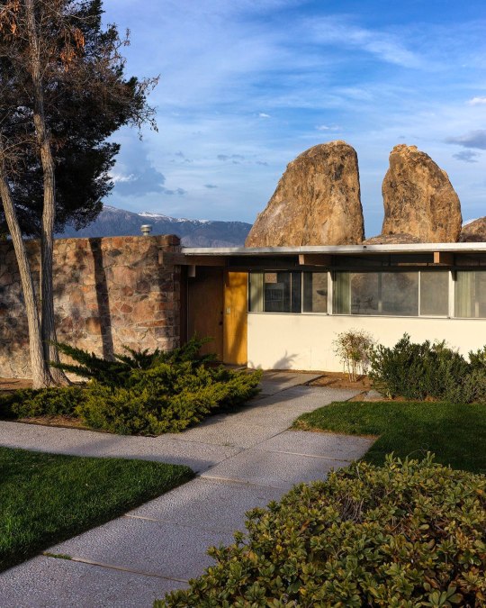

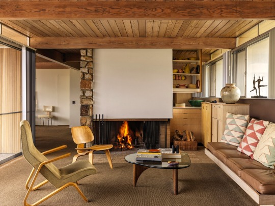


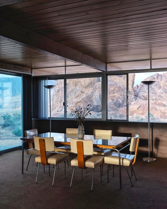
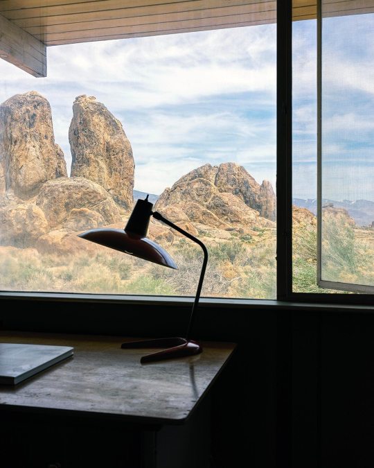
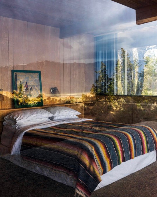
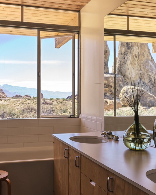
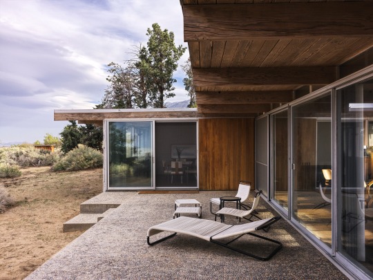


La Maison Oyler, conçue par Richard Neutra en 1959 à Lone Pine, en Californie pour Richard Oyler. Photo : Chris Mottalini. - source MCM Daily.
101 notes
·
View notes
Text
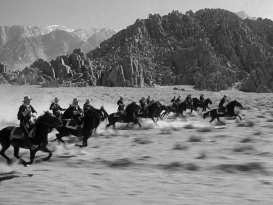

Yellow Sky
William A. Wellman. 1948
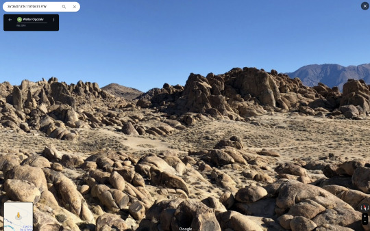
Rocks
Unnamed Road, Lone Pine, CA 93545, USA
See in map
See in imdb
#william a. wellman#yellow sky#gregory peck#anne baxter#alabama hills#lone pine#california#rocks#movie#cinema#horses#western#film#location#google maps#street view#1948
14 notes
·
View notes
Text


1865-1866.
Genocide in Owens Valley.
17 notes
·
View notes
Text


Rikuzentakata touring
20 notes
·
View notes
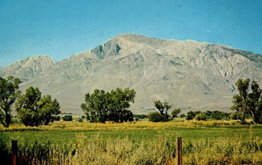
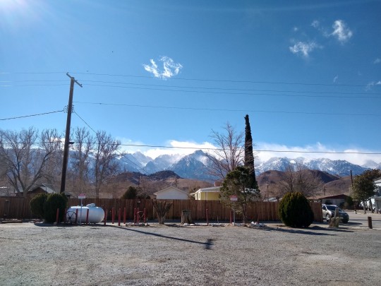
Text
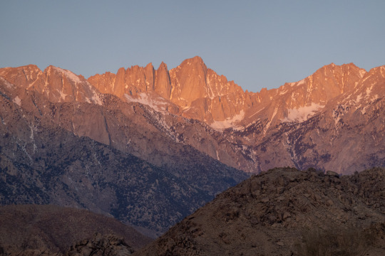
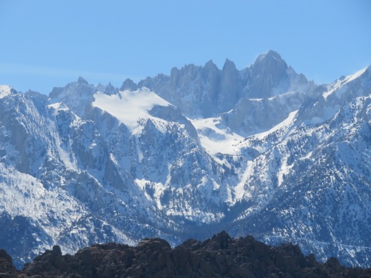
Sunrise, Mt Whitney, from Lone Pine, California.
95 notes
·
View notes
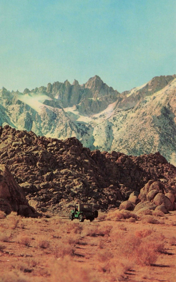
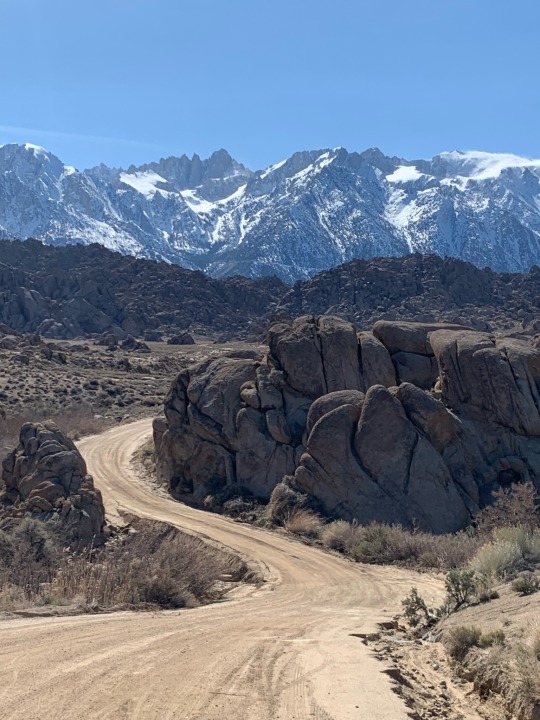
Text
Alabama Hills (Lone Pine CA)
1 April 2023

After two weeks in San Francisco, I’m on the road again, on my way to Arizona. I’ve got some ideas for rides along the way and this was one of them. Fortunately the weather cooperated, providing me a sunny, clear afternoon with the temperature in the low 60s.

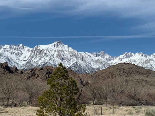
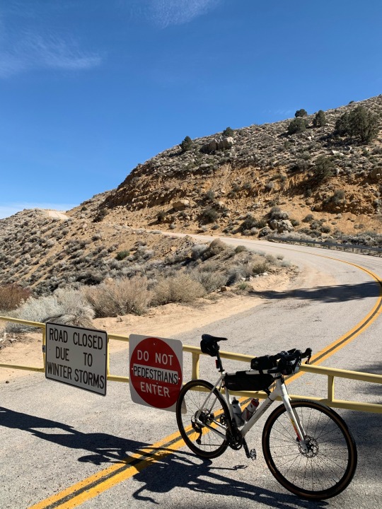

Lone Pine is in the Owens Valley, immediately east of the southern Sierras and Mount Whitney (which at 14,500’ is the highest point in the lower 48, although it’s only barely higher than Mount Rainier in Washington and Mount Elbert in Colorado). The Alabama Hills are weathered granitic knobs that protrude from the lower portion of the alluvial fans, just west of town, and have been the backdrop for many old western movies and TV shows.
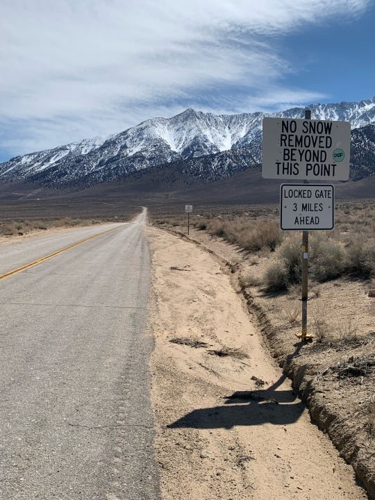
My ride climbed through the hills on Tuttle Creek Road and returned to Lone Pine on the main Whitney Portal Road. My two side trips were very different. The first was a long straight climb on Horseshoe Meadows Road to the gate that marks its current closure (a couple of miles before the first big switchbacks and probably where I would have begun seeing snow). The turnaround was right where the road reached the top of the alluvial fan and began climbing the mountains themselves.

The second detour, but also the main reason for the ride, was riding out and back on Movie Road through the main part of the Alabama Hills. It was packed with tourists (only a few others were on bikes). I think the combination of the granitic soils (grus) and some recent road grading were responsible for Movie Road being awfully sandy in places and difficult to ride. It was closed to cars just a couple miles in, apparently due to some recent washouts (yup, it’s been raining hard everywhere in California this winter), but I continued for a ways before turning around. It would have been fun to explore more of the side roads, but the sand was deep and loose and I would have been walking the bike.

25 notes
·
View notes
Text


came down with a cold exactly 1 year later 😭
low quality outtakes from lone pine and mount whitney this week (i can’t find my cable)
2 notes
·
View notes
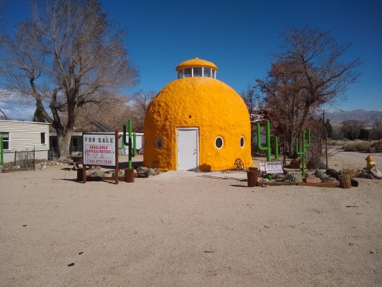
Photo
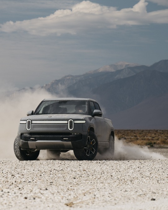
Rivian R1T in Lone Pine, CA
57 notes
·
View notes
Text
Alabama Hills
29 notes
·
View notes
Text
Lone Pine is famous for being the shooting of loads of western movies as well as some of the Tremors films and the Afghanistan scenes in Iron Man. Be careful out on the sands though; the worms in Tremors were local wildlife that invaded the set and the crew had to write a new script around them.
10 notes
·
View notes
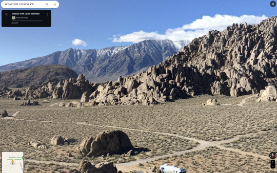
Text
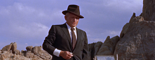
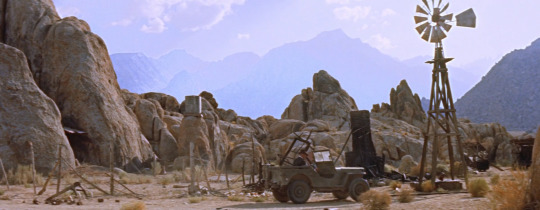
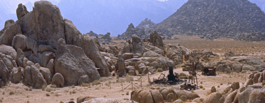
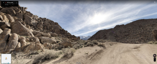
Bad Day at Black Rock
John Sturges. 1955
Desert
Horseshoe Meadows Rd, Lone Pine, CA 93545, USA
See in map
See in imdb
#john sturges#bad day at black rock#windmill#spencer tracy#rocks#california#alabama hills#lone pine#united states#movie#film#location#google maps#street view#1955
17 notes
·
View notes
Photo

Diana camera contact sheet, Sept. 2011
Death Valley & Lone Pine, California.
I've always appreciated the image-to-image flow and story that can be found in contact sheets from film negatives. In addition to scans of individual frames, I also create scans to make a contact sheet of the entire roll. I've always enjoyed seeing the physical record of all the images made on a particular roll. I was visiting folders in my Lightroom Classic catalog today that I've not seen for a while and this is one of the images I encountered again after a long time.
#black and white photography#Black and White#film photography#diana camera#diana#toycamera#contact sheet#death valley#lone pine#california
5 notes
·
View notes
Text

Another Lone Pine sunrise, Lone Pine, California (the view from the understatedly good Best Western Frontier Motel on US 395 (and no, they don't pay me to say that)).
102 notes
·
View notes
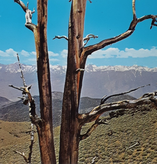
Text


A few more Sierra Nevada photos
#photography#california#sierra nevada#sierra#nature#mountains#winter#bishop#independence#lone pine#big pine#owens valley#snow#alpine#desert#landscape photography#lemon
3 notes
·
View notes
Last Seen Blogs

onairvers
ree

dykebyulyi
callie

rkivefr
i ‹𝟹 yoongi
greycappedjester
It's A Bird, It's A Plane, It's A Tumblr