#Distance matrix API
Explore tagged Tumblr posts
Visit Tumblr Blog
Explore Tumblr blogs with no restrictions, modern design and the best experience.
Last Seen Tumblr Blogs


Fun Fact
If you dial 1-866-584-6757, you can leave an audio post for your followers.
Text
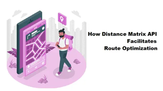
How Distance Matrix API Facilitates Route Optimization
In this digital era, efficient logistics and route planning have become vital for businesses and individuals alike. One of the many tools that have made this possible is the Distance Matrix API. This tool is instrumental in optimizing routes, saving time, reducing fuel consumption, and facilitating dynamic updates for real-time route changes. This article will explore how the distance api…
View On WordPress
#Algorithms Behind Route Optimization#Distance API#Distance matrix API#Reducing Fuel Consumption#Route Optimization
0 notes
Text
But also IF I am around all day long and you can tell I won't get tf off Tumblr you should be looking at me like this to shame me as if I were Dean Winchester eating a whole pint of ice cream and you were Sam telling me I am going to get killed by a werewolf because I can no longer run fast enough to escape.

I need to do soooo much actual work so if I am not around as much in the coming weeks that is why.
#i need to learn Python right this instant#and then run an arcpy code#and then run a google distance matrix api with pandas and a bunch of other shit#adderall please give me strength#i will be here after working hours on weekdays. and at lunch probably.#and of course if something insane happens and I need to come to the defense of my mutuals or mutuals in law#or am getting blasted by my mutuals in law who want to poison me at thanksgiving dinner#one of those#also maybe this will get me back on my rewatch consistently#strangely. i feel like. that might happen.#i still kinda wanna go back to season 2 tho ik it's weird#i just went soooo fast through it :(
8 notes
·
View notes
Text
Top Challenges in VR Development and How to Solve Them

Virtual Reality has transformed from a sci-fi fantasy into a rapidly growing industry, with applications spanning gaming, healthcare, education, and enterprise training. However, VR development remains a complex field filled with unique challenges that can make or break a project. Whether you're a seasoned developer or just starting your journey in VR development, understanding these obstacles and their solutions is crucial for creating compelling virtual experiences.
1. Motion Sickness and User Comfort
One of the most significant hurdles in VR development is preventing motion sickness, also known as VR sickness or simulator sickness. This occurs when there's a disconnect between what users see and what their inner ear perceives, leading to nausea, dizziness, and discomfort.
The Solution: Maintaining a consistent 90 frames per second (FPS) is non-negotiable in VR development. Any drops below this threshold can trigger motion sickness. Implement comfort settings like teleportation movement instead of smooth locomotion, reduce acceleration and deceleration, and provide stationary reference points within the virtual environment. Consider adding comfort vignettes that gradually darken the peripheral vision during movement to reduce visual-vestibular conflict.
2. Performance Optimization Challenges
VR applications demand significantly more processing power than traditional applications because they need to render two separate images simultaneously while maintaining high frame rates. Poor performance doesn't just affect user experience—it can cause physical discomfort and safety issues.
The Solution: Optimize your VR development process by implementing level-of-detail (LOD) systems that reduce polygon counts for distant objects. Use occlusion culling to avoid rendering objects outside the user's field of view, and implement foveated rendering when supported by the hardware. Profiling tools are essential—regularly test your application across different VR headsets to ensure consistent performance. Consider using techniques like reprojection and asynchronous timewarp to maintain smooth frame rates even when the GPU is under stress.
3. User Interface and User Experience Design
Traditional UI/UX principles don't translate directly to VR development. Designing interfaces that work in three-dimensional space while remaining intuitive and accessible presents unique challenges. Users interact with VR environments using hand controllers, eye tracking, or gesture recognition, requiring entirely new design paradigms.
The Solution: Embrace spatial UI design principles in your VR development workflow. Position UI elements at comfortable viewing distances (typically 1-3 meters) and avoid placing crucial interface components at the edges of the user's field of view. Implement clear visual feedback for interactions, use familiar metaphors like buttons and sliders adapted for 3D space, and ensure your UI elements are large enough to be easily selected with motion controllers. Always provide alternative input methods and consider accessibility from the start.
4. Hardware Fragmentation and Compatibility
The VR market features numerous headsets with different specifications, tracking systems, and input methods. Developing for multiple platforms simultaneously while ensuring consistent performance and user experience across devices is a major challenge in VR development.
The Solution: Adopt a platform-agnostic approach by using cross-platform development frameworks like Unity XR or Unreal Engine's VR template. These tools provide abstraction layers that handle device-specific implementations. Establish a testing matrix that includes the most popular VR headsets in your target market, and implement scalable graphics settings that automatically adjust based on the detected hardware capabilities. Consider using OpenXR, an open standard that provides a unified API for VR development across multiple platforms.
5. Spatial Audio Implementation
Audio plays a crucial role in creating immersive VR experiences, but implementing convincing spatial audio that accurately represents sound sources in 3D space is technically challenging. Poor audio implementation can break immersion and reduce the overall quality of the VR experience.
The Solution: Integrate spatial audio engines like Steam Audio, Oculus Audio SDK, or Unity's built-in spatial audio system into your VR development pipeline. These tools provide realistic sound propagation, room acoustics, and head-related transfer functions (HRTF). Position audio sources accurately in 3D space and implement proper attenuation curves. Test your audio implementation with different headphones and speakers to ensure compatibility across various audio setups.
6. Content Creation and Asset Pipeline
Creating high-quality 3D assets for VR requires specialized knowledge and tools. VR development demands detailed textures, complex 3D models, and optimized assets that maintain visual fidelity while meeting strict performance requirements.
The Solution: Establish a robust asset pipeline that includes automatic optimization processes. Use texture compression techniques appropriate for your target platforms, implement efficient UV mapping strategies, and create multiple LOD versions of complex models. Consider using photogrammetry and 3D scanning for realistic environments, but always optimize the resulting assets for VR performance requirements. Implement version control systems specifically designed for binary assets to manage your growing content library effectively.
7. Testing and Quality Assurance
Traditional software testing methods are insufficient for VR development. VR applications require physical testing with actual hardware, and issues like motion sickness or tracking problems can only be discovered through hands-on testing with real users.
The Solution: Develop a comprehensive VR testing strategy that includes both automated and manual testing phases. Create diverse test environments that simulate different room sizes and lighting conditions. Establish a user testing program with participants of varying VR experience levels, physical abilities, and comfort zones. Document common issues and their solutions in a knowledge base that your development team can reference. Implement telemetry systems to gather performance data and user behavior patterns from real-world usage.
8. Keeping Up with Rapid Technological Changes
The VR industry evolves rapidly, with new hardware, software updates, and development tools emerging regularly. Staying current with these changes while maintaining existing projects is a constant challenge in VR development.
The Solution: Allocate dedicated time for research and experimentation with new VR technologies. Follow industry leaders, attend VR conferences, and participate in developer communities to stay informed about emerging trends. Implement modular architecture in your VR projects that allows for easier updates and integration of new features. Consider the long-term implications of technology choices and build flexibility into your development roadmap.
Conclusion
VR development presents unique challenges that require specialized knowledge, tools, and approaches. Success in this field comes from understanding these obstacles and implementing proven solutions while staying adaptable to the rapidly evolving VR landscape. By addressing motion sickness, optimizing performance, designing intuitive interfaces, managing hardware compatibility, implementing spatial audio, streamlining content creation, establishing comprehensive testing procedures, and staying current with technological advances, developers can create compelling VR experiences that truly immerse users in virtual worlds.
The key to successful VR development lies in thorough planning, continuous testing, and a deep understanding of how humans interact with virtual environments. As the technology continues to mature, these challenges will evolve, but the fundamental principles of user-centered design and technical excellence will remain crucial for creating exceptional VR experiences.
#gaming#mobile game development#multiplayer games#metaverse#blockchain#unity game development#vr games#game#nft
0 notes
Text
Taksi Ücreti Hesaplama: Mesafe ve Zaman Bazlı Ücretlendirme Rehberi
Taksi ücreti hesaplama, günümüzde hem yolcular hem de sürücüler için oldukça önemli bir konudur. Ücret hesaplama sürecinde mesafe bazlı ücret ve zaman bazlı ücret gibi farklı faktörler dikkate alınır. Özellikle gidilen güzergâh, trafik durumu ve bekleme süreleri taksi fiyatlarını doğrudan etkiler.
Taksi Ücretini Belirleyen Temel Unsurlar
Taksi ücretleri, genellikle iki temel ölçüte dayanır: mesafe bazlı ücret ve zaman bazlı ücret. Mesafe bazlı ücret, gidilen kilometre üzerinden hesaplanırken, zaman bazlı ücret ise trafik yoğunluğu nedeniyle yavaş ilerleyen araçlarda veya bekleme süresinde devreye girer. Ayrıca, her takside bulunan taksi metre ile bu ücretler anlık olarak takip edilir.
Başlangıç ücreti (açılış ücreti) veya diğer bir deyişle taksi açılış fiyatı, yolculuğun ilk kısmı için sabit bir tutar olarak belirlenir. Bu ücret, yolculuğun kısa mesafelerde bile minimum bir fiyat olmasını sağlar.
Taksi Tarifesi ve İl Bazında Ücret Farkları
Türkiye’nin farklı şehirlerinde il bazında ücret farkları bulunabilir. Örneğin İstanbul, Ankara veya İzmir gibi büyükşehirlerde gündüz/gece tarifesi farklılıkları uygulanır. Gece tarifesi, gece 00:00-06:00 saatleri arasında genellikle daha yüksek ücretlendirme sağlar.
Ayrıca, taksi ücretlerine zam gelip gelmediği düzenli olarak takip edilmelidir. Çünkü taksi fiyatlarına zam geldi mi? sorusu, kullanıcıların bütçesini doğrudan etkileyen bir konudur.
Navigasyon ve Trafik Yoğunluğunun Taksi Ücretine Etkisi
Gidilen güzergâh ve seçilen rota, taksi ücretlerinde önemli rol oynar. Navigasyon ve güzergâh seçimi, en kısa ve en hızlı yolu bulmak için gereklidir. Ancak yoğun trafik saatlerinde, araçlar yavaşladığından trafik yoğunluğu etkisi ile ücretler artabilir. Bu durumda, bekleme süresi bazlı ücretlendirme devreye girer.
Dijital Araçlar ile Taksi Ücreti Hesaplama
Teknolojinin gelişmesiyle birlikte, mobil taksi uygulamaları ve online taksi hesaplama siteleri yaygınlaştı. Bu platformlarda kullanıcılar, önceden ücret hesaplama yapabilir ve bütçelerine uygun yolculuk planlayabilir.
GPS teknolojisi ve Harita API kullanımı (Google Distance Matrix API) sayesinde, gerçek zamanlı mesafe ve rota bilgisi alınarak, ücretler daha doğru hesaplanabilir. Ayrıca, bazı uygulamalar API tabanlı mesafe hesaplama yaparak, hem sürücülere hem yolculara kolaylık sağlar.
Taksi Ücretlerini Etkileyen Diğer Faktörler
Km başı ücret: Mesafe arttıkça ücret de orantılı şekilde artar.
Taksi metre: Ücretin anlık olarak ölçülmesini sağlar.
Havalimanı taksi ücretleri: Genellikle normal tarifeden farklıdır ve ek ücretler içerebilir.
Paylaşımlı taksi sistemleri: Maliyetleri düşürmek isteyenler için uygun olabilir.
Şehirlerarası taksi yolculukları: Daha uzun mesafeler ve farklı tarifeler söz konusu olabilir.
Ulaşım maliyeti karşılaştırması: Taksi ile toplu taşıma maliyetleri karşılaştırılarak en ucuz ulaşım yöntemi belirlenebilir.

1 note
·
View note
Text
Routing API - The Secret to Smarter Navigation and Seamless User Experience
Navigating your users from one point to another shouldn’t feel like rocket science. Whether you're building a ride-sharing app, logistics solution, or a local delivery platform, you need a reliable Routing API to power that navigation. At API Market, we understand how essential seamless routing is to your business - and we’re here to help you get it right.
Why You Need a Reliable Routing API Today
Every app that involves moving people, goods, or data across locations depends on precise routing. A good Routing API doesn’t just help with directions - it factors in real-time traffic, shortest paths, road restrictions, and even weather disruptions. When your users expect real-time accuracy, you can’t afford to compromise.
What Exactly Is a Routing API?
A Routing API is a tool that allows your app to calculate and visualize the best path between two or more points. Whether it's turn-by-turn navigation, distance matrix generation, or route optimization, it handles the heavy lifting behind the scenes. From cab booking apps to fleet tracking platforms, the Routing API has become a non-negotiable. It's not just about drawing lines on a map - it's about making informed, data-backed decisions with every mile.
Features That Make a Routing API Stand Out
Real-Time Traffic Updates: Avoid congested areas and reduce delays.
Multiple Waypoints: Let users add stops between start and end points. Route Optimization: Automatically choose the fastest or most efficient routes.
Custom Travel Modes: Support for cars, bikes, walking routes, and more.
Distance and Duration Calculation: Accurate ETAs for better planning.
With the right Routing API, these features don’t have to be extra - they come built-in and ready to deploy.
How API Market Helps You Get Started
At API Market, we make finding and integrating a dependable Routing API simple and straightforward. Our platform is designed to give developers and businesses access to trusted APIs without the hassle of long searches and compatibility concerns. You can browse, compare, and integrate the right solution directly from one place. Whether you're a startup building your MVP or an enterprise upgrading your infrastructure, we’re here to support your journey.
Ready to Elevate Your App’s Navigation?
Integrating a Routing API shouldn’t be overwhelming - and with API Market, it isn’t. We bring the right tools to your fingertips so you can focus on what matters - building great user experiences and growing your product. Explore powerful APIs on API Market and take the first step towards smarter routing today.
0 notes
Text
oh i forgot this one:


yeah no i refuse to believe that 170+ people have now successfully done all their remote learning course completions + tradesperson business license renewals on my stupid god damn web app.
#just use a google javascript api they said. it'll be fine & not at all like last time they said.#me @ past me#on like. i think three separate occasions now lol.#IT'S NOT MY FAULT. EVERY TIME IT IS SUCH A PAIN IN THE ASS THAT I JUST INSTANTLY REPRESS ALL MEMORY OF THE PROCESS.#the aforementioned Dumbfuck Clown Solution in the original post above was a side effect of the google maps distance matrix api lol.#apis be like#hey you know how the most fun & cool quality of javascript is how you can in no way ever trust it to execute in the order you wrote it#what if that but ALSO u gotta do several asynchronous requests for data from google servers with various degrees of latency#number of requests is variable BUT you will NEED TO BE SURE you have FINISHED ALL OF THEM before continuing to next step#oh lol you thought jquery .each would work because it has an iterator in it AAAHAHA YOU FOOL.#AGAIN YOU FALL INTO THE TRAP OF ASSUMING JAVASCRIPT WILL BEHAVE LIKE A PROGRAMMING LANGUAGE.#WHEN WILL U LEARN.
7 notes
·
View notes
Text
Google APIs: Powering Innovation Across the Web
In a world driven by data, seamless integrations, and intelligent services, Google APIs have become a go-to solution for developers. Whether you’re building a mobile app, a web tool, or an enterprise platform, Google’s APIs offer a reliable way to tap into the power of services like Maps, YouTube, Gmail, and Google Cloud.
What Are Google APIs?

Google APIs are tools and services offered by Google that allow developers to interact with Google’s platforms and use their functionalities within their own applications. These APIs cover everything from location tracking to machine learning and cloud services.
Popular Google APIs include:
Maps API — Embed maps and location features.
YouTube API — Manage videos and channels.
Drive API — Access and manage Google Drive files.
Translate API — Translate text between languages.
Cloud Vision API — Analyze image content.
Firebase APIs — Power real-time apps with backend services.
Why Use Google APIs?
Access Rich Data: Leverage real-time and historical data from Google.
Build Smarter Apps: Integrate AI, translation, and location features effortlessly.
Cross-Platform Support: Use on web, mobile, and desktop.
Scalable & Reliable: Backed by Google’s infrastructure.
Free Tiers Available: Many APIs offer generous free quotas for developers.
Common Categories of Google APIs
Maps & Location
Maps JavaScript API
Geocoding & Places API
Distance Matrix API
Media & YouTube
YouTube Data API
YouTube Analytics API
Productivity & Communication
Gmail API
Google Calendar API
Drive, Docs & Sheets APIs
Machine Learning
Vision API — Detect objects, faces, text.
Natural Language API — Understand text meaning.
Translation API — Instant language translation.
Speech APIs — Convert between speech and text.
Firebase APIs
Authentication, Firestore, Realtime Database, Cloud Messaging, and more.
How to Use a Google API

Create a Project in Google Cloud Console.
Enable the API you want (e.g., Maps, YouTube, etc.).
Generate Credentials (API key, OAuth client ID, or Service Account).
Install a Client Library or use direct REST calls.
Start Building your application using the API.
Discover the Full Guide Now
Authentication Methods
API Key: For simple apps that don’t access personal user data.
OAuth 2.0: Needed for accessing user-specific services like Gmail or Drive.
Service Account: For server-to-server interactions.
Real-World Use Cases
Ride-Sharing: Maps + Distance Matrix APIs.
E-commerce: Vision API for image recognition, Sheets API for inventory.
Education Apps: Drive & Classroom APIs for file management.
AI Chatbots: Natural Language + Speech APIs.
Costs & Quotas
Most Google APIs have free monthly usage quotas. Examples:
Maps API: 28,000 free map loads/month.
Vision API: 1,000 units/month free.
Translate API: 500K characters/month free.
Monitor usage in your Google Cloud Console and set billing alerts to avoid surprises.
Best Practices

Secure your API keys — don’t expose them in public code.
Use caching to reduce repeated API calls.
Read the official documentation thoroughly.
Handle errors and rate limits gracefully in your app.
Google APIs are powerful tools that help developers build feature-rich, scalable, and intelligent applications. Whether you’re building for web, mobile, or enterprise, there’s likely a Google API that can speed up development and improve user experience.
So if you’re planning to add maps, manage content, automate workflows, or introduce AI to your app — Google APIs have got you covered.
Helpful Links:
Google API Librar
Google API Doc
API Pricing
0 notes
Text
Barcode Definition 2025: How They Work in Modern Times

Barcodes have been a part of global commerce and logistics for decades—but in 2025, they’ve evolved far beyond basic black-and-white stripes on a product package. Today’s barcodes are smarter, faster, and more integrated into digital systems than ever before, playing a key role in supply chain automation, inventory management, retail checkouts, healthcare, and even customer engagement.
In this article, we’ll define what barcodes are in the context of 2025, explore how they function today, and discuss their growing importance in modern business and technology.
What is a Barcode in 2025?
A barcode is a machine-readable representation of data that encodes information into a visual pattern. Traditionally, barcodes used vertical lines (1D codes), but in 2025, 2D barcodes like QR codes, Data Matrix, and PDF417 have become standard in many industries.
Barcodes now serve as digital identifiers that connect physical objects to cloud-based data systems in real time. They're used for product tracking, authentication, traceability, marketing, and more.
How Barcodes Work in 2025
The basic principle remains the same: a barcode scanner reads the visual pattern and decodes it into usable data. However, in modern times, several advancements have transformed how barcodes are created, scanned, and used.
1. Modern Barcode Scanners
Devices now include smartphones, AI-enabled scanners, and IoT sensors.
Cameras and software can instantly scan multiple barcodes in one go.
Cloud integration means data is processed in real-time and accessible from anywhere.
2. Mobile and Cloud Integration
Scanned data is instantly uploaded to cloud-based inventory or ERP systems.
Businesses use barcode apps for real-time tracking, analytics, and automation.
APIs allow barcodes to interact with customer apps, POS systems, and logistics software.
3. 2D Barcode Expansion
QR codes and Data Matrix codes can store more data in less space.
They can encode URLs, product details, tracking IDs, and even dynamic content.
Often used in digital menus, vaccine passports, shipping labels, and smart packaging.
4. AI & Machine Learning Integration
AI enhances barcode recognition under poor lighting, angle distortion, or damaged labels.
Machine learning algorithms predict inventory needs based on barcode scan history.
5. Augmented Reality (AR) & Barcodes
Some systems allow workers to scan barcodes through AR glasses, showing item details instantly.
This improves picking speed and accuracy in large warehouses.
Types of Barcodes in 2025
TypeDescriptionCommon Use CasesUPC (1D)Basic linear barcodeRetail products, groceriesCode 128 (1D)High-density, alphanumericShipping, logisticsQR Code (2D)Square code, stores more dataMarketing, payments, authenticationData MatrixCompact 2D codePharmaceuticals, electronicsPDF417Stacked linear barcodeIDs, boarding passes, documents
Benefits of Modern Barcodes
✅ Real-Time Data Access
Scanned data is synced across platforms instantly, improving visibility and decision-making.
✅ High-Speed Scanning
Advanced scanners can read dozens of barcodes simultaneously, even from a distance or on moving packages.
✅ Enhanced Traceability
Used extensively in food, pharma, and logistics industries to track items from origin to delivery.
✅ Improved Customer Experience
QR codes connect products to rich media, reviews, promotions, or authentication tools.
✅ Cost-Effective & Scalable
Barcodes are low-cost to print or display and scale easily across large inventories or product lines.
Barcode Use Cases in 2025
● Retail & eCommerce
Dynamic pricing via barcode-linked software
Self-checkout systems using smartphone barcode scans
● Healthcare
Barcode wristbands for patients
Tracking medication, lab samples, and medical equipment
● Manufacturing
Parts traceability throughout production lines
Quality control through scan-and-check systems
● Logistics & Supply Chain
Real-time shipment tracking
Warehouse automation using barcode-based inventory robots
● Education & Events
Digital student IDs with QR codes
Entry passes and attendance via barcode scans
The Evolution of Barcodes: 2025 and Beyond
Barcodes are now a bridge between physical objects and digital ecosystems. As IoT, blockchain, and AI continue to grow, barcodes will serve as gateways for secure, real-time data exchange. In fact, smart barcodes embedded in sustainable packaging or NFC-enabled tags are already being tested to go beyond basic scanning.
Some emerging innovations include:
Dynamic barcodes that change after each scan to prevent fraud.
Biometric-linked barcodes for secure identity verification.
Voice-activated barcode scanning integrated with smart assistants.
Conclusion
Barcodes in 2025 are smarter, faster, and more connected than ever before. From retail shelves to hospital rooms, they continue to drive efficiency, accuracy, and innovation across industries. As businesses adapt to an increasingly digital and automated world, barcodes remain a simple yet powerful tool to bridge the physical and virtual realms.
Looking to upgrade your inventory or product tracking with advanced barcode solutions? Contact us today to get started with modern barcode systems built for 2025 and beyond.
#rfid solutions#asset management#real time tracking#barcode#aidc technologies india#aidc#electronic devices#technology#qr code#barcode printers
0 notes
Text
Vor- und Nachteile der Haversine Formel im Vergleich zur Google Maps API für Entfernungsberechnungen
Die genaue Berechnung von Entfernungen ist ein zentraler Bestandteil vieler geografischer und logistischer Anwendungen. Dabei stehen oft zwei Methoden im Fokus: die Haversine Formel und die Entfernungsberechnung mithilfe der Google Maps API. Doch welche Methode eignet sich für welchen Anwendungsfall, und worin liegen ihre Vor- und Nachteile? Was ist die Haversine Formel? Die Haversine Formel ist eine mathematische Methode zur Berechnung der kürzesten Entfernung zwischen zwei Punkten auf der Oberfläche einer Kugel. Diese Methode berücksichtigt die Krümmung der Erde, geht jedoch von einer idealisierten kugelförmigen Erde aus. Die Formel lautet:
a = sin²(Δφ / 2) + cos(φ₁) * cos(φ₂) * sin²(Δλ / 2) c = 2 * atan2(√a, √(1-a)) d = R * c Variablenbeschreibung: • φ₁, φ₂: Breitengrade der Punkte • λ₁, λ₂: Längengrade der Punkte • R: Erdradius (ca. 6.371 km) • d: Ergebnis der Entfernung
Vorteile der Haverschen Formel 1. Unabhängigkeit: Sie benötigt nur die geografischen Koordinaten der Punkte (Breitengrad und Längengrad). 2. Effizienz: Keine externe API-Abfrage notwendig; Berechnungen können lokal durchgeführt werden. 3. Einfache Implementierung: Kann in praktisch jeder Programmiersprache leicht umgesetzt werden. Nachteile der Haverschen Formel 1. Nur Luftlinie: Die Berechnung liefert die kürzeste Entfernung auf einer Kugel, berücksichtigt jedoch keine tatsächlichen Straßen, Hindernisse oder andere geografische Gegebenheiten. 2. Genauigkeit: Die Annahme einer perfekten Kugel führt zu leichten Abweichungen, da die Erde keine Kugel ist. Das kann im allgemeinen vernachlässigt werden, wenn wir z.B. ein Stadtgebiet betrachten wie Berlin, dann interessiert uns die Krümmung der Erde wenig. Viel schlimmer ist die Vernachlässigung der Straßenführung. Wie funktioniert die Entfernungsberechnung in der Google Maps API? Die Google Maps API verwendet eine komplexere Methodik zur Berechnung von Entfernungen. Dabei werden reale Straßennetze, Verkehrsdaten und andere Faktoren berücksichtigt, um die tatsächlich benötigte Strecke und Zeit zu ermitteln. 1. Schritt 1: Übermittlung der Koordinaten und Route per API-Call. 2. Schritt 2: Berechnung der Entfernung und/oder Dauer anhand von Straßendaten, Verkehrsbedingungen und anderen Faktoren. 3. Schritt 3: Rückgabe detaillierter Daten, z. B. Entfernung, Dauer und Streckenführung. Vorteile der Google Maps API 1. Reale Entfernungen: Liefert die tatsächliche Strecke basierend auf Straßen- und Verkehrsdaten. 2. Zusätzliche Informationen: Neben der Entfernung auch Zeitdauer, Wegbeschreibungen und Verkehrsinformationen verfügbar. 3. Hohe Genauigkeit: Ideal für Routenplanung und logistische Anwendungen. Nachteile der Google Maps API 1. Kosten: Ab einer bestimmten Anzahl an Anfragen können Gebühren anfallen. 2. Abhängigkeit von externen Diensten: Funktioniert nur mit einer stabilen Internetverbindung. 3. Komplexität: Die Integration erfordert API-Schlüssel und ein grundlegendes Verständnis der API-Dokumentation. Um die Google Maps API nutzen zu können, benötigen wir einen API-Schlüssel, den wir in der Google Cloud Console erstellen. Dieser Schlüssel ermöglicht den Zugriff auf verschiedene Dienste, darunter die Distance Matrix API oder die Directions API. 2. Beispiel: Entfernungsmessung mit der Directions API Die Directions API eignet sich hervorragend, um Entfernungen zwischen mehreren Punkten zu berechnen. Hier ein Beispiel: API-Aufruf Der Aufruf erfolgt durch eine URL wie diese: https://maps.googleapis.com/maps/api/directions/json?origin=52.515956,13.388512&destination=52.4981845,13.4610157&waypoints=52.520008,13.404954|52.529407,13.397634&key=DEIN_API_KEY • origin: Startpunkt • destination: Zielpunkt • waypoints: Zwischenstationen, durch | getrennt • key: Der API-Schlüssel Der Rückgabewert der API ist ein JSON-Objekt. Dieses JSON enthält Details zur Route, darunter Entfernungen, Fahrzeiten und Wegbeschreibungen. Aufruf:
<?php // API-Schlüssel $apiKey = 'DEIN_API_KEY'; // Parameter $origin = '52.515956,13.388512'; $destination = '52.4981845,13.4610157'; $waypoints = '52.520008,13.404954|52.529407,13.397634'; // API-URL zusammenbauen $url = "https://maps.googleapis.com/maps/api/directions/json?" . "origin=" . urlencode($origin) . "&destination=" . urlencode($destination) . "&waypoints=" . urlencode($waypoints) . "&key=" . $apiKey; // API-Anfrage $response = file_get_contents($url); $data = json_decode($response, true); // Ausgabe der Entfernungen if ($data['status'] === 'OK') { foreach ($data['routes'][0]['legs'] as $leg) { echo "Start: " . $leg['start_address'] . "\\n"; echo "Ziel: " . $leg['end_address'] . "\\n"; echo "Entfernung: " . $leg['distance']['text'] . "\\n"; echo "Dauer: " . $leg['duration']['text'] . "\\n"; echo "-----------------\\n"; } } else { echo "Fehler: " . $data['status']; } ?>
Die JSON Rückgabe würde so aussehen:
{ "status": "OK", "routes": [ { "legs": [ { "start_address": "Berlin Hauptbahnhof, Berlin, Germany", "end_address": "Alexanderplatz, Berlin, Germany", "distance": { "text": "3.4 km", "value": 3400 }, "duration": { "text": "10 mins", "value": 600 } }, { "start_address": "Alexanderplatz, Berlin, Germany", "end_address": "Brandenburger Tor, Berlin, Germany", "distance": { "text": "2.1 km", "value": 2100 }, "duration": { "text": "7 mins", "value": 420 } } ], "summary": "Route through Berlin", "bounds": { "northeast": { "lat": 52.531677, "lng": 13.40732 }, "southwest": { "lat": 52.49677, "lng": 13.37889 } } } ] }
Erklärung der JSON-Felder • status: Gibt den Status der API-Abfrage zurück. Hier ist der Wert "OK", was bedeutet, dass die Anfrage erfolgreich war. • routes: Enthält eine Liste von möglichen Routen. Jede Route hat Details wie die legs, summary, und bounds. • legs: Repräsentiert einzelne Abschnitte einer Route (z. B. von einem Waypoint zum nächsten). • start_address: Startpunkt dieses Abschnitts. • end_address: Endpunkt dieses Abschnitts. • distance: Entfernung in Text (text) und in Metern (value). • duration: Geschätzte Fahrzeit in Text (text) und in Sekunden (value). • summary: Eine kurze Beschreibung der Route. • bounds: Geografische Grenzen der Route, definiert durch northeast und southwest Ecken. In FileMaker kannst du JSON-Daten mit den eingebauten JSON-Funktionen verarbeiten. Über ein Insert from URL, so in der Art: Setzte Variable $$URL Wert https://maps.googleapis.com/maps/api/directions/json?origin=Berlin&destination=Munich&key=DEIN_API_KEY Flexibler wird das ganze natürlich wenn ich die URL schon als Variable vorliegen habe, aber das ist abhängig von der Art und Weise des Entwicklers. Die Antwort (Ziel) speichern wir in einer Variablen z.B. $$JSON Nun könnten wir diesen Bereich auslesen:
{ "routes": [ { "legs": [ { "start_address": "Berlin Hauptbahnhof, Berlin, Germany", "end_address": "Alexanderplatz, Berlin, Germany", "distance": { "text": "3.4 km", "value": 3400 }, "duration": { "text": "10 mins", "value": 600 } } ] } ] }
Variable setzen $start = Wert gleich JSONGetElement ( $json ; "routes[0].legs[0].start_address" ) Variable setzen $distance = Wert gleich JSONGetElement ( $json ; "routes[0].legs[0].distance.text" ) Das über eine Schleife durch alle Elemente der JSON Rückantwort. Die weitere Verarbeitung ist dann an den Zweck gebunden.
Set Variable [ $i ; Value: 0 ] Set Variable [ $legsCount ; Value: JSONListKeys ( $json ; "routes[0].legs" ) ] Loop Exit Loop If [ $i ≥ $legsCount ] Set Variable [ $startAddress ; JSONGetElement ( $json ; "routes[0].legs[" & $i & "].start_address" ) ] Set Variable [ $endAddress ; JSONGetElement ( $json ; "routes[0].legs[" & $i & "].end_address" ) ] Set Variable [ $distance ; JSONGetElement ( $json ; "routes[0].legs[" & $i & "].distance.text" ) ] Set Variable [ $duration ; JSONGetElement ( $json ; "routes[0].legs[" & $i & "].duration.text" ) ] New Record/Request Set Field [ Tabelle::StartAdresse ; $startAddress ] Set Field [ Tabelle::ZielAdresse ; $endAddress ] Set Field [ Tabelle::Entfernung ; $distance ] Set Field [ Tabelle::Dauer ; $duration ] Set Variable [ $i ; $i + 1 ] End Loop
Das Fazit. Die Google Maps API und die Haversche Formel sind zwei leistungsfähige Werkzeuge zur Entfernungsberechnung. Während die Haversche Formel durch ihre Einfachheit punktet, liefert die Google Maps API präzisere Ergebnisse für reale Anwendungsfälle. Die Wahl hängt letztlich von den Anforderungen an Genauigkeit und Komplexität ab. Ich persönlich nutze die Haversche Formel gern um schon eine Vorauswahl der zu übertragenden Werte zu treffen. Dann muss ich keine 100 Geo-Daten an die Maps API übertragen, es reichen auch 10.
0 notes
Text
Use The Azure Maps API To Enable Location Analytics

Azure Maps API documentation
Imagine discovering a wealth of knowledge hidden inside your current data sets that transforms the way you perceive the real world. Location analytics makes that possible. About 80% of enterprise data now contains “location data,” which is any data that has a geographic component. Data is generated from a variety of sources, including credit card transactions, Internet of Things (IoT) devices, linked cars, GPS units, and consumer databases. The science of adding and evaluating layers of location data to your current corporate data in order to extract novel insights is known as location analytics.
Many of the experiences you have on a daily basis are made possible by organisations using location analytics. For example, when you book a hotel in another country, the pricing is frequently displayed to you immediately in your currency. Hotel firms use location services in the background to map hotel locations and translate your IP address to your country. This makes it easier for them to give you the information you need without any hassle, improving your online booking experience.
Businesses from various sectors using Azure Maps APIs
Businesses all around the world are using location data to build mobile and online applications and experiences using Microsoft Azure Maps in order to solve important problems, obtain novel insights, and enhance their operations. With the help of Azure Maps’ portfolio of location services, developers and businesses can create scalable, map-based experiences.
Services accessible via Azure Maps APIs open up a multitude of use cases in many industries. Here is a brief summary of some of our services and some examples of their applications:
With data enrichment services, you may augment your existing data with additional information. Reverse geocoding is the process of converting coordinates into addresses and physical addresses into coordinates using the Geocoding service. Users can avoid paying additional fees and reusing the service repeatedly by using the Azure Maps Geocoding API to store the geocoded addresses for as long as they have an active Azure account. Addresses can be transformed and then used for additional analysis by visualising them on a map with the Get Map Tiles API service.
The healthcare sector is one of the most common uses for these location services. Here, organisations utilise the geocoding API to turn patient addresses into coordinates, and then utilise the Map Tiles service to see the locations of patients on a map and identify the closest medical facilities. In order to shorten emergency response times, some ambulance operators are also using location analytics to strategically position ambulances at “hot spot” locations. Because Azure Maps is based on Microsoft Azure and complies fully with the Health Insurance Portability and Accountability Act (HIPAA), healthcare organisations may feel secure while handling extremely private and sensitive patient data.
The time or distance needed to get from one place to another can be determined using routing services. The logistics sector is one of the most well-known use cases for routing, as companies utilise routing APIs to design the most effective vehicle routes for delivery of goods. Routes that are optimised help firms save money and time by promoting operational efficiency.
Azure and Nvidia recently agreed to leverage Nvidia cuOpt for multi-itinerary optimisation. Large logistics organisations frequently work with hundreds of drivers and drop locations; in order to select the most efficient routes, they must build a matrix of potential routes. It now takes only a few seconds instead of several minutes to generate and analyse the route matrix thanks to Nvidia’s cuOpt, a cutting-edge GPU-accelerated engine.
Temperature, air quality, storm information, and historical, normal, and real data are all provided by weather data services for any latitude and longitude. Additionally, the weather service offers useful information for modelling and prediction based on current and expected data, allowing for the creation of weather-informed applications.
Utilising historical and present weather data to forecast weather conditions is a common use case in the retail sector. They can use this information to organise their inventory and set prices and make educated judgements about sales and operations. Retailers may improve the efficacy of their marketing campaigns overall by using weather data to generate more focused advertisements and promotions.
Here Geocoding & search API
Map with assurance and accuracy
With Azure’s Geocoding API, you can look up and convert any address from a street intersection to a city or state into latitude and longitude and vice versa.
Strong global mapping
With the help of the robust geocoding and reverse geocoding features provided by Azure Maps APIs, you can track property, location, and regional boundaries and give your application a competitive advantage.
Address Reverse
Address Reverse Convert a GPS feed of coordinates into a street address or area boundary that is comprehensible to humans.
Polygon Search
You can also obtain polygon data of an area outline for a certain geographic region, like a city or region, from the Geocoding API.
Fuzzy Search
To find the coordinates of an address, point of interest, or location, do a fuzzy search for iterations of these items.
Batch Geocoding API
Make a single call to the API to send many batches of queries. For lightweight batch queries, this is perfect.
Global Location Intelligence
You can get unparalleled global geographic mapping with Azure Maps. Observe Azure geocoder’s flawless platform integration and outstanding worldwide coverage. Applications ranging from asset tracking, logistics, and mapping to optimised service delivery depend on the Azure Maps Geocoding API.
Reverse Geocoding API
Reverse geocoding is a feature of the API that lets you enter coordinates and have them translated into a street address, city location, or even a border.
Azure Maps Search API
In order to provide user services in your application, you can query the database for addresses, nearby points of interest, and other geographical information by combining geocoding with other Search APIs.
Fuzzy Search
The most ambiguous inputs, such as a mix of addresses or POI tokens, can be handled via the geocoding API. Additionally, a search radius or set of locations can be used to weight or completely confine the API.
Autocomplete
The geocoder is fairly forgiving of mistakes and partially completed addresses. If you misspell something, the API will provide you with the best contextual match for your search, which you may use to get the coordinates of the misspelt word.
Batch Geocoding API
You can use the Geocoding Batch API to batch query the geocoder up to 100 times with a single API call. This facilitates the simultaneous conversion of multiple addresses into geographic coordinates.
Read more on govindhtech.com
#use#azuremaps#api#aipdocumentation#microsoftazuremaps#microsoftazure#nvidiacuopt#autocomplete#geocodingapi#fuzzysearch#globallocation#polygonsearch#Addressreverse#technology#technews#news#govindhtech
0 notes
Link
4 notes
·
View notes
Text
Are You Mapping Your Business on Google Yet?
There's so many objects encompassing the restriction of Google Maps for little and average sized business around the globe. Dominant part of the present entrepreneurs has joined the astonishing open door by Google to be a piece of the Google Maps API Premier. This new assistance offers organizations the chance to find their clients, give bearings to their store areas, and that's just the beginning. In the event that you've at any point thought about utilizing this device, you should look at the extraordinary advantages offered from Google Maps API Alternative.
Register for the Service
In case you're not a piece of this progressive internet advertising instrument, you have to visit Google's LocalBusinessCenter to include your business free. Organizations that once positioned number one for geo-explicit ventures may discover their sites sitting the edge of the main page of Google results. In the event that you've considered the outcomes of this new mapping device, register your business for their free posting. Nothing can keep you away from taking your tossed back on the off chance that you've lost it to a dark horse in a similar area.
Join Marketing Efforts
The Google API Premier returns significant data to your clients when they scan for you through Google Maps. Rather than getting a charge out of a basic posting, you can appreciate these advantages too:
- Provide secure maps over https
- Increased limit with respect to high traffic locales
- Business-accommodating terms and conditions
- Control promotions on maps
- Service and bolster choices
- Strong intelligence with Google Maps
This isn't just an incredible answer for organizations experiencing restriction. You can utilize this to develop your showcasing endeavors into an all the more cutting edge advantage over rivalry.
For more details, Visit us: Distance Matrix API
google maps api replacement
best alternative to google maps api
1 note
·
View note
Text
#Google Routes API announced: the new enhanced version of the Directions and Distance Matrix APIs
https://cloud.google.com/blog/products/maps-platform/announcing-routes-api-new-enhanced-version-directions-and-distance-matrix-apis/
0 notes
Text
Anylogic professional

#Anylogic professional how to
#Anylogic professional professional
#Anylogic professional professional
J Modern IT concepts and theories Object-oriented approach New programming languages Hybrid modeling theory Theory of distributed communicated processes Modern graphical user interface New Millennium Traditional tools AnyLogic AnyLogic started inħ AnyLogic: all abstraction levels and mix approaches High Abstraction Less Details Macro Level Strategic Level Aggregates, global feedback dynamics, Alcohol Use Dynamics Competition in Pulp Market Flocks of Boids Transport Optimization Middle Abstraction Average Details Meso Level Tactical Level Beverage Production Transport Flow USA Blackout St.Petersburg Subway St.Charles Subway Station Candy Promotion Game Low Abstraction More Details Micro Level Operational Level Car Suspension Dynamic Damper Crane Control Gas Engine Individual objects, exact sizes, distances, velocities, timings, 7Ĩ AnyLogic Modeling Framework Ports Messages Statecharts Timers Events Statecharts -discrete -hybrid Variables ODE DAE NAE Matrixes Active Objects Encapsulation Hierarchy Inheritance Object Oriented Java API Hybrid Discrete Continuous UML-RT Java 8ĩ AnyLogic Professional Simulation Tool Discrete, continuous and hybrid modeling Multiple modeling approaches: UML-based OO modeling Block-based flowchart modeling using predefined library blocks Differential and algebraic equations Modeling in Java A strong set of concepts applicable across domains: Control, traffic, ecology, Economy, business, financial, Social, epidemic distribution, etolgy, Manufacturing, supply chain, logistics, Telecom, networks, protocols, hardware, Mechanics, chemical, material handling, Education, military - and more 9ġ0 AnyLogic - basics Java ОО-approach, UML-RT Active objects, messages, statecharts, timers, etc.,etc., etc. Harvard Business Rev., 1958, v.36, N4 Gordon, G. Industrial Dynamics: a Major Breakthrough for Decision Makers.
#Anylogic professional how to
Excel-based) Static, mostly deterministic model + Helps to find some solutions + Easy to implement - Hard to capture time, dynamics - Hard to capture complex causal dependencies - Hard to model time-related constraints - Cannot play the model in time Simulation Executable simulation model + Naturally captures causal dependencies and timed constraints of any complexity + Easily captures stochastic nature of the problem + Can play the model behavior in detail + Enables to measure virtually anything - Takes more time and skills to develop FOR SYSTEMS WITH DYNAMIC BEHAVIOR: - May miss a good solution or even give incorrect one + Gives better, more informed solutions 3Ĥ An Example: Airport Terminal Aircrafts appear with appropriate frequency Baggage is taken by passengers after passport control How many check-in, security check and passport control cabins are needed? How many passengers airport can serve? How many aircrafts airport can take? How to organize schedule? Run Each Check has appropriate throughput Passengers appear with variable frequency 4ĥ Abstraction Levels and Approaches High Abstraction Less Details Macro Level Strategic Level Middle Abstraction Average Details Meso Level Tactical Level Low Abstraction More Details Micro Level Operational Level Nano Level Aggregates, global feedback dynamics, Marketplace & Competition Urban Dynamics Agent Based System Dynamics (SD) R&D Project Management (AB) Levels Ecosystem (aggregates) Active objects Health Stock Economics & flow diagrams Manpower & Personnel Individuals Feedback loops Supply ChainBehavior rules Electrical Power Grid Direct or indirect Traffic / Highways Discrete Event inteaction (DE) Waste Management Transportation Environment Entities (passive models Computer Network objects) Flowcharts Emergency and/or Department Call center networks Warehouse Resources Factory Floor Dynamic Traffic / Crossroads Systems (DS) Physical state variables Pedestrian Movement Block diagrams and/or Computer Hardware algebraic-differential Automotive control eq Individual objects, exact sizes, distances, velocities, timings, Continuous media Elasticity of solids Hydrodynamics Aerodynamics 5Ħ AnyLogic A New Technology Simulation Tool 1950s 1960s 1970s 1980s 1990s Basic simulation modeling concepts are being developed Block-based modeling of ODE on analog computers Jay W.Forrester. Karpov VI International Congress on Mathematical Modeling September th, 2004 Nizni Novgorog, Russia XJTek St.Petersburg Polytechnical University RussiaĢ Modeling The model? Experiments, Analysis Simulation Analytical and optimization iterations Y = f(x) time The optimized model World of Models Real World? The Problem Experiments Too expensive or impossible The Solution 2ģ Analytical vs Simulation Modeling Analytical (e.g. 1 AnyLogic a New Generation Professional Simulation Tool Yuri G.
0 notes
Text
Critical Considerations For Retail Site Selection
Your retail store's location can have a massive impact on the success of your business. With that in mind, carefully considering the factors below will help you make the right site selection and ensure your business can maximize revenue.
How attractive the location is to customers
The first thing that you will need to consider when choosing a retail site is how attractive that location is to your target demographic. This means you will need to think about the geographical location, as well as the general aesthetics of the site and whether they appeal to the people you are trying to sell to.
For example, if you have a high-end fashion store a site in an out of town retail park may be best. However, installing your shop in a lower rent area of town is likely to put customers off.
Additionally, you need to think about where your ideal customers are already likely to be. This is because if you choose a spot they already frequent you can be sure of enough footfall to make your business a viable one.
Whether the city zoning allows for your store
Another very important consideration when looking for a site for your retail store is the city zoning regulations. You will find that you cannot open a store in just any old location. Instead, you will need to seek one out within an area that is specifically zoned for commerce.
This can be challenging too, as good sites in such locations can be hard to come across. Especially in town centers and on high streets, which means you could end up having to wait until a space becomes open.
Ease of accessibility
For your retail; business to be successful you will need to be located in a spot that not only customers can get without any hassle, but is accessible for deliveries, and is easy for your employees to reach as well.
Of course, comparing locations on this criteria can be a challenge as there are so many data points involved. The good news is some tools can help you with this take.
You can even read all about the main tools on offer in this post about distance matrix vs directions api, which includes the Google version of this tool. Then you will be able to choose the right one that will provide accurate data to help you choose the best site for your retail store.
youtube
The costs involved
Last, of all, it doesn't matter if you find the perfect site that fits all the criteria above if it's over your budget. After all, you will have to deduct your operating costs from your revenue to get your profits, and that means paying too much out means you could lose money instead of making it.
However, it is worth qualifying this statement, because getting the right location can also be worth a great deal in marketing and brand awareness. That is why it's important to carefully estimate the advantages it could provide and work these into your overall cost calculations just like you would do with other marketing costs.
0 notes