#Mapping the World
Text

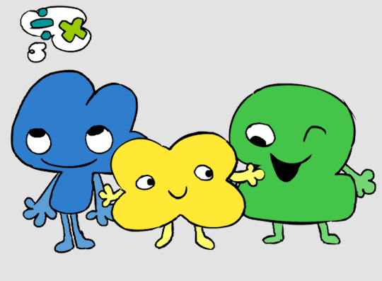
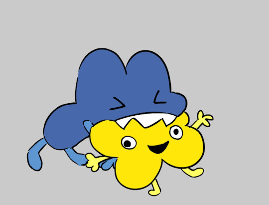
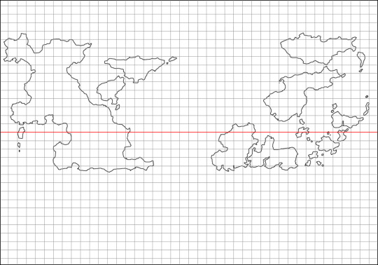
miku worldwide usa edition (click to fully appreciate)
(go follow the cool artists under the cut)
finished map: here
washington: @mochasucculent
oregon: @the-jelliphish
california: @camiliar
arizona: @apelgif
nevada: kikiCPU
utah: @ace-o-hearts
montana: @just-luxx
idaho: @roxyrot
wyoming: @saintlethanavir
colorado: @yaelartworks
new mexico: @eldritch-ace
north dakota: @schwoopsiedoodles
south dakota: beebeerock
nebraska: @glassofoj-twitter
kansas: @petziez
oklahoma: @razzafrazzle
texas: @princepsed
minnesota: @pastabaguette
iowa: @rumpledcrow
missouri: @inkyharpy
arkansas: @basement-buddy
louisiana: @circusclownproductions
wisconsin: @plush0fairy
illinois: @shrimpimage
kentucky: @double-m-b
tennessee: @thebiscuiteternal
mississippi: @juneyybee
alabama: @burnt-scone
michigan: @chorne-the-firstborn
idiana: @meowjuniper
ohio: @teethflavoured
west virginia: @littleivyart
virginia: @splemonocracy
georgia: @alyossan
florida: kierscribbles
south carolina: @ash-animates
north carolina: @pinkcultgirl
maryland: @f4ceache
pennsylvania: @sukifoof-art
new york: @doodoobirds
new jersey: @porcelain-rob0t
delaware: easybriizydraws
rhode island: @crazywolf828
conneticut: @koreyeet
vermont: @maggotwithanf
massechusettes: @wishpetal
new hampshire: @ohnoshiv
maine: @limesade
alaska: @owldart
hawaii: @theexistingbox
#IM SO SORRY TO THE MIKUS ON THE RIGHT#theyre so cramped :(#also if yall find any of the missing mikus @ me so i can update the map#hatsune miku#vocaloid#miku worldwide#miku world tour#miku#international miku#regional miku#usa miku
9K notes
·
View notes
Text
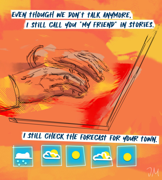
take a jacket just in case
#it's true i use a world meteorological map to see if my ex is in a heat wave lol out of love#ive had this idea in my head forever#my art#digital artists#artists on tumblr#queer art#all my love alright all of it!
43K notes
·
View notes
Text
Hey All,
I've been away for some time, as we've been working really hard on something quite exciting:
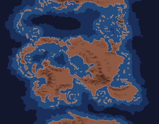
let me present to you the world's first ever global ocean drainage basin map that shows all permanent and temporary water flows on the planet.

This is quite big news, as far as I know this has never been done before. There are hundreds of hours of work in it (with the data + manual work as well) and it's quite a relief that they are all finished now.
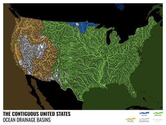
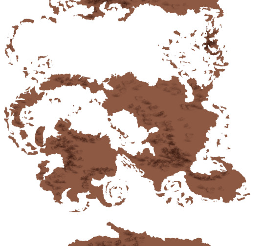
But what is an ocean drainage basin map, I hear most of you asking? A couple of years ago I tried to find a map that shows which ocean does each of the world's rivers end up in. I was a bit surprised to see there is no map like that, so I just decided I'll make it myself - as usual :) Well, after realizing all the technical difficulties, I wasn't so surprised any more that it didn't exist. So yeah, it was quite a challenge but I am very happy with the result.
In addition to the global map I've created a set of 43 maps for different countries, states and continents, four versions for each: maps with white and black background, and a version for both with coloured oceans (aka polygons). Here's the global map with polygons:
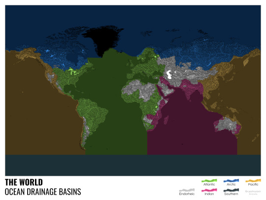
I know from experience that maps can be great conversation starters, and I aim to make maps that are visually striking and can effectively deliver a message. With these ocean drainage basin maps the most important part was to make them easily understandable, so after you have seen one, the others all become effortless to interpret as well. Let me know how I did, I really appreciate any and all kinds of feedback.
Here are a few more from the set, I hope you too learn something new from them. I certainly did, and I am a geographer.
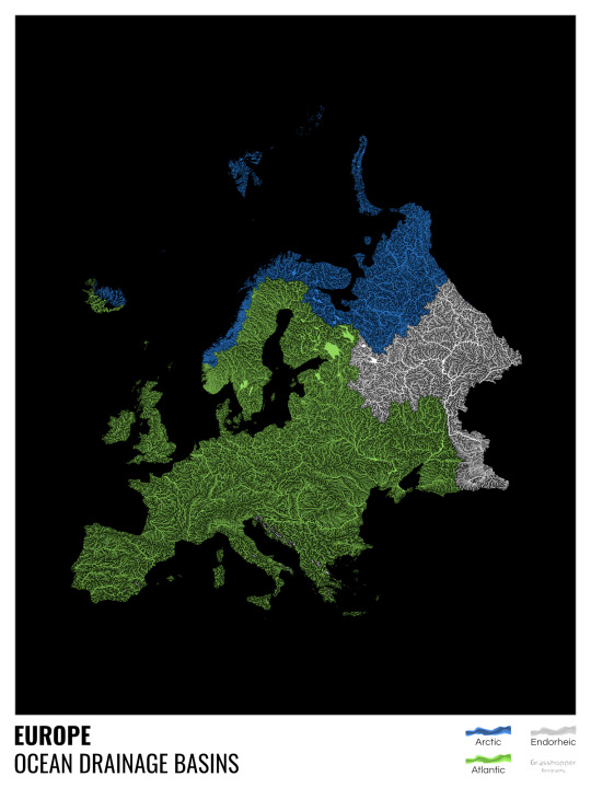
The greatest surprise with Europe is that its biggest river is all grey, as the Volga flows into the Caspian sea, therefore its basin counts as endorheic.
An endorheic basin is one which never reaches the ocean, mostly because it dries out in desert areas or ends up in lakes with no outflow. The biggest endorheic basin is the Caspian’s, but the area of the Great Basin in the US is also a good example of endorheic basins.
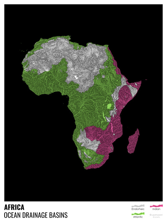
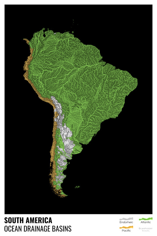
I love how the green of the Atlantic Ocean tangles together in the middle.
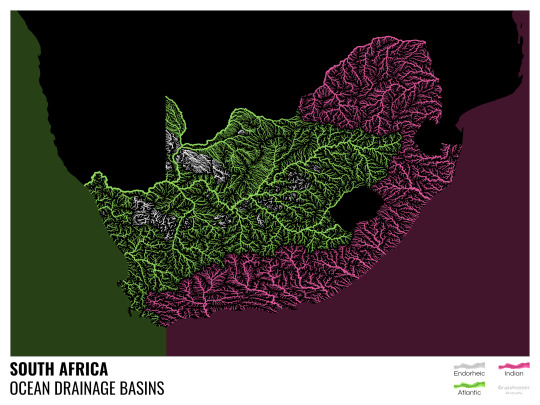
No, the dividing line is not at Cape Town, unfortunately.
I know these two colours weren’t the best choice for colourblind people and I sincerely apologize for that. I’ve been planning to make colourblind-friendly versions of my maps for ages now – still not sure when I get there, but I want you to know that it’s just moved up on my todo-list. A lot further up.
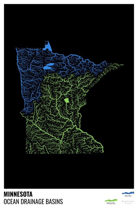
Minnesota is quite crazy with all that blue, right? Some other US states that are equally mind-blowing: North Dakota, New Mexico, Colorado, Wyoming. You can check them all out here.
Yes, most of the Peruvian waters drain into the Atlantic Ocean. Here are the maps of Peru, if you want to take a closer look.
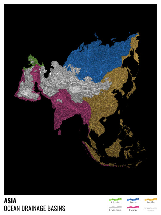
Asia is amazingly colourful with lots of endorheic basins in the middle areas: deserts, the Himalayas and the Caspian sea are to blame. Also note how the Indonesian islands of Java and Sumatra are divided.
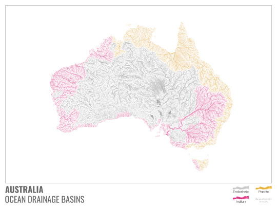
I mentioned earlier that I also made white versions of all maps. Here’s Australia with its vast deserts. If you're wondering about the weird lines in the middle: that’s the Simpson desert with its famous parallel sand dunes.
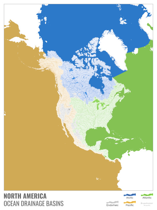
North America with white background and colourful oceans looks pretty neat, I think.

Finally, I made the drainage basin maps of the individual oceans: The Atlantic, the Arctic, the Indian and the Pacific. The Arctic is my favourite one.
I really hope you like my new maps, and that they will become as popular as my river basin maps. Those have already helped dozens of environmental NGOs to illustrate their important messages all around the world. It would be nice if these maps too could find their purpose.
#maps reimagined#geography#cartography#maps#my art#rivers of the world#ocean drainage basins#ocean maps#river maps
16K notes
·
View notes
Text
This came across my Facebook feed, felt I’d share it.
49K notes
·
View notes
Text
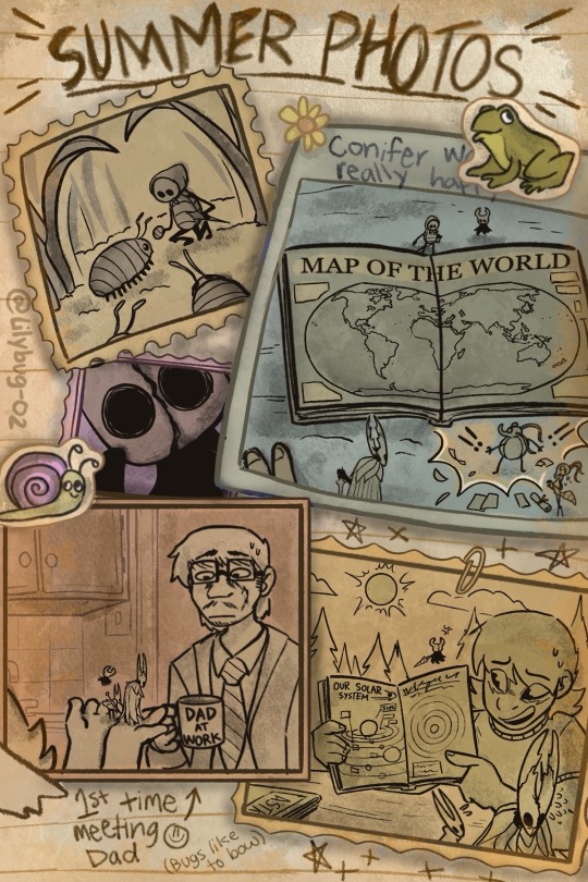
Final Bug Fact:
The world NEEDS bugs. They keep the soil healthy, pollinate, control pests, and contribute to the worlds' ecosystem. By the end of the century, it is estimated 40% of insect species may go extinct due to habitat loss. Yes, that is very scary. But with even one beetle spared, one caterpillar rescued, and one Hollow Knight comic of all things, things will change. Because I know there's a lot more Dewi's out there than most people realize. Stay curious.
Thanks for going on this adventure with me. ♥︎
First || Prev // END
Masterpost
Comic Thoughts and Pictures Below!
I wanted to put here how amazing and sweet everyone has been with this comic. I finished a 75 page comic in 3 MONTHS. I am at a loss for words. That sounds crazy and it IS crazy. But man was it fun. Even on days were I wasn't able to draw due to fatigue or business, I loved working on it from start to finish. And guess what!? This is my first ever FINISHED comic :D I'm so proud of myself. I know there's some things I want to change and the art is wonky in most places...... but I'm content to let it be. What an amazing summer adventure!
I'm hoping to post the full comic on another Comic website. I may or may not edit some of the art ^w^ So I'll let y'all know when I release it.
Interested in learning what you could do to help your local insects? This is the basic stuff. Maybe make some Insect Hotels if you have the time!!! And never forget to spread the word about bugs. They need our help just as any animal on earth.
Still Here? Well you can look in the tags for little lore dumps if ur looking for stuff like that ;)
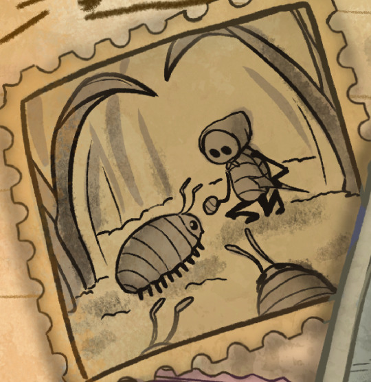
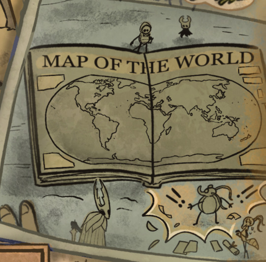
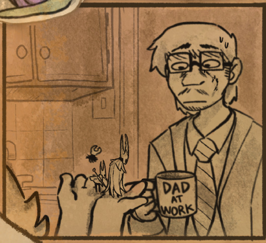
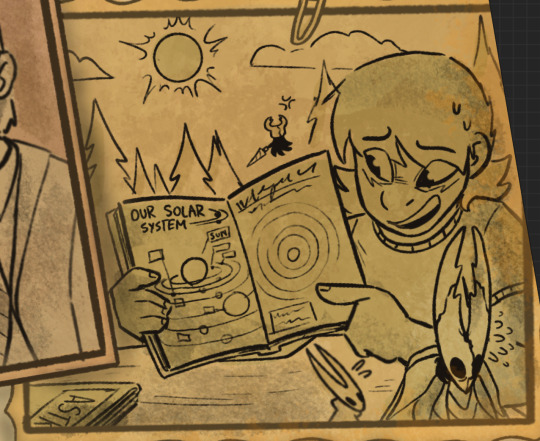
#dewi's adventures in hollow knight#thank you all for supporting this me and this comic. Truly. It means the world.#And we finally get to see Dewi's Dad! He has that iconic scar on his cheek Dewi told Hollow about.#(He got it from a Barbed wire accident as a kid. But he likes to try and convince Dewi it was from a Grizzly Bear)#Conifer almost had a heart attack from the “Map of the World” haha. His wife was beside herself#The bugs were terrified to meet his Dad. But it was kinda inevitable to have the encounter with the Beast if Dewi was in the picture.#So they sent out the only remaining heirs of the Pale King to make a Peace Agreement. It went as chaotic as you can expect.#Quirrel has taken a liking to the bugs outside Hallownest. He finds them very strange and interesting.#Also Hollow does not like the sun very much. It's brightness scares them.#I also like to think Dewi and humans null the effect of the Hallownest Bug's memories being erased when leaving the kingdom.#Makes it more fun ;)#art#my art#Hollow Knight#hollow knight au#Hollow Knight comic#Hollow Knight fanart#hollow knight hornet#the hollow knight#hollow knight ghost#hollow knight quirrel#hollow knight spoilers#hk spoilers#Also my “full name” dropped. I have it in some of my posts but i guess this is a little more known
2K notes
·
View notes
Photo
World map centered on Argentina.
2K notes
·
View notes
Text
i love animating these little freaks
#tpot#xfohv#bfdi#their designs are so simple its so fun. i missed this#i was able to make so much good hollow knight animation work because their designs were so simplistic that i could add detail in places-#-where it made sense to (cloaks + nails + etc) to make it look nice and it worked so well... ultrak sent me to hell world animating-#-complex armor and mecha but I Do what i must... and i've got that map part to finish still#thjank you clover for the four Loves to bite affectionately headcanon. it makes sense. hes just like that#bfb four#bfb x#tpot two#fourx#4x#fourtwo#twox#<- all of these a little implied. apart from fourx thats just a given#gen art#animations
2K notes
·
View notes
Text
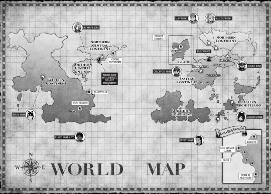
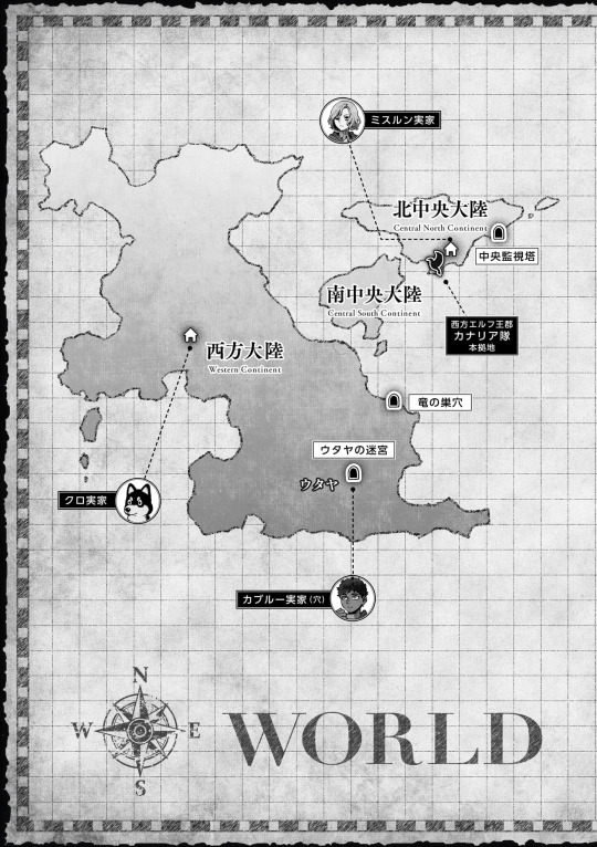
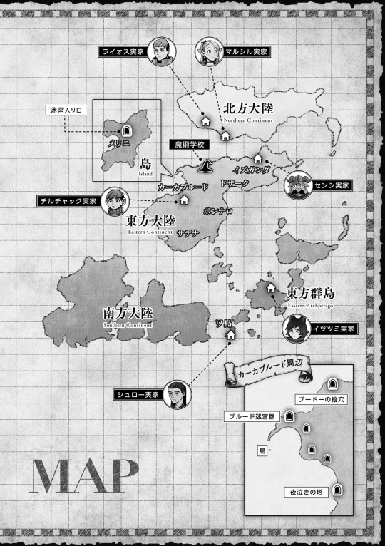
Dungeon Meshi World Map
REGIONS (Descriptions taken from the Adventurer's Bible)
WESTERN CONTINENT
Description: Bears the most scars from the ancient war. It has many monsters and ruined dungeons, and although it's vast, there are surprisingly few habitable areas. Most of the inhabitants are sturdy, short-lived races and demihumans. Elven culture has had a strong influence here.
Characters: Kabru and Kuro
Places of Note: Utaya
Dungeons of Note: The Utaya Dungeon, The Dragon's Lair
NORTHERN CENTRAL CONTINENT
Description: The continent that is home to the largest nation, ruled by the queen of the elves. The term "Western Elves" mostly indicates elves from this region. It's the safest area and life is easy here, but its shrinking population has dangerously weakened it.
Characters: Mithrun (and the Canaries)
Places of Note: Western Elves's Royal District, Canarie's Headquarters.
Dungeons of Note: Central Watchtower
SOUTHERN CENTRAL CONTINENT
Description: The area with the second-largest elf nation. It has more inbound immigration than the Northern Central Continent and a rather disorganized atmosphere. While it's in an alliance with the Northern Central Continent, they really aren't on good terms.
Characters: -
Places of Note: -
Dungeons of Note: -
EASTERN CONTINENT
Description: Home to the largest gnome nation. Once dwarfs and
gnomes made up the majority of the inhabitants, but in recent years there has been an influx of short-lived races from the Northern Continent and Eastern Archipelago, and the population is growing rapidly. It's a melting pot where various cultures are jumbled together.
Characters: Chilchuck Tims (Kahka Brud), Senshi (Izganda)
Places of Note: Magic School, The Island/Melini, Kahka Brud, Izganda, Dozahk, Bonnario, Sadena
Dungeons of Note: Island, Brud Dungeon Cluster, Budou Pit, Tower of Night Cries
NORTHERN CONTINENT
Description: A severely cold continent where over half of the land is covered in perpetual snow. The majority of the inhabitants are short-lived races, particularly tall-men, but the population isn't large to begin with. It has been strongly influenced by dwarf culture.
Characters: Laios & Falin, Marcille
Places of Note: -
Dungeons of Note: -
EASTERN ARCHIPELAGO
Description: An area where short-lived races live. As a result of a pact, there has been no interference by long-lived races for a very long time. The effects of the ancient war are slight, and they have almost no trouble with monsters or dungeons, but there's constant strife among humans.
Characters: (all from different Islands) Izutsumi, Shuro and his Retainers, Rinsha Fana (Not shown)
Places of Note: Island of Wa
Dungeons of Note: -
SOUTHERN CONTINENT
Description: Home to the largest dwarf city. Gnome and dwarf nations often build down rather than out, and the innermost layers are extraordinarily deep. War still erupts frequently, and there are never-ending disputes near the borders.
Characters: -
Places of Note: -
Dungeons of Note: -
If you're interested I've found a post on pixiv with the map outlines and some more info (in japanese)
I'll make a post about the dungeon descriptions later but here they are, there's a little more info about Kahka Brud dungeons on my last map post
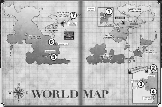
1 The Island, 2 Budou Pit, 3 The Brud Dungeon Cluster, 4 The tower of Night Cries 5 The Utaya Dungeon 6 The Dragon's Lair 7 The Central Watchtower
Map Outline
#dungeon meshi#dungeon meshi map#adventurers bible#maps#world map#Laios Touden#Marcille Donato#Senshi of Izganda#Chilchuck tims#Izutsumi#Toshiro Nakamoto#Kuro#Kabru of utaya#Utaya#The canaries#Mithrun#Edit: Shame on me I forgot to add one more map and a link to a pixiv post with the outlines#longpost#long post#worldbuilding#world building#fantasy map#fantasy world#for referencing
1K notes
·
View notes
Text

my best friend uttered the words “we may have a second astro situation here” and i cant believe she’d curse me like this.
#Why would you say this.No im not obsessed with glisten WHAT are you talking about im NORMAL.#dandys world#dandys world oc#★ my art#dandy’s world#dandys world glisten#twisted glisten#★ arin rambles#everytime we see yellow text at the bottom of the screen she calls my name like im a pokemon and i fly across the map to soothe him#i am at his every beck and call.#whenever that elevator door opens… i see yellow text …. ENGLISH WORDS CANT EVEN DESCRIBE IT#the joy. THE JOY. hes SO CUTE.#No i didnt grind out floors and buy his toon immediately when i hit 50% research What??????#No i do NOT have several doodles of him already Not even counting these. What???#What are you all talking about Haha#<- (genuinely going insane)#dw oc ae
987 notes
·
View notes
Text
as someone who has obviously done extensive research on the topic i would like to present to you all...dyketennant's "which david tennant character are you" uquiz
#it's almost 3am now and i started this at around 10-11pm i think so if this sucks. im sorry#also before you say 'what about x character' listen there's only so many i can add you guys#12 was the easiest number for me to work with i had to make some choices#yes i was influenced by my own bias that's inevitable#toyed with the idea of adding kilgrave but could not stomach the guilt of anyone actually getting him as their result#david tennant#good omens#doctor who#blackpool#takin over the asylum#bbc staged#around the world in 80 days#hamlet 2009#fright night 2011#broadchurch#la without a map#queues to watch out for
1K notes
·
View notes
Text
my part for @pansear-doodles' kiss me (kill me) map!
#rain world#rain world downpour#artihunter#cherrybomb#fanart#my art#animation#multi-animator project#map part#the artificer#the hunter#slugcat#chimney canopy#rw shipping#shipping#2024#video#undescribed
2K notes
·
View notes
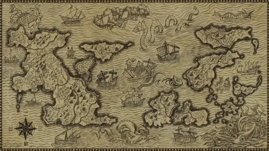
Text
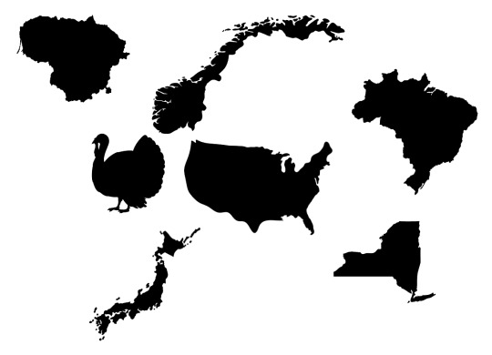
A tutorial on a (bit cheating) way of creating fictional maps.
Open your editing software (RECOMMENDING Krita, since it's free and it's very good).
Step 1: Google "X country silhouette" and copy it.
Paste it onto the canvas.
Step 2:
Separate the silhouette from the background you copied with it! You can do that by using magic wand selection tool or by making a gradient map with black on 49,9% and transparent on 50% on the slider.


Step 3: Repeat several times with numerous countries and/or islands, cities, municipalities, communes, continents et cetera.
Step 4: Combine, mesh, stretch, rotate, mirror - go ham, make it work.
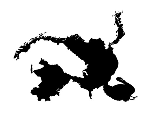
Step 5: Erase and add.
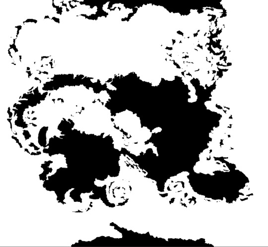
Step 6: Have your map outline ready, copy/paste it several times in the same doc on different layers and edit in different ways like biomes, kingdoms, mountains and other.
Step Mountains+: To figure out mountains, make another layer on the doc and do something like this:
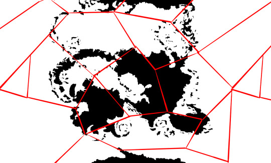
-and then in every polygon you add an arrow.
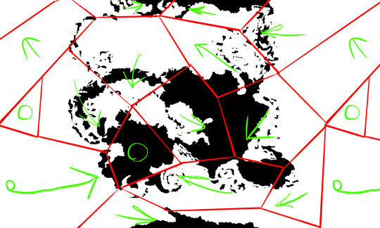
Where arrows meet or transfer onto continents, add mountains.
Color the sea with a couple layers of depth and you're done :D

#cartography#making maps#fantasy world#making fantasy maps#fantasy worldbuilding#worldbuilding map#map#maps
9K notes
·
View notes
Text
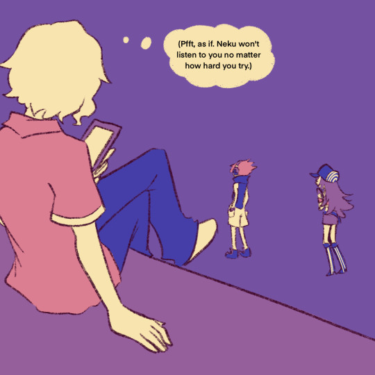
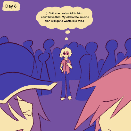
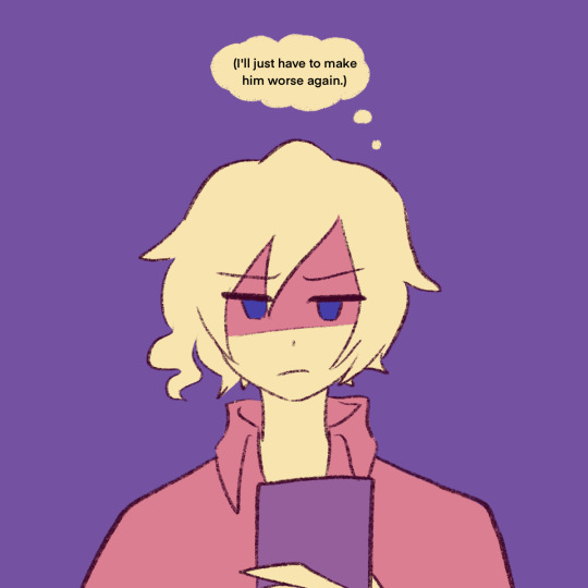
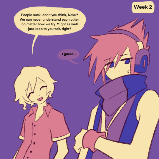
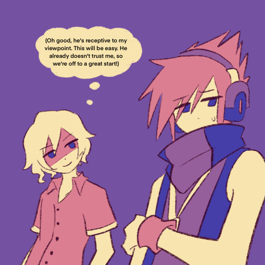
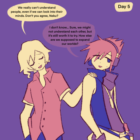
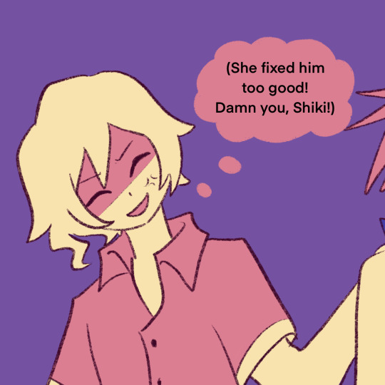
"I can fix him" girl vs "I can make him worse" boy who will win
#'why is everything purple' couldnt be bothered to color properly so i slapped a gradient map on it#shiki misaki#neku sakuraba#yoshiya kiryu#joshua#the world ends with you#twewy#art#my art#xanders art#digital art#fan art
692 notes
·
View notes
Text
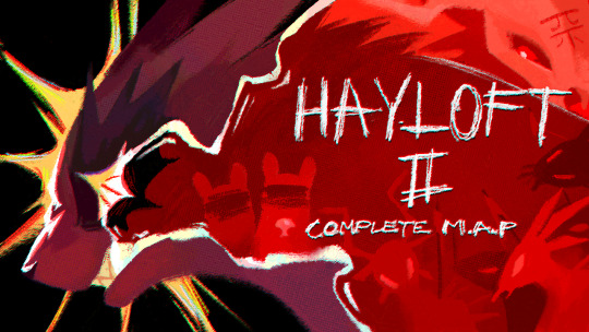
thumbnail entry for the hayloft II MAP!!
639 notes
·
View notes
Text
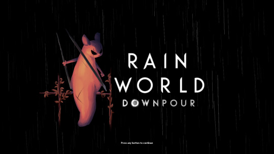
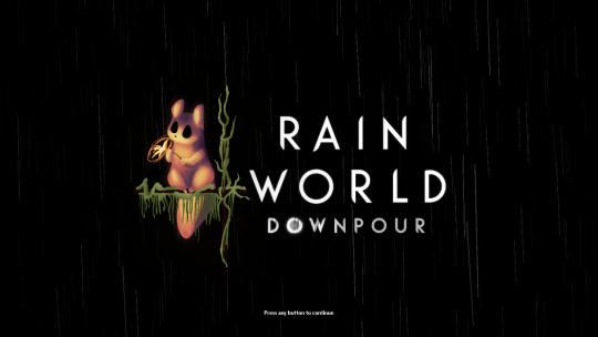

i finally finished these!! i felt bad that hunter and monk didnt have their own titlescreen art, so i started on making my own for them a few months ago. nailing the official rendering made this harder than i thought haha
also, when i originally made these, i had the idea of making this into a sort of challenge for other people to make their own title art for these two. im still standing with that! if you want to take a shot at making your own version of titlescreen art for these two, go ahead! hell, tag me if you want.
#thank you pansear for giving me the most comprehensible advice on rendering these ..... doing the whole thing in B&W first helped a LOT#and thank you gradient mapping for making things easy#my art#rain world#rain world downpour#the hunter#the monk#hunter rw#monk rw#slugcat
2K notes
·
View notes
Text
I thought it'd be fun to make a map of where all the Hermits live irl and until now I didn't quite realize how much of the server is either British or American
#like I knew there were lots of brits and lots of americans but I didn't think there'd be THIS MANY#poor little pearl looks so lonely down in australia#it's a world map so doc looks like he's keeping a safe distance from keralis and iskall as well as the British Behemoth#hermitcraft#hermitblr
4K notes
·
View notes
Last Seen Blogs

southernpacker
Southern Packers and movers
andypain
WELTSCHMERZ

hannahjae27
Hannah Jae
realkatsunemiku
Vriska (Vriska)

kaden75
Kaden