#RoadEngineering
Explore tagged Tumblr posts
Visit Tumblr Blog
Explore Tumblr blogs with no restrictions, modern design and the best experience.
Last Seen Tumblr Blogs


Fun Fact
Tumblr is available in 18 languages.
Text
How Civil Engineers Use CAD to Design Roads, Bridges & Infrastructure

If you’ve ever driven on a highway, crossed a bridge, or walked on a neatly paved sidewalk, there’s a high chance that CAD had something to do with it. While these structures might seem like basic parts of everyday life, they’re the result of intricate planning, coordination, and precision, most of which happens long before the first shovel hits the ground. And that planning? It often revolves around Computer-Aided Design, better known as CAD.
Let’s dig into how civil engineers use CAD to turn rough sketches and raw land into the roads, bridges, and infrastructure we all rely on.
What Exactly Is CAD?
Before we get ahead of ourselves, here’s a quick refresher: CAD stands for Computer-Aided Design. It’s software that allows engineers, architects, and designers to create, modify, analyze, and optimize designs digitally. Think of it like a digital drafting table—but with layers of intelligence, data, and precision built in.
For civil engineers, CAD isn't just a tool—it’s a core part of how they bring ideas to life.
Laying the Groundwork: Survey Data to Base Maps
The process usually starts with gathering real-world data. Civil engineers use topographical surveys, GIS data, drone imagery, and satellite maps. This data is imported into CAD platforms like AutoCAD Civil 3D, Bentley MicroStation, or InfraWorks.
CAD helps convert all this into a clear, layered base map. These maps display everything from elevation changes and soil types to utility lines and environmental zones. It’s not glamorous work, but it’s essential. Roads and bridges need to fit the landscape they’re built on, not fight it.
Planning Roads: It’s More Than Just Drawing a Line
Designing a road might sound straightforward, draw a line from point A to point B—but in practice, it’s a logistical puzzle with safety, efficiency, cost, and sustainability all in play.
With CAD, engineers can model horizontal alignments (where the road goes side to side) and vertical alignments (how it goes up and down). They factor in slopes, curves, drainage, and even traffic flow. Want to see what happens if you add an extra lane or move an intersection? CAD lets engineers simulate and test changes before committing to expensive builds.
One real-world example: in urban areas where space is limited, engineers use CAD to design multi-layered solutions like flyovers and underpasses. With 3D modeling, they can visualize how these structures will interact with existing roads, utilities, and buildings—all before a single cone is placed on the street.
Building Bridges: CAD for the Complex Stuff
Bridge design is where CAD truly shines. Bridges aren’t just functional—they’re complex structures balancing physics, loads, materials, and aesthetics. And each bridge has its unique challenges depending on location, length, span type, and environmental factors like wind, water flow, and seismic activity.
Using CAD, civil engineers model different bridge types (suspension, beam, truss, arch) and test structural performance. Programs like Revit, Civil 3D, and Tekla Structures enable engineers to simulate load distribution, material stresses, and environmental impacts.
Even better, 3D models created in CAD can be used for clash detection. That means identifying potential conflicts, like a beam that intersects with a utility line, before construction begins. It’s like having a crystal ball that prevents expensive surprises.
Coordinating Infrastructure: The Bigger Picture
Planning roads and bridges is just one piece of a much larger infrastructure puzzle. CAD is the platform where civil engineers coordinate everything else: stormwater management, sewer systems, electrical grids, fiber optics, bike paths, and even landscaping.
In large infrastructure projects, coordination is everything. Civil engineers use CAD to overlay multiple design disciplines—mechanical, electrical, plumbing, and structural—onto the same digital model. This kind of integrated approach prevents issues down the road (literally), where, say, a drainage pipe might interfere with a foundation if not caught early.
Real-Time Collaboration and BIM Integration
Modern CAD tools are more collaborative than ever. Engineers, architects, contractors, and city planners can work from a single shared model. With tools like Building Information Modeling (BIM), CAD evolves from a drawing tool into a smart ecosystem that tracks materials, schedules, and costs.
For instance, if a road design changes, the CAD model can automatically update related documents—material takeoffs, cost estimates, and construction schedules, saving hours of manual recalculation. That’s the kind of smart, connected workflow that’s becoming standard in infrastructure projects worldwide.
Going Beyond the Screen: From CAD to the Real World
Once designs are finalized, CAD doesn’t get filed away—it becomes a blueprint for action. Contractors use it to guide machinery, surveyors use it to stake out alignments, and city officials use it to review and approve plans.
Even during construction, CAD models remain crucial. Engineers refer to them to troubleshoot problems, coordinate deliveries, and track progress. Some advanced systems even link CAD models to GPS and machine control, letting bulldozers and graders follow digital designs with pinpoint accuracy.
Final Thoughts: Why It Matters
At first glance, CAD might seem like just another software tool, but in civil engineering, it’s transformative. It allows professionals to design with precision, test assumptions, avoid costly mistakes, and deliver safer, more efficient infrastructure.
Whether it's a rural highway, a city overpass, or a flood control system, CAD helps civil engineers think ahead, turning raw data into the roads we drive, the bridges we cross, and the infrastructure that quietly supports modern life.
So next time you're cruising down a smooth road or admiring a bridge’s sleek silhouette, remember: someone carefully designed it with CAD, long before the first bolt was tightened.
#CivilEngineering#CADDesign#InfrastructurePlanning#EngineeringLife#BridgeDesign#RoadEngineering#StructuralDesign#AutoCAD#Civil3D#EngineeringInnovation
0 notes
Text
ವಾಹನ ಸಂಚಾರರು ಮೊದಲು ಪಾದಾಚಾರಿಗಳನ್ನ ಗೌರವಿಸಬೇಕು!
This blog captures a thought-provoking and in-depth conversation with B.T. Sridhar, the former Project Director of the Bengaluru–Mysuru Expressway and current Superintendent Engineer with the Ministry of Road Transport and Highways (Kerala Division). Hosted by veteran journalist Gaurish Akki, the dialogue offers rare insights into the challenges, complexities, and public responsibilities tied to India's expanding road infrastructure.
Sridhar shares untold stories from the making of the expressway, including how legal hurdles, village demands, and design adjustments were handled with the support of Mysuru MP Pratap Simha. He discusses the vision of Union Minister Nitin Gadkari and explains how highway projects move through multiple layers of approval and execution.
youtube
Beyond infrastructure, the conversation dives into urgent civic issues—reckless two-wheeler driving, rising road accidents, misuse of vehicle lighting, and the growing distractions caused by smartphones and entertainment systems. Sridhar emphasizes the need for safer driving habits, pedestrian respect, and civic awareness.
Whether you're an urban commuter, policymaker, or someone concerned about road safety, this post is a must-read. It’s a reminder that while infrastructure can be built by the government, safety is a shared responsibility—shaped by every individual behind the wheel.
#pratapsimha#nitingadkari#roaddevelopment#india#roadprojects#highwayprojects#RoadSafety#IndianHighways#BTSridhar#GaurishAkkiStudio#BengaluruMysuruExpressway#HighwayDevelopment#TransportMinistry#InfrastructureIndia#DriveSafeIndia#AccidentPrevention#RoadEngineering#PublicSafety#PedestrianSafety#TwoWheelerSafety#SmartRoads#TrafficAwareness#BlackSpotsIndia#HighwaySafetyTips#UrbanPlanningIndia#IndiaDevelopment#Youtube
0 notes
Text
youtube
Explore the diverse types of roads in India, from bustling highways to rural pathways. Learn about National Highways, State Highways, Expressways, District Roads, and Village Roads that connect the nation. Dive into their unique features, importance, and how they contribute to India's infrastructure.
#RoadType#typesofroads#RoadTypesIndia#HighWayTypes#highway#expressway#NationalHighway#StateHighway#roads#shorts#roadconstruction#RoadConstructionIndia#RoadEngineering#HighwayEngineering#nhai#nitingadkari#Youtube
0 notes
Photo

La Caldera Volcano 🌋 The La Caldera volcano known in pre-Hispanic times as "Cuexomatl" is an extinct volcano located in Los Reyes la Paz in the state of Mexico and has two craters and a height of 2400 meters above sea level. Photo by @santiago_arau . . . #lacaldera #mexico #volcano #city #structure #infrastructure #urban #road #roadengineering #civil #construction #architecture #amazing #interesting #nature #geology #civilengineering https://www.instagram.com/p/CXYqWXHlVXC/?utm_medium=tumblr
#lacaldera#mexico#volcano#city#structure#infrastructure#urban#road#roadengineering#civil#construction#architecture#amazing#interesting#nature#geology#civilengineering
5 notes
·
View notes
Photo

This ingenious illustration reveals how much space we give to cars. What do you think? Image by Karl Jilg (@kallejilg) Whether you're in a quiet suburb an urban downtown, most public spaces are designed for cars instead of pedestrians. In the image, Jilg depicts city streets as gorges, crosswalks as wobbly planks, and sidewalks as shallow ledges to show how little space pedestrians are allowed to inhabit in a typical intersection. . . #cityscape #urbanism #urban #publicspaces #debate #discussion #architecture #illustration #civilengineering #urbanplanning #sportlife #roadengineering #environment #bikelover #environmental #construction #carlover https://www.instagram.com/p/CZto6V-OTCe/?utm_medium=tumblr
#cityscape#urbanism#urban#publicspaces#debate#discussion#architecture#illustration#civilengineering#urbanplanning#sportlife#roadengineering#environment#bikelover#environmental#construction#carlover
2 notes
·
View notes
Video
instagram
SUB-SEA , ROAD TUNNEL Norway is planning to build an underwater tunnel to help relieve traffic. ❤❤❤❤👷👷👷👷👷👷 . . Reposted from @road.engineering - 283. . . . #newcivilengineer #newtransportation #tunnelconstruction #roadengineer #roadengineering💪💪💪 #roadengineers #roadengineering #tunnel #tunnels #construction #civilengineering_life #civilengineeringstudents #civilengineering #civilengineeringvideo #civilengineeringstudent #highwayengineering #highwayconstruction #highway #civilengineeringproject #civil_engineers #newtechnology #newtunnel #roadtunnel #newcivilengineer🏗️ #newtravel #roadequipment #subseatunnel #road #roadreconstruction #norway🇳🇴 https://www.instagram.com/p/ByQUhv3AsL_/?igshid=8pnmjjs2u2l5
#newcivilengineer#newtransportation#tunnelconstruction#roadengineer#roadengineering💪💪💪#roadengineers#roadengineering#tunnel#tunnels#construction#civilengineering_life#civilengineeringstudents#civilengineering#civilengineeringvideo#civilengineeringstudent#highwayengineering#highwayconstruction#highway#civilengineeringproject#civil_engineers#newtechnology#newtunnel#roadtunnel#newcivilengineer🏗️#newtravel#roadequipment#subseatunnel#road#roadreconstruction#norway🇳🇴
1 note
·
View note
Video
Abu Dhabi Airport Mechanized Parking. 😎👌 . 👷 . 👷 . 👷@uchouz_ . 👷 . 👷 ➖ ➖ ➖ ➖ ➖ ➖ ➖ ➖ ➖ ➖ ➖ ➖ ➖ ➖ ➖ ➖ ➖ #airport✈️ #abudhabiairport #parking #airport #airplane #roadengineering #transportation #highwayengineering #civilengineer #civilengineeringstudents #civilengineering #newtechnologies #newmethod #newcivilengineer #abudhabi #dubai🇦🇪 #uae🇦🇪 #ai #vr #engineers #techie #nerds #geeks #coder #informationtechnology https://www.instagram.com/p/Bx62XgPgkZd/?igshid=uynito6420n3
#airport✈️#abudhabiairport#parking#airport#airplane#roadengineering#transportation#highwayengineering#civilengineer#civilengineeringstudents#civilengineering#newtechnologies#newmethod#newcivilengineer#abudhabi#dubai🇦🇪#uae🇦🇪#ai#vr#engineers#techie#nerds#geeks#coder#informationtechnology
1 note
·
View note
Photo

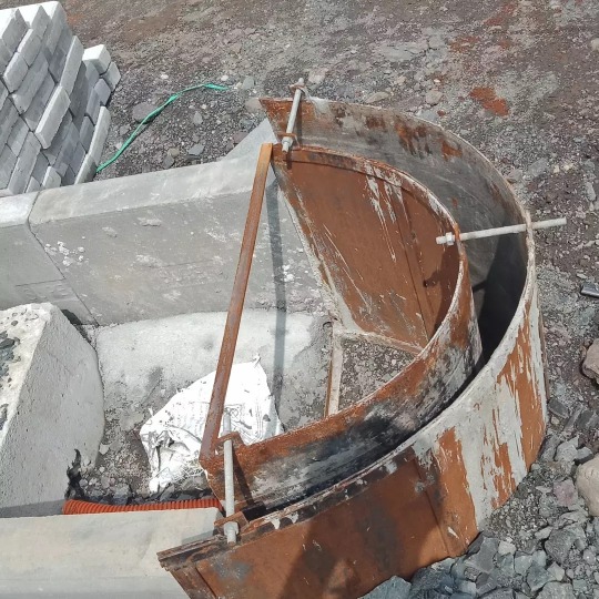
Types of Road curve
#constropedia#civilengineering#road#RoadSafety#constrofacts#roadengineering#roadtrip#roadbike#construction#civilconstruction
1 note
·
View note
Photo
Kerbing / Curbing End Point Circular Pattern Shuttering and Exposed Concrete Casting #kerbing #curbing #curbingcravings #curbingequipment #kerbings #curbing #architecturephotography #architect #roaddivider #roadconstruction #roadwork #roadengineering #roadengineer #roadcontractor #roadconstructions #roadengineering💪💪💪 #roads #civilwaytolearn #concretejungle @civilengineeringdiscoveries @civilized_civil_engineer @civilengineering.tc @civil_concepts @civil_engineers_team @civilengineering.co #civilengineering #civilengineer #civilengineers #engineercivil #constructions #civilconstruction #constructionlife #civilengineeringstudent #exposedconcrete #shuttering #msshuttering #mildsteelshuttering https://www.instagram.com/p/CRoM2vSL6ZW/?utm_medium=tumblr
#kerbing#curbing#curbingcravings#curbingequipment#kerbings#architecturephotography#architect#roaddivider#roadconstruction#roadwork#roadengineering#roadengineer#roadcontractor#roadconstructions#roadengineering💪💪💪#roads#civilwaytolearn#concretejungle#civilengineering#civilengineer#civilengineers#engineercivil#constructions#civilconstruction#constructionlife#civilengineeringstudent#exposedconcrete#shuttering#msshuttering#mildsteelshuttering
0 notes
Photo

The Bulldozer carving up the side of the mountain creating a road that leads to the top where the Convention Center is located here in Cagayan de Oro City. #engineeratwork #engineeringmarvel #bulldozer #roadopening #sidecut #road #roadengineering #LGU #CdO #CityEngineersOffice #fieldwork #survey #inspection #IGersCdO #igers #ig_captures #ig_philippines #igdaily #igaddict https://www.instagram.com/p/CAfOM_9HE3V/?igshid=c0b092ct2n88
#engineeratwork#engineeringmarvel#bulldozer#roadopening#sidecut#road#roadengineering#lgu#cdo#cityengineersoffice#fieldwork#survey#inspection#igerscdo#igers#ig_captures#ig_philippines#igdaily#igaddict
0 notes
Photo

Reposted from @engineeringandarchitecture Takaosan Interchange, Japan. Follow us! @engineeringandarchitecture . . . #complexinterchange #roadengineering #roadstructure #highway #highwayinterchange #infrastructure #construction #car #motorway #building #tokyo #japan #amazing #architect #engineer #civilengineering #architecture #places #travel #carlovers #nature #environmental #freeway #contractor #knowledge #Technology #instagram #engenhariacivil #ingenieria #Pavement https://www.instagram.com/p/B-RJ52vleffToyQwLqrTrpMwq-abdX4_RlfWY80/?igshid=1uogyh92g52r3
#complexinterchange#roadengineering#roadstructure#highway#highwayinterchange#infrastructure#construction#car#motorway#building#tokyo#japan#amazing#architect#engineer#civilengineering#architecture#places#travel#carlovers#nature#environmental#freeway#contractor#knowledge#technology#instagram#engenhariacivil#ingenieria#pavement
0 notes
Photo

We are looking for reliable, dedicated, and experienced candidates to join our 𝐑𝐚𝐬 𝐀𝐥 𝐊𝐡𝐚𝐢𝐦𝐚𝐡 team as a 𝐑𝐎𝐀𝐃 𝐄𝐍𝐆𝐈𝐍𝐄𝐄𝐑/ 𝐃𝐑𝐀𝐅𝐓𝐈𝐍𝐆 𝐀𝐍𝐃 𝐃𝐄𝐒𝐈𝐆𝐍𝐈𝐍𝐆 𝐑𝐎𝐀𝐃 𝐒𝐈𝐆𝐍𝐒. 𝐀𝐩𝐩𝐥𝐲 𝐍𝐨𝐰>>https://www.birigroup.com/…/Road-Engineer-Drafting-and-Desi… . . #birigroup #recruitingnow #roadengineer #draftingandesign #dubaijobs #jobsindubai #uaejobs #hiringalert #hiringnow #talentsearch (at Ras Al Khaimah, UAE) https://www.instagram.com/p/CFHKwivDmlx/?igshid=5vxupjagd8yt
#birigroup#recruitingnow#roadengineer#draftingandesign#dubaijobs#jobsindubai#uaejobs#hiringalert#hiringnow#talentsearch
0 notes
Photo

--- #lacaldera #mexico #volcano #city #structure #infrastructure #urban #road #roadengineering #civil #construction #architecture #amazing #interesting #nature #geology #civilengineering https://www.instagram.com/p/CXd4Ta6FpV_/?utm_medium=tumblr
#lacaldera#mexico#volcano#city#structure#infrastructure#urban#road#roadengineering#civil#construction#architecture#amazing#interesting#nature#geology#civilengineering
0 notes
Photo

The Millau viaduct is a 2,460m multi cable-stayed road bridge crossing the Valley of the River Tarn, near the Millau town in southern France. The Millau Viaduct is part of the A75 motorway linking Paris to Montpellier and Barcelona. The Millau viaduct received the 2006 Outstanding Structure Award from the International Association for Bridge and Structural Engineering. #bridge #viaduct #transport #transportationengineering #Roadconstruction #roadengineering #Infrastructure #structural #road #CablestayedBridge #Hightech #architecture #landmarks #civilengineering #construction #building (at Millau Viaduct Bridge) https://www.instagram.com/p/CXqm65br3KI/?utm_medium=tumblr
#bridge#viaduct#transport#transportationengineering#roadconstruction#roadengineering#infrastructure#structural#road#cablestayedbridge#hightech#architecture#landmarks#civilengineering#construction#building
2 notes
·
View notes
Video
instagram
History of Rail Transport Engineering Progress. . The history of rail transport began in 6th century BC in Ancient Greece. It can be divided up into several discrete periods defined by the principal means of track material and motive power used. . Evidence indicates that there was 6 to 8.5 km long Diolkos paved trackway, which transported boats across the Isthmus of Corinth in Greece from around 600 BC. Wheeled vehicles pulled by men and animals ran in grooves in limestone, which provided the track element, preventing the wagons from leaving the intended route. The Diolkos was in use for over 650 years, until at least the 1st century AD. Paved trackways were also later built in Roman Egypt. . 👷 . 👷 . 👷@road.engineering . 👷 . 👷 ➖ ➖ ➖ ➖ ➖ ➖ ➖ ➖ ➖ ➖ Reposted from @road.engineering (@get_regrann) - 681. ➖ ➖ ➖ ➖ ➖ ➖ ➖ #railroad #travel #railings #rail #track #civil_engineer #roadengineering #transportation #roadraceengineering #roadengineer #railway #civilengineering_life #civilengineeringstudents #civilconstruction #history - #regrann https://www.instagram.com/p/B4fJaieg7Dn/?igshid=aowxi8hbuw39
#railroad#travel#railings#rail#track#civil_engineer#roadengineering#transportation#roadraceengineering#roadengineer#railway#civilengineering_life#civilengineeringstudents#civilconstruction#history#regrann
0 notes
Video
437. Abu Dhabi Airport Mechanized Parking. . 👷 . 👷 . 👷@uchoiz_ . 👷 . 👷 ➖ ➖ ➖ ➖ ➖ ➖ ➖ ➖ ➖ ➖ ➖ ➖ ➖ ➖ ➖ ➖ ➖ #airport✈️ #abudhabiairport #parking #airport #airplane #roadengineering #transportation #highwayengineering #civilengineer #civilengineeringstudents #civilengineering #newtechnologies #newmethod #newcivilengineer #abudhabi #dubai🇦🇪 #uae🇦🇪 #techie #ai #vr #engineers #autonomous #howitsmade #architects #expo2020 https://www.instagram.com/p/Bx6dwU6gnpb/?igshid=118nqb4bo1hku
#airport✈️#abudhabiairport#parking#airport#airplane#roadengineering#transportation#highwayengineering#civilengineer#civilengineeringstudents#civilengineering#newtechnologies#newmethod#newcivilengineer#abudhabi#dubai🇦🇪#uae🇦🇪#techie#ai#vr#engineers#autonomous#howitsmade#architects#expo2020
1 note
·
View note