#Upper Kaligandaki
Text
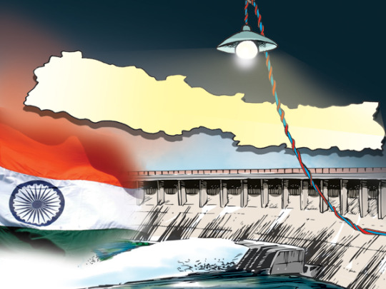
Approval for Exporting 110 MW of Power to India via Interim Agreement
522 MW can now be sold in the competitive market and 110 MW through a mid-term agreement in India
Kathmandu – India has given permission to sell electricity to Nepal through a mid-term agreement. India, which is allowed only in the competitive market, has also allowed the sale of 110 megawatts of electricity for two projects for five years. Along with this, monsoon electricity will be sold…
View On WordPress
#Bangladesh#Bhutan#Chilime Hydropower#Dordi Khola Hydropower Project#electricity through a mid-term agreement#electricity trade department of the authority#Himalayan Power#IEX#Indian Energy Market#Madhu Prasad Bhetuwal#medium-term five-year power purchase and sale agreement#Nepal#Nepal Electricity Authority#PPA#Sahash Energy#Shankar Prasad Sharma#Trishuli Hydropower#Upper Chameliya#Upper Kaligandaki#Upper Solu Hydropower Company
0 notes
Text

Ready for an unforgettable adventure? Join Third Eye Adventure on a 17-day trek to Upper Mustang, where you'll experience a hidden kingdom rich in history, culture, and natural beauty! 🌄 Walk through the Kaligandaki Gorge, the world's deepest canyon, and explore the ancient kingdom of Lo Manthang, known for its royal palace and stunning Buddhist temples. 🏯 Feel the Tibetan influence as you pass through traditional villages and soak in jaw-dropping views of Nilgiri, Annapurna, and Dhaulagiri mountains. 🏔
Kick off the adventure with a scenic flight from Pokhara to Jomsom and enjoy trekking in a rain-free, desert-like landscape. 🌵✨ This journey is a perfect blend of culture, spirituality, and adventure!
📲 For details, WhatsApp us at +977 985 1175534 or visit https://www.thirdeyeadventure.com/trek/upper-mustang-trekking/
0 notes
Text
Upper Mustang Helicopter Tour

Experience the extraordinary with the Upper Mustang Helicopter Tour. You'll tackle on an exhilarating journey to explore the ancient monasteries and forbidden kingdoms of Mustang on the border of Nepal and Tibet (China). This exclusive tour commences from Kathmandu and stops at Pokhara for fueling, where arrangements are made for the remainder of the journey. During the flight, the helicopter will glide close to the Annapurna Himalayan ranges along the Kaligandaki River, offering breathtaking views of the stunning mountain ranges and picturesque landscapes that are unparalleled in anyone's lifetime.
#UpperMustangTour#ForbiddenKingdomExperience#HelicopterRideAdventure#MonasteryExploration#HimalayanPanorama#NepalTibetBorder#LuxuryTravel#BucketListExperience#OnceInALifetimeJourney#AerialViews#HighAltitudeExcursion#KaligandakiRiverTour
0 notes
Text
5 Amazing Things You See On The Upper Mustang Trek

1. Skies Burial
When a person dies high up in the Himalayan kingdom, a Lama (Buddhist priest) cuts the body into tiny pieces which are then fed to the vultures. I understand it sounds ruthless, however, It is the means of the funeral in the Buddhist practice. Sky burial is influenced by Tibetan Buddhism and it is believed thought that feeding to the vultures (Holy bird) suggests the dead has no sin and also his/her soul can relax quietly in paradise. This sound extremely interesting as much as it is brutal. You may be wondering, will I have a possibility to see sky burial in Upper Mustang when I am there? Which was a frequent question to me by my clients, The response is no! Only the males in the family, as well as some locals, are brought there to carry the body, and the Lama (A priest) will attend this ritual.
2. Hundreds of cave and old monasteries
Mustang is home to one of the globe's greatest concentration of human sculpted cliff caves, large structures no one has actually had an opportunity to explore. Lot of them are so high up the unsteady rock making them difficult to reach. Some have been transformed to monasteries. A large part of the cave was found as ancient people's residence with thousands of years old painting on the falling apart wall. Extremely skilled old architects who lived in the caves centuries ago made these chambers for their security and as a refuge to live. The locals think the caves are holy which their forefathers carved out these caves for prayers. Tibetan Buddhism thought that all these were found by their holy people, PadamaShambhaba and Guru Rimpoche, who started monastries in the location. Only a few western climbers, as well as archaeologist who obtained a unique license for this certain exploration, have explored this cave.
3. Deepest Gorge in the world
The deepest gorge in the world, Kaligandaki river gorge lies in Upper Mustang trek route in Nepal. As tectonic activity raised the hills higher, the river was cut down through the uplift. This amazing Canyon was made from two of the highest mountains in the world Mt. Dhaulagiri (8,167 meters) and Annapurna to the deepness of 7,337 m to the Kaligandakiriver.
4. Silk Road and Ancient trade route
The river valley of Kaligandaki that runs through the Upper Mustang is the only valley that passes from north to south through the Mountain range in Nepal. It's an ancient route linking India to the south with China's Tibetan plateau to the north. It was likewise taken into consideration as part of the Silk Road.
5. One of the Expensive hiking license in Nepal.
By legislation, you are required to pay USD 500 for the 10 days and NPR 3,000 for ACAP permit to travel Upper Mustang. The only region in Nepal Upper Dolpa, as well as Upper Mustang, has the expensive permit established by the government for an expedition in the Mountain ranges. Due to it situated in the restricted region of Nepal, you are also required to hire a guide registered from a local company in Nepal.
2 notes
·
View notes
Text
The Annapurna Region, a popular trekking region in the majestic Himalayas of Nepal. There are so many famous short and long hiking and trekking trails within the Annapurna region including the Annapurna Circuit Trek, the Jomsom Muktinath Trek, the Annapurna Sanctuary Trek, the Upper Mustang Trek, the Tilicho Lake Trek, the Ghorepani Poon Hill Trek, the Annapurna Base Camp Trek, the Mardi Himal Trek, and the Royal Trek. This amazing Annapurna region also offers one of the world highest lakes namely Tilicho Lake and newly founded ice Lake.
The Annapurna Region, still the most visiting region in Nepal was inscribed as a conservation Area in 1986 and it has covered 7600 sq. km. areas of Nepal. Due to its easy access of guest houses, hotels with hygienic food, incredible divers’ scenery, high spectacular mountains, low lands, and the majestic Himalayan views, around two-thirds of visitors visit and explore this region every year.
The fascinating route of the Annapurna region also offers unique ways to discover the Gurung culture. The physical features of the Annapurna Region in Nepal are dominated with the scenery of the top mountains such as; Annapurna I (8,091m), Annapurna South (7,219m), Annapurna II, Annapurna III, Annapurna massif, Machhapuchhre (Fishtail) (6,996m), Dhaulagiri (8,167m), Manaslu (8,156m), Nilgiri (6,940m), Tukche Peak (6,920m), and many more. During trekking in this region, trekkers can encounter with the lush, fertile farmland, undisturbed natural forests, snow-covered mountains, numerous ethnic communities and their diverse sub-cultures which make this region as a famous trekking region in Nepal.
Where is the Annapurna Region of Nepal?
The Annapurna Region is located in the west central of Nepal which is covered with the sub-tropical lowlands with lush moderate rhododendron, pine, bamboo forests in the south to dry alpine steppe environments in the north. Apart from this Himalayan wonder, this region is also a natural habitat of the hundreds of rare and endangers animals, bird species and many wildlife’s.The trekking trail of Annapurna Region is displayed with exceptional species of flora and fauna, barren of the world’s deepest Kaligandaki gorge, lush green foothills, subtropical forests adorned with beautiful rhododendrons and other wild flora.
Full of adventure, the Annapurna Region is the home place to the highest altitude of this region named the Thorung La Pass, situated at the summit of 5416 meters from the sea level. Trekking through the world deepest gorge in the Kaligandaki River and Marsyangdi River Gorge with the Mt. Annapurna and Dhaulagiri on the backdrop, trekkers will discover Tatopani, where they get an opportunity to take a holy bath in the natural hot water springs is really amazing. A gradual and steady trek through the splendid rhododendron forest to the Ghorepani and nearby Poon hill (3210m), for the outstanding sunrise, sunset, and the stunning Himalayas views is really worth visiting that Annapurna Region offers to its visitors. Many trekkers desired to explore Tilicho, the highest lake, and newly born Ice Lake and the desert-like landscapes, Upper Mustang which trekking route also exists in the Annapurna Conservation Area Project (ACAP).

#trekking#trekking in nepal#nepal hiking#nepal trekking#hiking#nepal tours#hiking in nepal#annapurna region#annapurna trek#annapurna valley trek#Annapurna area trek#annapurna base camp trek#annapufna sanctuary trek#annapurna sanctuary#ghorepani poon hil trek#annapurna circuit trek#jomsom muktinath trek#muktinath trek#annapurna trekking
1 note
·
View note
Text
What is myth or story behind the name of sacred Shalagram shila?
Original Shaligram Stone are the highly valued dark stones that are usually available in the Kali Gandaki river valley of Mustang district in Nepal, the place is widely known as shaligramkshetra and or Muktikshetra. Hindus and Vaishnav sect do believe it as Lord Vishnu’s presence in the form of Shila (stone). The actual origin site of shaligrama is Damodarkunda (name of Lake), which lies in the lap of Damodar Himal. The exact location, which is few days far from Muktinath Temple (Chuming Gyatsa) premises. Shaligram-kshetra (area) is extended vertically approx. from Northern-region of Upper-Mustang to the Southern-part of Nepal, named as Ruru (part of Palpa district) and Narayani Water course.
In general, when Narsingh-Khola blends with the stream coming through Upper Mustang, it gets the name as Kaligandaki. Because Shaligram stones are commonly visible after this confluence point since Damodar-Himal and Damodar Kunda are the main sources of Narsingh Khola. As I already stated about the famous and origin site for Shaligrams. But yet some people claim that the river obtained its name as Kaligandaki once the holy streams that come from the sacred water-spouts of Mukti Dhara confluence with under-ground creek and waterway that come from Upper mustang at Kagbeni.To know more about Sacred Shilas Click here........
0 notes
Text
Tilicho Lake Trekking
Trek to Tilicho Lake -- world’s highest lake
Stunning mountain view of Annapurna range, Mount Manaslu, Dhaulagiri, and many other mountains
Manang village and the Thorong La Pass -- the longest pass
Tibetan influence Himalayan culture and ethnic group of Nepal

Trek to Tilicho Lake -- world’s highest lake
Stunning mountain view of Annapurna range, Mount Manaslu, Dhaulagiri, and many other mountains
Manang village and the Thorong La Pass -- the longest pass
Tibetan influence Himalayan culture and ethnic group of Nepal
Tilicho Lake Trek overview
The Tilicho lake which is highly known as the highest lake in the world situated at 4949m. The route to Tiliho lake is challenging whereas, your will power must be stronger if you want to see the lake. More, the trek takes you through the diverse ethnic group where you will learn about different cultures and lifestyles of people living at high altitudes. Adding on, triumph to the route rewards you with stunning views of the mountains and finally the Tilicho lake. The route is more challenging to your mind than your body. Nevertheless, the Tilicho lake trek is challenging yet rewarding at the end as you will collect loads of memories while returning back.
The itinerary for the Tilicho lake starts from Kathmandu, taking the bus or Hiace to the Beshishar. Thereafter, you will take the jeep and reach Manang via Chamje and Pisang. The Next day you will reach the Tilicho Base Camp and in the morning you hike up to see the Tilicho lake. After doing sightseeing for a while you will descend to the base camp and come back to Shrikharka and rest there for the night. Then we move to Highcamp and rest there as you will reach there in the day time you will have enough time for the acclimatization. In the morning, you move early as you have to cross the Thorong La pass(5416m). Then you directly rest at the Muktinath Which holds great value for the Hindu Pilgrimage. From there you take a bus directly to the Jomsom and reach Tatopani via Marfa following the Kaligandaki River. Tonight in Tatopani, where you can enjoy the natural hot spring water. Then in the morning, you will take a bus directly to the Pokhara where you can spend time at the lakeside and enjoy the nightlife of Pokhara. There are lots of other recreational things you can do in Pokhara. You will have two options from there to reach Kathmandu either by bus or via a flight where your journey ends.

Going through Manang is particular as you can enjoy the Himalayan beauties of this particular area. As we hike to Upper Tilicho Lake, you will cross through many local settlements where you can haul up and learn about the civilization and customs of the local people. After reaching Tilicho Base Camp and then finally reaching Tilicho Lake, you can view this amazing Lake right in front of your very eyes. After viewing the amazing beauty of Tilicho Lake, you make a beeline for Muktinath Temple – a holy place for both Hindus and Buddhists. You must cross Thorang La pass (5,416m) on the way to Muktinath temple and go through some beautiful villages. On the way, you will enjoy the adventure of altitude and enjoy the culture of locals living on the way. Finally, reaching Muktinath and spending some beautiful moments in this quiet place, the landscapes here are simply amazing. You will then visit Jomsom and finally return to the city of lakes – Pokhara. In this way, you will take advantage of the whole Annapurna Circuit Trek.
Tilicho lake trek 7 days
Tilicho Lake trek 7 days can be completed by using Jeep. Day 1 Drive to Beshisahar and reach there in the evening. Day 2 taking a jeep you will reach Manang Via Chamje and Pisang. Day 3 you will reach Tilicho Base Camp and rest there for the night. Day 4 you will reach Tilicho lake and come back to the base camp and descend to the Manang. Day 5 you will visit Gnagapurna lake and monasteries around in Manang. Day 6 you will come back the Beshishar. Day 7 you will arrive back to the Kathmandu.
Tilicho lake trek package
Tilicho lake trek is full adventure and challenging depending on the months that you are traveling. On the way, you will see many beautiful villages, rivers, gorges, landscapes, cliffs, flora and fauna and many more. The trek is full of ups and downs where the main challenge is to your mind rather than your body. The accommodations and meals available are not much-sophisticated, but you will find cozy food and environment in the tea houses. Adding on, the locals are so friendly that you will end up learning some words of the Nepali language and their culture and lifestyles while returning back. Overall the trek rewards you with life long memories to cherish all the time. Adding on, you can also complete your trek going through Annapurna Circuit Trek.
Tilicho lake trek best season
Tilicho lake situated at the world’s highest altitude which also holds greater value globally. And, the best time to visit the Tilicho lake in months of March, April, May and from September, October, and October. During these months the weather and temperature are better and you can explore more. Apart from these seasons, especially during winter(December, January, And February) due to snowfall and cold weather the route becomes more Challenging. More in the months of June, July and August due to rainy season it's difficult as the trails remain slippery and muddy.
Tilicho lake trek solo
Tilicho lake trek can be done solo but it is very dangerous. Therefore, you have to go through the companies which are recognized by the government. Where you can find all the facilities and the most important thing is your safety. Plus, there will be a well-experienced guide to help you throughout your journey.
Tilicho lake trek days
There will be a bus from Kathmandu to Beshishar, and from there you hike up to Jagat which takes around 6 hours. Then in the morning, you move from there to Dharapani which takes 5 hours. From there it takes 5 hours to reach Chame which is your station for the night. The next day, you reach Pisang after walking for 4 hours. Then from Pisang, it takes 7 hours to reach Manang. From Manang, in one day you will reach Tilicho Base Camp and the next day, you can come back to Manang for the rest after sightseeing the Tilicho lake. Then from there, you will take a Jeep to Beshishar and back to the Capital.
0 notes
Link
Damodar Kunda trek is situated high up in a rain- shadow area of the mountains north of the famous Annapurna range of the upper Mustang region around Kagbeni and Muktinath. The attitude of the Damodar Kunda is (5400 m). It is a cold and windy area, but also very beautiful views. Barah Puran has narrated by the Damodar kunda’s religious significance. While describing Damodar Kund, River Kaligandaki (black water) can’t be left untouched. River Kaligandaki(black water) has its source at Damodar Kund and throughout its flow to Indian border carries a manifestation of lying holy lord Vishnu with Damodar Kunda jeweled as His auspicious Head and with Muktinath dham as the mouth, holy stone of Nepal Shaligram Chakra as chest KuRu Kshetra of Palpa district as the waist, Devaghatdham as the Knee and lastly the auspicious feet of holy lord Vishnu goes through the credit of Gajendra Moksha Dham, Nawal Parasi. Such as a beautiful elaboration of the holy lord, one may find starting from the auspicious holy lakes of Damodar Kund.
In the 2nd column of Barah Puran; Lord Krishna said, that who pays a visit to this Damodar Kunda and takes a deep-bath, they will be feel freed from all the sin. This is also mentioned in Puran that both sons of Kuber were suffering from their wrongdoing sin, which they did in their previous birth but Lord Krishna said them to take a bath in this Kunda. Immediately after taking a bath in this lake they were released from all their sin. So the importance of a visit to this holy place cannot be described in a short paragraph. From Damodar Kund, the views are the spectacular Himalayas, a bit higher than the lakes, just a short trek up some of the hills. From here you can see the views of Tibetan plateau & Damodar Himal to the north and the massive views of Annapurna to the south. There are 65 peaks in this mountains range including Damodar Himal,bhrikuti peak(6364m) and Muktinath Himal (6,706m), It takes three days to walk through the Northeast of the main Mustang trekking route & very nearby the Tibetan border.
Normally this area is open for visitors from the month of April to September, but the best time to visit this area is during the full moon(which cal in Nepali language Purnima) of August every year, when you can enjoy with a big festival. Many Hindu and Buddhist pilgrims are also there to celebrate the full moon festival.
We (Sherpa expedition and trekking) welcomes you to a serene and highly religious(holy pond) Damodar Kund, Many Hindus from around the world are dreaming to take a holy bath at least once in their lifetime in the holy pond Damodar-Kund, located at the lap of high Himalayas. Here we are at their service to make always their dream come true.
While you are visiting Damodar Kund you are in the land of Mustang, its the hidden kingdom of Himalayas, you will enjoy with a very different culture religion than that of the Indian subcontinent.
Climbing and Expedition
https://sherpaexpeditiontrekking.com/climbing-and-expedition
https://sherpaexpeditiontrekking.com/island-peak-climbing
https://sherpaexpeditiontrekking.com/mera-peak-climbing
https://sherpaexpeditiontrekking.com/ama-dablam-expedition
https://sherpaexpeditiontrekking.com/lobuche-peak-climbing
https://sherpaexpeditiontrekking.com/pisang-peak-climbing
https://sherpaexpeditiontrekking.com/ebc-trek-with-island-peak-climbing
https://sherpaexpeditiontrekking.com/island-peak-climbing-with-everest-base-camp-service-trek
https://sherpaexpeditiontrekking.com/himlung-himal-expedition-7126-m-
https://sherpaexpeditiontrekking.com/chulu-far-east-peak-climbing
Nature and Wildlife
https://sherpaexpeditiontrekking.com/nature-and-wildlife
https://sherpaexpeditiontrekking.com/chitwan-jungle-safari-tour
https://sherpaexpeditiontrekking.com/bardia-jungle-safari-tour
https://sherpaexpeditiontrekking.com/koshi-tappu-bird-watching-tour
Hiking and Excursion
https://sherpaexpeditiontrekking.com/hiking-and-excursion
https://sherpaexpeditiontrekking.com/chisapani-nagarkot-hiking
https://sherpaexpeditiontrekking.com/kathmandu-valley-culture-hiking
https://sherpaexpeditiontrekking.com/3-days-dhampus-hiking-
Adventure Activities
https://sherpaexpeditiontrekking.com/paragliding-ultra-_light2
https://sherpaexpeditiontrekking.com/bungee-jumping-
https://sherpaexpeditiontrekking.com/bhotekoshi-rafting-
https://sherpaexpeditiontrekking.com/mountain-biking-tour
https://sherpaexpeditiontrekking.com/trishuli-river-rafting
Trekking
https://sherpaexpeditiontrekking.com/everest-region-trekking
https://sherpaexpeditiontrekking.com/annapurna-region-trekking
https://sherpaexpeditiontrekking.com/manaslu-region-trekking
https://sherpaexpeditiontrekking.com/langtang-region-trekking
https://sherpaexpeditiontrekking.com/dhawalagiri-region-trekking
https://sherpaexpeditiontrekking.com/kanchenjunga-region-trekking
https://sherpaexpeditiontrekking.com/dolpo-region-trekking
https://sherpaexpeditiontrekking.com/makalu-region-trek
https://sherpaexpeditiontrekking.com/camping-trek
https://sherpaexpeditiontrekking.com/nepal-off-the-beaten-trail-trek
https://sherpaexpeditiontrekking.com/monsoon-trek
Everest Region Trekking
https://sherpaexpeditiontrekking.com/everest-base-camp-trek
https://sherpaexpeditiontrekking.com/gokyo-valley-trek
https://sherpaexpeditiontrekking.com/kongma-la-cho-la-pass-trek
https://sherpaexpeditiontrekking.com/everest-panorama-trek
https://sherpaexpeditiontrekking.com/three-pass-trek
https://sherpaexpeditiontrekking.com/everest-base-camp-luxury-trek
https://sherpaexpeditiontrekking.com/classic-everest-trekjirieverest-base-camp-
https://sherpaexpeditiontrekking.com/arun-valley-trek
https://sherpaexpeditiontrekking.com/11-days-everest-base-camp-trek
https://sherpaexpeditiontrekking.com/everest-base-camp-service-trek
https://sherpaexpeditiontrekking.com/pikey-peak-trek
Annapurna Region Trekking
https://sherpaexpeditiontrekking.com/ghorepani-poon-hill-trek
https://sherpaexpeditiontrekking.com/annapurna-round-trek
https://sherpaexpeditiontrekking.com/annapurna-panorama-trek
https://sherpaexpeditiontrekking.com/tilicho-base-camp-trek
https://sherpaexpeditiontrekking.com/tilicho-lake-mesokonto-pass-trek
https://sherpaexpeditiontrekking.com/mohare-danda-trek
https://sherpaexpeditiontrekking.com/jomsom-muktinath-trek
https://sherpaexpeditiontrekking.com/gurung-culture-trek
https://sherpaexpeditiontrekking.com/upper-mustang-trek
https://sherpaexpeditiontrekking.com/mardi-himal-trek
https://sherpaexpeditiontrekking.com/nar-phu-valley-trek
https://sherpaexpeditiontrekking.com/panchase-trek
https://sherpaexpeditiontrekking.com/khopra-trek
https://sherpaexpeditiontrekking.com/ghorepani-poon-hill-abc-trek
https://sherpaexpeditiontrekking.com/annapurna-base-camp-trek
https://sherpaexpeditiontrekking.com/annapurna-circuit-service-trek
https://sherpaexpeditiontrekking.com/annapurna-base-camp-service-trek
Manaslu Region Trekking
https://sherpaexpeditiontrekking.com/manaslu-circuit-trek
https://sherpaexpeditiontrekking.com/tsum-valley-trek
https://sherpaexpeditiontrekking.com/manaslu-tsum-valley-trek-23-days
Langtang Region Trekking
https://sherpaexpeditiontrekking.com/langtang-trek
https://sherpaexpeditiontrekking.com/tamang-culture-heritage-trek
https://sherpaexpeditiontrekking.com/langtang-gosaikunda-pass-trek
https://sherpaexpeditiontrekking.com/gangjola-pass-trek
https://sherpaexpeditiontrekking.com/gosaikunda-pass-trek
https://sherpaexpeditiontrekking.com/helambu-trek
https://sherpaexpeditiontrekking.com/ganesh-himal-base-camp-trek-
https://sherpaexpeditiontrekking.com/panch-pokhari-trek-14-days
Dhaulagiri Region Trekking
https://sherpaexpeditiontrekking.com/dhaulagiri-pass-trek
Kanchenjunga Region Trekking
https://sherpaexpeditiontrekking.com/kanchenjunga-base-camp
https://sherpaexpeditiontrekking.com/lumba-sumba-pass
Dolpo Region Trekking
https://sherpaexpeditiontrekking.com/upper-dolpo-trek
https://sherpaexpeditiontrekking.com/lower-dolpa-trek
https://sherpaexpeditiontrekking.com/humla-limi-valley-trek-18-days
Makalu Region Trekking
https://sherpaexpeditiontrekking.com/makalu-base-camp-trek
Camping Trekking
https://sherpaexpeditiontrekking.com/ruby-valley-trek
https://sherpaexpeditiontrekking.com/guerrilla-trek
https://sherpaexpeditiontrekking.com/tent-peak-base-camp-trek
https://sherpaexpeditiontrekking.com/annapurna-north-base-camp-trek-14-days
Nepal Off beaten Trials
https://sherpaexpeditiontrekking.com/tshorolpa-lake-trekking
https://sherpaexpeditiontrekking.com/rara-lake-khaptad-circuit-trek
Moonsoon Trek
https://sherpaexpeditiontrekking.com/damodar-kunda-trek-17-days
Tours
https://sherpaexpeditiontrekking.com/tours
Nepal Tour
https://sherpaexpeditiontrekking.com/nepal-tour
https://sherpaexpeditiontrekking.com/lumbini-tour-
https://sherpaexpeditiontrekking.com/kathmandu-valley-day-tour
https://sherpaexpeditiontrekking.com/janakpur-tour
https://sherpaexpeditiontrekking.com/bhaktapur-city-tour
https://sherpaexpeditiontrekking.com/pokhara-tour
https://sherpaexpeditiontrekking.com/patan
https://sherpaexpeditiontrekking.com/bandipur-tour
https://sherpaexpeditiontrekking.com/kathmandu-pokhara-nagarkot-tour
https://sherpaexpeditiontrekking.com/kathmandu-pokhara-chitwan-tour
Helicopter Tour
https://sherpaexpeditiontrekking.com/helicopter-tour
https://sherpaexpeditiontrekking.com/mt-everest-base-camp-helicopter-tour
4wd Jeep Tour
https://sherpaexpeditiontrekking.com/4wd-jeep-tour
https://sherpaexpeditiontrekking.com/tour-de-lomanthang
0 notes
Photo

Upper mustang trekking package is one of the delightful top three travel destination in the world for 2013 and listed on trekking guidebook lonely planet. Upper mustang walking & Hiking route is decorated by colorful Tibetan Buddhist Monasteries, Chorten, Mani and culture. Mustang trek starts From Kathmandu, pokhara and flight to jomsom towards Kaligandaki to south of Tibetan border Kagbeni is usually referred as an upper mustang region is highly deserted. Mustang Trek is famous for thousands of year’s holding unique monasteries, caves, local tribes and scenic beauty. Outstanding Thousands of years of isolation the culture, lifestyle, and heritage are same as they were before. Upper mustang Trek package is also famously known as the last forbidden kingdom of Nepal Himalaya since it was restricted for the outsiders. The Nepal government has opened it since October 1991. Though it is opened there is firm control to get the permit from the department immigration of Nepal.upper mustang is done to protect their culture and tradition from the outsiders as well as to protect the environment. High peaks, glaciers, passes alpine valleys can be viewed during trekking
0 notes
Text
Why To Go Mustang?

Mustang is a stunning district in Nepal whose headquarters is Jomsom and Its area is 3,573 km². It sits in the Himalayas and extends northward onto the Tibetan upland wherever lies the former Lo Kingdom of Mustang. The Marsyangdi river is within the east of mustang and to the west lays the world’s deepest gorge, inscribed out by the wild waters of the Kaligandaki. mustang is a lost kingdom of Tibet. Although it’s a locality of Nepal now, all of its cultures, retire and festivities are purely Tibetan. This district is known for tourism, trade, and husbandry. The homes of Gurungs are in the lowlands, the welcome of Thakalis around Jomsom, Manangis in the east and Tibetans in the arid north.

The most renowned upper mustang trek offers an opportunity to explore the thousand years of an old cloister, caves, native tribes and scenic beauties of the various landscapes. there’s an almost tree-less barren landscape, a steep rocky path up and down a hill and wide views of Nilgiri, Annapurna, Dhaulagiri and a number of other peaks here.
Places To Visit in Mustang

Jomsom: This place is found at an altitude of 2800m that spreads over both the banks of the Kali Gandaki. The excel pinnacles of Dhaulagiri and Nilgiri frame an appealing background. Being the area base camp, it’s essentially an authoritative and business focus with government authorities and vendors rubbing shoulders with the neighborhood occupants of the district, called the Thakalis

Marpha: The city of Apple Orchards It lies in the Trans – Himalayan rain shadow zone and consequently remains pretty much untouched by an agitated storm of lower belts. The town is for the foremost half underpopulated by the Mawatan Thakalis talking to four particular tribes: Lalchan (Ruby), Hirachan (Diamond), Jwarchan (Jewel) and Pannachan (Emerald). Its economy is unambiguously indigent upon farming, animals, tourism, and work in outside nations.

Chhertosum (Marpha Hill): organized at an elevation of 4360m, Marpha slope may be a cheap place for a day-long side outing. It takes four to five hours to arrive. Its basic attractions are the assorted Yaks, bearing on a wonderful high elevation field (called “Yak Kharka”). it’s a door to Dhaulagiri base camp and Hidden Valley, offers superior perspective of Muktinath and completely different cities, and therefore the staggering views of Mt. Nilgiri (7060 m), Tilicho Peak (7139 m), Yak Kawa (6482 m), Mesokanto La (go to achieve Tilicho Lake, the foremost astounding lake on the planet).

Chhairo: It takes around half-hour from Marpha. there’s a Tibetan migrant camp wherever more than two hundred Tibetans live. A Nyingma-Pa Kagyutpa organization spiritual community known as Chhairo Gompa is close to the camp. This non-secular community is considered as the most imperative sacred cloister of Buddhist. Chhairo Gompa is claimed to have been established by Tibetan Lama named Kusyo Chhiwang Thilen in the mid-nineteenth century.

Muktinath Temple Sanctuary: Muktinath Temple Sanctuary is that the heavenly place for Hindus and Buddhists. Muktinath is one amongst the sacred spots among four “Dhams” of Hindu blessed spots being settled in the mountain space. the foremost reasonable time to go to Muktinath is from March to June, as the climate conditions wouldn’t be sufficiently protected to travel in different months. the journey goes through varied archeologic locales and sanctuaries. The 108 water taps and also the relentless shining flame is another fascination of this sanctuary.

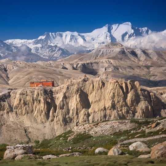
Lo Manthang: Lo Manthang is found in the district of Mustang, that offers a variety of exotic cultural experiences. Lo Manthang has only comparatively recently been visited by foreigners, and therefore the numbers of tourists to Upper Mustang are still restricted. because of this, the culture here is almost untouched, creating it an unbelievable site to go to.
Read the full article
#whytogoNepal#Mustang#Marpha#Chhertosum(MarphaHill)#Chhairo#MuktinathTempleSanctuary#LoManthang#WhyToGoMustang?#PlacesToVisitinMustang#Jomsom#VisitNepal#Gonepal#Visitnepal2020#Everythinginnepal#ExploreNepal#NEPAL
0 notes
Photo

Upper Mustang is the Trans-Himalayan mountain area having the great influence of Tibetan culture and lifestyle. This 17 days Upper Mustang Trekking route covers the most natural, spiritual and auspicious values of west Himalayan region of Nepal. The trail route covers some tributaries like Kaligandaki coming from Tibet, Kagbeni and many more. Explore the amazing landscape and built structures like monasteries, local stone houses etc. Kagbeni (2,858), Syanbochen (3,475m), Lo-Mangthang (3,810m) are the living images which reflects the society of the thousands years back to present. Most of the places of the Upper Mustang Trekking route offer us to enjoy the magnificent all-around views of Himalayas. Nilgiri, Annapurna, Dhaulagiri and some more other are the giant snow masses just in front of us. Upper Mustang Trekking is one of the remote and magical treks that Nepal has to offer! Visit us at https://www.trekkingmart.com/upper-mustang-trekking.
0 notes
Text
Upper Mustang Trekking
Beautiful landscape of Kagbeni, Mustang along with Kaligandaki river and Tsarang Monastery
You got best trekking experience with strong Tibetan culture with amazing breathtaking landscape...
For this amazing trekking info or inquiry:
http://bit.ly/royalmountainhttps://www.royalmountaintrekking.com
PC: Anil Bhatta & Pradipgrg

Kagbeni Village

Tsarang Monastery
0 notes
Text
Details Itinerary about Upper Mustang Trek
Upper mustang trek is one of the most popularly growing trek these days as this trek offers mind-blowing trekking experience in remote Himalayan mountain region of Nepal. Upper Mustang trek used to be important route for crossing the Himalaya between Tibet & Nepal. Trekking in Mustang is truly one of the most amazing thing to do in Nepal. You'll get to se the society that has remained unaffected by the modernization for centuries now. The treeless land, barren landscape & the hardships of people there is something that you won't get to see anywhere else.
Outline Itinerary
Day 01: Arrival in Kathmandu (1,300m/4,428ft)
Day 02: Drive from Kathmandu to Pokhara (827m/2689ft): 5-6 hours
Day 03: Fly to Jomsom (2,700m/8898ft) and trek to Kagbeni (2,810m/9,216ft): 3-4 hours trek
Day 04: Kagbeni to Chele (3,050m/10,004ft): 5-6 hours
Day 05: Chele to Syanbochen (3,475m/11,398ft): 6-7 hours
Day 06: Syanbochen to Ghami (3,520m/11,546ft): 5-6 hours
Day 07: Ghami to Tsarang (3,620m/11,873ft): 5-6 hours
Day 08: Tsarang to Lo-Manthang (3,730m/12,234ft): 3-4 hours
Day 09: Explore Lo Manthang/ Acclimatization
Day 10: Lo-Mangthang to Drakmar (3810 m/12,500ft): 6-7 hours
Day 11: Drakmar to Ghiling (3,806m/12,484ft): 5-6 hours
Day 12: Ghiling to Chhuksang (3050m/10,004ft): 5-6 hours
Day 13: Chhuksang to Jomsom (2,700/8,856ft): 6-7 hours
Day 14: Fly back to Pokhara
Day 15: Drive from Pokhara to Kathmandu
Day 16: Final departure

Detail Itinerary
Ø Day 01: Arrival in Kathmandu (1,300m/4,428ft) This is your arrival day in Nepal. Our Representative from Himalayan Recreation Treks will be there at Tribhuvan International Airport to welcome you & pick you up. After that, you'll be escorted at your hotel. Once you reach hotel, there will be a short briefying regarding your trip. You'll then, freshen up & take rest comfortably. Overnight stay at hotel in Kathmandu.
Ø Day 02: Drive from Kathmandu to Pokhara (827m/2689ft): 5-6 hours We'll leave for Pokhara early in the morning after having our breakfast. It will take us around 5-6 hours to reach pokhara from Kathmandu in a private vehicle. We then, check-in to our hotel & take rest. You can go for a short walk around lakeside is you want to. Overnight stay at hotel in Pokhara.
Ø Day 03: Fly to Jomsom (2,700m/8898ft) and trek to Kagbeni (2,810m/9,216ft): 3-4 hours trek We'll have an eary morning flight to Jomsom today. You can enjoy the well-raised massifs of more than 8,000 m and the deepest gorge on this planet during this flight. Jomsom is famous for its apples, strong winds and the landscape. After landing in Jomsom, we'll have a short trek of around 3-4 hours to Kagbeni which is a main gatepoint to upper mustang. Overnight at a guesthouse in Kagbeni.
Ø Day 04: Kagbeni to Chele (3,050m/10,004ft): 5-6 hours Today we'll start our trekking to Chele from Kagbeni. The trail today heads further to the eastern bank of Kaligandaki river & then, ascends through Tangbe village to Chhusang village. As we move forward, we'll soon cross the Kaligandaki river on a steel footbridge & then ascend toward the village of Chele. Chele is situated on a ridge above the gorge where we will be spending our night. It'll take us 5-6 hours to reach Chele from Kagbeni. Overnight stay at guesthouse in Chele.
Ø Day 05: Chele to Syanbochen (3,475m/11,398ft): 6-7 hours Our trek continues today as we climb through the steep & barren landscape & lower down the hill. We'll be continously trekking for about 6-7 hours today which is compartively hard then what we've experience before. We will be crossing two passes today, Taklam la pass (3,624) & Dajori la pass (3,735) during the trek. On our way, we can enjoy great views of Tilicho, Yakawa Kang and Damodar Danda and then, pass by Ramchung Cave. Moving forward, we reach Samar village from where we continue walking ona trail above the village. As we descend from there on asteep trail, we'll soon reach Syanbochen. Overnight stay at guesthouse in Syanbochen.
Ø Day 06: Syanbochen to Ghami (3,520m/11,546ft): 5-6 hours We continue our journey as we move forward & trek to Ghami from Syanbochen. As soon as we start our trek today, we'll ascend to the Yamda la pass at 3,850m. We pass through several tibetan style teahouses, local houses & chorten before we reach Yamda la pass. We continue to move forward & descend toward Ghami village which is one of the biggest village in Lo region. Ghami is a beautiful village with the fields surrounding the entire village. Overnight stay at guesthouse in Ghami.
Ø Day 07: Ghami to Tsarang (3,620m/11,873ft): 5-6 hours Our trek begins today as we descend through a rough & slippery trail. We will be crossing a suspension bridge over the Ghami khola. As, we start to ascend with mani walls along the trail we'll soon cross the Tsarang La Pass at 3870m and reach Tsarang village. It takes us around 5-6 hours to reach tsarang from Ghami. Tsarang village lies at the top of the Charang Chu canyon with a huge fortress and a red gompa towards its east. Overnight stay at guesthouse in Tsarang.
Day 08: Tsarang to Lo-Manthang (3,730m/12,234ft): 3-4 hours Today we move forward to Lo-manthang which is compartively a short journey than the others. It takes us 3-4 hours to reach Lo-manthang from Tsarang. We will descend from Tsarang to cross Tsarang-chu. From there we will ascend uphill through rocky path all the way to a piled up stones. We can get the view of the first look into walled city of Lo-Manthang from this point. As we continue our trrekking, we will descend and then move upward through another Highland to reach Lo-Manthang. We'll be spending our night at a guesthouse in Lo-Manthang.
Ø Day 09: Explore Lo Manthang/ Acclimatization Today is the rest day for you as you've been trekking continously for past few days. We will stretch our tired muscle & take time to get used to the environment. We can also explore around Lo-manthang if you want to. We can visit the western valley of Tingkhar to the summer palace of the Raja. The place offers majestic views of Kimling, Phuwa and the Namgyal Gompa. Taking rest during long treks is suggested by the experts as it helps our body to get refreshed & adjust in the environment. Overnight stay at guesthouse in Lo-manthang.
Ø Day 10: Lo-Mangthang to Drakmar (3810 m/12,500ft): 6-7 hours This is the 10th day of our treking & today we're returning back from Lo-manthang. Our trail today passes through a village called Gyakar village which have a century old houses called old ghar Gompa with beautiful rock painting. It is said that a wish made at Gompa comes true. Later, we will move upward through a ridge across a valley & follow the trail as we ascend to reach Drakmar. Overnight stay at guesthouse in Drakmar.
Ø Day 11: Drakmar to Ghiling (3,806m/12,484ft): 5-6 hours We'll be trekking from Drakmar to Ghiling today that takes us around 5-6 hours. Our trail to Ghiling today passes through dusty & windy road. We also go through a dry highlands & fields before reaching Ghiling. Ghiling is mostly dry which is why the walk today can be compartively hard as we are most likely to face strong winds on our way. We can get a good views of Mountain Dhaulagiri & Nilgiri from Ghiling. Overnight stay at guesthouse in Ghiling.
Ø Day 12: Ghiling to Chhuksang (3050m/10,004ft): 5-6 hours We'll be trekking down to Chhuksang today. We will have a esay walk today as we will only be trekking downward. En route we will pass through several small villages, terraced field & enjoy the great views of mountains. Overnight stay at guesthouse in Chhuksang.
Ø Day 13: Chhuksang to Jomsom (2,700/8,856ft): 6-7 hours Today is our last day of upper mustang trekking as we'll be moving back to Jomsom. Our journey today is of about 6-7 hours. We will move forward to the southern border of the region and proceed to Kagbeni. We will be stopping at Kagbeni for our lunch & then, From Kagbeni we will walk along the bank of Kali Gandaki River to make it to Jomsom. Overnight stay at guesthouse in Jomsom.
Ø Day 14: Fly back to Pokhara We have an early morning flight to Pokhara toady. About 20 min of flight will take us back to Pokhara. The flight offers beautiful views of Annapurna and Dhaulagiri mountains. After reaching Pokhara we can take rest or explore this beautiful lake-side city. Overnight stay at hotel in Pokhara.
Ø Day 15: Drive from Pokhara to Kathmandu Today we’ll get back to Kathmandu by us which takes around 6 hours of drive. After reaching Kathmandu you'll be dropped back to your hotel. Overnight stay at hotel in Kathmandu.
Ø Day 16: Departure Day This is your last day in Nepal. Our representative from Himalayan Recreation Treks will be there to drop you off at Tribhuvan International Airportat the time of your departure.
0 notes
Photo
Upper Mustang, absolutely different terrain than rest of other trekking route in Nepal where the rain shadow valley is similar to Tibetan plateau. The barren mountain region is home of the Lobhas who is really close to lo tribal of Tibet also Tibetan is only few miles far from Lomanthang. The local accessible to Tibet for trading. The forbidden Buddhist valley is home of ancient Tibetan Buddhism where numerous of oldest Gompa and monasteries are spreading throughout Kaligandaki valley. The sheer of mountains dominate entire eroded valley. #uppermustang #uppermustangtrek #uppermustangtrekking #SungdaChhorten #lomanthang #tijifestival #uppermustangtijifestivaltrek #mustang #outdoor #outfit #trekking #hiking #explore #exploring #mountains #nilgiri #neverstopexplore #cave #monastery #uppermustangtour #alpine 3#transhimalayas https://musicaltrek.com/ [email protected] WhatsApp: +9779851138499 https://www.instagram.com/p/BuRc_jsAwqW/?utm_source=ig_tumblr_share&igshid=1q5ckys7wzpco
#uppermustang#uppermustangtrek#uppermustangtrekking#sungdachhorten#lomanthang#tijifestival#uppermustangtijifestivaltrek#mustang#outdoor#outfit#trekking#hiking#explore#exploring#mountains#nilgiri#neverstopexplore#cave#monastery#uppermustangtour#alpine#transhimalayas
0 notes
Text
Budget Annapurna Circuit Trek - 10 Days
Trip Highlights
Daily constant views of Annapurna Himalayas with beautiful river
Complete Annapurna Circuit Trek in 10 Days
Best experience on biggest pass of the worlds
From low warm region to alpine cooler areas and glaciers
Amazing forest rhododendron-magnolia trees and natural garden with grand views
Exploring traditional cultural Gurung villages of high Manang and Mustang valley
Exceptional views from Thorang-la pass to world deepest gorge of Kaligandaki River
Adventure around Manang and Mustang (District) of massive Annapurna Himalayas
Trip Overview:
Budget Annapurna Circuit Trek 10 days follows the Annapurna Circuit trekking route and completes in 10 days. This is the special trekking package projected by Mountain Magic Treks with a great challenge in the world's biggest pass (Thorung-La Pass) in the Annapurna Himalayas of Nepal. You will be walking in the Annapurna region with beautiful views of Mt. Manaslu, Annapurna two, Tilicho Peak, and Marshyangdi River.
Budget Annapurna Circuit Trek is comfortably completed in 10 days because you will be taking private transportation twice to conclude this trip in 10 days. While you riding on the vehicle, you will have a scenic drive around the Annapurna region, the road goes through a hillside which makes you feel on top of the mountain and enjoying the beautiful scenery like waterfalls, Manang valley, and Annapurna Himalayan Peaks. This budget Annapurna Circuit Trek 10 day starts from Dharapani, for a few days trail follows river valley with views of monastery and Apples farming lands it is around Chame and Pisang which is the headquarters of Manang district. The 10 days budget trek leads to the picturesque Thorang-La Pass at 5,416 meters high with a Panorama of the snow-capped peaks with Dhaulagiri and Mustang Himal towards a western direction.
Thorung La Pass is the biggest pass in the world which is at a high altitude of 5,416 m. These are the highlights of Annapurna Circuit Trekking, from the top you can observe the Upper Mustang trekking route with a view of the Kaligandaki river valley and Annapurna Himalayan range. These 10 days Annapurna Circuit Trekking program has most of the interesting views you can observe such as in the long Annapurna Circuit Trekking program.
As the walk continues leading you to Kaligandaki river valley, between towering Dhaulagiri and Annapurna Mountain range forming as world’s deepest gorse with marvelous time around hill and mountain village of Manang and Thakali people of the Buddhist religion.
We will be visiting interesting monasteries. Our overwhelming and quickest trekking in budget price the Annapurna Circuit Short Trek concludes with a drive back to the beautiful and picturesque Pokhara side by peaceful Phewa Lake with the backdrop of the massive Annapurna Mountains. Budget Annapurna Circuit Trek, no wonder it is listed as the world’s top ten adventure destination where you will soak within its dramatic and magnificent landscapes with a touch of local age-old culture and interesting traditional way of life makes this one of the most sought destinations in the world.
Trip cost for Budget Annapurna Circuit Trek also be flexible with the itinerary & services and can adjust other details according to your demand, availability, and timing. As per our company, we can plan the trekking per your requirements, offering suitable discounts and guaranteed customer satisfaction. For this special circuit trek, Mountain Magic Treks Pvt. Ltd can offer you the best chance to inspect the Annapurna Massif without any worries.
How do we complete the Annapurna Circuit Trek in 10 days?
Budget Annapurna Circuit Trek package has only one rest day at Manang for acclimatization and 10 days Itinerary for trekking including the rest day. Nowadays we can use the transport to Manang as well not only to Dharapani from Kathmandu but this is not a good idea to go directly, but if you are fit enough and have trekking experience can do in 7 days as well instead of 10 days trek. We can use transport to Manang directly and rest in Manang the trek continues for the pass and again use transport to Pokhara the same as the following 10 days Itinerary after Manang.
Transport for Budget Annapurna Circuit Trek
Mountain Magic Treks provide airport pick up and drop service. At the beginning of the trekking from Kathmandu to Beshisahar includes a public bus and Beshisahar to Dharapani sharing jeep will provide as well. Again after the Thorong La pass from Muktinath also providing the local public bus to go to Tatopani which is not a long-distance but there will take a long time and need to switch twice because of the local community and need to collect the passengers even you will reach same day on your destination. The next day you would have enough time to relax at hot spring during the morning, after lunch, you can catch the bus to Pokhara ( The local bus anytime will be running so that easy to catch on your needs).
What are the services Mountain Magic Treks provide in this cost for Budget Annapurna Circuit Trek?
Mountain Magic Treks has another package also for Annapurna Circuit Trekking but this is one of the best and suitable trek package for a short vacation and wishes to accomplish in 10 days with a budget price. Free pick up and drop services by private car, Food (Breakfast, Lunch & Dinner with Tea or Coffee) during the trek, Accommodation (twin bedroom, Single, or triple as per required), English speaking and filed experienced trek guide, Local Sherpa porter to carry luggage, insurance for staffs, Trekking permits & TIMS, Private transport Kathmandu-Dharapani / Muktinath-Tatopani-Pokhara, Hotel in Pokhara, A comprehensive medical kit (This is important in the high altitude)
Outline Itinerary
Day 01: From Kathmandu Drive to Dharapani 1,943m - 07 hrs.
Day 02: From Dharapani Trek to Chame 2,720 m - 05 hrs.
Day 03: From Chame Trek to Pisang 3,190 m - 05 hrs.
Day 04:From Pisang Trek to Manang 3,540m - 04 hrs.
Day 05:Acclimatization day at Manang with short hikes.
Day 06:From Manang Trek to Yak Kharka 4,210 m - 04 hrs.
Day 07:From Yak Kharka Trek to Thorang- La High Camp or Phedi 4,450 m - 04 hrs.
Day 08:From High Camp or Phedi Cross over Thorang La 5,416 m / 17,769 ft and trek to Muktinath 3,800m-06 hrs.
Day 09:From Mukti Nath drive to Tatopani (Hot-Spring) 1,190 m - 05 hrs.
Day 10:From Tatopani Drive to Pokhara - 04 hrs.
0 notes
Text
Impacts of Climate change on Hydropower Potential in Kaligandaki River Basin -A Case Study of Kaligandaki Gorge Hydropower Project, North of Nepal- Juniper publishers
Abstract
Nepal has a considerable hydropower potentiality, however the analysis of Kaligandaki River Basin optimization of power potentiality and subsequently identified two critical impacts of climate change-GLOF's and variability of runoff along with temperature difference are most pronounced during the dry winter season, and least during the height of the monsoon. In Himalaya region the Intergovernmental Panel on Climate Change (IPCC) has indicated that global warming is occurring relatively faster in recent decades, with the rate of temperature increase being greater in the high altitude Himalaya, then lowland parts of Nepal [1].
It is more susceptible to impacts of climate change than a reservoir based hydro installation, on meteorological data obtained from Lete station, near a hydropower project site (Kaligandaki Gorge Hydropower), precipitation patterns slightly increase of 0.28mm, however overall steeply decreasing trend at Jomsom station.
This study reveals the optimization of power potentiality at Kaligandaki River Basin and impacts of Climate change in Kaligandaki George Hydropower projects a case study. In this basin, power potentiality area some hydropower station and their energy production fluctuations over the season reflect the climate change impacts to the hydropower production in Nepal as a whole.
Keywords: Kaligandaki climate change decreasing trend Himalayan region; Hydropower
Introduction
Nepal's vast water resources seems to electricity generation is almost dominated by hydropower and most of the hydropower systems installed are based on run-off-river (RoR) type. There are mainly two climatic factors that contribute to increased variability of river runoff: glacier retreat and change in timing and/or intensity of precipitation. Most of the hydropower projects are in critical danger from impacts of changing climatic parameters. Already, there is a general shortage of electricity during winter and dangers of spill in wet season. The large seasonal variation in electricity generation in Nepal results in acute power crisis during dry months. Before melting of snow and when there is less rainfall during winter, the discharge level in the river decreases resulting in very less production of electricity. In recent years the installed capacity (829MW) has always failed to fulfill the peak demand that has forced to power shortage of up to 18 hours a day during winter.
The year 2003/14 witnessed new records of power and energy demand, generation and import. Research on the impacts of climate change towards power generation is critically examined in this study which in turn is complex, so the present study seeks to examine optimization of power reflected by precipitation and temperature patterns in the Upper Kaligandaki River basin.
The Study Area
The Kaligandaki River is a glacier-fed antecedent river originating in the Nepal Himalayas. It runs from north to south in the higher Himalayan region, flows eastwardly through the lesser (or lower) Himalayan region, enters the Tarai plains of Nepal and ultimately joins the Ganges River in India. The study area, which covers a short stretch of Upper Kaligandaki River in the higher Himalaya, is located in the Trans-Himalayan region of Nepal ( Figure 1). Politico-administratively the area forms part of Mustang district, one of 16 mountain districts in the country. The Upper Kaligandaki River has a catchment area of about 3500km2 and its elevation ranges from about 2900m to 8137m (at Dhaulagiri Peak). The landscape of the river basin is characterized by moraine deposits and debris fans, with pine and mixed shrub-type vegetation in the river valleys.
Broadly, the basin can be divided into three climatic zones:
a. A cold temperate zone up to 3000m;
b. An alpine zone between 3000m and 4500m and
c. A tundra zone above 4500m.
The area above 5,000m is either perpetually covered with snow or consists of vertical bare rocks. The basin falls under a rain shadow and has a dry, arid climate. The area around the basin outlet has an average annual rainfall of 785mm whereas the Lo-Mangthang area, which lies further north, receives only about 200mm of rainfall per year [2].
The Upper Kaligandaki River basin receives most (61%) of its precipitation during the monsoon (June to September), with winter (December to February) being the driest season (7% of annual precipitation). During winter most of the precipitation falls as snow. The average annual flow of Upper Kaligandaki River is 25m3/s but there is large seasonal variability, with average flows in the monsoon season (June to September) and dry season (December to February) being 54.8m3/s and 8.6m3/s, respectively. In general, the maximum flows occur in August and the minimum flows in March. The width of the river varies from 30m-150m. The gradient of the river course varies from 3%-16%, with an average of 7%. There are about 1,025 glaciers in this region (ICIMOD, 2001; 2009) and a multitude of glacier-fed streams enter the Upper Kaligandaki River. The sediment-related risk is inherent in the Kaligandaki basin due to continuous uplifting and landscape evolution [3]. A study in Lete and Ghansa (downstream of the present study area) indicated that there was an increase in suspended sediment loads by about 0. 7% per year over a period of 30 years [4]. Retreating glaciers, melting of permafrost and annual fluctuation in snow cover areas in the context of rising temperatures due to accelerated global and local warming were responsible for the changing rate of sediment yields. The Major tributaries are
a) Mistri Khola in Myagdi District near Narchyang Rahughat Khola at Galeswor
b) Myagdi Khola at Beni
c) Modi Khola at Modibeni
d) Badigad Khola at Rudrabeni
e) Aandhi Khola at Mirmi
f) Ridi Khola at Ridi Bazaar
Objectives of the Study
The main objectives of this research is to identify and optimize the Kaligandaki River Basin power potentiality and possible impacts of the climate change in Kaligandaki Gorge hydropower project, some of the specific objectives are as follows;
a. To evaluate power potential in the River Basin with ROR and Storage Projects
b. Quantify benefits for cost and energy
c. Evaluate impact on optimal design criteria (percentile exceedance), and cost of project
d. The impacts of Climate change in hydropower potentiality in Kaligandaki George hydropower project
e. Recommend policy implications (Table 1-3)
Problem Statement
Out of the various natural resources available in Nepal, water resource is the Prime one. The available water resources in Nepal have abundant hydro potential which can be harnessed for the development of the country, but there is a lack of reliable and accurate information about the hydro potential in Nepal. The fundamental information regarding the magnitude and distribution of the potential in the country helps in planning, formulating policies and strategies for the development of hydropower [5].
The first assessment of the theoretical hydropower potential of Nepal was done by Shrestha during his PhD research work in the former USSR about 50 years ago with limited data and analysis tools. Shrestha assessed 83,280MW as the theoretical hydro-potential of Nepal. The estimate was made at a time when very little river discharge and precipitation data were available (Figure 2).
Now 154 hydrometric stations and 337 precipitation stations have been established in different parts of the country and provide more accurate hydrological data for more than 30 years. There have been advances in information technology such as remote sensing, computational tools such as geographic information system (GIS) and various hydrological modeling tools which can process and analyze the data more accurately and provide better results. Using these latest technologies, the potential can be estimated more accurately than before. However, very few studies have been done in this field after the first assessment (Figure 3).
Albeit Nepal Electricity Authority (NEA) studied the power potential of the several rivers in the past with the assistance of foreign experts, all of these studies are rather project oriented and do not cover the entire part of the country. Therefore, necessitated reassessing the theoretical ROR hydro potential of the rivers in Nepal by using the latest computational and analysis tools to come up with the accurate and better results. By using the available data an impacts of Climate change on hydropower potential in Kaligandaki River Basin (a case study of Kaligandaki gorge hydropower project) is studied [6].
Methodology
Hydropower Potential Calculation: Hydropower potential is a function of head drop and discharge at certain flow exceedance. The theoretical ROR hydropower potential is calculated by using equation,
P= ρ x g x Q x H ........ (1)
Where, P = Power generated in Watt (W)
ρ = Mass density of water (kg/m3)
g = Acceleration due to gravity (m/s2)
Q = Discharge (m3/s)
H = Gross head drop (m)
If there are numbers of sub-basins in a given basin, the total power of the basin can be calculated by summing the potential of all sub-basins.
P = Σ i to n ρ x g x Q x H...... (2)
Where, i = Sub-basin number = i..... n
n = Number of sub-basins
ρ=The mass density of water is taken as 1000kg/m3
g = Acceleration due to gravity (m/s2) Q = Discharge (m3/s)
H = Gross head drop (m)
The gross head is the elevation difference between headrace and tailrace. By estimating the head drop, H and discharge, Q of any basin, the theoretical hydro potential can be calculated. Along with Impacts of Climate Change parameters rainfall, discharge and temperature patterns have also been analyzed. This study is particularly quantitative and deductive in nature. It will incorporate study of the Kaligandaki gorge hydropower with available data to provide case study for climatic considerations in developing a hydropower.
Study parameters
To identify the controlling factors Daily rainfall data of three nearby stations (Jomsom, Lete and Ranipauwa) from 1985 to 2014 was analyzed during the study. Secondary data of the rainfall were taken from Department of Hydrology and Metrology (DHM). Optimum number of stations required for the study was based on statistical principal that a certain number of rain gauge stations are necessary to give average rainfall with a certain percentage of error. The optimum number of rain gauges (N) was obtained by the following equation:
N = (Cv/E)......... (1) 2
Where, E = allowable percentage error in the estimate of basic mean rainfall
Cv = coefficient of variation of rainfall based on existing rain gauge station and it is determined as,
Cv = s/Pm x_100% (2)
The standard deviation is given by:
s = Σ [ (Pm-Pi)/n-1] ½
Where, Pm = mean average annual rainfall values
n = existing number of rain gauges
Pi = normal annual rainfalls at existing rain gauges, for accuracy in various practical purposes; three stations were taken minimizing the error to 5%.
For temperature analysis the maximum, mean and minimum monthly temperature data recorded at Jomsom for the last 30 years were analyzed. Climatologically data recorded at Lete stations from 1998 to 2014 was also analyzed during this study. Discharge data for the past 20 years (1995 to 2014) were analyzed for Kaligandaki River. This was obtained from Jomsom hydrological station. Monthly discharge of the river at intake of the hydropower was provided by Hydro solutions Pvt. Ltd.
Scope and Limitations
The study is carried out at the Kaligandaki gorge HP that lies at northeastern part of Myagdi district in the Western Development Region of Nepal. Scope of work of the proposed study includes following major activities:
a. Case study of Kaligandaki River to analyze changes in river flow with respect to physical and socio economic changes affecting design capacity of hydropower plant.
b. Collection of secondary data; desk study and analysis of the data.
c. Interpretation and analysis of available rainfall and temperature data for interpretation of climate change along with the analysis of water and energy demand using LEAP and WEAP (Table 4).
Data Analysis
Precipitation
Nepal receives nearly 80% of annual precipitation during the months of June-September in most of the locations; Distribution of rainfall around the Kaligandaki gorge hydropower project area is not uniform either. Elevations well as exposition of mountains within the area plays major roles for uneven rainfall distribution. The 30 years of daily data available (1985-2014) for the area near the project site shows that 62% of rainfall occurs in monsoon with 25% in pre-monsoon followed by 8% and 5% in post-monsoon and winter respectively (Figure 4).
In a RoR project like Kaligandaki gorge project, electricity generation will vary as per precipitation patterns, which means dry seasons may require a substitute source for the demands to be met. In a reservoir based hydropower station like Kulekhani however, usage of water accumulated during monsoon can accommodate for electricity generation throughout the year. As illustrated by the graph below, precipitation around the project area peaks up from June to August and is highest during July. Winter months beginning from November and ending in January receives the lowest amount of precipitation (Figure 5).
The monsoon normally starts in the second week of June and continues until the fourth week of September. Monsoon is the main source of rainfall in the project site similar to other regions of Nepal. The large amount of Rainfall within a short period causes flash floods, landslides, soil erosion and sedimentation in hilly and mountainous regions, and inundation of the plains areas (Figure 6). There is no significant change in annual precipitation in Nepal. This study shows that the annual average rainfall around the Kaligandaki project site is increasing at a slight rate of about 0.246m and 0.284mm measured at Jomsom and Lete stations respectively as shown in the plot below is concerns with slight increase in precipitation rate as seen in study based on data from Andhi Ghat Station, Mustang (Figure 7 & 8).
Winter average annual rainfall distribution shows a slight increasing trend in recent years. This trend has continued in premonsoon and monsoon which provides for the annual increase in rainfall as mentioned earlier. There is a slight decrease in post monsoon rainfall (Figure 9-11).
Temperature
Annual temperature in Nepal is reported to be increasing and the impacts of warming have already been observed in the Himalayan glaciers [7]. Annual mean temperature in Nepal has increased steadily at a linear rate of 0.4C per decade from 1975 to 2005 [6]. Data collected from Jomsom meteorological station for 1985 to 2014 shows an increment in annual maximum, minimum and mean temperatures (Figure 12).
Discharge
Analysis of the available data from 1995 to 2013 shows that the average flow of 86 m3/s in 1995 has gradually decreased to 18.4 m3/s coming into 2014. It has been shown that the flow of the Kaligandaki River at 3 station are analyzed, it indicated that the discharge is slightly decreasing order, therefore power potentiality will also in decreasing order.
Analyzing the yearly mean flow, 1998 was the maximum with a mean average flow of 213m3/s and 2002 was the minimum with 15.1m3/s. Though precipitation data shows slight increase in rainfall, the decrease in discharge may be credited to decrement of melt from glacier. Monthly discharge measured at the intake of the planned hydropower shows increase in discharge during the monsoon i.e. July and August [8]. Annual average flow is seen at intake is around 40m3/s which concerns relatively with the data obtained from DHM (Figure 13-16).
The zone of impact of the Kaligandaki Gorge Hydropower includes 4 VDC's of Mustang, Lete, Kunjo, Dana and Narchang. Water usage in the area is mainly dominated by agricultural and domestic purposes. There is also consumption in commercial sector but due to unavailability of exact figures, we have only taken first two sectors as computing for water usage (Figure 17-19).
Conclusion
Climate change affects the dependability of hydro resources and hence the changing climatic parameters are an unavoidable factor in the forecasting system of hydropower projects. Some generalizations drawn for the study area are as follows:
a. An increasing trend of temperature is seen around the study area.
b. Though there is a general increasing trend in precipitation, shift of the fall seasons can in-crease the hydrological impacts and challenges.
c. Storage upstream gives optimum flows in dry season to downstream projects
d. The installed capacity with storage projects increase considerably compared to ROR e. Due to storage projects, dry energy in entirety increases by up to 3 times
f. Based on the results mentioned above, transmission line must be planned to evacuate the additional power.
g. Cost of projects decreases dramatically when rivers are planned with storage options.
h. Policies to promote storage where possible are essential to optimize Nepal's hydro resources.
i. Policies for pricing, safety R&R etc. also need to be effective.
Recommendation
Integration of Climate change impact assessment in integrating hydropower planning is imperative and major issues for the effective planning and management of the power systems in our country. The following are the some recommendations for hydropower planners, policy makers, and other concerned agencies for coping with climate change and planning accordingly for the management of the ongoing power deficiency.
I. The rainfall distribution around the region is very uneven and basin has insufficient rain-gauge network, discharge and rainfall recording network should be increased for intensity data that are most essential for hydrologic models and other detail hydrological study.
II. Since the data analysis shows that hydrology is changing, the design capacity of the hydro system should be revised. In the long run, sufficient water may not be available; water storage in damp should be a good method to control the how of the river.
III. Only a basic modeling has been done during this project. Creation of scenarios is a potential analytical tool to predict and assess the optimization needs of subsequent demand increment as seen from demand forecasts.
To Know More About Journal of Oceanography Please Click on: https://juniperpublishers.com/ofoaj/index.php
#Juniper journals#Juniper publishers group#Limnology#Marine Physics#Juniper Publishers Indexing List
0 notes
Last Seen Blogs

aintjesusperiod
Untitled

mrmodyvincento-blog
Untitled

chychaninterestingthings
Untitled

fruittarts-with-rosepetals
fruittart

putridintercourse
Putrid Intercourse